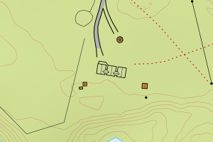
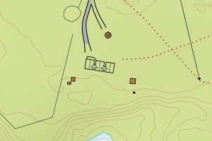
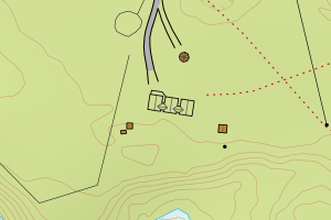
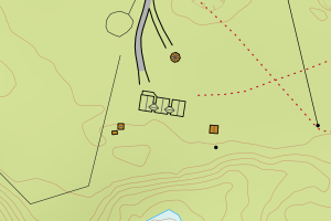
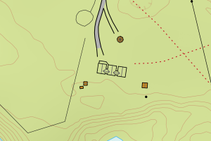
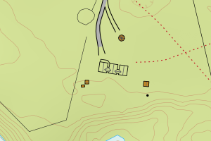
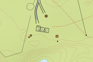
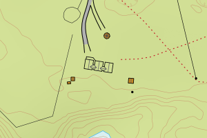
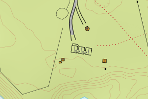
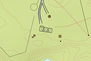
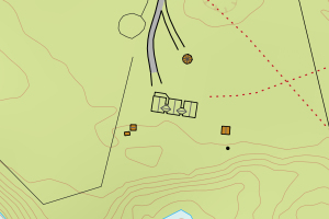
Avvikene skyldes oftest manglende sletting av bygningslinjer når bygningsflate er slettet i FKB-Bygning. Rettes i FKB-Bygning
Kommune | LokalId | Objekttype | Posisjon | WMS-bilde |
5612 Kautokeino | ad92b53a-534a-414d-9ce4-da294b8e074d | Bygningslinje | N: 7630967.14, Ø: 360075.65 | ![Kartbilde fra WMS-tjeneste av avviket](https://wms.geonorge.no/skwms1/wms.topo?VERSION=1.1.1&SERVICE=WMS&REQUEST=GetMap&LAYERS=topo&STYLES=&FORMAT=image/png&SRS=EPSG:25835&BBOX=360000.0,7630917,360150.0,7631017&WIDTH=300&HEIGHT=200) |
5612 Kautokeino | 9ac7ba1a-cd4f-4e5f-ae53-0785145471f0 | Bygningslinje | N: 7708299.39, Ø: 369980.64 | ![Kartbilde fra WMS-tjeneste av avviket](https://wms.geonorge.no/skwms1/wms.topo?VERSION=1.1.1&SERVICE=WMS&REQUEST=GetMap&LAYERS=topo&STYLES=&FORMAT=image/png&SRS=EPSG:25835&BBOX=369905.0,7708249,370055.0,7708349&WIDTH=300&HEIGHT=200) |
5612 Kautokeino | 65bb3cd6-3c3f-47c9-81a7-f08ed8204ba6 | Taksprang | N: 7630969.12, Ø: 360074.62 | ![Kartbilde fra WMS-tjeneste av avviket](https://wms.geonorge.no/skwms1/wms.topo?VERSION=1.1.1&SERVICE=WMS&REQUEST=GetMap&LAYERS=topo&STYLES=&FORMAT=image/png&SRS=EPSG:25835&BBOX=359999.0,7630919,360149.0,7631019&WIDTH=300&HEIGHT=200) |
5612 Kautokeino | 656b4b02-1707-408b-b5f3-69ccac09c7b4 | Taksprang | N: 7705613.77, Ø: 367784.39 | ![Kartbilde fra WMS-tjeneste av avviket](https://wms.geonorge.no/skwms1/wms.topo?VERSION=1.1.1&SERVICE=WMS&REQUEST=GetMap&LAYERS=topo&STYLES=&FORMAT=image/png&SRS=EPSG:25835&BBOX=367709.0,7705563,367859.0,7705663&WIDTH=300&HEIGHT=200) |
5612 Kautokeino | 2cb2db8f-6505-46ef-8fe8-b0eecc50cec3 | Taksprang | N: 7705362.88, Ø: 367788.05 | ![Kartbilde fra WMS-tjeneste av avviket](https://wms.geonorge.no/skwms1/wms.topo?VERSION=1.1.1&SERVICE=WMS&REQUEST=GetMap&LAYERS=topo&STYLES=&FORMAT=image/png&SRS=EPSG:25835&BBOX=367713.0,7705312,367863.0,7705412&WIDTH=300&HEIGHT=200) |
5612 Kautokeino | 5aec5330-7030-4fcc-8f68-b69e68f57b72 | Taksprang | N: 7705364.20, Ø: 367785.83 | ![Kartbilde fra WMS-tjeneste av avviket](https://wms.geonorge.no/skwms1/wms.topo?VERSION=1.1.1&SERVICE=WMS&REQUEST=GetMap&LAYERS=topo&STYLES=&FORMAT=image/png&SRS=EPSG:25835&BBOX=367710.0,7705314,367860.0,7705414&WIDTH=300&HEIGHT=200) |
5612 Kautokeino | f537b1fc-96ed-47f6-8cb5-bec68053f1d4 | Mønelinje | N: 7729490.77, Ø: 361857.77 | ![Kartbilde fra WMS-tjeneste av avviket](https://wms.geonorge.no/skwms1/wms.topo?VERSION=1.1.1&SERVICE=WMS&REQUEST=GetMap&LAYERS=topo&STYLES=&FORMAT=image/png&SRS=EPSG:25835&BBOX=361782.0,7729440,361932.0,7729540&WIDTH=300&HEIGHT=200) |
5612 Kautokeino | 66acec9f-8cba-4844-b176-90767b418d09 | Mønelinje | N: 7705360.65, Ø: 367791.69 | ![Kartbilde fra WMS-tjeneste av avviket](https://wms.geonorge.no/skwms1/wms.topo?VERSION=1.1.1&SERVICE=WMS&REQUEST=GetMap&LAYERS=topo&STYLES=&FORMAT=image/png&SRS=EPSG:25835&BBOX=367716.0,7705310,367866.0,7705410&WIDTH=300&HEIGHT=200) |
5612 Kautokeino | a8928cc7-8465-4f97-a4ae-c72e921ea6e5 | Mønelinje | N: 7705612.08, Ø: 367785.39 | ![Kartbilde fra WMS-tjeneste av avviket](https://wms.geonorge.no/skwms1/wms.topo?VERSION=1.1.1&SERVICE=WMS&REQUEST=GetMap&LAYERS=topo&STYLES=&FORMAT=image/png&SRS=EPSG:25835&BBOX=367710.0,7705562,367860.0,7705662&WIDTH=300&HEIGHT=200) |
5612 Kautokeino | e389db00-3254-4d1b-a585-412a99140aea | Mønelinje | N: 7705363.51, Ø: 367786.92 | ![Kartbilde fra WMS-tjeneste av avviket](https://wms.geonorge.no/skwms1/wms.topo?VERSION=1.1.1&SERVICE=WMS&REQUEST=GetMap&LAYERS=topo&STYLES=&FORMAT=image/png&SRS=EPSG:25835&BBOX=367711.0,7705313,367861.0,7705413&WIDTH=300&HEIGHT=200) |
5612 Kautokeino | e94566e8-1d0c-47bd-967b-63c52cb8f6f4 | Mønelinje | N: 7705366.53, Ø: 367782.10 | ![Kartbilde fra WMS-tjeneste av avviket](https://wms.geonorge.no/skwms1/wms.topo?VERSION=1.1.1&SERVICE=WMS&REQUEST=GetMap&LAYERS=topo&STYLES=&FORMAT=image/png&SRS=EPSG:25835&BBOX=367707.0,7705316,367857.0,7705416&WIDTH=300&HEIGHT=200) |
5612 Kautokeino | d420c195-fbbc-4e3b-9464-d54593c5d658 | Mønelinje | N: 7630967.15, Ø: 360074.37 | ![Kartbilde fra WMS-tjeneste av avviket](https://wms.geonorge.no/skwms1/wms.topo?VERSION=1.1.1&SERVICE=WMS&REQUEST=GetMap&LAYERS=topo&STYLES=&FORMAT=image/png&SRS=EPSG:25835&BBOX=359999.0,7630917,360149.0,7631017&WIDTH=300&HEIGHT=200) |
5612 Kautokeino | 1d7835b3-0514-40de-a942-4fca0bdc6fa9 | Mønelinje | N: 7708175.68, Ø: 369883.17 | ![Kartbilde fra WMS-tjeneste av avviket](https://wms.geonorge.no/skwms1/wms.topo?VERSION=1.1.1&SERVICE=WMS&REQUEST=GetMap&LAYERS=topo&STYLES=&FORMAT=image/png&SRS=EPSG:25835&BBOX=369808.0,7708125,369958.0,7708225&WIDTH=300&HEIGHT=200) |
5612 Kautokeino | 3cd580b2-16e4-47b7-bef4-c61a007ba1b4 | Mønelinje | N: 7708152.81, Ø: 370020.67 | ![Kartbilde fra WMS-tjeneste av avviket](https://wms.geonorge.no/skwms1/wms.topo?VERSION=1.1.1&SERVICE=WMS&REQUEST=GetMap&LAYERS=topo&STYLES=&FORMAT=image/png&SRS=EPSG:25835&BBOX=369945.0,7708102,370095.0,7708202&WIDTH=300&HEIGHT=200) |
5612 Kautokeino | 56d478bb-972c-40ca-a331-f15166e3582b | Mønelinje | N: 7708146.40, Ø: 370018.84 | ![Kartbilde fra WMS-tjeneste av avviket](https://wms.geonorge.no/skwms1/wms.topo?VERSION=1.1.1&SERVICE=WMS&REQUEST=GetMap&LAYERS=topo&STYLES=&FORMAT=image/png&SRS=EPSG:25835&BBOX=369943.0,7708096,370093.0,7708196&WIDTH=300&HEIGHT=200) |
5612 Kautokeino | 64b92424-85a5-469d-ab7a-92207118bb07 | Mønelinje | N: 7708296.90, Ø: 369978.69 | ![Kartbilde fra WMS-tjeneste av avviket](https://wms.geonorge.no/skwms1/wms.topo?VERSION=1.1.1&SERVICE=WMS&REQUEST=GetMap&LAYERS=topo&STYLES=&FORMAT=image/png&SRS=EPSG:25835&BBOX=369903.0,7708246,370053.0,7708346&WIDTH=300&HEIGHT=200) |
5612 Kautokeino | 835d7f98-e0df-4e22-85fe-6f65dab9123c | Mønelinje | N: 7708149.36, Ø: 370019.29 | ![Kartbilde fra WMS-tjeneste av avviket](https://wms.geonorge.no/skwms1/wms.topo?VERSION=1.1.1&SERVICE=WMS&REQUEST=GetMap&LAYERS=topo&STYLES=&FORMAT=image/png&SRS=EPSG:25835&BBOX=369944.0,7708099,370094.0,7708199&WIDTH=300&HEIGHT=200) |
5612 Kautokeino | 9e3a21e7-72e6-4fd0-8e61-741b781951f0 | Mønelinje | N: 7708156.49, Ø: 370021.17 | ![Kartbilde fra WMS-tjeneste av avviket](https://wms.geonorge.no/skwms1/wms.topo?VERSION=1.1.1&SERVICE=WMS&REQUEST=GetMap&LAYERS=topo&STYLES=&FORMAT=image/png&SRS=EPSG:25835&BBOX=369946.0,7708106,370096.0,7708206&WIDTH=300&HEIGHT=200) |
5612 Kautokeino | a245d41c-1f07-42ea-92dd-715835265658 | Mønelinje | N: 7708299.98, Ø: 369984.42 | ![Kartbilde fra WMS-tjeneste av avviket](https://wms.geonorge.no/skwms1/wms.topo?VERSION=1.1.1&SERVICE=WMS&REQUEST=GetMap&LAYERS=topo&STYLES=&FORMAT=image/png&SRS=EPSG:25835&BBOX=369909.0,7708249,370059.0,7708349&WIDTH=300&HEIGHT=200) |
5612 Kautokeino | b1d5f650-2953-464d-ad59-0af7a7646518 | TaksprangBunn | N: 7705362.89, Ø: 367788.04 | ![Kartbilde fra WMS-tjeneste av avviket](https://wms.geonorge.no/skwms1/wms.topo?VERSION=1.1.1&SERVICE=WMS&REQUEST=GetMap&LAYERS=topo&STYLES=&FORMAT=image/png&SRS=EPSG:25835&BBOX=367713.0,7705312,367863.0,7705412&WIDTH=300&HEIGHT=200) |
5612 Kautokeino | c453f90b-a9dc-4102-a87c-6487c3bdbbf2 | TaksprangBunn | N: 7705364.20, Ø: 367785.84 | ![Kartbilde fra WMS-tjeneste av avviket](https://wms.geonorge.no/skwms1/wms.topo?VERSION=1.1.1&SERVICE=WMS&REQUEST=GetMap&LAYERS=topo&STYLES=&FORMAT=image/png&SRS=EPSG:25835&BBOX=367710.0,7705314,367860.0,7705414&WIDTH=300&HEIGHT=200) |
5612 Kautokeino | f65b8169-b0b6-4080-b3d2-50abab085048 | TaksprangBunn | N: 7705613.77, Ø: 367784.39 | ![Kartbilde fra WMS-tjeneste av avviket](https://wms.geonorge.no/skwms1/wms.topo?VERSION=1.1.1&SERVICE=WMS&REQUEST=GetMap&LAYERS=topo&STYLES=&FORMAT=image/png&SRS=EPSG:25835&BBOX=367709.0,7705563,367859.0,7705663&WIDTH=300&HEIGHT=200) |