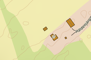
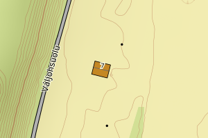
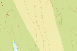
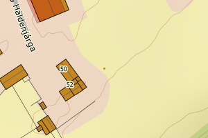
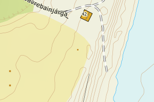
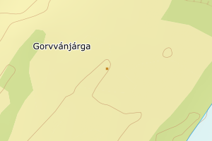
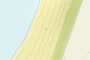
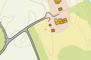
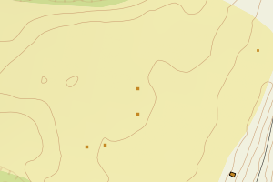
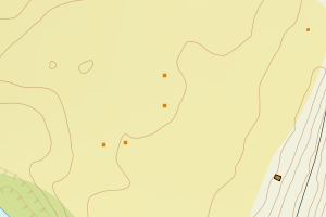
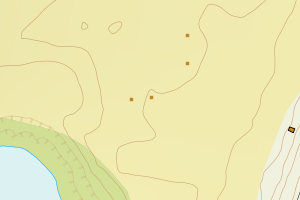
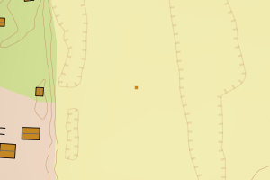
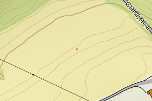
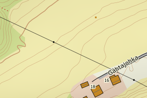
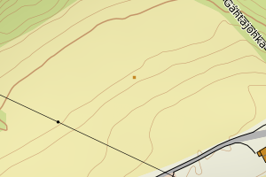
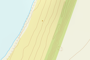
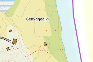
Avvikene kan skyldes enten feil bygningskoordinat eller bygningstype/status i matrikkel eller feil arealtype i AR5. Vær oppmerksom på det er krav om arealer på over 200 m2 før det er krav om endring av arealtype i AR5 så avvikene vil ikke alltid kreve retting i datagrunnlaget
Kommune | LokalId | Bygningsnummer | Arealtype | Bygningstatus | Bygningstype | matrikkel_vedtaksdato | Posisjon | WMS-bilde |
5610 Karasjok | 73d8ec24-2cfd-4603-a3a1-5b65c904362f | 192869226 | 21 | TB | 249 | None | N: 7743243.17, Ø: 470553.23 | ![Kartbilde fra WMS-tjeneste av avviket](https://wms.geonorge.no/skwms1/wms.topo?VERSION=1.1.1&SERVICE=WMS&REQUEST=GetMap&LAYERS=topo&STYLES=&FORMAT=image/png&SRS=EPSG:25835&BBOX=470478.0,7743193,470628.0,7743293&WIDTH=300&HEIGHT=200) |
5610 Karasjok | cc0bcafa-a14e-4346-9b3e-c029e4585bd6 | 192854075 | 21 | TB | 241 | None | N: 7704184.45, Ø: 430985.43 | ![Kartbilde fra WMS-tjeneste av avviket](https://wms.geonorge.no/skwms1/wms.topo?VERSION=1.1.1&SERVICE=WMS&REQUEST=GetMap&LAYERS=topo&STYLES=&FORMAT=image/png&SRS=EPSG:25835&BBOX=430910.0,7704134,431060.0,7704234&WIDTH=300&HEIGHT=200) |
5610 Karasjok | 35102304-b887-4bf6-b5fc-6f88c4f3688b | 192854539 | 21 | TB | 181 | None | N: 7704687.05, Ø: 435201.50 | ![Kartbilde fra WMS-tjeneste av avviket](https://wms.geonorge.no/skwms1/wms.topo?VERSION=1.1.1&SERVICE=WMS&REQUEST=GetMap&LAYERS=topo&STYLES=&FORMAT=image/png&SRS=EPSG:25835&BBOX=435126.0,7704637,435276.0,7704737&WIDTH=300&HEIGHT=200) |
5610 Karasjok | 1a5ea8b0-330c-4420-8aec-de0b5979ecff | 192872065 | 21 | TB | 181 | None | N: 7738095.38, Ø: 466862.13 | ![Kartbilde fra WMS-tjeneste av avviket](https://wms.geonorge.no/skwms1/wms.topo?VERSION=1.1.1&SERVICE=WMS&REQUEST=GetMap&LAYERS=topo&STYLES=&FORMAT=image/png&SRS=EPSG:25835&BBOX=466787.0,7738045,466937.0,7738145&WIDTH=300&HEIGHT=200) |
5610 Karasjok | 38102ccf-4e31-4b71-ab48-0d60867707f2 | 192869536 | 21 | TB | 241 | None | N: 7697485.43, Ø: 427469.33 | ![Kartbilde fra WMS-tjeneste av avviket](https://wms.geonorge.no/skwms1/wms.topo?VERSION=1.1.1&SERVICE=WMS&REQUEST=GetMap&LAYERS=topo&STYLES=&FORMAT=image/png&SRS=EPSG:25835&BBOX=427394.0,7697435,427544.0,7697535&WIDTH=300&HEIGHT=200) |
5610 Karasjok | 706791cb-73b4-4b80-a54b-1fab5f90da02 | 192853419 | 21 | TB | 182 | None | N: 7697484.05, Ø: 427480.28 | ![Kartbilde fra WMS-tjeneste av avviket](https://wms.geonorge.no/skwms1/wms.topo?VERSION=1.1.1&SERVICE=WMS&REQUEST=GetMap&LAYERS=topo&STYLES=&FORMAT=image/png&SRS=EPSG:25835&BBOX=427405.0,7697434,427555.0,7697534&WIDTH=300&HEIGHT=200) |
5610 Karasjok | a272b51e-ead6-42b5-9a8c-26b4b0763e43 | 192869706 | 21 | TB | 241 | None | N: 7739379.66, Ø: 468294.45 | ![Kartbilde fra WMS-tjeneste av avviket](https://wms.geonorge.no/skwms1/wms.topo?VERSION=1.1.1&SERVICE=WMS&REQUEST=GetMap&LAYERS=topo&STYLES=&FORMAT=image/png&SRS=EPSG:25835&BBOX=468219.0,7739329,468369.0,7739429&WIDTH=300&HEIGHT=200) |
5610 Karasjok | dc08244b-601f-4e9c-9bb1-54799f13e7d1 | 192871913 | 21 | TB | 249 | None | N: 7737351.40, Ø: 466560.15 | ![Kartbilde fra WMS-tjeneste av avviket](https://wms.geonorge.no/skwms1/wms.topo?VERSION=1.1.1&SERVICE=WMS&REQUEST=GetMap&LAYERS=topo&STYLES=&FORMAT=image/png&SRS=EPSG:25835&BBOX=466485.0,7737301,466635.0,7737401&WIDTH=300&HEIGHT=200) |
5610 Karasjok | ef850cc5-dfb9-4777-b446-e8fe02399a70 | 192871921 | 21 | TB | 249 | None | N: 7737337.40, Ø: 466560.15 | ![Kartbilde fra WMS-tjeneste av avviket](https://wms.geonorge.no/skwms1/wms.topo?VERSION=1.1.1&SERVICE=WMS&REQUEST=GetMap&LAYERS=topo&STYLES=&FORMAT=image/png&SRS=EPSG:25835&BBOX=466485.0,7737287,466635.0,7737387&WIDTH=300&HEIGHT=200) |
5610 Karasjok | 4583cd56-95bc-468c-8451-cfd6ec2d8a52 | 192871948 | 21 | TB | 241 | None | N: 7737320.40, Ø: 466542.15 | ![Kartbilde fra WMS-tjeneste av avviket](https://wms.geonorge.no/skwms1/wms.topo?VERSION=1.1.1&SERVICE=WMS&REQUEST=GetMap&LAYERS=topo&STYLES=&FORMAT=image/png&SRS=EPSG:25835&BBOX=466467.0,7737270,466617.0,7737370&WIDTH=300&HEIGHT=200) |
5610 Karasjok | b03afa77-b8f0-4f93-bbb2-adf794cbc6cc | 192868718 | 21 | TB | 241 | None | N: 7739396.78, Ø: 468118.02 | ![Kartbilde fra WMS-tjeneste av avviket](https://wms.geonorge.no/skwms1/wms.topo?VERSION=1.1.1&SERVICE=WMS&REQUEST=GetMap&LAYERS=topo&STYLES=&FORMAT=image/png&SRS=EPSG:25835&BBOX=468043.0,7739346,468193.0,7739446&WIDTH=300&HEIGHT=200) |
5610 Karasjok | a13ece73-14dc-477e-8ce0-1c8c35ae9a34 | 192867401 | 21 | TB | 241 | None | N: 7701535.32, Ø: 452677.81 | ![Kartbilde fra WMS-tjeneste av avviket](https://wms.geonorge.no/skwms1/wms.topo?VERSION=1.1.1&SERVICE=WMS&REQUEST=GetMap&LAYERS=topo&STYLES=&FORMAT=image/png&SRS=EPSG:25835&BBOX=452602.0,7701485,452752.0,7701585&WIDTH=300&HEIGHT=200) |
5610 Karasjok | 50810fd0-7a2c-49f7-b4d5-a42740edc74b | 192867770 | 21 | TB | 241 | None | N: 7710987.52, Ø: 454900.47 | ![Kartbilde fra WMS-tjeneste av avviket](https://wms.geonorge.no/skwms1/wms.topo?VERSION=1.1.1&SERVICE=WMS&REQUEST=GetMap&LAYERS=topo&STYLES=&FORMAT=image/png&SRS=EPSG:25835&BBOX=454825.0,7710937,454975.0,7711037&WIDTH=300&HEIGHT=200) |
5610 Karasjok | a1104597-1ea8-42cc-b826-245f953255b0 | 192867428 | 21 | TB | 113 | None | N: 7701550.48, Ø: 452702.34 | ![Kartbilde fra WMS-tjeneste av avviket](https://wms.geonorge.no/skwms1/wms.topo?VERSION=1.1.1&SERVICE=WMS&REQUEST=GetMap&LAYERS=topo&STYLES=&FORMAT=image/png&SRS=EPSG:25835&BBOX=452627.0,7701500,452777.0,7701600&WIDTH=300&HEIGHT=200) |
5610 Karasjok | 81743ab0-ad86-4594-b399-a3ccadccec4b | 192870992 | 21 | TB | 171 | None | N: 7660307.00, Ø: 450058.00 | ![Kartbilde fra WMS-tjeneste av avviket](https://wms.geonorge.no/skwms1/wms.topo?VERSION=1.1.1&SERVICE=WMS&REQUEST=GetMap&LAYERS=topo&STYLES=&FORMAT=image/png&SRS=EPSG:25835&BBOX=449983.0,7660257,450133.0,7660357&WIDTH=300&HEIGHT=200) |
5610 Karasjok | 43fe2a38-c00b-4cbf-8c6a-cd5ef809d599 | 192872073 | 21 | TB | 249 | None | N: 7731207.00, Ø: 458571.00 | ![Kartbilde fra WMS-tjeneste av avviket](https://wms.geonorge.no/skwms1/wms.topo?VERSION=1.1.1&SERVICE=WMS&REQUEST=GetMap&LAYERS=topo&STYLES=&FORMAT=image/png&SRS=EPSG:25835&BBOX=458496.0,7731157,458646.0,7731257&WIDTH=300&HEIGHT=200) |
5610 Karasjok | 480f9ed2-4f3b-4424-8189-56ef5fb68b8c | 192871018 | 21 | TB | 181 | None | N: 7660304.00, Ø: 450050.00 | ![Kartbilde fra WMS-tjeneste av avviket](https://wms.geonorge.no/skwms1/wms.topo?VERSION=1.1.1&SERVICE=WMS&REQUEST=GetMap&LAYERS=topo&STYLES=&FORMAT=image/png&SRS=EPSG:25835&BBOX=449975.0,7660254,450125.0,7660354&WIDTH=300&HEIGHT=200) |
5610 Karasjok | 52982224-66df-417f-a422-a52b5257726a | 192851629 | 21 | TB | 181 | None | N: 7715447.00, Ø: 398037.00 | ![Kartbilde fra WMS-tjeneste av avviket](https://wms.geonorge.no/skwms1/wms.topo?VERSION=1.1.1&SERVICE=WMS&REQUEST=GetMap&LAYERS=topo&STYLES=&FORMAT=image/png&SRS=EPSG:25835&BBOX=397962.0,7715397,398112.0,7715497&WIDTH=300&HEIGHT=200) |
5610 Karasjok | 083ce8d8-f1e3-47a1-9562-70b1f6a7d0bf | 192868610 | 21 | TB | 241 | None | N: 7737325.00, Ø: 466537.00 | ![Kartbilde fra WMS-tjeneste av avviket](https://wms.geonorge.no/skwms1/wms.topo?VERSION=1.1.1&SERVICE=WMS&REQUEST=GetMap&LAYERS=topo&STYLES=&FORMAT=image/png&SRS=EPSG:25835&BBOX=466462.0,7737275,466612.0,7737375&WIDTH=300&HEIGHT=200) |
5610 Karasjok | 377f420d-0ab4-4648-8e6d-d50587f46f04 | 192868416 | 21 | TB | 113 | None | N: 7731514.57, Ø: 458616.42 | ![Kartbilde fra WMS-tjeneste av avviket](https://wms.geonorge.no/skwms1/wms.topo?VERSION=1.1.1&SERVICE=WMS&REQUEST=GetMap&LAYERS=topo&STYLES=&FORMAT=image/png&SRS=EPSG:25835&BBOX=458541.0,7731464,458691.0,7731564&WIDTH=300&HEIGHT=200) |
5610 Karasjok | 65bb13f3-2912-42b2-8066-c02d35b23748 | 192867371 | 21 | TB | 241 | None | N: 7701568.00, Ø: 452684.00 | ![Kartbilde fra WMS-tjeneste av avviket](https://wms.geonorge.no/skwms1/wms.topo?VERSION=1.1.1&SERVICE=WMS&REQUEST=GetMap&LAYERS=topo&STYLES=&FORMAT=image/png&SRS=EPSG:25835&BBOX=452608.0,7701517,452758.0,7701617&WIDTH=300&HEIGHT=200) |
5610 Karasjok | f02e76c3-0605-4aba-8982-57f3b28ef746 | 192867509 | 21 | TB | 241 | None | N: 7701090.00, Ø: 453055.00 | ![Kartbilde fra WMS-tjeneste av avviket](https://wms.geonorge.no/skwms1/wms.topo?VERSION=1.1.1&SERVICE=WMS&REQUEST=GetMap&LAYERS=topo&STYLES=&FORMAT=image/png&SRS=EPSG:25835&BBOX=452979.0,7701039,453129.0,7701139&WIDTH=300&HEIGHT=200) |
5610 Karasjok | 8a71c54a-9f13-46ab-90b5-7786e7462266 | 192872049 | 21 | TB | 172 | None | N: 7738086.00, Ø: 466871.00 | ![Kartbilde fra WMS-tjeneste av avviket](https://wms.geonorge.no/skwms1/wms.topo?VERSION=1.1.1&SERVICE=WMS&REQUEST=GetMap&LAYERS=topo&STYLES=&FORMAT=image/png&SRS=EPSG:25835&BBOX=466796.0,7738036,466946.0,7738136&WIDTH=300&HEIGHT=200) |
5610 Karasjok | 8fe090d5-fc46-4d98-8369-1e9ac66c983d | 192871026 | 21 | TB | 241 | None | N: 7660329.00, Ø: 450060.00 | ![Kartbilde fra WMS-tjeneste av avviket](https://wms.geonorge.no/skwms1/wms.topo?VERSION=1.1.1&SERVICE=WMS&REQUEST=GetMap&LAYERS=topo&STYLES=&FORMAT=image/png&SRS=EPSG:25835&BBOX=449985.0,7660279,450135.0,7660379&WIDTH=300&HEIGHT=200) |
5610 Karasjok | ca08b496-592f-47fe-b62a-270cafba2874 | 192869692 | 21 | TB | 245 | None | N: 7699339.17, Ø: 391445.10 | ![Kartbilde fra WMS-tjeneste av avviket](https://wms.geonorge.no/skwms1/wms.topo?VERSION=1.1.1&SERVICE=WMS&REQUEST=GetMap&LAYERS=topo&STYLES=&FORMAT=image/png&SRS=EPSG:25835&BBOX=391370.0,7699289,391520.0,7699389&WIDTH=300&HEIGHT=200) |
5610 Karasjok | d0697eb8-a469-4ab2-9bb9-f53067c0ae4e | 192866081 | 21 | TB | 241 | None | N: 7706238.11, Ø: 443063.92 | ![Kartbilde fra WMS-tjeneste av avviket](https://wms.geonorge.no/skwms1/wms.topo?VERSION=1.1.1&SERVICE=WMS&REQUEST=GetMap&LAYERS=topo&STYLES=&FORMAT=image/png&SRS=EPSG:25835&BBOX=442988.0,7706188,443138.0,7706288&WIDTH=300&HEIGHT=200) |
5610 Karasjok | f7c978e3-04ab-40e5-b53f-9b31c74a7c31 | 192869625 | 21 | TB | 241 | None | N: 7700872.84, Ø: 408109.39 | ![Kartbilde fra WMS-tjeneste av avviket](https://wms.geonorge.no/skwms1/wms.topo?VERSION=1.1.1&SERVICE=WMS&REQUEST=GetMap&LAYERS=topo&STYLES=&FORMAT=image/png&SRS=EPSG:25835&BBOX=408034.0,7700822,408184.0,7700922&WIDTH=300&HEIGHT=200) |
5610 Karasjok | 2fbf9157-229d-453c-9024-bdffec66c3e1 | 192871840 | 21 | TB | 181 | None | N: 7737372.39, Ø: 466626.15 | ![Kartbilde fra WMS-tjeneste av avviket](https://wms.geonorge.no/skwms1/wms.topo?VERSION=1.1.1&SERVICE=WMS&REQUEST=GetMap&LAYERS=topo&STYLES=&FORMAT=image/png&SRS=EPSG:25835&BBOX=466551.0,7737322,466701.0,7737422&WIDTH=300&HEIGHT=200) |
5610 Karasjok | bccc6c12-e9b3-4fdf-afe3-b5da62a4788a | 192871522 | 21 | TB | 249 | None | N: 7695910.57, Ø: 427040.14 | ![Kartbilde fra WMS-tjeneste av avviket](https://wms.geonorge.no/skwms1/wms.topo?VERSION=1.1.1&SERVICE=WMS&REQUEST=GetMap&LAYERS=topo&STYLES=&FORMAT=image/png&SRS=EPSG:25835&BBOX=426965.0,7695860,427115.0,7695960&WIDTH=300&HEIGHT=200) |
5610 Karasjok | 7e4625eb-1864-4834-8aaa-18ab7573be51 | 192872111 | 21 | TB | 241 | None | N: 7731851.92, Ø: 458732.64 | ![Kartbilde fra WMS-tjeneste av avviket](https://wms.geonorge.no/skwms1/wms.topo?VERSION=1.1.1&SERVICE=WMS&REQUEST=GetMap&LAYERS=topo&STYLES=&FORMAT=image/png&SRS=EPSG:25835&BBOX=458657.0,7731801,458807.0,7731901&WIDTH=300&HEIGHT=200) |
5610 Karasjok | 971760a5-90a9-4a13-b7eb-2676249d743b | 192872146 | 21 | TB | 241 | None | N: 7732103.95, Ø: 458294.66 | ![Kartbilde fra WMS-tjeneste av avviket](https://wms.geonorge.no/skwms1/wms.topo?VERSION=1.1.1&SERVICE=WMS&REQUEST=GetMap&LAYERS=topo&STYLES=&FORMAT=image/png&SRS=EPSG:25835&BBOX=458219.0,7732053,458369.0,7732153&WIDTH=300&HEIGHT=200) |
5610 Karasjok | cf687148-788e-410b-9e8e-2c13cebeb2dc | 192872154 | 21 | TB | 171 | None | N: 7732072.95, Ø: 458272.66 | ![Kartbilde fra WMS-tjeneste av avviket](https://wms.geonorge.no/skwms1/wms.topo?VERSION=1.1.1&SERVICE=WMS&REQUEST=GetMap&LAYERS=topo&STYLES=&FORMAT=image/png&SRS=EPSG:25835&BBOX=458197.0,7732022,458347.0,7732122&WIDTH=300&HEIGHT=200) |
5610 Karasjok | 9102e49a-fa86-4fe8-8852-08d4daad3e20 | 192872170 | 21 | TB | 172 | None | N: 7732098.95, Ø: 458294.66 | ![Kartbilde fra WMS-tjeneste av avviket](https://wms.geonorge.no/skwms1/wms.topo?VERSION=1.1.1&SERVICE=WMS&REQUEST=GetMap&LAYERS=topo&STYLES=&FORMAT=image/png&SRS=EPSG:25835&BBOX=458219.0,7732048,458369.0,7732148&WIDTH=300&HEIGHT=200) |
5610 Karasjok | dd581979-fe34-4f79-a325-95bfaaf682c2 | 192869595 | 21 | TB | 181 | None | N: 7700861.28, Ø: 407930.86 | ![Kartbilde fra WMS-tjeneste av avviket](https://wms.geonorge.no/skwms1/wms.topo?VERSION=1.1.1&SERVICE=WMS&REQUEST=GetMap&LAYERS=topo&STYLES=&FORMAT=image/png&SRS=EPSG:25835&BBOX=407855.0,7700811,408005.0,7700911&WIDTH=300&HEIGHT=200) |
5610 Karasjok | c581a9a1-9560-483a-9dd9-f427404264fd | 192869609 | 21 | TB | 249 | None | N: 7700950.60, Ø: 408212.02 | ![Kartbilde fra WMS-tjeneste av avviket](https://wms.geonorge.no/skwms1/wms.topo?VERSION=1.1.1&SERVICE=WMS&REQUEST=GetMap&LAYERS=topo&STYLES=&FORMAT=image/png&SRS=EPSG:25835&BBOX=408137.0,7700900,408287.0,7701000&WIDTH=300&HEIGHT=200) |
5610 Karasjok | 499e4444-3a5a-4f30-9e8e-8a1ad33c9f02 | 192865662 | 21 | TB | 241 | None | N: 7703845.87, Ø: 448589.63 | ![Kartbilde fra WMS-tjeneste av avviket](https://wms.geonorge.no/skwms1/wms.topo?VERSION=1.1.1&SERVICE=WMS&REQUEST=GetMap&LAYERS=topo&STYLES=&FORMAT=image/png&SRS=EPSG:25835&BBOX=448514.0,7703795,448664.0,7703895&WIDTH=300&HEIGHT=200) |
5610 Karasjok | 9075244a-85a3-4b8c-8dab-79db3cc876ee | 192867495 | 21 | TB | 241 | None | N: 7700869.18, Ø: 452590.80 | ![Kartbilde fra WMS-tjeneste av avviket](https://wms.geonorge.no/skwms1/wms.topo?VERSION=1.1.1&SERVICE=WMS&REQUEST=GetMap&LAYERS=topo&STYLES=&FORMAT=image/png&SRS=EPSG:25835&BBOX=452515.0,7700819,452665.0,7700919&WIDTH=300&HEIGHT=200) |
5610 Karasjok | 6ffe4693-e949-4009-b5ff-fca453731008 | 192855624 | 21 | TB | 241 | None | N: 7705675.38, Ø: 439835.74 | ![Kartbilde fra WMS-tjeneste av avviket](https://wms.geonorge.no/skwms1/wms.topo?VERSION=1.1.1&SERVICE=WMS&REQUEST=GetMap&LAYERS=topo&STYLES=&FORMAT=image/png&SRS=EPSG:25835&BBOX=439760.0,7705625,439910.0,7705725&WIDTH=300&HEIGHT=200) |
5610 Karasjok | 53968535-a66f-4760-ac50-357ad96d0f39 | 192854466 | 21 | TB | 181 | None | N: 7704670.28, Ø: 434846.83 | ![Kartbilde fra WMS-tjeneste av avviket](https://wms.geonorge.no/skwms1/wms.topo?VERSION=1.1.1&SERVICE=WMS&REQUEST=GetMap&LAYERS=topo&STYLES=&FORMAT=image/png&SRS=EPSG:25835&BBOX=434771.0,7704620,434921.0,7704720&WIDTH=300&HEIGHT=200) |
5610 Karasjok | 356c4311-a801-4779-9097-4c77d614e90d | 192850339 | 21 | TB | 241 | None | N: 7703810.10, Ø: 448968.36 | ![Kartbilde fra WMS-tjeneste av avviket](https://wms.geonorge.no/skwms1/wms.topo?VERSION=1.1.1&SERVICE=WMS&REQUEST=GetMap&LAYERS=topo&STYLES=&FORMAT=image/png&SRS=EPSG:25835&BBOX=448893.0,7703760,449043.0,7703860&WIDTH=300&HEIGHT=200) |
5610 Karasjok | b97af1a4-eb05-4621-9d86-021f84f0c434 | 192853486 | 21 | TB | 241 | None | N: 7697989.86, Ø: 427033.99 | ![Kartbilde fra WMS-tjeneste av avviket](https://wms.geonorge.no/skwms1/wms.topo?VERSION=1.1.1&SERVICE=WMS&REQUEST=GetMap&LAYERS=topo&STYLES=&FORMAT=image/png&SRS=EPSG:25835&BBOX=426958.0,7697939,427108.0,7698039&WIDTH=300&HEIGHT=200) |
5610 Karasjok | 66b2b7e3-a9ee-4a1a-a466-b3c4063875ee | 300816586 | 21 | FA | 111 | 2021-10-22 | N: 7706056.00, Ø: 440231.00 | ![Kartbilde fra WMS-tjeneste av avviket](https://wms.geonorge.no/skwms1/wms.topo?VERSION=1.1.1&SERVICE=WMS&REQUEST=GetMap&LAYERS=topo&STYLES=&FORMAT=image/png&SRS=EPSG:25835&BBOX=440156.0,7706006,440306.0,7706106&WIDTH=300&HEIGHT=200) |
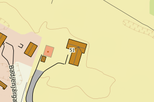
5610 Karasjok | 2f06a2c5-e9d8-4627-a196-608ff8b2678c | 300850708 | 21 | FA | 111 | 2021-09-30 | N: 7705608.10, Ø: 439655.50 | ![Kartbilde fra WMS-tjeneste av avviket](https://wms.geonorge.no/skwms1/wms.topo?VERSION=1.1.1&SERVICE=WMS&REQUEST=GetMap&LAYERS=topo&STYLES=&FORMAT=image/png&SRS=EPSG:25835&BBOX=439580.0,7705558,439730.0,7705658&WIDTH=300&HEIGHT=200) |
5610 Karasjok | f074e17d-9614-41e2-b968-f443d0b72eec | 300345065 | 21 | FA | 161 | 2015-05-04 | N: 7678500.70, Ø: 448848.30 | ![Kartbilde fra WMS-tjeneste av avviket](https://wms.geonorge.no/skwms1/wms.topo?VERSION=1.1.1&SERVICE=WMS&REQUEST=GetMap&LAYERS=topo&STYLES=&FORMAT=image/png&SRS=EPSG:25835&BBOX=448773.0,7678450,448923.0,7678550&WIDTH=300&HEIGHT=200) |
5610 Karasjok | 9ac02029-20e5-473b-8413-7993f0249a06 | 11710913 | 21 | TB | 999 | 1987-07-15 | N: 7706603.80, Ø: 441308.13 | ![Kartbilde fra WMS-tjeneste av avviket](https://wms.geonorge.no/skwms1/wms.topo?VERSION=1.1.1&SERVICE=WMS&REQUEST=GetMap&LAYERS=topo&STYLES=&FORMAT=image/png&SRS=EPSG:25835&BBOX=441233.0,7706553,441383.0,7706653&WIDTH=300&HEIGHT=200) |