Avvikene skyldes vanligvis unøyaktig registrering av bygningspunkt i matrikkelen slik at det har havnet utenfor bygningsomriss. Rettes vanligvis i matrikkelen
Kommune | LokalId | Bygningsnummer | Avstand (m) | Posisjon | WMS-bilde |
5540 Kåfjord | e5f4d90d-9801-4001-ae2e-71b386edd97d | 192087139 | 0.00 | N: 7712677.00, Ø: 718160.00 | ![Kartbilde fra WMS-tjeneste av avviket](https://wms.geonorge.no/skwms1/wms.topo?VERSION=1.1.1&SERVICE=WMS&REQUEST=GetMap&LAYERS=topo&STYLES=&FORMAT=image/png&SRS=EPSG:25833&BBOX=718085.0,7712627,718235.0,7712727&WIDTH=300&HEIGHT=200) |
5540 Kåfjord | 1f5b0c63-57f1-4271-8112-6914796088b3 | 300667221 | 0.02 | N: 7716159.00, Ø: 732065.00 | ![Kartbilde fra WMS-tjeneste av avviket](https://wms.geonorge.no/skwms1/wms.topo?VERSION=1.1.1&SERVICE=WMS&REQUEST=GetMap&LAYERS=topo&STYLES=&FORMAT=image/png&SRS=EPSG:25833&BBOX=731990.0,7716109,732140.0,7716209&WIDTH=300&HEIGHT=200) |
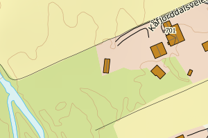
5540 Kåfjord | db1f463f-cb08-4e12-b916-3126a25e2861 | 192070678 | 0.04 | N: 7714508.00, Ø: 717148.00 | ![Kartbilde fra WMS-tjeneste av avviket](https://wms.geonorge.no/skwms1/wms.topo?VERSION=1.1.1&SERVICE=WMS&REQUEST=GetMap&LAYERS=topo&STYLES=&FORMAT=image/png&SRS=EPSG:25833&BBOX=717073.0,7714458,717223.0,7714558&WIDTH=300&HEIGHT=200) |
5540 Kåfjord | 9b017649-4670-44a9-bc05-e1f45a9f885a | 192087236 | 0.16 | N: 7712792.00, Ø: 717737.00 | ![Kartbilde fra WMS-tjeneste av avviket](https://wms.geonorge.no/skwms1/wms.topo?VERSION=1.1.1&SERVICE=WMS&REQUEST=GetMap&LAYERS=topo&STYLES=&FORMAT=image/png&SRS=EPSG:25833&BBOX=717662.0,7712742,717812.0,7712842&WIDTH=300&HEIGHT=200) |
5540 Kåfjord | cfdeb03d-f6ca-4576-8999-996bf91d40e4 | 192070031 | 0.24 | N: 7713084.00, Ø: 725798.00 | ![Kartbilde fra WMS-tjeneste av avviket](https://wms.geonorge.no/skwms1/wms.topo?VERSION=1.1.1&SERVICE=WMS&REQUEST=GetMap&LAYERS=topo&STYLES=&FORMAT=image/png&SRS=EPSG:25833&BBOX=725723.0,7713034,725873.0,7713134&WIDTH=300&HEIGHT=200) |
5540 Kåfjord | b5d22d4e-de85-4526-8f99-b6c24fe40128 | 140787116 | 0.46 | N: 7719227.00, Ø: 729573.00 | ![Kartbilde fra WMS-tjeneste av avviket](https://wms.geonorge.no/skwms1/wms.topo?VERSION=1.1.1&SERVICE=WMS&REQUEST=GetMap&LAYERS=topo&STYLES=&FORMAT=image/png&SRS=EPSG:25833&BBOX=729498.0,7719177,729648.0,7719277&WIDTH=300&HEIGHT=200) |
5540 Kåfjord | 55feaf59-1886-4c9c-8fbb-41f76814170e | 192079918 | 0.52 | N: 7731744.00, Ø: 714742.00 | ![Kartbilde fra WMS-tjeneste av avviket](https://wms.geonorge.no/skwms1/wms.topo?VERSION=1.1.1&SERVICE=WMS&REQUEST=GetMap&LAYERS=topo&STYLES=&FORMAT=image/png&SRS=EPSG:25833&BBOX=714667.0,7731694,714817.0,7731794&WIDTH=300&HEIGHT=200) |
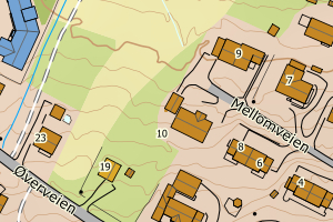
5540 Kåfjord | ad3d213e-9e74-47c5-a5b0-f199ab788e14 | 192075696 | 0.69 | N: 7721314.00, Ø: 716063.00 | ![Kartbilde fra WMS-tjeneste av avviket](https://wms.geonorge.no/skwms1/wms.topo?VERSION=1.1.1&SERVICE=WMS&REQUEST=GetMap&LAYERS=topo&STYLES=&FORMAT=image/png&SRS=EPSG:25833&BBOX=715988.0,7721264,716138.0,7721364&WIDTH=300&HEIGHT=200) |
5540 Kåfjord | 88af119e-67a9-4d52-813c-b8d8939c6042 | 140788252 | 0.71 | N: 7740168.00, Ø: 713269.00 | ![Kartbilde fra WMS-tjeneste av avviket](https://wms.geonorge.no/skwms1/wms.topo?VERSION=1.1.1&SERVICE=WMS&REQUEST=GetMap&LAYERS=topo&STYLES=&FORMAT=image/png&SRS=EPSG:25833&BBOX=713194.0,7740118,713344.0,7740218&WIDTH=300&HEIGHT=200) |
5540 Kåfjord | 1b324745-a0e7-4abd-adcc-d7d409850e09 | 192099285 | 0.85 | N: 7717593.00, Ø: 731823.00 | ![Kartbilde fra WMS-tjeneste av avviket](https://wms.geonorge.no/skwms1/wms.topo?VERSION=1.1.1&SERVICE=WMS&REQUEST=GetMap&LAYERS=topo&STYLES=&FORMAT=image/png&SRS=EPSG:25833&BBOX=731748.0,7717543,731898.0,7717643&WIDTH=300&HEIGHT=200) |