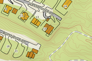
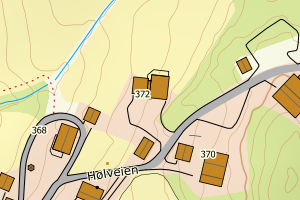
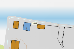
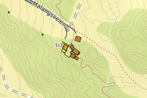
Avvikene skyldes vanligvis unøyaktig registrering av bygningspunkt i matrikkelen slik at det har havnet utenfor bygningsomriss. Rettes vanligvis i matrikkelen
Kommune | LokalId | Bygningsnummer | Avstand (m) | Posisjon | WMS-bilde |
5532 Balsfjord | cb840d02-cc16-4be5-acf5-495eba8c9461 | 191859316 | 0.01 | N: 7696177.00, Ø: 655622.00 | ![Kartbilde fra WMS-tjeneste av avviket](https://wms.geonorge.no/skwms1/wms.topo?VERSION=1.1.1&SERVICE=WMS&REQUEST=GetMap&LAYERS=topo&STYLES=&FORMAT=image/png&SRS=EPSG:25833&BBOX=655547.0,7696127,655697.0,7696227&WIDTH=300&HEIGHT=200) |
5532 Balsfjord | 9f379aab-5e7e-48b2-a97b-421c9d674ccb | 300706396 | 0.01 | N: 7682418.40, Ø: 668484.73 | ![Kartbilde fra WMS-tjeneste av avviket](https://wms.geonorge.no/skwms1/wms.topo?VERSION=1.1.1&SERVICE=WMS&REQUEST=GetMap&LAYERS=topo&STYLES=&FORMAT=image/png&SRS=EPSG:25833&BBOX=668409.0,7682368,668559.0,7682468&WIDTH=300&HEIGHT=200) |
5532 Balsfjord | 7e1f00c1-da73-412f-871e-d706547db035 | 191918428 | 0.01 | N: 7672501.60, Ø: 671352.10 | ![Kartbilde fra WMS-tjeneste av avviket](https://wms.geonorge.no/skwms1/wms.topo?VERSION=1.1.1&SERVICE=WMS&REQUEST=GetMap&LAYERS=topo&STYLES=&FORMAT=image/png&SRS=EPSG:25833&BBOX=671277.0,7672451,671427.0,7672551&WIDTH=300&HEIGHT=200) |
5532 Balsfjord | f390391a-6d99-48a8-aa1d-6e2a7941db9f | 11582532 | 0.02 | N: 7697345.00, Ø: 648316.00 | ![Kartbilde fra WMS-tjeneste av avviket](https://wms.geonorge.no/skwms1/wms.topo?VERSION=1.1.1&SERVICE=WMS&REQUEST=GetMap&LAYERS=topo&STYLES=&FORMAT=image/png&SRS=EPSG:25833&BBOX=648241.0,7697295,648391.0,7697395&WIDTH=300&HEIGHT=200) |
5532 Balsfjord | 26b669ff-65f3-4e70-aaea-5259b6b8749a | 23381567 | 0.02 | N: 7670214.00, Ø: 666422.00 | ![Kartbilde fra WMS-tjeneste av avviket](https://wms.geonorge.no/skwms1/wms.topo?VERSION=1.1.1&SERVICE=WMS&REQUEST=GetMap&LAYERS=topo&STYLES=&FORMAT=image/png&SRS=EPSG:25833&BBOX=666347.0,7670164,666497.0,7670264&WIDTH=300&HEIGHT=200) |
5532 Balsfjord | 7616be60-298a-410d-b3e6-d625ee561833 | 300200743 | 0.02 | N: 7673616.00, Ø: 663506.00 | ![Kartbilde fra WMS-tjeneste av avviket](https://wms.geonorge.no/skwms1/wms.topo?VERSION=1.1.1&SERVICE=WMS&REQUEST=GetMap&LAYERS=topo&STYLES=&FORMAT=image/png&SRS=EPSG:25833&BBOX=663430.0,7673565,663580.0,7673665&WIDTH=300&HEIGHT=200) |
5532 Balsfjord | 2f0649ca-d162-4504-a677-dd039334a2db | 191912594 | 0.03 | N: 7687180.70, Ø: 682235.10 | ![Kartbilde fra WMS-tjeneste av avviket](https://wms.geonorge.no/skwms1/wms.topo?VERSION=1.1.1&SERVICE=WMS&REQUEST=GetMap&LAYERS=topo&STYLES=&FORMAT=image/png&SRS=EPSG:25833&BBOX=682160.0,7687130,682310.0,7687230&WIDTH=300&HEIGHT=200) |
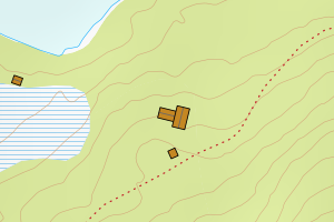
5532 Balsfjord | 228456f7-215a-4478-a0c3-7d1e4da1710f | 23382563 | 0.03 | N: 7686649.10, Ø: 665136.10 | ![Kartbilde fra WMS-tjeneste av avviket](https://wms.geonorge.no/skwms1/wms.topo?VERSION=1.1.1&SERVICE=WMS&REQUEST=GetMap&LAYERS=topo&STYLES=&FORMAT=image/png&SRS=EPSG:25833&BBOX=665061.0,7686599,665211.0,7686699&WIDTH=300&HEIGHT=200) |
5532 Balsfjord | eff4f9c8-b269-4437-bd29-85b5b15ece0c | 300274936 | 0.04 | N: 7669466.00, Ø: 667026.40 | ![Kartbilde fra WMS-tjeneste av avviket](https://wms.geonorge.no/skwms1/wms.topo?VERSION=1.1.1&SERVICE=WMS&REQUEST=GetMap&LAYERS=topo&STYLES=&FORMAT=image/png&SRS=EPSG:25833&BBOX=666951.0,7669416,667101.0,7669516&WIDTH=300&HEIGHT=200) |
5532 Balsfjord | 579a349d-51b5-4a3f-a2c9-bf0b4d4ee766 | 300609401 | 0.04 | N: 7697859.60, Ø: 646385.40 | ![Kartbilde fra WMS-tjeneste av avviket](https://wms.geonorge.no/skwms1/wms.topo?VERSION=1.1.1&SERVICE=WMS&REQUEST=GetMap&LAYERS=topo&STYLES=&FORMAT=image/png&SRS=EPSG:25833&BBOX=646310.0,7697809,646460.0,7697909&WIDTH=300&HEIGHT=200) |
5532 Balsfjord | 65ea1997-25bc-459a-bc31-d2ddd02ab9b2 | 191901118 | 0.04 | N: 7702686.00, Ø: 667101.00 | ![Kartbilde fra WMS-tjeneste av avviket](https://wms.geonorge.no/skwms1/wms.topo?VERSION=1.1.1&SERVICE=WMS&REQUEST=GetMap&LAYERS=topo&STYLES=&FORMAT=image/png&SRS=EPSG:25833&BBOX=667026.0,7702636,667176.0,7702736&WIDTH=300&HEIGHT=200) |
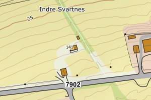
5532 Balsfjord | ba291109-c540-4233-99d9-a01825a9686a | 191838521 | 0.05 | N: 7696752.00, Ø: 650014.00 | ![Kartbilde fra WMS-tjeneste av avviket](https://wms.geonorge.no/skwms1/wms.topo?VERSION=1.1.1&SERVICE=WMS&REQUEST=GetMap&LAYERS=topo&STYLES=&FORMAT=image/png&SRS=EPSG:25833&BBOX=649939.0,7696702,650089.0,7696802&WIDTH=300&HEIGHT=200) |
5532 Balsfjord | 198a56dd-d39c-4c12-9277-ade825356541 | 191867319 | 0.06 | N: 7670250.30, Ø: 665875.70 | ![Kartbilde fra WMS-tjeneste av avviket](https://wms.geonorge.no/skwms1/wms.topo?VERSION=1.1.1&SERVICE=WMS&REQUEST=GetMap&LAYERS=topo&STYLES=&FORMAT=image/png&SRS=EPSG:25833&BBOX=665800.0,7670200,665950.0,7670300&WIDTH=300&HEIGHT=200) |
5532 Balsfjord | 34f97aaa-92f8-4055-b659-43cd71f85d98 | 191884671 | 0.07 | N: 7698179.00, Ø: 662431.00 | ![Kartbilde fra WMS-tjeneste av avviket](https://wms.geonorge.no/skwms1/wms.topo?VERSION=1.1.1&SERVICE=WMS&REQUEST=GetMap&LAYERS=topo&STYLES=&FORMAT=image/png&SRS=EPSG:25833&BBOX=662356.0,7698129,662506.0,7698229&WIDTH=300&HEIGHT=200) |
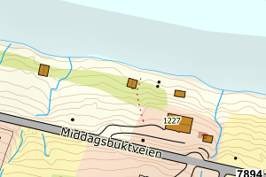
5532 Balsfjord | 4a978592-40a3-4fa5-9726-154f7401c627 | 191865464 | 0.07 | N: 7713558.00, Ø: 656198.00 | ![Kartbilde fra WMS-tjeneste av avviket](https://wms.geonorge.no/skwms1/wms.topo?VERSION=1.1.1&SERVICE=WMS&REQUEST=GetMap&LAYERS=topo&STYLES=&FORMAT=image/png&SRS=EPSG:25833&BBOX=656123.0,7713508,656273.0,7713608&WIDTH=300&HEIGHT=200) |
5532 Balsfjord | 15269076-e0d4-4adc-b860-3ff03b0ccc3c | 191869656 | 0.07 | N: 7673380.00, Ø: 664208.00 | ![Kartbilde fra WMS-tjeneste av avviket](https://wms.geonorge.no/skwms1/wms.topo?VERSION=1.1.1&SERVICE=WMS&REQUEST=GetMap&LAYERS=topo&STYLES=&FORMAT=image/png&SRS=EPSG:25833&BBOX=664133.0,7673330,664283.0,7673430&WIDTH=300&HEIGHT=200) |
5532 Balsfjord | 79f96cfb-30a7-498d-81f4-509690a954b2 | 191867645 | 0.09 | N: 7669777.00, Ø: 666848.00 | ![Kartbilde fra WMS-tjeneste av avviket](https://wms.geonorge.no/skwms1/wms.topo?VERSION=1.1.1&SERVICE=WMS&REQUEST=GetMap&LAYERS=topo&STYLES=&FORMAT=image/png&SRS=EPSG:25833&BBOX=666773.0,7669727,666923.0,7669827&WIDTH=300&HEIGHT=200) |
5532 Balsfjord | feba87e8-e5f0-4968-97cb-b9ea92b0998d | 191922239 | 0.11 | N: 7689173.00, Ø: 650287.00 | ![Kartbilde fra WMS-tjeneste av avviket](https://wms.geonorge.no/skwms1/wms.topo?VERSION=1.1.1&SERVICE=WMS&REQUEST=GetMap&LAYERS=topo&STYLES=&FORMAT=image/png&SRS=EPSG:25833&BBOX=650212.0,7689123,650362.0,7689223&WIDTH=300&HEIGHT=200) |
5532 Balsfjord | 3f84be43-1f6f-4077-90eb-97aa849acb03 | 11582826 | 0.11 | N: 7690174.70, Ø: 646890.30 | ![Kartbilde fra WMS-tjeneste av avviket](https://wms.geonorge.no/skwms1/wms.topo?VERSION=1.1.1&SERVICE=WMS&REQUEST=GetMap&LAYERS=topo&STYLES=&FORMAT=image/png&SRS=EPSG:25833&BBOX=646815.0,7690124,646965.0,7690224&WIDTH=300&HEIGHT=200) |
5532 Balsfjord | 6939f50d-b90b-4567-bcf3-9e5a0f491bd4 | 191845994 | 0.11 | N: 7695565.70, Ø: 652358.80 | ![Kartbilde fra WMS-tjeneste av avviket](https://wms.geonorge.no/skwms1/wms.topo?VERSION=1.1.1&SERVICE=WMS&REQUEST=GetMap&LAYERS=topo&STYLES=&FORMAT=image/png&SRS=EPSG:25833&BBOX=652283.0,7695515,652433.0,7695615&WIDTH=300&HEIGHT=200) |
5532 Balsfjord | 6aa94056-1fb5-473e-9e53-46727d27e66f | 191836847 | 0.12 | N: 7694011.00, Ø: 650332.30 | ![Kartbilde fra WMS-tjeneste av avviket](https://wms.geonorge.no/skwms1/wms.topo?VERSION=1.1.1&SERVICE=WMS&REQUEST=GetMap&LAYERS=topo&STYLES=&FORMAT=image/png&SRS=EPSG:25833&BBOX=650257.0,7693961,650407.0,7694061&WIDTH=300&HEIGHT=200) |
5532 Balsfjord | 89fe7598-7c96-4ef3-92ae-6708baf3820d | 300607935 | 0.12 | N: 7694731.90, Ø: 656086.30 | ![Kartbilde fra WMS-tjeneste av avviket](https://wms.geonorge.no/skwms1/wms.topo?VERSION=1.1.1&SERVICE=WMS&REQUEST=GetMap&LAYERS=topo&STYLES=&FORMAT=image/png&SRS=EPSG:25833&BBOX=656011.0,7694681,656161.0,7694781&WIDTH=300&HEIGHT=200) |
5532 Balsfjord | 2c5d532f-4ccb-403c-aa29-97d9dd061987 | 191853547 | 0.12 | N: 7681362.20, Ø: 659399.50 | ![Kartbilde fra WMS-tjeneste av avviket](https://wms.geonorge.no/skwms1/wms.topo?VERSION=1.1.1&SERVICE=WMS&REQUEST=GetMap&LAYERS=topo&STYLES=&FORMAT=image/png&SRS=EPSG:25833&BBOX=659324.0,7681312,659474.0,7681412&WIDTH=300&HEIGHT=200) |
5532 Balsfjord | 45545c87-e7a6-4c27-9ffe-27d7373c06fa | 300609396 | 0.14 | N: 7698087.60, Ø: 646199.40 | ![Kartbilde fra WMS-tjeneste av avviket](https://wms.geonorge.no/skwms1/wms.topo?VERSION=1.1.1&SERVICE=WMS&REQUEST=GetMap&LAYERS=topo&STYLES=&FORMAT=image/png&SRS=EPSG:25833&BBOX=646124.0,7698037,646274.0,7698137&WIDTH=300&HEIGHT=200) |
5532 Balsfjord | 8dbccc62-281c-4a2d-bfac-ba853ee3a51d | 11580645 | 0.17 | N: 7682038.95, Ø: 661770.00 | ![Kartbilde fra WMS-tjeneste av avviket](https://wms.geonorge.no/skwms1/wms.topo?VERSION=1.1.1&SERVICE=WMS&REQUEST=GetMap&LAYERS=topo&STYLES=&FORMAT=image/png&SRS=EPSG:25833&BBOX=661695.0,7681988,661845.0,7682088&WIDTH=300&HEIGHT=200) |
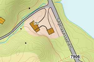
5532 Balsfjord | 3ffa6b0a-5084-4477-901b-ac1c6a56242c | 191904729 | 0.18 | N: 7685569.00, Ø: 676016.00 | ![Kartbilde fra WMS-tjeneste av avviket](https://wms.geonorge.no/skwms1/wms.topo?VERSION=1.1.1&SERVICE=WMS&REQUEST=GetMap&LAYERS=topo&STYLES=&FORMAT=image/png&SRS=EPSG:25833&BBOX=675941.0,7685519,676091.0,7685619&WIDTH=300&HEIGHT=200) |
5532 Balsfjord | 5974bc5d-d9cf-41a4-8409-ea12eb7acd81 | 191869087 | 0.18 | N: 7669280.00, Ø: 669873.00 | ![Kartbilde fra WMS-tjeneste av avviket](https://wms.geonorge.no/skwms1/wms.topo?VERSION=1.1.1&SERVICE=WMS&REQUEST=GetMap&LAYERS=topo&STYLES=&FORMAT=image/png&SRS=EPSG:25833&BBOX=669798.0,7669230,669948.0,7669330&WIDTH=300&HEIGHT=200) |
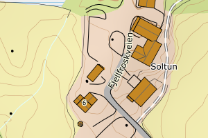
5532 Balsfjord | 64b986fb-670a-4001-bf1b-cb1b35d780e0 | 300531222 | 0.18 | N: 7682968.10, Ø: 660817.60 | ![Kartbilde fra WMS-tjeneste av avviket](https://wms.geonorge.no/skwms1/wms.topo?VERSION=1.1.1&SERVICE=WMS&REQUEST=GetMap&LAYERS=topo&STYLES=&FORMAT=image/png&SRS=EPSG:25833&BBOX=660742.0,7682918,660892.0,7683018&WIDTH=300&HEIGHT=200) |
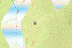
5532 Balsfjord | ff3dfd9d-e636-4c5a-a58d-7676607027eb | 300609228 | 0.19 | N: 7683032.80, Ø: 660747.50 | ![Kartbilde fra WMS-tjeneste av avviket](https://wms.geonorge.no/skwms1/wms.topo?VERSION=1.1.1&SERVICE=WMS&REQUEST=GetMap&LAYERS=topo&STYLES=&FORMAT=image/png&SRS=EPSG:25833&BBOX=660672.0,7682982,660822.0,7683082&WIDTH=300&HEIGHT=200) |
5532 Balsfjord | ad4e91cc-b6ba-4095-8ec3-f1f6ee0ee6cc | 300608631 | 0.19 | N: 7688332.20, Ø: 666683.80 | ![Kartbilde fra WMS-tjeneste av avviket](https://wms.geonorge.no/skwms1/wms.topo?VERSION=1.1.1&SERVICE=WMS&REQUEST=GetMap&LAYERS=topo&STYLES=&FORMAT=image/png&SRS=EPSG:25833&BBOX=666608.0,7688282,666758.0,7688382&WIDTH=300&HEIGHT=200) |
5532 Balsfjord | 31d59255-5494-46a3-8f02-8fb872d9c0eb | 300610992 | 0.22 | N: 7690123.60, Ø: 646762.30 | ![Kartbilde fra WMS-tjeneste av avviket](https://wms.geonorge.no/skwms1/wms.topo?VERSION=1.1.1&SERVICE=WMS&REQUEST=GetMap&LAYERS=topo&STYLES=&FORMAT=image/png&SRS=EPSG:25833&BBOX=646687.0,7690073,646837.0,7690173&WIDTH=300&HEIGHT=200) |
5532 Balsfjord | 7ac8f8ba-1250-4fd6-8408-a18600168fc9 | 23383268 | 0.22 | N: 7707236.90, Ø: 636203.90 | ![Kartbilde fra WMS-tjeneste av avviket](https://wms.geonorge.no/skwms1/wms.topo?VERSION=1.1.1&SERVICE=WMS&REQUEST=GetMap&LAYERS=topo&STYLES=&FORMAT=image/png&SRS=EPSG:25833&BBOX=636128.0,7707186,636278.0,7707286&WIDTH=300&HEIGHT=200) |
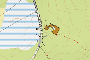
5532 Balsfjord | 502ff471-5e08-4873-a3d6-a8de58eec8f9 | 300710884 | 0.23 | N: 7685295.12, Ø: 680882.99 | ![Kartbilde fra WMS-tjeneste av avviket](https://wms.geonorge.no/skwms1/wms.topo?VERSION=1.1.1&SERVICE=WMS&REQUEST=GetMap&LAYERS=topo&STYLES=&FORMAT=image/png&SRS=EPSG:25833&BBOX=680807.0,7685245,680957.0,7685345&WIDTH=300&HEIGHT=200) |
5532 Balsfjord | 10cf188d-8198-475d-b1bb-fb9bf204d37a | 191887786 | 0.23 | N: 7667731.00, Ø: 672078.00 | ![Kartbilde fra WMS-tjeneste av avviket](https://wms.geonorge.no/skwms1/wms.topo?VERSION=1.1.1&SERVICE=WMS&REQUEST=GetMap&LAYERS=topo&STYLES=&FORMAT=image/png&SRS=EPSG:25833&BBOX=672003.0,7667681,672153.0,7667781&WIDTH=300&HEIGHT=200) |
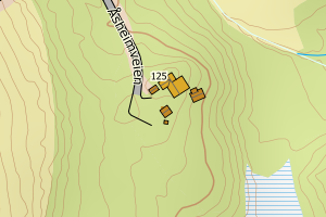
5532 Balsfjord | cae2a17e-4e93-4c89-834d-82c7e7b4c173 | 191868978 | 0.23 | N: 7667960.00, Ø: 670028.00 | ![Kartbilde fra WMS-tjeneste av avviket](https://wms.geonorge.no/skwms1/wms.topo?VERSION=1.1.1&SERVICE=WMS&REQUEST=GetMap&LAYERS=topo&STYLES=&FORMAT=image/png&SRS=EPSG:25833&BBOX=669953.0,7667910,670103.0,7668010&WIDTH=300&HEIGHT=200) |
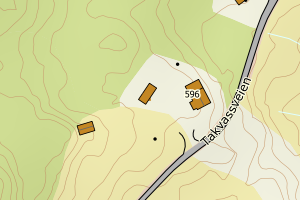
5532 Balsfjord | c4f4c31b-55c8-429f-90ce-9aa1f01f4e37 | 300606985 | 0.26 | N: 7691649.50, Ø: 645054.00 | ![Kartbilde fra WMS-tjeneste av avviket](https://wms.geonorge.no/skwms1/wms.topo?VERSION=1.1.1&SERVICE=WMS&REQUEST=GetMap&LAYERS=topo&STYLES=&FORMAT=image/png&SRS=EPSG:25833&BBOX=644979.0,7691599,645129.0,7691699&WIDTH=300&HEIGHT=200) |
5532 Balsfjord | 42e22990-0461-436d-a328-f202ead5b1fd | 300608717 | 0.26 | N: 7701045.70, Ø: 645086.70 | ![Kartbilde fra WMS-tjeneste av avviket](https://wms.geonorge.no/skwms1/wms.topo?VERSION=1.1.1&SERVICE=WMS&REQUEST=GetMap&LAYERS=topo&STYLES=&FORMAT=image/png&SRS=EPSG:25833&BBOX=645011.0,7700995,645161.0,7701095&WIDTH=300&HEIGHT=200) |
5532 Balsfjord | e3966dd5-80ce-4742-9801-be84009e49cc | 191924053 | 0.28 | N: 7679768.00, Ø: 662921.00 | ![Kartbilde fra WMS-tjeneste av avviket](https://wms.geonorge.no/skwms1/wms.topo?VERSION=1.1.1&SERVICE=WMS&REQUEST=GetMap&LAYERS=topo&STYLES=&FORMAT=image/png&SRS=EPSG:25833&BBOX=662846.0,7679718,662996.0,7679818&WIDTH=300&HEIGHT=200) |
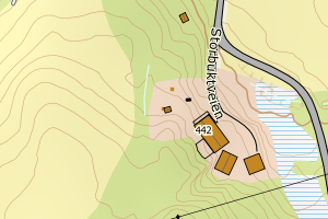
5532 Balsfjord | ed6fd342-2556-4c58-8251-db84c35508d3 | 23376903 | 0.28 | N: 7695160.50, Ø: 678331.40 | ![Kartbilde fra WMS-tjeneste av avviket](https://wms.geonorge.no/skwms1/wms.topo?VERSION=1.1.1&SERVICE=WMS&REQUEST=GetMap&LAYERS=topo&STYLES=&FORMAT=image/png&SRS=EPSG:25833&BBOX=678256.0,7695110,678406.0,7695210&WIDTH=300&HEIGHT=200) |
5532 Balsfjord | 77129e1f-0756-4f6f-802a-711954534e41 | 300607951 | 0.28 | N: 7692570.80, Ø: 654205.50 | ![Kartbilde fra WMS-tjeneste av avviket](https://wms.geonorge.no/skwms1/wms.topo?VERSION=1.1.1&SERVICE=WMS&REQUEST=GetMap&LAYERS=topo&STYLES=&FORMAT=image/png&SRS=EPSG:25833&BBOX=654130.0,7692520,654280.0,7692620&WIDTH=300&HEIGHT=200) |
5532 Balsfjord | daeeddf6-c020-4245-9b60-7e5c3d75d907 | 191922840 | 0.30 | N: 7692653.00, Ø: 654383.00 | ![Kartbilde fra WMS-tjeneste av avviket](https://wms.geonorge.no/skwms1/wms.topo?VERSION=1.1.1&SERVICE=WMS&REQUEST=GetMap&LAYERS=topo&STYLES=&FORMAT=image/png&SRS=EPSG:25833&BBOX=654308.0,7692603,654458.0,7692703&WIDTH=300&HEIGHT=200) |
5532 Balsfjord | 7184dad1-43ec-42c9-b7a1-9411b3495538 | 300606949 | 0.30 | N: 7692338.90, Ø: 655043.60 | ![Kartbilde fra WMS-tjeneste av avviket](https://wms.geonorge.no/skwms1/wms.topo?VERSION=1.1.1&SERVICE=WMS&REQUEST=GetMap&LAYERS=topo&STYLES=&FORMAT=image/png&SRS=EPSG:25833&BBOX=654968.0,7692288,655118.0,7692388&WIDTH=300&HEIGHT=200) |
5532 Balsfjord | e32fcb30-9d50-4cc9-a59f-4fd104f4e5ab | 300608264 | 0.31 | N: 7699291.20, Ø: 680323.80 | ![Kartbilde fra WMS-tjeneste av avviket](https://wms.geonorge.no/skwms1/wms.topo?VERSION=1.1.1&SERVICE=WMS&REQUEST=GetMap&LAYERS=topo&STYLES=&FORMAT=image/png&SRS=EPSG:25833&BBOX=680248.0,7699241,680398.0,7699341&WIDTH=300&HEIGHT=200) |
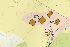
5532 Balsfjord | 08d8b2a7-6ba9-43dd-9c0f-bca1ecd571a6 | 191898125 | 0.33 | N: 7698642.00, Ø: 668232.00 | ![Kartbilde fra WMS-tjeneste av avviket](https://wms.geonorge.no/skwms1/wms.topo?VERSION=1.1.1&SERVICE=WMS&REQUEST=GetMap&LAYERS=topo&STYLES=&FORMAT=image/png&SRS=EPSG:25833&BBOX=668157.0,7698592,668307.0,7698692&WIDTH=300&HEIGHT=200) |
5532 Balsfjord | f3b06274-5f57-4df4-a93e-037138f4ea62 | 191859308 | 0.33 | N: 7696174.00, Ø: 655633.00 | ![Kartbilde fra WMS-tjeneste av avviket](https://wms.geonorge.no/skwms1/wms.topo?VERSION=1.1.1&SERVICE=WMS&REQUEST=GetMap&LAYERS=topo&STYLES=&FORMAT=image/png&SRS=EPSG:25833&BBOX=655558.0,7696124,655708.0,7696224&WIDTH=300&HEIGHT=200) |
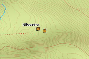
5532 Balsfjord | 1166b831-c490-4ceb-9431-fdddb9ca85f3 | 191888324 | 0.36 | N: 7672855.00, Ø: 673117.00 | ![Kartbilde fra WMS-tjeneste av avviket](https://wms.geonorge.no/skwms1/wms.topo?VERSION=1.1.1&SERVICE=WMS&REQUEST=GetMap&LAYERS=topo&STYLES=&FORMAT=image/png&SRS=EPSG:25833&BBOX=673042.0,7672805,673192.0,7672905&WIDTH=300&HEIGHT=200) |
5532 Balsfjord | a19c41ff-9943-47eb-a823-9bbfe21771b5 | 191858484 | 0.36 | N: 7690819.10, Ø: 658669.90 | ![Kartbilde fra WMS-tjeneste av avviket](https://wms.geonorge.no/skwms1/wms.topo?VERSION=1.1.1&SERVICE=WMS&REQUEST=GetMap&LAYERS=topo&STYLES=&FORMAT=image/png&SRS=EPSG:25833&BBOX=658594.0,7690769,658744.0,7690869&WIDTH=300&HEIGHT=200) |
5532 Balsfjord | 1280b03c-6e16-4d9a-ac6c-c523d0997b0e | 191836219 | 0.38 | N: 7689229.00, Ø: 650484.00 | ![Kartbilde fra WMS-tjeneste av avviket](https://wms.geonorge.no/skwms1/wms.topo?VERSION=1.1.1&SERVICE=WMS&REQUEST=GetMap&LAYERS=topo&STYLES=&FORMAT=image/png&SRS=EPSG:25833&BBOX=650409.0,7689179,650559.0,7689279&WIDTH=300&HEIGHT=200) |
5532 Balsfjord | 0c0bbae1-7434-4705-a6e7-cd0945520959 | 191854527 | 0.39 | N: 7682396.00, Ø: 661829.00 | ![Kartbilde fra WMS-tjeneste av avviket](https://wms.geonorge.no/skwms1/wms.topo?VERSION=1.1.1&SERVICE=WMS&REQUEST=GetMap&LAYERS=topo&STYLES=&FORMAT=image/png&SRS=EPSG:25833&BBOX=661754.0,7682346,661904.0,7682446&WIDTH=300&HEIGHT=200) |
5532 Balsfjord | dbc97626-aff3-4375-8db2-2be86a4b5e15 | 300607932 | 0.40 | N: 7694734.70, Ø: 656084.10 | ![Kartbilde fra WMS-tjeneste av avviket](https://wms.geonorge.no/skwms1/wms.topo?VERSION=1.1.1&SERVICE=WMS&REQUEST=GetMap&LAYERS=topo&STYLES=&FORMAT=image/png&SRS=EPSG:25833&BBOX=656009.0,7694684,656159.0,7694784&WIDTH=300&HEIGHT=200) |
5532 Balsfjord | 8298fed0-657e-46e6-8443-28b9f3ca6262 | 191923278 | 0.40 | N: 7682820.00, Ø: 662108.70 | ![Kartbilde fra WMS-tjeneste av avviket](https://wms.geonorge.no/skwms1/wms.topo?VERSION=1.1.1&SERVICE=WMS&REQUEST=GetMap&LAYERS=topo&STYLES=&FORMAT=image/png&SRS=EPSG:25833&BBOX=662033.0,7682770,662183.0,7682870&WIDTH=300&HEIGHT=200) |
5532 Balsfjord | 8040ffb8-04eb-4b43-b4ea-5bc9902a264f | 191845714 | 0.42 | N: 7694816.00, Ø: 651217.00 | ![Kartbilde fra WMS-tjeneste av avviket](https://wms.geonorge.no/skwms1/wms.topo?VERSION=1.1.1&SERVICE=WMS&REQUEST=GetMap&LAYERS=topo&STYLES=&FORMAT=image/png&SRS=EPSG:25833&BBOX=651142.0,7694766,651292.0,7694866&WIDTH=300&HEIGHT=200) |
5532 Balsfjord | dc79c55d-3df4-484d-96c0-489b12ebc793 | 300472127 | 0.42 | N: 7687288.80, Ø: 667037.60 | ![Kartbilde fra WMS-tjeneste av avviket](https://wms.geonorge.no/skwms1/wms.topo?VERSION=1.1.1&SERVICE=WMS&REQUEST=GetMap&LAYERS=topo&STYLES=&FORMAT=image/png&SRS=EPSG:25833&BBOX=666962.0,7687238,667112.0,7687338&WIDTH=300&HEIGHT=200) |
5532 Balsfjord | 66744348-b437-48c1-8a49-20cd05921e2f | 300608270 | 0.42 | N: 7699291.40, Ø: 680364.30 | ![Kartbilde fra WMS-tjeneste av avviket](https://wms.geonorge.no/skwms1/wms.topo?VERSION=1.1.1&SERVICE=WMS&REQUEST=GetMap&LAYERS=topo&STYLES=&FORMAT=image/png&SRS=EPSG:25833&BBOX=680289.0,7699241,680439.0,7699341&WIDTH=300&HEIGHT=200) |
5532 Balsfjord | 91e049d6-baaa-481c-a195-218f5dbbb780 | 191836901 | 0.43 | N: 7693646.40, Ø: 650057.70 | ![Kartbilde fra WMS-tjeneste av avviket](https://wms.geonorge.no/skwms1/wms.topo?VERSION=1.1.1&SERVICE=WMS&REQUEST=GetMap&LAYERS=topo&STYLES=&FORMAT=image/png&SRS=EPSG:25833&BBOX=649982.0,7693596,650132.0,7693696&WIDTH=300&HEIGHT=200) |
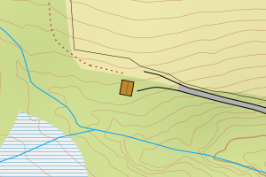
5532 Balsfjord | be716438-737c-452e-ad35-fda9d7180f63 | 191903285 | 0.44 | N: 7702523.20, Ø: 671311.60 | ![Kartbilde fra WMS-tjeneste av avviket](https://wms.geonorge.no/skwms1/wms.topo?VERSION=1.1.1&SERVICE=WMS&REQUEST=GetMap&LAYERS=topo&STYLES=&FORMAT=image/png&SRS=EPSG:25833&BBOX=671236.0,7702473,671386.0,7702573&WIDTH=300&HEIGHT=200) |
5532 Balsfjord | 39c7bd9e-6286-4b46-bbf0-3415eae0c3b9 | 191876806 | 0.48 | N: 7688848.00, Ø: 665212.00 | ![Kartbilde fra WMS-tjeneste av avviket](https://wms.geonorge.no/skwms1/wms.topo?VERSION=1.1.1&SERVICE=WMS&REQUEST=GetMap&LAYERS=topo&STYLES=&FORMAT=image/png&SRS=EPSG:25833&BBOX=665137.0,7688798,665287.0,7688898&WIDTH=300&HEIGHT=200) |
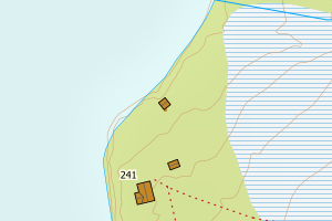
5532 Balsfjord | 1977af28-23a5-441f-996b-92d6be40738f | 191835468 | 0.48 | N: 7704362.00, Ø: 643413.00 | ![Kartbilde fra WMS-tjeneste av avviket](https://wms.geonorge.no/skwms1/wms.topo?VERSION=1.1.1&SERVICE=WMS&REQUEST=GetMap&LAYERS=topo&STYLES=&FORMAT=image/png&SRS=EPSG:25833&BBOX=643338.0,7704312,643488.0,7704412&WIDTH=300&HEIGHT=200) |
5532 Balsfjord | 27649588-3025-43fe-aa13-90de84267e20 | 191854748 | 0.49 | N: 7685686.70, Ø: 658453.20 | ![Kartbilde fra WMS-tjeneste av avviket](https://wms.geonorge.no/skwms1/wms.topo?VERSION=1.1.1&SERVICE=WMS&REQUEST=GetMap&LAYERS=topo&STYLES=&FORMAT=image/png&SRS=EPSG:25833&BBOX=658378.0,7685636,658528.0,7685736&WIDTH=300&HEIGHT=200) |
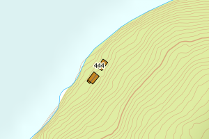
5532 Balsfjord | 7db2a1cb-5c9d-4b60-8293-492899ad4d0b | 191893042 | 0.49 | N: 7686675.00, Ø: 673183.00 | ![Kartbilde fra WMS-tjeneste av avviket](https://wms.geonorge.no/skwms1/wms.topo?VERSION=1.1.1&SERVICE=WMS&REQUEST=GetMap&LAYERS=topo&STYLES=&FORMAT=image/png&SRS=EPSG:25833&BBOX=673108.0,7686625,673258.0,7686725&WIDTH=300&HEIGHT=200) |
5532 Balsfjord | f97e4397-826c-4a0c-b4bd-f67342e40e2a | 23381540 | 0.49 | N: 7670266.80, Ø: 666379.70 | ![Kartbilde fra WMS-tjeneste av avviket](https://wms.geonorge.no/skwms1/wms.topo?VERSION=1.1.1&SERVICE=WMS&REQUEST=GetMap&LAYERS=topo&STYLES=&FORMAT=image/png&SRS=EPSG:25833&BBOX=666304.0,7670216,666454.0,7670316&WIDTH=300&HEIGHT=200) |
5532 Balsfjord | 9260fc12-6885-43ff-a7a2-c0cd9cb44d09 | 191852125 | 0.51 | N: 7678401.70, Ø: 659447.70 | ![Kartbilde fra WMS-tjeneste av avviket](https://wms.geonorge.no/skwms1/wms.topo?VERSION=1.1.1&SERVICE=WMS&REQUEST=GetMap&LAYERS=topo&STYLES=&FORMAT=image/png&SRS=EPSG:25833&BBOX=659372.0,7678351,659522.0,7678451&WIDTH=300&HEIGHT=200) |
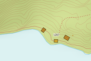
5532 Balsfjord | b82d3981-331a-4fc1-a11b-978dd3f1b34a | 191853520 | 0.51 | N: 7680597.80, Ø: 658658.00 | ![Kartbilde fra WMS-tjeneste av avviket](https://wms.geonorge.no/skwms1/wms.topo?VERSION=1.1.1&SERVICE=WMS&REQUEST=GetMap&LAYERS=topo&STYLES=&FORMAT=image/png&SRS=EPSG:25833&BBOX=658583.0,7680547,658733.0,7680647&WIDTH=300&HEIGHT=200) |
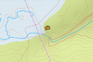
5532 Balsfjord | 63524c84-089b-4c77-847b-7f404649063d | 191870506 | 0.52 | N: 7677222.00, Ø: 665608.00 | ![Kartbilde fra WMS-tjeneste av avviket](https://wms.geonorge.no/skwms1/wms.topo?VERSION=1.1.1&SERVICE=WMS&REQUEST=GetMap&LAYERS=topo&STYLES=&FORMAT=image/png&SRS=EPSG:25833&BBOX=665533.0,7677172,665683.0,7677272&WIDTH=300&HEIGHT=200) |
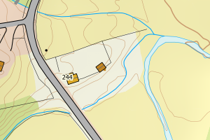
5532 Balsfjord | 67b795f4-871c-4d2c-8fb9-b59355061660 | 300388729 | 0.52 | N: 7696533.30, Ø: 650274.30 | ![Kartbilde fra WMS-tjeneste av avviket](https://wms.geonorge.no/skwms1/wms.topo?VERSION=1.1.1&SERVICE=WMS&REQUEST=GetMap&LAYERS=topo&STYLES=&FORMAT=image/png&SRS=EPSG:25833&BBOX=650199.0,7696483,650349.0,7696583&WIDTH=300&HEIGHT=200) |
5532 Balsfjord | 2405105e-8202-48a3-9a8f-56226083c48d | 191847784 | 0.57 | N: 7692638.00, Ø: 654272.00 | ![Kartbilde fra WMS-tjeneste av avviket](https://wms.geonorge.no/skwms1/wms.topo?VERSION=1.1.1&SERVICE=WMS&REQUEST=GetMap&LAYERS=topo&STYLES=&FORMAT=image/png&SRS=EPSG:25833&BBOX=654197.0,7692588,654347.0,7692688&WIDTH=300&HEIGHT=200) |
5532 Balsfjord | 63ee8aed-bd28-4062-996b-61e729d56619 | 191854772 | 0.57 | N: 7685508.90, Ø: 657124.90 | ![Kartbilde fra WMS-tjeneste av avviket](https://wms.geonorge.no/skwms1/wms.topo?VERSION=1.1.1&SERVICE=WMS&REQUEST=GetMap&LAYERS=topo&STYLES=&FORMAT=image/png&SRS=EPSG:25833&BBOX=657049.0,7685458,657199.0,7685558&WIDTH=300&HEIGHT=200) |
5532 Balsfjord | 440849fc-78a9-449c-8fc1-968962d4f80a | 191925882 | 0.58 | N: 7675022.20, Ø: 660944.10 | ![Kartbilde fra WMS-tjeneste av avviket](https://wms.geonorge.no/skwms1/wms.topo?VERSION=1.1.1&SERVICE=WMS&REQUEST=GetMap&LAYERS=topo&STYLES=&FORMAT=image/png&SRS=EPSG:25833&BBOX=660869.0,7674972,661019.0,7675072&WIDTH=300&HEIGHT=200) |
5532 Balsfjord | acd86b1b-17a9-4789-a5e4-7acd2b161354 | 300400274 | 0.59 | N: 7696240.20, Ø: 654176.10 | ![Kartbilde fra WMS-tjeneste av avviket](https://wms.geonorge.no/skwms1/wms.topo?VERSION=1.1.1&SERVICE=WMS&REQUEST=GetMap&LAYERS=topo&STYLES=&FORMAT=image/png&SRS=EPSG:25833&BBOX=654101.0,7696190,654251.0,7696290&WIDTH=300&HEIGHT=200) |
5532 Balsfjord | aff3d150-de5d-4676-910f-179f939fe259 | 301229159 | 0.59 | N: 7697582.96, Ø: 646672.69 | ![Kartbilde fra WMS-tjeneste av avviket](https://wms.geonorge.no/skwms1/wms.topo?VERSION=1.1.1&SERVICE=WMS&REQUEST=GetMap&LAYERS=topo&STYLES=&FORMAT=image/png&SRS=EPSG:25833&BBOX=646597.0,7697532,646747.0,7697632&WIDTH=300&HEIGHT=200) |
5532 Balsfjord | 2a5231c7-aa6f-481f-b6c6-f33f28d7faa1 | 191868870 | 0.60 | N: 7667691.00, Ø: 669895.00 | ![Kartbilde fra WMS-tjeneste av avviket](https://wms.geonorge.no/skwms1/wms.topo?VERSION=1.1.1&SERVICE=WMS&REQUEST=GetMap&LAYERS=topo&STYLES=&FORMAT=image/png&SRS=EPSG:25833&BBOX=669820.0,7667641,669970.0,7667741&WIDTH=300&HEIGHT=200) |
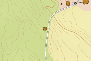
5532 Balsfjord | 48dd5605-43db-4339-99bb-11062dc16071 | 300400265 | 0.61 | N: 7683889.20, Ø: 663504.50 | ![Kartbilde fra WMS-tjeneste av avviket](https://wms.geonorge.no/skwms1/wms.topo?VERSION=1.1.1&SERVICE=WMS&REQUEST=GetMap&LAYERS=topo&STYLES=&FORMAT=image/png&SRS=EPSG:25833&BBOX=663429.0,7683839,663579.0,7683939&WIDTH=300&HEIGHT=200) |
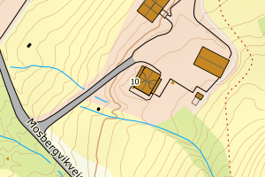
5532 Balsfjord | 2ce0321b-a849-4fd5-9114-187879a5abad | 300202362 | 0.61 | N: 7699279.30, Ø: 672234.50 | ![Kartbilde fra WMS-tjeneste av avviket](https://wms.geonorge.no/skwms1/wms.topo?VERSION=1.1.1&SERVICE=WMS&REQUEST=GetMap&LAYERS=topo&STYLES=&FORMAT=image/png&SRS=EPSG:25833&BBOX=672159.0,7699229,672309.0,7699329&WIDTH=300&HEIGHT=200) |
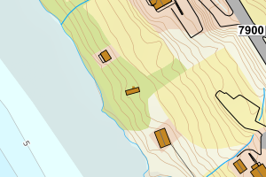
5532 Balsfjord | 2dcd5525-7aae-41d0-83d4-b19b815ef8d7 | 191845358 | 0.61 | N: 7696717.00, Ø: 650959.00 | ![Kartbilde fra WMS-tjeneste av avviket](https://wms.geonorge.no/skwms1/wms.topo?VERSION=1.1.1&SERVICE=WMS&REQUEST=GetMap&LAYERS=topo&STYLES=&FORMAT=image/png&SRS=EPSG:25833&BBOX=650884.0,7696667,651034.0,7696767&WIDTH=300&HEIGHT=200) |
5532 Balsfjord | 206b9ba0-9419-44aa-b43b-2682fe0b6b67 | 11580130 | 0.62 | N: 7668383.30, Ø: 672049.70 | ![Kartbilde fra WMS-tjeneste av avviket](https://wms.geonorge.no/skwms1/wms.topo?VERSION=1.1.1&SERVICE=WMS&REQUEST=GetMap&LAYERS=topo&STYLES=&FORMAT=image/png&SRS=EPSG:25833&BBOX=671974.0,7668333,672124.0,7668433&WIDTH=300&HEIGHT=200) |
5532 Balsfjord | 7477581b-6846-4153-b666-6379b17257f5 | 300607748 | 0.62 | N: 7670234.50, Ø: 665894.60 | ![Kartbilde fra WMS-tjeneste av avviket](https://wms.geonorge.no/skwms1/wms.topo?VERSION=1.1.1&SERVICE=WMS&REQUEST=GetMap&LAYERS=topo&STYLES=&FORMAT=image/png&SRS=EPSG:25833&BBOX=665819.0,7670184,665969.0,7670284&WIDTH=300&HEIGHT=200) |
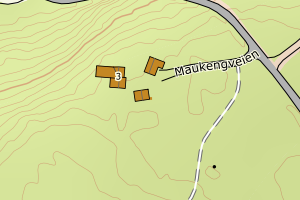
5532 Balsfjord | d0ec0251-87d8-4c9e-b78c-2cc92fdb7e5b | 191868242 | 0.65 | N: 7670441.00, Ø: 668970.00 | ![Kartbilde fra WMS-tjeneste av avviket](https://wms.geonorge.no/skwms1/wms.topo?VERSION=1.1.1&SERVICE=WMS&REQUEST=GetMap&LAYERS=topo&STYLES=&FORMAT=image/png&SRS=EPSG:25833&BBOX=668895.0,7670391,669045.0,7670491&WIDTH=300&HEIGHT=200) |
5532 Balsfjord | 9c9f2a75-17af-4de5-9013-239c04c5af9e | 300409718 | 0.66 | N: 7698033.70, Ø: 646107.20 | ![Kartbilde fra WMS-tjeneste av avviket](https://wms.geonorge.no/skwms1/wms.topo?VERSION=1.1.1&SERVICE=WMS&REQUEST=GetMap&LAYERS=topo&STYLES=&FORMAT=image/png&SRS=EPSG:25833&BBOX=646032.0,7697983,646182.0,7698083&WIDTH=300&HEIGHT=200) |
5532 Balsfjord | a5f6ac00-eb63-416f-8f26-8062971bf523 | 191866959 | 0.74 | N: 7709623.60, Ø: 656545.10 | ![Kartbilde fra WMS-tjeneste av avviket](https://wms.geonorge.no/skwms1/wms.topo?VERSION=1.1.1&SERVICE=WMS&REQUEST=GetMap&LAYERS=topo&STYLES=&FORMAT=image/png&SRS=EPSG:25833&BBOX=656470.0,7709573,656620.0,7709673&WIDTH=300&HEIGHT=200) |
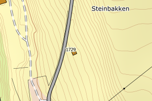
5532 Balsfjord | ade2699f-0044-4744-b6a3-270f739089ff | 191863844 | 0.76 | N: 7708510.00, Ø: 658098.00 | ![Kartbilde fra WMS-tjeneste av avviket](https://wms.geonorge.no/skwms1/wms.topo?VERSION=1.1.1&SERVICE=WMS&REQUEST=GetMap&LAYERS=topo&STYLES=&FORMAT=image/png&SRS=EPSG:25833&BBOX=658023.0,7708460,658173.0,7708560&WIDTH=300&HEIGHT=200) |
5532 Balsfjord | fd614850-dbc7-48d3-951b-e877f5b2c5f6 | 300607669 | 0.77 | N: 7668435.90, Ø: 671992.20 | ![Kartbilde fra WMS-tjeneste av avviket](https://wms.geonorge.no/skwms1/wms.topo?VERSION=1.1.1&SERVICE=WMS&REQUEST=GetMap&LAYERS=topo&STYLES=&FORMAT=image/png&SRS=EPSG:25833&BBOX=671917.0,7668385,672067.0,7668485&WIDTH=300&HEIGHT=200) |
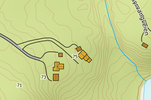
5532 Balsfjord | d4304fad-b931-4eea-a2eb-a300a7ed205b | 191870719 | 0.81 | N: 7678194.00, Ø: 665965.00 | ![Kartbilde fra WMS-tjeneste av avviket](https://wms.geonorge.no/skwms1/wms.topo?VERSION=1.1.1&SERVICE=WMS&REQUEST=GetMap&LAYERS=topo&STYLES=&FORMAT=image/png&SRS=EPSG:25833&BBOX=665890.0,7678144,666040.0,7678244&WIDTH=300&HEIGHT=200) |
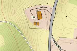
5532 Balsfjord | e0bc8fc4-ea61-4d19-9b7a-5a96d49200b4 | 23382792 | 0.83 | N: 7696874.50, Ø: 649184.40 | ![Kartbilde fra WMS-tjeneste av avviket](https://wms.geonorge.no/skwms1/wms.topo?VERSION=1.1.1&SERVICE=WMS&REQUEST=GetMap&LAYERS=topo&STYLES=&FORMAT=image/png&SRS=EPSG:25833&BBOX=649109.0,7696824,649259.0,7696924&WIDTH=300&HEIGHT=200) |
5532 Balsfjord | f63cf936-1387-4ecb-8323-3ff8f1a9c377 | 300383422 | 0.84 | N: 7697705.10, Ø: 646573.00 | ![Kartbilde fra WMS-tjeneste av avviket](https://wms.geonorge.no/skwms1/wms.topo?VERSION=1.1.1&SERVICE=WMS&REQUEST=GetMap&LAYERS=topo&STYLES=&FORMAT=image/png&SRS=EPSG:25833&BBOX=646498.0,7697655,646648.0,7697755&WIDTH=300&HEIGHT=200) |
5532 Balsfjord | 55e96b16-0272-432b-93b4-a34b0f5eed30 | 301083966 | 0.84 | N: 7686902.05, Ø: 672126.12 | ![Kartbilde fra WMS-tjeneste av avviket](https://wms.geonorge.no/skwms1/wms.topo?VERSION=1.1.1&SERVICE=WMS&REQUEST=GetMap&LAYERS=topo&STYLES=&FORMAT=image/png&SRS=EPSG:25833&BBOX=672051.0,7686852,672201.0,7686952&WIDTH=300&HEIGHT=200) |
5532 Balsfjord | e3ee1636-8ec9-4b6e-afd1-b5fee480aa97 | 300462535 | 0.85 | N: 7701723.20, Ø: 643372.50 | ![Kartbilde fra WMS-tjeneste av avviket](https://wms.geonorge.no/skwms1/wms.topo?VERSION=1.1.1&SERVICE=WMS&REQUEST=GetMap&LAYERS=topo&STYLES=&FORMAT=image/png&SRS=EPSG:25833&BBOX=643297.0,7701673,643447.0,7701773&WIDTH=300&HEIGHT=200) |
5532 Balsfjord | 8fdd77e3-f063-44e3-b19c-f4d56fa15ac8 | 300690535 | 0.86 | N: 7673217.95, Ø: 664224.96 | ![Kartbilde fra WMS-tjeneste av avviket](https://wms.geonorge.no/skwms1/wms.topo?VERSION=1.1.1&SERVICE=WMS&REQUEST=GetMap&LAYERS=topo&STYLES=&FORMAT=image/png&SRS=EPSG:25833&BBOX=664149.0,7673167,664299.0,7673267&WIDTH=300&HEIGHT=200) |
5532 Balsfjord | ec32ea06-1829-4d8e-ba46-e5642122127c | 191912578 | 0.86 | N: 7686807.80, Ø: 682977.80 | ![Kartbilde fra WMS-tjeneste av avviket](https://wms.geonorge.no/skwms1/wms.topo?VERSION=1.1.1&SERVICE=WMS&REQUEST=GetMap&LAYERS=topo&STYLES=&FORMAT=image/png&SRS=EPSG:25833&BBOX=682902.0,7686757,683052.0,7686857&WIDTH=300&HEIGHT=200) |
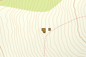
5532 Balsfjord | 0bf33601-c9e6-4496-99c7-83231a400e48 | 300357408 | 0.92 | N: 7697277.40, Ø: 648557.40 | ![Kartbilde fra WMS-tjeneste av avviket](https://wms.geonorge.no/skwms1/wms.topo?VERSION=1.1.1&SERVICE=WMS&REQUEST=GetMap&LAYERS=topo&STYLES=&FORMAT=image/png&SRS=EPSG:25833&BBOX=648482.0,7697227,648632.0,7697327&WIDTH=300&HEIGHT=200) |
5532 Balsfjord | 3b0986b8-87a7-4539-814f-3b873925b312 | 300466191 | 0.94 | N: 7694394.20, Ø: 645773.30 | ![Kartbilde fra WMS-tjeneste av avviket](https://wms.geonorge.no/skwms1/wms.topo?VERSION=1.1.1&SERVICE=WMS&REQUEST=GetMap&LAYERS=topo&STYLES=&FORMAT=image/png&SRS=EPSG:25833&BBOX=645698.0,7694344,645848.0,7694444&WIDTH=300&HEIGHT=200) |