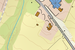
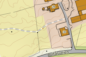
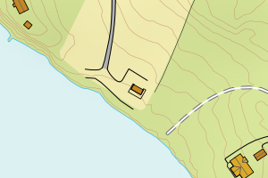
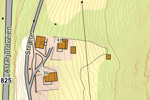
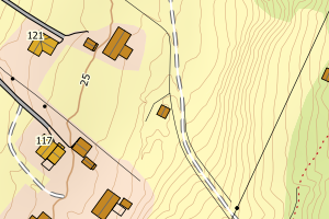
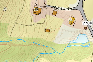
Avvikene kan skyldes enten feil bygningskoordinat eller bygningstype/status i matrikkel eller feil arealtype i AR5. Vær oppmerksom på det er krav om arealer på over 200 m2 før det er krav om endring av arealtype i AR5 så avvikene vil ikke alltid kreve retting i datagrunnlaget
Kommune | LokalId | Bygningsnummer | Arealtype | Bygningstatus | Bygningstype | matrikkel_vedtaksdato | Posisjon | WMS-bilde |
5512 Tjeldsund | fd330f57-4ec1-46e5-996a-92d8250153ab | 191113837 | 21 | TB | 249 | None | N: 7620189.00, Ø: 577795.00 | ![Kartbilde fra WMS-tjeneste av avviket](https://wms.geonorge.no/skwms1/wms.topo?VERSION=1.1.1&SERVICE=WMS&REQUEST=GetMap&LAYERS=topo&STYLES=&FORMAT=image/png&SRS=EPSG:25833&BBOX=577720.0,7620139,577870.0,7620239&WIDTH=300&HEIGHT=200) |
5512 Tjeldsund | ed50afcf-bd07-48f7-ad65-d80017769af1 | 189327927 | 21 | TB | 181 | None | N: 7590665.00, Ø: 554277.00 | ![Kartbilde fra WMS-tjeneste av avviket](https://wms.geonorge.no/skwms1/wms.topo?VERSION=1.1.1&SERVICE=WMS&REQUEST=GetMap&LAYERS=topo&STYLES=&FORMAT=image/png&SRS=EPSG:25833&BBOX=554202.0,7590615,554352.0,7590715&WIDTH=300&HEIGHT=200) |
5512 Tjeldsund | f5061035-c56a-4a01-860e-ca094b5c2d38 | 300193506 | 21 | TB | 182 | None | N: 7619094.56, Ø: 585442.03 | ![Kartbilde fra WMS-tjeneste av avviket](https://wms.geonorge.no/skwms1/wms.topo?VERSION=1.1.1&SERVICE=WMS&REQUEST=GetMap&LAYERS=topo&STYLES=&FORMAT=image/png&SRS=EPSG:25833&BBOX=585367.0,7619044,585517.0,7619144&WIDTH=300&HEIGHT=200) |
5512 Tjeldsund | 719e1612-43c6-4c64-a039-42842214432d | 191127455 | 21 | TB | 249 | None | N: 7603710.76, Ø: 571501.94 | ![Kartbilde fra WMS-tjeneste av avviket](https://wms.geonorge.no/skwms1/wms.topo?VERSION=1.1.1&SERVICE=WMS&REQUEST=GetMap&LAYERS=topo&STYLES=&FORMAT=image/png&SRS=EPSG:25833&BBOX=571426.0,7603660,571576.0,7603760&WIDTH=300&HEIGHT=200) |
5512 Tjeldsund | 17858061-6d78-4ca1-aea3-85e2b35b593e | 191095707 | 21 | TB | 111 | None | N: 7608652.00, Ø: 563932.00 | ![Kartbilde fra WMS-tjeneste av avviket](https://wms.geonorge.no/skwms1/wms.topo?VERSION=1.1.1&SERVICE=WMS&REQUEST=GetMap&LAYERS=topo&STYLES=&FORMAT=image/png&SRS=EPSG:25833&BBOX=563857.0,7608602,564007.0,7608702&WIDTH=300&HEIGHT=200) |
5512 Tjeldsund | 14412857-d264-4818-ba9b-1ac0203c6c8f | 300208625 | 21 | TB | 181 | None | N: 7619483.66, Ø: 572318.50 | ![Kartbilde fra WMS-tjeneste av avviket](https://wms.geonorge.no/skwms1/wms.topo?VERSION=1.1.1&SERVICE=WMS&REQUEST=GetMap&LAYERS=topo&STYLES=&FORMAT=image/png&SRS=EPSG:25833&BBOX=572243.0,7619433,572393.0,7619533&WIDTH=300&HEIGHT=200) |
5512 Tjeldsund | 5e65241f-c574-4314-b303-3b336ed20bca | 189318863 | 21 | TB | 999 | None | N: 7605068.74, Ø: 556574.68 | ![Kartbilde fra WMS-tjeneste av avviket](https://wms.geonorge.no/skwms1/wms.topo?VERSION=1.1.1&SERVICE=WMS&REQUEST=GetMap&LAYERS=topo&STYLES=&FORMAT=image/png&SRS=EPSG:25833&BBOX=556499.0,7605018,556649.0,7605118&WIDTH=300&HEIGHT=200) |
5512 Tjeldsund | 81bb787f-fd67-4cde-9a98-a8d2f88354ae | 300193667 | 21 | TB | 216 | None | N: 7619385.19, Ø: 586661.55 | ![Kartbilde fra WMS-tjeneste av avviket](https://wms.geonorge.no/skwms1/wms.topo?VERSION=1.1.1&SERVICE=WMS&REQUEST=GetMap&LAYERS=topo&STYLES=&FORMAT=image/png&SRS=EPSG:25833&BBOX=586586.0,7619335,586736.0,7619435&WIDTH=300&HEIGHT=200) |
5512 Tjeldsund | 871ca770-2482-4c25-8efb-a37096459d97 | 191129261 | 21 | TB | 249 | None | N: 7615561.35, Ø: 591978.00 | ![Kartbilde fra WMS-tjeneste av avviket](https://wms.geonorge.no/skwms1/wms.topo?VERSION=1.1.1&SERVICE=WMS&REQUEST=GetMap&LAYERS=topo&STYLES=&FORMAT=image/png&SRS=EPSG:25833&BBOX=591903.0,7615511,592053.0,7615611&WIDTH=300&HEIGHT=200) |
5512 Tjeldsund | acf2e710-97c1-49f7-8389-9541c206c58a | 300207949 | 21 | TB | 249 | None | N: 7619225.51, Ø: 586735.48 | ![Kartbilde fra WMS-tjeneste av avviket](https://wms.geonorge.no/skwms1/wms.topo?VERSION=1.1.1&SERVICE=WMS&REQUEST=GetMap&LAYERS=topo&STYLES=&FORMAT=image/png&SRS=EPSG:25833&BBOX=586660.0,7619175,586810.0,7619275&WIDTH=300&HEIGHT=200) |
5512 Tjeldsund | b35a37d1-fac7-4b9f-9899-e0e4900f826d | 300339349 | 21 | TB | 249 | None | N: 7623028.37, Ø: 579529.09 | ![Kartbilde fra WMS-tjeneste av avviket](https://wms.geonorge.no/skwms1/wms.topo?VERSION=1.1.1&SERVICE=WMS&REQUEST=GetMap&LAYERS=topo&STYLES=&FORMAT=image/png&SRS=EPSG:25833&BBOX=579454.0,7622978,579604.0,7623078&WIDTH=300&HEIGHT=200) |
5512 Tjeldsund | b9e9889a-85da-452b-8588-9a2639b0796e | 191115708 | 21 | TB | 181 | None | N: 7620196.00, Ø: 586089.00 | ![Kartbilde fra WMS-tjeneste av avviket](https://wms.geonorge.no/skwms1/wms.topo?VERSION=1.1.1&SERVICE=WMS&REQUEST=GetMap&LAYERS=topo&STYLES=&FORMAT=image/png&SRS=EPSG:25833&BBOX=586014.0,7620146,586164.0,7620246&WIDTH=300&HEIGHT=200) |
5512 Tjeldsund | 10b28f11-a5c8-432f-9266-bef2b6980883 | 300030224 | 21 | TB | 113 | None | N: 7619750.00, Ø: 576441.00 | ![Kartbilde fra WMS-tjeneste av avviket](https://wms.geonorge.no/skwms1/wms.topo?VERSION=1.1.1&SERVICE=WMS&REQUEST=GetMap&LAYERS=topo&STYLES=&FORMAT=image/png&SRS=EPSG:25833&BBOX=576366.0,7619700,576516.0,7619800&WIDTH=300&HEIGHT=200) |
5512 Tjeldsund | 4197e305-56a4-4d88-a97c-57d5df3a44b7 | 300191173 | 21 | TB | 181 | None | N: 7619980.23, Ø: 576723.99 | ![Kartbilde fra WMS-tjeneste av avviket](https://wms.geonorge.no/skwms1/wms.topo?VERSION=1.1.1&SERVICE=WMS&REQUEST=GetMap&LAYERS=topo&STYLES=&FORMAT=image/png&SRS=EPSG:25833&BBOX=576648.0,7619930,576798.0,7620030&WIDTH=300&HEIGHT=200) |
5512 Tjeldsund | fec231ec-3946-40f4-8b0c-5a7606769a34 | 300268198 | 21 | TB | 181 | None | N: 7606024.26, Ø: 551614.72 | ![Kartbilde fra WMS-tjeneste av avviket](https://wms.geonorge.no/skwms1/wms.topo?VERSION=1.1.1&SERVICE=WMS&REQUEST=GetMap&LAYERS=topo&STYLES=&FORMAT=image/png&SRS=EPSG:25833&BBOX=551539.0,7605974,551689.0,7606074&WIDTH=300&HEIGHT=200) |
5512 Tjeldsund | 61b80200-3bc1-4953-8a59-57528724b360 | 191091914 | 21 | TB | 249 | None | N: 7602942.00, Ø: 565992.00 | ![Kartbilde fra WMS-tjeneste av avviket](https://wms.geonorge.no/skwms1/wms.topo?VERSION=1.1.1&SERVICE=WMS&REQUEST=GetMap&LAYERS=topo&STYLES=&FORMAT=image/png&SRS=EPSG:25833&BBOX=565917.0,7602892,566067.0,7602992&WIDTH=300&HEIGHT=200) |
5512 Tjeldsund | 8377fa8d-c975-4778-96c9-d49ec91c47a9 | 191125525 | 21 | TB | 183 | None | N: 7607009.29, Ø: 567351.46 | ![Kartbilde fra WMS-tjeneste av avviket](https://wms.geonorge.no/skwms1/wms.topo?VERSION=1.1.1&SERVICE=WMS&REQUEST=GetMap&LAYERS=topo&STYLES=&FORMAT=image/png&SRS=EPSG:25833&BBOX=567276.0,7606959,567426.0,7607059&WIDTH=300&HEIGHT=200) |
5512 Tjeldsund | 5a2e6374-ab51-4806-8034-ae819e97deeb | 189317050 | 21 | TB | 183 | None | N: 7606739.00, Ø: 555209.60 | ![Kartbilde fra WMS-tjeneste av avviket](https://wms.geonorge.no/skwms1/wms.topo?VERSION=1.1.1&SERVICE=WMS&REQUEST=GetMap&LAYERS=topo&STYLES=&FORMAT=image/png&SRS=EPSG:25833&BBOX=555134.0,7606689,555284.0,7606789&WIDTH=300&HEIGHT=200) |
5512 Tjeldsund | 6ed59c3d-1c7b-4fe0-a337-d9c44ac357a0 | 189328672 | 21 | TB | 241 | None | N: 7606388.38, Ø: 553487.10 | ![Kartbilde fra WMS-tjeneste av avviket](https://wms.geonorge.no/skwms1/wms.topo?VERSION=1.1.1&SERVICE=WMS&REQUEST=GetMap&LAYERS=topo&STYLES=&FORMAT=image/png&SRS=EPSG:25833&BBOX=553412.0,7606338,553562.0,7606438&WIDTH=300&HEIGHT=200) |
5512 Tjeldsund | b1ee1d20-765e-4424-b45f-19b4a3215e18 | 191125649 | 21 | TB | 181 | None | N: 7616946.00, Ø: 569822.00 | ![Kartbilde fra WMS-tjeneste av avviket](https://wms.geonorge.no/skwms1/wms.topo?VERSION=1.1.1&SERVICE=WMS&REQUEST=GetMap&LAYERS=topo&STYLES=&FORMAT=image/png&SRS=EPSG:25833&BBOX=569747.0,7616896,569897.0,7616996&WIDTH=300&HEIGHT=200) |
5512 Tjeldsund | 48904e66-1dce-4cd1-8ddf-571ce1eed569 | 300256027 | 21 | TB | 181 | None | N: 7609862.79, Ø: 568429.66 | ![Kartbilde fra WMS-tjeneste av avviket](https://wms.geonorge.no/skwms1/wms.topo?VERSION=1.1.1&SERVICE=WMS&REQUEST=GetMap&LAYERS=topo&STYLES=&FORMAT=image/png&SRS=EPSG:25833&BBOX=568354.0,7609812,568504.0,7609912&WIDTH=300&HEIGHT=200) |
5512 Tjeldsund | 4c8f1f74-3571-4231-b9ea-b3d2ba64486a | 191114019 | 21 | TB | 183 | None | N: 7621015.00, Ø: 577705.00 | ![Kartbilde fra WMS-tjeneste av avviket](https://wms.geonorge.no/skwms1/wms.topo?VERSION=1.1.1&SERVICE=WMS&REQUEST=GetMap&LAYERS=topo&STYLES=&FORMAT=image/png&SRS=EPSG:25833&BBOX=577630.0,7620965,577780.0,7621065&WIDTH=300&HEIGHT=200) |
5512 Tjeldsund | 42f5ad3e-1ce8-4990-96fd-5ccedbcc0e18 | 300177687 | 21 | TB | 181 | None | N: 7620826.72, Ø: 577762.60 | ![Kartbilde fra WMS-tjeneste av avviket](https://wms.geonorge.no/skwms1/wms.topo?VERSION=1.1.1&SERVICE=WMS&REQUEST=GetMap&LAYERS=topo&STYLES=&FORMAT=image/png&SRS=EPSG:25833&BBOX=577687.0,7620776,577837.0,7620876&WIDTH=300&HEIGHT=200) |
5512 Tjeldsund | ecac1816-bb8d-4bad-8150-2906130879fe | 300726004 | 21 | TB | 181 | None | N: 7601060.01, Ø: 569330.19 | ![Kartbilde fra WMS-tjeneste av avviket](https://wms.geonorge.no/skwms1/wms.topo?VERSION=1.1.1&SERVICE=WMS&REQUEST=GetMap&LAYERS=topo&STYLES=&FORMAT=image/png&SRS=EPSG:25833&BBOX=569255.0,7601010,569405.0,7601110&WIDTH=300&HEIGHT=200) |
5512 Tjeldsund | ea32500f-b398-480a-ae5a-ec79d89a122d | 191126866 | 21 | TB | 249 | None | N: 7601086.59, Ø: 569370.18 | ![Kartbilde fra WMS-tjeneste av avviket](https://wms.geonorge.no/skwms1/wms.topo?VERSION=1.1.1&SERVICE=WMS&REQUEST=GetMap&LAYERS=topo&STYLES=&FORMAT=image/png&SRS=EPSG:25833&BBOX=569295.0,7601036,569445.0,7601136&WIDTH=300&HEIGHT=200) |
5512 Tjeldsund | dd0ff74a-bb11-4962-a4ce-d060f317f645 | 300183863 | 21 | TB | 669 | None | N: 7609111.23, Ø: 563999.49 | ![Kartbilde fra WMS-tjeneste av avviket](https://wms.geonorge.no/skwms1/wms.topo?VERSION=1.1.1&SERVICE=WMS&REQUEST=GetMap&LAYERS=topo&STYLES=&FORMAT=image/png&SRS=EPSG:25833&BBOX=563924.0,7609061,564074.0,7609161&WIDTH=300&HEIGHT=200) |
5512 Tjeldsund | 29865cec-d990-4fa3-9ecc-3c5c9ed78df2 | 300266339 | 21 | TB | 183 | None | N: 7604656.00, Ø: 553221.97 | ![Kartbilde fra WMS-tjeneste av avviket](https://wms.geonorge.no/skwms1/wms.topo?VERSION=1.1.1&SERVICE=WMS&REQUEST=GetMap&LAYERS=topo&STYLES=&FORMAT=image/png&SRS=EPSG:25833&BBOX=553146.0,7604606,553296.0,7604706&WIDTH=300&HEIGHT=200) |
5512 Tjeldsund | 743cdb8a-05f2-412e-bf12-178bab93cae9 | 300204980 | 21 | TB | 182 | None | N: 7617806.20, Ø: 572339.54 | ![Kartbilde fra WMS-tjeneste av avviket](https://wms.geonorge.no/skwms1/wms.topo?VERSION=1.1.1&SERVICE=WMS&REQUEST=GetMap&LAYERS=topo&STYLES=&FORMAT=image/png&SRS=EPSG:25833&BBOX=572264.0,7617756,572414.0,7617856&WIDTH=300&HEIGHT=200) |
5512 Tjeldsund | 4ca116fa-7523-44f8-abe4-744103266e6c | 189313292 | 21 | TB | 183 | None | N: 7604284.32, Ø: 552904.01 | ![Kartbilde fra WMS-tjeneste av avviket](https://wms.geonorge.no/skwms1/wms.topo?VERSION=1.1.1&SERVICE=WMS&REQUEST=GetMap&LAYERS=topo&STYLES=&FORMAT=image/png&SRS=EPSG:25833&BBOX=552829.0,7604234,552979.0,7604334&WIDTH=300&HEIGHT=200) |
5512 Tjeldsund | 9d8be4ed-8429-4505-8056-b1d82f660bbd | 300174527 | 21 | TB | 181 | None | N: 7619251.11, Ø: 586781.28 | ![Kartbilde fra WMS-tjeneste av avviket](https://wms.geonorge.no/skwms1/wms.topo?VERSION=1.1.1&SERVICE=WMS&REQUEST=GetMap&LAYERS=topo&STYLES=&FORMAT=image/png&SRS=EPSG:25833&BBOX=586706.0,7619201,586856.0,7619301&WIDTH=300&HEIGHT=200) |
5512 Tjeldsund | a5829674-7f15-46c8-a90d-baeb881ebc29 | 189310889 | 21 | TB | 999 | None | N: 7593494.47, Ø: 546123.82 | ![Kartbilde fra WMS-tjeneste av avviket](https://wms.geonorge.no/skwms1/wms.topo?VERSION=1.1.1&SERVICE=WMS&REQUEST=GetMap&LAYERS=topo&STYLES=&FORMAT=image/png&SRS=EPSG:25833&BBOX=546048.0,7593444,546198.0,7593544&WIDTH=300&HEIGHT=200) |
5512 Tjeldsund | 0017d6bb-816a-4a6f-8d47-c10b261fc590 | 191115414 | 21 | TB | 181 | None | N: 7620651.00, Ø: 577621.00 | ![Kartbilde fra WMS-tjeneste av avviket](https://wms.geonorge.no/skwms1/wms.topo?VERSION=1.1.1&SERVICE=WMS&REQUEST=GetMap&LAYERS=topo&STYLES=&FORMAT=image/png&SRS=EPSG:25833&BBOX=577546.0,7620601,577696.0,7620701&WIDTH=300&HEIGHT=200) |
5512 Tjeldsund | bcda8c6a-625b-4b78-8ab2-e29292d83303 | 191116372 | 21 | TB | 249 | None | N: 7619370.00, Ø: 585589.00 | ![Kartbilde fra WMS-tjeneste av avviket](https://wms.geonorge.no/skwms1/wms.topo?VERSION=1.1.1&SERVICE=WMS&REQUEST=GetMap&LAYERS=topo&STYLES=&FORMAT=image/png&SRS=EPSG:25833&BBOX=585514.0,7619320,585664.0,7619420&WIDTH=300&HEIGHT=200) |
5512 Tjeldsund | d9ae82dc-e7cc-4070-a56b-fba3fcdc68d7 | 300268143 | 21 | TB | 181 | None | N: 7606420.42, Ø: 551150.21 | ![Kartbilde fra WMS-tjeneste av avviket](https://wms.geonorge.no/skwms1/wms.topo?VERSION=1.1.1&SERVICE=WMS&REQUEST=GetMap&LAYERS=topo&STYLES=&FORMAT=image/png&SRS=EPSG:25833&BBOX=551075.0,7606370,551225.0,7606470&WIDTH=300&HEIGHT=200) |
5512 Tjeldsund | 689b5dfb-fa46-4e1b-9457-93c10333a6f3 | 301252284 | 21 | MB | 136 | 2024-02-14 | N: 7608509.54, Ø: 564333.01 | ![Kartbilde fra WMS-tjeneste av avviket](https://wms.geonorge.no/skwms1/wms.topo?VERSION=1.1.1&SERVICE=WMS&REQUEST=GetMap&LAYERS=topo&STYLES=&FORMAT=image/png&SRS=EPSG:25833&BBOX=564258.0,7608459,564408.0,7608559&WIDTH=300&HEIGHT=200) |
5512 Tjeldsund | e01efb0e-b438-468f-8f23-906163a2a5b3 | 301106662 | 21 | FA | 161 | 2023-11-23 | N: 7622265.97, Ø: 578396.92 | ![Kartbilde fra WMS-tjeneste av avviket](https://wms.geonorge.no/skwms1/wms.topo?VERSION=1.1.1&SERVICE=WMS&REQUEST=GetMap&LAYERS=topo&STYLES=&FORMAT=image/png&SRS=EPSG:25833&BBOX=578321.0,7622215,578471.0,7622315&WIDTH=300&HEIGHT=200) |
5512 Tjeldsund | 3c42dc27-29d4-416c-93c6-3ca692f14e3e | 300939141 | 21 | FA | 136 | 2023-01-06 | N: 7608495.34, Ø: 564271.73 | ![Kartbilde fra WMS-tjeneste av avviket](https://wms.geonorge.no/skwms1/wms.topo?VERSION=1.1.1&SERVICE=WMS&REQUEST=GetMap&LAYERS=topo&STYLES=&FORMAT=image/png&SRS=EPSG:25833&BBOX=564196.0,7608445,564346.0,7608545&WIDTH=300&HEIGHT=200) |
5512 Tjeldsund | bfe06fa4-261e-46d0-b9b3-0e05ccb3f4bc | 300939162 | 21 | FA | 136 | 2023-01-06 | N: 7608477.47, Ø: 564299.40 | ![Kartbilde fra WMS-tjeneste av avviket](https://wms.geonorge.no/skwms1/wms.topo?VERSION=1.1.1&SERVICE=WMS&REQUEST=GetMap&LAYERS=topo&STYLES=&FORMAT=image/png&SRS=EPSG:25833&BBOX=564224.0,7608427,564374.0,7608527&WIDTH=300&HEIGHT=200) |
5512 Tjeldsund | 4d2f4458-760a-4246-8f30-1a371f56f2ef | 300587946 | 21 | FA | 181 | 2022-11-03 | N: 7606384.56, Ø: 551506.41 | ![Kartbilde fra WMS-tjeneste av avviket](https://wms.geonorge.no/skwms1/wms.topo?VERSION=1.1.1&SERVICE=WMS&REQUEST=GetMap&LAYERS=topo&STYLES=&FORMAT=image/png&SRS=EPSG:25833&BBOX=551431.0,7606334,551581.0,7606434&WIDTH=300&HEIGHT=200) |
5512 Tjeldsund | 07b810f0-c752-46f8-8292-38532f1f7aef | 301188690 | 21 | FA | 183 | 2022-10-03 | N: 7616566.40, Ø: 569854.98 | ![Kartbilde fra WMS-tjeneste av avviket](https://wms.geonorge.no/skwms1/wms.topo?VERSION=1.1.1&SERVICE=WMS&REQUEST=GetMap&LAYERS=topo&STYLES=&FORMAT=image/png&SRS=EPSG:25833&BBOX=569779.0,7616516,569929.0,7616616&WIDTH=300&HEIGHT=200) |
5512 Tjeldsund | a6abe7a7-c4bf-4216-ac5d-b680fdb116e0 | 300817393 | 21 | FA | 615 | 2021-06-29 | N: 7608371.32, Ø: 564449.26 | ![Kartbilde fra WMS-tjeneste av avviket](https://wms.geonorge.no/skwms1/wms.topo?VERSION=1.1.1&SERVICE=WMS&REQUEST=GetMap&LAYERS=topo&STYLES=&FORMAT=image/png&SRS=EPSG:25833&BBOX=564374.0,7608321,564524.0,7608421&WIDTH=300&HEIGHT=200) |
5512 Tjeldsund | 26d8de28-0734-4ae0-bfc5-2d9a3ce70022 | 300809224 | 21 | FA | 111 | 2021-04-06 | N: 7610484.37, Ø: 563722.10 | ![Kartbilde fra WMS-tjeneste av avviket](https://wms.geonorge.no/skwms1/wms.topo?VERSION=1.1.1&SERVICE=WMS&REQUEST=GetMap&LAYERS=topo&STYLES=&FORMAT=image/png&SRS=EPSG:25833&BBOX=563647.0,7610434,563797.0,7610534&WIDTH=300&HEIGHT=200) |
5512 Tjeldsund | c68deac7-e1a7-42e5-adf6-9d23138a2861 | 300749340 | 21 | MB | 651 | 2020-01-17 | N: 7620004.33, Ø: 573008.06 | ![Kartbilde fra WMS-tjeneste av avviket](https://wms.geonorge.no/skwms1/wms.topo?VERSION=1.1.1&SERVICE=WMS&REQUEST=GetMap&LAYERS=topo&STYLES=&FORMAT=image/png&SRS=EPSG:25833&BBOX=572933.0,7619954,573083.0,7620054&WIDTH=300&HEIGHT=200) |
5512 Tjeldsund | 2dacc983-6eda-49ab-a283-6296f922563d | 300716753 | 21 | FA | 181 | 2019-05-02 | N: 7620046.65, Ø: 573534.23 | ![Kartbilde fra WMS-tjeneste av avviket](https://wms.geonorge.no/skwms1/wms.topo?VERSION=1.1.1&SERVICE=WMS&REQUEST=GetMap&LAYERS=topo&STYLES=&FORMAT=image/png&SRS=EPSG:25833&BBOX=573459.0,7619996,573609.0,7620096&WIDTH=300&HEIGHT=200) |
5512 Tjeldsund | 00c3f34f-0fec-45dd-89aa-e3759c9c5c96 | 300719018 | 21 | FA | 619 | 2018-12-17 | N: 7620032.84, Ø: 572912.75 | ![Kartbilde fra WMS-tjeneste av avviket](https://wms.geonorge.no/skwms1/wms.topo?VERSION=1.1.1&SERVICE=WMS&REQUEST=GetMap&LAYERS=topo&STYLES=&FORMAT=image/png&SRS=EPSG:25833&BBOX=572837.0,7619982,572987.0,7620082&WIDTH=300&HEIGHT=200) |
5512 Tjeldsund | dcd82002-44c4-46b5-bfd9-e0f49fc28663 | 300845504 | 21 | FA | 612 | 2017-07-27 | N: 7608268.19, Ø: 564565.53 | ![Kartbilde fra WMS-tjeneste av avviket](https://wms.geonorge.no/skwms1/wms.topo?VERSION=1.1.1&SERVICE=WMS&REQUEST=GetMap&LAYERS=topo&STYLES=&FORMAT=image/png&SRS=EPSG:25833&BBOX=564490.0,7608218,564640.0,7608318&WIDTH=300&HEIGHT=200) |
5512 Tjeldsund | df9ff3a9-ae46-4b91-bb9d-cda5d19d7471 | 300462546 | 21 | FA | 111 | 2017-01-30 | N: 7620229.16, Ø: 586150.82 | ![Kartbilde fra WMS-tjeneste av avviket](https://wms.geonorge.no/skwms1/wms.topo?VERSION=1.1.1&SERVICE=WMS&REQUEST=GetMap&LAYERS=topo&STYLES=&FORMAT=image/png&SRS=EPSG:25833&BBOX=586075.0,7620179,586225.0,7620279&WIDTH=300&HEIGHT=200) |
5512 Tjeldsund | 988d751d-d1b5-4911-97e8-d69b8b5c823c | 300456835 | 21 | FA | 111 | 2016-09-13 | N: 7612176.62, Ø: 564312.33 | ![Kartbilde fra WMS-tjeneste av avviket](https://wms.geonorge.no/skwms1/wms.topo?VERSION=1.1.1&SERVICE=WMS&REQUEST=GetMap&LAYERS=topo&STYLES=&FORMAT=image/png&SRS=EPSG:25833&BBOX=564237.0,7612126,564387.0,7612226&WIDTH=300&HEIGHT=200) |
5512 Tjeldsund | a67a8c88-e444-4ce0-bc3c-6976f5adf3b0 | 300245800 | 21 | FA | 111 | 2015-03-02 | N: 7609535.63, Ø: 564087.78 | ![Kartbilde fra WMS-tjeneste av avviket](https://wms.geonorge.no/skwms1/wms.topo?VERSION=1.1.1&SERVICE=WMS&REQUEST=GetMap&LAYERS=topo&STYLES=&FORMAT=image/png&SRS=EPSG:25833&BBOX=564012.0,7609485,564162.0,7609585&WIDTH=300&HEIGHT=200) |
5512 Tjeldsund | bf282c3b-605f-404d-9b5f-64c4df56be26 | 300411150 | 21 | FA | 111 | 2014-03-26 | N: 7609987.07, Ø: 563990.87 | ![Kartbilde fra WMS-tjeneste av avviket](https://wms.geonorge.no/skwms1/wms.topo?VERSION=1.1.1&SERVICE=WMS&REQUEST=GetMap&LAYERS=topo&STYLES=&FORMAT=image/png&SRS=EPSG:25833&BBOX=563915.0,7609937,564065.0,7610037&WIDTH=300&HEIGHT=200) |
5512 Tjeldsund | 24f91ed9-38d6-4a74-aa2d-261c606a930a | 300049954 | 21 | FA | 144 | 2014-01-10 | N: 7609333.00, Ø: 564180.00 | ![Kartbilde fra WMS-tjeneste av avviket](https://wms.geonorge.no/skwms1/wms.topo?VERSION=1.1.1&SERVICE=WMS&REQUEST=GetMap&LAYERS=topo&STYLES=&FORMAT=image/png&SRS=EPSG:25833&BBOX=564105.0,7609283,564255.0,7609383&WIDTH=300&HEIGHT=200) |
5512 Tjeldsund | df1423cb-e62c-4ef9-998e-eb1d36ccfb16 | 300245707 | 21 | TB | 181 | 2012-09-26 | N: 7606757.12, Ø: 567552.84 | ![Kartbilde fra WMS-tjeneste av avviket](https://wms.geonorge.no/skwms1/wms.topo?VERSION=1.1.1&SERVICE=WMS&REQUEST=GetMap&LAYERS=topo&STYLES=&FORMAT=image/png&SRS=EPSG:25833&BBOX=567477.0,7606707,567627.0,7606807&WIDTH=300&HEIGHT=200) |
5512 Tjeldsund | 3d0a5528-5bea-4fe0-958b-6b0632c9f939 | 300279501 | 21 | FA | 181 | 2011-05-06 | N: 7620329.96, Ø: 586256.27 | ![Kartbilde fra WMS-tjeneste av avviket](https://wms.geonorge.no/skwms1/wms.topo?VERSION=1.1.1&SERVICE=WMS&REQUEST=GetMap&LAYERS=topo&STYLES=&FORMAT=image/png&SRS=EPSG:25833&BBOX=586181.0,7620279,586331.0,7620379&WIDTH=300&HEIGHT=200) |
5512 Tjeldsund | 56f45d12-10a3-4049-88fe-315bfd3fdbdc | 300149021 | 21 | TB | 111 | 2009-12-19 | N: 7606750.57, Ø: 567556.90 | ![Kartbilde fra WMS-tjeneste av avviket](https://wms.geonorge.no/skwms1/wms.topo?VERSION=1.1.1&SERVICE=WMS&REQUEST=GetMap&LAYERS=topo&STYLES=&FORMAT=image/png&SRS=EPSG:25833&BBOX=567481.0,7606700,567631.0,7606800&WIDTH=300&HEIGHT=200) |
5512 Tjeldsund | ad5352cc-142e-4999-896a-97a2eb821d56 | 300150920 | 21 | MB | 111 | 2009-10-25 | N: 7620332.23, Ø: 577446.26 | ![Kartbilde fra WMS-tjeneste av avviket](https://wms.geonorge.no/skwms1/wms.topo?VERSION=1.1.1&SERVICE=WMS&REQUEST=GetMap&LAYERS=topo&STYLES=&FORMAT=image/png&SRS=EPSG:25833&BBOX=577371.0,7620282,577521.0,7620382&WIDTH=300&HEIGHT=200) |
5512 Tjeldsund | 76c4f17d-8e6e-4e24-98cc-546b8cabe678 | 300046786 | 21 | TB | 183 | 2009-03-10 | N: 7622060.00, Ø: 578224.00 | ![Kartbilde fra WMS-tjeneste av avviket](https://wms.geonorge.no/skwms1/wms.topo?VERSION=1.1.1&SERVICE=WMS&REQUEST=GetMap&LAYERS=topo&STYLES=&FORMAT=image/png&SRS=EPSG:25833&BBOX=578149.0,7622010,578299.0,7622110&WIDTH=300&HEIGHT=200) |
5512 Tjeldsund | 009238b7-0039-4bf1-8197-6f55401662a6 | 191113926 | 21 | TB | 183 | 1935-01-01 | N: 7622022.00, Ø: 578211.00 | ![Kartbilde fra WMS-tjeneste av avviket](https://wms.geonorge.no/skwms1/wms.topo?VERSION=1.1.1&SERVICE=WMS&REQUEST=GetMap&LAYERS=topo&STYLES=&FORMAT=image/png&SRS=EPSG:25833&BBOX=578136.0,7621972,578286.0,7622072&WIDTH=300&HEIGHT=200) |