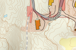
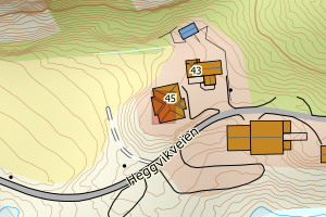
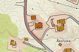
Avvikene skyldes oftest manglende oppdatering av kartreg-egenskapen i FKB-Tiltak. Rettes vanligvis i FKB-Tiltak
Kommune | LokalId | Tiltak_Byggnr | Saksreferanse | Byggstatus | Tiltak_Avgjørelsesdato | Matrikkel_Bygningsstatus | Matrikkel_Vedtaksdato | Posisjon | WMS-bilde |
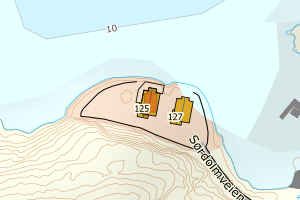
5056 Hitra | dda83579-b16e-4c8d-bcd4-7bd43311ca12 | None | 20093349 | 161 | 2010-02-05 00:00:00 | TB | 2012-02-05 | N: 7043512.91, Ø: 468368.39 | ![Kartbilde fra WMS-tjeneste av avviket](https://wms.geonorge.no/skwms1/wms.topo?VERSION=1.1.1&SERVICE=WMS&REQUEST=GetMap&LAYERS=topo&STYLES=&FORMAT=image/png&SRS=EPSG:25832&BBOX=468293.0,7043462,468443.0,7043562&WIDTH=300&HEIGHT=200) |
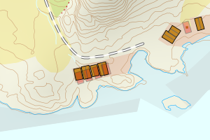
5056 Hitra | e3d43317-8833-45c0-8793-467b09b91ffa | None | 20121063 | 244 | 2012-05-31 00:00:00 | TB | None | N: 7058160.78, Ø: 487365.40 | ![Kartbilde fra WMS-tjeneste av avviket](https://wms.geonorge.no/skwms1/wms.topo?VERSION=1.1.1&SERVICE=WMS&REQUEST=GetMap&LAYERS=topo&STYLES=&FORMAT=image/png&SRS=EPSG:25832&BBOX=487290.0,7058110,487440.0,7058210&WIDTH=300&HEIGHT=200) |
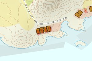
5056 Hitra | 573e831a-62ab-4917-8564-c060dd347350 | None | 2014000828 | 161 | 2014-05-26 00:00:00 | TB | 2015-01-01 | N: 7047554.25, Ø: 507051.46 | ![Kartbilde fra WMS-tjeneste av avviket](https://wms.geonorge.no/skwms1/wms.topo?VERSION=1.1.1&SERVICE=WMS&REQUEST=GetMap&LAYERS=topo&STYLES=&FORMAT=image/png&SRS=EPSG:25832&BBOX=506976.0,7047504,507126.0,7047604&WIDTH=300&HEIGHT=200) |
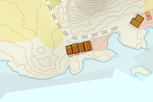
5056 Hitra | 75b15c8e-0618-41b5-98b7-6787fe729a59 | None | 2016001947 | 161 | 2016-08-24 00:00:00 | TB | 2017-01-01 | N: 7045789.35, Ø: 470392.19 | ![Kartbilde fra WMS-tjeneste av avviket](https://wms.geonorge.no/skwms1/wms.topo?VERSION=1.1.1&SERVICE=WMS&REQUEST=GetMap&LAYERS=topo&STYLES=&FORMAT=image/png&SRS=EPSG:25832&BBOX=470317.0,7045739,470467.0,7045839&WIDTH=300&HEIGHT=200) |
5056 Hitra | 8e3c2f50-b04c-4c6c-8ef6-8fc8d8aeb9fe | None | 2016003407 | 161 | 2016-11-16 00:00:00 | TB | 2018-01-01 | N: 7048920.32, Ø: 470969.07 | ![Kartbilde fra WMS-tjeneste av avviket](https://wms.geonorge.no/skwms1/wms.topo?VERSION=1.1.1&SERVICE=WMS&REQUEST=GetMap&LAYERS=topo&STYLES=&FORMAT=image/png&SRS=EPSG:25832&BBOX=470894.0,7048870,471044.0,7048970&WIDTH=300&HEIGHT=200) |
5056 Hitra | b975b632-433e-4703-ac4e-4dcecd488da2 | None | 2016003414 | 161 | 2017-01-25 00:00:00 | TB | 2018-01-01 | N: 7054714.40, Ø: 495883.82 | ![Kartbilde fra WMS-tjeneste av avviket](https://wms.geonorge.no/skwms1/wms.topo?VERSION=1.1.1&SERVICE=WMS&REQUEST=GetMap&LAYERS=topo&STYLES=&FORMAT=image/png&SRS=EPSG:25832&BBOX=495808.0,7054664,495958.0,7054764&WIDTH=300&HEIGHT=200) |
5056 Hitra | 2acaeded-4574-4d93-8dbf-bc33f57a6c93 | None | 2016002488 | 161 | 2017-01-26 00:00:00 | TB | 2018-01-01 | N: 7054789.08, Ø: 495837.46 | ![Kartbilde fra WMS-tjeneste av avviket](https://wms.geonorge.no/skwms1/wms.topo?VERSION=1.1.1&SERVICE=WMS&REQUEST=GetMap&LAYERS=topo&STYLES=&FORMAT=image/png&SRS=EPSG:25832&BBOX=495762.0,7054739,495912.0,7054839&WIDTH=300&HEIGHT=200) |
5056 Hitra | 15a521a3-bab3-4554-beb4-0ecd21cd3b11 | None | 2017000883 | 161 | 2017-04-10 00:00:00 | TB | 2018-01-01 | N: 7040986.45, Ø: 497892.26 | ![Kartbilde fra WMS-tjeneste av avviket](https://wms.geonorge.no/skwms1/wms.topo?VERSION=1.1.1&SERVICE=WMS&REQUEST=GetMap&LAYERS=topo&STYLES=&FORMAT=image/png&SRS=EPSG:25832&BBOX=497817.0,7040936,497967.0,7041036&WIDTH=300&HEIGHT=200) |
5056 Hitra | 5e028fa3-3f43-4ec9-a2f1-7526cedf2174 | None | 2018007001 | 181 | 2018-11-20 00:00:00 | TB | 1994-06-23 | N: 7052543.05, Ø: 498275.09 | ![Kartbilde fra WMS-tjeneste av avviket](https://wms.geonorge.no/skwms1/wms.topo?VERSION=1.1.1&SERVICE=WMS&REQUEST=GetMap&LAYERS=topo&STYLES=&FORMAT=image/png&SRS=EPSG:25832&BBOX=498200.0,7052493,498350.0,7052593&WIDTH=300&HEIGHT=200) |
5056 Hitra | b43f9ae4-8256-4084-94cb-617048062ed5 | None | 2018003895 | 141 | 2019-03-28 00:00:00 | FA | 2023-04-27 | N: 7053164.43, Ø: 498777.28 | ![Kartbilde fra WMS-tjeneste av avviket](https://wms.geonorge.no/skwms1/wms.topo?VERSION=1.1.1&SERVICE=WMS&REQUEST=GetMap&LAYERS=topo&STYLES=&FORMAT=image/png&SRS=EPSG:25832&BBOX=498702.0,7053114,498852.0,7053214&WIDTH=300&HEIGHT=200) |
5056 Hitra | 87beaec8-8ec3-4d34-b881-11b9236ca01a | None | 2019000847 | 161 | 2019-07-01 00:00:00 | FA | 2023-11-01 | N: 7045914.70, Ø: 470474.04 | ![Kartbilde fra WMS-tjeneste av avviket](https://wms.geonorge.no/skwms1/wms.topo?VERSION=1.1.1&SERVICE=WMS&REQUEST=GetMap&LAYERS=topo&STYLES=&FORMAT=image/png&SRS=EPSG:25832&BBOX=470399.0,7045864,470549.0,7045964&WIDTH=300&HEIGHT=200) |
5056 Hitra | db160094-e7f0-4eec-9de7-1e011b1a7275 | None | 2019001199 | 111 | 2019-07-17 00:00:00 | TB | 2006-03-08 | N: 7056773.62, Ø: 499609.93 | ![Kartbilde fra WMS-tjeneste av avviket](https://wms.geonorge.no/skwms1/wms.topo?VERSION=1.1.1&SERVICE=WMS&REQUEST=GetMap&LAYERS=topo&STYLES=&FORMAT=image/png&SRS=EPSG:25832&BBOX=499534.0,7056723,499684.0,7056823&WIDTH=300&HEIGHT=200) |
5056 Hitra | 145ec72f-58b8-494d-a791-9bc1737e0e60 | None | 2019006913 | 161 | 2019-12-04 00:00:00 | TB | 2021-01-01 | N: 7056318.59, Ø: 501738.85 | ![Kartbilde fra WMS-tjeneste av avviket](https://wms.geonorge.no/skwms1/wms.topo?VERSION=1.1.1&SERVICE=WMS&REQUEST=GetMap&LAYERS=topo&STYLES=&FORMAT=image/png&SRS=EPSG:25832&BBOX=501663.0,7056268,501813.0,7056368&WIDTH=300&HEIGHT=200) |
5056 Hitra | 8bb4192c-4a5e-4f7b-befe-54bea087df7d | None | 2020000314 | 161 | 2020-01-08 00:00:00 | TB | None | N: 7036213.98, Ø: 480258.26 | ![Kartbilde fra WMS-tjeneste av avviket](https://wms.geonorge.no/skwms1/wms.topo?VERSION=1.1.1&SERVICE=WMS&REQUEST=GetMap&LAYERS=topo&STYLES=&FORMAT=image/png&SRS=EPSG:25832&BBOX=480183.0,7036163,480333.0,7036263&WIDTH=300&HEIGHT=200) |
5056 Hitra | 9332c350-3be5-423b-83b7-d464d7086ca7 | None | 2021000184 | 111 | 2021-02-15 00:00:00 | FA | 2022-01-25 | N: 7057772.52, Ø: 499710.50 | ![Kartbilde fra WMS-tjeneste av avviket](https://wms.geonorge.no/skwms1/wms.topo?VERSION=1.1.1&SERVICE=WMS&REQUEST=GetMap&LAYERS=topo&STYLES=&FORMAT=image/png&SRS=EPSG:25832&BBOX=499635.0,7057722,499785.0,7057822&WIDTH=300&HEIGHT=200) |
5056 Hitra | 99b83054-db8f-4fa5-ac7c-51a1a09b3b6e | None | 2020001266 | 161 | 2021-03-11 00:00:00 | FA | 2023-08-24 | N: 7052055.34, Ø: 504986.71 | ![Kartbilde fra WMS-tjeneste av avviket](https://wms.geonorge.no/skwms1/wms.topo?VERSION=1.1.1&SERVICE=WMS&REQUEST=GetMap&LAYERS=topo&STYLES=&FORMAT=image/png&SRS=EPSG:25832&BBOX=504911.0,7052005,505061.0,7052105&WIDTH=300&HEIGHT=200) |
5056 Hitra | 380fa7e7-65ec-4e80-b3f5-10889c9cd64e | None | 2021000777 | 181 | 2021-03-22 00:00:00 | FA | 2021-07-13 | N: 7041514.13, Ø: 498511.10 | ![Kartbilde fra WMS-tjeneste av avviket](https://wms.geonorge.no/skwms1/wms.topo?VERSION=1.1.1&SERVICE=WMS&REQUEST=GetMap&LAYERS=topo&STYLES=&FORMAT=image/png&SRS=EPSG:25832&BBOX=498436.0,7041464,498586.0,7041564&WIDTH=300&HEIGHT=200) |
5056 Hitra | 5567b87d-8cc1-4afe-94e9-9d6ada0f764f | None | 2021000259 | 161 | 2021-03-24 00:00:00 | FA | 2021-11-04 | N: 7060296.21, Ø: 505035.06 | ![Kartbilde fra WMS-tjeneste av avviket](https://wms.geonorge.no/skwms1/wms.topo?VERSION=1.1.1&SERVICE=WMS&REQUEST=GetMap&LAYERS=topo&STYLES=&FORMAT=image/png&SRS=EPSG:25832&BBOX=504960.0,7060246,505110.0,7060346&WIDTH=300&HEIGHT=200) |
5056 Hitra | f67e4c9a-d648-4b94-ab1b-798f8668b511 | None | 2021001062 | 161 | 2021-07-13 00:00:00 | FA | 2023-06-22 | N: 7045816.83, Ø: 470207.75 | ![Kartbilde fra WMS-tjeneste av avviket](https://wms.geonorge.no/skwms1/wms.topo?VERSION=1.1.1&SERVICE=WMS&REQUEST=GetMap&LAYERS=topo&STYLES=&FORMAT=image/png&SRS=EPSG:25832&BBOX=470132.0,7045766,470282.0,7045866&WIDTH=300&HEIGHT=200) |
5056 Hitra | 0764858c-2535-48df-8c95-d448a66c1b38 | None | 2021000552 | 183 | 2021-08-20 00:00:00 | FA | 2022-10-17 | N: 7059248.21, Ø: 503077.80 | ![Kartbilde fra WMS-tjeneste av avviket](https://wms.geonorge.no/skwms1/wms.topo?VERSION=1.1.1&SERVICE=WMS&REQUEST=GetMap&LAYERS=topo&STYLES=&FORMAT=image/png&SRS=EPSG:25832&BBOX=503002.0,7059198,503152.0,7059298&WIDTH=300&HEIGHT=200) |
5056 Hitra | 07dea8d5-ad43-4c58-93ac-bfe8a5d06f14 | None | 2021001518 | 111 | 2021-09-02 00:00:00 | FA | 2022-07-07 | N: 7052880.53, Ø: 498383.36 | ![Kartbilde fra WMS-tjeneste av avviket](https://wms.geonorge.no/skwms1/wms.topo?VERSION=1.1.1&SERVICE=WMS&REQUEST=GetMap&LAYERS=topo&STYLES=&FORMAT=image/png&SRS=EPSG:25832&BBOX=498308.0,7052830,498458.0,7052930&WIDTH=300&HEIGHT=200) |
5056 Hitra | 99273282-8918-4a2d-b975-a72ad92920cc | None | 2021002688 | 239 | 2021-09-15 00:00:00 | TB | 2012-12-21 | N: 7043681.40, Ø: 505518.46 | ![Kartbilde fra WMS-tjeneste av avviket](https://wms.geonorge.no/skwms1/wms.topo?VERSION=1.1.1&SERVICE=WMS&REQUEST=GetMap&LAYERS=topo&STYLES=&FORMAT=image/png&SRS=EPSG:25832&BBOX=505443.0,7043631,505593.0,7043731&WIDTH=300&HEIGHT=200) |
5056 Hitra | 403e89c2-93b5-46a5-ad4d-0efe4b656cce | None | 2022000445 | 111 | 2022-02-04 00:00:00 | FA | 2023-01-10 | N: 7052762.51, Ø: 498297.72 | ![Kartbilde fra WMS-tjeneste av avviket](https://wms.geonorge.no/skwms1/wms.topo?VERSION=1.1.1&SERVICE=WMS&REQUEST=GetMap&LAYERS=topo&STYLES=&FORMAT=image/png&SRS=EPSG:25832&BBOX=498222.0,7052712,498372.0,7052812&WIDTH=300&HEIGHT=200) |
5056 Hitra | 2ec153bf-ee54-46fd-8cb5-227990b66a44 | None | 2021004191 | 219 | 2022-02-07 00:00:00 | FA | 2023-01-12 | N: 7044163.22, Ø: 503717.31 | ![Kartbilde fra WMS-tjeneste av avviket](https://wms.geonorge.no/skwms1/wms.topo?VERSION=1.1.1&SERVICE=WMS&REQUEST=GetMap&LAYERS=topo&STYLES=&FORMAT=image/png&SRS=EPSG:25832&BBOX=503642.0,7044113,503792.0,7044213&WIDTH=300&HEIGHT=200) |
5056 Hitra | f5a98899-fb3b-4ff8-853a-887c825b7175 | None | 2021004018 | 159 | 2022-02-25 00:00:00 | FA | 2022-10-13 | N: 7043298.30, Ø: 465465.78 | ![Kartbilde fra WMS-tjeneste av avviket](https://wms.geonorge.no/skwms1/wms.topo?VERSION=1.1.1&SERVICE=WMS&REQUEST=GetMap&LAYERS=topo&STYLES=&FORMAT=image/png&SRS=EPSG:25832&BBOX=465390.0,7043248,465540.0,7043348&WIDTH=300&HEIGHT=200) |
5056 Hitra | e0fa48f6-28f6-42a7-9643-ba116f6308f3 | None | 2021002958 | 161 | 2022-03-09 00:00:00 | FA | 2023-07-04 | N: 7059719.00, Ø: 505226.68 | ![Kartbilde fra WMS-tjeneste av avviket](https://wms.geonorge.no/skwms1/wms.topo?VERSION=1.1.1&SERVICE=WMS&REQUEST=GetMap&LAYERS=topo&STYLES=&FORMAT=image/png&SRS=EPSG:25832&BBOX=505151.0,7059668,505301.0,7059768&WIDTH=300&HEIGHT=200) |
5056 Hitra | 63b116aa-1268-4771-be87-43206acf89e4 | None | 2022002866 | 612 | 2022-07-15 00:00:00 | FA | 2023-02-21 | N: 7046058.92, Ø: 507594.92 | ![Kartbilde fra WMS-tjeneste av avviket](https://wms.geonorge.no/skwms1/wms.topo?VERSION=1.1.1&SERVICE=WMS&REQUEST=GetMap&LAYERS=topo&STYLES=&FORMAT=image/png&SRS=EPSG:25832&BBOX=507519.0,7046008,507669.0,7046108&WIDTH=300&HEIGHT=200) |
5056 Hitra | 20819f7c-47ee-4e2c-b2ae-48fc2df0bc81 | None | 2022002778 | 161 | 2023-01-10 00:00:00 | FA | 2023-01-25 | N: 7057539.83, Ø: 491166.88 | ![Kartbilde fra WMS-tjeneste av avviket](https://wms.geonorge.no/skwms1/wms.topo?VERSION=1.1.1&SERVICE=WMS&REQUEST=GetMap&LAYERS=topo&STYLES=&FORMAT=image/png&SRS=EPSG:25832&BBOX=491091.0,7057489,491241.0,7057589&WIDTH=300&HEIGHT=200) |
5056 Hitra | 02a1a454-3f57-4f7b-a447-42840e323625 | 300508313 | 121136 | 161 | 2013-01-10 00:00:00 | FA | 2016-09-15 | N: 7041141.24, Ø: 506222.44 | ![Kartbilde fra WMS-tjeneste av avviket](https://wms.geonorge.no/skwms1/wms.topo?VERSION=1.1.1&SERVICE=WMS&REQUEST=GetMap&LAYERS=topo&STYLES=&FORMAT=image/png&SRS=EPSG:25832&BBOX=506147.0,7041091,506297.0,7041191&WIDTH=300&HEIGHT=200) |
5056 Hitra | 08ae8b8f-3583-4df7-b447-4b78e993e70a | 300648583 | 2017002582 | 161 | 2017-10-13 00:00:00 | FA | 2019-10-08 | N: 7056616.64, Ø: 501631.25 | ![Kartbilde fra WMS-tjeneste av avviket](https://wms.geonorge.no/skwms1/wms.topo?VERSION=1.1.1&SERVICE=WMS&REQUEST=GetMap&LAYERS=topo&STYLES=&FORMAT=image/png&SRS=EPSG:25832&BBOX=501556.0,7056566,501706.0,7056666&WIDTH=300&HEIGHT=200) |
5056 Hitra | 122df333-28b6-4e18-a006-75b41391b9cd | 300555865 | 2014002956 | 111 | 2016-04-18 00:00:00 | FA | 2024-08-13 | N: 7059578.41, Ø: 504481.78 | ![Kartbilde fra WMS-tjeneste av avviket](https://wms.geonorge.no/skwms1/wms.topo?VERSION=1.1.1&SERVICE=WMS&REQUEST=GetMap&LAYERS=topo&STYLES=&FORMAT=image/png&SRS=EPSG:25832&BBOX=504406.0,7059528,504556.0,7059628&WIDTH=300&HEIGHT=200) |
5056 Hitra | 71113358-74b5-4488-a717-4fcfc24a20ed | 300745439 | 2018002717 | 111 | 2019-05-20 00:00:00 | FA | 2020-07-31 | N: 7048988.94, Ø: 509743.37 | ![Kartbilde fra WMS-tjeneste av avviket](https://wms.geonorge.no/skwms1/wms.topo?VERSION=1.1.1&SERVICE=WMS&REQUEST=GetMap&LAYERS=topo&STYLES=&FORMAT=image/png&SRS=EPSG:25832&BBOX=509668.0,7048938,509818.0,7049038&WIDTH=300&HEIGHT=200) |
5056 Hitra | a1c935df-f929-4d77-9282-0e6c554dcb13 | 300508313 | 121136 | 161 | 2013-01-10 00:00:00 | FA | 2016-09-15 | N: 7041167.56, Ø: 506249.12 | ![Kartbilde fra WMS-tjeneste av avviket](https://wms.geonorge.no/skwms1/wms.topo?VERSION=1.1.1&SERVICE=WMS&REQUEST=GetMap&LAYERS=topo&STYLES=&FORMAT=image/png&SRS=EPSG:25832&BBOX=506174.0,7041117,506324.0,7041217&WIDTH=300&HEIGHT=200) |
5056 Hitra | b3ae3db6-9088-431c-869c-f30c4e6a97a2 | 300860251 | 2021000259 | 161 | 2021-03-24 00:00:00 | FA | 2021-11-04 | N: 7060308.23, Ø: 505030.99 | ![Kartbilde fra WMS-tjeneste av avviket](https://wms.geonorge.no/skwms1/wms.topo?VERSION=1.1.1&SERVICE=WMS&REQUEST=GetMap&LAYERS=topo&STYLES=&FORMAT=image/png&SRS=EPSG:25832&BBOX=504955.0,7060258,505105.0,7060358&WIDTH=300&HEIGHT=200) |
5056 Hitra | c33fc4b8-9271-445c-8473-a0f37534498d | 300642138 | 2017002264 | 161 | 2017-09-01 00:00:00 | TB | 2018-01-01 | N: 7054770.69, Ø: 495746.53 | ![Kartbilde fra WMS-tjeneste av avviket](https://wms.geonorge.no/skwms1/wms.topo?VERSION=1.1.1&SERVICE=WMS&REQUEST=GetMap&LAYERS=topo&STYLES=&FORMAT=image/png&SRS=EPSG:25832&BBOX=495671.0,7054720,495821.0,7054820&WIDTH=300&HEIGHT=200) |
5056 Hitra | 270c576e-961d-4295-ad52-15b197fd7160 | 300900395 | 2020002073 | 231 | 2020-04-22 00:00:00 | FA | 2021-06-30 | N: 7058138.61, Ø: 487272.82 | ![Kartbilde fra WMS-tjeneste av avviket](https://wms.geonorge.no/skwms1/wms.topo?VERSION=1.1.1&SERVICE=WMS&REQUEST=GetMap&LAYERS=topo&STYLES=&FORMAT=image/png&SRS=EPSG:25832&BBOX=487197.0,7058088,487347.0,7058188&WIDTH=300&HEIGHT=200) |
5056 Hitra | d0460580-641e-4ca5-aa37-b91684112ea1 | 300886088 | 2004006763 | 111 | 2020-11-21 00:00:00 | FA | 2020-08-27 | N: 7058708.70, Ø: 489936.95 | ![Kartbilde fra WMS-tjeneste av avviket](https://wms.geonorge.no/skwms1/wms.topo?VERSION=1.1.1&SERVICE=WMS&REQUEST=GetMap&LAYERS=topo&STYLES=&FORMAT=image/png&SRS=EPSG:25832&BBOX=489861.0,7058658,490011.0,7058758&WIDTH=300&HEIGHT=200) |
5056 Hitra | 8f7c2955-cf03-4021-8f82-8e9dcf39ee95 | 300887756 | 2021000660 | 111 | 2021-05-13 00:00:00 | FA | 2023-01-30 | N: 7055357.77, Ø: 493018.36 | ![Kartbilde fra WMS-tjeneste av avviket](https://wms.geonorge.no/skwms1/wms.topo?VERSION=1.1.1&SERVICE=WMS&REQUEST=GetMap&LAYERS=topo&STYLES=&FORMAT=image/png&SRS=EPSG:25832&BBOX=492943.0,7055307,493093.0,7055407&WIDTH=300&HEIGHT=200) |
5056 Hitra | 901fa2cb-afdd-4994-8925-8a977f73c027 | 300897813 | 2021000985 | 219 | 2021-06-08 00:00:00 | FA | 2022-05-18 | N: 7058509.14, Ø: 502089.62 | ![Kartbilde fra WMS-tjeneste av avviket](https://wms.geonorge.no/skwms1/wms.topo?VERSION=1.1.1&SERVICE=WMS&REQUEST=GetMap&LAYERS=topo&STYLES=&FORMAT=image/png&SRS=EPSG:25832&BBOX=502014.0,7058459,502164.0,7058559&WIDTH=300&HEIGHT=200) |
5056 Hitra | e172994c-e5bb-46d9-9606-bd86106e7a1a | 300864506 | 2021000508 | 161 | 2021-04-07 00:00:00 | FA | 2024-04-04 | N: 7060330.24, Ø: 505013.49 | ![Kartbilde fra WMS-tjeneste av avviket](https://wms.geonorge.no/skwms1/wms.topo?VERSION=1.1.1&SERVICE=WMS&REQUEST=GetMap&LAYERS=topo&STYLES=&FORMAT=image/png&SRS=EPSG:25832&BBOX=504938.0,7060280,505088.0,7060380&WIDTH=300&HEIGHT=200) |
5056 Hitra | 221c0b05-2c68-423c-babf-1b102ac385b4 | 300818822 | 2020004007 | 161 | 2020-07-28 00:00:00 | MB | 2021-06-29 | N: 7060075.14, Ø: 502924.94 | ![Kartbilde fra WMS-tjeneste av avviket](https://wms.geonorge.no/skwms1/wms.topo?VERSION=1.1.1&SERVICE=WMS&REQUEST=GetMap&LAYERS=topo&STYLES=&FORMAT=image/png&SRS=EPSG:25832&BBOX=502849.0,7060025,502999.0,7060125&WIDTH=300&HEIGHT=200) |
5056 Hitra | d20281cb-b1e2-4309-8f90-e9d87c1643c9 | 300897770 | 2021000985 | 319 | 2021-06-08 00:00:00 | FA | 2022-05-18 | N: 7058507.47, Ø: 502021.25 | ![Kartbilde fra WMS-tjeneste av avviket](https://wms.geonorge.no/skwms1/wms.topo?VERSION=1.1.1&SERVICE=WMS&REQUEST=GetMap&LAYERS=topo&STYLES=&FORMAT=image/png&SRS=EPSG:25832&BBOX=501946.0,7058457,502096.0,7058557&WIDTH=300&HEIGHT=200) |
5056 Hitra | 614ae341-fa29-4cb4-9202-f29ce962a152 | 300673407 | 2017000736 | 161 | 2017-10-25 00:00:00 | TB | 2018-01-01 | N: 7053694.25, Ø: 492862.13 | ![Kartbilde fra WMS-tjeneste av avviket](https://wms.geonorge.no/skwms1/wms.topo?VERSION=1.1.1&SERVICE=WMS&REQUEST=GetMap&LAYERS=topo&STYLES=&FORMAT=image/png&SRS=EPSG:25832&BBOX=492787.0,7053644,492937.0,7053744&WIDTH=300&HEIGHT=200) |
5056 Hitra | 6292f0f1-c101-4750-8536-004a3df1bf3f | 300508313 | 121136 | 161 | 2013-01-10 00:00:00 | FA | 2016-09-15 | N: 7041152.40, Ø: 506237.88 | ![Kartbilde fra WMS-tjeneste av avviket](https://wms.geonorge.no/skwms1/wms.topo?VERSION=1.1.1&SERVICE=WMS&REQUEST=GetMap&LAYERS=topo&STYLES=&FORMAT=image/png&SRS=EPSG:25832&BBOX=506162.0,7041102,506312.0,7041202&WIDTH=300&HEIGHT=200) |
5056 Hitra | 6ee3844a-a7ab-41c6-ad26-b6c1972428df | 300541434 | 2015003269 | 141 | 2016-01-20 00:00:00 | MB | 2024-03-07 | N: 7047734.95, Ø: 509063.28 | ![Kartbilde fra WMS-tjeneste av avviket](https://wms.geonorge.no/skwms1/wms.topo?VERSION=1.1.1&SERVICE=WMS&REQUEST=GetMap&LAYERS=topo&STYLES=&FORMAT=image/png&SRS=EPSG:25832&BBOX=508988.0,7047684,509138.0,7047784&WIDTH=300&HEIGHT=200) |
5056 Hitra | a07479f6-ad0d-408f-a66c-bc4e14051033 | 300799990 | 2020000871 | 245 | 2020-04-02 00:00:00 | FA | 2021-08-01 | N: 7048278.36, Ø: 486831.36 | ![Kartbilde fra WMS-tjeneste av avviket](https://wms.geonorge.no/skwms1/wms.topo?VERSION=1.1.1&SERVICE=WMS&REQUEST=GetMap&LAYERS=topo&STYLES=&FORMAT=image/png&SRS=EPSG:25832&BBOX=486756.0,7048228,486906.0,7048328&WIDTH=300&HEIGHT=200) |
5056 Hitra | 0e8827fe-9169-4a64-9819-8bb4f9c444dc | 300799499 | 2020001958 | 161 | 2020-03-26 00:00:00 | FA | 2020-12-01 | N: 7060266.17, Ø: 505045.89 | ![Kartbilde fra WMS-tjeneste av avviket](https://wms.geonorge.no/skwms1/wms.topo?VERSION=1.1.1&SERVICE=WMS&REQUEST=GetMap&LAYERS=topo&STYLES=&FORMAT=image/png&SRS=EPSG:25832&BBOX=504970.0,7060216,505120.0,7060316&WIDTH=300&HEIGHT=200) |
5056 Hitra | 4d3430fd-f8be-4588-b91a-077a89dd8514 | 300819628 | 2020001186 | 161 | 2020-05-29 00:00:00 | FA | 2024-03-15 | N: 7042090.94, Ø: 504287.47 | ![Kartbilde fra WMS-tjeneste av avviket](https://wms.geonorge.no/skwms1/wms.topo?VERSION=1.1.1&SERVICE=WMS&REQUEST=GetMap&LAYERS=topo&STYLES=&FORMAT=image/png&SRS=EPSG:25832&BBOX=504212.0,7042040,504362.0,7042140&WIDTH=300&HEIGHT=200) |
5056 Hitra | ca2f0631-2812-40d4-84a8-12e3e194e5d8 | 300820966 | 2020004105 | 111 | 2020-08-24 00:00:00 | FA | 2023-03-27 | N: 7052922.43, Ø: 498380.27 | ![Kartbilde fra WMS-tjeneste av avviket](https://wms.geonorge.no/skwms1/wms.topo?VERSION=1.1.1&SERVICE=WMS&REQUEST=GetMap&LAYERS=topo&STYLES=&FORMAT=image/png&SRS=EPSG:25832&BBOX=498305.0,7052872,498455.0,7052972&WIDTH=300&HEIGHT=200) |
5056 Hitra | feff9d71-779e-4caf-9531-8014d26551d0 | 300822502 | 2020003422 | 181 | 2020-09-02 00:00:00 | TB | 2021-09-02 | N: 7054898.11, Ø: 484956.13 | ![Kartbilde fra WMS-tjeneste av avviket](https://wms.geonorge.no/skwms1/wms.topo?VERSION=1.1.1&SERVICE=WMS&REQUEST=GetMap&LAYERS=topo&STYLES=&FORMAT=image/png&SRS=EPSG:25832&BBOX=484881.0,7054848,485031.0,7054948&WIDTH=300&HEIGHT=200) |
5056 Hitra | 2aacd23c-4d07-4751-9ff5-e93eb4ccd04e | 300822516 | 2020003084 | 182 | 2020-09-02 00:00:00 | TB | 2021-09-02 | N: 7054623.75, Ø: 482498.12 | ![Kartbilde fra WMS-tjeneste av avviket](https://wms.geonorge.no/skwms1/wms.topo?VERSION=1.1.1&SERVICE=WMS&REQUEST=GetMap&LAYERS=topo&STYLES=&FORMAT=image/png&SRS=EPSG:25832&BBOX=482423.0,7054573,482573.0,7054673&WIDTH=300&HEIGHT=200) |
5056 Hitra | 9061104a-9aa3-4856-94df-94d4da27bad3 | 300827407 | 2020003685 | 181 | 2020-09-25 00:00:00 | FA | 2023-06-08 | N: 7047223.63, Ø: 508896.42 | ![Kartbilde fra WMS-tjeneste av avviket](https://wms.geonorge.no/skwms1/wms.topo?VERSION=1.1.1&SERVICE=WMS&REQUEST=GetMap&LAYERS=topo&STYLES=&FORMAT=image/png&SRS=EPSG:25832&BBOX=508821.0,7047173,508971.0,7047273&WIDTH=300&HEIGHT=200) |
5056 Hitra | 3a96734e-46ce-4da2-a5f8-8e23e493c1fd | 300837748 | 2020005316 | 161 | 2020-11-10 00:00:00 | FA | 2021-06-01 | N: 7060222.59, Ø: 505085.95 | ![Kartbilde fra WMS-tjeneste av avviket](https://wms.geonorge.no/skwms1/wms.topo?VERSION=1.1.1&SERVICE=WMS&REQUEST=GetMap&LAYERS=topo&STYLES=&FORMAT=image/png&SRS=EPSG:25832&BBOX=505010.0,7060172,505160.0,7060272&WIDTH=300&HEIGHT=200) |
5056 Hitra | 998dd7af-9d4b-431b-89d9-895b0806aa65 | 300837787 | 2020005025 | 111 | 2020-11-17 00:00:00 | FA | 2021-09-08 | N: 7057804.40, Ø: 487171.06 | ![Kartbilde fra WMS-tjeneste av avviket](https://wms.geonorge.no/skwms1/wms.topo?VERSION=1.1.1&SERVICE=WMS&REQUEST=GetMap&LAYERS=topo&STYLES=&FORMAT=image/png&SRS=EPSG:25832&BBOX=487096.0,7057754,487246.0,7057854&WIDTH=300&HEIGHT=200) |
5056 Hitra | 1f0d32ce-a858-4555-80f4-a592aed8d944 | 300501840 | 2015000483 | 161 | 2015-05-28 00:00:00 | TB | 2016-01-01 | N: 7049957.81, Ø: 506229.91 | ![Kartbilde fra WMS-tjeneste av avviket](https://wms.geonorge.no/skwms1/wms.topo?VERSION=1.1.1&SERVICE=WMS&REQUEST=GetMap&LAYERS=topo&STYLES=&FORMAT=image/png&SRS=EPSG:25832&BBOX=506154.0,7049907,506304.0,7050007&WIDTH=300&HEIGHT=200) |
5056 Hitra | 3527496c-8b74-4948-a52d-f7d2c72a3783 | 301187281 | 2023001675 | 659 | 2023-03-29 00:00:00 | FA | 2023-10-18 | N: 7052689.16, Ø: 498415.50 | ![Kartbilde fra WMS-tjeneste av avviket](https://wms.geonorge.no/skwms1/wms.topo?VERSION=1.1.1&SERVICE=WMS&REQUEST=GetMap&LAYERS=topo&STYLES=&FORMAT=image/png&SRS=EPSG:25832&BBOX=498340.0,7052639,498490.0,7052739&WIDTH=300&HEIGHT=200) |
5056 Hitra | bf9b1baf-bb68-4cb8-8437-8d581f55e0da | 301187289 | 2023001675 | 431 | 2023-03-29 00:00:00 | FA | 2023-10-18 | N: 7052708.77, Ø: 498418.10 | ![Kartbilde fra WMS-tjeneste av avviket](https://wms.geonorge.no/skwms1/wms.topo?VERSION=1.1.1&SERVICE=WMS&REQUEST=GetMap&LAYERS=topo&STYLES=&FORMAT=image/png&SRS=EPSG:25832&BBOX=498343.0,7052658,498493.0,7052758&WIDTH=300&HEIGHT=200) |