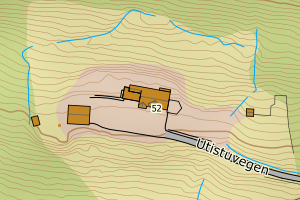
Avvikene skyldes oftest manglende eller unøyaktig registrering av bygningspunkt i matrikkelen. Rettes vanligvis i matrikkelen
Kommune | LokalId | Areal (m2) | Posisjon | WMS-bilde |
5055 Heim | addd96c4-9ca4-402a-a050-0ec4f2c396a1 | 2125.85 | N: 6994214.04, Ø: 462289.44 | ![Kartbilde fra WMS-tjeneste av avviket](https://wms.geonorge.no/skwms1/wms.topo?VERSION=1.1.1&SERVICE=WMS&REQUEST=GetMap&LAYERS=topo&STYLES=&FORMAT=image/png&SRS=EPSG:25832&BBOX=462214.0,6994164,462364.0,6994264&WIDTH=300&HEIGHT=200) |
5055 Heim | 1ec28b1f-4314-4da6-9796-25ab1ecba6f1 | 981.53 | N: 7025566.64, Ø: 517296.57 | ![Kartbilde fra WMS-tjeneste av avviket](https://wms.geonorge.no/skwms1/wms.topo?VERSION=1.1.1&SERVICE=WMS&REQUEST=GetMap&LAYERS=topo&STYLES=&FORMAT=image/png&SRS=EPSG:25832&BBOX=517221.0,7025516,517371.0,7025616&WIDTH=300&HEIGHT=200) |
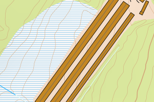
5055 Heim | 74f9c219-82f2-4005-abf8-0fa737998b27 | 568.81 | N: 7000344.62, Ø: 476043.30 | ![Kartbilde fra WMS-tjeneste av avviket](https://wms.geonorge.no/skwms1/wms.topo?VERSION=1.1.1&SERVICE=WMS&REQUEST=GetMap&LAYERS=topo&STYLES=&FORMAT=image/png&SRS=EPSG:25832&BBOX=475968.0,7000294,476118.0,7000394&WIDTH=300&HEIGHT=200) |
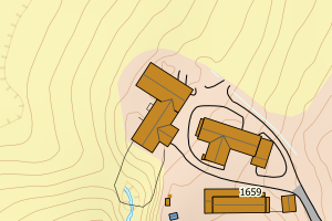
5055 Heim | d3758259-6b3b-42d8-89cd-4e84d70f7ee1 | 460.87 | N: 7025560.54, Ø: 517320.45 | ![Kartbilde fra WMS-tjeneste av avviket](https://wms.geonorge.no/skwms1/wms.topo?VERSION=1.1.1&SERVICE=WMS&REQUEST=GetMap&LAYERS=topo&STYLES=&FORMAT=image/png&SRS=EPSG:25832&BBOX=517245.0,7025510,517395.0,7025610&WIDTH=300&HEIGHT=200) |
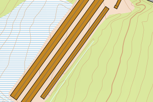
5055 Heim | 7cf15bd6-290d-43d8-9d99-d3f6d04e719b | 414.38 | N: 7011872.05, Ø: 503757.99 | ![Kartbilde fra WMS-tjeneste av avviket](https://wms.geonorge.no/skwms1/wms.topo?VERSION=1.1.1&SERVICE=WMS&REQUEST=GetMap&LAYERS=topo&STYLES=&FORMAT=image/png&SRS=EPSG:25832&BBOX=503682.0,7011822,503832.0,7011922&WIDTH=300&HEIGHT=200) |
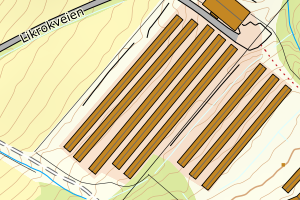
5055 Heim | 05f5a2eb-969f-4665-837a-05956a33a8fb | 384.76 | N: 7011876.47, Ø: 503750.09 | ![Kartbilde fra WMS-tjeneste av avviket](https://wms.geonorge.no/skwms1/wms.topo?VERSION=1.1.1&SERVICE=WMS&REQUEST=GetMap&LAYERS=topo&STYLES=&FORMAT=image/png&SRS=EPSG:25832&BBOX=503675.0,7011826,503825.0,7011926&WIDTH=300&HEIGHT=200) |
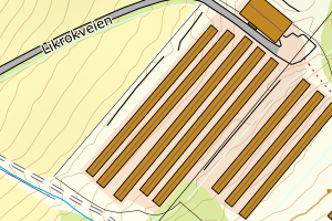
5055 Heim | 3e9945ca-0e23-47be-9fa0-ed5c659257b8 | 383.66 | N: 7011870.82, Ø: 503766.76 | ![Kartbilde fra WMS-tjeneste av avviket](https://wms.geonorge.no/skwms1/wms.topo?VERSION=1.1.1&SERVICE=WMS&REQUEST=GetMap&LAYERS=topo&STYLES=&FORMAT=image/png&SRS=EPSG:25832&BBOX=503691.0,7011820,503841.0,7011920&WIDTH=300&HEIGHT=200) |
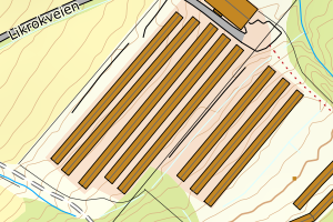
5055 Heim | f855170b-040e-460e-8cdf-d845dd11d4d7 | 381.89 | N: 7017798.62, Ø: 503461.25 | ![Kartbilde fra WMS-tjeneste av avviket](https://wms.geonorge.no/skwms1/wms.topo?VERSION=1.1.1&SERVICE=WMS&REQUEST=GetMap&LAYERS=topo&STYLES=&FORMAT=image/png&SRS=EPSG:25832&BBOX=503386.0,7017748,503536.0,7017848&WIDTH=300&HEIGHT=200) |
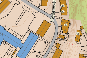
5055 Heim | fcaaa190-d024-4ed1-a626-167d18615871 | 358.14 | N: 7035380.11, Ø: 497804.05 | ![Kartbilde fra WMS-tjeneste av avviket](https://wms.geonorge.no/skwms1/wms.topo?VERSION=1.1.1&SERVICE=WMS&REQUEST=GetMap&LAYERS=topo&STYLES=&FORMAT=image/png&SRS=EPSG:25832&BBOX=497729.0,7035330,497879.0,7035430&WIDTH=300&HEIGHT=200) |
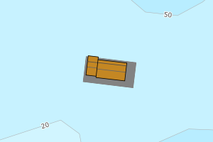
5055 Heim | 2d3ae9e5-bb45-4eb2-b374-69e0812774da | 354.62 | N: 7011880.07, Ø: 503743.97 | ![Kartbilde fra WMS-tjeneste av avviket](https://wms.geonorge.no/skwms1/wms.topo?VERSION=1.1.1&SERVICE=WMS&REQUEST=GetMap&LAYERS=topo&STYLES=&FORMAT=image/png&SRS=EPSG:25832&BBOX=503668.0,7011830,503818.0,7011930&WIDTH=300&HEIGHT=200) |
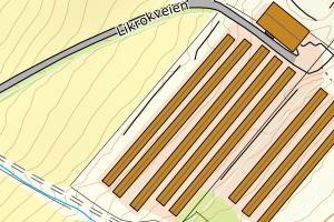
5055 Heim | 5214adc4-6035-49e1-b125-3f6e0fb76494 | 348.70 | N: 7011866.00, Ø: 503772.62 | ![Kartbilde fra WMS-tjeneste av avviket](https://wms.geonorge.no/skwms1/wms.topo?VERSION=1.1.1&SERVICE=WMS&REQUEST=GetMap&LAYERS=topo&STYLES=&FORMAT=image/png&SRS=EPSG:25832&BBOX=503697.0,7011816,503847.0,7011916&WIDTH=300&HEIGHT=200) |
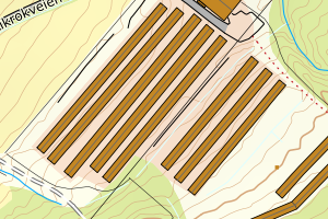
5055 Heim | fd191a7e-8f12-479e-8b9e-5d21131c60d4 | 342.79 | N: 7011836.34, Ø: 503845.78 | ![Kartbilde fra WMS-tjeneste av avviket](https://wms.geonorge.no/skwms1/wms.topo?VERSION=1.1.1&SERVICE=WMS&REQUEST=GetMap&LAYERS=topo&STYLES=&FORMAT=image/png&SRS=EPSG:25832&BBOX=503770.0,7011786,503920.0,7011886&WIDTH=300&HEIGHT=200) |
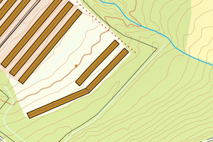
5055 Heim | 00cc5385-75fa-404a-b0ab-66d189f6f736 | 341.17 | N: 6998918.12, Ø: 464453.42 | ![Kartbilde fra WMS-tjeneste av avviket](https://wms.geonorge.no/skwms1/wms.topo?VERSION=1.1.1&SERVICE=WMS&REQUEST=GetMap&LAYERS=topo&STYLES=&FORMAT=image/png&SRS=EPSG:25832&BBOX=464378.0,6998868,464528.0,6998968&WIDTH=300&HEIGHT=200) |
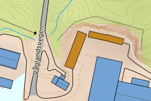
5055 Heim | 1c87e822-6a9c-4c74-a37d-7a1cf5307112 | 336.92 | N: 7008338.95, Ø: 500394.18 | ![Kartbilde fra WMS-tjeneste av avviket](https://wms.geonorge.no/skwms1/wms.topo?VERSION=1.1.1&SERVICE=WMS&REQUEST=GetMap&LAYERS=topo&STYLES=&FORMAT=image/png&SRS=EPSG:25832&BBOX=500319.0,7008288,500469.0,7008388&WIDTH=300&HEIGHT=200) |
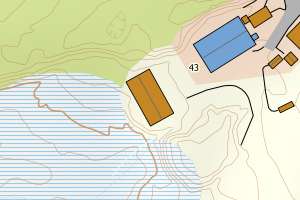
5055 Heim | 62f4dae5-a8b4-4f43-9b0c-7b416096ffb0 | 320.42 | N: 7008374.48, Ø: 500475.86 | ![Kartbilde fra WMS-tjeneste av avviket](https://wms.geonorge.no/skwms1/wms.topo?VERSION=1.1.1&SERVICE=WMS&REQUEST=GetMap&LAYERS=topo&STYLES=&FORMAT=image/png&SRS=EPSG:25832&BBOX=500400.0,7008324,500550.0,7008424&WIDTH=300&HEIGHT=200) |
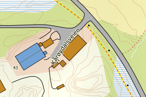
5055 Heim | 6505996f-dac1-4761-8bda-ae46c21472ae | 314.42 | N: 7005749.76, Ø: 486860.30 | ![Kartbilde fra WMS-tjeneste av avviket](https://wms.geonorge.no/skwms1/wms.topo?VERSION=1.1.1&SERVICE=WMS&REQUEST=GetMap&LAYERS=topo&STYLES=&FORMAT=image/png&SRS=EPSG:25832&BBOX=486785.0,7005699,486935.0,7005799&WIDTH=300&HEIGHT=200) |
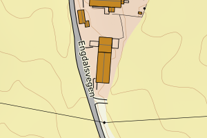
5055 Heim | 515eaa32-b841-4694-8dfe-31c6fc01cac7 | 284.66 | N: 6996633.34, Ø: 481095.23 | ![Kartbilde fra WMS-tjeneste av avviket](https://wms.geonorge.no/skwms1/wms.topo?VERSION=1.1.1&SERVICE=WMS&REQUEST=GetMap&LAYERS=topo&STYLES=&FORMAT=image/png&SRS=EPSG:25832&BBOX=481020.0,6996583,481170.0,6996683&WIDTH=300&HEIGHT=200) |
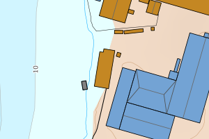
5055 Heim | a8b3be80-bc69-4ac4-8c91-04fa3a337def | 283.59 | N: 6995847.69, Ø: 464472.47 | ![Kartbilde fra WMS-tjeneste av avviket](https://wms.geonorge.no/skwms1/wms.topo?VERSION=1.1.1&SERVICE=WMS&REQUEST=GetMap&LAYERS=topo&STYLES=&FORMAT=image/png&SRS=EPSG:25832&BBOX=464397.0,6995797,464547.0,6995897&WIDTH=300&HEIGHT=200) |
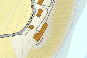
5055 Heim | 0a85936e-1618-41ee-b737-f4b7daccb017 | 269.16 | N: 7011864.03, Ø: 503793.17 | ![Kartbilde fra WMS-tjeneste av avviket](https://wms.geonorge.no/skwms1/wms.topo?VERSION=1.1.1&SERVICE=WMS&REQUEST=GetMap&LAYERS=topo&STYLES=&FORMAT=image/png&SRS=EPSG:25832&BBOX=503718.0,7011814,503868.0,7011914&WIDTH=300&HEIGHT=200) |
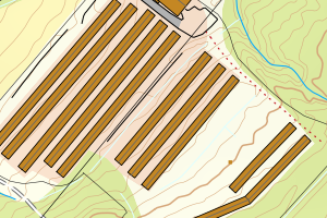
5055 Heim | 7924f646-6f92-4d6c-bb60-250e68eb208f | 234.39 | N: 6999107.15, Ø: 476022.11 | ![Kartbilde fra WMS-tjeneste av avviket](https://wms.geonorge.no/skwms1/wms.topo?VERSION=1.1.1&SERVICE=WMS&REQUEST=GetMap&LAYERS=topo&STYLES=&FORMAT=image/png&SRS=EPSG:25832&BBOX=475947.0,6999057,476097.0,6999157&WIDTH=300&HEIGHT=200) |
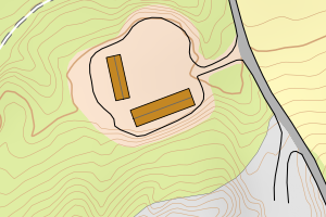
5055 Heim | 0b3169a0-2bee-4584-bd00-e8e2bc431ee5 | 232.14 | N: 7020075.78, Ø: 504619.97 | ![Kartbilde fra WMS-tjeneste av avviket](https://wms.geonorge.no/skwms1/wms.topo?VERSION=1.1.1&SERVICE=WMS&REQUEST=GetMap&LAYERS=topo&STYLES=&FORMAT=image/png&SRS=EPSG:25832&BBOX=504544.0,7020025,504694.0,7020125&WIDTH=300&HEIGHT=200) |
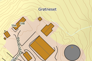
5055 Heim | 59c80722-cd75-44fb-bc62-3dd8929e3efb | 225.10 | N: 7007321.64, Ø: 497645.87 | ![Kartbilde fra WMS-tjeneste av avviket](https://wms.geonorge.no/skwms1/wms.topo?VERSION=1.1.1&SERVICE=WMS&REQUEST=GetMap&LAYERS=topo&STYLES=&FORMAT=image/png&SRS=EPSG:25832&BBOX=497570.0,7007271,497720.0,7007371&WIDTH=300&HEIGHT=200) |
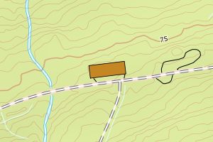
5055 Heim | 5f4cd02b-803c-4187-b7fb-713ef3c0ec98 | 223.85 | N: 6993962.57, Ø: 462047.99 | ![Kartbilde fra WMS-tjeneste av avviket](https://wms.geonorge.no/skwms1/wms.topo?VERSION=1.1.1&SERVICE=WMS&REQUEST=GetMap&LAYERS=topo&STYLES=&FORMAT=image/png&SRS=EPSG:25832&BBOX=461972.0,6993912,462122.0,6994012&WIDTH=300&HEIGHT=200) |
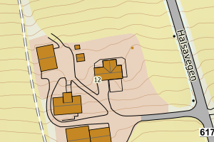
5055 Heim | bd5dbd26-137d-40d9-8d13-bb3c471696b0 | 219.92 | N: 7029538.20, Ø: 499523.10 | ![Kartbilde fra WMS-tjeneste av avviket](https://wms.geonorge.no/skwms1/wms.topo?VERSION=1.1.1&SERVICE=WMS&REQUEST=GetMap&LAYERS=topo&STYLES=&FORMAT=image/png&SRS=EPSG:25832&BBOX=499448.0,7029488,499598.0,7029588&WIDTH=300&HEIGHT=200) |
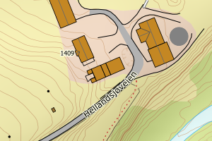
5055 Heim | d4955fb7-fbee-4fb1-84bf-c89037df8f93 | 217.93 | N: 7036326.11, Ø: 497531.21 | ![Kartbilde fra WMS-tjeneste av avviket](https://wms.geonorge.no/skwms1/wms.topo?VERSION=1.1.1&SERVICE=WMS&REQUEST=GetMap&LAYERS=topo&STYLES=&FORMAT=image/png&SRS=EPSG:25832&BBOX=497456.0,7036276,497606.0,7036376&WIDTH=300&HEIGHT=200) |
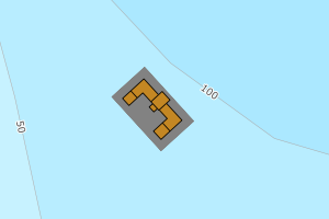
5055 Heim | a63cebbe-8840-4e15-b419-9f8aa7686b54 | 217.30 | N: 7031570.97, Ø: 501654.98 | ![Kartbilde fra WMS-tjeneste av avviket](https://wms.geonorge.no/skwms1/wms.topo?VERSION=1.1.1&SERVICE=WMS&REQUEST=GetMap&LAYERS=topo&STYLES=&FORMAT=image/png&SRS=EPSG:25832&BBOX=501579.0,7031520,501729.0,7031620&WIDTH=300&HEIGHT=200) |
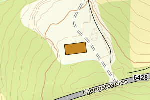
5055 Heim | 909c12b1-52f7-4b4b-9910-d2d327619dad | 213.68 | N: 6998930.25, Ø: 464483.54 | ![Kartbilde fra WMS-tjeneste av avviket](https://wms.geonorge.no/skwms1/wms.topo?VERSION=1.1.1&SERVICE=WMS&REQUEST=GetMap&LAYERS=topo&STYLES=&FORMAT=image/png&SRS=EPSG:25832&BBOX=464408.0,6998880,464558.0,6998980&WIDTH=300&HEIGHT=200) |
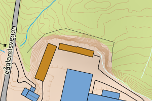
5055 Heim | 0086f512-a626-4a14-b874-e6a2263d17da | 204.03 | N: 6999459.71, Ø: 464721.40 | ![Kartbilde fra WMS-tjeneste av avviket](https://wms.geonorge.no/skwms1/wms.topo?VERSION=1.1.1&SERVICE=WMS&REQUEST=GetMap&LAYERS=topo&STYLES=&FORMAT=image/png&SRS=EPSG:25832&BBOX=464646.0,6999409,464796.0,6999509&WIDTH=300&HEIGHT=200) |