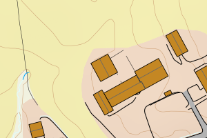
Avvikene skyldes oftest manglende eller unøyaktig registrering av bygningspunkt i matrikkelen. Rettes vanligvis i matrikkelen
Kommune | LokalId | Areal (m2) | Posisjon | WMS-bilde |
5046 Høylandet | c21d385a-ab1f-45bd-8d4f-0806c744951c | 7212.23 | N: 7169739.03, Ø: 657523.32 | ![Kartbilde fra WMS-tjeneste av avviket](https://wms.geonorge.no/skwms1/wms.topo?VERSION=1.1.1&SERVICE=WMS&REQUEST=GetMap&LAYERS=topo&STYLES=&FORMAT=image/png&SRS=EPSG:25832&BBOX=657448.0,7169689,657598.0,7169789&WIDTH=300&HEIGHT=200) |
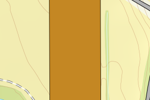
5046 Høylandet | 03352d34-3916-4387-9204-f5b42f993248 | 992.46 | N: 7169273.76, Ø: 658245.70 | ![Kartbilde fra WMS-tjeneste av avviket](https://wms.geonorge.no/skwms1/wms.topo?VERSION=1.1.1&SERVICE=WMS&REQUEST=GetMap&LAYERS=topo&STYLES=&FORMAT=image/png&SRS=EPSG:25832&BBOX=658170.0,7169223,658320.0,7169323&WIDTH=300&HEIGHT=200) |
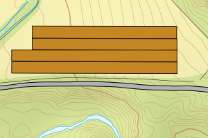
5046 Høylandet | d762e56e-7b7e-406c-9aeb-2f2ec3168b40 | 991.61 | N: 7169282.35, Ø: 658245.68 | ![Kartbilde fra WMS-tjeneste av avviket](https://wms.geonorge.no/skwms1/wms.topo?VERSION=1.1.1&SERVICE=WMS&REQUEST=GetMap&LAYERS=topo&STYLES=&FORMAT=image/png&SRS=EPSG:25832&BBOX=658170.0,7169232,658320.0,7169332&WIDTH=300&HEIGHT=200) |
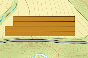
5046 Høylandet | b192ff81-92c5-464d-86fa-4dee576db2bf | 891.88 | N: 7169299.32, Ø: 658245.64 | ![Kartbilde fra WMS-tjeneste av avviket](https://wms.geonorge.no/skwms1/wms.topo?VERSION=1.1.1&SERVICE=WMS&REQUEST=GetMap&LAYERS=topo&STYLES=&FORMAT=image/png&SRS=EPSG:25832&BBOX=658170.0,7169249,658320.0,7169349&WIDTH=300&HEIGHT=200) |
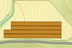
5046 Høylandet | bbbf7824-2d0b-4a45-9d3b-3e4224474805 | 859.83 | N: 7169290.75, Ø: 658245.71 | ![Kartbilde fra WMS-tjeneste av avviket](https://wms.geonorge.no/skwms1/wms.topo?VERSION=1.1.1&SERVICE=WMS&REQUEST=GetMap&LAYERS=topo&STYLES=&FORMAT=image/png&SRS=EPSG:25832&BBOX=658170.0,7169240,658320.0,7169340&WIDTH=300&HEIGHT=200) |
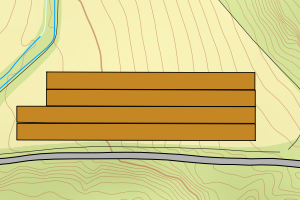
5046 Høylandet | d61e6307-3f93-4e00-a5bc-db334ed148b6 | 814.96 | N: 7163014.29, Ø: 651717.06 | ![Kartbilde fra WMS-tjeneste av avviket](https://wms.geonorge.no/skwms1/wms.topo?VERSION=1.1.1&SERVICE=WMS&REQUEST=GetMap&LAYERS=topo&STYLES=&FORMAT=image/png&SRS=EPSG:25832&BBOX=651642.0,7162964,651792.0,7163064&WIDTH=300&HEIGHT=200) |
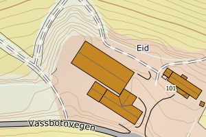
5046 Høylandet | 68438ef0-6111-4739-b777-b3a29b39bdd5 | 640.55 | N: 7165500.25, Ø: 653297.54 | ![Kartbilde fra WMS-tjeneste av avviket](https://wms.geonorge.no/skwms1/wms.topo?VERSION=1.1.1&SERVICE=WMS&REQUEST=GetMap&LAYERS=topo&STYLES=&FORMAT=image/png&SRS=EPSG:25832&BBOX=653222.0,7165450,653372.0,7165550&WIDTH=300&HEIGHT=200) |
5046 Høylandet | 8cbab72b-19d3-481c-a5e5-e4da405d9124 | 487.30 | N: 7170144.50, Ø: 659805.53 | ![Kartbilde fra WMS-tjeneste av avviket](https://wms.geonorge.no/skwms1/wms.topo?VERSION=1.1.1&SERVICE=WMS&REQUEST=GetMap&LAYERS=topo&STYLES=&FORMAT=image/png&SRS=EPSG:25832&BBOX=659730.0,7170094,659880.0,7170194&WIDTH=300&HEIGHT=200) |
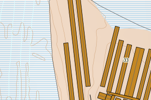
5046 Høylandet | 0d5d49c1-9315-4020-a931-745956124bf8 | 444.80 | N: 7171451.29, Ø: 657369.42 | ![Kartbilde fra WMS-tjeneste av avviket](https://wms.geonorge.no/skwms1/wms.topo?VERSION=1.1.1&SERVICE=WMS&REQUEST=GetMap&LAYERS=topo&STYLES=&FORMAT=image/png&SRS=EPSG:25832&BBOX=657294.0,7171401,657444.0,7171501&WIDTH=300&HEIGHT=200) |
5046 Høylandet | 5fde119f-cab0-4150-ab9e-784c8a84639c | 411.33 | N: 7170153.29, Ø: 659812.60 | ![Kartbilde fra WMS-tjeneste av avviket](https://wms.geonorge.no/skwms1/wms.topo?VERSION=1.1.1&SERVICE=WMS&REQUEST=GetMap&LAYERS=topo&STYLES=&FORMAT=image/png&SRS=EPSG:25832&BBOX=659737.0,7170103,659887.0,7170203&WIDTH=300&HEIGHT=200) |
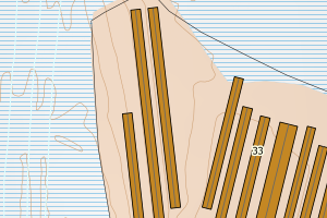
5046 Høylandet | 2aea525a-98c1-47a2-83a4-49bf1373c03a | 354.06 | N: 7183813.89, Ø: 659121.52 | ![Kartbilde fra WMS-tjeneste av avviket](https://wms.geonorge.no/skwms1/wms.topo?VERSION=1.1.1&SERVICE=WMS&REQUEST=GetMap&LAYERS=topo&STYLES=&FORMAT=image/png&SRS=EPSG:25832&BBOX=659046.0,7183763,659196.0,7183863&WIDTH=300&HEIGHT=200) |
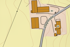
5046 Høylandet | 6317fc8e-fba0-4dea-9ea4-1e02fce7a620 | 324.05 | N: 7170114.07, Ø: 659799.69 | ![Kartbilde fra WMS-tjeneste av avviket](https://wms.geonorge.no/skwms1/wms.topo?VERSION=1.1.1&SERVICE=WMS&REQUEST=GetMap&LAYERS=topo&STYLES=&FORMAT=image/png&SRS=EPSG:25832&BBOX=659724.0,7170064,659874.0,7170164&WIDTH=300&HEIGHT=200) |
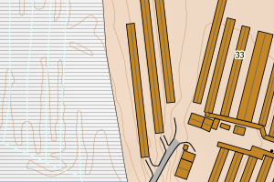
5046 Høylandet | e3f559ea-8436-427f-bd7e-6c61dd275d34 | 311.17 | N: 7167394.76, Ø: 653701.19 | ![Kartbilde fra WMS-tjeneste av avviket](https://wms.geonorge.no/skwms1/wms.topo?VERSION=1.1.1&SERVICE=WMS&REQUEST=GetMap&LAYERS=topo&STYLES=&FORMAT=image/png&SRS=EPSG:25832&BBOX=653626.0,7167344,653776.0,7167444&WIDTH=300&HEIGHT=200) |
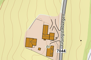
5046 Høylandet | b8f8a276-2dc0-43a6-8d08-9ca08665e7c5 | 298.01 | N: 7171901.48, Ø: 658458.67 | ![Kartbilde fra WMS-tjeneste av avviket](https://wms.geonorge.no/skwms1/wms.topo?VERSION=1.1.1&SERVICE=WMS&REQUEST=GetMap&LAYERS=topo&STYLES=&FORMAT=image/png&SRS=EPSG:25832&BBOX=658383.0,7171851,658533.0,7171951&WIDTH=300&HEIGHT=200) |
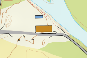
5046 Høylandet | c4785a57-f5ea-4430-9025-2fc5ccc20e91 | 281.87 | N: 7197292.86, Ø: 662153.41 | ![Kartbilde fra WMS-tjeneste av avviket](https://wms.geonorge.no/skwms1/wms.topo?VERSION=1.1.1&SERVICE=WMS&REQUEST=GetMap&LAYERS=topo&STYLES=&FORMAT=image/png&SRS=EPSG:25832&BBOX=662078.0,7197242,662228.0,7197342&WIDTH=300&HEIGHT=200) |
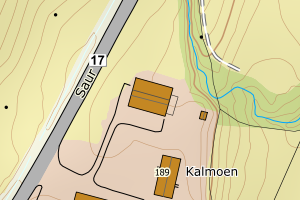
5046 Høylandet | 7597f888-49e3-46f5-a542-42b2fd7cbd0e | 265.43 | N: 7173177.53, Ø: 659643.72 | ![Kartbilde fra WMS-tjeneste av avviket](https://wms.geonorge.no/skwms1/wms.topo?VERSION=1.1.1&SERVICE=WMS&REQUEST=GetMap&LAYERS=topo&STYLES=&FORMAT=image/png&SRS=EPSG:25832&BBOX=659568.0,7173127,659718.0,7173227&WIDTH=300&HEIGHT=200) |
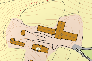
5046 Høylandet | 6e86c722-e648-4c74-8d6f-8a503da3f88f | 261.41 | N: 7170137.11, Ø: 659839.46 | ![Kartbilde fra WMS-tjeneste av avviket](https://wms.geonorge.no/skwms1/wms.topo?VERSION=1.1.1&SERVICE=WMS&REQUEST=GetMap&LAYERS=topo&STYLES=&FORMAT=image/png&SRS=EPSG:25832&BBOX=659764.0,7170087,659914.0,7170187&WIDTH=300&HEIGHT=200) |
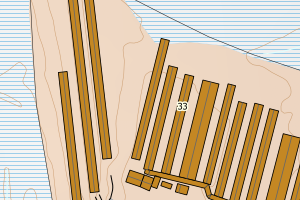
5046 Høylandet | 472b684a-ed02-48f1-bff4-f1c07ed199d0 | 253.41 | N: 7200602.02, Ø: 662147.06 | ![Kartbilde fra WMS-tjeneste av avviket](https://wms.geonorge.no/skwms1/wms.topo?VERSION=1.1.1&SERVICE=WMS&REQUEST=GetMap&LAYERS=topo&STYLES=&FORMAT=image/png&SRS=EPSG:25832&BBOX=662072.0,7200552,662222.0,7200652&WIDTH=300&HEIGHT=200) |
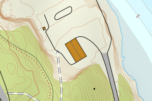
5046 Høylandet | c76e4c51-bdc7-4371-9804-5fc248bf93f7 | 250.32 | N: 7199911.84, Ø: 662722.99 | ![Kartbilde fra WMS-tjeneste av avviket](https://wms.geonorge.no/skwms1/wms.topo?VERSION=1.1.1&SERVICE=WMS&REQUEST=GetMap&LAYERS=topo&STYLES=&FORMAT=image/png&SRS=EPSG:25832&BBOX=662647.0,7199861,662797.0,7199961&WIDTH=300&HEIGHT=200) |
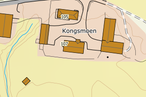
5046 Høylandet | b7ad2be2-b973-4638-92c8-c7867b916ea8 | 242.60 | N: 7178334.55, Ø: 659709.02 | ![Kartbilde fra WMS-tjeneste av avviket](https://wms.geonorge.no/skwms1/wms.topo?VERSION=1.1.1&SERVICE=WMS&REQUEST=GetMap&LAYERS=topo&STYLES=&FORMAT=image/png&SRS=EPSG:25832&BBOX=659634.0,7178284,659784.0,7178384&WIDTH=300&HEIGHT=200) |
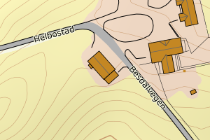
5046 Høylandet | 6c96c0db-68a2-4354-b76a-914f1aac0fd8 | 242.14 | N: 7167591.56, Ø: 661140.67 | ![Kartbilde fra WMS-tjeneste av avviket](https://wms.geonorge.no/skwms1/wms.topo?VERSION=1.1.1&SERVICE=WMS&REQUEST=GetMap&LAYERS=topo&STYLES=&FORMAT=image/png&SRS=EPSG:25832&BBOX=661065.0,7167541,661215.0,7167641&WIDTH=300&HEIGHT=200) |
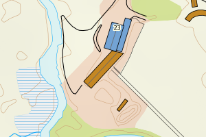
5046 Høylandet | 33ac1e25-5472-4f49-86a3-6b42e09d8135 | 237.91 | N: 7198208.13, Ø: 662485.47 | ![Kartbilde fra WMS-tjeneste av avviket](https://wms.geonorge.no/skwms1/wms.topo?VERSION=1.1.1&SERVICE=WMS&REQUEST=GetMap&LAYERS=topo&STYLES=&FORMAT=image/png&SRS=EPSG:25832&BBOX=662410.0,7198158,662560.0,7198258&WIDTH=300&HEIGHT=200) |
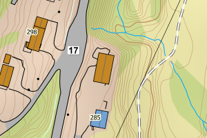
5046 Høylandet | 6a06ea9d-f6cf-4436-a579-c4673f2f1944 | 235.78 | N: 7170988.49, Ø: 657301.27 | ![Kartbilde fra WMS-tjeneste av avviket](https://wms.geonorge.no/skwms1/wms.topo?VERSION=1.1.1&SERVICE=WMS&REQUEST=GetMap&LAYERS=topo&STYLES=&FORMAT=image/png&SRS=EPSG:25832&BBOX=657226.0,7170938,657376.0,7171038&WIDTH=300&HEIGHT=200) |
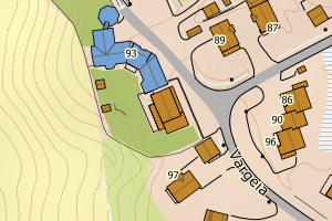
5046 Høylandet | 3c0512b2-a218-4a2e-88c1-9a2ab31bf090 | 215.45 | N: 7174260.51, Ø: 659488.38 | ![Kartbilde fra WMS-tjeneste av avviket](https://wms.geonorge.no/skwms1/wms.topo?VERSION=1.1.1&SERVICE=WMS&REQUEST=GetMap&LAYERS=topo&STYLES=&FORMAT=image/png&SRS=EPSG:25832&BBOX=659413.0,7174210,659563.0,7174310&WIDTH=300&HEIGHT=200) |
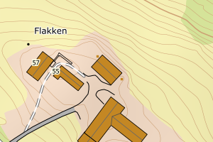
5046 Høylandet | cdb899e4-844f-4a23-bc3a-61af98c6b30c | 212.07 | N: 7162242.36, Ø: 652190.33 | ![Kartbilde fra WMS-tjeneste av avviket](https://wms.geonorge.no/skwms1/wms.topo?VERSION=1.1.1&SERVICE=WMS&REQUEST=GetMap&LAYERS=topo&STYLES=&FORMAT=image/png&SRS=EPSG:25832&BBOX=652115.0,7162192,652265.0,7162292&WIDTH=300&HEIGHT=200) |
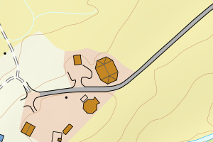
5046 Høylandet | 9fb94c97-8d6d-4ff3-afa1-822107919760 | 210.08 | N: 7168118.59, Ø: 654543.79 | ![Kartbilde fra WMS-tjeneste av avviket](https://wms.geonorge.no/skwms1/wms.topo?VERSION=1.1.1&SERVICE=WMS&REQUEST=GetMap&LAYERS=topo&STYLES=&FORMAT=image/png&SRS=EPSG:25832&BBOX=654468.0,7168068,654618.0,7168168&WIDTH=300&HEIGHT=200) |