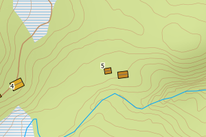
Avvikene skyldes vanligvis unøyaktig registrering av bygningspunkt i matrikkelen slik at det har havnet utenfor bygningsomriss. Rettes vanligvis i matrikkelen
Kommune | LokalId | Bygningsnummer | Avstand (m) | Posisjon | WMS-bilde |
5042 Lierne | ca6c0e9d-baee-4d9d-9282-72678148a65f | 140734713 | 0.01 | N: 7162180.35, Ø: 727218.33 | ![Kartbilde fra WMS-tjeneste av avviket](https://wms.geonorge.no/skwms1/wms.topo?VERSION=1.1.1&SERVICE=WMS&REQUEST=GetMap&LAYERS=topo&STYLES=&FORMAT=image/png&SRS=EPSG:25832&BBOX=727143.0,7162130,727293.0,7162230&WIDTH=300&HEIGHT=200) |
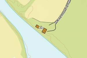
5042 Lierne | f7888f4f-a6a0-4e31-a0c6-43051c2c6028 | 140734209 | 0.01 | N: 7148798.00, Ø: 724897.00 | ![Kartbilde fra WMS-tjeneste av avviket](https://wms.geonorge.no/skwms1/wms.topo?VERSION=1.1.1&SERVICE=WMS&REQUEST=GetMap&LAYERS=topo&STYLES=&FORMAT=image/png&SRS=EPSG:25832&BBOX=724822.0,7148747,724972.0,7148847&WIDTH=300&HEIGHT=200) |
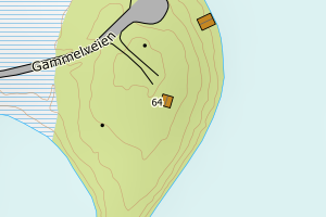
5042 Lierne | fdf76b3a-92e2-42b0-a281-7dd19d1cfbef | 186403584 | 0.02 | N: 7155105.00, Ø: 723915.00 | ![Kartbilde fra WMS-tjeneste av avviket](https://wms.geonorge.no/skwms1/wms.topo?VERSION=1.1.1&SERVICE=WMS&REQUEST=GetMap&LAYERS=topo&STYLES=&FORMAT=image/png&SRS=EPSG:25832&BBOX=723840.0,7155054,723990.0,7155154&WIDTH=300&HEIGHT=200) |
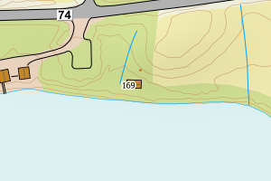
5042 Lierne | 67b65808-d252-43f2-ae3a-608fe475b143 | 186416023 | 0.02 | N: 7124061.00, Ø: 736940.00 | ![Kartbilde fra WMS-tjeneste av avviket](https://wms.geonorge.no/skwms1/wms.topo?VERSION=1.1.1&SERVICE=WMS&REQUEST=GetMap&LAYERS=topo&STYLES=&FORMAT=image/png&SRS=EPSG:25832&BBOX=736864.0,7124010,737014.0,7124110&WIDTH=300&HEIGHT=200) |
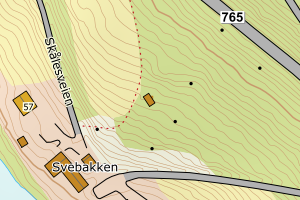
5042 Lierne | f1cd7373-741e-4221-894c-9aa32583a1ce | 186412869 | 0.05 | N: 7136377.00, Ø: 731088.00 | ![Kartbilde fra WMS-tjeneste av avviket](https://wms.geonorge.no/skwms1/wms.topo?VERSION=1.1.1&SERVICE=WMS&REQUEST=GetMap&LAYERS=topo&STYLES=&FORMAT=image/png&SRS=EPSG:25832&BBOX=731012.0,7136326,731162.0,7136426&WIDTH=300&HEIGHT=200) |
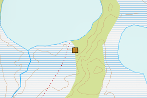
5042 Lierne | b566923a-365c-4c58-9b44-91e398eea3a3 | 186390644 | 0.06 | N: 7161631.00, Ø: 703720.00 | ![Kartbilde fra WMS-tjeneste av avviket](https://wms.geonorge.no/skwms1/wms.topo?VERSION=1.1.1&SERVICE=WMS&REQUEST=GetMap&LAYERS=topo&STYLES=&FORMAT=image/png&SRS=EPSG:25832&BBOX=703645.0,7161580,703795.0,7161680&WIDTH=300&HEIGHT=200) |
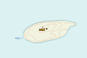
5042 Lierne | e5efc190-7800-4bb4-8a89-99c94104088a | 186423739 | 0.06 | N: 7139754.64, Ø: 729243.43 | ![Kartbilde fra WMS-tjeneste av avviket](https://wms.geonorge.no/skwms1/wms.topo?VERSION=1.1.1&SERVICE=WMS&REQUEST=GetMap&LAYERS=topo&STYLES=&FORMAT=image/png&SRS=EPSG:25832&BBOX=729168.0,7139704,729318.0,7139804&WIDTH=300&HEIGHT=200) |
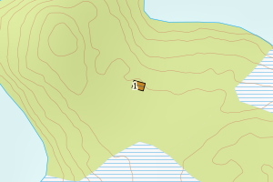
5042 Lierne | b4d80ee8-cb6f-4d7d-a92e-bf75c7da28a5 | 19006921 | 0.08 | N: 7156472.66, Ø: 704464.44 | ![Kartbilde fra WMS-tjeneste av avviket](https://wms.geonorge.no/skwms1/wms.topo?VERSION=1.1.1&SERVICE=WMS&REQUEST=GetMap&LAYERS=topo&STYLES=&FORMAT=image/png&SRS=EPSG:25832&BBOX=704389.0,7156422,704539.0,7156522&WIDTH=300&HEIGHT=200) |
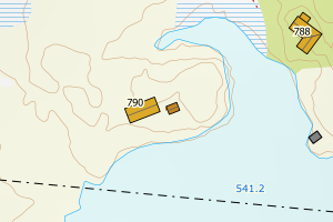
5042 Lierne | 4856ee55-df0c-47dc-8d2b-2459a1fdb245 | 186411811 | 0.09 | N: 7130475.00, Ø: 732315.19 | ![Kartbilde fra WMS-tjeneste av avviket](https://wms.geonorge.no/skwms1/wms.topo?VERSION=1.1.1&SERVICE=WMS&REQUEST=GetMap&LAYERS=topo&STYLES=&FORMAT=image/png&SRS=EPSG:25832&BBOX=732240.0,7130424,732390.0,7130524&WIDTH=300&HEIGHT=200) |
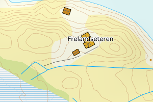
5042 Lierne | d0eac4cd-8a64-4315-9274-e3556d1cd2b4 | 300306895 | 0.10 | N: 7125789.82, Ø: 727292.68 | ![Kartbilde fra WMS-tjeneste av avviket](https://wms.geonorge.no/skwms1/wms.topo?VERSION=1.1.1&SERVICE=WMS&REQUEST=GetMap&LAYERS=topo&STYLES=&FORMAT=image/png&SRS=EPSG:25832&BBOX=727217.0,7125739,727367.0,7125839&WIDTH=300&HEIGHT=200) |
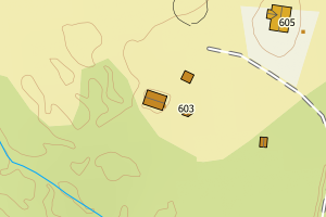
5042 Lierne | db3f72a2-ac10-47f4-84cd-cdc563fa57b8 | 186414187 | 0.21 | N: 7162541.65, Ø: 731000.85 | ![Kartbilde fra WMS-tjeneste av avviket](https://wms.geonorge.no/skwms1/wms.topo?VERSION=1.1.1&SERVICE=WMS&REQUEST=GetMap&LAYERS=topo&STYLES=&FORMAT=image/png&SRS=EPSG:25832&BBOX=730925.0,7162491,731075.0,7162591&WIDTH=300&HEIGHT=200) |
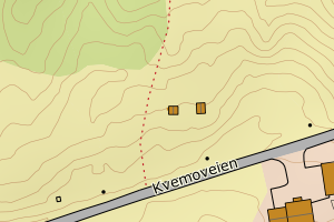
5042 Lierne | a155925c-bea4-4305-894a-8e45aadad062 | 300459962 | 0.21 | N: 7148642.73, Ø: 724836.47 | ![Kartbilde fra WMS-tjeneste av avviket](https://wms.geonorge.no/skwms1/wms.topo?VERSION=1.1.1&SERVICE=WMS&REQUEST=GetMap&LAYERS=topo&STYLES=&FORMAT=image/png&SRS=EPSG:25832&BBOX=724761.0,7148592,724911.0,7148692&WIDTH=300&HEIGHT=200) |
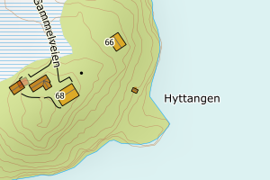
5042 Lierne | 3c3da006-bc47-4b29-b7ee-34059aa88405 | 186390504 | 0.21 | N: 7157635.00, Ø: 706952.00 | ![Kartbilde fra WMS-tjeneste av avviket](https://wms.geonorge.no/skwms1/wms.topo?VERSION=1.1.1&SERVICE=WMS&REQUEST=GetMap&LAYERS=topo&STYLES=&FORMAT=image/png&SRS=EPSG:25832&BBOX=706877.0,7157584,707027.0,7157684&WIDTH=300&HEIGHT=200) |
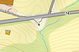
5042 Lierne | 99aa5010-2085-4a53-8782-37e11190353e | 186413814 | 0.24 | N: 7154345.12, Ø: 730188.03 | ![Kartbilde fra WMS-tjeneste av avviket](https://wms.geonorge.no/skwms1/wms.topo?VERSION=1.1.1&SERVICE=WMS&REQUEST=GetMap&LAYERS=topo&STYLES=&FORMAT=image/png&SRS=EPSG:25832&BBOX=730113.0,7154295,730263.0,7154395&WIDTH=300&HEIGHT=200) |
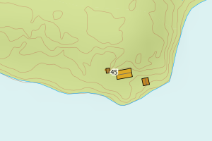
5042 Lierne | 61df3028-6666-495c-8459-872eea6aee8d | 186418867 | 0.24 | N: 7160722.00, Ø: 738934.00 | ![Kartbilde fra WMS-tjeneste av avviket](https://wms.geonorge.no/skwms1/wms.topo?VERSION=1.1.1&SERVICE=WMS&REQUEST=GetMap&LAYERS=topo&STYLES=&FORMAT=image/png&SRS=EPSG:25832&BBOX=738859.0,7160671,739009.0,7160771&WIDTH=300&HEIGHT=200) |
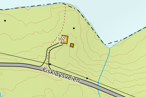
5042 Lierne | aa8f1951-42ca-4c63-ab15-0d62a9e111c7 | 186399617 | 0.26 | N: 7183399.00, Ø: 718768.00 | ![Kartbilde fra WMS-tjeneste av avviket](https://wms.geonorge.no/skwms1/wms.topo?VERSION=1.1.1&SERVICE=WMS&REQUEST=GetMap&LAYERS=topo&STYLES=&FORMAT=image/png&SRS=EPSG:25832&BBOX=718693.0,7183348,718843.0,7183448&WIDTH=300&HEIGHT=200) |
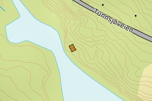
5042 Lierne | d2f36cde-f41f-4bd9-a743-e6a159f9f232 | 300440596 | 0.26 | N: 7128441.54, Ø: 733263.71 | ![Kartbilde fra WMS-tjeneste av avviket](https://wms.geonorge.no/skwms1/wms.topo?VERSION=1.1.1&SERVICE=WMS&REQUEST=GetMap&LAYERS=topo&STYLES=&FORMAT=image/png&SRS=EPSG:25832&BBOX=733188.0,7128391,733338.0,7128491&WIDTH=300&HEIGHT=200) |
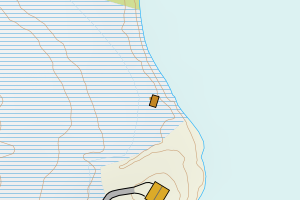
5042 Lierne | 05d6fe9e-ebc1-4bd8-a784-870cb392f9dd | 186394437 | 0.29 | N: 7144727.59, Ø: 720337.52 | ![Kartbilde fra WMS-tjeneste av avviket](https://wms.geonorge.no/skwms1/wms.topo?VERSION=1.1.1&SERVICE=WMS&REQUEST=GetMap&LAYERS=topo&STYLES=&FORMAT=image/png&SRS=EPSG:25832&BBOX=720262.0,7144677,720412.0,7144777&WIDTH=300&HEIGHT=200) |
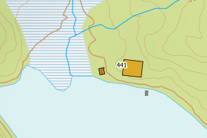
5042 Lierne | 42c0e097-e58e-4d0c-a426-355e9456c4ee | 186390814 | 0.32 | N: 7166032.98, Ø: 708084.17 | ![Kartbilde fra WMS-tjeneste av avviket](https://wms.geonorge.no/skwms1/wms.topo?VERSION=1.1.1&SERVICE=WMS&REQUEST=GetMap&LAYERS=topo&STYLES=&FORMAT=image/png&SRS=EPSG:25832&BBOX=708009.0,7165982,708159.0,7166082&WIDTH=300&HEIGHT=200) |
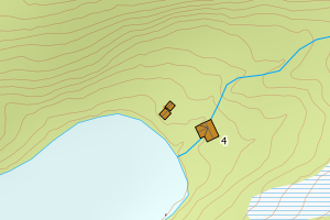
5042 Lierne | 8c77997d-e813-494a-a8e1-d6382be29413 | 19005860 | 0.34 | N: 7157977.89, Ø: 711409.88 | ![Kartbilde fra WMS-tjeneste av avviket](https://wms.geonorge.no/skwms1/wms.topo?VERSION=1.1.1&SERVICE=WMS&REQUEST=GetMap&LAYERS=topo&STYLES=&FORMAT=image/png&SRS=EPSG:25832&BBOX=711334.0,7157927,711484.0,7158027&WIDTH=300&HEIGHT=200) |
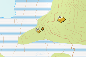
5042 Lierne | 42c0e097-e58e-4d0c-a426-355e9456c4ee | 186390814 | 0.37 | N: 7166032.98, Ø: 708084.17 | ![Kartbilde fra WMS-tjeneste av avviket](https://wms.geonorge.no/skwms1/wms.topo?VERSION=1.1.1&SERVICE=WMS&REQUEST=GetMap&LAYERS=topo&STYLES=&FORMAT=image/png&SRS=EPSG:25832&BBOX=708009.0,7165982,708159.0,7166082&WIDTH=300&HEIGHT=200) |
5042 Lierne | 0b3df0f0-aa3f-43a9-bacd-a23cb4ae49e6 | 186411773 | 0.40 | N: 7132854.00, Ø: 735328.00 | ![Kartbilde fra WMS-tjeneste av avviket](https://wms.geonorge.no/skwms1/wms.topo?VERSION=1.1.1&SERVICE=WMS&REQUEST=GetMap&LAYERS=topo&STYLES=&FORMAT=image/png&SRS=EPSG:25832&BBOX=735252.0,7132803,735402.0,7132903&WIDTH=300&HEIGHT=200) |
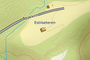
5042 Lierne | c9d74aa1-6bce-44e4-9c63-d317890203d7 | 19005577 | 0.44 | N: 7154589.22, Ø: 723342.39 | ![Kartbilde fra WMS-tjeneste av avviket](https://wms.geonorge.no/skwms1/wms.topo?VERSION=1.1.1&SERVICE=WMS&REQUEST=GetMap&LAYERS=topo&STYLES=&FORMAT=image/png&SRS=EPSG:25832&BBOX=723267.0,7154539,723417.0,7154639&WIDTH=300&HEIGHT=200) |
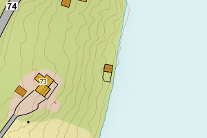
5042 Lierne | 092dcc16-769a-4f73-8497-c0f7e4e993e9 | 300574338 | 0.45 | N: 7157937.22, Ø: 705806.41 | ![Kartbilde fra WMS-tjeneste av avviket](https://wms.geonorge.no/skwms1/wms.topo?VERSION=1.1.1&SERVICE=WMS&REQUEST=GetMap&LAYERS=topo&STYLES=&FORMAT=image/png&SRS=EPSG:25832&BBOX=705731.0,7157887,705881.0,7157987&WIDTH=300&HEIGHT=200) |
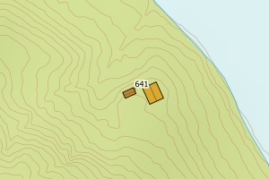
5042 Lierne | f5bca0d7-fd74-4ca3-ae6e-3a13509ed664 | 300462324 | 0.46 | N: 7148419.68, Ø: 723274.84 | ![Kartbilde fra WMS-tjeneste av avviket](https://wms.geonorge.no/skwms1/wms.topo?VERSION=1.1.1&SERVICE=WMS&REQUEST=GetMap&LAYERS=topo&STYLES=&FORMAT=image/png&SRS=EPSG:25832&BBOX=723199.0,7148369,723349.0,7148469&WIDTH=300&HEIGHT=200) |
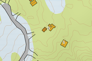
5042 Lierne | edf8f948-a12c-4b4f-a8b2-0fa56a0c652f | 186421116 | 0.51 | N: 7167454.07, Ø: 717946.99 | ![Kartbilde fra WMS-tjeneste av avviket](https://wms.geonorge.no/skwms1/wms.topo?VERSION=1.1.1&SERVICE=WMS&REQUEST=GetMap&LAYERS=topo&STYLES=&FORMAT=image/png&SRS=EPSG:25832&BBOX=717871.0,7167404,718021.0,7167504&WIDTH=300&HEIGHT=200) |
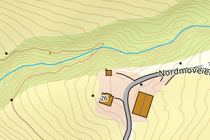
5042 Lierne | aaaf88a3-b205-4e5f-a690-0f045e5228a8 | 140734845 | 0.56 | N: 7165207.00, Ø: 724020.00 | ![Kartbilde fra WMS-tjeneste av avviket](https://wms.geonorge.no/skwms1/wms.topo?VERSION=1.1.1&SERVICE=WMS&REQUEST=GetMap&LAYERS=topo&STYLES=&FORMAT=image/png&SRS=EPSG:25832&BBOX=723945.0,7165156,724095.0,7165256&WIDTH=300&HEIGHT=200) |
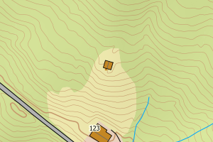
5042 Lierne | d5bc7c16-f2f7-4a3a-85fe-bcce1768ddbc | 300345358 | 0.63 | N: 7136950.66, Ø: 724463.51 | ![Kartbilde fra WMS-tjeneste av avviket](https://wms.geonorge.no/skwms1/wms.topo?VERSION=1.1.1&SERVICE=WMS&REQUEST=GetMap&LAYERS=topo&STYLES=&FORMAT=image/png&SRS=EPSG:25832&BBOX=724388.0,7136900,724538.0,7137000&WIDTH=300&HEIGHT=200) |
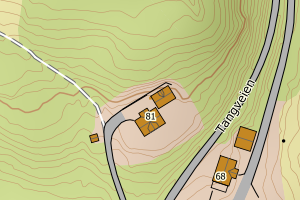
5042 Lierne | 500b49c8-e3c8-4507-9ef7-31b141b2b81d | 186407490 | 0.65 | N: 7177356.00, Ø: 724758.00 | ![Kartbilde fra WMS-tjeneste av avviket](https://wms.geonorge.no/skwms1/wms.topo?VERSION=1.1.1&SERVICE=WMS&REQUEST=GetMap&LAYERS=topo&STYLES=&FORMAT=image/png&SRS=EPSG:25832&BBOX=724683.0,7177305,724833.0,7177405&WIDTH=300&HEIGHT=200) |
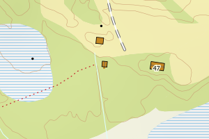
5042 Lierne | a7c93a85-dcfd-45df-b58f-50596580f509 | 10948266 | 0.70 | N: 7130495.45, Ø: 740132.17 | ![Kartbilde fra WMS-tjeneste av avviket](https://wms.geonorge.no/skwms1/wms.topo?VERSION=1.1.1&SERVICE=WMS&REQUEST=GetMap&LAYERS=topo&STYLES=&FORMAT=image/png&SRS=EPSG:25832&BBOX=740057.0,7130445,740207.0,7130545&WIDTH=300&HEIGHT=200) |
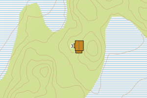
5042 Lierne | e5173909-3a1a-4c8d-bcb0-97bae1ba9c82 | 19006905 | 0.71 | N: 7155037.00, Ø: 725917.00 | ![Kartbilde fra WMS-tjeneste av avviket](https://wms.geonorge.no/skwms1/wms.topo?VERSION=1.1.1&SERVICE=WMS&REQUEST=GetMap&LAYERS=topo&STYLES=&FORMAT=image/png&SRS=EPSG:25832&BBOX=725842.0,7154986,725992.0,7155086&WIDTH=300&HEIGHT=200) |
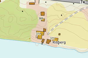
5042 Lierne | 79cc2545-5866-4e1a-b949-ea56de8cebdc | 19002780 | 0.71 | N: 7125787.16, Ø: 727306.55 | ![Kartbilde fra WMS-tjeneste av avviket](https://wms.geonorge.no/skwms1/wms.topo?VERSION=1.1.1&SERVICE=WMS&REQUEST=GetMap&LAYERS=topo&STYLES=&FORMAT=image/png&SRS=EPSG:25832&BBOX=727231.0,7125737,727381.0,7125837&WIDTH=300&HEIGHT=200) |
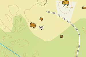
5042 Lierne | 44208ade-e4d1-4747-a51e-c624763300b9 | 186390660 | 0.75 | N: 7163268.46, Ø: 703529.68 | ![Kartbilde fra WMS-tjeneste av avviket](https://wms.geonorge.no/skwms1/wms.topo?VERSION=1.1.1&SERVICE=WMS&REQUEST=GetMap&LAYERS=topo&STYLES=&FORMAT=image/png&SRS=EPSG:25832&BBOX=703454.0,7163218,703604.0,7163318&WIDTH=300&HEIGHT=200) |
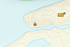
5042 Lierne | 4a162968-ac1b-49e6-88a5-6d6528fed9ef | 300464437 | 0.78 | N: 7171757.05, Ø: 711964.28 | ![Kartbilde fra WMS-tjeneste av avviket](https://wms.geonorge.no/skwms1/wms.topo?VERSION=1.1.1&SERVICE=WMS&REQUEST=GetMap&LAYERS=topo&STYLES=&FORMAT=image/png&SRS=EPSG:25832&BBOX=711889.0,7171707,712039.0,7171807&WIDTH=300&HEIGHT=200) |
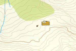
5042 Lierne | 2f50284c-5941-48f6-91f2-fa4c3460bb7f | 300459881 | 0.98 | N: 7152889.63, Ø: 711609.61 | ![Kartbilde fra WMS-tjeneste av avviket](https://wms.geonorge.no/skwms1/wms.topo?VERSION=1.1.1&SERVICE=WMS&REQUEST=GetMap&LAYERS=topo&STYLES=&FORMAT=image/png&SRS=EPSG:25832&BBOX=711534.0,7152839,711684.0,7152939&WIDTH=300&HEIGHT=200) |
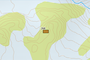
5042 Lierne | e28d4408-ee98-4076-9ed6-867ec8e328b0 | 186398947 | 0.98 | N: 7174975.38, Ø: 716035.43 | ![Kartbilde fra WMS-tjeneste av avviket](https://wms.geonorge.no/skwms1/wms.topo?VERSION=1.1.1&SERVICE=WMS&REQUEST=GetMap&LAYERS=topo&STYLES=&FORMAT=image/png&SRS=EPSG:25832&BBOX=715960.0,7174925,716110.0,7175025&WIDTH=300&HEIGHT=200) |