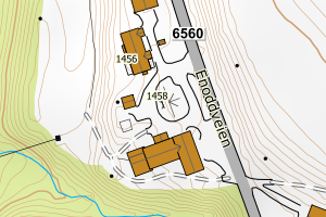
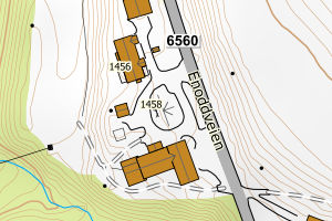
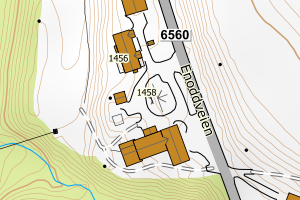
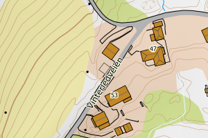
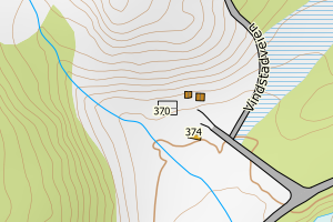
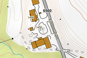
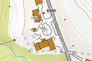
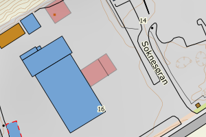
Avvikene skyldes oftest manglende sletting av bygningslinjer når bygningsflate er slettet i FKB-Bygning. Rettes i FKB-Bygning
Kommune | LokalId | Objekttype | Posisjon | WMS-bilde |
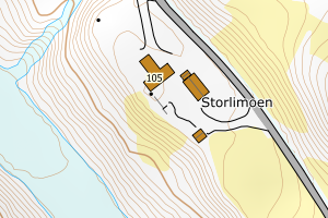
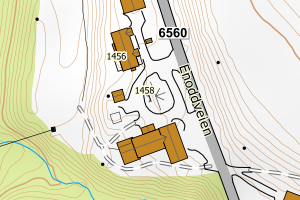
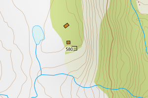
5027 Midtre Gauldal | 94051f85-d910-4fff-91fc-a9596c36e018 | Bygningslinje | N: 6990102.75, Ø: 564542.50 | ![Kartbilde fra WMS-tjeneste av avviket](https://wms.geonorge.no/skwms1/wms.topo?VERSION=1.1.1&SERVICE=WMS&REQUEST=GetMap&LAYERS=topo&STYLES=&FORMAT=image/png&SRS=EPSG:25832&BBOX=564467.0,6990052,564617.0,6990152&WIDTH=300&HEIGHT=200) |
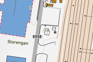
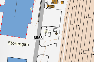
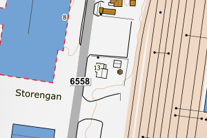
5027 Midtre Gauldal | 14aaabf0-fc33-451b-a513-fd6e0a587436 | Bygningslinje | N: 6967838.62, Ø: 569241.54 | ![Kartbilde fra WMS-tjeneste av avviket](https://wms.geonorge.no/skwms1/wms.topo?VERSION=1.1.1&SERVICE=WMS&REQUEST=GetMap&LAYERS=topo&STYLES=&FORMAT=image/png&SRS=EPSG:25832&BBOX=569166.0,6967788,569316.0,6967888&WIDTH=300&HEIGHT=200) |
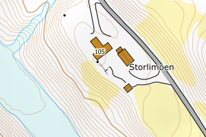
5027 Midtre Gauldal | 5378247c-5420-490e-b157-194abd2b57af | Taksprang | N: 6990053.57, Ø: 564578.27 | ![Kartbilde fra WMS-tjeneste av avviket](https://wms.geonorge.no/skwms1/wms.topo?VERSION=1.1.1&SERVICE=WMS&REQUEST=GetMap&LAYERS=topo&STYLES=&FORMAT=image/png&SRS=EPSG:25832&BBOX=564503.0,6990003,564653.0,6990103&WIDTH=300&HEIGHT=200) |
5027 Midtre Gauldal | d9bca4d5-9598-40a1-88c4-0840f10b12cb | Taksprang | N: 6990037.47, Ø: 564589.43 | ![Kartbilde fra WMS-tjeneste av avviket](https://wms.geonorge.no/skwms1/wms.topo?VERSION=1.1.1&SERVICE=WMS&REQUEST=GetMap&LAYERS=topo&STYLES=&FORMAT=image/png&SRS=EPSG:25832&BBOX=564514.0,6989987,564664.0,6990087&WIDTH=300&HEIGHT=200) |
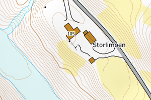
5027 Midtre Gauldal | 983012e0-c759-4dfd-a83e-d1cc50baa1fd | Taksprang | N: 6990096.02, Ø: 564542.68 | ![Kartbilde fra WMS-tjeneste av avviket](https://wms.geonorge.no/skwms1/wms.topo?VERSION=1.1.1&SERVICE=WMS&REQUEST=GetMap&LAYERS=topo&STYLES=&FORMAT=image/png&SRS=EPSG:25832&BBOX=564467.0,6990046,564617.0,6990146&WIDTH=300&HEIGHT=200) |
5027 Midtre Gauldal | a081e524-7575-4a6a-842e-db302527be99 | Taksprang | N: 6990034.61, Ø: 564576.98 | ![Kartbilde fra WMS-tjeneste av avviket](https://wms.geonorge.no/skwms1/wms.topo?VERSION=1.1.1&SERVICE=WMS&REQUEST=GetMap&LAYERS=topo&STYLES=&FORMAT=image/png&SRS=EPSG:25832&BBOX=564501.0,6989984,564651.0,6990084&WIDTH=300&HEIGHT=200) |
5027 Midtre Gauldal | e5e10711-7eb6-4ce1-82e5-4414641d6521 | Taksprang | N: 6978584.90, Ø: 563070.75 | ![Kartbilde fra WMS-tjeneste av avviket](https://wms.geonorge.no/skwms1/wms.topo?VERSION=1.1.1&SERVICE=WMS&REQUEST=GetMap&LAYERS=topo&STYLES=&FORMAT=image/png&SRS=EPSG:25832&BBOX=562995.0,6978534,563145.0,6978634&WIDTH=300&HEIGHT=200) |
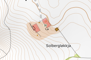
5027 Midtre Gauldal | 074fdcf4-525a-4a5d-ae67-83023e33554f | Taksprang | N: 6990222.97, Ø: 566070.69 | ![Kartbilde fra WMS-tjeneste av avviket](https://wms.geonorge.no/skwms1/wms.topo?VERSION=1.1.1&SERVICE=WMS&REQUEST=GetMap&LAYERS=topo&STYLES=&FORMAT=image/png&SRS=EPSG:25832&BBOX=565995.0,6990172,566145.0,6990272&WIDTH=300&HEIGHT=200) |
5027 Midtre Gauldal | 4c073f0c-4730-4551-9100-e574478f5061 | Taksprang | N: 6992446.77, Ø: 564978.91 | ![Kartbilde fra WMS-tjeneste av avviket](https://wms.geonorge.no/skwms1/wms.topo?VERSION=1.1.1&SERVICE=WMS&REQUEST=GetMap&LAYERS=topo&STYLES=&FORMAT=image/png&SRS=EPSG:25832&BBOX=564903.0,6992396,565053.0,6992496&WIDTH=300&HEIGHT=200) |
5027 Midtre Gauldal | 39aac908-e4b4-47c1-bdbc-a51973b23ce5 | Mønelinje | N: 6978589.87, Ø: 563070.74 | ![Kartbilde fra WMS-tjeneste av avviket](https://wms.geonorge.no/skwms1/wms.topo?VERSION=1.1.1&SERVICE=WMS&REQUEST=GetMap&LAYERS=topo&STYLES=&FORMAT=image/png&SRS=EPSG:25832&BBOX=562995.0,6978539,563145.0,6978639&WIDTH=300&HEIGHT=200) |
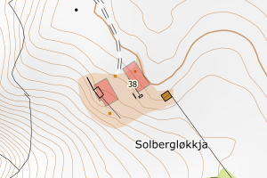
5027 Midtre Gauldal | e30eacbe-b52d-48d0-9117-c2527c5410ab | Mønelinje | N: 6978578.43, Ø: 563057.59 | ![Kartbilde fra WMS-tjeneste av avviket](https://wms.geonorge.no/skwms1/wms.topo?VERSION=1.1.1&SERVICE=WMS&REQUEST=GetMap&LAYERS=topo&STYLES=&FORMAT=image/png&SRS=EPSG:25832&BBOX=562982.0,6978528,563132.0,6978628&WIDTH=300&HEIGHT=200) |
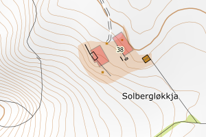
5027 Midtre Gauldal | 5c1133b5-f952-4de8-935a-9c230e6cfc38 | Mønelinje | N: 6977102.35, Ø: 585708.37 | ![Kartbilde fra WMS-tjeneste av avviket](https://wms.geonorge.no/skwms1/wms.topo?VERSION=1.1.1&SERVICE=WMS&REQUEST=GetMap&LAYERS=topo&STYLES=&FORMAT=image/png&SRS=EPSG:25832&BBOX=585633.0,6977052,585783.0,6977152&WIDTH=300&HEIGHT=200) |
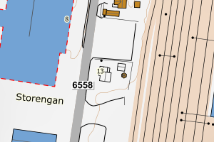
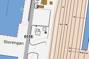
5027 Midtre Gauldal | c82cffe6-8e30-4c60-a490-e176db675213 | Mønelinje | N: 6967835.59, Ø: 569239.72 | ![Kartbilde fra WMS-tjeneste av avviket](https://wms.geonorge.no/skwms1/wms.topo?VERSION=1.1.1&SERVICE=WMS&REQUEST=GetMap&LAYERS=topo&STYLES=&FORMAT=image/png&SRS=EPSG:25832&BBOX=569164.0,6967785,569314.0,6967885&WIDTH=300&HEIGHT=200) |
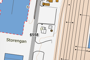
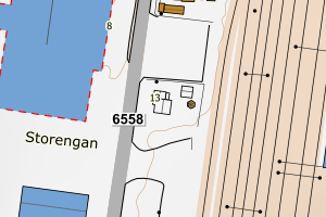
5027 Midtre Gauldal | 80b8446e-f233-404a-9c30-a4f7b1b84f67 | Mønelinje | N: 6967842.26, Ø: 569239.76 | ![Kartbilde fra WMS-tjeneste av avviket](https://wms.geonorge.no/skwms1/wms.topo?VERSION=1.1.1&SERVICE=WMS&REQUEST=GetMap&LAYERS=topo&STYLES=&FORMAT=image/png&SRS=EPSG:25832&BBOX=569164.0,6967792,569314.0,6967892&WIDTH=300&HEIGHT=200) |
5027 Midtre Gauldal | 1f1457e7-b21a-4a49-b510-3e6ebba3bfe7 | Mønelinje | N: 6990093.37, Ø: 564539.53 | ![Kartbilde fra WMS-tjeneste av avviket](https://wms.geonorge.no/skwms1/wms.topo?VERSION=1.1.1&SERVICE=WMS&REQUEST=GetMap&LAYERS=topo&STYLES=&FORMAT=image/png&SRS=EPSG:25832&BBOX=564464.0,6990043,564614.0,6990143&WIDTH=300&HEIGHT=200) |
5027 Midtre Gauldal | 14a86852-6edf-411d-bca7-c26bf255d72c | Mønelinje | N: 6990099.23, Ø: 564545.31 | ![Kartbilde fra WMS-tjeneste av avviket](https://wms.geonorge.no/skwms1/wms.topo?VERSION=1.1.1&SERVICE=WMS&REQUEST=GetMap&LAYERS=topo&STYLES=&FORMAT=image/png&SRS=EPSG:25832&BBOX=564470.0,6990049,564620.0,6990149&WIDTH=300&HEIGHT=200) |
5027 Midtre Gauldal | 8b6486be-d142-4af3-bcd2-3d6275d4e760 | Mønelinje | N: 6990037.52, Ø: 564582.98 | ![Kartbilde fra WMS-tjeneste av avviket](https://wms.geonorge.no/skwms1/wms.topo?VERSION=1.1.1&SERVICE=WMS&REQUEST=GetMap&LAYERS=topo&STYLES=&FORMAT=image/png&SRS=EPSG:25832&BBOX=564507.0,6989987,564657.0,6990087&WIDTH=300&HEIGHT=200) |
5027 Midtre Gauldal | eb73c238-120b-4b29-a7d0-2ccb2ac46be1 | Mønelinje | N: 6968947.92, Ø: 561208.72 | ![Kartbilde fra WMS-tjeneste av avviket](https://wms.geonorge.no/skwms1/wms.topo?VERSION=1.1.1&SERVICE=WMS&REQUEST=GetMap&LAYERS=topo&STYLES=&FORMAT=image/png&SRS=EPSG:25832&BBOX=561133.0,6968897,561283.0,6968997&WIDTH=300&HEIGHT=200) |
5027 Midtre Gauldal | eff4dee4-0d03-4de7-bb2d-2efc4a47a1aa | Mønelinje | N: 6990224.87, Ø: 566073.48 | ![Kartbilde fra WMS-tjeneste av avviket](https://wms.geonorge.no/skwms1/wms.topo?VERSION=1.1.1&SERVICE=WMS&REQUEST=GetMap&LAYERS=topo&STYLES=&FORMAT=image/png&SRS=EPSG:25832&BBOX=565998.0,6990174,566148.0,6990274&WIDTH=300&HEIGHT=200) |
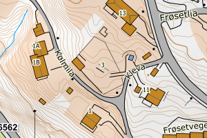
5027 Midtre Gauldal | 6e6b45e6-3505-4afb-a175-5cf68fa89a8f | TaksprangBunn | N: 6978584.90, Ø: 563070.75 | ![Kartbilde fra WMS-tjeneste av avviket](https://wms.geonorge.no/skwms1/wms.topo?VERSION=1.1.1&SERVICE=WMS&REQUEST=GetMap&LAYERS=topo&STYLES=&FORMAT=image/png&SRS=EPSG:25832&BBOX=562995.0,6978534,563145.0,6978634&WIDTH=300&HEIGHT=200) |
5027 Midtre Gauldal | 03110b40-3353-4e66-97fb-b1037cb7106f | TaksprangBunn | N: 6990053.57, Ø: 564578.27 | ![Kartbilde fra WMS-tjeneste av avviket](https://wms.geonorge.no/skwms1/wms.topo?VERSION=1.1.1&SERVICE=WMS&REQUEST=GetMap&LAYERS=topo&STYLES=&FORMAT=image/png&SRS=EPSG:25832&BBOX=564503.0,6990003,564653.0,6990103&WIDTH=300&HEIGHT=200) |
5027 Midtre Gauldal | 5ee31a75-cbda-40a3-89cd-00dd226266e2 | TaksprangBunn | N: 6990096.02, Ø: 564542.68 | ![Kartbilde fra WMS-tjeneste av avviket](https://wms.geonorge.no/skwms1/wms.topo?VERSION=1.1.1&SERVICE=WMS&REQUEST=GetMap&LAYERS=topo&STYLES=&FORMAT=image/png&SRS=EPSG:25832&BBOX=564467.0,6990046,564617.0,6990146&WIDTH=300&HEIGHT=200) |
5027 Midtre Gauldal | 1678e96b-66e2-428d-bc4f-00937dbb035e | TaksprangBunn | N: 6987901.22, Ø: 572698.16 | ![Kartbilde fra WMS-tjeneste av avviket](https://wms.geonorge.no/skwms1/wms.topo?VERSION=1.1.1&SERVICE=WMS&REQUEST=GetMap&LAYERS=topo&STYLES=&FORMAT=image/png&SRS=EPSG:25832&BBOX=572623.0,6987851,572773.0,6987951&WIDTH=300&HEIGHT=200) |
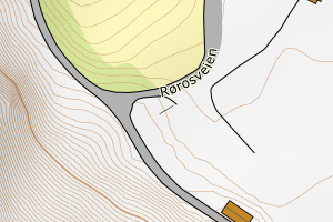
5027 Midtre Gauldal | 774aa6e0-e184-4c42-9496-3fb9abd1175f | TaksprangBunn | N: 6990222.97, Ø: 566070.69 | ![Kartbilde fra WMS-tjeneste av avviket](https://wms.geonorge.no/skwms1/wms.topo?VERSION=1.1.1&SERVICE=WMS&REQUEST=GetMap&LAYERS=topo&STYLES=&FORMAT=image/png&SRS=EPSG:25832&BBOX=565995.0,6990172,566145.0,6990272&WIDTH=300&HEIGHT=200) |
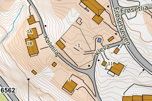
5027 Midtre Gauldal | 9fdf1ef3-b913-49be-b71f-7a7dc3995010 | TaksprangBunn | N: 6990034.61, Ø: 564576.98 | ![Kartbilde fra WMS-tjeneste av avviket](https://wms.geonorge.no/skwms1/wms.topo?VERSION=1.1.1&SERVICE=WMS&REQUEST=GetMap&LAYERS=topo&STYLES=&FORMAT=image/png&SRS=EPSG:25832&BBOX=564501.0,6989984,564651.0,6990084&WIDTH=300&HEIGHT=200) |
5027 Midtre Gauldal | f146c488-cf68-49ff-a491-f1d51abb422a | TaksprangBunn | N: 6990037.47, Ø: 564589.43 | ![Kartbilde fra WMS-tjeneste av avviket](https://wms.geonorge.no/skwms1/wms.topo?VERSION=1.1.1&SERVICE=WMS&REQUEST=GetMap&LAYERS=topo&STYLES=&FORMAT=image/png&SRS=EPSG:25832&BBOX=564514.0,6989987,564664.0,6990087&WIDTH=300&HEIGHT=200) |