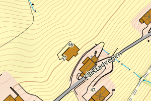
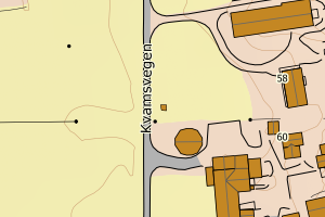
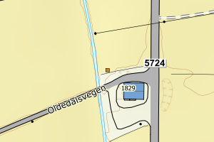
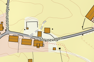
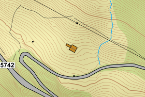
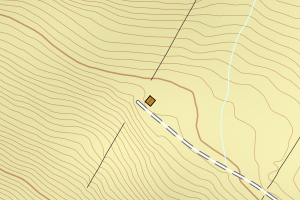
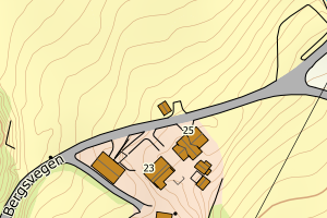
Avvikene kan skyldes enten feil bygningskoordinat eller bygningstype/status i matrikkel eller feil arealtype i AR5. Vær oppmerksom på det er krav om arealer på over 200 m2 før det er krav om endring av arealtype i AR5 så avvikene vil ikke alltid kreve retting i datagrunnlaget
Kommune | LokalId | Bygningsnummer | Arealtype | Bygningstatus | Bygningstype | matrikkel_vedtaksdato | Posisjon | WMS-bilde |
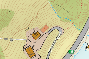
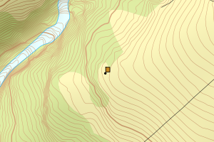
4651 Stryn | 94a19114-6bc9-45f4-94e9-9a4882ffc52f | 178531417 | 21 | TB | 241 | None | N: 6842870.00, Ø: 383941.00 | ![Kartbilde fra WMS-tjeneste av avviket](https://wms.geonorge.no/skwms1/wms.topo?VERSION=1.1.1&SERVICE=WMS&REQUEST=GetMap&LAYERS=topo&STYLES=&FORMAT=image/png&SRS=EPSG:25832&BBOX=383865.0,6842820,384015.0,6842920&WIDTH=300&HEIGHT=200) |
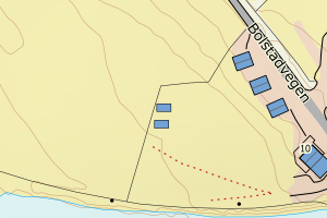
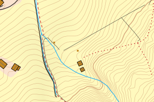
4651 Stryn | 4cedf4fe-a62f-4430-8a76-304bcb634c10 | 178561618 | 21 | TB | 249 | None | N: 6862858.00, Ø: 358832.00 | ![Kartbilde fra WMS-tjeneste av avviket](https://wms.geonorge.no/skwms1/wms.topo?VERSION=1.1.1&SERVICE=WMS&REQUEST=GetMap&LAYERS=topo&STYLES=&FORMAT=image/png&SRS=EPSG:25832&BBOX=358756.0,6862808,358906.0,6862908&WIDTH=300&HEIGHT=200) |
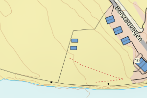
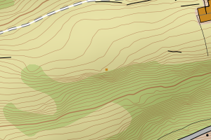
4651 Stryn | 01788806-b3fc-43bb-b010-a0d17d1f0776 | 178580647 | 21 | TB | 249 | None | N: 6866031.00, Ø: 381779.00 | ![Kartbilde fra WMS-tjeneste av avviket](https://wms.geonorge.no/skwms1/wms.topo?VERSION=1.1.1&SERVICE=WMS&REQUEST=GetMap&LAYERS=topo&STYLES=&FORMAT=image/png&SRS=EPSG:25832&BBOX=381703.0,6865981,381853.0,6866081&WIDTH=300&HEIGHT=200) |
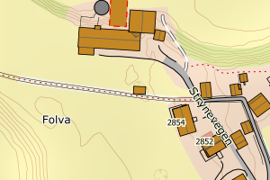
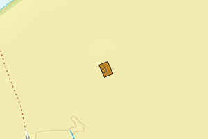
4651 Stryn | 16de5770-9df5-45ef-9e9d-b85a18d01259 | 178561995 | 21 | TB | 249 | None | N: 6862214.00, Ø: 358347.00 | ![Kartbilde fra WMS-tjeneste av avviket](https://wms.geonorge.no/skwms1/wms.topo?VERSION=1.1.1&SERVICE=WMS&REQUEST=GetMap&LAYERS=topo&STYLES=&FORMAT=image/png&SRS=EPSG:25832&BBOX=358271.0,6862164,358421.0,6862264&WIDTH=300&HEIGHT=200) |
4651 Stryn | b6d8dea7-9077-4840-9cca-5ef373a78297 | 178543059 | 21 | TB | 241 | None | N: 6862125.00, Ø: 374886.00 | ![Kartbilde fra WMS-tjeneste av avviket](https://wms.geonorge.no/skwms1/wms.topo?VERSION=1.1.1&SERVICE=WMS&REQUEST=GetMap&LAYERS=topo&STYLES=&FORMAT=image/png&SRS=EPSG:25832&BBOX=374810.0,6862075,374960.0,6862175&WIDTH=300&HEIGHT=200) |
4651 Stryn | 2fe089c3-a4a4-4540-b613-bd95b21babc4 | 178561790 | 21 | TB | 249 | None | N: 6863045.00, Ø: 358481.00 | ![Kartbilde fra WMS-tjeneste av avviket](https://wms.geonorge.no/skwms1/wms.topo?VERSION=1.1.1&SERVICE=WMS&REQUEST=GetMap&LAYERS=topo&STYLES=&FORMAT=image/png&SRS=EPSG:25832&BBOX=358405.0,6862995,358555.0,6863095&WIDTH=300&HEIGHT=200) |
4651 Stryn | fb3c082d-16f8-43ee-aeb6-295c2841aab7 | 178563289 | 21 | TB | 249 | None | N: 6861513.00, Ø: 360230.00 | ![Kartbilde fra WMS-tjeneste av avviket](https://wms.geonorge.no/skwms1/wms.topo?VERSION=1.1.1&SERVICE=WMS&REQUEST=GetMap&LAYERS=topo&STYLES=&FORMAT=image/png&SRS=EPSG:25832&BBOX=360154.0,6861463,360304.0,6861563&WIDTH=300&HEIGHT=200) |
4651 Stryn | e884a17c-6eac-4ade-8aa2-a02d96eb1bbd | 178563114 | 21 | TB | 249 | None | N: 6861908.00, Ø: 360616.00 | ![Kartbilde fra WMS-tjeneste av avviket](https://wms.geonorge.no/skwms1/wms.topo?VERSION=1.1.1&SERVICE=WMS&REQUEST=GetMap&LAYERS=topo&STYLES=&FORMAT=image/png&SRS=EPSG:25832&BBOX=360540.0,6861858,360690.0,6861958&WIDTH=300&HEIGHT=200) |
4651 Stryn | 33796e83-9e4c-44ea-911d-5cedced07318 | 178563629 | 21 | TB | 524 | None | N: 6861917.00, Ø: 359182.00 | ![Kartbilde fra WMS-tjeneste av avviket](https://wms.geonorge.no/skwms1/wms.topo?VERSION=1.1.1&SERVICE=WMS&REQUEST=GetMap&LAYERS=topo&STYLES=&FORMAT=image/png&SRS=EPSG:25832&BBOX=359106.0,6861867,359256.0,6861967&WIDTH=300&HEIGHT=200) |
4651 Stryn | 2e5331f1-a776-4b56-82f6-8b578648a648 | 178598252 | 21 | TB | 249 | None | N: 6867022.00, Ø: 405893.00 | ![Kartbilde fra WMS-tjeneste av avviket](https://wms.geonorge.no/skwms1/wms.topo?VERSION=1.1.1&SERVICE=WMS&REQUEST=GetMap&LAYERS=topo&STYLES=&FORMAT=image/png&SRS=EPSG:25832&BBOX=405817.0,6866972,405967.0,6867072&WIDTH=300&HEIGHT=200) |
4651 Stryn | 9757cb12-d89e-4641-ae3b-5e03043dd9ef | 178608444 | 21 | TB | 241 | None | N: 6867193.00, Ø: 384319.00 | ![Kartbilde fra WMS-tjeneste av avviket](https://wms.geonorge.no/skwms1/wms.topo?VERSION=1.1.1&SERVICE=WMS&REQUEST=GetMap&LAYERS=topo&STYLES=&FORMAT=image/png&SRS=EPSG:25832&BBOX=384243.0,6867143,384393.0,6867243&WIDTH=300&HEIGHT=200) |
4651 Stryn | 254a17fc-bb32-4239-8b97-50078411a876 | 178603221 | 21 | TB | 249 | None | N: 6859832.00, Ø: 362765.00 | ![Kartbilde fra WMS-tjeneste av avviket](https://wms.geonorge.no/skwms1/wms.topo?VERSION=1.1.1&SERVICE=WMS&REQUEST=GetMap&LAYERS=topo&STYLES=&FORMAT=image/png&SRS=EPSG:25832&BBOX=362689.0,6859782,362839.0,6859882&WIDTH=300&HEIGHT=200) |
4651 Stryn | 57efbb4e-5191-40ba-a8fa-d83d8405d8ef | 178606670 | 21 | TB | 249 | None | N: 6868313.00, Ø: 374001.00 | ![Kartbilde fra WMS-tjeneste av avviket](https://wms.geonorge.no/skwms1/wms.topo?VERSION=1.1.1&SERVICE=WMS&REQUEST=GetMap&LAYERS=topo&STYLES=&FORMAT=image/png&SRS=EPSG:25832&BBOX=373925.0,6868263,374075.0,6868363&WIDTH=300&HEIGHT=200) |
4651 Stryn | a4f2569d-4b3f-447f-a01e-a1171ec6a2ce | 178608169 | 21 | TB | 249 | None | N: 6867065.00, Ø: 384548.00 | ![Kartbilde fra WMS-tjeneste av avviket](https://wms.geonorge.no/skwms1/wms.topo?VERSION=1.1.1&SERVICE=WMS&REQUEST=GetMap&LAYERS=topo&STYLES=&FORMAT=image/png&SRS=EPSG:25832&BBOX=384472.0,6867015,384622.0,6867115&WIDTH=300&HEIGHT=200) |
4651 Stryn | 8af813ea-9984-404d-bb93-38388ede81d8 | 178582054 | 21 | TB | 249 | None | N: 6867059.00, Ø: 382854.00 | ![Kartbilde fra WMS-tjeneste av avviket](https://wms.geonorge.no/skwms1/wms.topo?VERSION=1.1.1&SERVICE=WMS&REQUEST=GetMap&LAYERS=topo&STYLES=&FORMAT=image/png&SRS=EPSG:25832&BBOX=382778.0,6867009,382928.0,6867109&WIDTH=300&HEIGHT=200) |
4651 Stryn | 8403bcf1-f600-4d76-b01f-d87e1ebab20a | 178599569 | 21 | TB | 249 | None | N: 6867424.00, Ø: 406769.00 | ![Kartbilde fra WMS-tjeneste av avviket](https://wms.geonorge.no/skwms1/wms.topo?VERSION=1.1.1&SERVICE=WMS&REQUEST=GetMap&LAYERS=topo&STYLES=&FORMAT=image/png&SRS=EPSG:25832&BBOX=406693.0,6867374,406843.0,6867474&WIDTH=300&HEIGHT=200) |
4651 Stryn | df899d7a-1fe5-4b80-b9e8-70d8fda3d910 | 178537725 | 21 | TB | 249 | None | N: 6853309.00, Ø: 385021.00 | ![Kartbilde fra WMS-tjeneste av avviket](https://wms.geonorge.no/skwms1/wms.topo?VERSION=1.1.1&SERVICE=WMS&REQUEST=GetMap&LAYERS=topo&STYLES=&FORMAT=image/png&SRS=EPSG:25832&BBOX=384945.0,6853259,385095.0,6853359&WIDTH=300&HEIGHT=200) |
4651 Stryn | b082ea69-5068-4b58-a718-05fbb1fc6f82 | 178581643 | 21 | TB | 249 | None | N: 6866596.00, Ø: 383383.00 | ![Kartbilde fra WMS-tjeneste av avviket](https://wms.geonorge.no/skwms1/wms.topo?VERSION=1.1.1&SERVICE=WMS&REQUEST=GetMap&LAYERS=topo&STYLES=&FORMAT=image/png&SRS=EPSG:25832&BBOX=383307.0,6866546,383457.0,6866646&WIDTH=300&HEIGHT=200) |
4651 Stryn | 8cfac310-cce2-4343-bdcf-39359b902069 | 178595342 | 21 | TB | 181 | None | N: 6861884.00, Ø: 401251.00 | ![Kartbilde fra WMS-tjeneste av avviket](https://wms.geonorge.no/skwms1/wms.topo?VERSION=1.1.1&SERVICE=WMS&REQUEST=GetMap&LAYERS=topo&STYLES=&FORMAT=image/png&SRS=EPSG:25832&BBOX=401175.0,6861834,401325.0,6861934&WIDTH=300&HEIGHT=200) |
4651 Stryn | b0b9f8a4-9524-488c-9404-b462f25f3877 | 178575627 | 21 | TB | 249 | None | N: 6864777.00, Ø: 378354.00 | ![Kartbilde fra WMS-tjeneste av avviket](https://wms.geonorge.no/skwms1/wms.topo?VERSION=1.1.1&SERVICE=WMS&REQUEST=GetMap&LAYERS=topo&STYLES=&FORMAT=image/png&SRS=EPSG:25832&BBOX=378278.0,6864727,378428.0,6864827&WIDTH=300&HEIGHT=200) |
4651 Stryn | 7a5552ff-2e02-43a8-9426-17171a2b6923 | 178574485 | 21 | TB | 249 | None | N: 6863965.00, Ø: 377385.00 | ![Kartbilde fra WMS-tjeneste av avviket](https://wms.geonorge.no/skwms1/wms.topo?VERSION=1.1.1&SERVICE=WMS&REQUEST=GetMap&LAYERS=topo&STYLES=&FORMAT=image/png&SRS=EPSG:25832&BBOX=377309.0,6863915,377459.0,6864015&WIDTH=300&HEIGHT=200) |
4651 Stryn | a5927a7f-614b-43a1-aeaa-a6fd4f74cb9a | 178575341 | 21 | TB | 249 | None | N: 6864424.00, Ø: 377900.00 | ![Kartbilde fra WMS-tjeneste av avviket](https://wms.geonorge.no/skwms1/wms.topo?VERSION=1.1.1&SERVICE=WMS&REQUEST=GetMap&LAYERS=topo&STYLES=&FORMAT=image/png&SRS=EPSG:25832&BBOX=377824.0,6864374,377974.0,6864474&WIDTH=300&HEIGHT=200) |
4651 Stryn | d01f09cf-fe7e-484e-b320-f0a77ce491a3 | 178586416 | 21 | TB | 249 | None | N: 6866797.00, Ø: 384904.00 | ![Kartbilde fra WMS-tjeneste av avviket](https://wms.geonorge.no/skwms1/wms.topo?VERSION=1.1.1&SERVICE=WMS&REQUEST=GetMap&LAYERS=topo&STYLES=&FORMAT=image/png&SRS=EPSG:25832&BBOX=384828.0,6866747,384978.0,6866847&WIDTH=300&HEIGHT=200) |
4651 Stryn | 1f18a20f-30d7-4f81-961b-ec5d774d5eae | 178593625 | 21 | TB | 249 | None | N: 6864460.00, Ø: 398778.00 | ![Kartbilde fra WMS-tjeneste av avviket](https://wms.geonorge.no/skwms1/wms.topo?VERSION=1.1.1&SERVICE=WMS&REQUEST=GetMap&LAYERS=topo&STYLES=&FORMAT=image/png&SRS=EPSG:25832&BBOX=398702.0,6864410,398852.0,6864510&WIDTH=300&HEIGHT=200) |
4651 Stryn | 9d7de4c5-27a2-40ca-a293-ce3b40158234 | 178530240 | 21 | TB | 249 | None | N: 6840419.00, Ø: 384135.00 | ![Kartbilde fra WMS-tjeneste av avviket](https://wms.geonorge.no/skwms1/wms.topo?VERSION=1.1.1&SERVICE=WMS&REQUEST=GetMap&LAYERS=topo&STYLES=&FORMAT=image/png&SRS=EPSG:25832&BBOX=384059.0,6840369,384209.0,6840469&WIDTH=300&HEIGHT=200) |
4651 Stryn | 5f3753bf-095c-4a5f-9396-fdee3a158ef4 | 178572571 | 21 | TB | 249 | None | N: 6867813.20, Ø: 375008.10 | ![Kartbilde fra WMS-tjeneste av avviket](https://wms.geonorge.no/skwms1/wms.topo?VERSION=1.1.1&SERVICE=WMS&REQUEST=GetMap&LAYERS=topo&STYLES=&FORMAT=image/png&SRS=EPSG:25832&BBOX=374933.0,6867763,375083.0,6867863&WIDTH=300&HEIGHT=200) |
4651 Stryn | 60d7676e-55c7-42de-a0c8-13c5fbea6360 | 178606654 | 21 | TB | 249 | None | N: 6867895.40, Ø: 374919.50 | ![Kartbilde fra WMS-tjeneste av avviket](https://wms.geonorge.no/skwms1/wms.topo?VERSION=1.1.1&SERVICE=WMS&REQUEST=GetMap&LAYERS=topo&STYLES=&FORMAT=image/png&SRS=EPSG:25832&BBOX=374844.0,6867845,374994.0,6867945&WIDTH=300&HEIGHT=200) |
4651 Stryn | 1f88a096-74a5-4d1f-8c2f-5710e0f3b129 | 178575058 | 21 | TB | 249 | None | N: 6864161.00, Ø: 377510.00 | ![Kartbilde fra WMS-tjeneste av avviket](https://wms.geonorge.no/skwms1/wms.topo?VERSION=1.1.1&SERVICE=WMS&REQUEST=GetMap&LAYERS=topo&STYLES=&FORMAT=image/png&SRS=EPSG:25832&BBOX=377434.0,6864111,377584.0,6864211&WIDTH=300&HEIGHT=200) |
4651 Stryn | ca2dc3da-a539-4e0c-af82-66ff6c10211e | 178607685 | 21 | TB | 241 | None | N: 6848953.00, Ø: 385278.00 | ![Kartbilde fra WMS-tjeneste av avviket](https://wms.geonorge.no/skwms1/wms.topo?VERSION=1.1.1&SERVICE=WMS&REQUEST=GetMap&LAYERS=topo&STYLES=&FORMAT=image/png&SRS=EPSG:25832&BBOX=385202.0,6848903,385352.0,6849003&WIDTH=300&HEIGHT=200) |
4651 Stryn | f4ba7cca-cdee-4d29-924d-bbea22f7469d | 178605976 | 21 | TB | 249 | None | N: 6858251.00, Ø: 375633.00 | ![Kartbilde fra WMS-tjeneste av avviket](https://wms.geonorge.no/skwms1/wms.topo?VERSION=1.1.1&SERVICE=WMS&REQUEST=GetMap&LAYERS=topo&STYLES=&FORMAT=image/png&SRS=EPSG:25832&BBOX=375557.0,6858201,375707.0,6858301&WIDTH=300&HEIGHT=200) |
4651 Stryn | 6d9178c2-a1f1-4c81-9060-0fa659b1ba65 | 178562002 | 21 | TB | 249 | None | N: 6862200.00, Ø: 358335.00 | ![Kartbilde fra WMS-tjeneste av avviket](https://wms.geonorge.no/skwms1/wms.topo?VERSION=1.1.1&SERVICE=WMS&REQUEST=GetMap&LAYERS=topo&STYLES=&FORMAT=image/png&SRS=EPSG:25832&BBOX=358259.0,6862150,358409.0,6862250&WIDTH=300&HEIGHT=200) |
4651 Stryn | 589da20f-eacb-4b7c-869d-5ec6a43b5ec6 | 178546023 | 21 | TB | 249 | None | N: 6859239.00, Ø: 374486.00 | ![Kartbilde fra WMS-tjeneste av avviket](https://wms.geonorge.no/skwms1/wms.topo?VERSION=1.1.1&SERVICE=WMS&REQUEST=GetMap&LAYERS=topo&STYLES=&FORMAT=image/png&SRS=EPSG:25832&BBOX=374410.0,6859189,374560.0,6859289&WIDTH=300&HEIGHT=200) |
4651 Stryn | 4c570342-f8a4-4c08-a858-a8c0052d0dfa | 178561626 | 21 | TB | 249 | None | N: 6862705.00, Ø: 358929.00 | ![Kartbilde fra WMS-tjeneste av avviket](https://wms.geonorge.no/skwms1/wms.topo?VERSION=1.1.1&SERVICE=WMS&REQUEST=GetMap&LAYERS=topo&STYLES=&FORMAT=image/png&SRS=EPSG:25832&BBOX=358853.0,6862655,359003.0,6862755&WIDTH=300&HEIGHT=200) |
4651 Stryn | a79a0732-13d2-4977-b7e7-8fefe09a8f3f | 178563033 | 21 | TB | 249 | None | N: 6862097.00, Ø: 360903.00 | ![Kartbilde fra WMS-tjeneste av avviket](https://wms.geonorge.no/skwms1/wms.topo?VERSION=1.1.1&SERVICE=WMS&REQUEST=GetMap&LAYERS=topo&STYLES=&FORMAT=image/png&SRS=EPSG:25832&BBOX=360827.0,6862047,360977.0,6862147&WIDTH=300&HEIGHT=200) |
4651 Stryn | e26b62ad-2f4a-42cd-ae09-20aa9e4cd565 | 178562444 | 21 | TB | 249 | None | N: 6862201.00, Ø: 358727.00 | ![Kartbilde fra WMS-tjeneste av avviket](https://wms.geonorge.no/skwms1/wms.topo?VERSION=1.1.1&SERVICE=WMS&REQUEST=GetMap&LAYERS=topo&STYLES=&FORMAT=image/png&SRS=EPSG:25832&BBOX=358651.0,6862151,358801.0,6862251&WIDTH=300&HEIGHT=200) |
4651 Stryn | b45730e0-7856-4814-bec8-acb9753f7068 | 178564803 | 21 | TB | 249 | None | N: 6859796.00, Ø: 362528.00 | ![Kartbilde fra WMS-tjeneste av avviket](https://wms.geonorge.no/skwms1/wms.topo?VERSION=1.1.1&SERVICE=WMS&REQUEST=GetMap&LAYERS=topo&STYLES=&FORMAT=image/png&SRS=EPSG:25832&BBOX=362452.0,6859746,362602.0,6859846&WIDTH=300&HEIGHT=200) |
4651 Stryn | 329366d6-e681-4570-a2f3-d45d410da103 | 178563610 | 21 | TB | 249 | None | N: 6861876.00, Ø: 359212.00 | ![Kartbilde fra WMS-tjeneste av avviket](https://wms.geonorge.no/skwms1/wms.topo?VERSION=1.1.1&SERVICE=WMS&REQUEST=GetMap&LAYERS=topo&STYLES=&FORMAT=image/png&SRS=EPSG:25832&BBOX=359136.0,6861826,359286.0,6861926&WIDTH=300&HEIGHT=200) |
4651 Stryn | 6f9b7afb-1c1b-4ed2-b2ef-aea511493137 | 178596934 | 21 | TB | 249 | None | N: 6866656.00, Ø: 402319.00 | ![Kartbilde fra WMS-tjeneste av avviket](https://wms.geonorge.no/skwms1/wms.topo?VERSION=1.1.1&SERVICE=WMS&REQUEST=GetMap&LAYERS=topo&STYLES=&FORMAT=image/png&SRS=EPSG:25832&BBOX=402243.0,6866606,402393.0,6866706&WIDTH=300&HEIGHT=200) |
4651 Stryn | ce073cba-acaf-4cc9-872a-0c0361633d83 | 178561634 | 21 | TB | 249 | None | N: 6862601.00, Ø: 358982.00 | ![Kartbilde fra WMS-tjeneste av avviket](https://wms.geonorge.no/skwms1/wms.topo?VERSION=1.1.1&SERVICE=WMS&REQUEST=GetMap&LAYERS=topo&STYLES=&FORMAT=image/png&SRS=EPSG:25832&BBOX=358906.0,6862551,359056.0,6862651&WIDTH=300&HEIGHT=200) |
4651 Stryn | 7112df04-ee97-4d23-9d60-eb296eaed2ed | 178586718 | 21 | TB | 249 | None | N: 6867356.00, Ø: 384670.00 | ![Kartbilde fra WMS-tjeneste av avviket](https://wms.geonorge.no/skwms1/wms.topo?VERSION=1.1.1&SERVICE=WMS&REQUEST=GetMap&LAYERS=topo&STYLES=&FORMAT=image/png&SRS=EPSG:25832&BBOX=384594.0,6867306,384744.0,6867406&WIDTH=300&HEIGHT=200) |
4651 Stryn | 2fe63aaf-4e8b-456e-a3cf-13e0f0f45982 | 178592041 | 21 | TB | 245 | None | N: 6869448.00, Ø: 397094.00 | ![Kartbilde fra WMS-tjeneste av avviket](https://wms.geonorge.no/skwms1/wms.topo?VERSION=1.1.1&SERVICE=WMS&REQUEST=GetMap&LAYERS=topo&STYLES=&FORMAT=image/png&SRS=EPSG:25832&BBOX=397018.0,6869398,397168.0,6869498&WIDTH=300&HEIGHT=200) |
4651 Stryn | dc3514f0-b3fc-4d42-838f-1dc6968fbb26 | 178563505 | 21 | TB | 181 | None | N: 6862033.00, Ø: 359366.00 | ![Kartbilde fra WMS-tjeneste av avviket](https://wms.geonorge.no/skwms1/wms.topo?VERSION=1.1.1&SERVICE=WMS&REQUEST=GetMap&LAYERS=topo&STYLES=&FORMAT=image/png&SRS=EPSG:25832&BBOX=359290.0,6861983,359440.0,6862083&WIDTH=300&HEIGHT=200) |
4651 Stryn | 788225eb-9d9a-43a5-a9df-856b1ee53e85 | 178595539 | 21 | TB | 249 | None | N: 6860930.00, Ø: 401521.00 | ![Kartbilde fra WMS-tjeneste av avviket](https://wms.geonorge.no/skwms1/wms.topo?VERSION=1.1.1&SERVICE=WMS&REQUEST=GetMap&LAYERS=topo&STYLES=&FORMAT=image/png&SRS=EPSG:25832&BBOX=401445.0,6860880,401595.0,6860980&WIDTH=300&HEIGHT=200) |
4651 Stryn | 2139016f-df2d-4878-b078-0ceaf4d386cf | 178535765 | 21 | TB | 249 | None | N: 6858016.00, Ø: 384751.00 | ![Kartbilde fra WMS-tjeneste av avviket](https://wms.geonorge.no/skwms1/wms.topo?VERSION=1.1.1&SERVICE=WMS&REQUEST=GetMap&LAYERS=topo&STYLES=&FORMAT=image/png&SRS=EPSG:25832&BBOX=384675.0,6857966,384825.0,6858066&WIDTH=300&HEIGHT=200) |
4651 Stryn | ed23b4d6-f9d4-477a-89e6-ba2159b5963d | 178549006 | 21 | TB | 249 | None | N: 6858071.00, Ø: 372767.00 | ![Kartbilde fra WMS-tjeneste av avviket](https://wms.geonorge.no/skwms1/wms.topo?VERSION=1.1.1&SERVICE=WMS&REQUEST=GetMap&LAYERS=topo&STYLES=&FORMAT=image/png&SRS=EPSG:25832&BBOX=372691.0,6858021,372841.0,6858121&WIDTH=300&HEIGHT=200) |
4651 Stryn | 5064a24b-1fbe-49fa-9452-2c1e0466e087 | 178595318 | 21 | TB | 249 | None | N: 6862390.00, Ø: 401237.00 | ![Kartbilde fra WMS-tjeneste av avviket](https://wms.geonorge.no/skwms1/wms.topo?VERSION=1.1.1&SERVICE=WMS&REQUEST=GetMap&LAYERS=topo&STYLES=&FORMAT=image/png&SRS=EPSG:25832&BBOX=401161.0,6862340,401311.0,6862440&WIDTH=300&HEIGHT=200) |
4651 Stryn | fcd22fc0-8849-41f4-a20d-693d6266ebf2 | 178595326 | 21 | TB | 249 | None | N: 6862021.00, Ø: 400971.00 | ![Kartbilde fra WMS-tjeneste av avviket](https://wms.geonorge.no/skwms1/wms.topo?VERSION=1.1.1&SERVICE=WMS&REQUEST=GetMap&LAYERS=topo&STYLES=&FORMAT=image/png&SRS=EPSG:25832&BBOX=400895.0,6861971,401045.0,6862071&WIDTH=300&HEIGHT=200) |
4651 Stryn | 42dc7ec4-9124-4750-96a4-a321abbc7064 | 301438423 | 21 | FA | 999 | 2024-12-17 | N: 6842087.40, Ø: 384091.70 | ![Kartbilde fra WMS-tjeneste av avviket](https://wms.geonorge.no/skwms1/wms.topo?VERSION=1.1.1&SERVICE=WMS&REQUEST=GetMap&LAYERS=topo&STYLES=&FORMAT=image/png&SRS=EPSG:25832&BBOX=384016.0,6842037,384166.0,6842137&WIDTH=300&HEIGHT=200) |
4651 Stryn | 27762d94-c77b-4dc9-b14a-7a67b3628e11 | 301438396 | 21 | FA | 999 | 2024-12-17 | N: 6843070.10, Ø: 384479.80 | ![Kartbilde fra WMS-tjeneste av avviket](https://wms.geonorge.no/skwms1/wms.topo?VERSION=1.1.1&SERVICE=WMS&REQUEST=GetMap&LAYERS=topo&STYLES=&FORMAT=image/png&SRS=EPSG:25832&BBOX=384404.0,6843020,384554.0,6843120&WIDTH=300&HEIGHT=200) |
4651 Stryn | a5be95d8-0e69-480f-b772-74344bde9dfe | 301367238 | 21 | FA | 181 | 2024-12-16 | N: 6866772.70, Ø: 404146.60 | ![Kartbilde fra WMS-tjeneste av avviket](https://wms.geonorge.no/skwms1/wms.topo?VERSION=1.1.1&SERVICE=WMS&REQUEST=GetMap&LAYERS=topo&STYLES=&FORMAT=image/png&SRS=EPSG:25832&BBOX=404071.0,6866722,404221.0,6866822&WIDTH=300&HEIGHT=200) |
4651 Stryn | 2b09986e-f74e-4f30-ab01-c58f6db8bab4 | 301176784 | 21 | FA | 249 | 2024-12-11 | N: 6866703.20, Ø: 399703.30 | ![Kartbilde fra WMS-tjeneste av avviket](https://wms.geonorge.no/skwms1/wms.topo?VERSION=1.1.1&SERVICE=WMS&REQUEST=GetMap&LAYERS=topo&STYLES=&FORMAT=image/png&SRS=EPSG:25832&BBOX=399628.0,6866653,399778.0,6866753&WIDTH=300&HEIGHT=200) |
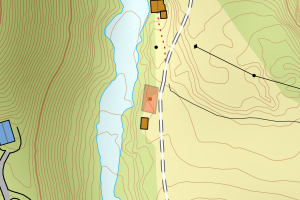
4651 Stryn | b528abba-7c17-4b76-9180-a9d8387347ac | 300929291 | 21 | TB | 999 | 2024-12-03 | N: 6858435.70, Ø: 384839.10 | ![Kartbilde fra WMS-tjeneste av avviket](https://wms.geonorge.no/skwms1/wms.topo?VERSION=1.1.1&SERVICE=WMS&REQUEST=GetMap&LAYERS=topo&STYLES=&FORMAT=image/png&SRS=EPSG:25832&BBOX=384764.0,6858385,384914.0,6858485&WIDTH=300&HEIGHT=200) |
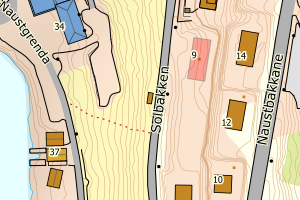
4651 Stryn | 516ee61c-1523-4af9-ad2e-c5a4af80817f | 301322489 | 21 | FA | 161 | 2024-07-16 | N: 6838663.80, Ø: 384501.00 | ![Kartbilde fra WMS-tjeneste av avviket](https://wms.geonorge.no/skwms1/wms.topo?VERSION=1.1.1&SERVICE=WMS&REQUEST=GetMap&LAYERS=topo&STYLES=&FORMAT=image/png&SRS=EPSG:25832&BBOX=384425.0,6838613,384575.0,6838713&WIDTH=300&HEIGHT=200) |
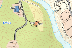
4651 Stryn | d270e565-2872-4291-9835-595afcf05504 | 301195627 | 21 | FA | 111 | 2024-04-18 | N: 6858844.20, Ø: 366641.10 | ![Kartbilde fra WMS-tjeneste av avviket](https://wms.geonorge.no/skwms1/wms.topo?VERSION=1.1.1&SERVICE=WMS&REQUEST=GetMap&LAYERS=topo&STYLES=&FORMAT=image/png&SRS=EPSG:25832&BBOX=366566.0,6858794,366716.0,6858894&WIDTH=300&HEIGHT=200) |
4651 Stryn | 71100405-593d-48f3-8e46-4b514bde5e44 | 301070717 | 21 | FA | 113 | 2022-05-06 | N: 6862250.60, Ø: 384252.20 | ![Kartbilde fra WMS-tjeneste av avviket](https://wms.geonorge.no/skwms1/wms.topo?VERSION=1.1.1&SERVICE=WMS&REQUEST=GetMap&LAYERS=topo&STYLES=&FORMAT=image/png&SRS=EPSG:25832&BBOX=384177.0,6862200,384327.0,6862300&WIDTH=300&HEIGHT=200) |
4651 Stryn | a2269fdc-1d5c-499d-828b-c7168ff2c03a | 300713226 | 21 | FA | 999 | 2020-12-15 | N: 6862602.90, Ø: 359098.80 | ![Kartbilde fra WMS-tjeneste av avviket](https://wms.geonorge.no/skwms1/wms.topo?VERSION=1.1.1&SERVICE=WMS&REQUEST=GetMap&LAYERS=topo&STYLES=&FORMAT=image/png&SRS=EPSG:25832&BBOX=359023.0,6862552,359173.0,6862652&WIDTH=300&HEIGHT=200) |
4651 Stryn | 7a9c2f0b-0b5d-4636-b3a4-f89b5b7da954 | 300653995 | 21 | TB | 181 | 2017-11-13 | N: 6862396.60, Ø: 384570.80 | ![Kartbilde fra WMS-tjeneste av avviket](https://wms.geonorge.no/skwms1/wms.topo?VERSION=1.1.1&SERVICE=WMS&REQUEST=GetMap&LAYERS=topo&STYLES=&FORMAT=image/png&SRS=EPSG:25832&BBOX=384495.0,6862346,384645.0,6862446&WIDTH=300&HEIGHT=200) |
4651 Stryn | 726ab2be-e4f8-4758-a5d5-ce13261d6fc7 | 300647748 | 21 | TB | 181 | 2017-10-09 | N: 6867134.50, Ø: 383009.50 | ![Kartbilde fra WMS-tjeneste av avviket](https://wms.geonorge.no/skwms1/wms.topo?VERSION=1.1.1&SERVICE=WMS&REQUEST=GetMap&LAYERS=topo&STYLES=&FORMAT=image/png&SRS=EPSG:25832&BBOX=382934.0,6867084,383084.0,6867184&WIDTH=300&HEIGHT=200) |
4651 Stryn | eeade5bb-aadc-4c9f-9b06-355d8685828b | 300638936 | 21 | TB | 181 | 2017-08-22 | N: 6862248.70, Ø: 359467.40 | ![Kartbilde fra WMS-tjeneste av avviket](https://wms.geonorge.no/skwms1/wms.topo?VERSION=1.1.1&SERVICE=WMS&REQUEST=GetMap&LAYERS=topo&STYLES=&FORMAT=image/png&SRS=EPSG:25832&BBOX=359392.0,6862198,359542.0,6862298&WIDTH=300&HEIGHT=200) |
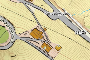
4651 Stryn | 49d131a4-3667-45f6-9831-6e39049cb25c | 300059445 | 21 | TB | 249 | 2011-12-31 | N: 6843383.20, Ø: 383932.40 | ![Kartbilde fra WMS-tjeneste av avviket](https://wms.geonorge.no/skwms1/wms.topo?VERSION=1.1.1&SERVICE=WMS&REQUEST=GetMap&LAYERS=topo&STYLES=&FORMAT=image/png&SRS=EPSG:25832&BBOX=383857.0,6843333,384007.0,6843433&WIDTH=300&HEIGHT=200) |
4651 Stryn | 9947e0b7-8688-422d-9c88-1460264584e0 | 18080826 | 21 | TB | 524 | 1992-12-20 | N: 6861895.00, Ø: 359176.00 | ![Kartbilde fra WMS-tjeneste av avviket](https://wms.geonorge.no/skwms1/wms.topo?VERSION=1.1.1&SERVICE=WMS&REQUEST=GetMap&LAYERS=topo&STYLES=&FORMAT=image/png&SRS=EPSG:25832&BBOX=359100.0,6861845,359250.0,6861945&WIDTH=300&HEIGHT=200) |
4651 Stryn | 4da8baf6-8a8f-4a1a-8192-fdefb7c26a4f | 18074575 | 21 | TB | 183 | 1977-10-17 | N: 6866892.00, Ø: 383540.00 | ![Kartbilde fra WMS-tjeneste av avviket](https://wms.geonorge.no/skwms1/wms.topo?VERSION=1.1.1&SERVICE=WMS&REQUEST=GetMap&LAYERS=topo&STYLES=&FORMAT=image/png&SRS=EPSG:25832&BBOX=383464.0,6866842,383614.0,6866942&WIDTH=300&HEIGHT=200) |
4651 Stryn | 331571ef-b35c-4e8a-b26e-e579c0a3a9f2 | 178590944 | 21 | TB | 161 | 1954-12-20 | N: 6869142.00, Ø: 391984.00 | ![Kartbilde fra WMS-tjeneste av avviket](https://wms.geonorge.no/skwms1/wms.topo?VERSION=1.1.1&SERVICE=WMS&REQUEST=GetMap&LAYERS=topo&STYLES=&FORMAT=image/png&SRS=EPSG:25832&BBOX=391908.0,6869092,392058.0,6869192&WIDTH=300&HEIGHT=200) |