Avvikene skyldes oftest manglende oppdatering av kartreg-egenskapen i FKB-Tiltak. Rettes vanligvis i FKB-Tiltak
Kommune | LokalId | Tiltak_Byggnr | Saksreferanse | Byggstatus | Tiltak_Avgjørelsesdato | Matrikkel_Bygningsstatus | Matrikkel_Vedtaksdato | Posisjon | WMS-bilde |
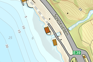
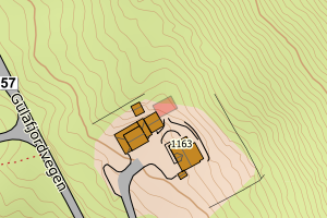
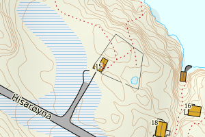
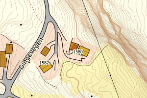
4635 Gulen | c2cf197e-e720-459b-a371-d1ce0dada3bd | None | 0 | 111 | 2008-12-15 00:00:00 | TB | 2008-12-31 | N: 6770352.38, Ø: 281823.54 | ![Kartbilde fra WMS-tjeneste av avviket](https://wms.geonorge.no/skwms1/wms.topo?VERSION=1.1.1&SERVICE=WMS&REQUEST=GetMap&LAYERS=topo&STYLES=&FORMAT=image/png&SRS=EPSG:25832&BBOX=281748.0,6770302,281898.0,6770402&WIDTH=300&HEIGHT=200) |
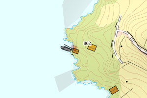
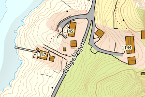
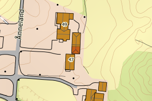
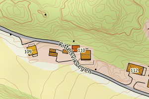
4635 Gulen | 5e1e0ce6-86aa-4304-b414-49c0c0da6986 | None | 2013389 | 113 | 2013-04-12 00:00:00 | TB | None | N: 6771154.73, Ø: 310452.95 | ![Kartbilde fra WMS-tjeneste av avviket](https://wms.geonorge.no/skwms1/wms.topo?VERSION=1.1.1&SERVICE=WMS&REQUEST=GetMap&LAYERS=topo&STYLES=&FORMAT=image/png&SRS=EPSG:25832&BBOX=310377.0,6771104,310527.0,6771204&WIDTH=300&HEIGHT=200) |
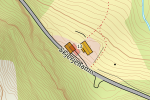
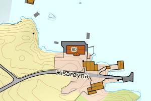
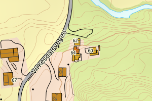
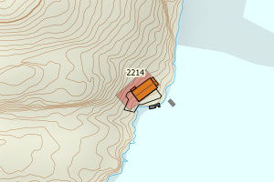
4635 Gulen | 371d62c1-2a34-4dc1-99a8-b9124ebd3e51 | 300545560 | 2015000221 | 161 | 2015-11-11 00:00:00 | TB | 2016-12-31 | N: 6768462.39, Ø: 282354.67 | ![Kartbilde fra WMS-tjeneste av avviket](https://wms.geonorge.no/skwms1/wms.topo?VERSION=1.1.1&SERVICE=WMS&REQUEST=GetMap&LAYERS=topo&STYLES=&FORMAT=image/png&SRS=EPSG:25832&BBOX=282279.0,6768412,282429.0,6768512&WIDTH=300&HEIGHT=200) |
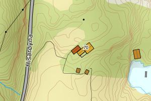
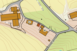
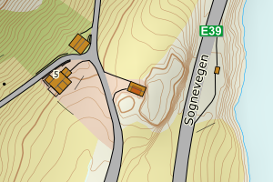
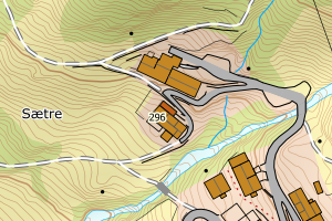
4635 Gulen | c063eff7-c9df-41e4-a533-86bc9ddbbde7 | 300039214 | 0 | 181 | 2008-12-31 00:00:00 | TB | 2008-12-31 | N: 6757400.67, Ø: 282004.93 | ![Kartbilde fra WMS-tjeneste av avviket](https://wms.geonorge.no/skwms1/wms.topo?VERSION=1.1.1&SERVICE=WMS&REQUEST=GetMap&LAYERS=topo&STYLES=&FORMAT=image/png&SRS=EPSG:25832&BBOX=281929.0,6757350,282079.0,6757450&WIDTH=300&HEIGHT=200) |
4635 Gulen | edca5256-1ef8-4bc7-a681-d2e62ec2644d | 300585778 | 2016000205 | 249 | 2016-10-12 00:00:00 | TB | 2017-12-17 | N: 6761015.15, Ø: 310577.14 | ![Kartbilde fra WMS-tjeneste av avviket](https://wms.geonorge.no/skwms1/wms.topo?VERSION=1.1.1&SERVICE=WMS&REQUEST=GetMap&LAYERS=topo&STYLES=&FORMAT=image/png&SRS=EPSG:25832&BBOX=310502.0,6760965,310652.0,6761065&WIDTH=300&HEIGHT=200) |
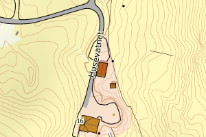
4635 Gulen | 12a31d84-9357-4642-bd11-808fa06e932f | 300022199 | 20081105 | 183 | 2008-10-20 00:00:00 | FA | 2009-05-05 | N: 6771075.85, Ø: 310347.85 | ![Kartbilde fra WMS-tjeneste av avviket](https://wms.geonorge.no/skwms1/wms.topo?VERSION=1.1.1&SERVICE=WMS&REQUEST=GetMap&LAYERS=topo&STYLES=&FORMAT=image/png&SRS=EPSG:25832&BBOX=310272.0,6771025,310422.0,6771125&WIDTH=300&HEIGHT=200) |
4635 Gulen | 39bb14da-e492-4c5f-9a15-b425ff085c83 | 300039986 | 0 | 181 | 2008-12-15 00:00:00 | TB | 2008-12-31 | N: 6759211.70, Ø: 290529.97 | ![Kartbilde fra WMS-tjeneste av avviket](https://wms.geonorge.no/skwms1/wms.topo?VERSION=1.1.1&SERVICE=WMS&REQUEST=GetMap&LAYERS=topo&STYLES=&FORMAT=image/png&SRS=EPSG:25832&BBOX=290454.0,6759161,290604.0,6759261&WIDTH=300&HEIGHT=200) |
4635 Gulen | 3def3314-1ed6-4608-94c1-f52108a03e62 | 300038537 | 0 | 183 | 2008-12-15 00:00:00 | TB | 2008-12-31 | N: 6756566.84, Ø: 289901.97 | ![Kartbilde fra WMS-tjeneste av avviket](https://wms.geonorge.no/skwms1/wms.topo?VERSION=1.1.1&SERVICE=WMS&REQUEST=GetMap&LAYERS=topo&STYLES=&FORMAT=image/png&SRS=EPSG:25832&BBOX=289826.0,6756516,289976.0,6756616&WIDTH=300&HEIGHT=200) |
4635 Gulen | 488b3e79-c156-4691-948b-b0c3fa5e8232 | 300039229 | 0 | 181 | 2008-12-31 00:00:00 | TB | 2008-12-31 | N: 6757172.03, Ø: 282024.09 | ![Kartbilde fra WMS-tjeneste av avviket](https://wms.geonorge.no/skwms1/wms.topo?VERSION=1.1.1&SERVICE=WMS&REQUEST=GetMap&LAYERS=topo&STYLES=&FORMAT=image/png&SRS=EPSG:25832&BBOX=281949.0,6757122,282099.0,6757222&WIDTH=300&HEIGHT=200) |
4635 Gulen | 6b377d93-d360-43ae-a97f-67c65b972182 | 300068594 | 2009659 | 183 | 2009-07-17 00:00:00 | TB | 2017-06-21 | N: 6760844.39, Ø: 287814.87 | ![Kartbilde fra WMS-tjeneste av avviket](https://wms.geonorge.no/skwms1/wms.topo?VERSION=1.1.1&SERVICE=WMS&REQUEST=GetMap&LAYERS=topo&STYLES=&FORMAT=image/png&SRS=EPSG:25832&BBOX=287739.0,6760794,287889.0,6760894&WIDTH=300&HEIGHT=200) |
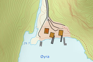
4635 Gulen | 834041f0-b2da-44fe-8408-65ae4d6873e3 | 300038645 | 0 | 181 | 2009-01-15 00:00:00 | TB | 2008-12-31 | N: 6762230.02, Ø: 282363.16 | ![Kartbilde fra WMS-tjeneste av avviket](https://wms.geonorge.no/skwms1/wms.topo?VERSION=1.1.1&SERVICE=WMS&REQUEST=GetMap&LAYERS=topo&STYLES=&FORMAT=image/png&SRS=EPSG:25832&BBOX=282288.0,6762180,282438.0,6762280&WIDTH=300&HEIGHT=200) |
4635 Gulen | 9d954129-59ac-455a-88dd-fa89c3e48265 | 300037896 | 20081226 | 182 | 2008-12-17 00:00:00 | TB | 2008-12-31 | N: 6769605.34, Ø: 281643.83 | ![Kartbilde fra WMS-tjeneste av avviket](https://wms.geonorge.no/skwms1/wms.topo?VERSION=1.1.1&SERVICE=WMS&REQUEST=GetMap&LAYERS=topo&STYLES=&FORMAT=image/png&SRS=EPSG:25832&BBOX=281568.0,6769555,281718.0,6769655&WIDTH=300&HEIGHT=200) |
4635 Gulen | c131ef87-a5e9-48ac-854a-7b8fe08ffeb8 | 300006282 | 0 | 245 | 2008-05-16 00:00:00 | TB | 2015-12-31 | N: 6758854.01, Ø: 273907.41 | ![Kartbilde fra WMS-tjeneste av avviket](https://wms.geonorge.no/skwms1/wms.topo?VERSION=1.1.1&SERVICE=WMS&REQUEST=GetMap&LAYERS=topo&STYLES=&FORMAT=image/png&SRS=EPSG:25832&BBOX=273832.0,6758804,273982.0,6758904&WIDTH=300&HEIGHT=200) |
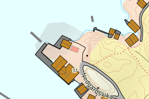
4635 Gulen | d0ae21ca-e188-4ef6-b880-2a0c315156e7 | 300037651 | 0 | 181 | 2009-01-28 00:00:00 | TB | 2008-12-31 | N: 6775455.95, Ø: 286448.93 | ![Kartbilde fra WMS-tjeneste av avviket](https://wms.geonorge.no/skwms1/wms.topo?VERSION=1.1.1&SERVICE=WMS&REQUEST=GetMap&LAYERS=topo&STYLES=&FORMAT=image/png&SRS=EPSG:25832&BBOX=286373.0,6775405,286523.0,6775505&WIDTH=300&HEIGHT=200) |
4635 Gulen | dcb9fbd1-a1f2-4ab8-8fc9-32eb43a0fcca | 300002526 | 200800208 | 183 | 2008-03-17 00:00:00 | TB | 2010-01-01 | N: 6758283.61, Ø: 274352.14 | ![Kartbilde fra WMS-tjeneste av avviket](https://wms.geonorge.no/skwms1/wms.topo?VERSION=1.1.1&SERVICE=WMS&REQUEST=GetMap&LAYERS=topo&STYLES=&FORMAT=image/png&SRS=EPSG:25832&BBOX=274277.0,6758233,274427.0,6758333&WIDTH=300&HEIGHT=200) |
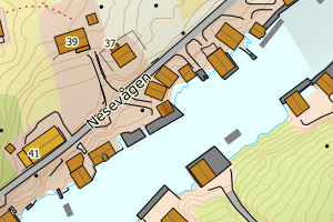
4635 Gulen | cb8a6ed5-2ea5-43ed-902a-5a32ce9bd3cc | 300594832 | 2016000244 | 183 | 2016-12-09 00:00:00 | FA | 2023-01-04 | N: 6769234.32, Ø: 293816.96 | ![Kartbilde fra WMS-tjeneste av avviket](https://wms.geonorge.no/skwms1/wms.topo?VERSION=1.1.1&SERVICE=WMS&REQUEST=GetMap&LAYERS=topo&STYLES=&FORMAT=image/png&SRS=EPSG:25832&BBOX=293741.0,6769184,293891.0,6769284&WIDTH=300&HEIGHT=200) |
4635 Gulen | f0a31b10-dc65-4c8d-a592-85bd3dd95d03 | 300045827 | 0 | 161 | 2008-12-15 00:00:00 | TB | 2008-12-31 | N: 6769122.90, Ø: 284545.16 | ![Kartbilde fra WMS-tjeneste av avviket](https://wms.geonorge.no/skwms1/wms.topo?VERSION=1.1.1&SERVICE=WMS&REQUEST=GetMap&LAYERS=topo&STYLES=&FORMAT=image/png&SRS=EPSG:25832&BBOX=284470.0,6769072,284620.0,6769172&WIDTH=300&HEIGHT=200) |
4635 Gulen | f53c04ac-4ae3-4cdf-94e1-500eea566620 | 300027997 | 0 | 181 | 2008-12-01 00:00:00 | TB | 2008-12-01 | N: 6752594.63, Ø: 282527.61 | ![Kartbilde fra WMS-tjeneste av avviket](https://wms.geonorge.no/skwms1/wms.topo?VERSION=1.1.1&SERVICE=WMS&REQUEST=GetMap&LAYERS=topo&STYLES=&FORMAT=image/png&SRS=EPSG:25832&BBOX=282452.0,6752544,282602.0,6752644&WIDTH=300&HEIGHT=200) |
4635 Gulen | 0dd62937-87c4-4ee3-8770-f0d0f858dfa4 | 300059779 | 0 | 161 | 2009-05-28 00:00:00 | TB | 2008-12-31 | N: 6760938.24, Ø: 292804.57 | ![Kartbilde fra WMS-tjeneste av avviket](https://wms.geonorge.no/skwms1/wms.topo?VERSION=1.1.1&SERVICE=WMS&REQUEST=GetMap&LAYERS=topo&STYLES=&FORMAT=image/png&SRS=EPSG:25832&BBOX=292729.0,6760888,292879.0,6760988&WIDTH=300&HEIGHT=200) |
4635 Gulen | 2914e755-0996-4177-a50c-8f5fef3bb0ae | 300028020 | 0 | 182 | 2008-12-01 00:00:00 | TB | 2008-12-01 | N: 6772239.76, Ø: 286843.74 | ![Kartbilde fra WMS-tjeneste av avviket](https://wms.geonorge.no/skwms1/wms.topo?VERSION=1.1.1&SERVICE=WMS&REQUEST=GetMap&LAYERS=topo&STYLES=&FORMAT=image/png&SRS=EPSG:25832&BBOX=286768.0,6772189,286918.0,6772289&WIDTH=300&HEIGHT=200) |
4635 Gulen | 29429c5c-9c14-47e1-9727-aecc0b7e086e | 300048065 | 0 | 161 | 1982-08-24 00:00:00 | TB | 1984-07-01 | N: 6757145.27, Ø: 275501.75 | ![Kartbilde fra WMS-tjeneste av avviket](https://wms.geonorge.no/skwms1/wms.topo?VERSION=1.1.1&SERVICE=WMS&REQUEST=GetMap&LAYERS=topo&STYLES=&FORMAT=image/png&SRS=EPSG:25832&BBOX=275426.0,6757095,275576.0,6757195&WIDTH=300&HEIGHT=200) |
4635 Gulen | 37bb977e-cf6a-47fc-8b0b-357806f8133d | 300038543 | 0 | 181 | 2008-12-15 00:00:00 | TB | 2008-12-31 | N: 6760707.08, Ø: 310233.02 | ![Kartbilde fra WMS-tjeneste av avviket](https://wms.geonorge.no/skwms1/wms.topo?VERSION=1.1.1&SERVICE=WMS&REQUEST=GetMap&LAYERS=topo&STYLES=&FORMAT=image/png&SRS=EPSG:25832&BBOX=310158.0,6760657,310308.0,6760757&WIDTH=300&HEIGHT=200) |
4635 Gulen | 4b9dd231-3efa-4d03-b2d7-a4178c20425c | 300039219 | 0 | 181 | 2008-12-31 00:00:00 | TB | 2008-12-31 | N: 6757456.78, Ø: 281860.84 | ![Kartbilde fra WMS-tjeneste av avviket](https://wms.geonorge.no/skwms1/wms.topo?VERSION=1.1.1&SERVICE=WMS&REQUEST=GetMap&LAYERS=topo&STYLES=&FORMAT=image/png&SRS=EPSG:25832&BBOX=281785.0,6757406,281935.0,6757506&WIDTH=300&HEIGHT=200) |