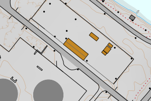
Avvikene skyldes oftest manglende eller unøyaktig registrering av bygningspunkt i matrikkelen. Rettes vanligvis i matrikkelen
Kommune | LokalId | Areal (m2) | Posisjon | WMS-bilde |
4631 Alver | 67852bfd-6413-4d66-8e13-ad0cc013747c | 1723.46 | N: 6748102.81, Ø: 284033.39 | ![Kartbilde fra WMS-tjeneste av avviket](https://wms.geonorge.no/skwms1/wms.topo?VERSION=1.1.1&SERVICE=WMS&REQUEST=GetMap&LAYERS=topo&STYLES=&FORMAT=image/png&SRS=EPSG:25832&BBOX=283958.0,6748052,284108.0,6748152&WIDTH=300&HEIGHT=200) |
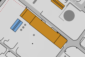
4631 Alver | 52e9c48f-a3ac-48bc-b694-c0559f479d40 | 1229.38 | N: 6747498.24, Ø: 284041.46 | ![Kartbilde fra WMS-tjeneste av avviket](https://wms.geonorge.no/skwms1/wms.topo?VERSION=1.1.1&SERVICE=WMS&REQUEST=GetMap&LAYERS=topo&STYLES=&FORMAT=image/png&SRS=EPSG:25832&BBOX=283966.0,6747448,284116.0,6747548&WIDTH=300&HEIGHT=200) |
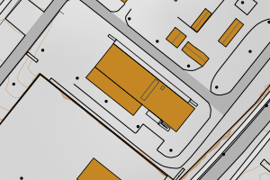
4631 Alver | af08647b-a57d-4c26-961a-9eae2d2c5201 | 1185.27 | N: 6747600.22, Ø: 284320.32 | ![Kartbilde fra WMS-tjeneste av avviket](https://wms.geonorge.no/skwms1/wms.topo?VERSION=1.1.1&SERVICE=WMS&REQUEST=GetMap&LAYERS=topo&STYLES=&FORMAT=image/png&SRS=EPSG:25832&BBOX=284245.0,6747550,284395.0,6747650&WIDTH=300&HEIGHT=200) |
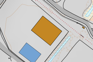
4631 Alver | bab31745-a9d9-4d2a-ab10-7d4aa2344a48 | 1117.46 | N: 6748435.88, Ø: 284200.28 | ![Kartbilde fra WMS-tjeneste av avviket](https://wms.geonorge.no/skwms1/wms.topo?VERSION=1.1.1&SERVICE=WMS&REQUEST=GetMap&LAYERS=topo&STYLES=&FORMAT=image/png&SRS=EPSG:25832&BBOX=284125.0,6748385,284275.0,6748485&WIDTH=300&HEIGHT=200) |
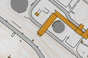
4631 Alver | b5967f76-bf7b-475f-9584-6cbb7615cdc8 | 1113.16 | N: 6718089.32, Ø: 296696.73 | ![Kartbilde fra WMS-tjeneste av avviket](https://wms.geonorge.no/skwms1/wms.topo?VERSION=1.1.1&SERVICE=WMS&REQUEST=GetMap&LAYERS=topo&STYLES=&FORMAT=image/png&SRS=EPSG:25832&BBOX=296621.0,6718039,296771.0,6718139&WIDTH=300&HEIGHT=200) |
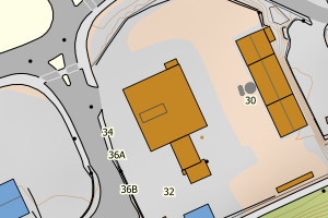
4631 Alver | 0fb6f7d8-a286-4f27-9d90-0188c0029828 | 1095.75 | N: 6747324.34, Ø: 283539.10 | ![Kartbilde fra WMS-tjeneste av avviket](https://wms.geonorge.no/skwms1/wms.topo?VERSION=1.1.1&SERVICE=WMS&REQUEST=GetMap&LAYERS=topo&STYLES=&FORMAT=image/png&SRS=EPSG:25832&BBOX=283464.0,6747274,283614.0,6747374&WIDTH=300&HEIGHT=200) |
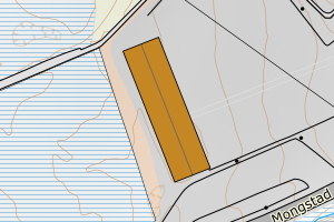
4631 Alver | f62fb340-e3af-4f42-9911-04c1b4b9e9c1 | 1000.41 | N: 6714619.57, Ø: 292886.33 | ![Kartbilde fra WMS-tjeneste av avviket](https://wms.geonorge.no/skwms1/wms.topo?VERSION=1.1.1&SERVICE=WMS&REQUEST=GetMap&LAYERS=topo&STYLES=&FORMAT=image/png&SRS=EPSG:25832&BBOX=292811.0,6714569,292961.0,6714669&WIDTH=300&HEIGHT=200) |
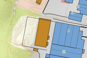
4631 Alver | c79d017b-7fce-45f6-974a-8ea3000fdd00 | 949.09 | N: 6748140.20, Ø: 284365.42 | ![Kartbilde fra WMS-tjeneste av avviket](https://wms.geonorge.no/skwms1/wms.topo?VERSION=1.1.1&SERVICE=WMS&REQUEST=GetMap&LAYERS=topo&STYLES=&FORMAT=image/png&SRS=EPSG:25832&BBOX=284290.0,6748090,284440.0,6748190&WIDTH=300&HEIGHT=200) |
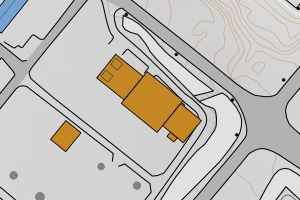
4631 Alver | 662fa7b9-e79a-41df-9aa1-650b7a393455 | 873.90 | N: 6747858.32, Ø: 284238.45 | ![Kartbilde fra WMS-tjeneste av avviket](https://wms.geonorge.no/skwms1/wms.topo?VERSION=1.1.1&SERVICE=WMS&REQUEST=GetMap&LAYERS=topo&STYLES=&FORMAT=image/png&SRS=EPSG:25832&BBOX=284163.0,6747808,284313.0,6747908&WIDTH=300&HEIGHT=200) |
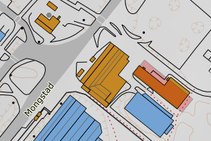
4631 Alver | 6963bbc7-5984-404e-90a4-3614ebb55a08 | 823.66 | N: 6748031.89, Ø: 284484.59 | ![Kartbilde fra WMS-tjeneste av avviket](https://wms.geonorge.no/skwms1/wms.topo?VERSION=1.1.1&SERVICE=WMS&REQUEST=GetMap&LAYERS=topo&STYLES=&FORMAT=image/png&SRS=EPSG:25832&BBOX=284409.0,6747981,284559.0,6748081&WIDTH=300&HEIGHT=200) |
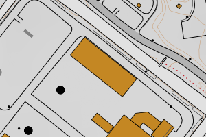
4631 Alver | 14675f6e-0c84-4b57-b48f-b705a76fee2a | 799.17 | N: 6747864.29, Ø: 284333.83 | ![Kartbilde fra WMS-tjeneste av avviket](https://wms.geonorge.no/skwms1/wms.topo?VERSION=1.1.1&SERVICE=WMS&REQUEST=GetMap&LAYERS=topo&STYLES=&FORMAT=image/png&SRS=EPSG:25832&BBOX=284258.0,6747814,284408.0,6747914&WIDTH=300&HEIGHT=200) |
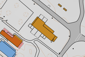
4631 Alver | 47f095dd-824a-4b5f-b6e4-952e928a24cf | 791.59 | N: 6748304.57, Ø: 283875.58 | ![Kartbilde fra WMS-tjeneste av avviket](https://wms.geonorge.no/skwms1/wms.topo?VERSION=1.1.1&SERVICE=WMS&REQUEST=GetMap&LAYERS=topo&STYLES=&FORMAT=image/png&SRS=EPSG:25832&BBOX=283800.0,6748254,283950.0,6748354&WIDTH=300&HEIGHT=200) |
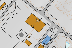
4631 Alver | 7c2feee9-89fb-4cd8-b506-c9cbeb70da76 | 770.54 | N: 6747240.62, Ø: 284449.58 | ![Kartbilde fra WMS-tjeneste av avviket](https://wms.geonorge.no/skwms1/wms.topo?VERSION=1.1.1&SERVICE=WMS&REQUEST=GetMap&LAYERS=topo&STYLES=&FORMAT=image/png&SRS=EPSG:25832&BBOX=284374.0,6747190,284524.0,6747290&WIDTH=300&HEIGHT=200) |
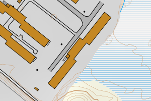
4631 Alver | a599b8c0-8dbb-4276-b679-b68b051d71a6 | 765.03 | N: 6747257.85, Ø: 284377.39 | ![Kartbilde fra WMS-tjeneste av avviket](https://wms.geonorge.no/skwms1/wms.topo?VERSION=1.1.1&SERVICE=WMS&REQUEST=GetMap&LAYERS=topo&STYLES=&FORMAT=image/png&SRS=EPSG:25832&BBOX=284302.0,6747207,284452.0,6747307&WIDTH=300&HEIGHT=200) |
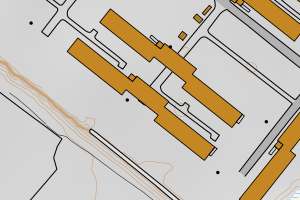
4631 Alver | 0d58571b-4a9f-453b-84ee-e171f885725a | 759.29 | N: 6747315.86, Ø: 284413.20 | ![Kartbilde fra WMS-tjeneste av avviket](https://wms.geonorge.no/skwms1/wms.topo?VERSION=1.1.1&SERVICE=WMS&REQUEST=GetMap&LAYERS=topo&STYLES=&FORMAT=image/png&SRS=EPSG:25832&BBOX=284338.0,6747265,284488.0,6747365&WIDTH=300&HEIGHT=200) |
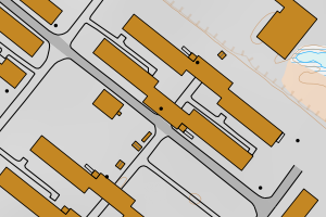
4631 Alver | b4dcd526-4843-4e76-8f74-dbbfbcd3fc86 | 758.93 | N: 6747328.37, Ø: 284436.11 | ![Kartbilde fra WMS-tjeneste av avviket](https://wms.geonorge.no/skwms1/wms.topo?VERSION=1.1.1&SERVICE=WMS&REQUEST=GetMap&LAYERS=topo&STYLES=&FORMAT=image/png&SRS=EPSG:25832&BBOX=284361.0,6747278,284511.0,6747378&WIDTH=300&HEIGHT=200) |
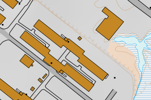
4631 Alver | e2e0d16a-9f99-412f-a6bc-d2a521378582 | 732.50 | N: 6747274.22, Ø: 284391.25 | ![Kartbilde fra WMS-tjeneste av avviket](https://wms.geonorge.no/skwms1/wms.topo?VERSION=1.1.1&SERVICE=WMS&REQUEST=GetMap&LAYERS=topo&STYLES=&FORMAT=image/png&SRS=EPSG:25832&BBOX=284316.0,6747224,284466.0,6747324&WIDTH=300&HEIGHT=200) |
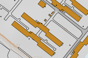
4631 Alver | 07670a04-ecc4-4a8f-80a8-b3995ce8cdbb | 730.96 | N: 6748807.15, Ø: 284101.85 | ![Kartbilde fra WMS-tjeneste av avviket](https://wms.geonorge.no/skwms1/wms.topo?VERSION=1.1.1&SERVICE=WMS&REQUEST=GetMap&LAYERS=topo&STYLES=&FORMAT=image/png&SRS=EPSG:25832&BBOX=284026.0,6748757,284176.0,6748857&WIDTH=300&HEIGHT=200) |
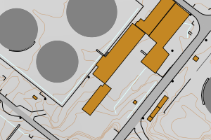
4631 Alver | e16cea75-642d-4686-a73c-fa9372b0fa5b | 686.96 | N: 6718102.12, Ø: 296744.87 | ![Kartbilde fra WMS-tjeneste av avviket](https://wms.geonorge.no/skwms1/wms.topo?VERSION=1.1.1&SERVICE=WMS&REQUEST=GetMap&LAYERS=topo&STYLES=&FORMAT=image/png&SRS=EPSG:25832&BBOX=296669.0,6718052,296819.0,6718152&WIDTH=300&HEIGHT=200) |
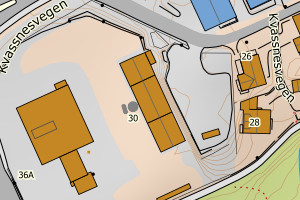
4631 Alver | 0738d62e-8559-4d71-b794-ce9331f6dc35 | 642.45 | N: 6748595.33, Ø: 284625.22 | ![Kartbilde fra WMS-tjeneste av avviket](https://wms.geonorge.no/skwms1/wms.topo?VERSION=1.1.1&SERVICE=WMS&REQUEST=GetMap&LAYERS=topo&STYLES=&FORMAT=image/png&SRS=EPSG:25832&BBOX=284550.0,6748545,284700.0,6748645&WIDTH=300&HEIGHT=200) |
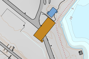
4631 Alver | 373f565c-e09c-4b08-8a47-ee4b23cb2c0c | 622.76 | N: 6748829.11, Ø: 284141.28 | ![Kartbilde fra WMS-tjeneste av avviket](https://wms.geonorge.no/skwms1/wms.topo?VERSION=1.1.1&SERVICE=WMS&REQUEST=GetMap&LAYERS=topo&STYLES=&FORMAT=image/png&SRS=EPSG:25832&BBOX=284066.0,6748779,284216.0,6748879&WIDTH=300&HEIGHT=200) |
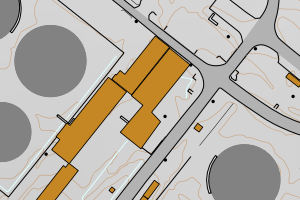
4631 Alver | bf42400b-5441-41fd-9c19-e2aa26394636 | 538.88 | N: 6748497.53, Ø: 283459.64 | ![Kartbilde fra WMS-tjeneste av avviket](https://wms.geonorge.no/skwms1/wms.topo?VERSION=1.1.1&SERVICE=WMS&REQUEST=GetMap&LAYERS=topo&STYLES=&FORMAT=image/png&SRS=EPSG:25832&BBOX=283384.0,6748447,283534.0,6748547&WIDTH=300&HEIGHT=200) |
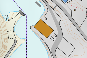
4631 Alver | 3e387070-b41a-4d54-b77e-eea21a54a5e3 | 484.57 | N: 6748982.86, Ø: 283941.22 | ![Kartbilde fra WMS-tjeneste av avviket](https://wms.geonorge.no/skwms1/wms.topo?VERSION=1.1.1&SERVICE=WMS&REQUEST=GetMap&LAYERS=topo&STYLES=&FORMAT=image/png&SRS=EPSG:25832&BBOX=283866.0,6748932,284016.0,6749032&WIDTH=300&HEIGHT=200) |
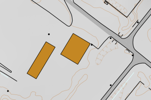
4631 Alver | a32b09e2-0596-4fed-ba37-e8b074ad8001 | 461.03 | N: 6718691.28, Ø: 297448.77 | ![Kartbilde fra WMS-tjeneste av avviket](https://wms.geonorge.no/skwms1/wms.topo?VERSION=1.1.1&SERVICE=WMS&REQUEST=GetMap&LAYERS=topo&STYLES=&FORMAT=image/png&SRS=EPSG:25832&BBOX=297373.0,6718641,297523.0,6718741&WIDTH=300&HEIGHT=200) |
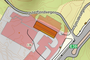
4631 Alver | 9a8748db-2fdf-4f49-aa93-63f86421a3fd | 443.24 | N: 6718849.67, Ø: 296088.69 | ![Kartbilde fra WMS-tjeneste av avviket](https://wms.geonorge.no/skwms1/wms.topo?VERSION=1.1.1&SERVICE=WMS&REQUEST=GetMap&LAYERS=topo&STYLES=&FORMAT=image/png&SRS=EPSG:25832&BBOX=296013.0,6718799,296163.0,6718899&WIDTH=300&HEIGHT=200) |
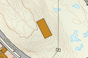
4631 Alver | 35b40a39-9ae8-4468-8a21-482ec64054d9 | 436.31 | N: 6747844.14, Ø: 284283.92 | ![Kartbilde fra WMS-tjeneste av avviket](https://wms.geonorge.no/skwms1/wms.topo?VERSION=1.1.1&SERVICE=WMS&REQUEST=GetMap&LAYERS=topo&STYLES=&FORMAT=image/png&SRS=EPSG:25832&BBOX=284208.0,6747794,284358.0,6747894&WIDTH=300&HEIGHT=200) |
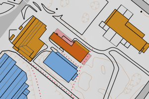
4631 Alver | 43693ed4-d077-45b1-b865-3b77ef1d7e85 | 435.88 | N: 6747837.04, Ø: 283945.27 | ![Kartbilde fra WMS-tjeneste av avviket](https://wms.geonorge.no/skwms1/wms.topo?VERSION=1.1.1&SERVICE=WMS&REQUEST=GetMap&LAYERS=topo&STYLES=&FORMAT=image/png&SRS=EPSG:25832&BBOX=283870.0,6747787,284020.0,6747887&WIDTH=300&HEIGHT=200) |
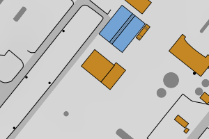
4631 Alver | 7eed5fdd-5c54-4f0d-ab3d-4531847f7c4e | 428.73 | N: 6747847.37, Ø: 284004.83 | ![Kartbilde fra WMS-tjeneste av avviket](https://wms.geonorge.no/skwms1/wms.topo?VERSION=1.1.1&SERVICE=WMS&REQUEST=GetMap&LAYERS=topo&STYLES=&FORMAT=image/png&SRS=EPSG:25832&BBOX=283929.0,6747797,284079.0,6747897&WIDTH=300&HEIGHT=200) |
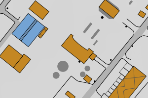
4631 Alver | 5967eefe-f43a-41cb-97d5-e02938d24aed | 409.89 | N: 6747356.46, Ø: 284337.49 | ![Kartbilde fra WMS-tjeneste av avviket](https://wms.geonorge.no/skwms1/wms.topo?VERSION=1.1.1&SERVICE=WMS&REQUEST=GetMap&LAYERS=topo&STYLES=&FORMAT=image/png&SRS=EPSG:25832&BBOX=284262.0,6747306,284412.0,6747406&WIDTH=300&HEIGHT=200) |
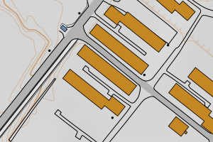
4631 Alver | 61255b48-c612-4996-bc85-fd17fef078ba | 396.33 | N: 6747382.15, Ø: 284364.30 | ![Kartbilde fra WMS-tjeneste av avviket](https://wms.geonorge.no/skwms1/wms.topo?VERSION=1.1.1&SERVICE=WMS&REQUEST=GetMap&LAYERS=topo&STYLES=&FORMAT=image/png&SRS=EPSG:25832&BBOX=284289.0,6747332,284439.0,6747432&WIDTH=300&HEIGHT=200) |
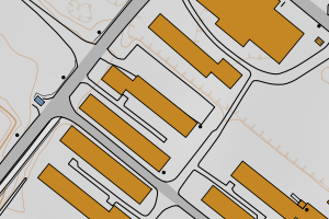
4631 Alver | b0a48ef2-a2d4-4cd7-ad91-92df8a43ed43 | 394.06 | N: 6748971.47, Ø: 283907.07 | ![Kartbilde fra WMS-tjeneste av avviket](https://wms.geonorge.no/skwms1/wms.topo?VERSION=1.1.1&SERVICE=WMS&REQUEST=GetMap&LAYERS=topo&STYLES=&FORMAT=image/png&SRS=EPSG:25832&BBOX=283832.0,6748921,283982.0,6749021&WIDTH=300&HEIGHT=200) |
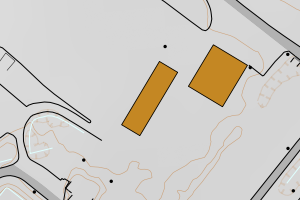
4631 Alver | d4c01fbb-b0ac-42f6-a2f3-417f7543fbca | 390.36 | N: 6747344.04, Ø: 284321.22 | ![Kartbilde fra WMS-tjeneste av avviket](https://wms.geonorge.no/skwms1/wms.topo?VERSION=1.1.1&SERVICE=WMS&REQUEST=GetMap&LAYERS=topo&STYLES=&FORMAT=image/png&SRS=EPSG:25832&BBOX=284246.0,6747294,284396.0,6747394&WIDTH=300&HEIGHT=200) |
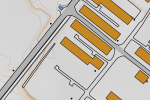
4631 Alver | 0533e2db-6a15-443e-b1fd-9275de5f5a2e | 389.37 | N: 6747371.08, Ø: 284346.13 | ![Kartbilde fra WMS-tjeneste av avviket](https://wms.geonorge.no/skwms1/wms.topo?VERSION=1.1.1&SERVICE=WMS&REQUEST=GetMap&LAYERS=topo&STYLES=&FORMAT=image/png&SRS=EPSG:25832&BBOX=284271.0,6747321,284421.0,6747421&WIDTH=300&HEIGHT=200) |
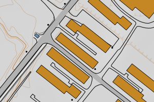
4631 Alver | 834e7b15-78e8-4fcb-9817-b8a60dd43b98 | 388.32 | N: 6747411.98, Ø: 284371.53 | ![Kartbilde fra WMS-tjeneste av avviket](https://wms.geonorge.no/skwms1/wms.topo?VERSION=1.1.1&SERVICE=WMS&REQUEST=GetMap&LAYERS=topo&STYLES=&FORMAT=image/png&SRS=EPSG:25832&BBOX=284296.0,6747361,284446.0,6747461&WIDTH=300&HEIGHT=200) |
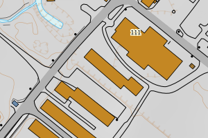
4631 Alver | 82e6ce8b-1e88-43f4-acfa-151865d88b79 | 365.30 | N: 6747618.84, Ø: 284455.49 | ![Kartbilde fra WMS-tjeneste av avviket](https://wms.geonorge.no/skwms1/wms.topo?VERSION=1.1.1&SERVICE=WMS&REQUEST=GetMap&LAYERS=topo&STYLES=&FORMAT=image/png&SRS=EPSG:25832&BBOX=284380.0,6747568,284530.0,6747668&WIDTH=300&HEIGHT=200) |
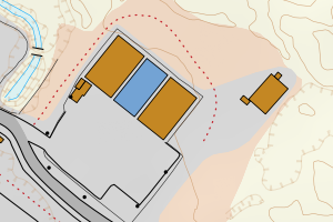
4631 Alver | 34f135a6-c65c-4fd4-b3c0-37ff65db8608 | 364.58 | N: 6747637.79, Ø: 284431.88 | ![Kartbilde fra WMS-tjeneste av avviket](https://wms.geonorge.no/skwms1/wms.topo?VERSION=1.1.1&SERVICE=WMS&REQUEST=GetMap&LAYERS=topo&STYLES=&FORMAT=image/png&SRS=EPSG:25832&BBOX=284356.0,6747587,284506.0,6747687&WIDTH=300&HEIGHT=200) |
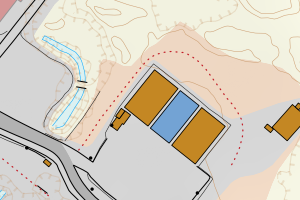
4631 Alver | 2de561d6-8da0-4a37-b031-2379320a9f0b | 362.32 | N: 6746179.86, Ø: 285527.82 | ![Kartbilde fra WMS-tjeneste av avviket](https://wms.geonorge.no/skwms1/wms.topo?VERSION=1.1.1&SERVICE=WMS&REQUEST=GetMap&LAYERS=topo&STYLES=&FORMAT=image/png&SRS=EPSG:25832&BBOX=285452.0,6746129,285602.0,6746229&WIDTH=300&HEIGHT=200) |
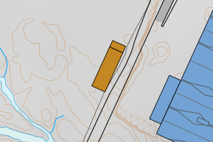
4631 Alver | c3e77092-4627-4a0c-9d2c-429082aa0dc3 | 352.94 | N: 6721797.63, Ø: 302810.61 | ![Kartbilde fra WMS-tjeneste av avviket](https://wms.geonorge.no/skwms1/wms.topo?VERSION=1.1.1&SERVICE=WMS&REQUEST=GetMap&LAYERS=topo&STYLES=&FORMAT=image/png&SRS=EPSG:25832&BBOX=302735.0,6721747,302885.0,6721847&WIDTH=300&HEIGHT=200) |
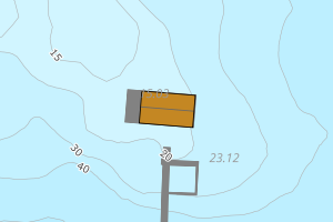
4631 Alver | 9ef1ec78-6bb8-4371-aec6-0fde0f84eb25 | 352.60 | N: 6747446.79, Ø: 284022.74 | ![Kartbilde fra WMS-tjeneste av avviket](https://wms.geonorge.no/skwms1/wms.topo?VERSION=1.1.1&SERVICE=WMS&REQUEST=GetMap&LAYERS=topo&STYLES=&FORMAT=image/png&SRS=EPSG:25832&BBOX=283947.0,6747396,284097.0,6747496&WIDTH=300&HEIGHT=200) |
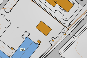
4631 Alver | 5d1ce52b-4dee-483e-98fe-8ccf701e8fe4 | 332.88 | N: 6748683.46, Ø: 284226.63 | ![Kartbilde fra WMS-tjeneste av avviket](https://wms.geonorge.no/skwms1/wms.topo?VERSION=1.1.1&SERVICE=WMS&REQUEST=GetMap&LAYERS=topo&STYLES=&FORMAT=image/png&SRS=EPSG:25832&BBOX=284151.0,6748633,284301.0,6748733&WIDTH=300&HEIGHT=200) |
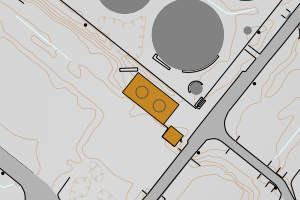
4631 Alver | 401137e9-4edb-4fa9-a877-599a8948e259 | 329.15 | N: 6748134.86, Ø: 284504.52 | ![Kartbilde fra WMS-tjeneste av avviket](https://wms.geonorge.no/skwms1/wms.topo?VERSION=1.1.1&SERVICE=WMS&REQUEST=GetMap&LAYERS=topo&STYLES=&FORMAT=image/png&SRS=EPSG:25832&BBOX=284429.0,6748084,284579.0,6748184&WIDTH=300&HEIGHT=200) |
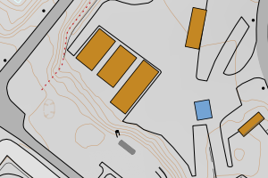
4631 Alver | 62e0a191-f7d5-4f7b-bbe2-5bb90f4c371a | 321.93 | N: 6747913.62, Ø: 283829.95 | ![Kartbilde fra WMS-tjeneste av avviket](https://wms.geonorge.no/skwms1/wms.topo?VERSION=1.1.1&SERVICE=WMS&REQUEST=GetMap&LAYERS=topo&STYLES=&FORMAT=image/png&SRS=EPSG:25832&BBOX=283754.0,6747863,283904.0,6747963&WIDTH=300&HEIGHT=200) |
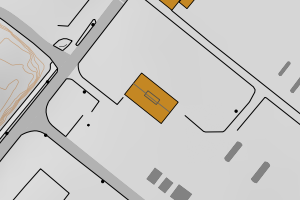
4631 Alver | 2cd6a9f3-8c3b-4e01-90dc-f7adf972ed62 | 320.25 | N: 6749293.54, Ø: 283629.88 | ![Kartbilde fra WMS-tjeneste av avviket](https://wms.geonorge.no/skwms1/wms.topo?VERSION=1.1.1&SERVICE=WMS&REQUEST=GetMap&LAYERS=topo&STYLES=&FORMAT=image/png&SRS=EPSG:25832&BBOX=283554.0,6749243,283704.0,6749343&WIDTH=300&HEIGHT=200) |
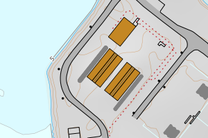
4631 Alver | a69e2924-3abd-4bd0-8723-dbf4d4e91011 | 318.67 | N: 6749283.68, Ø: 283642.45 | ![Kartbilde fra WMS-tjeneste av avviket](https://wms.geonorge.no/skwms1/wms.topo?VERSION=1.1.1&SERVICE=WMS&REQUEST=GetMap&LAYERS=topo&STYLES=&FORMAT=image/png&SRS=EPSG:25832&BBOX=283567.0,6749233,283717.0,6749333&WIDTH=300&HEIGHT=200) |
4631 Alver | 69e33aae-a60c-446b-b26b-6d3f1854f88b | 313.96 | N: 6747733.36, Ø: 283606.68 | ![Kartbilde fra WMS-tjeneste av avviket](https://wms.geonorge.no/skwms1/wms.topo?VERSION=1.1.1&SERVICE=WMS&REQUEST=GetMap&LAYERS=topo&STYLES=&FORMAT=image/png&SRS=EPSG:25832&BBOX=283531.0,6747683,283681.0,6747783&WIDTH=300&HEIGHT=200) |
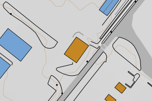
4631 Alver | 633c84b3-f818-43b8-bb61-498f3859c115 | 303.82 | N: 6747777.99, Ø: 283514.97 | ![Kartbilde fra WMS-tjeneste av avviket](https://wms.geonorge.no/skwms1/wms.topo?VERSION=1.1.1&SERVICE=WMS&REQUEST=GetMap&LAYERS=topo&STYLES=&FORMAT=image/png&SRS=EPSG:25832&BBOX=283439.0,6747727,283589.0,6747827&WIDTH=300&HEIGHT=200) |
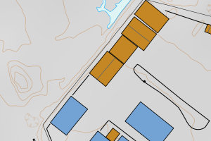
4631 Alver | 2c2ea6c8-20c6-4700-9404-15d14c225dcc | 302.32 | N: 6747802.82, Ø: 283538.07 | ![Kartbilde fra WMS-tjeneste av avviket](https://wms.geonorge.no/skwms1/wms.topo?VERSION=1.1.1&SERVICE=WMS&REQUEST=GetMap&LAYERS=topo&STYLES=&FORMAT=image/png&SRS=EPSG:25832&BBOX=283463.0,6747752,283613.0,6747852&WIDTH=300&HEIGHT=200) |
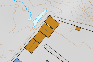
4631 Alver | 362ead62-f161-4184-a57a-ab7f3e4cc500 | 297.53 | N: 6748849.51, Ø: 284140.75 | ![Kartbilde fra WMS-tjeneste av avviket](https://wms.geonorge.no/skwms1/wms.topo?VERSION=1.1.1&SERVICE=WMS&REQUEST=GetMap&LAYERS=topo&STYLES=&FORMAT=image/png&SRS=EPSG:25832&BBOX=284065.0,6748799,284215.0,6748899&WIDTH=300&HEIGHT=200) |
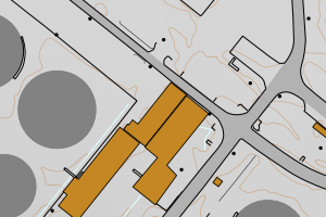
4631 Alver | 4665aff0-cc62-410f-8f26-5f43779fd777 | 297.39 | N: 6748698.75, Ø: 284450.89 | ![Kartbilde fra WMS-tjeneste av avviket](https://wms.geonorge.no/skwms1/wms.topo?VERSION=1.1.1&SERVICE=WMS&REQUEST=GetMap&LAYERS=topo&STYLES=&FORMAT=image/png&SRS=EPSG:25832&BBOX=284375.0,6748648,284525.0,6748748&WIDTH=300&HEIGHT=200) |
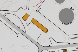
4631 Alver | 90fe861d-6a3f-4170-8e04-6384f3b48ad6 | 297.22 | N: 6734589.98, Ø: 311730.10 | ![Kartbilde fra WMS-tjeneste av avviket](https://wms.geonorge.no/skwms1/wms.topo?VERSION=1.1.1&SERVICE=WMS&REQUEST=GetMap&LAYERS=topo&STYLES=&FORMAT=image/png&SRS=EPSG:25832&BBOX=311655.0,6734539,311805.0,6734639&WIDTH=300&HEIGHT=200) |
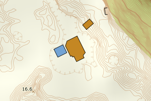
4631 Alver | a2ce20b8-726b-48f9-a879-a16186092fb0 | 293.46 | N: 6717324.70, Ø: 293907.18 | ![Kartbilde fra WMS-tjeneste av avviket](https://wms.geonorge.no/skwms1/wms.topo?VERSION=1.1.1&SERVICE=WMS&REQUEST=GetMap&LAYERS=topo&STYLES=&FORMAT=image/png&SRS=EPSG:25832&BBOX=293832.0,6717274,293982.0,6717374&WIDTH=300&HEIGHT=200) |
4631 Alver | d402fb59-ef1d-4d38-929a-f10a488876ec | 291.57 | N: 6748672.97, Ø: 284067.53 | ![Kartbilde fra WMS-tjeneste av avviket](https://wms.geonorge.no/skwms1/wms.topo?VERSION=1.1.1&SERVICE=WMS&REQUEST=GetMap&LAYERS=topo&STYLES=&FORMAT=image/png&SRS=EPSG:25832&BBOX=283992.0,6748622,284142.0,6748722&WIDTH=300&HEIGHT=200) |
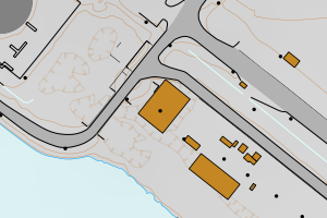
4631 Alver | 322826da-dbb2-46de-8f5b-eba3c150f1cc | 284.32 | N: 6746356.94, Ø: 284395.08 | ![Kartbilde fra WMS-tjeneste av avviket](https://wms.geonorge.no/skwms1/wms.topo?VERSION=1.1.1&SERVICE=WMS&REQUEST=GetMap&LAYERS=topo&STYLES=&FORMAT=image/png&SRS=EPSG:25832&BBOX=284320.0,6746306,284470.0,6746406&WIDTH=300&HEIGHT=200) |
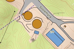
4631 Alver | ff615d50-0de1-468f-9392-48fc5e86e525 | 273.44 | N: 6747815.02, Ø: 283547.11 | ![Kartbilde fra WMS-tjeneste av avviket](https://wms.geonorge.no/skwms1/wms.topo?VERSION=1.1.1&SERVICE=WMS&REQUEST=GetMap&LAYERS=topo&STYLES=&FORMAT=image/png&SRS=EPSG:25832&BBOX=283472.0,6747765,283622.0,6747865&WIDTH=300&HEIGHT=200) |
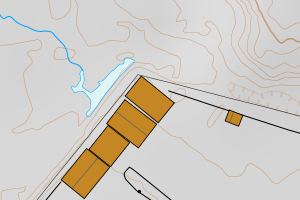
4631 Alver | 26327d4e-f898-421c-abe4-eefcefc46a2d | 271.28 | N: 6749188.35, Ø: 283777.00 | ![Kartbilde fra WMS-tjeneste av avviket](https://wms.geonorge.no/skwms1/wms.topo?VERSION=1.1.1&SERVICE=WMS&REQUEST=GetMap&LAYERS=topo&STYLES=&FORMAT=image/png&SRS=EPSG:25832&BBOX=283701.0,6749138,283851.0,6749238&WIDTH=300&HEIGHT=200) |
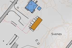
4631 Alver | 0ce78ebf-1c37-4be4-8f90-e0e35c02e1c2 | 269.52 | N: 6745833.10, Ø: 284094.44 | ![Kartbilde fra WMS-tjeneste av avviket](https://wms.geonorge.no/skwms1/wms.topo?VERSION=1.1.1&SERVICE=WMS&REQUEST=GetMap&LAYERS=topo&STYLES=&FORMAT=image/png&SRS=EPSG:25832&BBOX=284019.0,6745783,284169.0,6745883&WIDTH=300&HEIGHT=200) |
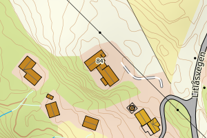
4631 Alver | 86bb5ed5-c16d-4194-abaa-7ec82a14df35 | 267.31 | N: 6747912.66, Ø: 283962.53 | ![Kartbilde fra WMS-tjeneste av avviket](https://wms.geonorge.no/skwms1/wms.topo?VERSION=1.1.1&SERVICE=WMS&REQUEST=GetMap&LAYERS=topo&STYLES=&FORMAT=image/png&SRS=EPSG:25832&BBOX=283887.0,6747862,284037.0,6747962&WIDTH=300&HEIGHT=200) |
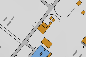
4631 Alver | 01792355-e25c-410f-a2c9-5c18cd343560 | 257.44 | N: 6747943.90, Ø: 284822.88 | ![Kartbilde fra WMS-tjeneste av avviket](https://wms.geonorge.no/skwms1/wms.topo?VERSION=1.1.1&SERVICE=WMS&REQUEST=GetMap&LAYERS=topo&STYLES=&FORMAT=image/png&SRS=EPSG:25832&BBOX=284747.0,6747893,284897.0,6747993&WIDTH=300&HEIGHT=200) |
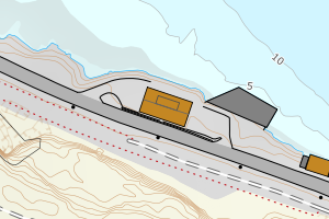
4631 Alver | f8fcb31d-09e4-4304-a556-8c20562be768 | 255.25 | N: 6748299.99, Ø: 284167.11 | ![Kartbilde fra WMS-tjeneste av avviket](https://wms.geonorge.no/skwms1/wms.topo?VERSION=1.1.1&SERVICE=WMS&REQUEST=GetMap&LAYERS=topo&STYLES=&FORMAT=image/png&SRS=EPSG:25832&BBOX=284092.0,6748249,284242.0,6748349&WIDTH=300&HEIGHT=200) |
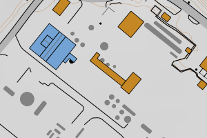
4631 Alver | e7201394-678d-4644-97a9-3763fd09a0e9 | 254.68 | N: 6747598.84, Ø: 283573.19 | ![Kartbilde fra WMS-tjeneste av avviket](https://wms.geonorge.no/skwms1/wms.topo?VERSION=1.1.1&SERVICE=WMS&REQUEST=GetMap&LAYERS=topo&STYLES=&FORMAT=image/png&SRS=EPSG:25832&BBOX=283498.0,6747548,283648.0,6747648&WIDTH=300&HEIGHT=200) |
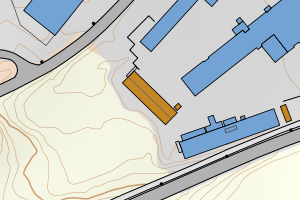
4631 Alver | dc3765a6-9bd5-4c18-89fa-8260d39207d7 | 253.03 | N: 6746373.71, Ø: 284377.16 | ![Kartbilde fra WMS-tjeneste av avviket](https://wms.geonorge.no/skwms1/wms.topo?VERSION=1.1.1&SERVICE=WMS&REQUEST=GetMap&LAYERS=topo&STYLES=&FORMAT=image/png&SRS=EPSG:25832&BBOX=284302.0,6746323,284452.0,6746423&WIDTH=300&HEIGHT=200) |
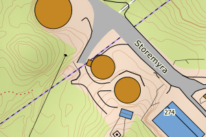
4631 Alver | f1f90688-6eb1-4fcd-9912-9b10eb163860 | 249.60 | N: 6748445.80, Ø: 284580.44 | ![Kartbilde fra WMS-tjeneste av avviket](https://wms.geonorge.no/skwms1/wms.topo?VERSION=1.1.1&SERVICE=WMS&REQUEST=GetMap&LAYERS=topo&STYLES=&FORMAT=image/png&SRS=EPSG:25832&BBOX=284505.0,6748395,284655.0,6748495&WIDTH=300&HEIGHT=200) |
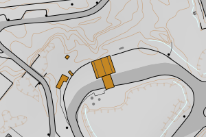
4631 Alver | 848a6f34-19e0-4c02-85b8-b30bb3eb66dd | 249.31 | N: 6715099.47, Ø: 292295.73 | ![Kartbilde fra WMS-tjeneste av avviket](https://wms.geonorge.no/skwms1/wms.topo?VERSION=1.1.1&SERVICE=WMS&REQUEST=GetMap&LAYERS=topo&STYLES=&FORMAT=image/png&SRS=EPSG:25832&BBOX=292220.0,6715049,292370.0,6715149&WIDTH=300&HEIGHT=200) |
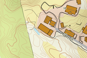
4631 Alver | 61808f03-6d42-4776-b7ca-adad3a43dabe | 249.12 | N: 6745764.88, Ø: 285892.57 | ![Kartbilde fra WMS-tjeneste av avviket](https://wms.geonorge.no/skwms1/wms.topo?VERSION=1.1.1&SERVICE=WMS&REQUEST=GetMap&LAYERS=topo&STYLES=&FORMAT=image/png&SRS=EPSG:25832&BBOX=285817.0,6745714,285967.0,6745814&WIDTH=300&HEIGHT=200) |
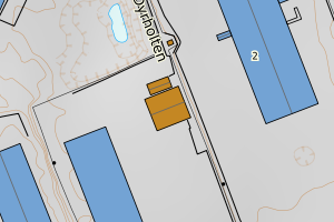
4631 Alver | 823d68f7-4c1b-4b34-b346-fdee145ec6ad | 248.72 | N: 6748146.50, Ø: 284494.63 | ![Kartbilde fra WMS-tjeneste av avviket](https://wms.geonorge.no/skwms1/wms.topo?VERSION=1.1.1&SERVICE=WMS&REQUEST=GetMap&LAYERS=topo&STYLES=&FORMAT=image/png&SRS=EPSG:25832&BBOX=284419.0,6748096,284569.0,6748196&WIDTH=300&HEIGHT=200) |
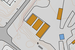
4631 Alver | 2bcad33f-44d0-41af-95f9-0f8fba05634a | 245.68 | N: 6748155.88, Ø: 284482.79 | ![Kartbilde fra WMS-tjeneste av avviket](https://wms.geonorge.no/skwms1/wms.topo?VERSION=1.1.1&SERVICE=WMS&REQUEST=GetMap&LAYERS=topo&STYLES=&FORMAT=image/png&SRS=EPSG:25832&BBOX=284407.0,6748105,284557.0,6748205&WIDTH=300&HEIGHT=200) |
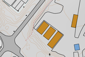
4631 Alver | bf50c243-6634-44a9-aad5-ec757106fb57 | 244.04 | N: 6747722.10, Ø: 284331.85 | ![Kartbilde fra WMS-tjeneste av avviket](https://wms.geonorge.no/skwms1/wms.topo?VERSION=1.1.1&SERVICE=WMS&REQUEST=GetMap&LAYERS=topo&STYLES=&FORMAT=image/png&SRS=EPSG:25832&BBOX=284256.0,6747672,284406.0,6747772&WIDTH=300&HEIGHT=200) |
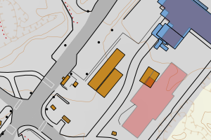
4631 Alver | 5d9cb83d-f3fb-43dc-9878-631377f24138 | 230.40 | N: 6748320.14, Ø: 284537.51 | ![Kartbilde fra WMS-tjeneste av avviket](https://wms.geonorge.no/skwms1/wms.topo?VERSION=1.1.1&SERVICE=WMS&REQUEST=GetMap&LAYERS=topo&STYLES=&FORMAT=image/png&SRS=EPSG:25832&BBOX=284462.0,6748270,284612.0,6748370&WIDTH=300&HEIGHT=200) |
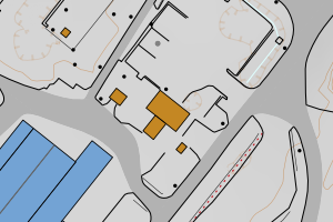
4631 Alver | 1d248340-bccf-43ea-aa3d-a322d7292375 | 230.05 | N: 6746843.55, Ø: 284805.64 | ![Kartbilde fra WMS-tjeneste av avviket](https://wms.geonorge.no/skwms1/wms.topo?VERSION=1.1.1&SERVICE=WMS&REQUEST=GetMap&LAYERS=topo&STYLES=&FORMAT=image/png&SRS=EPSG:25832&BBOX=284730.0,6746793,284880.0,6746893&WIDTH=300&HEIGHT=200) |
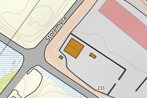
4631 Alver | a9ee0ccd-b29f-4aaf-9245-401e7f1121ac | 225.66 | N: 6748122.43, Ø: 284244.91 | ![Kartbilde fra WMS-tjeneste av avviket](https://wms.geonorge.no/skwms1/wms.topo?VERSION=1.1.1&SERVICE=WMS&REQUEST=GetMap&LAYERS=topo&STYLES=&FORMAT=image/png&SRS=EPSG:25832&BBOX=284169.0,6748072,284319.0,6748172&WIDTH=300&HEIGHT=200) |
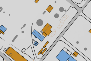
4631 Alver | 5f71b112-7f4c-4f69-bc50-44207a458710 | 218.59 | N: 6746774.97, Ø: 284902.28 | ![Kartbilde fra WMS-tjeneste av avviket](https://wms.geonorge.no/skwms1/wms.topo?VERSION=1.1.1&SERVICE=WMS&REQUEST=GetMap&LAYERS=topo&STYLES=&FORMAT=image/png&SRS=EPSG:25832&BBOX=284827.0,6746724,284977.0,6746824&WIDTH=300&HEIGHT=200) |
4631 Alver | e4c7e55f-a0c9-4078-8e51-2779135ddba3 | 218.11 | N: 6748145.80, Ø: 284060.30 | ![Kartbilde fra WMS-tjeneste av avviket](https://wms.geonorge.no/skwms1/wms.topo?VERSION=1.1.1&SERVICE=WMS&REQUEST=GetMap&LAYERS=topo&STYLES=&FORMAT=image/png&SRS=EPSG:25832&BBOX=283985.0,6748095,284135.0,6748195&WIDTH=300&HEIGHT=200) |
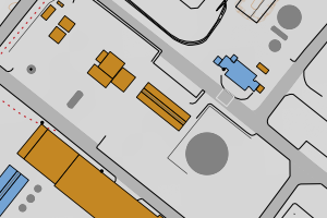
4631 Alver | dac3330d-7c72-4edd-8d80-35e7eba4ce4e | 214.03 | N: 6747791.73, Ø: 283526.90 | ![Kartbilde fra WMS-tjeneste av avviket](https://wms.geonorge.no/skwms1/wms.topo?VERSION=1.1.1&SERVICE=WMS&REQUEST=GetMap&LAYERS=topo&STYLES=&FORMAT=image/png&SRS=EPSG:25832&BBOX=283451.0,6747741,283601.0,6747841&WIDTH=300&HEIGHT=200) |
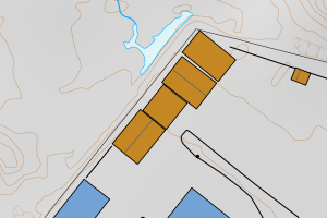
4631 Alver | b014d899-d675-434d-9c4c-a37196e6c01a | 213.84 | N: 6723849.66, Ø: 302980.39 | ![Kartbilde fra WMS-tjeneste av avviket](https://wms.geonorge.no/skwms1/wms.topo?VERSION=1.1.1&SERVICE=WMS&REQUEST=GetMap&LAYERS=topo&STYLES=&FORMAT=image/png&SRS=EPSG:25832&BBOX=302905.0,6723799,303055.0,6723899&WIDTH=300&HEIGHT=200) |
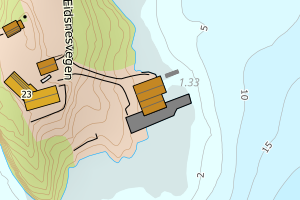
4631 Alver | 02123172-efde-4d6a-ac77-d2615f4503e1 | 210.88 | N: 6748708.06, Ø: 284655.94 | ![Kartbilde fra WMS-tjeneste av avviket](https://wms.geonorge.no/skwms1/wms.topo?VERSION=1.1.1&SERVICE=WMS&REQUEST=GetMap&LAYERS=topo&STYLES=&FORMAT=image/png&SRS=EPSG:25832&BBOX=284580.0,6748658,284730.0,6748758&WIDTH=300&HEIGHT=200) |
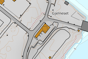
4631 Alver | c4225e97-e031-46e5-9df2-fa2e63ee9d0e | 206.73 | N: 6742018.84, Ø: 275788.00 | ![Kartbilde fra WMS-tjeneste av avviket](https://wms.geonorge.no/skwms1/wms.topo?VERSION=1.1.1&SERVICE=WMS&REQUEST=GetMap&LAYERS=topo&STYLES=&FORMAT=image/png&SRS=EPSG:25832&BBOX=275712.0,6741968,275862.0,6742068&WIDTH=300&HEIGHT=200) |
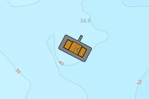
4631 Alver | df637e7d-ebf3-4774-bfe7-b02ba33bbc9b | 204.51 | N: 6748640.74, Ø: 284090.64 | ![Kartbilde fra WMS-tjeneste av avviket](https://wms.geonorge.no/skwms1/wms.topo?VERSION=1.1.1&SERVICE=WMS&REQUEST=GetMap&LAYERS=topo&STYLES=&FORMAT=image/png&SRS=EPSG:25832&BBOX=284015.0,6748590,284165.0,6748690&WIDTH=300&HEIGHT=200) |
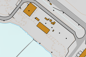
4631 Alver | 0009fa9d-0869-46bf-bb89-c4cf870542e2 | 203.34 | N: 6748760.96, Ø: 284575.59 | ![Kartbilde fra WMS-tjeneste av avviket](https://wms.geonorge.no/skwms1/wms.topo?VERSION=1.1.1&SERVICE=WMS&REQUEST=GetMap&LAYERS=topo&STYLES=&FORMAT=image/png&SRS=EPSG:25832&BBOX=284500.0,6748710,284650.0,6748810&WIDTH=300&HEIGHT=200) |