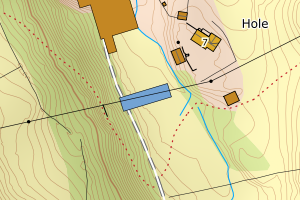
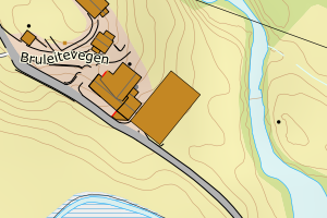
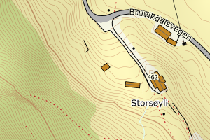
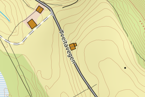
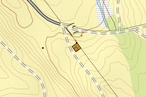
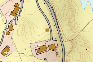
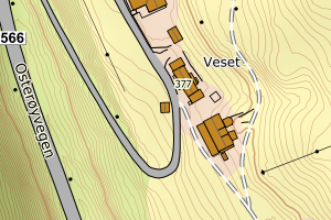
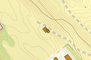
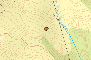
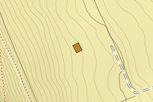
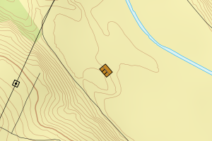
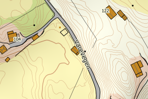
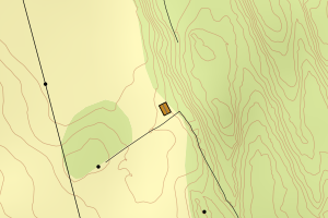
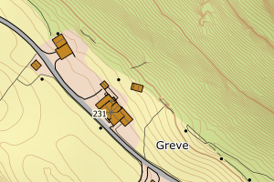
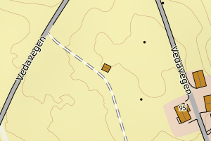
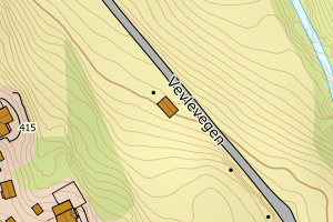
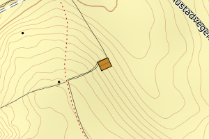
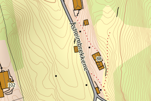
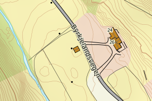
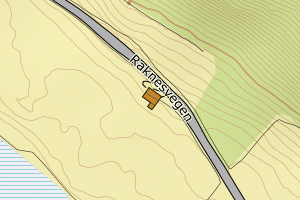
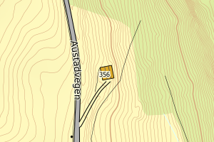
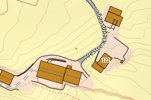
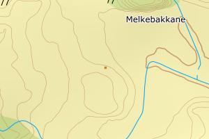
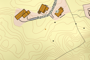
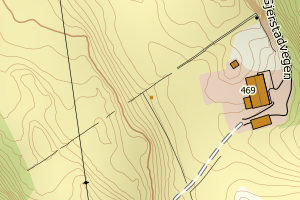
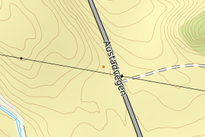
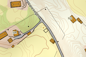
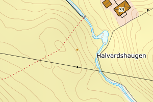
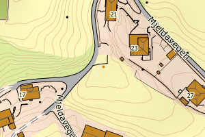
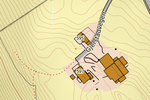
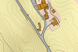
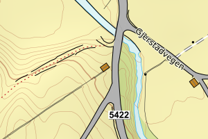
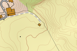
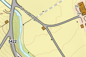
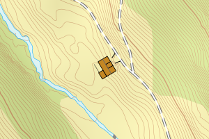
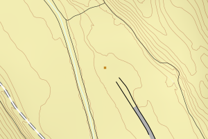
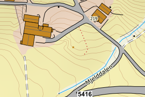
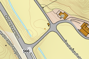
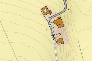
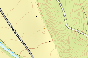
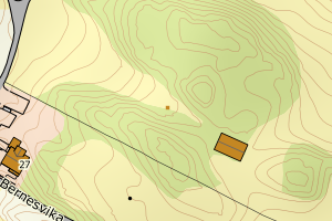
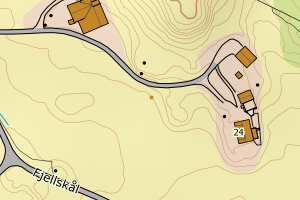
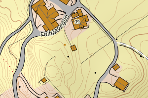
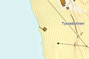
Avvikene kan skyldes enten feil bygningskoordinat eller bygningstype/status i matrikkel eller feil arealtype i AR5. Vær oppmerksom på det er krav om arealer på over 200 m2 før det er krav om endring av arealtype i AR5 så avvikene vil ikke alltid kreve retting i datagrunnlaget
Kommune | LokalId | Bygningsnummer | Arealtype | Bygningstatus | Bygningstype | matrikkel_vedtaksdato | Posisjon | WMS-bilde |
4630 Osterøy | f6a1eca3-0278-4dd9-952f-4fb460672166 | 175889825 | 21 | TB | 249 | None | N: 6709424.00, Ø: 309924.00 | ![Kartbilde fra WMS-tjeneste av avviket](https://wms.geonorge.no/skwms1/wms.topo?VERSION=1.1.1&SERVICE=WMS&REQUEST=GetMap&LAYERS=topo&STYLES=&FORMAT=image/png&SRS=EPSG:25832&BBOX=309848.0,6709373,309998.0,6709473&WIDTH=300&HEIGHT=200) |
4630 Osterøy | 2b9bd94c-bb68-456a-a737-903592b8661b | 175902872 | 21 | TB | 249 | None | N: 6720877.00, Ø: 307796.00 | ![Kartbilde fra WMS-tjeneste av avviket](https://wms.geonorge.no/skwms1/wms.topo?VERSION=1.1.1&SERVICE=WMS&REQUEST=GetMap&LAYERS=topo&STYLES=&FORMAT=image/png&SRS=EPSG:25832&BBOX=307720.0,6720826,307870.0,6720926&WIDTH=300&HEIGHT=200) |
4630 Osterøy | 8b6fffeb-685c-45b3-9cac-7cf9911dc671 | 175951199 | 21 | TB | 249 | None | N: 6710660.00, Ø: 310619.00 | ![Kartbilde fra WMS-tjeneste av avviket](https://wms.geonorge.no/skwms1/wms.topo?VERSION=1.1.1&SERVICE=WMS&REQUEST=GetMap&LAYERS=topo&STYLES=&FORMAT=image/png&SRS=EPSG:25832&BBOX=310543.0,6710609,310693.0,6710709&WIDTH=300&HEIGHT=200) |
4630 Osterøy | db56c04b-67f5-421a-bb34-69ce92b0a094 | 175864563 | 21 | TB | 249 | None | N: 6715030.00, Ø: 305951.00 | ![Kartbilde fra WMS-tjeneste av avviket](https://wms.geonorge.no/skwms1/wms.topo?VERSION=1.1.1&SERVICE=WMS&REQUEST=GetMap&LAYERS=topo&STYLES=&FORMAT=image/png&SRS=EPSG:25832&BBOX=305875.0,6714979,306025.0,6715079&WIDTH=300&HEIGHT=200) |
4630 Osterøy | 7d281a26-cefd-48b8-a26d-dfbc08207410 | 175885072 | 21 | TB | 249 | None | N: 6711355.00, Ø: 309122.00 | ![Kartbilde fra WMS-tjeneste av avviket](https://wms.geonorge.no/skwms1/wms.topo?VERSION=1.1.1&SERVICE=WMS&REQUEST=GetMap&LAYERS=topo&STYLES=&FORMAT=image/png&SRS=EPSG:25832&BBOX=309046.0,6711304,309196.0,6711404&WIDTH=300&HEIGHT=200) |
4630 Osterøy | 0242fb1b-a18a-4ec6-b9c6-4cfef1be1c3d | 175905383 | 21 | TB | 249 | None | N: 6720755.00, Ø: 311909.00 | ![Kartbilde fra WMS-tjeneste av avviket](https://wms.geonorge.no/skwms1/wms.topo?VERSION=1.1.1&SERVICE=WMS&REQUEST=GetMap&LAYERS=topo&STYLES=&FORMAT=image/png&SRS=EPSG:25832&BBOX=311833.0,6720704,311983.0,6720804&WIDTH=300&HEIGHT=200) |
4630 Osterøy | 22eb4a22-e2b8-48f2-b271-959fc307261f | 175907459 | 21 | TB | 181 | None | N: 6718199.00, Ø: 310427.00 | ![Kartbilde fra WMS-tjeneste av avviket](https://wms.geonorge.no/skwms1/wms.topo?VERSION=1.1.1&SERVICE=WMS&REQUEST=GetMap&LAYERS=topo&STYLES=&FORMAT=image/png&SRS=EPSG:25832&BBOX=310351.0,6718148,310501.0,6718248&WIDTH=300&HEIGHT=200) |
4630 Osterøy | 6a323756-74ec-4f15-acb7-fe1da71ea1e1 | 175947345 | 21 | TB | 181 | None | N: 6707852.00, Ø: 310203.00 | ![Kartbilde fra WMS-tjeneste av avviket](https://wms.geonorge.no/skwms1/wms.topo?VERSION=1.1.1&SERVICE=WMS&REQUEST=GetMap&LAYERS=topo&STYLES=&FORMAT=image/png&SRS=EPSG:25832&BBOX=310127.0,6707801,310277.0,6707901&WIDTH=300&HEIGHT=200) |
4630 Osterøy | 6b2c6c81-a29b-40a5-96bd-33713f2b103e | 175889051 | 21 | TB | 249 | None | N: 6708301.00, Ø: 310905.00 | ![Kartbilde fra WMS-tjeneste av avviket](https://wms.geonorge.no/skwms1/wms.topo?VERSION=1.1.1&SERVICE=WMS&REQUEST=GetMap&LAYERS=topo&STYLES=&FORMAT=image/png&SRS=EPSG:25832&BBOX=310829.0,6708250,310979.0,6708350&WIDTH=300&HEIGHT=200) |
4630 Osterøy | 6cac0aea-f6ce-4690-a2e8-a79347e5e0f8 | 175941304 | 21 | TB | 181 | None | N: 6706477.00, Ø: 307846.00 | ![Kartbilde fra WMS-tjeneste av avviket](https://wms.geonorge.no/skwms1/wms.topo?VERSION=1.1.1&SERVICE=WMS&REQUEST=GetMap&LAYERS=topo&STYLES=&FORMAT=image/png&SRS=EPSG:25832&BBOX=307770.0,6706426,307920.0,6706526&WIDTH=300&HEIGHT=200) |
4630 Osterøy | d1277148-1fd4-4992-941e-1dd8ae9f0d7b | 175889329 | 21 | TB | 249 | None | N: 6709432.00, Ø: 310941.00 | ![Kartbilde fra WMS-tjeneste av avviket](https://wms.geonorge.no/skwms1/wms.topo?VERSION=1.1.1&SERVICE=WMS&REQUEST=GetMap&LAYERS=topo&STYLES=&FORMAT=image/png&SRS=EPSG:25832&BBOX=310865.0,6709381,311015.0,6709481&WIDTH=300&HEIGHT=200) |
4630 Osterøy | 38aefe73-cb37-4719-a4e6-9d9a9380c2ee | 175897607 | 21 | TB | 249 | None | N: 6712899.00, Ø: 307864.00 | ![Kartbilde fra WMS-tjeneste av avviket](https://wms.geonorge.no/skwms1/wms.topo?VERSION=1.1.1&SERVICE=WMS&REQUEST=GetMap&LAYERS=topo&STYLES=&FORMAT=image/png&SRS=EPSG:25832&BBOX=307788.0,6712848,307938.0,6712948&WIDTH=300&HEIGHT=200) |
4630 Osterøy | e0eed1aa-738f-4d2f-93c2-ce2b079a1ac5 | 175889868 | 21 | TB | 249 | None | N: 6709381.00, Ø: 310095.00 | ![Kartbilde fra WMS-tjeneste av avviket](https://wms.geonorge.no/skwms1/wms.topo?VERSION=1.1.1&SERVICE=WMS&REQUEST=GetMap&LAYERS=topo&STYLES=&FORMAT=image/png&SRS=EPSG:25832&BBOX=310019.0,6709330,310169.0,6709430&WIDTH=300&HEIGHT=200) |
4630 Osterøy | e63dd3d8-502c-4412-b253-ad1c05223845 | 175905375 | 21 | TB | 241 | None | N: 6720776.00, Ø: 311894.00 | ![Kartbilde fra WMS-tjeneste av avviket](https://wms.geonorge.no/skwms1/wms.topo?VERSION=1.1.1&SERVICE=WMS&REQUEST=GetMap&LAYERS=topo&STYLES=&FORMAT=image/png&SRS=EPSG:25832&BBOX=311818.0,6720725,311968.0,6720825&WIDTH=300&HEIGHT=200) |
4630 Osterøy | 114cdec8-be63-4a3c-aa08-910c9788a3ed | 175912967 | 21 | TB | 249 | None | N: 6723916.00, Ø: 309311.00 | ![Kartbilde fra WMS-tjeneste av avviket](https://wms.geonorge.no/skwms1/wms.topo?VERSION=1.1.1&SERVICE=WMS&REQUEST=GetMap&LAYERS=topo&STYLES=&FORMAT=image/png&SRS=EPSG:25832&BBOX=309235.0,6723865,309385.0,6723965&WIDTH=300&HEIGHT=200) |
4630 Osterøy | a86b8fdc-3cda-4a42-96f2-1abc02aac534 | 175901760 | 21 | TB | 241 | None | N: 6713220.00, Ø: 306414.00 | ![Kartbilde fra WMS-tjeneste av avviket](https://wms.geonorge.no/skwms1/wms.topo?VERSION=1.1.1&SERVICE=WMS&REQUEST=GetMap&LAYERS=topo&STYLES=&FORMAT=image/png&SRS=EPSG:25832&BBOX=306338.0,6713169,306488.0,6713269&WIDTH=300&HEIGHT=200) |
4630 Osterøy | 48c6de70-4f50-423f-984a-eea8d315991d | 175923446 | 21 | TB | 249 | None | N: 6712810.20, Ø: 316108.30 | ![Kartbilde fra WMS-tjeneste av avviket](https://wms.geonorge.no/skwms1/wms.topo?VERSION=1.1.1&SERVICE=WMS&REQUEST=GetMap&LAYERS=topo&STYLES=&FORMAT=image/png&SRS=EPSG:25832&BBOX=316033.0,6712760,316183.0,6712860&WIDTH=300&HEIGHT=200) |
4630 Osterøy | 3afcc6a9-f1e4-49a1-8a2b-7e48092e4d82 | 175949569 | 21 | TB | 249 | None | N: 6714681.00, Ø: 306365.00 | ![Kartbilde fra WMS-tjeneste av avviket](https://wms.geonorge.no/skwms1/wms.topo?VERSION=1.1.1&SERVICE=WMS&REQUEST=GetMap&LAYERS=topo&STYLES=&FORMAT=image/png&SRS=EPSG:25832&BBOX=306289.0,6714630,306439.0,6714730&WIDTH=300&HEIGHT=200) |
4630 Osterøy | 3eb359ce-a050-457f-9159-939208a748a8 | 175889337 | 21 | TB | 249 | None | N: 6709503.00, Ø: 311125.00 | ![Kartbilde fra WMS-tjeneste av avviket](https://wms.geonorge.no/skwms1/wms.topo?VERSION=1.1.1&SERVICE=WMS&REQUEST=GetMap&LAYERS=topo&STYLES=&FORMAT=image/png&SRS=EPSG:25832&BBOX=311049.0,6709452,311199.0,6709552&WIDTH=300&HEIGHT=200) |
4630 Osterøy | 4450a88a-6d30-49ed-9a67-fd3a6a28f4da | 175886443 | 21 | TB | 241 | None | N: 6709808.00, Ø: 309697.00 | ![Kartbilde fra WMS-tjeneste av avviket](https://wms.geonorge.no/skwms1/wms.topo?VERSION=1.1.1&SERVICE=WMS&REQUEST=GetMap&LAYERS=topo&STYLES=&FORMAT=image/png&SRS=EPSG:25832&BBOX=309621.0,6709757,309771.0,6709857&WIDTH=300&HEIGHT=200) |
4630 Osterøy | 92fc1076-7ec0-4829-b218-11c54821e3c0 | 175901701 | 21 | TB | 249 | None | N: 6713229.00, Ø: 306213.00 | ![Kartbilde fra WMS-tjeneste av avviket](https://wms.geonorge.no/skwms1/wms.topo?VERSION=1.1.1&SERVICE=WMS&REQUEST=GetMap&LAYERS=topo&STYLES=&FORMAT=image/png&SRS=EPSG:25832&BBOX=306137.0,6713178,306287.0,6713278&WIDTH=300&HEIGHT=200) |
4630 Osterøy | 9c0ff520-0d5b-43d6-a79b-3e218a5758a9 | 175863818 | 21 | TB | 249 | None | N: 6716624.00, Ø: 303438.00 | ![Kartbilde fra WMS-tjeneste av avviket](https://wms.geonorge.no/skwms1/wms.topo?VERSION=1.1.1&SERVICE=WMS&REQUEST=GetMap&LAYERS=topo&STYLES=&FORMAT=image/png&SRS=EPSG:25832&BBOX=303362.0,6716573,303512.0,6716673&WIDTH=300&HEIGHT=200) |
4630 Osterøy | f8bc7280-29fb-4a43-9a06-0e376b54a933 | 175897690 | 21 | TB | 249 | None | N: 6714241.00, Ø: 309313.00 | ![Kartbilde fra WMS-tjeneste av avviket](https://wms.geonorge.no/skwms1/wms.topo?VERSION=1.1.1&SERVICE=WMS&REQUEST=GetMap&LAYERS=topo&STYLES=&FORMAT=image/png&SRS=EPSG:25832&BBOX=309237.0,6714190,309387.0,6714290&WIDTH=300&HEIGHT=200) |
4630 Osterøy | fc7b73e2-d2c3-491e-a8ca-0a33d38a95a6 | 175951202 | 21 | TB | 249 | None | N: 6710650.00, Ø: 310683.00 | ![Kartbilde fra WMS-tjeneste av avviket](https://wms.geonorge.no/skwms1/wms.topo?VERSION=1.1.1&SERVICE=WMS&REQUEST=GetMap&LAYERS=topo&STYLES=&FORMAT=image/png&SRS=EPSG:25832&BBOX=310607.0,6710599,310757.0,6710699&WIDTH=300&HEIGHT=200) |
4630 Osterøy | 60de5f67-b9d8-4ff6-9b19-a361487716d9 | 175879641 | 21 | TB | 241 | None | N: 6706872.00, Ø: 308464.00 | ![Kartbilde fra WMS-tjeneste av avviket](https://wms.geonorge.no/skwms1/wms.topo?VERSION=1.1.1&SERVICE=WMS&REQUEST=GetMap&LAYERS=topo&STYLES=&FORMAT=image/png&SRS=EPSG:25832&BBOX=308388.0,6706821,308538.0,6706921&WIDTH=300&HEIGHT=200) |
4630 Osterøy | b6882963-6133-4a7d-aafa-3659e00d3d86 | 175948996 | 21 | TB | 181 | None | N: 6710553.00, Ø: 310564.00 | ![Kartbilde fra WMS-tjeneste av avviket](https://wms.geonorge.no/skwms1/wms.topo?VERSION=1.1.1&SERVICE=WMS&REQUEST=GetMap&LAYERS=topo&STYLES=&FORMAT=image/png&SRS=EPSG:25832&BBOX=310488.0,6710502,310638.0,6710602&WIDTH=300&HEIGHT=200) |
4630 Osterøy | 5c83d6c8-6940-482c-b007-5650075a429f | 175899227 | 21 | TB | 249 | None | N: 6712362.00, Ø: 309217.00 | ![Kartbilde fra WMS-tjeneste av avviket](https://wms.geonorge.no/skwms1/wms.topo?VERSION=1.1.1&SERVICE=WMS&REQUEST=GetMap&LAYERS=topo&STYLES=&FORMAT=image/png&SRS=EPSG:25832&BBOX=309141.0,6712311,309291.0,6712411&WIDTH=300&HEIGHT=200) |
4630 Osterøy | 5d155257-3805-46b8-b197-15028b1ffe8e | 175907203 | 21 | TB | 181 | None | N: 6718787.00, Ø: 307006.00 | ![Kartbilde fra WMS-tjeneste av avviket](https://wms.geonorge.no/skwms1/wms.topo?VERSION=1.1.1&SERVICE=WMS&REQUEST=GetMap&LAYERS=topo&STYLES=&FORMAT=image/png&SRS=EPSG:25832&BBOX=306930.0,6718736,307080.0,6718836&WIDTH=300&HEIGHT=200) |
4630 Osterøy | a688a696-6b67-4c8b-a0f1-ce52f34501d4 | 175874216 | 21 | TB | 181 | None | N: 6717550.00, Ø: 302966.00 | ![Kartbilde fra WMS-tjeneste av avviket](https://wms.geonorge.no/skwms1/wms.topo?VERSION=1.1.1&SERVICE=WMS&REQUEST=GetMap&LAYERS=topo&STYLES=&FORMAT=image/png&SRS=EPSG:25832&BBOX=302890.0,6717499,303040.0,6717599&WIDTH=300&HEIGHT=200) |
4630 Osterøy | d182b51e-ba9d-4054-bcc8-c84c0ae01fef | 175882081 | 21 | TB | 161 | None | N: 6706863.00, Ø: 311438.00 | ![Kartbilde fra WMS-tjeneste av avviket](https://wms.geonorge.no/skwms1/wms.topo?VERSION=1.1.1&SERVICE=WMS&REQUEST=GetMap&LAYERS=topo&STYLES=&FORMAT=image/png&SRS=EPSG:25832&BBOX=311362.0,6706813,311512.0,6706913&WIDTH=300&HEIGHT=200) |
4630 Osterøy | 1592c66f-b56b-4e66-9ca6-a31a87d4e2e7 | 175943013 | 21 | TB | 249 | None | N: 6708229.00, Ø: 309793.00 | ![Kartbilde fra WMS-tjeneste av avviket](https://wms.geonorge.no/skwms1/wms.topo?VERSION=1.1.1&SERVICE=WMS&REQUEST=GetMap&LAYERS=topo&STYLES=&FORMAT=image/png&SRS=EPSG:25832&BBOX=309717.0,6708178,309867.0,6708278&WIDTH=300&HEIGHT=200) |
4630 Osterøy | 16ee29ce-7f2a-4da0-a3a1-725052292f1a | 175880054 | 21 | TB | 241 | None | N: 6707107.00, Ø: 308265.00 | ![Kartbilde fra WMS-tjeneste av avviket](https://wms.geonorge.no/skwms1/wms.topo?VERSION=1.1.1&SERVICE=WMS&REQUEST=GetMap&LAYERS=topo&STYLES=&FORMAT=image/png&SRS=EPSG:25832&BBOX=308189.0,6707056,308339.0,6707156&WIDTH=300&HEIGHT=200) |
4630 Osterøy | 1db0662f-d22b-4fa6-a512-00caa5a74830 | 175889760 | 21 | TB | 241 | None | N: 6709202.00, Ø: 309200.00 | ![Kartbilde fra WMS-tjeneste av avviket](https://wms.geonorge.no/skwms1/wms.topo?VERSION=1.1.1&SERVICE=WMS&REQUEST=GetMap&LAYERS=topo&STYLES=&FORMAT=image/png&SRS=EPSG:25832&BBOX=309124.0,6709151,309274.0,6709251&WIDTH=300&HEIGHT=200) |
4630 Osterøy | 2113cdb5-50d4-47e3-b578-96ea960c077f | 175886990 | 21 | TB | 241 | None | N: 6709673.00, Ø: 310942.00 | ![Kartbilde fra WMS-tjeneste av avviket](https://wms.geonorge.no/skwms1/wms.topo?VERSION=1.1.1&SERVICE=WMS&REQUEST=GetMap&LAYERS=topo&STYLES=&FORMAT=image/png&SRS=EPSG:25832&BBOX=310866.0,6709622,311016.0,6709722&WIDTH=300&HEIGHT=200) |
4630 Osterøy | 4ddeeac0-5dc1-4e5d-9460-a496c77b82e0 | 175885854 | 21 | TB | 249 | None | N: 6710591.00, Ø: 310779.00 | ![Kartbilde fra WMS-tjeneste av avviket](https://wms.geonorge.no/skwms1/wms.topo?VERSION=1.1.1&SERVICE=WMS&REQUEST=GetMap&LAYERS=topo&STYLES=&FORMAT=image/png&SRS=EPSG:25832&BBOX=310703.0,6710540,310853.0,6710640&WIDTH=300&HEIGHT=200) |
4630 Osterøy | 55809202-288b-41d3-bcae-c4b18dfbbe65 | 175931635 | 21 | TB | 249 | None | N: 6719774.00, Ø: 305710.00 | ![Kartbilde fra WMS-tjeneste av avviket](https://wms.geonorge.no/skwms1/wms.topo?VERSION=1.1.1&SERVICE=WMS&REQUEST=GetMap&LAYERS=topo&STYLES=&FORMAT=image/png&SRS=EPSG:25832&BBOX=305634.0,6719723,305784.0,6719823&WIDTH=300&HEIGHT=200) |
4630 Osterøy | 5b6dbea4-8285-45b3-b4e3-6baf38cd1853 | 175914668 | 21 | TB | 241 | None | N: 6722316.00, Ø: 310536.00 | ![Kartbilde fra WMS-tjeneste av avviket](https://wms.geonorge.no/skwms1/wms.topo?VERSION=1.1.1&SERVICE=WMS&REQUEST=GetMap&LAYERS=topo&STYLES=&FORMAT=image/png&SRS=EPSG:25832&BBOX=310460.0,6722265,310610.0,6722365&WIDTH=300&HEIGHT=200) |
4630 Osterøy | 63be246f-adf3-443e-a1bb-8b924813f22b | 175921141 | 21 | TB | 249 | None | N: 6715315.00, Ø: 312994.00 | ![Kartbilde fra WMS-tjeneste av avviket](https://wms.geonorge.no/skwms1/wms.topo?VERSION=1.1.1&SERVICE=WMS&REQUEST=GetMap&LAYERS=topo&STYLES=&FORMAT=image/png&SRS=EPSG:25832&BBOX=312918.0,6715264,313068.0,6715364&WIDTH=300&HEIGHT=200) |
4630 Osterøy | bf5b6f51-5275-40d2-8117-8fb880049777 | 175936483 | 21 | TB | 249 | None | N: 6718725.00, Ø: 306916.00 | ![Kartbilde fra WMS-tjeneste av avviket](https://wms.geonorge.no/skwms1/wms.topo?VERSION=1.1.1&SERVICE=WMS&REQUEST=GetMap&LAYERS=topo&STYLES=&FORMAT=image/png&SRS=EPSG:25832&BBOX=306840.0,6718674,306990.0,6718774&WIDTH=300&HEIGHT=200) |
4630 Osterøy | d3f1c2af-129e-4295-b214-388196270dbc | 175949089 | 21 | TB | 241 | None | N: 6711781.00, Ø: 310294.00 | ![Kartbilde fra WMS-tjeneste av avviket](https://wms.geonorge.no/skwms1/wms.topo?VERSION=1.1.1&SERVICE=WMS&REQUEST=GetMap&LAYERS=topo&STYLES=&FORMAT=image/png&SRS=EPSG:25832&BBOX=310218.0,6711730,310368.0,6711830&WIDTH=300&HEIGHT=200) |
4630 Osterøy | dc96fe96-16c8-4dd4-9388-c772185e3083 | 301215140 | 21 | FA | 219 | 2024-08-28 | N: 6720297.10, Ø: 307012.60 | ![Kartbilde fra WMS-tjeneste av avviket](https://wms.geonorge.no/skwms1/wms.topo?VERSION=1.1.1&SERVICE=WMS&REQUEST=GetMap&LAYERS=topo&STYLES=&FORMAT=image/png&SRS=EPSG:25832&BBOX=306937.0,6720247,307087.0,6720347&WIDTH=300&HEIGHT=200) |
4630 Osterøy | 547d6bcd-326a-4a9e-948f-8892672a3c1c | 300914481 | 21 | FA | 241 | 2023-01-17 | N: 6712682.80, Ø: 308849.50 | ![Kartbilde fra WMS-tjeneste av avviket](https://wms.geonorge.no/skwms1/wms.topo?VERSION=1.1.1&SERVICE=WMS&REQUEST=GetMap&LAYERS=topo&STYLES=&FORMAT=image/png&SRS=EPSG:25832&BBOX=308774.0,6712632,308924.0,6712732&WIDTH=300&HEIGHT=200) |
4630 Osterøy | b6e5f853-9f26-4777-9807-83365417be9d | 175923462 | 21 | TB | 181 | 1900-01-01 | N: 6712715.00, Ø: 316021.00 | ![Kartbilde fra WMS-tjeneste av avviket](https://wms.geonorge.no/skwms1/wms.topo?VERSION=1.1.1&SERVICE=WMS&REQUEST=GetMap&LAYERS=topo&STYLES=&FORMAT=image/png&SRS=EPSG:25832&BBOX=315945.0,6712664,316095.0,6712764&WIDTH=300&HEIGHT=200) |