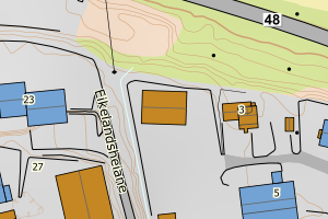
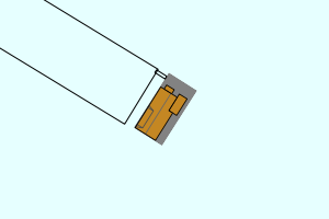
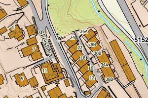
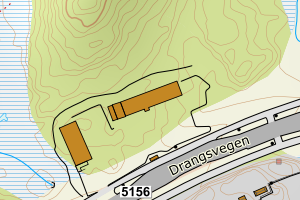
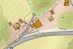
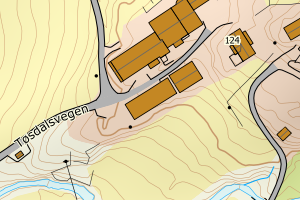
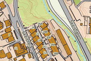
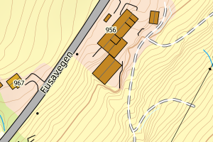
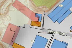
Avvikene skyldes oftest manglende eller unøyaktig registrering av bygningspunkt i matrikkelen. Rettes vanligvis i matrikkelen
Kommune | LokalId | Areal (m2) | Posisjon | WMS-bilde |
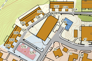
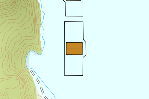
4624 Bjørnafjorden | 1084c907-ec12-474f-96e0-633262d25084 | 1657.30 | N: 6682168.65, Ø: 300948.12 | ![Kartbilde fra WMS-tjeneste av avviket](https://wms.geonorge.no/skwms1/wms.topo?VERSION=1.1.1&SERVICE=WMS&REQUEST=GetMap&LAYERS=topo&STYLES=&FORMAT=image/png&SRS=EPSG:25832&BBOX=300873.0,6682118,301023.0,6682218&WIDTH=300&HEIGHT=200) |
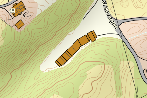
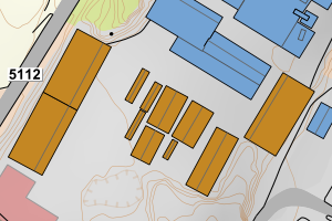
4624 Bjørnafjorden | 96c294e0-5e7e-4788-b2ef-18c4543f1e40 | 1153.73 | N: 6686508.93, Ø: 314482.45 | ![Kartbilde fra WMS-tjeneste av avviket](https://wms.geonorge.no/skwms1/wms.topo?VERSION=1.1.1&SERVICE=WMS&REQUEST=GetMap&LAYERS=topo&STYLES=&FORMAT=image/png&SRS=EPSG:25832&BBOX=314407.0,6686458,314557.0,6686558&WIDTH=300&HEIGHT=200) |
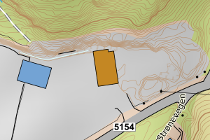
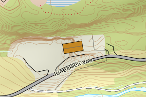
4624 Bjørnafjorden | 272d89d7-ead7-4800-89bf-9ec03e6eb930 | 963.04 | N: 6678695.73, Ø: 311912.56 | ![Kartbilde fra WMS-tjeneste av avviket](https://wms.geonorge.no/skwms1/wms.topo?VERSION=1.1.1&SERVICE=WMS&REQUEST=GetMap&LAYERS=topo&STYLES=&FORMAT=image/png&SRS=EPSG:25832&BBOX=311837.0,6678645,311987.0,6678745&WIDTH=300&HEIGHT=200) |
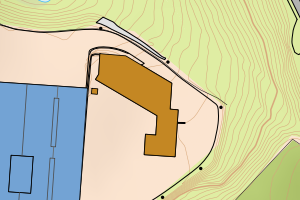
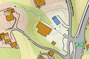
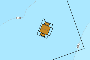
4624 Bjørnafjorden | 0b83ce84-b387-4ed1-b977-17691761cb9a | 705.64 | N: 6678971.96, Ø: 306377.18 | ![Kartbilde fra WMS-tjeneste av avviket](https://wms.geonorge.no/skwms1/wms.topo?VERSION=1.1.1&SERVICE=WMS&REQUEST=GetMap&LAYERS=topo&STYLES=&FORMAT=image/png&SRS=EPSG:25832&BBOX=306302.0,6678921,306452.0,6679021&WIDTH=300&HEIGHT=200) |
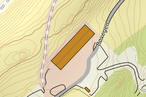
4624 Bjørnafjorden | 59cb2797-da8c-453f-b6a3-1e1ded42a3a4 | 570.14 | N: 6686502.99, Ø: 314581.46 | ![Kartbilde fra WMS-tjeneste av avviket](https://wms.geonorge.no/skwms1/wms.topo?VERSION=1.1.1&SERVICE=WMS&REQUEST=GetMap&LAYERS=topo&STYLES=&FORMAT=image/png&SRS=EPSG:25832&BBOX=314506.0,6686452,314656.0,6686552&WIDTH=300&HEIGHT=200) |
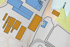
4624 Bjørnafjorden | e7223be1-dca5-4c83-a5be-84a157d426ba | 390.84 | N: 6673541.46, Ø: 302101.00 | ![Kartbilde fra WMS-tjeneste av avviket](https://wms.geonorge.no/skwms1/wms.topo?VERSION=1.1.1&SERVICE=WMS&REQUEST=GetMap&LAYERS=topo&STYLES=&FORMAT=image/png&SRS=EPSG:25832&BBOX=302026.0,6673491,302176.0,6673591&WIDTH=300&HEIGHT=200) |
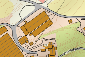
4624 Bjørnafjorden | c3988303-6330-4a5b-873c-dfc419d8e3fd | 359.89 | N: 6682716.61, Ø: 320717.19 | ![Kartbilde fra WMS-tjeneste av avviket](https://wms.geonorge.no/skwms1/wms.topo?VERSION=1.1.1&SERVICE=WMS&REQUEST=GetMap&LAYERS=topo&STYLES=&FORMAT=image/png&SRS=EPSG:25832&BBOX=320642.0,6682666,320792.0,6682766&WIDTH=300&HEIGHT=200) |
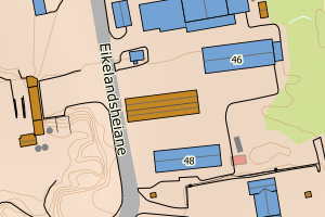
4624 Bjørnafjorden | 4be67ff8-b57d-4fad-90dd-95ac13938b14 | 336.58 | N: 6678129.59, Ø: 297856.50 | ![Kartbilde fra WMS-tjeneste av avviket](https://wms.geonorge.no/skwms1/wms.topo?VERSION=1.1.1&SERVICE=WMS&REQUEST=GetMap&LAYERS=topo&STYLES=&FORMAT=image/png&SRS=EPSG:25832&BBOX=297781.0,6678079,297931.0,6678179&WIDTH=300&HEIGHT=200) |
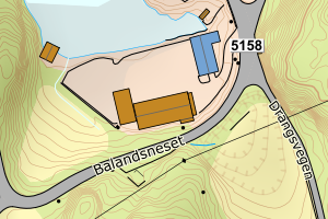
4624 Bjørnafjorden | 3b8d1367-c2f1-4e9b-b8f6-82ee1d85897d | 332.74 | N: 6686481.59, Ø: 314551.07 | ![Kartbilde fra WMS-tjeneste av avviket](https://wms.geonorge.no/skwms1/wms.topo?VERSION=1.1.1&SERVICE=WMS&REQUEST=GetMap&LAYERS=topo&STYLES=&FORMAT=image/png&SRS=EPSG:25832&BBOX=314476.0,6686431,314626.0,6686531&WIDTH=300&HEIGHT=200) |
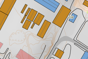
4624 Bjørnafjorden | 0e0b4476-77f3-4720-b27c-955b78fbd365 | 328.68 | N: 6679113.06, Ø: 301982.59 | ![Kartbilde fra WMS-tjeneste av avviket](https://wms.geonorge.no/skwms1/wms.topo?VERSION=1.1.1&SERVICE=WMS&REQUEST=GetMap&LAYERS=topo&STYLES=&FORMAT=image/png&SRS=EPSG:25832&BBOX=301907.0,6679063,302057.0,6679163&WIDTH=300&HEIGHT=200) |
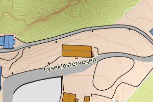
4624 Bjørnafjorden | e45b6aff-fd79-49eb-9400-352a75e3cb0b | 307.74 | N: 6665967.15, Ø: 322137.66 | ![Kartbilde fra WMS-tjeneste av avviket](https://wms.geonorge.no/skwms1/wms.topo?VERSION=1.1.1&SERVICE=WMS&REQUEST=GetMap&LAYERS=topo&STYLES=&FORMAT=image/png&SRS=EPSG:25832&BBOX=322062.0,6665917,322212.0,6666017&WIDTH=300&HEIGHT=200) |
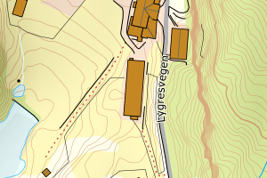
4624 Bjørnafjorden | f42163d0-26d4-4230-9ede-7c656a3e55dd | 291.57 | N: 6675873.03, Ø: 302639.11 | ![Kartbilde fra WMS-tjeneste av avviket](https://wms.geonorge.no/skwms1/wms.topo?VERSION=1.1.1&SERVICE=WMS&REQUEST=GetMap&LAYERS=topo&STYLES=&FORMAT=image/png&SRS=EPSG:25832&BBOX=302564.0,6675823,302714.0,6675923&WIDTH=300&HEIGHT=200) |
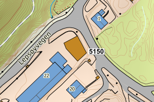
4624 Bjørnafjorden | 356340a1-b822-4520-9ecf-50b905587abd | 290.40 | N: 6678779.08, Ø: 305496.02 | ![Kartbilde fra WMS-tjeneste av avviket](https://wms.geonorge.no/skwms1/wms.topo?VERSION=1.1.1&SERVICE=WMS&REQUEST=GetMap&LAYERS=topo&STYLES=&FORMAT=image/png&SRS=EPSG:25832&BBOX=305421.0,6678729,305571.0,6678829&WIDTH=300&HEIGHT=200) |
4624 Bjørnafjorden | db41fd59-c742-4912-9049-af811257b19f | 290.31 | N: 6682618.56, Ø: 314082.15 | ![Kartbilde fra WMS-tjeneste av avviket](https://wms.geonorge.no/skwms1/wms.topo?VERSION=1.1.1&SERVICE=WMS&REQUEST=GetMap&LAYERS=topo&STYLES=&FORMAT=image/png&SRS=EPSG:25832&BBOX=314007.0,6682568,314157.0,6682668&WIDTH=300&HEIGHT=200) |
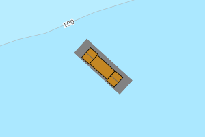
4624 Bjørnafjorden | 213d8c88-a400-4637-a4e1-b60d3a775ae7 | 285.54 | N: 6680936.44, Ø: 309294.11 | ![Kartbilde fra WMS-tjeneste av avviket](https://wms.geonorge.no/skwms1/wms.topo?VERSION=1.1.1&SERVICE=WMS&REQUEST=GetMap&LAYERS=topo&STYLES=&FORMAT=image/png&SRS=EPSG:25832&BBOX=309219.0,6680886,309369.0,6680986&WIDTH=300&HEIGHT=200) |
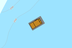
4624 Bjørnafjorden | 947f6353-5c9b-469e-b783-8e48d5a4cc0f | 274.50 | N: 6678701.25, Ø: 301692.11 | ![Kartbilde fra WMS-tjeneste av avviket](https://wms.geonorge.no/skwms1/wms.topo?VERSION=1.1.1&SERVICE=WMS&REQUEST=GetMap&LAYERS=topo&STYLES=&FORMAT=image/png&SRS=EPSG:25832&BBOX=301617.0,6678651,301767.0,6678751&WIDTH=300&HEIGHT=200) |
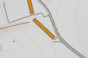
4624 Bjørnafjorden | 35a9c8e3-e5d9-40f9-bfa4-64dca50b4cf0 | 269.59 | N: 6684124.80, Ø: 316832.92 | ![Kartbilde fra WMS-tjeneste av avviket](https://wms.geonorge.no/skwms1/wms.topo?VERSION=1.1.1&SERVICE=WMS&REQUEST=GetMap&LAYERS=topo&STYLES=&FORMAT=image/png&SRS=EPSG:25832&BBOX=316757.0,6684074,316907.0,6684174&WIDTH=300&HEIGHT=200) |
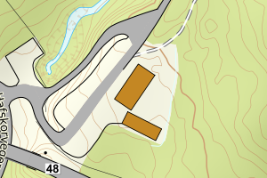
4624 Bjørnafjorden | d4ead464-54d9-4080-aae3-caffa544fa0b | 258.39 | N: 6681718.43, Ø: 315832.04 | ![Kartbilde fra WMS-tjeneste av avviket](https://wms.geonorge.no/skwms1/wms.topo?VERSION=1.1.1&SERVICE=WMS&REQUEST=GetMap&LAYERS=topo&STYLES=&FORMAT=image/png&SRS=EPSG:25832&BBOX=315757.0,6681668,315907.0,6681768&WIDTH=300&HEIGHT=200) |
4624 Bjørnafjorden | 4b6b03f0-d4b9-4506-866d-2d37ae21fe56 | 256.21 | N: 6674288.12, Ø: 302401.80 | ![Kartbilde fra WMS-tjeneste av avviket](https://wms.geonorge.no/skwms1/wms.topo?VERSION=1.1.1&SERVICE=WMS&REQUEST=GetMap&LAYERS=topo&STYLES=&FORMAT=image/png&SRS=EPSG:25832&BBOX=302326.0,6674238,302476.0,6674338&WIDTH=300&HEIGHT=200) |
4624 Bjørnafjorden | bb489b39-6faa-4e82-9549-64c3d745cde1 | 255.53 | N: 6677481.69, Ø: 300764.60 | ![Kartbilde fra WMS-tjeneste av avviket](https://wms.geonorge.no/skwms1/wms.topo?VERSION=1.1.1&SERVICE=WMS&REQUEST=GetMap&LAYERS=topo&STYLES=&FORMAT=image/png&SRS=EPSG:25832&BBOX=300689.0,6677431,300839.0,6677531&WIDTH=300&HEIGHT=200) |
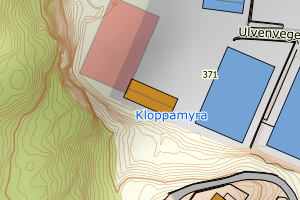
4624 Bjørnafjorden | 4bacb3ba-dda4-4c85-82b8-4b8521bd9a5a | 245.84 | N: 6679061.09, Ø: 301973.97 | ![Kartbilde fra WMS-tjeneste av avviket](https://wms.geonorge.no/skwms1/wms.topo?VERSION=1.1.1&SERVICE=WMS&REQUEST=GetMap&LAYERS=topo&STYLES=&FORMAT=image/png&SRS=EPSG:25832&BBOX=301898.0,6679011,302048.0,6679111&WIDTH=300&HEIGHT=200) |
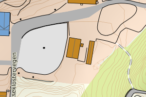
4624 Bjørnafjorden | 53afb568-8d5e-4066-86c9-7d70d5ea9c11 | 227.65 | N: 6686962.65, Ø: 330646.81 | ![Kartbilde fra WMS-tjeneste av avviket](https://wms.geonorge.no/skwms1/wms.topo?VERSION=1.1.1&SERVICE=WMS&REQUEST=GetMap&LAYERS=topo&STYLES=&FORMAT=image/png&SRS=EPSG:25832&BBOX=330571.0,6686912,330721.0,6687012&WIDTH=300&HEIGHT=200) |
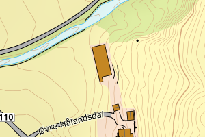
4624 Bjørnafjorden | fce1eefc-4631-4c2e-91ce-c884e0c5d2dd | 222.90 | N: 6683686.27, Ø: 319802.49 | ![Kartbilde fra WMS-tjeneste av avviket](https://wms.geonorge.no/skwms1/wms.topo?VERSION=1.1.1&SERVICE=WMS&REQUEST=GetMap&LAYERS=topo&STYLES=&FORMAT=image/png&SRS=EPSG:25832&BBOX=319727.0,6683636,319877.0,6683736&WIDTH=300&HEIGHT=200) |
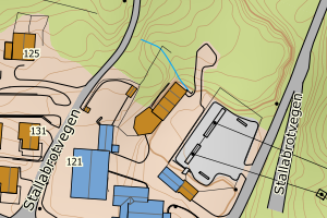
4624 Bjørnafjorden | 26952728-7bfe-4811-98e0-8cd1ee7b4ffc | 215.54 | N: 6672885.11, Ø: 312158.00 | ![Kartbilde fra WMS-tjeneste av avviket](https://wms.geonorge.no/skwms1/wms.topo?VERSION=1.1.1&SERVICE=WMS&REQUEST=GetMap&LAYERS=topo&STYLES=&FORMAT=image/png&SRS=EPSG:25832&BBOX=312083.0,6672835,312233.0,6672935&WIDTH=300&HEIGHT=200) |
4624 Bjørnafjorden | b170e377-74fa-45d5-81c5-bbe4ff494a1d | 211.18 | N: 6683757.65, Ø: 313908.32 | ![Kartbilde fra WMS-tjeneste av avviket](https://wms.geonorge.no/skwms1/wms.topo?VERSION=1.1.1&SERVICE=WMS&REQUEST=GetMap&LAYERS=topo&STYLES=&FORMAT=image/png&SRS=EPSG:25832&BBOX=313833.0,6683707,313983.0,6683807&WIDTH=300&HEIGHT=200) |
4624 Bjørnafjorden | 211d5a53-bb79-4439-b9b6-58f877cc15a5 | 210.64 | N: 6678895.24, Ø: 301490.96 | ![Kartbilde fra WMS-tjeneste av avviket](https://wms.geonorge.no/skwms1/wms.topo?VERSION=1.1.1&SERVICE=WMS&REQUEST=GetMap&LAYERS=topo&STYLES=&FORMAT=image/png&SRS=EPSG:25832&BBOX=301415.0,6678845,301565.0,6678945&WIDTH=300&HEIGHT=200) |
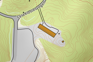
4624 Bjørnafjorden | 5627ba9b-3a28-4c65-8140-b290b1df9081 | 209.61 | N: 6675470.31, Ø: 297089.52 | ![Kartbilde fra WMS-tjeneste av avviket](https://wms.geonorge.no/skwms1/wms.topo?VERSION=1.1.1&SERVICE=WMS&REQUEST=GetMap&LAYERS=topo&STYLES=&FORMAT=image/png&SRS=EPSG:25832&BBOX=297014.0,6675420,297164.0,6675520&WIDTH=300&HEIGHT=200) |
4624 Bjørnafjorden | c01f4018-afd8-4f7b-816f-7c47439eab83 | 209.19 | N: 6686498.44, Ø: 314542.30 | ![Kartbilde fra WMS-tjeneste av avviket](https://wms.geonorge.no/skwms1/wms.topo?VERSION=1.1.1&SERVICE=WMS&REQUEST=GetMap&LAYERS=topo&STYLES=&FORMAT=image/png&SRS=EPSG:25832&BBOX=314467.0,6686448,314617.0,6686548&WIDTH=300&HEIGHT=200) |
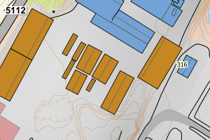
4624 Bjørnafjorden | 36cc8b56-5e03-4cae-88d5-eaf7a2aba729 | 208.52 | N: 6686505.12, Ø: 314530.86 | ![Kartbilde fra WMS-tjeneste av avviket](https://wms.geonorge.no/skwms1/wms.topo?VERSION=1.1.1&SERVICE=WMS&REQUEST=GetMap&LAYERS=topo&STYLES=&FORMAT=image/png&SRS=EPSG:25832&BBOX=314455.0,6686455,314605.0,6686555&WIDTH=300&HEIGHT=200) |