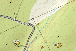
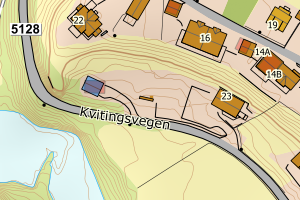
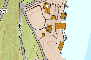
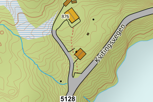
Avvikene skyldes vanligvis unøyaktig registrering av bygningspunkt i matrikkelen slik at det har havnet utenfor bygningsomriss. Rettes vanligvis i matrikkelen
Kommune | LokalId | Bygningsnummer | Avstand (m) | Posisjon | WMS-bilde |
4623 Samnanger | fe496618-2718-4c6f-8b0e-fc5a83ff80b5 | 300457089 | 0.02 | N: 6700585.25, Ø: 325764.68 | ![Kartbilde fra WMS-tjeneste av avviket](https://wms.geonorge.no/skwms1/wms.topo?VERSION=1.1.1&SERVICE=WMS&REQUEST=GetMap&LAYERS=topo&STYLES=&FORMAT=image/png&SRS=EPSG:25832&BBOX=325689.0,6700535,325839.0,6700635&WIDTH=300&HEIGHT=200) |
4623 Samnanger | dcecae8c-811e-4e24-99ad-673f2c62d507 | 140010200 | 0.09 | N: 6700457.00, Ø: 317241.00 | ![Kartbilde fra WMS-tjeneste av avviket](https://wms.geonorge.no/skwms1/wms.topo?VERSION=1.1.1&SERVICE=WMS&REQUEST=GetMap&LAYERS=topo&STYLES=&FORMAT=image/png&SRS=EPSG:25832&BBOX=317165.0,6700406,317315.0,6700506&WIDTH=300&HEIGHT=200) |
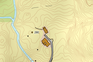
4623 Samnanger | a7ff2156-6838-4088-8c78-ab0054e95d10 | 140013919 | 0.14 | N: 6702328.00, Ø: 319747.00 | ![Kartbilde fra WMS-tjeneste av avviket](https://wms.geonorge.no/skwms1/wms.topo?VERSION=1.1.1&SERVICE=WMS&REQUEST=GetMap&LAYERS=topo&STYLES=&FORMAT=image/png&SRS=EPSG:25832&BBOX=319671.0,6702277,319821.0,6702377&WIDTH=300&HEIGHT=200) |
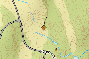
4623 Samnanger | 87385ec2-dcf7-45bc-8e96-7272fd10306d | 140009350 | 0.17 | N: 6690886.00, Ø: 313379.00 | ![Kartbilde fra WMS-tjeneste av avviket](https://wms.geonorge.no/skwms1/wms.topo?VERSION=1.1.1&SERVICE=WMS&REQUEST=GetMap&LAYERS=topo&STYLES=&FORMAT=image/png&SRS=EPSG:25832&BBOX=313303.0,6690835,313453.0,6690935&WIDTH=300&HEIGHT=200) |
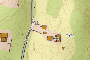
4623 Samnanger | 62523192-97a5-40a1-8673-8c470f9bb88b | 140009644 | 0.17 | N: 6692208.00, Ø: 313424.00 | ![Kartbilde fra WMS-tjeneste av avviket](https://wms.geonorge.no/skwms1/wms.topo?VERSION=1.1.1&SERVICE=WMS&REQUEST=GetMap&LAYERS=topo&STYLES=&FORMAT=image/png&SRS=EPSG:25832&BBOX=313348.0,6692157,313498.0,6692257&WIDTH=300&HEIGHT=200) |
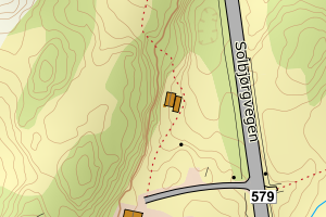
4623 Samnanger | 98e62d8c-3be3-420f-9e89-706837032dc7 | 300196518 | 0.19 | N: 6693155.78, Ø: 313746.26 | ![Kartbilde fra WMS-tjeneste av avviket](https://wms.geonorge.no/skwms1/wms.topo?VERSION=1.1.1&SERVICE=WMS&REQUEST=GetMap&LAYERS=topo&STYLES=&FORMAT=image/png&SRS=EPSG:25832&BBOX=313671.0,6693105,313821.0,6693205&WIDTH=300&HEIGHT=200) |
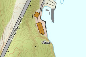
4623 Samnanger | 7f00c04a-d5c7-4df9-a7db-36af27a7da60 | 140011398 | 0.19 | N: 6696689.00, Ø: 315549.00 | ![Kartbilde fra WMS-tjeneste av avviket](https://wms.geonorge.no/skwms1/wms.topo?VERSION=1.1.1&SERVICE=WMS&REQUEST=GetMap&LAYERS=topo&STYLES=&FORMAT=image/png&SRS=EPSG:25832&BBOX=315473.0,6696638,315623.0,6696738&WIDTH=300&HEIGHT=200) |
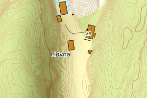
4623 Samnanger | e074c3f5-d58d-4c42-bd86-dde3c44a437e | 20130482 | 0.22 | N: 6691637.00, Ø: 313610.00 | ![Kartbilde fra WMS-tjeneste av avviket](https://wms.geonorge.no/skwms1/wms.topo?VERSION=1.1.1&SERVICE=WMS&REQUEST=GetMap&LAYERS=topo&STYLES=&FORMAT=image/png&SRS=EPSG:25832&BBOX=313534.0,6691586,313684.0,6691686&WIDTH=300&HEIGHT=200) |
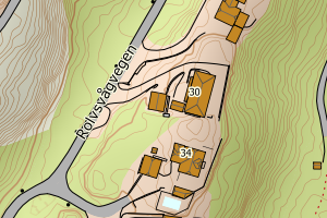
4623 Samnanger | 1fdef760-4f0b-4fed-acd8-656661e91a2b | 20131977 | 0.24 | N: 6701217.00, Ø: 325524.00 | ![Kartbilde fra WMS-tjeneste av avviket](https://wms.geonorge.no/skwms1/wms.topo?VERSION=1.1.1&SERVICE=WMS&REQUEST=GetMap&LAYERS=topo&STYLES=&FORMAT=image/png&SRS=EPSG:25832&BBOX=325448.0,6701166,325598.0,6701266&WIDTH=300&HEIGHT=200) |
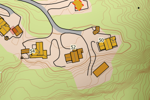
4623 Samnanger | 87b983d4-496e-4142-a0b6-efb5eeb3e2fe | 9767673 | 0.25 | N: 6699973.00, Ø: 320229.00 | ![Kartbilde fra WMS-tjeneste av avviket](https://wms.geonorge.no/skwms1/wms.topo?VERSION=1.1.1&SERVICE=WMS&REQUEST=GetMap&LAYERS=topo&STYLES=&FORMAT=image/png&SRS=EPSG:25832&BBOX=320153.0,6699922,320303.0,6700022&WIDTH=300&HEIGHT=200) |
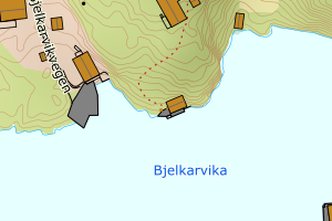
4623 Samnanger | 301fef6b-4b58-46a8-9a48-1fb693c3280c | 300301736 | 0.29 | N: 6698452.70, Ø: 329032.80 | ![Kartbilde fra WMS-tjeneste av avviket](https://wms.geonorge.no/skwms1/wms.topo?VERSION=1.1.1&SERVICE=WMS&REQUEST=GetMap&LAYERS=topo&STYLES=&FORMAT=image/png&SRS=EPSG:25832&BBOX=328957.0,6698402,329107.0,6698502&WIDTH=300&HEIGHT=200) |
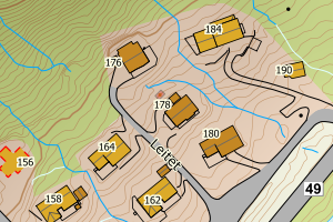
4623 Samnanger | 0d5634d3-1268-49f2-a3dd-f73d8d21fa7d | 140016632 | 0.31 | N: 6695731.00, Ø: 317904.00 | ![Kartbilde fra WMS-tjeneste av avviket](https://wms.geonorge.no/skwms1/wms.topo?VERSION=1.1.1&SERVICE=WMS&REQUEST=GetMap&LAYERS=topo&STYLES=&FORMAT=image/png&SRS=EPSG:25832&BBOX=317828.0,6695680,317978.0,6695780&WIDTH=300&HEIGHT=200) |
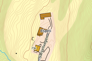
4623 Samnanger | c15b40c6-b8d3-4707-8114-5c1d32eec050 | 300390694 | 0.40 | N: 6696219.80, Ø: 324226.40 | ![Kartbilde fra WMS-tjeneste av avviket](https://wms.geonorge.no/skwms1/wms.topo?VERSION=1.1.1&SERVICE=WMS&REQUEST=GetMap&LAYERS=topo&STYLES=&FORMAT=image/png&SRS=EPSG:25832&BBOX=324151.0,6696169,324301.0,6696269&WIDTH=300&HEIGHT=200) |
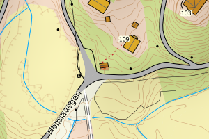
4623 Samnanger | 376e697a-f2bf-4a2c-a748-edfe3b62aba8 | 194740263 | 0.43 | N: 6702235.00, Ø: 325769.00 | ![Kartbilde fra WMS-tjeneste av avviket](https://wms.geonorge.no/skwms1/wms.topo?VERSION=1.1.1&SERVICE=WMS&REQUEST=GetMap&LAYERS=topo&STYLES=&FORMAT=image/png&SRS=EPSG:25832&BBOX=325693.0,6702184,325843.0,6702284&WIDTH=300&HEIGHT=200) |
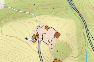
4623 Samnanger | 20e03d65-d7c4-4908-815a-9790b55f2905 | 300205625 | 0.43 | N: 6700618.88, Ø: 330072.48 | ![Kartbilde fra WMS-tjeneste av avviket](https://wms.geonorge.no/skwms1/wms.topo?VERSION=1.1.1&SERVICE=WMS&REQUEST=GetMap&LAYERS=topo&STYLES=&FORMAT=image/png&SRS=EPSG:25832&BBOX=329997.0,6700568,330147.0,6700668&WIDTH=300&HEIGHT=200) |
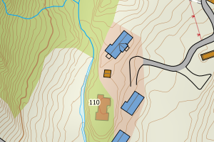
4623 Samnanger | 5609e013-f7e1-4acf-a2a6-6febb6670328 | 194721994 | 0.47 | N: 6694919.00, Ø: 314643.00 | ![Kartbilde fra WMS-tjeneste av avviket](https://wms.geonorge.no/skwms1/wms.topo?VERSION=1.1.1&SERVICE=WMS&REQUEST=GetMap&LAYERS=topo&STYLES=&FORMAT=image/png&SRS=EPSG:25832&BBOX=314567.0,6694868,314717.0,6694968&WIDTH=300&HEIGHT=200) |
4623 Samnanger | 5b889899-3105-4584-95e4-f0385cb9224f | 300719183 | 0.49 | N: 6689546.30, Ø: 311270.30 | ![Kartbilde fra WMS-tjeneste av avviket](https://wms.geonorge.no/skwms1/wms.topo?VERSION=1.1.1&SERVICE=WMS&REQUEST=GetMap&LAYERS=topo&STYLES=&FORMAT=image/png&SRS=EPSG:25832&BBOX=311195.0,6689496,311345.0,6689596&WIDTH=300&HEIGHT=200) |
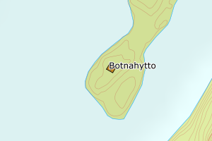
4623 Samnanger | b74bec2a-7d9c-46e8-95ef-91a9bab3362e | 194726171 | 0.53 | N: 6694400.00, Ø: 318982.00 | ![Kartbilde fra WMS-tjeneste av avviket](https://wms.geonorge.no/skwms1/wms.topo?VERSION=1.1.1&SERVICE=WMS&REQUEST=GetMap&LAYERS=topo&STYLES=&FORMAT=image/png&SRS=EPSG:25832&BBOX=318906.0,6694349,319056.0,6694449&WIDTH=300&HEIGHT=200) |
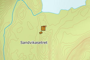
4623 Samnanger | e285fe86-2328-4947-a677-16f0737fef97 | 20128445 | 0.55 | N: 6699349.00, Ø: 322138.00 | ![Kartbilde fra WMS-tjeneste av avviket](https://wms.geonorge.no/skwms1/wms.topo?VERSION=1.1.1&SERVICE=WMS&REQUEST=GetMap&LAYERS=topo&STYLES=&FORMAT=image/png&SRS=EPSG:25832&BBOX=322062.0,6699298,322212.0,6699398&WIDTH=300&HEIGHT=200) |
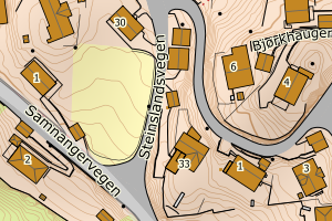
4623 Samnanger | 88f4102d-2911-4de2-ad4d-d070b1abcafb | 194743262 | 0.69 | N: 6696686.00, Ø: 315567.00 | ![Kartbilde fra WMS-tjeneste av avviket](https://wms.geonorge.no/skwms1/wms.topo?VERSION=1.1.1&SERVICE=WMS&REQUEST=GetMap&LAYERS=topo&STYLES=&FORMAT=image/png&SRS=EPSG:25832&BBOX=315491.0,6696635,315641.0,6696735&WIDTH=300&HEIGHT=200) |
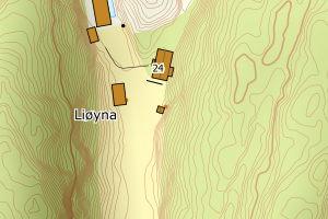
4623 Samnanger | 6d8046e4-63ad-49db-abf9-ae0a84c9539f | 20131063 | 0.78 | N: 6700187.00, Ø: 321588.00 | ![Kartbilde fra WMS-tjeneste av avviket](https://wms.geonorge.no/skwms1/wms.topo?VERSION=1.1.1&SERVICE=WMS&REQUEST=GetMap&LAYERS=topo&STYLES=&FORMAT=image/png&SRS=EPSG:25832&BBOX=321512.0,6700136,321662.0,6700236&WIDTH=300&HEIGHT=200) |
4623 Samnanger | 3b390911-8fad-4b4c-9f50-42bb348bd30e | 300464062 | 0.85 | N: 6700524.60, Ø: 320347.10 | ![Kartbilde fra WMS-tjeneste av avviket](https://wms.geonorge.no/skwms1/wms.topo?VERSION=1.1.1&SERVICE=WMS&REQUEST=GetMap&LAYERS=topo&STYLES=&FORMAT=image/png&SRS=EPSG:25832&BBOX=320272.0,6700474,320422.0,6700574&WIDTH=300&HEIGHT=200) |
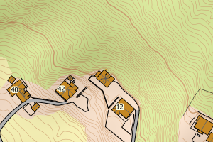
4623 Samnanger | beb2cdff-f68e-40d3-af35-b40459977a4b | 300051529 | 0.93 | N: 6698472.00, Ø: 329012.00 | ![Kartbilde fra WMS-tjeneste av avviket](https://wms.geonorge.no/skwms1/wms.topo?VERSION=1.1.1&SERVICE=WMS&REQUEST=GetMap&LAYERS=topo&STYLES=&FORMAT=image/png&SRS=EPSG:25832&BBOX=328936.0,6698421,329086.0,6698521&WIDTH=300&HEIGHT=200) |
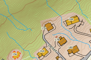
4623 Samnanger | 8dcf020e-e827-4490-b639-011a62448edb | 300207418 | 0.95 | N: 6696262.24, Ø: 324284.72 | ![Kartbilde fra WMS-tjeneste av avviket](https://wms.geonorge.no/skwms1/wms.topo?VERSION=1.1.1&SERVICE=WMS&REQUEST=GetMap&LAYERS=topo&STYLES=&FORMAT=image/png&SRS=EPSG:25832&BBOX=324209.0,6696212,324359.0,6696312&WIDTH=300&HEIGHT=200) |
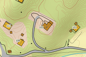
4623 Samnanger | 51544d10-e5b9-4b52-a456-6a0bef66ed97 | 300207759 | 0.95 | N: 6704196.25, Ø: 326387.49 | ![Kartbilde fra WMS-tjeneste av avviket](https://wms.geonorge.no/skwms1/wms.topo?VERSION=1.1.1&SERVICE=WMS&REQUEST=GetMap&LAYERS=topo&STYLES=&FORMAT=image/png&SRS=EPSG:25832&BBOX=326312.0,6704146,326462.0,6704246&WIDTH=300&HEIGHT=200) |