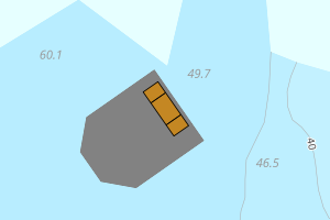
Avvikene skyldes oftest manglende eller unøyaktig registrering av bygningspunkt i matrikkelen. Rettes vanligvis i matrikkelen
Kommune | LokalId | Areal (m2) | Posisjon | WMS-bilde |
4613 Bømlo | 4295d143-4a70-488e-aadc-ba5adf5517b8 | 2431.02 | N: 6635514.69, Ø: 283034.68 | ![Kartbilde fra WMS-tjeneste av avviket](https://wms.geonorge.no/skwms1/wms.topo?VERSION=1.1.1&SERVICE=WMS&REQUEST=GetMap&LAYERS=topo&STYLES=&FORMAT=image/png&SRS=EPSG:25832&BBOX=282959.0,6635464,283109.0,6635564&WIDTH=300&HEIGHT=200) |
4613 Bømlo | 8fe7e516-e0a6-45dc-86af-8fb7a7cc85e2 | 719.69 | N: 6634794.34, Ø: 287173.43 | ![Kartbilde fra WMS-tjeneste av avviket](https://wms.geonorge.no/skwms1/wms.topo?VERSION=1.1.1&SERVICE=WMS&REQUEST=GetMap&LAYERS=topo&STYLES=&FORMAT=image/png&SRS=EPSG:25832&BBOX=287098.0,6634744,287248.0,6634844&WIDTH=300&HEIGHT=200) |
4613 Bømlo | 5bc22d1a-40cd-43fd-9792-4896750b2e18 | 629.71 | N: 6635199.05, Ø: 292822.57 | ![Kartbilde fra WMS-tjeneste av avviket](https://wms.geonorge.no/skwms1/wms.topo?VERSION=1.1.1&SERVICE=WMS&REQUEST=GetMap&LAYERS=topo&STYLES=&FORMAT=image/png&SRS=EPSG:25832&BBOX=292747.0,6635149,292897.0,6635249&WIDTH=300&HEIGHT=200) |
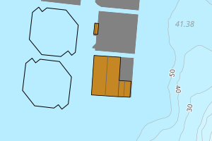
4613 Bømlo | 0084f39c-9d64-452b-950a-486a20d1edf7 | 425.70 | N: 6637269.83, Ø: 290276.24 | ![Kartbilde fra WMS-tjeneste av avviket](https://wms.geonorge.no/skwms1/wms.topo?VERSION=1.1.1&SERVICE=WMS&REQUEST=GetMap&LAYERS=topo&STYLES=&FORMAT=image/png&SRS=EPSG:25832&BBOX=290201.0,6637219,290351.0,6637319&WIDTH=300&HEIGHT=200) |
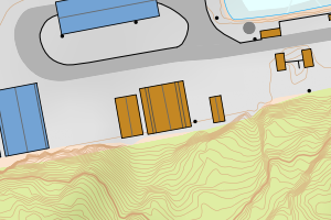
4613 Bømlo | c662b818-50f7-4fb8-a746-ae303e8e00c8 | 401.63 | N: 6629756.01, Ø: 289158.48 | ![Kartbilde fra WMS-tjeneste av avviket](https://wms.geonorge.no/skwms1/wms.topo?VERSION=1.1.1&SERVICE=WMS&REQUEST=GetMap&LAYERS=topo&STYLES=&FORMAT=image/png&SRS=EPSG:25832&BBOX=289083.0,6629706,289233.0,6629806&WIDTH=300&HEIGHT=200) |
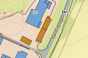
4613 Bømlo | ea39a4ab-0c54-4e5a-948a-d12044a7ff98 | 389.56 | N: 6630634.61, Ø: 293179.71 | ![Kartbilde fra WMS-tjeneste av avviket](https://wms.geonorge.no/skwms1/wms.topo?VERSION=1.1.1&SERVICE=WMS&REQUEST=GetMap&LAYERS=topo&STYLES=&FORMAT=image/png&SRS=EPSG:25832&BBOX=293104.0,6630584,293254.0,6630684&WIDTH=300&HEIGHT=200) |
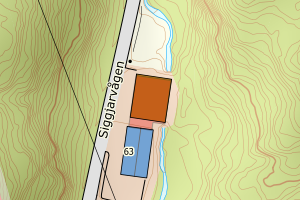
4613 Bømlo | b2179038-65ce-499e-b4e3-47042128ffee | 368.39 | N: 6646209.85, Ø: 282058.38 | ![Kartbilde fra WMS-tjeneste av avviket](https://wms.geonorge.no/skwms1/wms.topo?VERSION=1.1.1&SERVICE=WMS&REQUEST=GetMap&LAYERS=topo&STYLES=&FORMAT=image/png&SRS=EPSG:25832&BBOX=281983.0,6646159,282133.0,6646259&WIDTH=300&HEIGHT=200) |
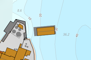
4613 Bømlo | 9c9ac360-1044-4239-9672-f1fd3cb8b463 | 357.94 | N: 6616859.13, Ø: 284332.12 | ![Kartbilde fra WMS-tjeneste av avviket](https://wms.geonorge.no/skwms1/wms.topo?VERSION=1.1.1&SERVICE=WMS&REQUEST=GetMap&LAYERS=topo&STYLES=&FORMAT=image/png&SRS=EPSG:25832&BBOX=284257.0,6616809,284407.0,6616909&WIDTH=300&HEIGHT=200) |
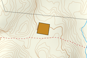
4613 Bømlo | 5e70faf8-b1cf-4050-8366-87282e07df58 | 329.67 | N: 6614000.31, Ø: 288123.71 | ![Kartbilde fra WMS-tjeneste av avviket](https://wms.geonorge.no/skwms1/wms.topo?VERSION=1.1.1&SERVICE=WMS&REQUEST=GetMap&LAYERS=topo&STYLES=&FORMAT=image/png&SRS=EPSG:25832&BBOX=288048.0,6613950,288198.0,6614050&WIDTH=300&HEIGHT=200) |
4613 Bømlo | ee84e3b7-c33b-41bc-8712-c4638cdd4090 | 310.39 | N: 6628372.33, Ø: 288255.24 | ![Kartbilde fra WMS-tjeneste av avviket](https://wms.geonorge.no/skwms1/wms.topo?VERSION=1.1.1&SERVICE=WMS&REQUEST=GetMap&LAYERS=topo&STYLES=&FORMAT=image/png&SRS=EPSG:25832&BBOX=288180.0,6628322,288330.0,6628422&WIDTH=300&HEIGHT=200) |
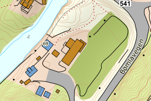
4613 Bømlo | 374df461-eea1-4d9d-8ac0-32d523e7f714 | 293.61 | N: 6635589.68, Ø: 283101.00 | ![Kartbilde fra WMS-tjeneste av avviket](https://wms.geonorge.no/skwms1/wms.topo?VERSION=1.1.1&SERVICE=WMS&REQUEST=GetMap&LAYERS=topo&STYLES=&FORMAT=image/png&SRS=EPSG:25832&BBOX=283025.0,6635539,283175.0,6635639&WIDTH=300&HEIGHT=200) |
4613 Bømlo | 9964066d-881b-4dd1-9885-0bd8b6b52ce7 | 278.46 | N: 6632634.98, Ø: 285586.50 | ![Kartbilde fra WMS-tjeneste av avviket](https://wms.geonorge.no/skwms1/wms.topo?VERSION=1.1.1&SERVICE=WMS&REQUEST=GetMap&LAYERS=topo&STYLES=&FORMAT=image/png&SRS=EPSG:25832&BBOX=285511.0,6632584,285661.0,6632684&WIDTH=300&HEIGHT=200) |
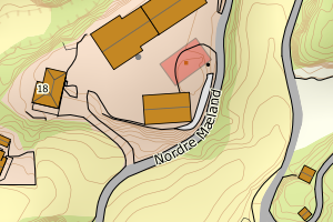
4613 Bømlo | a4e7325f-fa2c-4a94-a549-b67ec36c501d | 272.83 | N: 6640035.44, Ø: 290607.63 | ![Kartbilde fra WMS-tjeneste av avviket](https://wms.geonorge.no/skwms1/wms.topo?VERSION=1.1.1&SERVICE=WMS&REQUEST=GetMap&LAYERS=topo&STYLES=&FORMAT=image/png&SRS=EPSG:25832&BBOX=290532.0,6639985,290682.0,6640085&WIDTH=300&HEIGHT=200) |
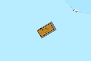
4613 Bømlo | 45365bb0-6214-466f-8bfc-f96811faee9d | 270.31 | N: 6634625.56, Ø: 285408.14 | ![Kartbilde fra WMS-tjeneste av avviket](https://wms.geonorge.no/skwms1/wms.topo?VERSION=1.1.1&SERVICE=WMS&REQUEST=GetMap&LAYERS=topo&STYLES=&FORMAT=image/png&SRS=EPSG:25832&BBOX=285333.0,6634575,285483.0,6634675&WIDTH=300&HEIGHT=200) |
4613 Bømlo | db3dbef3-be58-4ec1-82df-9949c6ba75ef | 228.52 | N: 6634372.57, Ø: 285659.61 | ![Kartbilde fra WMS-tjeneste av avviket](https://wms.geonorge.no/skwms1/wms.topo?VERSION=1.1.1&SERVICE=WMS&REQUEST=GetMap&LAYERS=topo&STYLES=&FORMAT=image/png&SRS=EPSG:25832&BBOX=285584.0,6634322,285734.0,6634422&WIDTH=300&HEIGHT=200) |
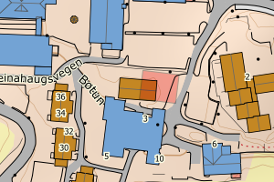
4613 Bømlo | d6f62c15-6efc-4e59-8b43-a96ba7e18ce6 | 222.19 | N: 6612166.20, Ø: 283193.23 | ![Kartbilde fra WMS-tjeneste av avviket](https://wms.geonorge.no/skwms1/wms.topo?VERSION=1.1.1&SERVICE=WMS&REQUEST=GetMap&LAYERS=topo&STYLES=&FORMAT=image/png&SRS=EPSG:25832&BBOX=283118.0,6612116,283268.0,6612216&WIDTH=300&HEIGHT=200) |
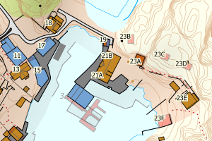
4613 Bømlo | c8218d2e-4306-457d-9518-beb2a7ba6e4f | 219.54 | N: 6635899.29, Ø: 283770.96 | ![Kartbilde fra WMS-tjeneste av avviket](https://wms.geonorge.no/skwms1/wms.topo?VERSION=1.1.1&SERVICE=WMS&REQUEST=GetMap&LAYERS=topo&STYLES=&FORMAT=image/png&SRS=EPSG:25832&BBOX=283695.0,6635849,283845.0,6635949&WIDTH=300&HEIGHT=200) |
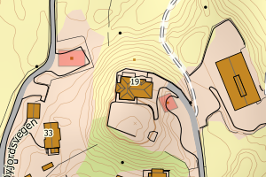
4613 Bømlo | 9067ad61-cadf-488c-a98e-c284b5b2f897 | 209.96 | N: 6634696.74, Ø: 289629.51 | ![Kartbilde fra WMS-tjeneste av avviket](https://wms.geonorge.no/skwms1/wms.topo?VERSION=1.1.1&SERVICE=WMS&REQUEST=GetMap&LAYERS=topo&STYLES=&FORMAT=image/png&SRS=EPSG:25832&BBOX=289554.0,6634646,289704.0,6634746&WIDTH=300&HEIGHT=200) |
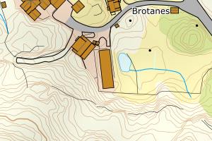
4613 Bømlo | 91cd2e67-4a2a-4bd0-9e08-3ed1233a2025 | 209.29 | N: 6627551.20, Ø: 283702.41 | ![Kartbilde fra WMS-tjeneste av avviket](https://wms.geonorge.no/skwms1/wms.topo?VERSION=1.1.1&SERVICE=WMS&REQUEST=GetMap&LAYERS=topo&STYLES=&FORMAT=image/png&SRS=EPSG:25832&BBOX=283627.0,6627501,283777.0,6627601&WIDTH=300&HEIGHT=200) |
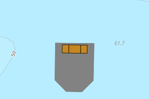
4613 Bømlo | 0047ae65-d07b-4e02-bef5-75f65cf428e3 | 201.74 | N: 6636875.60, Ø: 290827.49 | ![Kartbilde fra WMS-tjeneste av avviket](https://wms.geonorge.no/skwms1/wms.topo?VERSION=1.1.1&SERVICE=WMS&REQUEST=GetMap&LAYERS=topo&STYLES=&FORMAT=image/png&SRS=EPSG:25832&BBOX=290752.0,6636825,290902.0,6636925&WIDTH=300&HEIGHT=200) |
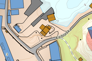
4613 Bømlo | e11ce469-3b0f-417b-a03b-13541ed0a81b | 201.02 | N: 6627215.27, Ø: 283321.65 | ![Kartbilde fra WMS-tjeneste av avviket](https://wms.geonorge.no/skwms1/wms.topo?VERSION=1.1.1&SERVICE=WMS&REQUEST=GetMap&LAYERS=topo&STYLES=&FORMAT=image/png&SRS=EPSG:25832&BBOX=283246.0,6627165,283396.0,6627265&WIDTH=300&HEIGHT=200) |