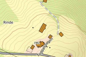
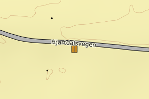
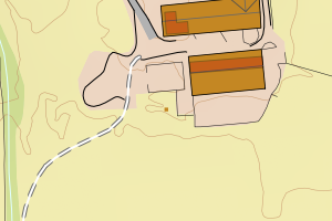
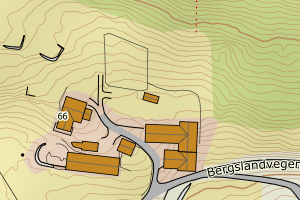
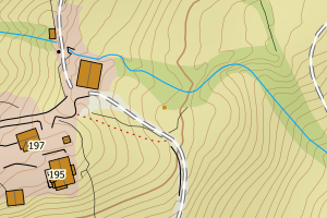
Avvikene kan skyldes enten feil bygningskoordinat eller bygningstype/status i matrikkel eller feil arealtype i AR5. Vær oppmerksom på det er krav om arealer på over 200 m2 før det er krav om endring av arealtype i AR5 så avvikene vil ikke alltid kreve retting i datagrunnlaget
Kommune | LokalId | Bygningsnummer | Arealtype | Bygningstatus | Bygningstype | matrikkel_vedtaksdato | Posisjon | WMS-bilde |
4024 Hjartdal | 42ad972d-b3f9-41af-a7b9-4efeb2f74c73 | 166028892 | 21 | TB | 249 | None | N: 6609178.00, Ø: 473950.00 | ![Kartbilde fra WMS-tjeneste av avviket](https://wms.geonorge.no/skwms1/wms.topo?VERSION=1.1.1&SERVICE=WMS&REQUEST=GetMap&LAYERS=topo&STYLES=&FORMAT=image/png&SRS=EPSG:25832&BBOX=473874.0,6609127,474024.0,6609227&WIDTH=300&HEIGHT=200) |
4024 Hjartdal | a50876d2-4b43-48a3-a66c-b2a3dd3f6546 | 166030099 | 21 | TB | 171 | None | N: 6612944.00, Ø: 476164.00 | ![Kartbilde fra WMS-tjeneste av avviket](https://wms.geonorge.no/skwms1/wms.topo?VERSION=1.1.1&SERVICE=WMS&REQUEST=GetMap&LAYERS=topo&STYLES=&FORMAT=image/png&SRS=EPSG:25832&BBOX=476088.0,6612893,476238.0,6612993&WIDTH=300&HEIGHT=200) |
4024 Hjartdal | 2481280b-9a63-488b-ba18-216569977943 | 166013666 | 21 | TB | 249 | None | N: 6609645.00, Ø: 491989.00 | ![Kartbilde fra WMS-tjeneste av avviket](https://wms.geonorge.no/skwms1/wms.topo?VERSION=1.1.1&SERVICE=WMS&REQUEST=GetMap&LAYERS=topo&STYLES=&FORMAT=image/png&SRS=EPSG:25832&BBOX=491913.0,6609594,492063.0,6609694&WIDTH=300&HEIGHT=200) |
4024 Hjartdal | 35faba03-a9b8-4f76-9029-e7db5ef54015 | 165990013 | 21 | TB | 249 | None | N: 6623878.90, Ø: 487671.20 | ![Kartbilde fra WMS-tjeneste av avviket](https://wms.geonorge.no/skwms1/wms.topo?VERSION=1.1.1&SERVICE=WMS&REQUEST=GetMap&LAYERS=topo&STYLES=&FORMAT=image/png&SRS=EPSG:25832&BBOX=487596.0,6623828,487746.0,6623928&WIDTH=300&HEIGHT=200) |
4024 Hjartdal | 9ca3f115-7f7d-4b64-8677-5414b98e59bc | 166018722 | 21 | TB | 249 | None | N: 6606442.00, Ø: 501110.00 | ![Kartbilde fra WMS-tjeneste av avviket](https://wms.geonorge.no/skwms1/wms.topo?VERSION=1.1.1&SERVICE=WMS&REQUEST=GetMap&LAYERS=topo&STYLES=&FORMAT=image/png&SRS=EPSG:25832&BBOX=501034.0,6606391,501184.0,6606491&WIDTH=300&HEIGHT=200) |
4024 Hjartdal | c038dcb9-c0ad-4a43-a298-41b75f7e6f74 | 165995880 | 21 | TB | 249 | None | N: 6623168.00, Ø: 489585.00 | ![Kartbilde fra WMS-tjeneste av avviket](https://wms.geonorge.no/skwms1/wms.topo?VERSION=1.1.1&SERVICE=WMS&REQUEST=GetMap&LAYERS=topo&STYLES=&FORMAT=image/png&SRS=EPSG:25832&BBOX=489509.0,6623117,489659.0,6623217&WIDTH=300&HEIGHT=200) |
4024 Hjartdal | aa44050b-1f3f-4ddf-a124-e80e593be77b | 165991397 | 21 | TB | 249 | None | N: 6623526.00, Ø: 487683.00 | ![Kartbilde fra WMS-tjeneste av avviket](https://wms.geonorge.no/skwms1/wms.topo?VERSION=1.1.1&SERVICE=WMS&REQUEST=GetMap&LAYERS=topo&STYLES=&FORMAT=image/png&SRS=EPSG:25832&BBOX=487607.0,6623475,487757.0,6623575&WIDTH=300&HEIGHT=200) |
4024 Hjartdal | 53746429-97a8-449f-92c2-b13fdaed6c2c | 166034493 | 21 | TB | 249 | None | N: 6625502.00, Ø: 483615.20 | ![Kartbilde fra WMS-tjeneste av avviket](https://wms.geonorge.no/skwms1/wms.topo?VERSION=1.1.1&SERVICE=WMS&REQUEST=GetMap&LAYERS=topo&STYLES=&FORMAT=image/png&SRS=EPSG:25832&BBOX=483540.0,6625451,483690.0,6625551&WIDTH=300&HEIGHT=200) |
4024 Hjartdal | fb4ed850-578a-4990-a478-25a6cac93948 | 166037174 | 21 | TB | 249 | None | N: 6625532.00, Ø: 483562.00 | ![Kartbilde fra WMS-tjeneste av avviket](https://wms.geonorge.no/skwms1/wms.topo?VERSION=1.1.1&SERVICE=WMS&REQUEST=GetMap&LAYERS=topo&STYLES=&FORMAT=image/png&SRS=EPSG:25832&BBOX=483486.0,6625481,483636.0,6625581&WIDTH=300&HEIGHT=200) |
4024 Hjartdal | d685552e-7973-4333-85e3-617e3c8ac01a | 166034450 | 21 | TB | 249 | None | N: 6625317.00, Ø: 483586.00 | ![Kartbilde fra WMS-tjeneste av avviket](https://wms.geonorge.no/skwms1/wms.topo?VERSION=1.1.1&SERVICE=WMS&REQUEST=GetMap&LAYERS=topo&STYLES=&FORMAT=image/png&SRS=EPSG:25832&BBOX=483510.0,6625266,483660.0,6625366&WIDTH=300&HEIGHT=200) |
4024 Hjartdal | 638138c5-07ac-4583-96ad-dd186c0875b2 | 166034434 | 21 | TB | 161 | None | N: 6625269.00, Ø: 483638.00 | ![Kartbilde fra WMS-tjeneste av avviket](https://wms.geonorge.no/skwms1/wms.topo?VERSION=1.1.1&SERVICE=WMS&REQUEST=GetMap&LAYERS=topo&STYLES=&FORMAT=image/png&SRS=EPSG:25832&BBOX=483562.0,6625218,483712.0,6625318&WIDTH=300&HEIGHT=200) |
4024 Hjartdal | 32cb4826-2229-4aa2-a78b-d91fbf4f3002 | 166030080 | 21 | TB | 249 | None | N: 6612959.00, Ø: 476157.00 | ![Kartbilde fra WMS-tjeneste av avviket](https://wms.geonorge.no/skwms1/wms.topo?VERSION=1.1.1&SERVICE=WMS&REQUEST=GetMap&LAYERS=topo&STYLES=&FORMAT=image/png&SRS=EPSG:25832&BBOX=476081.0,6612908,476231.0,6613008&WIDTH=300&HEIGHT=200) |
4024 Hjartdal | ca2a94ab-ff28-4153-8a2e-2eba549b7634 | 166007232 | 21 | TB | 249 | None | N: 6607892.70, Ø: 483538.80 | ![Kartbilde fra WMS-tjeneste av avviket](https://wms.geonorge.no/skwms1/wms.topo?VERSION=1.1.1&SERVICE=WMS&REQUEST=GetMap&LAYERS=topo&STYLES=&FORMAT=image/png&SRS=EPSG:25832&BBOX=483463.0,6607842,483613.0,6607942&WIDTH=300&HEIGHT=200) |
4024 Hjartdal | 5d56c3ff-0da8-4e13-8a8f-4bac986a11ec | 166002249 | 21 | TB | 524 | None | N: 6606902.30, Ø: 480742.40 | ![Kartbilde fra WMS-tjeneste av avviket](https://wms.geonorge.no/skwms1/wms.topo?VERSION=1.1.1&SERVICE=WMS&REQUEST=GetMap&LAYERS=topo&STYLES=&FORMAT=image/png&SRS=EPSG:25832&BBOX=480667.0,6606852,480817.0,6606952&WIDTH=300&HEIGHT=200) |
4024 Hjartdal | abc32169-795a-4ef8-99f3-abc70307b854 | 166001870 | 21 | TB | 241 | None | N: 6606982.00, Ø: 480813.00 | ![Kartbilde fra WMS-tjeneste av avviket](https://wms.geonorge.no/skwms1/wms.topo?VERSION=1.1.1&SERVICE=WMS&REQUEST=GetMap&LAYERS=topo&STYLES=&FORMAT=image/png&SRS=EPSG:25832&BBOX=480737.0,6606931,480887.0,6607031&WIDTH=300&HEIGHT=200) |
4024 Hjartdal | 03f8945c-85fd-4baf-8f3b-e6ab04c9a739 | 166026369 | 21 | TB | 241 | None | N: 6606364.50, Ø: 500226.00 | ![Kartbilde fra WMS-tjeneste av avviket](https://wms.geonorge.no/skwms1/wms.topo?VERSION=1.1.1&SERVICE=WMS&REQUEST=GetMap&LAYERS=topo&STYLES=&FORMAT=image/png&SRS=EPSG:25832&BBOX=500150.0,6606314,500300.0,6606414&WIDTH=300&HEIGHT=200) |
4024 Hjartdal | 19b36fb2-a528-4fb9-81c7-cb60a73b8c3c | 166009219 | 21 | TB | 249 | None | N: 6607123.00, Ø: 483976.00 | ![Kartbilde fra WMS-tjeneste av avviket](https://wms.geonorge.no/skwms1/wms.topo?VERSION=1.1.1&SERVICE=WMS&REQUEST=GetMap&LAYERS=topo&STYLES=&FORMAT=image/png&SRS=EPSG:25832&BBOX=483900.0,6607072,484050.0,6607172&WIDTH=300&HEIGHT=200) |
4024 Hjartdal | cea80661-6364-4c49-942f-e605e5184d8f | 165994604 | 21 | TB | 249 | None | N: 6623575.80, Ø: 488747.60 | ![Kartbilde fra WMS-tjeneste av avviket](https://wms.geonorge.no/skwms1/wms.topo?VERSION=1.1.1&SERVICE=WMS&REQUEST=GetMap&LAYERS=topo&STYLES=&FORMAT=image/png&SRS=EPSG:25832&BBOX=488672.0,6623525,488822.0,6623625&WIDTH=300&HEIGHT=200) |
4024 Hjartdal | 00ff8415-162e-4cbf-ac1c-94fcdee8c5c4 | 166035821 | 21 | TB | 249 | None | N: 6628091.00, Ø: 482545.00 | ![Kartbilde fra WMS-tjeneste av avviket](https://wms.geonorge.no/skwms1/wms.topo?VERSION=1.1.1&SERVICE=WMS&REQUEST=GetMap&LAYERS=topo&STYLES=&FORMAT=image/png&SRS=EPSG:25832&BBOX=482469.0,6628040,482619.0,6628140&WIDTH=300&HEIGHT=200) |
4024 Hjartdal | c37ddb9a-08d4-4a48-81ae-d1de3b5c8f14 | 166009138 | 21 | TB | 249 | None | N: 6606879.00, Ø: 483418.00 | ![Kartbilde fra WMS-tjeneste av avviket](https://wms.geonorge.no/skwms1/wms.topo?VERSION=1.1.1&SERVICE=WMS&REQUEST=GetMap&LAYERS=topo&STYLES=&FORMAT=image/png&SRS=EPSG:25832&BBOX=483342.0,6606828,483492.0,6606928&WIDTH=300&HEIGHT=200) |
4024 Hjartdal | 3012a6ae-907f-4485-8811-a684291628e0 | 166009146 | 21 | TB | 249 | None | N: 6606884.00, Ø: 483505.00 | ![Kartbilde fra WMS-tjeneste av avviket](https://wms.geonorge.no/skwms1/wms.topo?VERSION=1.1.1&SERVICE=WMS&REQUEST=GetMap&LAYERS=topo&STYLES=&FORMAT=image/png&SRS=EPSG:25832&BBOX=483429.0,6606833,483579.0,6606933&WIDTH=300&HEIGHT=200) |
4024 Hjartdal | d6b696cb-61d2-468c-b753-45f42d9874b6 | 166009162 | 21 | TB | 249 | None | N: 6606759.00, Ø: 483623.00 | ![Kartbilde fra WMS-tjeneste av avviket](https://wms.geonorge.no/skwms1/wms.topo?VERSION=1.1.1&SERVICE=WMS&REQUEST=GetMap&LAYERS=topo&STYLES=&FORMAT=image/png&SRS=EPSG:25832&BBOX=483547.0,6606708,483697.0,6606808&WIDTH=300&HEIGHT=200) |
4024 Hjartdal | 2914eab6-5151-4a6a-abc5-dbffb8469640 | 166009170 | 21 | TB | 249 | None | N: 6606844.00, Ø: 483755.00 | ![Kartbilde fra WMS-tjeneste av avviket](https://wms.geonorge.no/skwms1/wms.topo?VERSION=1.1.1&SERVICE=WMS&REQUEST=GetMap&LAYERS=topo&STYLES=&FORMAT=image/png&SRS=EPSG:25832&BBOX=483679.0,6606793,483829.0,6606893&WIDTH=300&HEIGHT=200) |
4024 Hjartdal | b469d61e-45ec-456e-a047-7af6308f37f4 | 166019095 | 21 | TB | 249 | None | N: 6611244.00, Ø: 498420.00 | ![Kartbilde fra WMS-tjeneste av avviket](https://wms.geonorge.no/skwms1/wms.topo?VERSION=1.1.1&SERVICE=WMS&REQUEST=GetMap&LAYERS=topo&STYLES=&FORMAT=image/png&SRS=EPSG:25832&BBOX=498344.0,6611193,498494.0,6611293&WIDTH=300&HEIGHT=200) |
4024 Hjartdal | 1aa393c3-39ef-441e-9307-cfbe1b8c6919 | 166026253 | 21 | TB | 249 | None | N: 6606262.00, Ø: 500135.00 | ![Kartbilde fra WMS-tjeneste av avviket](https://wms.geonorge.no/skwms1/wms.topo?VERSION=1.1.1&SERVICE=WMS&REQUEST=GetMap&LAYERS=topo&STYLES=&FORMAT=image/png&SRS=EPSG:25832&BBOX=500059.0,6606211,500209.0,6606311&WIDTH=300&HEIGHT=200) |
4024 Hjartdal | 2bc82720-c8ac-42be-9c1a-7d2d250b2f2d | 166026296 | 21 | TB | 241 | None | N: 6606280.00, Ø: 500119.00 | ![Kartbilde fra WMS-tjeneste av avviket](https://wms.geonorge.no/skwms1/wms.topo?VERSION=1.1.1&SERVICE=WMS&REQUEST=GetMap&LAYERS=topo&STYLES=&FORMAT=image/png&SRS=EPSG:25832&BBOX=500043.0,6606229,500193.0,6606329&WIDTH=300&HEIGHT=200) |
4024 Hjartdal | f507b28e-50a6-45b7-bd6c-8c55bc36e44f | 166026261 | 21 | TB | 249 | None | N: 6606271.00, Ø: 500149.00 | ![Kartbilde fra WMS-tjeneste av avviket](https://wms.geonorge.no/skwms1/wms.topo?VERSION=1.1.1&SERVICE=WMS&REQUEST=GetMap&LAYERS=topo&STYLES=&FORMAT=image/png&SRS=EPSG:25832&BBOX=500073.0,6606220,500223.0,6606320&WIDTH=300&HEIGHT=200) |
4024 Hjartdal | a34c07ab-5716-4545-85dc-15bb30a4b36b | 166018668 | 21 | TB | 241 | None | N: 6606538.00, Ø: 500838.00 | ![Kartbilde fra WMS-tjeneste av avviket](https://wms.geonorge.no/skwms1/wms.topo?VERSION=1.1.1&SERVICE=WMS&REQUEST=GetMap&LAYERS=topo&STYLES=&FORMAT=image/png&SRS=EPSG:25832&BBOX=500762.0,6606487,500912.0,6606587&WIDTH=300&HEIGHT=200) |
4024 Hjartdal | 6f98eb83-4193-4d4a-8548-589895d36c48 | 165994264 | 21 | TB | 249 | None | N: 6623385.00, Ø: 489092.00 | ![Kartbilde fra WMS-tjeneste av avviket](https://wms.geonorge.no/skwms1/wms.topo?VERSION=1.1.1&SERVICE=WMS&REQUEST=GetMap&LAYERS=topo&STYLES=&FORMAT=image/png&SRS=EPSG:25832&BBOX=489016.0,6623334,489166.0,6623434&WIDTH=300&HEIGHT=200) |
4024 Hjartdal | f95a948a-0802-43ed-968f-de4acb7c854c | 166001307 | 21 | TB | 249 | None | N: 6606726.00, Ø: 478810.00 | ![Kartbilde fra WMS-tjeneste av avviket](https://wms.geonorge.no/skwms1/wms.topo?VERSION=1.1.1&SERVICE=WMS&REQUEST=GetMap&LAYERS=topo&STYLES=&FORMAT=image/png&SRS=EPSG:25832&BBOX=478734.0,6606675,478884.0,6606775&WIDTH=300&HEIGHT=200) |
4024 Hjartdal | febf04ea-8fab-4765-bb1b-16bdd49f8e5c | 166001218 | 21 | TB | 249 | None | N: 6606395.00, Ø: 478611.00 | ![Kartbilde fra WMS-tjeneste av avviket](https://wms.geonorge.no/skwms1/wms.topo?VERSION=1.1.1&SERVICE=WMS&REQUEST=GetMap&LAYERS=topo&STYLES=&FORMAT=image/png&SRS=EPSG:25832&BBOX=478535.0,6606344,478685.0,6606444&WIDTH=300&HEIGHT=200) |
4024 Hjartdal | 4485010b-a5e2-47f8-98c8-96f3cda8a1fc | 166041554 | 21 | TB | 249 | None | N: 6622818.00, Ø: 491025.00 | ![Kartbilde fra WMS-tjeneste av avviket](https://wms.geonorge.no/skwms1/wms.topo?VERSION=1.1.1&SERVICE=WMS&REQUEST=GetMap&LAYERS=topo&STYLES=&FORMAT=image/png&SRS=EPSG:25832&BBOX=490949.0,6622767,491099.0,6622867&WIDTH=300&HEIGHT=200) |
4024 Hjartdal | e03d8d11-f3ab-4fbc-89b8-0c364a31b364 | 166025966 | 21 | TB | 249 | None | N: 6617871.00, Ø: 492928.00 | ![Kartbilde fra WMS-tjeneste av avviket](https://wms.geonorge.no/skwms1/wms.topo?VERSION=1.1.1&SERVICE=WMS&REQUEST=GetMap&LAYERS=topo&STYLES=&FORMAT=image/png&SRS=EPSG:25832&BBOX=492852.0,6617820,493002.0,6617920&WIDTH=300&HEIGHT=200) |
4024 Hjartdal | 96999c72-f558-492e-83ab-694f4626511c | 166039711 | 21 | TB | 249 | None | N: 6623007.00, Ø: 488539.00 | ![Kartbilde fra WMS-tjeneste av avviket](https://wms.geonorge.no/skwms1/wms.topo?VERSION=1.1.1&SERVICE=WMS&REQUEST=GetMap&LAYERS=topo&STYLES=&FORMAT=image/png&SRS=EPSG:25832&BBOX=488463.0,6622956,488613.0,6623056&WIDTH=300&HEIGHT=200) |
4024 Hjartdal | 882f9d41-f27b-4721-865a-ee681cb0fc91 | 166043689 | 21 | TB | 249 | None | N: 6606887.00, Ø: 478643.00 | ![Kartbilde fra WMS-tjeneste av avviket](https://wms.geonorge.no/skwms1/wms.topo?VERSION=1.1.1&SERVICE=WMS&REQUEST=GetMap&LAYERS=topo&STYLES=&FORMAT=image/png&SRS=EPSG:25832&BBOX=478567.0,6606836,478717.0,6606936&WIDTH=300&HEIGHT=200) |
4024 Hjartdal | 250d9289-1415-4bed-a053-e99767ba9471 | 301076810 | 21 | FA | 121 | 2023-11-29 | N: 6608383.20, Ø: 497181.60 | ![Kartbilde fra WMS-tjeneste av avviket](https://wms.geonorge.no/skwms1/wms.topo?VERSION=1.1.1&SERVICE=WMS&REQUEST=GetMap&LAYERS=topo&STYLES=&FORMAT=image/png&SRS=EPSG:25832&BBOX=497106.0,6608333,497256.0,6608433&WIDTH=300&HEIGHT=200) |
4024 Hjartdal | 0c9cf0dc-e04d-4aaa-b591-1cb72f73ea2c | 301076789 | 21 | FA | 131 | 2023-11-29 | N: 6608405.50, Ø: 497192.30 | ![Kartbilde fra WMS-tjeneste av avviket](https://wms.geonorge.no/skwms1/wms.topo?VERSION=1.1.1&SERVICE=WMS&REQUEST=GetMap&LAYERS=topo&STYLES=&FORMAT=image/png&SRS=EPSG:25832&BBOX=497117.0,6608355,497267.0,6608455&WIDTH=300&HEIGHT=200) |
4024 Hjartdal | 3d89bd02-a863-4054-af99-b6bad026f6f4 | 301076819 | 21 | FA | 121 | 2023-11-29 | N: 6608367.00, Ø: 497208.70 | ![Kartbilde fra WMS-tjeneste av avviket](https://wms.geonorge.no/skwms1/wms.topo?VERSION=1.1.1&SERVICE=WMS&REQUEST=GetMap&LAYERS=topo&STYLES=&FORMAT=image/png&SRS=EPSG:25832&BBOX=497133.0,6608316,497283.0,6608416&WIDTH=300&HEIGHT=200) |
4024 Hjartdal | 2e59e19b-b676-4e56-aa50-1cc28514d867 | 301076764 | 21 | FA | 131 | 2023-11-29 | N: 6608423.80, Ø: 497172.10 | ![Kartbilde fra WMS-tjeneste av avviket](https://wms.geonorge.no/skwms1/wms.topo?VERSION=1.1.1&SERVICE=WMS&REQUEST=GetMap&LAYERS=topo&STYLES=&FORMAT=image/png&SRS=EPSG:25832&BBOX=497097.0,6608373,497247.0,6608473&WIDTH=300&HEIGHT=200) |
4024 Hjartdal | bce7e97f-5a82-48d3-a3a8-514ef89294f4 | 300674949 | 21 | FA | 181 | 2021-01-04 | N: 6606911.30, Ø: 483258.00 | ![Kartbilde fra WMS-tjeneste av avviket](https://wms.geonorge.no/skwms1/wms.topo?VERSION=1.1.1&SERVICE=WMS&REQUEST=GetMap&LAYERS=topo&STYLES=&FORMAT=image/png&SRS=EPSG:25832&BBOX=483182.0,6606861,483332.0,6606961&WIDTH=300&HEIGHT=200) |
4024 Hjartdal | 88352171-6994-4c64-ad60-680dd7d53349 | 300553914 | 21 | FA | 241 | 2018-02-15 | N: 6611269.80, Ø: 498241.60 | ![Kartbilde fra WMS-tjeneste av avviket](https://wms.geonorge.no/skwms1/wms.topo?VERSION=1.1.1&SERVICE=WMS&REQUEST=GetMap&LAYERS=topo&STYLES=&FORMAT=image/png&SRS=EPSG:25832&BBOX=498166.0,6611219,498316.0,6611319&WIDTH=300&HEIGHT=200) |
4024 Hjartdal | b01ec191-48ca-4b62-89b4-90f6351f0d04 | 21571849 | 21 | TB | 249 | 2002-12-31 | N: 6608520.00, Ø: 498355.00 | ![Kartbilde fra WMS-tjeneste av avviket](https://wms.geonorge.no/skwms1/wms.topo?VERSION=1.1.1&SERVICE=WMS&REQUEST=GetMap&LAYERS=topo&STYLES=&FORMAT=image/png&SRS=EPSG:25832&BBOX=498279.0,6608469,498429.0,6608569&WIDTH=300&HEIGHT=200) |
4024 Hjartdal | 0455484d-fb20-4687-ab74-ad907eeae672 | 14524762 | 21 | TB | 241 | 1998-06-18 | N: 6609197.00, Ø: 489979.00 | ![Kartbilde fra WMS-tjeneste av avviket](https://wms.geonorge.no/skwms1/wms.topo?VERSION=1.1.1&SERVICE=WMS&REQUEST=GetMap&LAYERS=topo&STYLES=&FORMAT=image/png&SRS=EPSG:25832&BBOX=489903.0,6609146,490053.0,6609246&WIDTH=300&HEIGHT=200) |
4024 Hjartdal | ab7a842b-0e95-4d09-9b59-592adecf0877 | 14522166 | 21 | TB | 241 | 1993-10-03 | N: 6608965.00, Ø: 490792.00 | ![Kartbilde fra WMS-tjeneste av avviket](https://wms.geonorge.no/skwms1/wms.topo?VERSION=1.1.1&SERVICE=WMS&REQUEST=GetMap&LAYERS=topo&STYLES=&FORMAT=image/png&SRS=EPSG:25832&BBOX=490716.0,6608914,490866.0,6609014&WIDTH=300&HEIGHT=200) |
4024 Hjartdal | 1c144a2f-7018-4cb8-94be-e4725f61550d | 8654395 | 21 | TB | 161 | 1987-02-11 | N: 6625164.00, Ø: 483784.00 | ![Kartbilde fra WMS-tjeneste av avviket](https://wms.geonorge.no/skwms1/wms.topo?VERSION=1.1.1&SERVICE=WMS&REQUEST=GetMap&LAYERS=topo&STYLES=&FORMAT=image/png&SRS=EPSG:25832&BBOX=483708.0,6625113,483858.0,6625213&WIDTH=300&HEIGHT=200) |