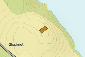
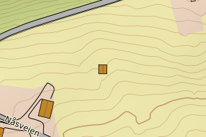
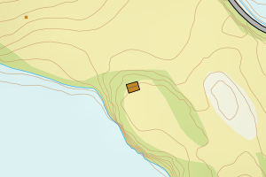
Avvikene kan skyldes enten feil bygningskoordinat eller bygningstype/status i matrikkel eller feil arealtype i AR5. Vær oppmerksom på det er krav om arealer på over 200 m2 før det er krav om endring av arealtype i AR5 så avvikene vil ikke alltid kreve retting i datagrunnlaget. Matrikkel_vedtaksdato angir når bygning er lagt inn i Matrikkelen. Hvis du tidligere har sjekket alle påviste tilfeller, kan du nå se på de som har dato etter siste gjennomgang og rette disse. Det kan i noen tilfeller stå «Ingen vedtaksdato» som betyr at det ikke finnes vedtaksdato i matrikkelen. Dette er ofte gamle registreringer f.eks Mabygg. Mulig byggstat i matrikkelen må endres(revet/brent)
| Kommune | LokalId | Bygningsnummer | Arealtype | Bygningstatus | Bygningstype | matrikkel_vedtaksdato | matrikkel_registreringsdato | Posisjon | WMS-bilde |
|---|
| 4016 Drangedal | 1c58c55a-1b4d-41d4-b050-602905db2ff2 | 165495179 | 21 | TB | 249 | Ingen vedtaksdato | 2005-02-25 | N: 6546483.00, Ø: 504148.00 |  |
| 4016 Drangedal | 4edec9d1-5dd6-43c0-8e80-4ba452badbd5 | 165495659 | 21 | TB | 249 | Ingen vedtaksdato | 2005-02-25 | N: 6547330.00, Ø: 504043.00 |  |
| 4016 Drangedal | e5a0c62a-f900-449b-966f-6d16550a2f70 | 165492242 | 21 | TB | 241 | Ingen vedtaksdato | 2005-02-25 | N: 6534742.00, Ø: 509174.00 |  |
| 4016 Drangedal | e9846aa9-8066-4706-a8c0-9bed5c329803 | 165483138 | 21 | TB | 249 | Ingen vedtaksdato | 2005-02-25 | N: 6556260.00, Ø: 499682.00 |  |
| 4016 Drangedal | 06c685c4-bfc3-435f-bfbd-fa1ce65fa4e4 | 165510593 | 21 | TB | 249 | Ingen vedtaksdato | 2005-02-25 | N: 6540033.00, Ø: 512184.00 |  |
| 4016 Drangedal | 271f5f83-d1bc-48ca-987e-46ce9e4370e6 | 165505212 | 21 | TB | 249 | Ingen vedtaksdato | 2005-02-25 | N: 6555643.00, Ø: 503356.00 |  |
| 4016 Drangedal | 5ee93f8b-10da-4783-bfad-486d49bc9330 | 165496949 | 21 | TB | 181 | Ingen vedtaksdato | 2005-02-25 | N: 6546760.80, Ø: 506726.00 |  |
| 4016 Drangedal | 7f23bcce-4f35-4cc9-adb0-c8b047a35fbc | 165484754 | 21 | TB | 249 | Ingen vedtaksdato | 2005-02-25 | N: 6556901.00, Ø: 502609.00 |  |
| 4016 Drangedal | c47ef9ee-8fbd-4ddd-909e-327e4971815d | 165505220 | 21 | TB | 249 | Ingen vedtaksdato | 2005-02-25 | N: 6555692.00, Ø: 503253.00 |  |
| 4016 Drangedal | f909ef7e-8c9d-411c-8f2a-efe0465b7b15 | 165517628 | 21 | TB | 249 | Ingen vedtaksdato | 2005-02-25 | N: 6549760.00, Ø: 503304.00 |  |
| 4016 Drangedal | fa68331d-f21e-423a-a7ef-52a74a87efbf | 165496620 | 21 | TB | 249 | Ingen vedtaksdato | 2005-02-25 | N: 6546661.00, Ø: 508006.00 |  |
| 4016 Drangedal | 6bccf0b8-7686-4614-840c-c49ab6811223 | 165485653 | 21 | TB | 249 | Ingen vedtaksdato | 2005-02-25 | N: 6555320.00, Ø: 498765.00 |  |
| 4016 Drangedal | 90b86666-2af9-490e-8e7c-c36d42a347fb | 165478517 | 21 | TB | 249 | Ingen vedtaksdato | 2005-02-25 | N: 6549759.00, Ø: 499499.00 |  |
| 4016 Drangedal | 502178d9-40ce-403d-923e-39cbd143d97c | 165477421 | 21 | TB | 181 | Ingen vedtaksdato | 2005-02-25 | N: 6547676.00, Ø: 503097.00 |  |
| 4016 Drangedal | 89bbd7de-b6c2-4385-8321-a6a5bd4c02bd | 165510577 | 21 | TB | 249 | Ingen vedtaksdato | 2005-02-25 | N: 6539994.00, Ø: 512245.00 |  |