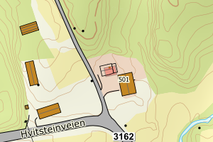
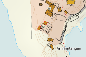
Avvikene skyldes oftest manglende sletting av bygningslinjer når bygningsflate er slettet i FKB-Bygning. Rettes i FKB-Bygning
Kommune | LokalId | Objekttype | Posisjon | WMS-bilde |
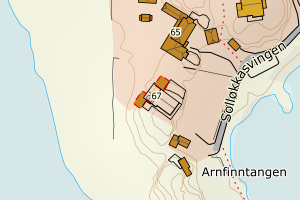
3907 Sandefjord | 7b9982ac-1026-4c67-8711-8c70d25e7190 | Taksprang | N: 6558109.81, Ø: 569631.34 | ![Kartbilde fra WMS-tjeneste av avviket](https://wms.geonorge.no/skwms1/wms.topo?VERSION=1.1.1&SERVICE=WMS&REQUEST=GetMap&LAYERS=topo&STYLES=&FORMAT=image/png&SRS=EPSG:25832&BBOX=569556.0,6558059,569706.0,6558159&WIDTH=300&HEIGHT=200) |
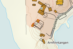
3907 Sandefjord | fed28bb3-290a-4400-b6dc-596c449451ad | Taksprang | N: 6558110.57, Ø: 569637.32 | ![Kartbilde fra WMS-tjeneste av avviket](https://wms.geonorge.no/skwms1/wms.topo?VERSION=1.1.1&SERVICE=WMS&REQUEST=GetMap&LAYERS=topo&STYLES=&FORMAT=image/png&SRS=EPSG:25832&BBOX=569562.0,6558060,569712.0,6558160&WIDTH=300&HEIGHT=200) |
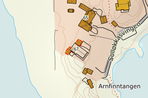
3907 Sandefjord | 97d0c320-74aa-4700-aac4-f16a2ebea836 | Taksprang | N: 6558108.68, Ø: 569637.18 | ![Kartbilde fra WMS-tjeneste av avviket](https://wms.geonorge.no/skwms1/wms.topo?VERSION=1.1.1&SERVICE=WMS&REQUEST=GetMap&LAYERS=topo&STYLES=&FORMAT=image/png&SRS=EPSG:25832&BBOX=569562.0,6558058,569712.0,6558158&WIDTH=300&HEIGHT=200) |
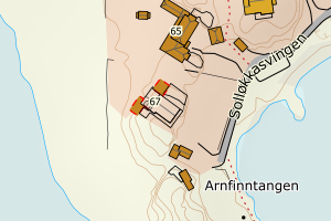
3907 Sandefjord | 89debc0a-bf68-4bee-b226-e7764602873e | Taksprang | N: 6558109.31, Ø: 569639.16 | ![Kartbilde fra WMS-tjeneste av avviket](https://wms.geonorge.no/skwms1/wms.topo?VERSION=1.1.1&SERVICE=WMS&REQUEST=GetMap&LAYERS=topo&STYLES=&FORMAT=image/png&SRS=EPSG:25832&BBOX=569564.0,6558059,569714.0,6558159&WIDTH=300&HEIGHT=200) |
3907 Sandefjord | bb35c6da-5fd7-4196-914a-77f3a3043854 | Taksprang | N: 6558107.40, Ø: 569637.09 | ![Kartbilde fra WMS-tjeneste av avviket](https://wms.geonorge.no/skwms1/wms.topo?VERSION=1.1.1&SERVICE=WMS&REQUEST=GetMap&LAYERS=topo&STYLES=&FORMAT=image/png&SRS=EPSG:25832&BBOX=569562.0,6558057,569712.0,6558157&WIDTH=300&HEIGHT=200) |
3907 Sandefjord | 0f23e594-e5a6-4b45-8864-84b21b456bba | Taksprang | N: 6566866.44, Ø: 560595.59 | ![Kartbilde fra WMS-tjeneste av avviket](https://wms.geonorge.no/skwms1/wms.topo?VERSION=1.1.1&SERVICE=WMS&REQUEST=GetMap&LAYERS=topo&STYLES=&FORMAT=image/png&SRS=EPSG:25832&BBOX=560520.0,6566816,560670.0,6566916&WIDTH=300&HEIGHT=200) |
3907 Sandefjord | 7e1261f0-f5c6-4dd8-b1e8-85fcbe1cdbcc | Mønelinje | N: 6558109.68, Ø: 569634.29 | ![Kartbilde fra WMS-tjeneste av avviket](https://wms.geonorge.no/skwms1/wms.topo?VERSION=1.1.1&SERVICE=WMS&REQUEST=GetMap&LAYERS=topo&STYLES=&FORMAT=image/png&SRS=EPSG:25832&BBOX=569559.0,6558059,569709.0,6558159&WIDTH=300&HEIGHT=200) |
3907 Sandefjord | 428221c8-0818-4f78-9cc2-5a9f14d9f7b2 | Mønelinje | N: 6556148.46, Ø: 567844.85 | ![Kartbilde fra WMS-tjeneste av avviket](https://wms.geonorge.no/skwms1/wms.topo?VERSION=1.1.1&SERVICE=WMS&REQUEST=GetMap&LAYERS=topo&STYLES=&FORMAT=image/png&SRS=EPSG:25832&BBOX=567769.0,6556098,567919.0,6556198&WIDTH=300&HEIGHT=200) |
3907 Sandefjord | 97dd2b7b-d604-4297-aee0-454a13e69f27 | Mønelinje | N: 6556707.46, Ø: 572982.02 | ![Kartbilde fra WMS-tjeneste av avviket](https://wms.geonorge.no/skwms1/wms.topo?VERSION=1.1.1&SERVICE=WMS&REQUEST=GetMap&LAYERS=topo&STYLES=&FORMAT=image/png&SRS=EPSG:25832&BBOX=572907.0,6556657,573057.0,6556757&WIDTH=300&HEIGHT=200) |
3907 Sandefjord | 0c7bbc5c-36d7-424e-8686-61d5e3f5f59c | Mønelinje | N: 6568230.35, Ø: 574161.04 | ![Kartbilde fra WMS-tjeneste av avviket](https://wms.geonorge.no/skwms1/wms.topo?VERSION=1.1.1&SERVICE=WMS&REQUEST=GetMap&LAYERS=topo&STYLES=&FORMAT=image/png&SRS=EPSG:25832&BBOX=574086.0,6568180,574236.0,6568280&WIDTH=300&HEIGHT=200) |
3907 Sandefjord | 3680e465-2a5d-4759-a05c-a40208b4bb12 | Mønelinje | N: 6558110.10, Ø: 569628.40 | ![Kartbilde fra WMS-tjeneste av avviket](https://wms.geonorge.no/skwms1/wms.topo?VERSION=1.1.1&SERVICE=WMS&REQUEST=GetMap&LAYERS=topo&STYLES=&FORMAT=image/png&SRS=EPSG:25832&BBOX=569553.0,6558060,569703.0,6558160&WIDTH=300&HEIGHT=200) |
3907 Sandefjord | 1e126530-200b-4b5c-8de7-f919d7cc3cb6 | Mønelinje | N: 6564391.44, Ø: 575723.21 | ![Kartbilde fra WMS-tjeneste av avviket](https://wms.geonorge.no/skwms1/wms.topo?VERSION=1.1.1&SERVICE=WMS&REQUEST=GetMap&LAYERS=topo&STYLES=&FORMAT=image/png&SRS=EPSG:25832&BBOX=575648.0,6564341,575798.0,6564441&WIDTH=300&HEIGHT=200) |
3907 Sandefjord | 99891ea8-7e9d-48a6-b78e-67fdeec25fc2 | Mønelinje | N: 6566865.56, Ø: 560591.45 | ![Kartbilde fra WMS-tjeneste av avviket](https://wms.geonorge.no/skwms1/wms.topo?VERSION=1.1.1&SERVICE=WMS&REQUEST=GetMap&LAYERS=topo&STYLES=&FORMAT=image/png&SRS=EPSG:25832&BBOX=560516.0,6566815,560666.0,6566915&WIDTH=300&HEIGHT=200) |
3907 Sandefjord | 04e40dd6-ed56-420a-997c-a1043334fbd4 | Mønelinje | N: 6567582.50, Ø: 571183.41 | ![Kartbilde fra WMS-tjeneste av avviket](https://wms.geonorge.no/skwms1/wms.topo?VERSION=1.1.1&SERVICE=WMS&REQUEST=GetMap&LAYERS=topo&STYLES=&FORMAT=image/png&SRS=EPSG:25832&BBOX=571108.0,6567532,571258.0,6567632&WIDTH=300&HEIGHT=200) |
3907 Sandefjord | d2c36210-39dd-4419-aa30-d87878740c93 | Mønelinje | N: 6565850.30, Ø: 564742.06 | ![Kartbilde fra WMS-tjeneste av avviket](https://wms.geonorge.no/skwms1/wms.topo?VERSION=1.1.1&SERVICE=WMS&REQUEST=GetMap&LAYERS=topo&STYLES=&FORMAT=image/png&SRS=EPSG:25832&BBOX=564667.0,6565800,564817.0,6565900&WIDTH=300&HEIGHT=200) |
3907 Sandefjord | cd8bbd14-1775-4560-bc08-b22cf837a7b8 | Mønelinje | N: 6554327.84, Ø: 568470.74 | ![Kartbilde fra WMS-tjeneste av avviket](https://wms.geonorge.no/skwms1/wms.topo?VERSION=1.1.1&SERVICE=WMS&REQUEST=GetMap&LAYERS=topo&STYLES=&FORMAT=image/png&SRS=EPSG:25832&BBOX=568395.0,6554277,568545.0,6554377&WIDTH=300&HEIGHT=200) |
3907 Sandefjord | 3a25a2b0-a102-4d82-9a8f-67ad48582dc9 | TaksprangBunn | N: 6566866.44, Ø: 560595.58 | ![Kartbilde fra WMS-tjeneste av avviket](https://wms.geonorge.no/skwms1/wms.topo?VERSION=1.1.1&SERVICE=WMS&REQUEST=GetMap&LAYERS=topo&STYLES=&FORMAT=image/png&SRS=EPSG:25832&BBOX=560520.0,6566816,560670.0,6566916&WIDTH=300&HEIGHT=200) |
3907 Sandefjord | 958f5a9c-500a-4933-9998-1f618a7746f0 | TaksprangBunn | N: 6558109.81, Ø: 569631.34 | ![Kartbilde fra WMS-tjeneste av avviket](https://wms.geonorge.no/skwms1/wms.topo?VERSION=1.1.1&SERVICE=WMS&REQUEST=GetMap&LAYERS=topo&STYLES=&FORMAT=image/png&SRS=EPSG:25832&BBOX=569556.0,6558059,569706.0,6558159&WIDTH=300&HEIGHT=200) |
3907 Sandefjord | f3dc84e3-9e20-499e-80f3-9b12550694d5 | TaksprangBunn | N: 6558110.57, Ø: 569637.32 | ![Kartbilde fra WMS-tjeneste av avviket](https://wms.geonorge.no/skwms1/wms.topo?VERSION=1.1.1&SERVICE=WMS&REQUEST=GetMap&LAYERS=topo&STYLES=&FORMAT=image/png&SRS=EPSG:25832&BBOX=569562.0,6558060,569712.0,6558160&WIDTH=300&HEIGHT=200) |
3907 Sandefjord | 4db6fd10-7906-46d1-a294-9128d2e1d7d5 | TaksprangBunn | N: 6558108.68, Ø: 569637.18 | ![Kartbilde fra WMS-tjeneste av avviket](https://wms.geonorge.no/skwms1/wms.topo?VERSION=1.1.1&SERVICE=WMS&REQUEST=GetMap&LAYERS=topo&STYLES=&FORMAT=image/png&SRS=EPSG:25832&BBOX=569562.0,6558058,569712.0,6558158&WIDTH=300&HEIGHT=200) |
3907 Sandefjord | b055d9a5-5aa7-42b7-b228-6ae86ece16ec | TaksprangBunn | N: 6558107.40, Ø: 569637.09 | ![Kartbilde fra WMS-tjeneste av avviket](https://wms.geonorge.no/skwms1/wms.topo?VERSION=1.1.1&SERVICE=WMS&REQUEST=GetMap&LAYERS=topo&STYLES=&FORMAT=image/png&SRS=EPSG:25832&BBOX=569562.0,6558057,569712.0,6558157&WIDTH=300&HEIGHT=200) |
3907 Sandefjord | 00887920-d4b4-427c-bc2a-2d7e43af90b9 | TaksprangBunn | N: 6558109.31, Ø: 569639.16 | ![Kartbilde fra WMS-tjeneste av avviket](https://wms.geonorge.no/skwms1/wms.topo?VERSION=1.1.1&SERVICE=WMS&REQUEST=GetMap&LAYERS=topo&STYLES=&FORMAT=image/png&SRS=EPSG:25832&BBOX=569564.0,6558059,569714.0,6558159&WIDTH=300&HEIGHT=200) |