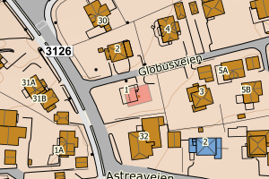
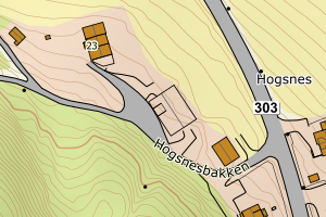
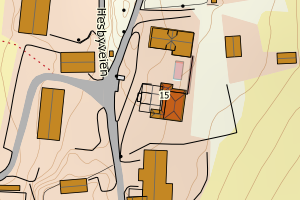
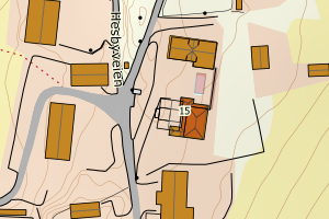
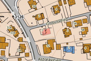
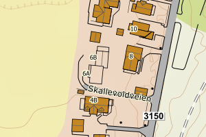
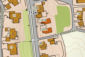
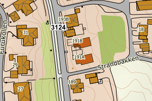
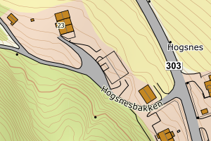
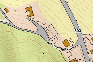
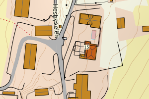
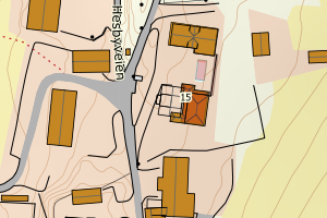
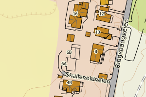
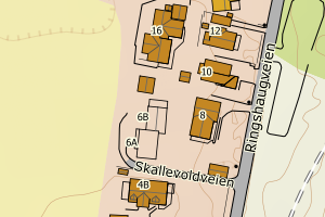
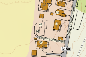
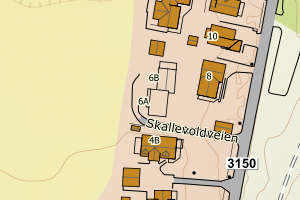
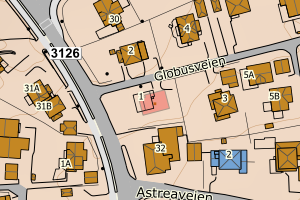
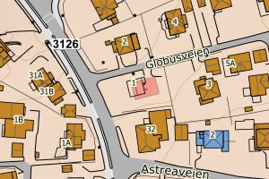
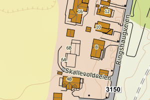
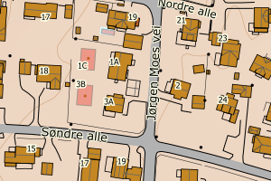
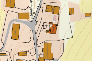
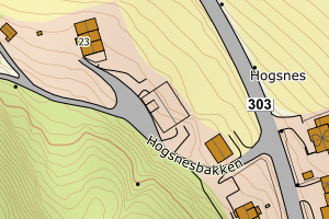
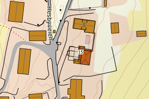
Avvikene skyldes oftest manglende sletting av bygningslinjer når bygningsflate er slettet i FKB-Bygning. Rettes i FKB-Bygning
Kommune | LokalId | Objekttype | Posisjon | WMS-bilde |
3905 Tønsberg | 329168e5-2113-4431-ac95-c9864bc6a6be | Bygningslinje | N: 6577837.15, Ø: 584930.33 | ![Kartbilde fra WMS-tjeneste av avviket](https://wms.geonorge.no/skwms1/wms.topo?VERSION=1.1.1&SERVICE=WMS&REQUEST=GetMap&LAYERS=topo&STYLES=&FORMAT=image/png&SRS=EPSG:25832&BBOX=584855.0,6577787,585005.0,6577887&WIDTH=300&HEIGHT=200) |
3905 Tønsberg | 8729ef12-299b-4bb8-8a37-a87a164ef4f7 | Bygningslinje | N: 6577827.06, Ø: 584928.16 | ![Kartbilde fra WMS-tjeneste av avviket](https://wms.geonorge.no/skwms1/wms.topo?VERSION=1.1.1&SERVICE=WMS&REQUEST=GetMap&LAYERS=topo&STYLES=&FORMAT=image/png&SRS=EPSG:25832&BBOX=584853.0,6577777,585003.0,6577877&WIDTH=300&HEIGHT=200) |
3905 Tønsberg | 2547b9f6-62f0-4299-83d9-b19e5614eae5 | Bygningslinje | N: 6577833.25, Ø: 584927.03 | ![Kartbilde fra WMS-tjeneste av avviket](https://wms.geonorge.no/skwms1/wms.topo?VERSION=1.1.1&SERVICE=WMS&REQUEST=GetMap&LAYERS=topo&STYLES=&FORMAT=image/png&SRS=EPSG:25832&BBOX=584852.0,6577783,585002.0,6577883&WIDTH=300&HEIGHT=200) |
3905 Tønsberg | 5119584a-5bb2-4ab1-b029-b14f69f65c87 | Bygningslinje | N: 6577825.81, Ø: 584925.41 | ![Kartbilde fra WMS-tjeneste av avviket](https://wms.geonorge.no/skwms1/wms.topo?VERSION=1.1.1&SERVICE=WMS&REQUEST=GetMap&LAYERS=topo&STYLES=&FORMAT=image/png&SRS=EPSG:25832&BBOX=584850.0,6577775,585000.0,6577875&WIDTH=300&HEIGHT=200) |
3905 Tønsberg | 42944452-be2a-442d-821b-90bc72a0ccfc | Bygningslinje | N: 6577835.33, Ø: 584929.20 | ![Kartbilde fra WMS-tjeneste av avviket](https://wms.geonorge.no/skwms1/wms.topo?VERSION=1.1.1&SERVICE=WMS&REQUEST=GetMap&LAYERS=topo&STYLES=&FORMAT=image/png&SRS=EPSG:25832&BBOX=584854.0,6577785,585004.0,6577885&WIDTH=300&HEIGHT=200) |
3905 Tønsberg | 38115710-449f-4e08-a618-7d43123af13a | Bygningslinje | N: 6570764.29, Ø: 580331.85 | ![Kartbilde fra WMS-tjeneste av avviket](https://wms.geonorge.no/skwms1/wms.topo?VERSION=1.1.1&SERVICE=WMS&REQUEST=GetMap&LAYERS=topo&STYLES=&FORMAT=image/png&SRS=EPSG:25832&BBOX=580256.0,6570714,580406.0,6570814&WIDTH=300&HEIGHT=200) |
3905 Tønsberg | 0d7c51fc-c41e-4480-846e-be0caaf2193f | Bygningslinje | N: 6577835.11, Ø: 584922.84 | ![Kartbilde fra WMS-tjeneste av avviket](https://wms.geonorge.no/skwms1/wms.topo?VERSION=1.1.1&SERVICE=WMS&REQUEST=GetMap&LAYERS=topo&STYLES=&FORMAT=image/png&SRS=EPSG:25832&BBOX=584847.0,6577785,584997.0,6577885&WIDTH=300&HEIGHT=200) |
3905 Tønsberg | 62017445-ff5b-4ecd-ac22-03d045b1e489 | Bygningslinje | N: 6577839.40, Ø: 584929.31 | ![Kartbilde fra WMS-tjeneste av avviket](https://wms.geonorge.no/skwms1/wms.topo?VERSION=1.1.1&SERVICE=WMS&REQUEST=GetMap&LAYERS=topo&STYLES=&FORMAT=image/png&SRS=EPSG:25832&BBOX=584854.0,6577789,585004.0,6577889&WIDTH=300&HEIGHT=200) |
3905 Tønsberg | 5a5d335d-f45f-4021-97e1-2b91ceb704de | Taksprang | N: 6570761.93, Ø: 580327.01 | ![Kartbilde fra WMS-tjeneste av avviket](https://wms.geonorge.no/skwms1/wms.topo?VERSION=1.1.1&SERVICE=WMS&REQUEST=GetMap&LAYERS=topo&STYLES=&FORMAT=image/png&SRS=EPSG:25832&BBOX=580252.0,6570711,580402.0,6570811&WIDTH=300&HEIGHT=200) |
3905 Tønsberg | 8982e62f-0b36-46d9-8506-cb738f7cf708 | Taksprang | N: 6570763.68, Ø: 580330.31 | ![Kartbilde fra WMS-tjeneste av avviket](https://wms.geonorge.no/skwms1/wms.topo?VERSION=1.1.1&SERVICE=WMS&REQUEST=GetMap&LAYERS=topo&STYLES=&FORMAT=image/png&SRS=EPSG:25832&BBOX=580255.0,6570713,580405.0,6570813&WIDTH=300&HEIGHT=200) |
3905 Tønsberg | 7fc8e4d0-c64d-416a-87d8-03757c9323e4 | Taksprang | N: 6569894.61, Ø: 580292.42 | ![Kartbilde fra WMS-tjeneste av avviket](https://wms.geonorge.no/skwms1/wms.topo?VERSION=1.1.1&SERVICE=WMS&REQUEST=GetMap&LAYERS=topo&STYLES=&FORMAT=image/png&SRS=EPSG:25832&BBOX=580217.0,6569844,580367.0,6569944&WIDTH=300&HEIGHT=200) |
3905 Tønsberg | 008e9a5f-1922-49e6-b142-9a5073a5b770 | Taksprang | N: 6569872.67, Ø: 580275.69 | ![Kartbilde fra WMS-tjeneste av avviket](https://wms.geonorge.no/skwms1/wms.topo?VERSION=1.1.1&SERVICE=WMS&REQUEST=GetMap&LAYERS=topo&STYLES=&FORMAT=image/png&SRS=EPSG:25832&BBOX=580200.0,6569822,580350.0,6569922&WIDTH=300&HEIGHT=200) |
3905 Tønsberg | b6482ea7-6ad1-4087-a6cc-7b42ada7a2d7 | Taksprang | N: 6569875.25, Ø: 580273.91 | ![Kartbilde fra WMS-tjeneste av avviket](https://wms.geonorge.no/skwms1/wms.topo?VERSION=1.1.1&SERVICE=WMS&REQUEST=GetMap&LAYERS=topo&STYLES=&FORMAT=image/png&SRS=EPSG:25832&BBOX=580198.0,6569825,580348.0,6569925&WIDTH=300&HEIGHT=200) |
3905 Tønsberg | fe81797d-8451-4aea-991f-06724d7cd270 | Taksprang | N: 6570767.23, Ø: 580333.14 | ![Kartbilde fra WMS-tjeneste av avviket](https://wms.geonorge.no/skwms1/wms.topo?VERSION=1.1.1&SERVICE=WMS&REQUEST=GetMap&LAYERS=topo&STYLES=&FORMAT=image/png&SRS=EPSG:25832&BBOX=580258.0,6570717,580408.0,6570817&WIDTH=300&HEIGHT=200) |
3905 Tønsberg | 3937577b-219e-4864-a66b-3310d79ec484 | Taksprang | N: 6570767.37, Ø: 580331.19 | ![Kartbilde fra WMS-tjeneste av avviket](https://wms.geonorge.no/skwms1/wms.topo?VERSION=1.1.1&SERVICE=WMS&REQUEST=GetMap&LAYERS=topo&STYLES=&FORMAT=image/png&SRS=EPSG:25832&BBOX=580256.0,6570717,580406.0,6570817&WIDTH=300&HEIGHT=200) |
3905 Tønsberg | e454c239-4b3a-4310-9e06-06fc588750fc | Taksprang | N: 6582337.18, Ø: 570598.51 | ![Kartbilde fra WMS-tjeneste av avviket](https://wms.geonorge.no/skwms1/wms.topo?VERSION=1.1.1&SERVICE=WMS&REQUEST=GetMap&LAYERS=topo&STYLES=&FORMAT=image/png&SRS=EPSG:25832&BBOX=570523.0,6582287,570673.0,6582387&WIDTH=300&HEIGHT=200) |
3905 Tønsberg | 641909b1-faba-473d-9734-8a449a66f7bb | Mønelinje | N: 6571039.03, Ø: 579850.68 | ![Kartbilde fra WMS-tjeneste av avviket](https://wms.geonorge.no/skwms1/wms.topo?VERSION=1.1.1&SERVICE=WMS&REQUEST=GetMap&LAYERS=topo&STYLES=&FORMAT=image/png&SRS=EPSG:25832&BBOX=579775.0,6570989,579925.0,6571089&WIDTH=300&HEIGHT=200) |
3905 Tønsberg | 04f4a8af-8a3c-4914-a397-961dabda6b59 | Mønelinje | N: 6568531.60, Ø: 578181.93 | ![Kartbilde fra WMS-tjeneste av avviket](https://wms.geonorge.no/skwms1/wms.topo?VERSION=1.1.1&SERVICE=WMS&REQUEST=GetMap&LAYERS=topo&STYLES=&FORMAT=image/png&SRS=EPSG:25832&BBOX=578106.0,6568481,578256.0,6568581&WIDTH=300&HEIGHT=200) |
3905 Tønsberg | d223a4ca-9194-499e-b086-4b869d8632cc | Mønelinje | N: 6582335.05, Ø: 570594.15 | ![Kartbilde fra WMS-tjeneste av avviket](https://wms.geonorge.no/skwms1/wms.topo?VERSION=1.1.1&SERVICE=WMS&REQUEST=GetMap&LAYERS=topo&STYLES=&FORMAT=image/png&SRS=EPSG:25832&BBOX=570519.0,6582285,570669.0,6582385&WIDTH=300&HEIGHT=200) |
3905 Tønsberg | 787cd446-35d3-4130-a631-1a82e3b911a3 | Mønelinje | N: 6587417.04, Ø: 574640.10 | ![Kartbilde fra WMS-tjeneste av avviket](https://wms.geonorge.no/skwms1/wms.topo?VERSION=1.1.1&SERVICE=WMS&REQUEST=GetMap&LAYERS=topo&STYLES=&FORMAT=image/png&SRS=EPSG:25832&BBOX=574565.0,6587367,574715.0,6587467&WIDTH=300&HEIGHT=200) |
3905 Tønsberg | 31ffe4dc-1971-4269-993a-f52e42ae14c8 | Mønelinje | N: 6587406.00, Ø: 574622.05 | ![Kartbilde fra WMS-tjeneste av avviket](https://wms.geonorge.no/skwms1/wms.topo?VERSION=1.1.1&SERVICE=WMS&REQUEST=GetMap&LAYERS=topo&STYLES=&FORMAT=image/png&SRS=EPSG:25832&BBOX=574547.0,6587356,574697.0,6587456&WIDTH=300&HEIGHT=200) |
3905 Tønsberg | 9f0c81dc-acc6-4aec-94a5-fe213de54f37 | Mønelinje | N: 6587413.86, Ø: 574633.61 | ![Kartbilde fra WMS-tjeneste av avviket](https://wms.geonorge.no/skwms1/wms.topo?VERSION=1.1.1&SERVICE=WMS&REQUEST=GetMap&LAYERS=topo&STYLES=&FORMAT=image/png&SRS=EPSG:25832&BBOX=574558.0,6587363,574708.0,6587463&WIDTH=300&HEIGHT=200) |
3905 Tønsberg | 70cd0d18-1d46-4531-b33a-fbd9424aa0ca | Mønelinje | N: 6587379.35, Ø: 574660.13 | ![Kartbilde fra WMS-tjeneste av avviket](https://wms.geonorge.no/skwms1/wms.topo?VERSION=1.1.1&SERVICE=WMS&REQUEST=GetMap&LAYERS=topo&STYLES=&FORMAT=image/png&SRS=EPSG:25832&BBOX=574585.0,6587329,574735.0,6587429&WIDTH=300&HEIGHT=200) |
3905 Tønsberg | 43d85da4-b308-4c6f-a550-ac92522ea867 | Mønelinje | N: 6571650.84, Ø: 582627.30 | ![Kartbilde fra WMS-tjeneste av avviket](https://wms.geonorge.no/skwms1/wms.topo?VERSION=1.1.1&SERVICE=WMS&REQUEST=GetMap&LAYERS=topo&STYLES=&FORMAT=image/png&SRS=EPSG:25832&BBOX=582552.0,6571600,582702.0,6571700&WIDTH=300&HEIGHT=200) |
3905 Tønsberg | 2bfe73b9-5479-46ab-9a37-356ec086b4fb | Mønelinje | N: 6571037.44, Ø: 579847.29 | ![Kartbilde fra WMS-tjeneste av avviket](https://wms.geonorge.no/skwms1/wms.topo?VERSION=1.1.1&SERVICE=WMS&REQUEST=GetMap&LAYERS=topo&STYLES=&FORMAT=image/png&SRS=EPSG:25832&BBOX=579772.0,6570987,579922.0,6571087&WIDTH=300&HEIGHT=200) |
3905 Tønsberg | 372eea29-0217-4104-ae7e-27b06ba20a7b | Mønelinje | N: 6575941.31, Ø: 585096.26 | ![Kartbilde fra WMS-tjeneste av avviket](https://wms.geonorge.no/skwms1/wms.topo?VERSION=1.1.1&SERVICE=WMS&REQUEST=GetMap&LAYERS=topo&STYLES=&FORMAT=image/png&SRS=EPSG:25832&BBOX=585021.0,6575891,585171.0,6575991&WIDTH=300&HEIGHT=200) |
3905 Tønsberg | ceb5c85b-e1c7-4666-9f9f-0b60cb195960 | Mønelinje | N: 6573440.94, Ø: 580661.29 | ![Kartbilde fra WMS-tjeneste av avviket](https://wms.geonorge.no/skwms1/wms.topo?VERSION=1.1.1&SERVICE=WMS&REQUEST=GetMap&LAYERS=topo&STYLES=&FORMAT=image/png&SRS=EPSG:25832&BBOX=580586.0,6573390,580736.0,6573490&WIDTH=300&HEIGHT=200) |
3905 Tønsberg | 6079db7f-0600-4da8-9b01-6447fb2e31d1 | Mønelinje | N: 6577833.66, Ø: 584925.09 | ![Kartbilde fra WMS-tjeneste av avviket](https://wms.geonorge.no/skwms1/wms.topo?VERSION=1.1.1&SERVICE=WMS&REQUEST=GetMap&LAYERS=topo&STYLES=&FORMAT=image/png&SRS=EPSG:25832&BBOX=584850.0,6577783,585000.0,6577883&WIDTH=300&HEIGHT=200) |
3905 Tønsberg | 17070ca5-8c0b-45a5-a3bd-a46ef9aaf7ae | Mønelinje | N: 6587957.32, Ø: 568401.77 | ![Kartbilde fra WMS-tjeneste av avviket](https://wms.geonorge.no/skwms1/wms.topo?VERSION=1.1.1&SERVICE=WMS&REQUEST=GetMap&LAYERS=topo&STYLES=&FORMAT=image/png&SRS=EPSG:25832&BBOX=568326.0,6587907,568476.0,6588007&WIDTH=300&HEIGHT=200) |
3905 Tønsberg | 611fb9a9-62b2-4d5a-9304-837ec081dd4d | TaksprangBunn | N: 6570762.72, Ø: 580327.80 | ![Kartbilde fra WMS-tjeneste av avviket](https://wms.geonorge.no/skwms1/wms.topo?VERSION=1.1.1&SERVICE=WMS&REQUEST=GetMap&LAYERS=topo&STYLES=&FORMAT=image/png&SRS=EPSG:25832&BBOX=580252.0,6570712,580402.0,6570812&WIDTH=300&HEIGHT=200) |
3905 Tønsberg | 7e6cd3b7-1012-429f-a6d4-28adf1cf4a29 | TaksprangBunn | N: 6570767.23, Ø: 580333.14 | ![Kartbilde fra WMS-tjeneste av avviket](https://wms.geonorge.no/skwms1/wms.topo?VERSION=1.1.1&SERVICE=WMS&REQUEST=GetMap&LAYERS=topo&STYLES=&FORMAT=image/png&SRS=EPSG:25832&BBOX=580258.0,6570717,580408.0,6570817&WIDTH=300&HEIGHT=200) |
3905 Tønsberg | b1a96b86-cc99-45a6-a33c-4be57f1be0cb | TaksprangBunn | N: 6570768.16, Ø: 580331.72 | ![Kartbilde fra WMS-tjeneste av avviket](https://wms.geonorge.no/skwms1/wms.topo?VERSION=1.1.1&SERVICE=WMS&REQUEST=GetMap&LAYERS=topo&STYLES=&FORMAT=image/png&SRS=EPSG:25832&BBOX=580256.0,6570718,580406.0,6570818&WIDTH=300&HEIGHT=200) |
3905 Tønsberg | 198e6649-d318-4c31-bb02-d89c13afdd73 | TaksprangBunn | N: 6570763.68, Ø: 580330.31 | ![Kartbilde fra WMS-tjeneste av avviket](https://wms.geonorge.no/skwms1/wms.topo?VERSION=1.1.1&SERVICE=WMS&REQUEST=GetMap&LAYERS=topo&STYLES=&FORMAT=image/png&SRS=EPSG:25832&BBOX=580255.0,6570713,580405.0,6570813&WIDTH=300&HEIGHT=200) |
3905 Tønsberg | 684ac154-f46c-42ed-a796-33c2294fcf3b | TaksprangBunn | N: 6569875.25, Ø: 580273.91 | ![Kartbilde fra WMS-tjeneste av avviket](https://wms.geonorge.no/skwms1/wms.topo?VERSION=1.1.1&SERVICE=WMS&REQUEST=GetMap&LAYERS=topo&STYLES=&FORMAT=image/png&SRS=EPSG:25832&BBOX=580198.0,6569825,580348.0,6569925&WIDTH=300&HEIGHT=200) |
3905 Tønsberg | 7e0eabf0-faf1-41d0-bde4-b042f7780bc2 | TaksprangBunn | N: 6569894.61, Ø: 580292.42 | ![Kartbilde fra WMS-tjeneste av avviket](https://wms.geonorge.no/skwms1/wms.topo?VERSION=1.1.1&SERVICE=WMS&REQUEST=GetMap&LAYERS=topo&STYLES=&FORMAT=image/png&SRS=EPSG:25832&BBOX=580217.0,6569844,580367.0,6569944&WIDTH=300&HEIGHT=200) |
3905 Tønsberg | 782b7a13-0cf2-4be8-9f29-9d9e15b8a167 | TaksprangBunn | N: 6569889.17, Ø: 580298.95 | ![Kartbilde fra WMS-tjeneste av avviket](https://wms.geonorge.no/skwms1/wms.topo?VERSION=1.1.1&SERVICE=WMS&REQUEST=GetMap&LAYERS=topo&STYLES=&FORMAT=image/png&SRS=EPSG:25832&BBOX=580223.0,6569839,580373.0,6569939&WIDTH=300&HEIGHT=200) |
3905 Tønsberg | d53f18d8-feec-49a3-8c6b-c33dfd359ec1 | TaksprangBunn | N: 6569872.67, Ø: 580275.69 | ![Kartbilde fra WMS-tjeneste av avviket](https://wms.geonorge.no/skwms1/wms.topo?VERSION=1.1.1&SERVICE=WMS&REQUEST=GetMap&LAYERS=topo&STYLES=&FORMAT=image/png&SRS=EPSG:25832&BBOX=580200.0,6569822,580350.0,6569922&WIDTH=300&HEIGHT=200) |
3905 Tønsberg | dad8ca8e-1fd6-40e3-a6c2-67ab585b35ed | TaksprangBunn | N: 6582337.18, Ø: 570598.51 | ![Kartbilde fra WMS-tjeneste av avviket](https://wms.geonorge.no/skwms1/wms.topo?VERSION=1.1.1&SERVICE=WMS&REQUEST=GetMap&LAYERS=topo&STYLES=&FORMAT=image/png&SRS=EPSG:25832&BBOX=570523.0,6582287,570673.0,6582387&WIDTH=300&HEIGHT=200) |
3905 Tønsberg | 578f0699-8270-49f4-9ced-9214f418de77 | TaksprangBunn | N: 6587215.17, Ø: 564289.30 | ![Kartbilde fra WMS-tjeneste av avviket](https://wms.geonorge.no/skwms1/wms.topo?VERSION=1.1.1&SERVICE=WMS&REQUEST=GetMap&LAYERS=topo&STYLES=&FORMAT=image/png&SRS=EPSG:25832&BBOX=564214.0,6587165,564364.0,6587265&WIDTH=300&HEIGHT=200) |