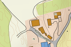
Avvikene skyldes oftest manglende eller unøyaktig registrering av bygningspunkt i matrikkelen. Rettes vanligvis i matrikkelen
Kommune | LokalId | Areal (m2) | Posisjon | WMS-bilde |
3446 Gran | 4ed12af7-d123-46d5-b6f6-1735f4cb1db6 | 751.32 | N: 6691079.14, Ø: 582445.10 | ![Kartbilde fra WMS-tjeneste av avviket](https://wms.geonorge.no/skwms1/wms.topo?VERSION=1.1.1&SERVICE=WMS&REQUEST=GetMap&LAYERS=topo&STYLES=&FORMAT=image/png&SRS=EPSG:25832&BBOX=582370.0,6691029,582520.0,6691129&WIDTH=300&HEIGHT=200) |
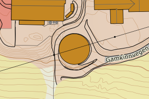
3446 Gran | a9efe461-f262-4c91-bfc6-42995e72c87c | 704.10 | N: 6699092.16, Ø: 582484.48 | ![Kartbilde fra WMS-tjeneste av avviket](https://wms.geonorge.no/skwms1/wms.topo?VERSION=1.1.1&SERVICE=WMS&REQUEST=GetMap&LAYERS=topo&STYLES=&FORMAT=image/png&SRS=EPSG:25832&BBOX=582409.0,6699042,582559.0,6699142&WIDTH=300&HEIGHT=200) |
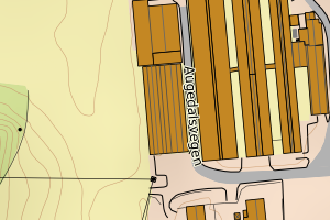
3446 Gran | f240cc36-4090-421b-879b-4f9ecb319de8 | 584.43 | N: 6701654.68, Ø: 588356.76 | ![Kartbilde fra WMS-tjeneste av avviket](https://wms.geonorge.no/skwms1/wms.topo?VERSION=1.1.1&SERVICE=WMS&REQUEST=GetMap&LAYERS=topo&STYLES=&FORMAT=image/png&SRS=EPSG:25832&BBOX=588281.0,6701604,588431.0,6701704&WIDTH=300&HEIGHT=200) |
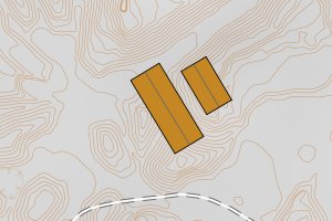
3446 Gran | 7e813bad-b607-4cf0-aea0-9c3e1e679a1f | 544.84 | N: 6691721.75, Ø: 581126.83 | ![Kartbilde fra WMS-tjeneste av avviket](https://wms.geonorge.no/skwms1/wms.topo?VERSION=1.1.1&SERVICE=WMS&REQUEST=GetMap&LAYERS=topo&STYLES=&FORMAT=image/png&SRS=EPSG:25832&BBOX=581051.0,6691671,581201.0,6691771&WIDTH=300&HEIGHT=200) |
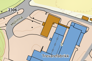
3446 Gran | 5c5f8713-c4cf-4f09-ae5f-094b02e202ba | 523.44 | N: 6690034.18, Ø: 588148.01 | ![Kartbilde fra WMS-tjeneste av avviket](https://wms.geonorge.no/skwms1/wms.topo?VERSION=1.1.1&SERVICE=WMS&REQUEST=GetMap&LAYERS=topo&STYLES=&FORMAT=image/png&SRS=EPSG:25832&BBOX=588073.0,6689984,588223.0,6690084&WIDTH=300&HEIGHT=200) |
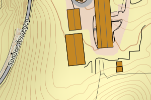
3446 Gran | 926671b4-a0a8-4ced-bdcb-c1eb12ebfa69 | 463.85 | N: 6691127.27, Ø: 582564.15 | ![Kartbilde fra WMS-tjeneste av avviket](https://wms.geonorge.no/skwms1/wms.topo?VERSION=1.1.1&SERVICE=WMS&REQUEST=GetMap&LAYERS=topo&STYLES=&FORMAT=image/png&SRS=EPSG:25832&BBOX=582489.0,6691077,582639.0,6691177&WIDTH=300&HEIGHT=200) |
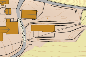
3446 Gran | 7d06a4a1-edc4-40e7-8a4b-bc1c4b1b144d | 455.43 | N: 6695753.37, Ø: 586006.93 | ![Kartbilde fra WMS-tjeneste av avviket](https://wms.geonorge.no/skwms1/wms.topo?VERSION=1.1.1&SERVICE=WMS&REQUEST=GetMap&LAYERS=topo&STYLES=&FORMAT=image/png&SRS=EPSG:25832&BBOX=585931.0,6695703,586081.0,6695803&WIDTH=300&HEIGHT=200) |
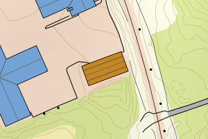
3446 Gran | 667e1fd7-b547-4fb4-8676-1553e6bb7b5d | 430.65 | N: 6697747.82, Ø: 584542.81 | ![Kartbilde fra WMS-tjeneste av avviket](https://wms.geonorge.no/skwms1/wms.topo?VERSION=1.1.1&SERVICE=WMS&REQUEST=GetMap&LAYERS=topo&STYLES=&FORMAT=image/png&SRS=EPSG:25832&BBOX=584467.0,6697697,584617.0,6697797&WIDTH=300&HEIGHT=200) |
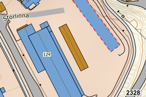
3446 Gran | e1341004-e008-48b7-b5ae-1ff55b81f526 | 411.70 | N: 6703256.12, Ø: 590452.44 | ![Kartbilde fra WMS-tjeneste av avviket](https://wms.geonorge.no/skwms1/wms.topo?VERSION=1.1.1&SERVICE=WMS&REQUEST=GetMap&LAYERS=topo&STYLES=&FORMAT=image/png&SRS=EPSG:25832&BBOX=590377.0,6703206,590527.0,6703306&WIDTH=300&HEIGHT=200) |
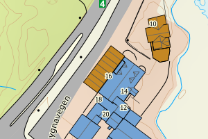
3446 Gran | 91a40f4f-b62f-49c7-9b2b-628f24edb686 | 409.61 | N: 6688130.86, Ø: 577367.40 | ![Kartbilde fra WMS-tjeneste av avviket](https://wms.geonorge.no/skwms1/wms.topo?VERSION=1.1.1&SERVICE=WMS&REQUEST=GetMap&LAYERS=topo&STYLES=&FORMAT=image/png&SRS=EPSG:25832&BBOX=577292.0,6688080,577442.0,6688180&WIDTH=300&HEIGHT=200) |
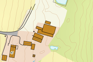
3446 Gran | 9e1875a5-fcab-4592-a139-5f2c1428d867 | 361.01 | N: 6693181.77, Ø: 584848.51 | ![Kartbilde fra WMS-tjeneste av avviket](https://wms.geonorge.no/skwms1/wms.topo?VERSION=1.1.1&SERVICE=WMS&REQUEST=GetMap&LAYERS=topo&STYLES=&FORMAT=image/png&SRS=EPSG:25832&BBOX=584773.0,6693131,584923.0,6693231&WIDTH=300&HEIGHT=200) |
3446 Gran | ac7bea4a-625c-42a2-92e8-1bd952d83145 | 355.60 | N: 6694291.15, Ø: 578587.38 | ![Kartbilde fra WMS-tjeneste av avviket](https://wms.geonorge.no/skwms1/wms.topo?VERSION=1.1.1&SERVICE=WMS&REQUEST=GetMap&LAYERS=topo&STYLES=&FORMAT=image/png&SRS=EPSG:25832&BBOX=578512.0,6694241,578662.0,6694341&WIDTH=300&HEIGHT=200) |
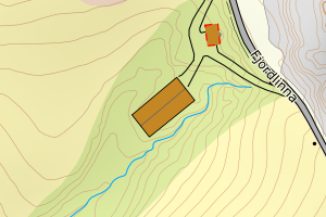
3446 Gran | 18c520fd-0ec9-43a6-83c2-dbbfc6c2f119 | 297.13 | N: 6701664.99, Ø: 588374.52 | ![Kartbilde fra WMS-tjeneste av avviket](https://wms.geonorge.no/skwms1/wms.topo?VERSION=1.1.1&SERVICE=WMS&REQUEST=GetMap&LAYERS=topo&STYLES=&FORMAT=image/png&SRS=EPSG:25832&BBOX=588299.0,6701614,588449.0,6701714&WIDTH=300&HEIGHT=200) |
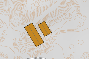
3446 Gran | e0d3a952-b4e3-41e9-b7ac-5a4d2fa1ec9a | 296.77 | N: 6691674.97, Ø: 586410.17 | ![Kartbilde fra WMS-tjeneste av avviket](https://wms.geonorge.no/skwms1/wms.topo?VERSION=1.1.1&SERVICE=WMS&REQUEST=GetMap&LAYERS=topo&STYLES=&FORMAT=image/png&SRS=EPSG:25832&BBOX=586335.0,6691624,586485.0,6691724&WIDTH=300&HEIGHT=200) |
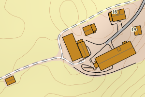
3446 Gran | 9c22a8ec-a328-42b2-bd33-b8c372f3feaf | 295.48 | N: 6707333.29, Ø: 578631.20 | ![Kartbilde fra WMS-tjeneste av avviket](https://wms.geonorge.no/skwms1/wms.topo?VERSION=1.1.1&SERVICE=WMS&REQUEST=GetMap&LAYERS=topo&STYLES=&FORMAT=image/png&SRS=EPSG:25832&BBOX=578556.0,6707283,578706.0,6707383&WIDTH=300&HEIGHT=200) |
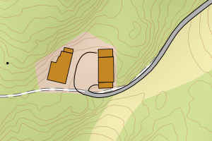
3446 Gran | d3027dcd-6355-42de-8d7b-ff12a18c9ba4 | 290.45 | N: 6709980.03, Ø: 576791.48 | ![Kartbilde fra WMS-tjeneste av avviket](https://wms.geonorge.no/skwms1/wms.topo?VERSION=1.1.1&SERVICE=WMS&REQUEST=GetMap&LAYERS=topo&STYLES=&FORMAT=image/png&SRS=EPSG:25832&BBOX=576716.0,6709930,576866.0,6710030&WIDTH=300&HEIGHT=200) |
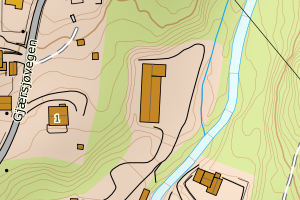
3446 Gran | decdd96d-070f-47fb-ade0-737986ec56af | 285.82 | N: 6689593.95, Ø: 587573.80 | ![Kartbilde fra WMS-tjeneste av avviket](https://wms.geonorge.no/skwms1/wms.topo?VERSION=1.1.1&SERVICE=WMS&REQUEST=GetMap&LAYERS=topo&STYLES=&FORMAT=image/png&SRS=EPSG:25832&BBOX=587498.0,6689543,587648.0,6689643&WIDTH=300&HEIGHT=200) |
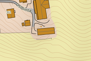
3446 Gran | 64d396de-f02a-48ba-8197-15e65b82b93f | 275.48 | N: 6699141.48, Ø: 583180.07 | ![Kartbilde fra WMS-tjeneste av avviket](https://wms.geonorge.no/skwms1/wms.topo?VERSION=1.1.1&SERVICE=WMS&REQUEST=GetMap&LAYERS=topo&STYLES=&FORMAT=image/png&SRS=EPSG:25832&BBOX=583105.0,6699091,583255.0,6699191&WIDTH=300&HEIGHT=200) |
3446 Gran | a7822be2-2d20-4c42-94a7-b87c0b41f365 | 274.12 | N: 6691685.43, Ø: 587402.56 | ![Kartbilde fra WMS-tjeneste av avviket](https://wms.geonorge.no/skwms1/wms.topo?VERSION=1.1.1&SERVICE=WMS&REQUEST=GetMap&LAYERS=topo&STYLES=&FORMAT=image/png&SRS=EPSG:25832&BBOX=587327.0,6691635,587477.0,6691735&WIDTH=300&HEIGHT=200) |
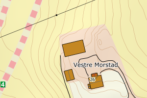
3446 Gran | 9a944c1a-f1c0-4410-af1b-46f37612ce12 | 273.18 | N: 6707332.77, Ø: 578597.97 | ![Kartbilde fra WMS-tjeneste av avviket](https://wms.geonorge.no/skwms1/wms.topo?VERSION=1.1.1&SERVICE=WMS&REQUEST=GetMap&LAYERS=topo&STYLES=&FORMAT=image/png&SRS=EPSG:25832&BBOX=578522.0,6707282,578672.0,6707382&WIDTH=300&HEIGHT=200) |
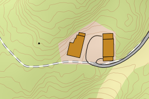
3446 Gran | 1a6d97dc-8522-4fd0-bf1d-6a16893810ec | 267.65 | N: 6691098.10, Ø: 583689.79 | ![Kartbilde fra WMS-tjeneste av avviket](https://wms.geonorge.no/skwms1/wms.topo?VERSION=1.1.1&SERVICE=WMS&REQUEST=GetMap&LAYERS=topo&STYLES=&FORMAT=image/png&SRS=EPSG:25832&BBOX=583614.0,6691048,583764.0,6691148&WIDTH=300&HEIGHT=200) |
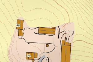
3446 Gran | 0d6e0fb8-76de-4ce2-89f2-0568a75f0e71 | 265.45 | N: 6695176.91, Ø: 582967.92 | ![Kartbilde fra WMS-tjeneste av avviket](https://wms.geonorge.no/skwms1/wms.topo?VERSION=1.1.1&SERVICE=WMS&REQUEST=GetMap&LAYERS=topo&STYLES=&FORMAT=image/png&SRS=EPSG:25832&BBOX=582892.0,6695126,583042.0,6695226&WIDTH=300&HEIGHT=200) |
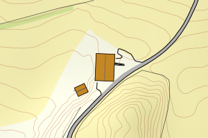
3446 Gran | a21d9f62-3428-4da1-ad30-afb2491fe2e0 | 264.99 | N: 6697153.35, Ø: 581783.77 | ![Kartbilde fra WMS-tjeneste av avviket](https://wms.geonorge.no/skwms1/wms.topo?VERSION=1.1.1&SERVICE=WMS&REQUEST=GetMap&LAYERS=topo&STYLES=&FORMAT=image/png&SRS=EPSG:25832&BBOX=581708.0,6697103,581858.0,6697203&WIDTH=300&HEIGHT=200) |
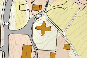
3446 Gran | 463273a4-1ff2-43ed-bf6d-ab136e447dcd | 257.31 | N: 6698109.67, Ø: 582690.11 | ![Kartbilde fra WMS-tjeneste av avviket](https://wms.geonorge.no/skwms1/wms.topo?VERSION=1.1.1&SERVICE=WMS&REQUEST=GetMap&LAYERS=topo&STYLES=&FORMAT=image/png&SRS=EPSG:25832&BBOX=582615.0,6698059,582765.0,6698159&WIDTH=300&HEIGHT=200) |
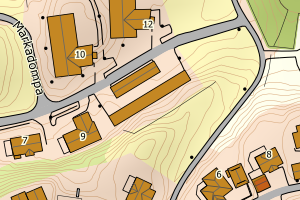
3446 Gran | 3bda6b15-2c28-48a1-8d9f-5b0b69921d3e | 254.89 | N: 6694797.58, Ø: 591475.40 | ![Kartbilde fra WMS-tjeneste av avviket](https://wms.geonorge.no/skwms1/wms.topo?VERSION=1.1.1&SERVICE=WMS&REQUEST=GetMap&LAYERS=topo&STYLES=&FORMAT=image/png&SRS=EPSG:25832&BBOX=591400.0,6694747,591550.0,6694847&WIDTH=300&HEIGHT=200) |
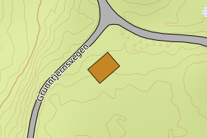
3446 Gran | 76e94e1b-6de3-488a-a94f-1f216bb8cf42 | 251.29 | N: 6689197.74, Ø: 585533.44 | ![Kartbilde fra WMS-tjeneste av avviket](https://wms.geonorge.no/skwms1/wms.topo?VERSION=1.1.1&SERVICE=WMS&REQUEST=GetMap&LAYERS=topo&STYLES=&FORMAT=image/png&SRS=EPSG:25832&BBOX=585458.0,6689147,585608.0,6689247&WIDTH=300&HEIGHT=200) |
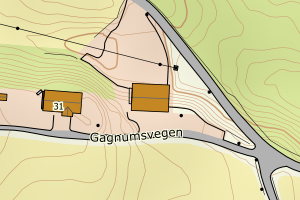
3446 Gran | 3f5aa5a0-e26e-4292-8ffb-4b01583a0866 | 251.20 | N: 6701245.17, Ø: 589628.33 | ![Kartbilde fra WMS-tjeneste av avviket](https://wms.geonorge.no/skwms1/wms.topo?VERSION=1.1.1&SERVICE=WMS&REQUEST=GetMap&LAYERS=topo&STYLES=&FORMAT=image/png&SRS=EPSG:25832&BBOX=589553.0,6701195,589703.0,6701295&WIDTH=300&HEIGHT=200) |
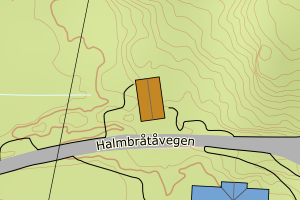
3446 Gran | fb0b158c-0a22-4bed-96a8-29d439d9d285 | 251.12 | N: 6691316.96, Ø: 586171.05 | ![Kartbilde fra WMS-tjeneste av avviket](https://wms.geonorge.no/skwms1/wms.topo?VERSION=1.1.1&SERVICE=WMS&REQUEST=GetMap&LAYERS=topo&STYLES=&FORMAT=image/png&SRS=EPSG:25832&BBOX=586096.0,6691266,586246.0,6691366&WIDTH=300&HEIGHT=200) |
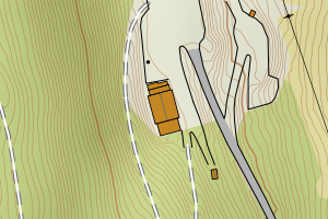
3446 Gran | 40aaee02-c23a-4923-906b-ccb7e46e30f2 | 248.16 | N: 6695348.03, Ø: 587042.55 | ![Kartbilde fra WMS-tjeneste av avviket](https://wms.geonorge.no/skwms1/wms.topo?VERSION=1.1.1&SERVICE=WMS&REQUEST=GetMap&LAYERS=topo&STYLES=&FORMAT=image/png&SRS=EPSG:25832&BBOX=586967.0,6695298,587117.0,6695398&WIDTH=300&HEIGHT=200) |
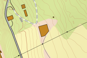
3446 Gran | 4146207d-ff28-4b63-aaa8-471d72af9a0d | 247.08 | N: 6694364.39, Ø: 579273.93 | ![Kartbilde fra WMS-tjeneste av avviket](https://wms.geonorge.no/skwms1/wms.topo?VERSION=1.1.1&SERVICE=WMS&REQUEST=GetMap&LAYERS=topo&STYLES=&FORMAT=image/png&SRS=EPSG:25832&BBOX=579198.0,6694314,579348.0,6694414&WIDTH=300&HEIGHT=200) |
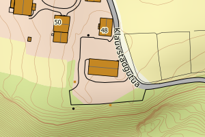
3446 Gran | f97adbb1-5ae9-47fa-a539-410629c82d69 | 246.95 | N: 6708860.82, Ø: 573103.74 | ![Kartbilde fra WMS-tjeneste av avviket](https://wms.geonorge.no/skwms1/wms.topo?VERSION=1.1.1&SERVICE=WMS&REQUEST=GetMap&LAYERS=topo&STYLES=&FORMAT=image/png&SRS=EPSG:25832&BBOX=573028.0,6708810,573178.0,6708910&WIDTH=300&HEIGHT=200) |
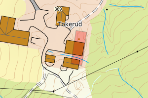
3446 Gran | 1d98fe2b-f5de-4bb9-83f5-db57e30e5e6f | 237.84 | N: 6696504.05, Ø: 587545.06 | ![Kartbilde fra WMS-tjeneste av avviket](https://wms.geonorge.no/skwms1/wms.topo?VERSION=1.1.1&SERVICE=WMS&REQUEST=GetMap&LAYERS=topo&STYLES=&FORMAT=image/png&SRS=EPSG:25832&BBOX=587470.0,6696454,587620.0,6696554&WIDTH=300&HEIGHT=200) |
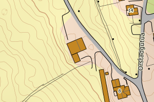
3446 Gran | 596e5df8-9a53-46bc-a779-5c21f50b928b | 236.68 | N: 6709581.87, Ø: 571153.37 | ![Kartbilde fra WMS-tjeneste av avviket](https://wms.geonorge.no/skwms1/wms.topo?VERSION=1.1.1&SERVICE=WMS&REQUEST=GetMap&LAYERS=topo&STYLES=&FORMAT=image/png&SRS=EPSG:25832&BBOX=571078.0,6709531,571228.0,6709631&WIDTH=300&HEIGHT=200) |
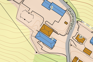
3446 Gran | 13ddb41b-cb1d-4cbb-8c52-4e9c95a98372 | 232.02 | N: 6690207.01, Ø: 579197.68 | ![Kartbilde fra WMS-tjeneste av avviket](https://wms.geonorge.no/skwms1/wms.topo?VERSION=1.1.1&SERVICE=WMS&REQUEST=GetMap&LAYERS=topo&STYLES=&FORMAT=image/png&SRS=EPSG:25832&BBOX=579122.0,6690157,579272.0,6690257&WIDTH=300&HEIGHT=200) |
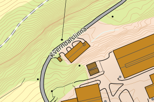
3446 Gran | d6344562-fdaf-4eed-8f95-4250a6d4ef3f | 230.49 | N: 6697382.85, Ø: 584733.98 | ![Kartbilde fra WMS-tjeneste av avviket](https://wms.geonorge.no/skwms1/wms.topo?VERSION=1.1.1&SERVICE=WMS&REQUEST=GetMap&LAYERS=topo&STYLES=&FORMAT=image/png&SRS=EPSG:25832&BBOX=584658.0,6697332,584808.0,6697432&WIDTH=300&HEIGHT=200) |
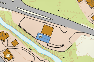
3446 Gran | 1c315882-7b5a-4de8-814f-7e13a8ff2b55 | 226.65 | N: 6695271.74, Ø: 579100.49 | ![Kartbilde fra WMS-tjeneste av avviket](https://wms.geonorge.no/skwms1/wms.topo?VERSION=1.1.1&SERVICE=WMS&REQUEST=GetMap&LAYERS=topo&STYLES=&FORMAT=image/png&SRS=EPSG:25832&BBOX=579025.0,6695221,579175.0,6695321&WIDTH=300&HEIGHT=200) |
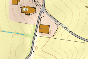
3446 Gran | f64a0bf6-f05b-4143-abc9-aab172b7259b | 220.64 | N: 6694851.50, Ø: 584713.30 | ![Kartbilde fra WMS-tjeneste av avviket](https://wms.geonorge.no/skwms1/wms.topo?VERSION=1.1.1&SERVICE=WMS&REQUEST=GetMap&LAYERS=topo&STYLES=&FORMAT=image/png&SRS=EPSG:25832&BBOX=584638.0,6694801,584788.0,6694901&WIDTH=300&HEIGHT=200) |
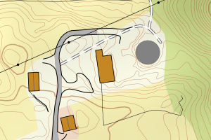
3446 Gran | 2ed508da-48ef-4eb2-94af-d5eea364c709 | 219.59 | N: 6691626.70, Ø: 581062.66 | ![Kartbilde fra WMS-tjeneste av avviket](https://wms.geonorge.no/skwms1/wms.topo?VERSION=1.1.1&SERVICE=WMS&REQUEST=GetMap&LAYERS=topo&STYLES=&FORMAT=image/png&SRS=EPSG:25832&BBOX=580987.0,6691576,581137.0,6691676&WIDTH=300&HEIGHT=200) |
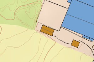
3446 Gran | aa2a30c5-2ff9-4698-b990-b54242ecbce4 | 218.09 | N: 6700857.79, Ø: 580721.37 | ![Kartbilde fra WMS-tjeneste av avviket](https://wms.geonorge.no/skwms1/wms.topo?VERSION=1.1.1&SERVICE=WMS&REQUEST=GetMap&LAYERS=topo&STYLES=&FORMAT=image/png&SRS=EPSG:25832&BBOX=580646.0,6700807,580796.0,6700907&WIDTH=300&HEIGHT=200) |
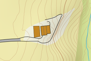
3446 Gran | 39522f88-466c-4d22-a838-2ff09dbbf421 | 215.42 | N: 6694565.87, Ø: 582019.49 | ![Kartbilde fra WMS-tjeneste av avviket](https://wms.geonorge.no/skwms1/wms.topo?VERSION=1.1.1&SERVICE=WMS&REQUEST=GetMap&LAYERS=topo&STYLES=&FORMAT=image/png&SRS=EPSG:25832&BBOX=581944.0,6694515,582094.0,6694615&WIDTH=300&HEIGHT=200) |
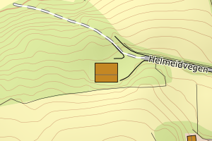
3446 Gran | bde65c51-d42c-4823-b6ab-8dc6efb9f90d | 212.46 | N: 6701551.14, Ø: 588375.23 | ![Kartbilde fra WMS-tjeneste av avviket](https://wms.geonorge.no/skwms1/wms.topo?VERSION=1.1.1&SERVICE=WMS&REQUEST=GetMap&LAYERS=topo&STYLES=&FORMAT=image/png&SRS=EPSG:25832&BBOX=588300.0,6701501,588450.0,6701601&WIDTH=300&HEIGHT=200) |
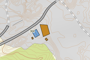
3446 Gran | d428040d-32d7-491f-9826-1c745cc4616f | 210.48 | N: 6694927.67, Ø: 584148.36 | ![Kartbilde fra WMS-tjeneste av avviket](https://wms.geonorge.no/skwms1/wms.topo?VERSION=1.1.1&SERVICE=WMS&REQUEST=GetMap&LAYERS=topo&STYLES=&FORMAT=image/png&SRS=EPSG:25832&BBOX=584073.0,6694877,584223.0,6694977&WIDTH=300&HEIGHT=200) |
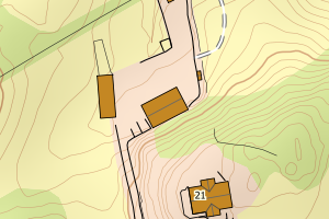
3446 Gran | e74a6969-86cc-4853-ad76-cfdc35486fff | 208.28 | N: 6701205.83, Ø: 581104.18 | ![Kartbilde fra WMS-tjeneste av avviket](https://wms.geonorge.no/skwms1/wms.topo?VERSION=1.1.1&SERVICE=WMS&REQUEST=GetMap&LAYERS=topo&STYLES=&FORMAT=image/png&SRS=EPSG:25832&BBOX=581029.0,6701155,581179.0,6701255&WIDTH=300&HEIGHT=200) |
3446 Gran | cc2d206a-1ae1-47ea-a5e9-f5c0f9b52696 | 206.54 | N: 6699854.42, Ø: 596985.66 | ![Kartbilde fra WMS-tjeneste av avviket](https://wms.geonorge.no/skwms1/wms.topo?VERSION=1.1.1&SERVICE=WMS&REQUEST=GetMap&LAYERS=topo&STYLES=&FORMAT=image/png&SRS=EPSG:25832&BBOX=596910.0,6699804,597060.0,6699904&WIDTH=300&HEIGHT=200) |
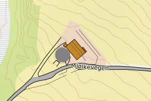
3446 Gran | b0c1bbe6-ca55-4fda-8bf8-aab731837933 | 204.87 | N: 6699276.35, Ø: 597830.05 | ![Kartbilde fra WMS-tjeneste av avviket](https://wms.geonorge.no/skwms1/wms.topo?VERSION=1.1.1&SERVICE=WMS&REQUEST=GetMap&LAYERS=topo&STYLES=&FORMAT=image/png&SRS=EPSG:25832&BBOX=597755.0,6699226,597905.0,6699326&WIDTH=300&HEIGHT=200) |
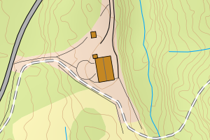
3446 Gran | 68b150ad-aee4-484e-8f8a-46a8b04452a2 | 204.69 | N: 6692621.57, Ø: 586521.07 | ![Kartbilde fra WMS-tjeneste av avviket](https://wms.geonorge.no/skwms1/wms.topo?VERSION=1.1.1&SERVICE=WMS&REQUEST=GetMap&LAYERS=topo&STYLES=&FORMAT=image/png&SRS=EPSG:25832&BBOX=586446.0,6692571,586596.0,6692671&WIDTH=300&HEIGHT=200) |
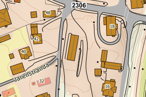
3446 Gran | a8307579-0e2f-426f-a95e-fc8400e9071d | 202.85 | N: 6704992.71, Ø: 583466.39 | ![Kartbilde fra WMS-tjeneste av avviket](https://wms.geonorge.no/skwms1/wms.topo?VERSION=1.1.1&SERVICE=WMS&REQUEST=GetMap&LAYERS=topo&STYLES=&FORMAT=image/png&SRS=EPSG:25832&BBOX=583391.0,6704942,583541.0,6705042&WIDTH=300&HEIGHT=200) |