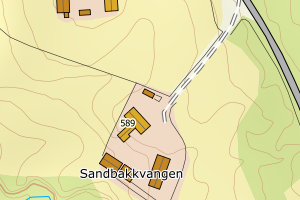
Avvikene skyldes vanligvis unøyaktig registrering av bygningspunkt i matrikkelen slik at det har havnet utenfor bygningsomriss. Rettes vanligvis i matrikkelen
Kommune | LokalId | Bygningsnummer | Avstand (m) | Posisjon | WMS-bilde |
3427 Tynset | 9f057cd3-e618-47f8-b95b-335b03b7a90d | 155008946 | 0.03 | N: 6916161.00, Ø: 579660.00 | ![Kartbilde fra WMS-tjeneste av avviket](https://wms.geonorge.no/skwms1/wms.topo?VERSION=1.1.1&SERVICE=WMS&REQUEST=GetMap&LAYERS=topo&STYLES=&FORMAT=image/png&SRS=EPSG:25832&BBOX=579584.0,6916111,579734.0,6916211&WIDTH=300&HEIGHT=200) |
3427 Tynset | d0287da9-5fce-4174-b428-849ffee69801 | 300367307 | 0.03 | N: 6909226.20, Ø: 579727.60 | ![Kartbilde fra WMS-tjeneste av avviket](https://wms.geonorge.no/skwms1/wms.topo?VERSION=1.1.1&SERVICE=WMS&REQUEST=GetMap&LAYERS=topo&STYLES=&FORMAT=image/png&SRS=EPSG:25832&BBOX=579652.0,6909176,579802.0,6909276&WIDTH=300&HEIGHT=200) |
3427 Tynset | 010fe775-c2d6-4cba-bbb7-783a150d2fb7 | 155035730 | 0.03 | N: 6912899.00, Ø: 593103.00 | ![Kartbilde fra WMS-tjeneste av avviket](https://wms.geonorge.no/skwms1/wms.topo?VERSION=1.1.1&SERVICE=WMS&REQUEST=GetMap&LAYERS=topo&STYLES=&FORMAT=image/png&SRS=EPSG:25832&BBOX=593027.0,6912849,593177.0,6912949&WIDTH=300&HEIGHT=200) |
3427 Tynset | 10e83de3-9d56-41a2-b7a2-1115d9281c54 | 155042540 | 0.03 | N: 6904183.00, Ø: 597821.00 | ![Kartbilde fra WMS-tjeneste av avviket](https://wms.geonorge.no/skwms1/wms.topo?VERSION=1.1.1&SERVICE=WMS&REQUEST=GetMap&LAYERS=topo&STYLES=&FORMAT=image/png&SRS=EPSG:25832&BBOX=597745.0,6904133,597895.0,6904233&WIDTH=300&HEIGHT=200) |
3427 Tynset | 072ca1e6-7fa1-4f0c-a4b1-c177c5256149 | 155046422 | 0.04 | N: 6888949.00, Ø: 602843.00 | ![Kartbilde fra WMS-tjeneste av avviket](https://wms.geonorge.no/skwms1/wms.topo?VERSION=1.1.1&SERVICE=WMS&REQUEST=GetMap&LAYERS=topo&STYLES=&FORMAT=image/png&SRS=EPSG:25832&BBOX=602767.0,6888899,602917.0,6888999&WIDTH=300&HEIGHT=200) |
3427 Tynset | a61686bf-e54c-404c-9881-d585b7695b34 | 155043733 | 0.04 | N: 6903698.00, Ø: 601189.00 | ![Kartbilde fra WMS-tjeneste av avviket](https://wms.geonorge.no/skwms1/wms.topo?VERSION=1.1.1&SERVICE=WMS&REQUEST=GetMap&LAYERS=topo&STYLES=&FORMAT=image/png&SRS=EPSG:25832&BBOX=601113.0,6903648,601263.0,6903748&WIDTH=300&HEIGHT=200) |
3427 Tynset | 240afca0-45d5-4420-a1fe-c0f5dc0f4038 | 155017406 | 0.04 | N: 6913660.00, Ø: 584860.00 | ![Kartbilde fra WMS-tjeneste av avviket](https://wms.geonorge.no/skwms1/wms.topo?VERSION=1.1.1&SERVICE=WMS&REQUEST=GetMap&LAYERS=topo&STYLES=&FORMAT=image/png&SRS=EPSG:25832&BBOX=584784.0,6913610,584934.0,6913710&WIDTH=300&HEIGHT=200) |
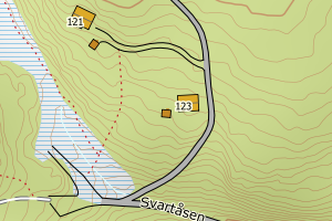
3427 Tynset | 512e1140-3472-4252-867b-e9d95d12faf6 | 155051051 | 0.05 | N: 6900336.00, Ø: 594791.00 | ![Kartbilde fra WMS-tjeneste av avviket](https://wms.geonorge.no/skwms1/wms.topo?VERSION=1.1.1&SERVICE=WMS&REQUEST=GetMap&LAYERS=topo&STYLES=&FORMAT=image/png&SRS=EPSG:25832&BBOX=594715.0,6900286,594865.0,6900386&WIDTH=300&HEIGHT=200) |
3427 Tynset | 35c1997f-b68f-463c-81d7-d6bae415b3e4 | 155017392 | 0.07 | N: 6913691.00, Ø: 584828.00 | ![Kartbilde fra WMS-tjeneste av avviket](https://wms.geonorge.no/skwms1/wms.topo?VERSION=1.1.1&SERVICE=WMS&REQUEST=GetMap&LAYERS=topo&STYLES=&FORMAT=image/png&SRS=EPSG:25832&BBOX=584752.0,6913641,584902.0,6913741&WIDTH=300&HEIGHT=200) |
3427 Tynset | c4a9e743-be3f-4806-a160-c8813969f11a | 155059257 | 0.07 | N: 6897865.00, Ø: 601747.00 | ![Kartbilde fra WMS-tjeneste av avviket](https://wms.geonorge.no/skwms1/wms.topo?VERSION=1.1.1&SERVICE=WMS&REQUEST=GetMap&LAYERS=topo&STYLES=&FORMAT=image/png&SRS=EPSG:25832&BBOX=601671.0,6897815,601821.0,6897915&WIDTH=300&HEIGHT=200) |
3427 Tynset | a0e155fd-fbc2-42a5-baeb-29d4609100a2 | 155037121 | 0.07 | N: 6911820.90, Ø: 593233.80 | ![Kartbilde fra WMS-tjeneste av avviket](https://wms.geonorge.no/skwms1/wms.topo?VERSION=1.1.1&SERVICE=WMS&REQUEST=GetMap&LAYERS=topo&STYLES=&FORMAT=image/png&SRS=EPSG:25832&BBOX=593158.0,6911770,593308.0,6911870&WIDTH=300&HEIGHT=200) |
3427 Tynset | 303ff12b-f7c2-42db-9105-2ba99a70e9e4 | 155042788 | 0.08 | N: 6903994.00, Ø: 597881.00 | ![Kartbilde fra WMS-tjeneste av avviket](https://wms.geonorge.no/skwms1/wms.topo?VERSION=1.1.1&SERVICE=WMS&REQUEST=GetMap&LAYERS=topo&STYLES=&FORMAT=image/png&SRS=EPSG:25832&BBOX=597805.0,6903944,597955.0,6904044&WIDTH=300&HEIGHT=200) |
3427 Tynset | b54f10b7-51f5-4f52-831b-69f71047e8bd | 25938402 | 0.11 | N: 6909646.00, Ø: 580353.00 | ![Kartbilde fra WMS-tjeneste av avviket](https://wms.geonorge.no/skwms1/wms.topo?VERSION=1.1.1&SERVICE=WMS&REQUEST=GetMap&LAYERS=topo&STYLES=&FORMAT=image/png&SRS=EPSG:25832&BBOX=580277.0,6909596,580427.0,6909696&WIDTH=300&HEIGHT=200) |
3427 Tynset | 042d3e1c-6ccb-4df7-b8bb-95ff05fefd84 | 300775580 | 0.11 | N: 6918915.40, Ø: 588057.60 | ![Kartbilde fra WMS-tjeneste av avviket](https://wms.geonorge.no/skwms1/wms.topo?VERSION=1.1.1&SERVICE=WMS&REQUEST=GetMap&LAYERS=topo&STYLES=&FORMAT=image/png&SRS=EPSG:25832&BBOX=587982.0,6918865,588132.0,6918965&WIDTH=300&HEIGHT=200) |
3427 Tynset | bd60e7d1-465c-4aba-8418-5cd034d3b144 | 155026782 | 0.12 | N: 6894223.00, Ø: 591471.00 | ![Kartbilde fra WMS-tjeneste av avviket](https://wms.geonorge.no/skwms1/wms.topo?VERSION=1.1.1&SERVICE=WMS&REQUEST=GetMap&LAYERS=topo&STYLES=&FORMAT=image/png&SRS=EPSG:25832&BBOX=591395.0,6894173,591545.0,6894273&WIDTH=300&HEIGHT=200) |
3427 Tynset | bd78b0fa-b538-4fd4-bc26-693abc6bba03 | 155030100 | 0.12 | N: 6899503.00, Ø: 591200.60 | ![Kartbilde fra WMS-tjeneste av avviket](https://wms.geonorge.no/skwms1/wms.topo?VERSION=1.1.1&SERVICE=WMS&REQUEST=GetMap&LAYERS=topo&STYLES=&FORMAT=image/png&SRS=EPSG:25832&BBOX=591125.0,6899453,591275.0,6899553&WIDTH=300&HEIGHT=200) |
3427 Tynset | ccc1c59c-8dd0-4c39-9e34-65a1e8163cd0 | 155033878 | 0.12 | N: 6914499.00, Ø: 589324.00 | ![Kartbilde fra WMS-tjeneste av avviket](https://wms.geonorge.no/skwms1/wms.topo?VERSION=1.1.1&SERVICE=WMS&REQUEST=GetMap&LAYERS=topo&STYLES=&FORMAT=image/png&SRS=EPSG:25832&BBOX=589248.0,6914449,589398.0,6914549&WIDTH=300&HEIGHT=200) |
3427 Tynset | b15ddf32-96a2-4915-87f2-0d0b398df415 | 300247081 | 0.13 | N: 6899369.60, Ø: 591233.70 | ![Kartbilde fra WMS-tjeneste av avviket](https://wms.geonorge.no/skwms1/wms.topo?VERSION=1.1.1&SERVICE=WMS&REQUEST=GetMap&LAYERS=topo&STYLES=&FORMAT=image/png&SRS=EPSG:25832&BBOX=591158.0,6899319,591308.0,6899419&WIDTH=300&HEIGHT=200) |
3427 Tynset | dc444bd1-b595-4ba6-91d0-406e4892ccd7 | 155008903 | 0.13 | N: 6916170.00, Ø: 579678.00 | ![Kartbilde fra WMS-tjeneste av avviket](https://wms.geonorge.no/skwms1/wms.topo?VERSION=1.1.1&SERVICE=WMS&REQUEST=GetMap&LAYERS=topo&STYLES=&FORMAT=image/png&SRS=EPSG:25832&BBOX=579602.0,6916120,579752.0,6916220&WIDTH=300&HEIGHT=200) |
3427 Tynset | 0a93cee5-4c59-44b1-9154-8c7d77d1abe3 | 19033155 | 0.13 | N: 6923252.00, Ø: 571845.00 | ![Kartbilde fra WMS-tjeneste av avviket](https://wms.geonorge.no/skwms1/wms.topo?VERSION=1.1.1&SERVICE=WMS&REQUEST=GetMap&LAYERS=topo&STYLES=&FORMAT=image/png&SRS=EPSG:25832&BBOX=571769.0,6923202,571919.0,6923302&WIDTH=300&HEIGHT=200) |
3427 Tynset | 32abe04b-6d0b-4eb8-8346-42d08596e599 | 300746993 | 0.15 | N: 6910539.60, Ø: 577373.40 | ![Kartbilde fra WMS-tjeneste av avviket](https://wms.geonorge.no/skwms1/wms.topo?VERSION=1.1.1&SERVICE=WMS&REQUEST=GetMap&LAYERS=topo&STYLES=&FORMAT=image/png&SRS=EPSG:25832&BBOX=577298.0,6910489,577448.0,6910589&WIDTH=300&HEIGHT=200) |
3427 Tynset | f0bad896-7686-47df-80fc-447003166f19 | 155009462 | 0.18 | N: 6922628.00, Ø: 579223.00 | ![Kartbilde fra WMS-tjeneste av avviket](https://wms.geonorge.no/skwms1/wms.topo?VERSION=1.1.1&SERVICE=WMS&REQUEST=GetMap&LAYERS=topo&STYLES=&FORMAT=image/png&SRS=EPSG:25832&BBOX=579147.0,6922578,579297.0,6922678&WIDTH=300&HEIGHT=200) |
3427 Tynset | 4854bd7b-2d4f-49ae-b17c-383aa207a6f2 | 155038632 | 0.18 | N: 6887317.00, Ø: 598306.00 | ![Kartbilde fra WMS-tjeneste av avviket](https://wms.geonorge.no/skwms1/wms.topo?VERSION=1.1.1&SERVICE=WMS&REQUEST=GetMap&LAYERS=topo&STYLES=&FORMAT=image/png&SRS=EPSG:25832&BBOX=598230.0,6887267,598380.0,6887367&WIDTH=300&HEIGHT=200) |
3427 Tynset | c3bb663b-9ef0-4e23-91f2-525d9d0fe267 | 155008873 | 0.19 | N: 6916174.00, Ø: 579635.00 | ![Kartbilde fra WMS-tjeneste av avviket](https://wms.geonorge.no/skwms1/wms.topo?VERSION=1.1.1&SERVICE=WMS&REQUEST=GetMap&LAYERS=topo&STYLES=&FORMAT=image/png&SRS=EPSG:25832&BBOX=579559.0,6916124,579709.0,6916224&WIDTH=300&HEIGHT=200) |
3427 Tynset | b5f673cb-ea6e-4309-813a-3a76fbebed24 | 155042524 | 0.20 | N: 6904258.00, Ø: 598006.00 | ![Kartbilde fra WMS-tjeneste av avviket](https://wms.geonorge.no/skwms1/wms.topo?VERSION=1.1.1&SERVICE=WMS&REQUEST=GetMap&LAYERS=topo&STYLES=&FORMAT=image/png&SRS=EPSG:25832&BBOX=597930.0,6904208,598080.0,6904308&WIDTH=300&HEIGHT=200) |
3427 Tynset | d334dd85-5a7d-430a-a036-10f5f087b29a | 155015241 | 0.20 | N: 6906255.00, Ø: 585526.00 | ![Kartbilde fra WMS-tjeneste av avviket](https://wms.geonorge.no/skwms1/wms.topo?VERSION=1.1.1&SERVICE=WMS&REQUEST=GetMap&LAYERS=topo&STYLES=&FORMAT=image/png&SRS=EPSG:25832&BBOX=585450.0,6906205,585600.0,6906305&WIDTH=300&HEIGHT=200) |
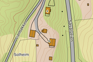
3427 Tynset | 7d47a357-d32f-45e9-878f-2e0800dda70c | 155012412 | 0.21 | N: 6902335.00, Ø: 582970.00 | ![Kartbilde fra WMS-tjeneste av avviket](https://wms.geonorge.no/skwms1/wms.topo?VERSION=1.1.1&SERVICE=WMS&REQUEST=GetMap&LAYERS=topo&STYLES=&FORMAT=image/png&SRS=EPSG:25832&BBOX=582894.0,6902285,583044.0,6902385&WIDTH=300&HEIGHT=200) |
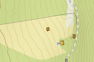
3427 Tynset | 477b918b-219f-4c53-940c-aa5ae6c81164 | 155022027 | 0.21 | N: 6890402.00, Ø: 590574.00 | ![Kartbilde fra WMS-tjeneste av avviket](https://wms.geonorge.no/skwms1/wms.topo?VERSION=1.1.1&SERVICE=WMS&REQUEST=GetMap&LAYERS=topo&STYLES=&FORMAT=image/png&SRS=EPSG:25832&BBOX=590498.0,6890352,590648.0,6890452&WIDTH=300&HEIGHT=200) |
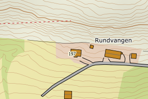
3427 Tynset | 6fbe49f2-86ab-4a0f-9ba2-ef2acdf7bbbc | 155025115 | 0.22 | N: 6887518.00, Ø: 594149.00 | ![Kartbilde fra WMS-tjeneste av avviket](https://wms.geonorge.no/skwms1/wms.topo?VERSION=1.1.1&SERVICE=WMS&REQUEST=GetMap&LAYERS=topo&STYLES=&FORMAT=image/png&SRS=EPSG:25832&BBOX=594073.0,6887468,594223.0,6887568&WIDTH=300&HEIGHT=200) |
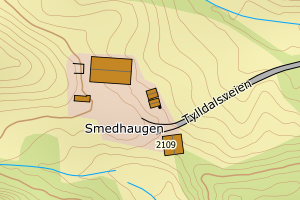
3427 Tynset | 71bb00fb-c0e4-4460-8b72-51e9154fd464 | 155037407 | 0.26 | N: 6914906.00, Ø: 589728.00 | ![Kartbilde fra WMS-tjeneste av avviket](https://wms.geonorge.no/skwms1/wms.topo?VERSION=1.1.1&SERVICE=WMS&REQUEST=GetMap&LAYERS=topo&STYLES=&FORMAT=image/png&SRS=EPSG:25832&BBOX=589652.0,6914856,589802.0,6914956&WIDTH=300&HEIGHT=200) |
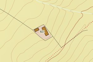
3427 Tynset | 8d2322c6-af66-43b1-8c69-2e15f06b6bef | 155046953 | 0.26 | N: 6895721.00, Ø: 606786.00 | ![Kartbilde fra WMS-tjeneste av avviket](https://wms.geonorge.no/skwms1/wms.topo?VERSION=1.1.1&SERVICE=WMS&REQUEST=GetMap&LAYERS=topo&STYLES=&FORMAT=image/png&SRS=EPSG:25832&BBOX=606710.0,6895671,606860.0,6895771&WIDTH=300&HEIGHT=200) |
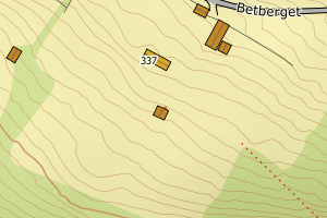
3427 Tynset | ca8bd464-8f3e-459e-990a-8337b09de812 | 154986529 | 0.29 | N: 6913062.00, Ø: 597917.00 | ![Kartbilde fra WMS-tjeneste av avviket](https://wms.geonorge.no/skwms1/wms.topo?VERSION=1.1.1&SERVICE=WMS&REQUEST=GetMap&LAYERS=topo&STYLES=&FORMAT=image/png&SRS=EPSG:25832&BBOX=597841.0,6913012,597991.0,6913112&WIDTH=300&HEIGHT=200) |
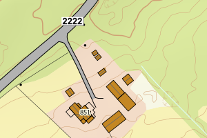
3427 Tynset | 8d7cc221-7699-45b3-ab53-56c74bd3f717 | 155037326 | 0.30 | N: 6914769.00, Ø: 589317.00 | ![Kartbilde fra WMS-tjeneste av avviket](https://wms.geonorge.no/skwms1/wms.topo?VERSION=1.1.1&SERVICE=WMS&REQUEST=GetMap&LAYERS=topo&STYLES=&FORMAT=image/png&SRS=EPSG:25832&BBOX=589241.0,6914719,589391.0,6914819&WIDTH=300&HEIGHT=200) |
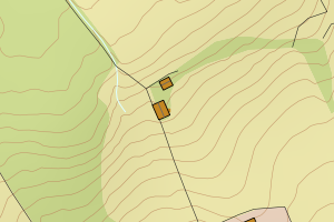
3427 Tynset | 2f35015f-094c-4500-bcb7-b0f45c56b036 | 154972692 | 0.30 | N: 6906417.00, Ø: 589472.00 | ![Kartbilde fra WMS-tjeneste av avviket](https://wms.geonorge.no/skwms1/wms.topo?VERSION=1.1.1&SERVICE=WMS&REQUEST=GetMap&LAYERS=topo&STYLES=&FORMAT=image/png&SRS=EPSG:25832&BBOX=589396.0,6906367,589546.0,6906467&WIDTH=300&HEIGHT=200) |
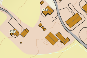
3427 Tynset | 5950bac6-0d5e-4ffb-a903-acf86a614d00 | 155012331 | 0.31 | N: 6902433.00, Ø: 582990.00 | ![Kartbilde fra WMS-tjeneste av avviket](https://wms.geonorge.no/skwms1/wms.topo?VERSION=1.1.1&SERVICE=WMS&REQUEST=GetMap&LAYERS=topo&STYLES=&FORMAT=image/png&SRS=EPSG:25832&BBOX=582914.0,6902383,583064.0,6902483&WIDTH=300&HEIGHT=200) |
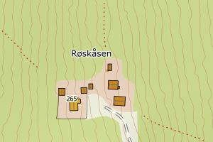
3427 Tynset | 35761a9e-deba-4964-af4c-be8edff6cde1 | 155062169 | 0.31 | N: 6913803.00, Ø: 590054.00 | ![Kartbilde fra WMS-tjeneste av avviket](https://wms.geonorge.no/skwms1/wms.topo?VERSION=1.1.1&SERVICE=WMS&REQUEST=GetMap&LAYERS=topo&STYLES=&FORMAT=image/png&SRS=EPSG:25832&BBOX=589978.0,6913753,590128.0,6913853&WIDTH=300&HEIGHT=200) |
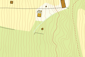
3427 Tynset | 89eaf1c4-ccb6-4a6a-8b1f-bb61c4d91081 | 155009535 | 0.34 | N: 6920269.00, Ø: 581769.00 | ![Kartbilde fra WMS-tjeneste av avviket](https://wms.geonorge.no/skwms1/wms.topo?VERSION=1.1.1&SERVICE=WMS&REQUEST=GetMap&LAYERS=topo&STYLES=&FORMAT=image/png&SRS=EPSG:25832&BBOX=581693.0,6920219,581843.0,6920319&WIDTH=300&HEIGHT=200) |
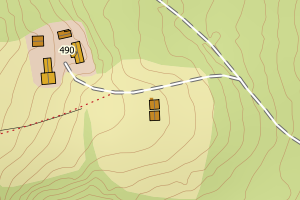
3427 Tynset | 7b79a320-e025-4264-808c-251a51eb5462 | 155038462 | 0.34 | N: 6889316.00, Ø: 597855.00 | ![Kartbilde fra WMS-tjeneste av avviket](https://wms.geonorge.no/skwms1/wms.topo?VERSION=1.1.1&SERVICE=WMS&REQUEST=GetMap&LAYERS=topo&STYLES=&FORMAT=image/png&SRS=EPSG:25832&BBOX=597779.0,6889266,597929.0,6889366&WIDTH=300&HEIGHT=200) |
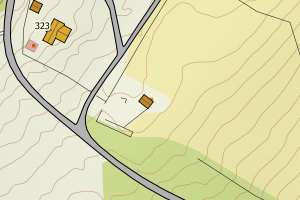
3427 Tynset | cef352b8-b142-4557-a810-4963ac825ea5 | 7429363 | 0.36 | N: 6904538.00, Ø: 598856.00 | ![Kartbilde fra WMS-tjeneste av avviket](https://wms.geonorge.no/skwms1/wms.topo?VERSION=1.1.1&SERVICE=WMS&REQUEST=GetMap&LAYERS=topo&STYLES=&FORMAT=image/png&SRS=EPSG:25832&BBOX=598780.0,6904488,598930.0,6904588&WIDTH=300&HEIGHT=200) |
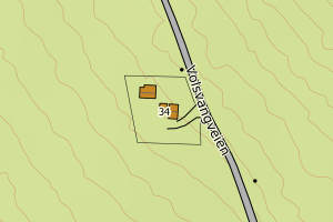
3427 Tynset | 0b332be4-c4c7-42c4-bdd6-87bf33c56ccb | 155036168 | 0.39 | N: 6912453.00, Ø: 593233.00 | ![Kartbilde fra WMS-tjeneste av avviket](https://wms.geonorge.no/skwms1/wms.topo?VERSION=1.1.1&SERVICE=WMS&REQUEST=GetMap&LAYERS=topo&STYLES=&FORMAT=image/png&SRS=EPSG:25832&BBOX=593157.0,6912403,593307.0,6912503&WIDTH=300&HEIGHT=200) |
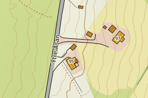
3427 Tynset | 6fbe49f2-86ab-4a0f-9ba2-ef2acdf7bbbc | 155025115 | 0.40 | N: 6887518.00, Ø: 594149.00 | ![Kartbilde fra WMS-tjeneste av avviket](https://wms.geonorge.no/skwms1/wms.topo?VERSION=1.1.1&SERVICE=WMS&REQUEST=GetMap&LAYERS=topo&STYLES=&FORMAT=image/png&SRS=EPSG:25832&BBOX=594073.0,6887468,594223.0,6887568&WIDTH=300&HEIGHT=200) |
3427 Tynset | 953d6af4-431b-43ce-8440-11b585379da5 | 300446839 | 0.41 | N: 6936745.60, Ø: 570131.10 | ![Kartbilde fra WMS-tjeneste av avviket](https://wms.geonorge.no/skwms1/wms.topo?VERSION=1.1.1&SERVICE=WMS&REQUEST=GetMap&LAYERS=topo&STYLES=&FORMAT=image/png&SRS=EPSG:25832&BBOX=570056.0,6936695,570206.0,6936795&WIDTH=300&HEIGHT=200) |
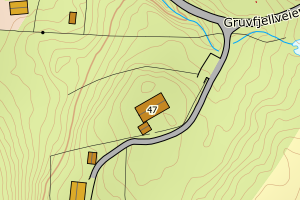
3427 Tynset | 3492215e-6659-4106-bbd1-9d38248f4d38 | 300165834 | 0.43 | N: 6907793.40, Ø: 602206.80 | ![Kartbilde fra WMS-tjeneste av avviket](https://wms.geonorge.no/skwms1/wms.topo?VERSION=1.1.1&SERVICE=WMS&REQUEST=GetMap&LAYERS=topo&STYLES=&FORMAT=image/png&SRS=EPSG:25832&BBOX=602131.0,6907743,602281.0,6907843&WIDTH=300&HEIGHT=200) |
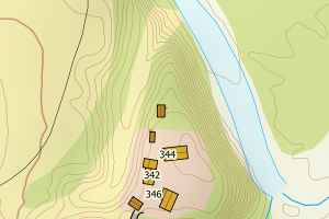
3427 Tynset | cef352b8-b142-4557-a810-4963ac825ea5 | 7429363 | 0.43 | N: 6904538.00, Ø: 598856.00 | ![Kartbilde fra WMS-tjeneste av avviket](https://wms.geonorge.no/skwms1/wms.topo?VERSION=1.1.1&SERVICE=WMS&REQUEST=GetMap&LAYERS=topo&STYLES=&FORMAT=image/png&SRS=EPSG:25832&BBOX=598780.0,6904488,598930.0,6904588&WIDTH=300&HEIGHT=200) |
3427 Tynset | e8de72f1-7ac2-40c2-98f5-ccae6991332b | 155048921 | 0.45 | N: 6907783.00, Ø: 602200.00 | ![Kartbilde fra WMS-tjeneste av avviket](https://wms.geonorge.no/skwms1/wms.topo?VERSION=1.1.1&SERVICE=WMS&REQUEST=GetMap&LAYERS=topo&STYLES=&FORMAT=image/png&SRS=EPSG:25832&BBOX=602124.0,6907733,602274.0,6907833&WIDTH=300&HEIGHT=200) |
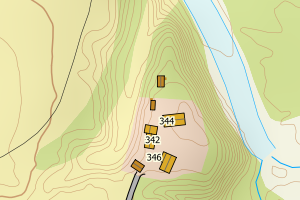
3427 Tynset | b0e32e66-5937-41b5-8b54-6dcf2191280b | 19023850 | 0.46 | N: 6896638.60, Ø: 604132.50 | ![Kartbilde fra WMS-tjeneste av avviket](https://wms.geonorge.no/skwms1/wms.topo?VERSION=1.1.1&SERVICE=WMS&REQUEST=GetMap&LAYERS=topo&STYLES=&FORMAT=image/png&SRS=EPSG:25832&BBOX=604057.0,6896588,604207.0,6896688&WIDTH=300&HEIGHT=200) |
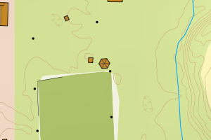
3427 Tynset | 7a0ef3fe-90bc-42b8-8fe4-88612497cc7b | 155030984 | 0.51 | N: 6900312.00, Ø: 594725.00 | ![Kartbilde fra WMS-tjeneste av avviket](https://wms.geonorge.no/skwms1/wms.topo?VERSION=1.1.1&SERVICE=WMS&REQUEST=GetMap&LAYERS=topo&STYLES=&FORMAT=image/png&SRS=EPSG:25832&BBOX=594649.0,6900262,594799.0,6900362&WIDTH=300&HEIGHT=200) |
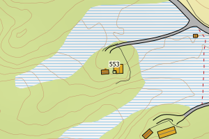
3427 Tynset | 29ec4425-5e45-4e22-ac86-2500d3b1a9e5 | 300665046 | 0.53 | N: 6945087.80, Ø: 566948.80 | ![Kartbilde fra WMS-tjeneste av avviket](https://wms.geonorge.no/skwms1/wms.topo?VERSION=1.1.1&SERVICE=WMS&REQUEST=GetMap&LAYERS=topo&STYLES=&FORMAT=image/png&SRS=EPSG:25832&BBOX=566873.0,6945037,567023.0,6945137&WIDTH=300&HEIGHT=200) |
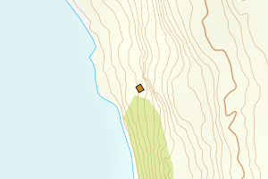
3427 Tynset | 4854bd7b-2d4f-49ae-b17c-383aa207a6f2 | 155038632 | 0.55 | N: 6887317.00, Ø: 598306.00 | ![Kartbilde fra WMS-tjeneste av avviket](https://wms.geonorge.no/skwms1/wms.topo?VERSION=1.1.1&SERVICE=WMS&REQUEST=GetMap&LAYERS=topo&STYLES=&FORMAT=image/png&SRS=EPSG:25832&BBOX=598230.0,6887267,598380.0,6887367&WIDTH=300&HEIGHT=200) |
3427 Tynset | 64e44e75-7d45-4730-a6c0-ca28b93179cb | 300726029 | 0.56 | N: 6896486.80, Ø: 604204.30 | ![Kartbilde fra WMS-tjeneste av avviket](https://wms.geonorge.no/skwms1/wms.topo?VERSION=1.1.1&SERVICE=WMS&REQUEST=GetMap&LAYERS=topo&STYLES=&FORMAT=image/png&SRS=EPSG:25832&BBOX=604129.0,6896436,604279.0,6896536&WIDTH=300&HEIGHT=200) |
3427 Tynset | b699e864-6e22-4049-862e-08a19520bef9 | 300558545 | 0.57 | N: 6898777.90, Ø: 591413.60 | ![Kartbilde fra WMS-tjeneste av avviket](https://wms.geonorge.no/skwms1/wms.topo?VERSION=1.1.1&SERVICE=WMS&REQUEST=GetMap&LAYERS=topo&STYLES=&FORMAT=image/png&SRS=EPSG:25832&BBOX=591338.0,6898727,591488.0,6898827&WIDTH=300&HEIGHT=200) |
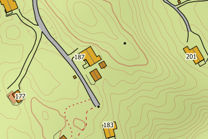
3427 Tynset | 6b381246-737c-471a-803e-2d2dc982755f | 155004797 | 0.62 | N: 6899936.00, Ø: 582852.00 | ![Kartbilde fra WMS-tjeneste av avviket](https://wms.geonorge.no/skwms1/wms.topo?VERSION=1.1.1&SERVICE=WMS&REQUEST=GetMap&LAYERS=topo&STYLES=&FORMAT=image/png&SRS=EPSG:25832&BBOX=582776.0,6899886,582926.0,6899986&WIDTH=300&HEIGHT=200) |
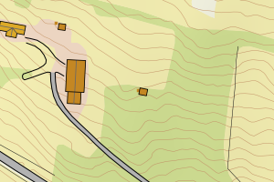
3427 Tynset | adf08ce0-6a45-46ac-8c3a-63c732ec9614 | 300434270 | 0.63 | N: 6903320.70, Ø: 590939.70 | ![Kartbilde fra WMS-tjeneste av avviket](https://wms.geonorge.no/skwms1/wms.topo?VERSION=1.1.1&SERVICE=WMS&REQUEST=GetMap&LAYERS=topo&STYLES=&FORMAT=image/png&SRS=EPSG:25832&BBOX=590864.0,6903270,591014.0,6903370&WIDTH=300&HEIGHT=200) |
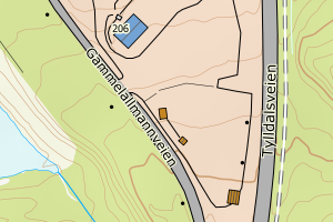
3427 Tynset | 48158036-5690-4961-9e3b-b54e09d64200 | 300338249 | 0.63 | N: 6895692.20, Ø: 595103.50 | ![Kartbilde fra WMS-tjeneste av avviket](https://wms.geonorge.no/skwms1/wms.topo?VERSION=1.1.1&SERVICE=WMS&REQUEST=GetMap&LAYERS=topo&STYLES=&FORMAT=image/png&SRS=EPSG:25832&BBOX=595028.0,6895642,595178.0,6895742&WIDTH=300&HEIGHT=200) |
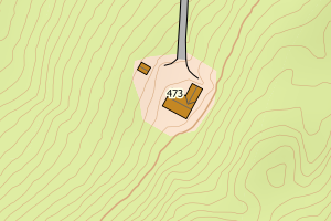
3427 Tynset | 2aaf9f22-b672-4ab7-9f9b-d771875fea09 | 19027139 | 0.70 | N: 6903577.00, Ø: 600568.00 | ![Kartbilde fra WMS-tjeneste av avviket](https://wms.geonorge.no/skwms1/wms.topo?VERSION=1.1.1&SERVICE=WMS&REQUEST=GetMap&LAYERS=topo&STYLES=&FORMAT=image/png&SRS=EPSG:25832&BBOX=600492.0,6903527,600642.0,6903627&WIDTH=300&HEIGHT=200) |
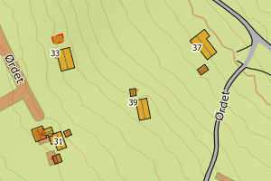
3427 Tynset | 30772b9f-33e4-4f65-adaa-81903b885a23 | 155037474 | 0.72 | N: 6915193.00, Ø: 590898.00 | ![Kartbilde fra WMS-tjeneste av avviket](https://wms.geonorge.no/skwms1/wms.topo?VERSION=1.1.1&SERVICE=WMS&REQUEST=GetMap&LAYERS=topo&STYLES=&FORMAT=image/png&SRS=EPSG:25832&BBOX=590822.0,6915143,590972.0,6915243&WIDTH=300&HEIGHT=200) |
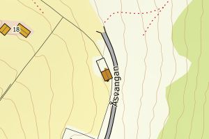
3427 Tynset | 2f35015f-094c-4500-bcb7-b0f45c56b036 | 154972692 | 0.73 | N: 6906417.00, Ø: 589472.00 | ![Kartbilde fra WMS-tjeneste av avviket](https://wms.geonorge.no/skwms1/wms.topo?VERSION=1.1.1&SERVICE=WMS&REQUEST=GetMap&LAYERS=topo&STYLES=&FORMAT=image/png&SRS=EPSG:25832&BBOX=589396.0,6906367,589546.0,6906467&WIDTH=300&HEIGHT=200) |
3427 Tynset | f70f063f-1ebd-4bdf-8a25-d3a7861fedc6 | 154994130 | 0.75 | N: 6946667.00, Ø: 568860.00 | ![Kartbilde fra WMS-tjeneste av avviket](https://wms.geonorge.no/skwms1/wms.topo?VERSION=1.1.1&SERVICE=WMS&REQUEST=GetMap&LAYERS=topo&STYLES=&FORMAT=image/png&SRS=EPSG:25832&BBOX=568784.0,6946617,568934.0,6946717&WIDTH=300&HEIGHT=200) |
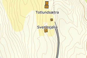
3427 Tynset | 16879af1-abbe-4e0b-ba46-c898c46e98ce | 155052368 | 0.82 | N: 6909706.00, Ø: 579319.00 | ![Kartbilde fra WMS-tjeneste av avviket](https://wms.geonorge.no/skwms1/wms.topo?VERSION=1.1.1&SERVICE=WMS&REQUEST=GetMap&LAYERS=topo&STYLES=&FORMAT=image/png&SRS=EPSG:25832&BBOX=579243.0,6909656,579393.0,6909756&WIDTH=300&HEIGHT=200) |
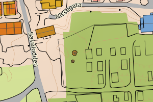
3427 Tynset | f8a05578-cad6-4595-9c83-304c0f39834d | 300325449 | 0.84 | N: 6894731.90, Ø: 594744.60 | ![Kartbilde fra WMS-tjeneste av avviket](https://wms.geonorge.no/skwms1/wms.topo?VERSION=1.1.1&SERVICE=WMS&REQUEST=GetMap&LAYERS=topo&STYLES=&FORMAT=image/png&SRS=EPSG:25832&BBOX=594669.0,6894681,594819.0,6894781&WIDTH=300&HEIGHT=200) |
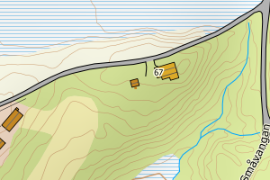
3427 Tynset | 2203aa46-3943-4886-8307-0f9f7decf911 | 300394864 | 0.86 | N: 6908371.10, Ø: 589803.00 | ![Kartbilde fra WMS-tjeneste av avviket](https://wms.geonorge.no/skwms1/wms.topo?VERSION=1.1.1&SERVICE=WMS&REQUEST=GetMap&LAYERS=topo&STYLES=&FORMAT=image/png&SRS=EPSG:25832&BBOX=589727.0,6908321,589877.0,6908421&WIDTH=300&HEIGHT=200) |
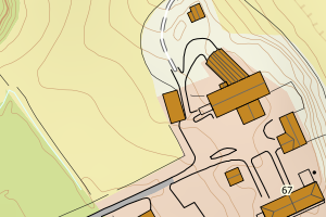
3427 Tynset | 4c32083b-8352-4ec4-88e6-637f514ef574 | 24355039 | 0.88 | N: 6900406.20, Ø: 590695.50 | ![Kartbilde fra WMS-tjeneste av avviket](https://wms.geonorge.no/skwms1/wms.topo?VERSION=1.1.1&SERVICE=WMS&REQUEST=GetMap&LAYERS=topo&STYLES=&FORMAT=image/png&SRS=EPSG:25832&BBOX=590620.0,6900356,590770.0,6900456&WIDTH=300&HEIGHT=200) |
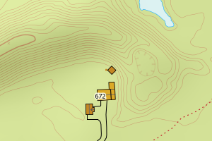
3427 Tynset | 600ef408-c0e4-4672-81ea-59baf024255f | 300631821 | 0.92 | N: 6936963.30, Ø: 570347.70 | ![Kartbilde fra WMS-tjeneste av avviket](https://wms.geonorge.no/skwms1/wms.topo?VERSION=1.1.1&SERVICE=WMS&REQUEST=GetMap&LAYERS=topo&STYLES=&FORMAT=image/png&SRS=EPSG:25832&BBOX=570272.0,6936913,570422.0,6937013&WIDTH=300&HEIGHT=200) |
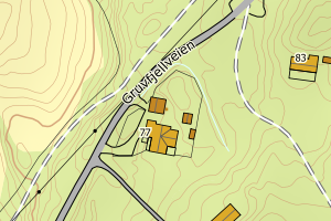
3427 Tynset | 6e8125eb-6397-4046-8464-2c008664d6d0 | 300132383 | 0.93 | N: 6909253.20, Ø: 579677.90 | ![Kartbilde fra WMS-tjeneste av avviket](https://wms.geonorge.no/skwms1/wms.topo?VERSION=1.1.1&SERVICE=WMS&REQUEST=GetMap&LAYERS=topo&STYLES=&FORMAT=image/png&SRS=EPSG:25832&BBOX=579602.0,6909203,579752.0,6909303&WIDTH=300&HEIGHT=200) |
3427 Tynset | a70ad03c-0de4-4bec-90de-071206563854 | 155066709 | 0.94 | N: 6936532.00, Ø: 569162.00 | ![Kartbilde fra WMS-tjeneste av avviket](https://wms.geonorge.no/skwms1/wms.topo?VERSION=1.1.1&SERVICE=WMS&REQUEST=GetMap&LAYERS=topo&STYLES=&FORMAT=image/png&SRS=EPSG:25832&BBOX=569086.0,6936482,569236.0,6936582&WIDTH=300&HEIGHT=200) |
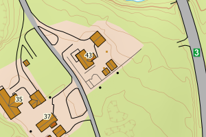
3427 Tynset | ca237eed-4042-4b8f-8857-bbe17c5d04f9 | 155008954 | 0.95 | N: 6916158.00, Ø: 579651.00 | ![Kartbilde fra WMS-tjeneste av avviket](https://wms.geonorge.no/skwms1/wms.topo?VERSION=1.1.1&SERVICE=WMS&REQUEST=GetMap&LAYERS=topo&STYLES=&FORMAT=image/png&SRS=EPSG:25832&BBOX=579575.0,6916108,579725.0,6916208&WIDTH=300&HEIGHT=200) |
3427 Tynset | df5503ab-450d-4285-a968-e9e93777e270 | 300742083 | 0.97 | N: 6909806.20, Ø: 602115.20 | ![Kartbilde fra WMS-tjeneste av avviket](https://wms.geonorge.no/skwms1/wms.topo?VERSION=1.1.1&SERVICE=WMS&REQUEST=GetMap&LAYERS=topo&STYLES=&FORMAT=image/png&SRS=EPSG:25832&BBOX=602040.0,6909756,602190.0,6909856&WIDTH=300&HEIGHT=200) |