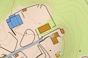
Avvikene skyldes oftest manglende eller unøyaktig registrering av bygningspunkt i matrikkelen. Rettes vanligvis i matrikkelen
Kommune | LokalId | Areal (m2) | Posisjon | WMS-bilde |
3416 Eidskog | 4d5e9969-c39b-4c5e-bea5-fb90cf4c9f79 | 2218.03 | N: 6655569.64, Ø: 673891.06 | ![Kartbilde fra WMS-tjeneste av avviket](https://wms.geonorge.no/skwms1/wms.topo?VERSION=1.1.1&SERVICE=WMS&REQUEST=GetMap&LAYERS=topo&STYLES=&FORMAT=image/png&SRS=EPSG:25832&BBOX=673816.0,6655519,673966.0,6655619&WIDTH=300&HEIGHT=200) |
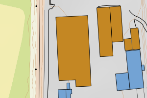
3416 Eidskog | b46005e2-7a05-4e7c-b9dd-c4f1a3b15821 | 1109.93 | N: 6655763.29, Ø: 673880.19 | ![Kartbilde fra WMS-tjeneste av avviket](https://wms.geonorge.no/skwms1/wms.topo?VERSION=1.1.1&SERVICE=WMS&REQUEST=GetMap&LAYERS=topo&STYLES=&FORMAT=image/png&SRS=EPSG:25832&BBOX=673805.0,6655713,673955.0,6655813&WIDTH=300&HEIGHT=200) |
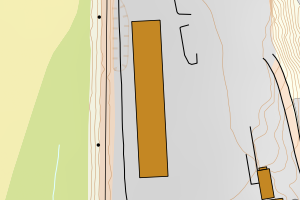
3416 Eidskog | b686d2dc-54c4-475e-b560-81f2ed0165c1 | 1071.69 | N: 6655593.48, Ø: 673928.45 | ![Kartbilde fra WMS-tjeneste av avviket](https://wms.geonorge.no/skwms1/wms.topo?VERSION=1.1.1&SERVICE=WMS&REQUEST=GetMap&LAYERS=topo&STYLES=&FORMAT=image/png&SRS=EPSG:25832&BBOX=673853.0,6655543,674003.0,6655643&WIDTH=300&HEIGHT=200) |
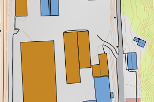
3416 Eidskog | 2365ee44-520f-4a0e-8f82-928034c10a6e | 1004.06 | N: 6652206.96, Ø: 667524.42 | ![Kartbilde fra WMS-tjeneste av avviket](https://wms.geonorge.no/skwms1/wms.topo?VERSION=1.1.1&SERVICE=WMS&REQUEST=GetMap&LAYERS=topo&STYLES=&FORMAT=image/png&SRS=EPSG:25832&BBOX=667449.0,6652156,667599.0,6652256&WIDTH=300&HEIGHT=200) |
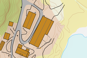
3416 Eidskog | 045468f1-47e3-4979-b088-81c16285e45e | 855.80 | N: 6655673.12, Ø: 673872.87 | ![Kartbilde fra WMS-tjeneste av avviket](https://wms.geonorge.no/skwms1/wms.topo?VERSION=1.1.1&SERVICE=WMS&REQUEST=GetMap&LAYERS=topo&STYLES=&FORMAT=image/png&SRS=EPSG:25832&BBOX=673797.0,6655623,673947.0,6655723&WIDTH=300&HEIGHT=200) |
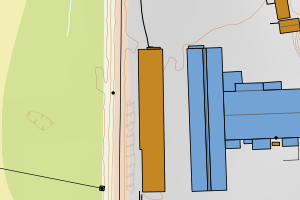
3416 Eidskog | cc5ff236-a0c5-4ce6-8faf-7d00496a1f52 | 661.49 | N: 6661511.97, Ø: 674420.47 | ![Kartbilde fra WMS-tjeneste av avviket](https://wms.geonorge.no/skwms1/wms.topo?VERSION=1.1.1&SERVICE=WMS&REQUEST=GetMap&LAYERS=topo&STYLES=&FORMAT=image/png&SRS=EPSG:25832&BBOX=674345.0,6661461,674495.0,6661561&WIDTH=300&HEIGHT=200) |
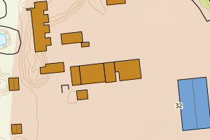
3416 Eidskog | 45770e39-a970-4870-b464-9cd5c66fe518 | 390.82 | N: 6648125.82, Ø: 677629.05 | ![Kartbilde fra WMS-tjeneste av avviket](https://wms.geonorge.no/skwms1/wms.topo?VERSION=1.1.1&SERVICE=WMS&REQUEST=GetMap&LAYERS=topo&STYLES=&FORMAT=image/png&SRS=EPSG:25832&BBOX=677554.0,6648075,677704.0,6648175&WIDTH=300&HEIGHT=200) |
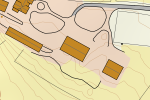
3416 Eidskog | 49503da9-3ad7-474b-bec8-5b265fba5878 | 389.16 | N: 6661892.64, Ø: 674277.23 | ![Kartbilde fra WMS-tjeneste av avviket](https://wms.geonorge.no/skwms1/wms.topo?VERSION=1.1.1&SERVICE=WMS&REQUEST=GetMap&LAYERS=topo&STYLES=&FORMAT=image/png&SRS=EPSG:25832&BBOX=674202.0,6661842,674352.0,6661942&WIDTH=300&HEIGHT=200) |
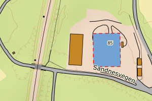
3416 Eidskog | 6cf43bc8-fed8-473e-bab3-fb412a7f9880 | 369.16 | N: 6661539.69, Ø: 674374.69 | ![Kartbilde fra WMS-tjeneste av avviket](https://wms.geonorge.no/skwms1/wms.topo?VERSION=1.1.1&SERVICE=WMS&REQUEST=GetMap&LAYERS=topo&STYLES=&FORMAT=image/png&SRS=EPSG:25832&BBOX=674299.0,6661489,674449.0,6661589&WIDTH=300&HEIGHT=200) |
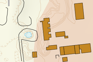
3416 Eidskog | a76706c0-0ea3-4e12-8728-6d83b752d79f | 359.30 | N: 6656423.14, Ø: 671657.20 | ![Kartbilde fra WMS-tjeneste av avviket](https://wms.geonorge.no/skwms1/wms.topo?VERSION=1.1.1&SERVICE=WMS&REQUEST=GetMap&LAYERS=topo&STYLES=&FORMAT=image/png&SRS=EPSG:25832&BBOX=671582.0,6656373,671732.0,6656473&WIDTH=300&HEIGHT=200) |
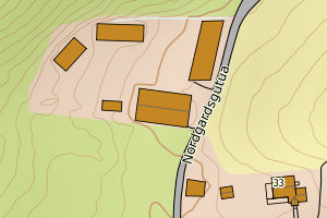
3416 Eidskog | d85dfdd7-f9c4-4e45-af68-08b98f205766 | 341.22 | N: 6661570.55, Ø: 674426.99 | ![Kartbilde fra WMS-tjeneste av avviket](https://wms.geonorge.no/skwms1/wms.topo?VERSION=1.1.1&SERVICE=WMS&REQUEST=GetMap&LAYERS=topo&STYLES=&FORMAT=image/png&SRS=EPSG:25832&BBOX=674351.0,6661520,674501.0,6661620&WIDTH=300&HEIGHT=200) |
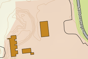
3416 Eidskog | c6cf3ef9-8f3a-4df1-9f69-c3827f0a9806 | 333.46 | N: 6648547.00, Ø: 679980.35 | ![Kartbilde fra WMS-tjeneste av avviket](https://wms.geonorge.no/skwms1/wms.topo?VERSION=1.1.1&SERVICE=WMS&REQUEST=GetMap&LAYERS=topo&STYLES=&FORMAT=image/png&SRS=EPSG:25832&BBOX=679905.0,6648497,680055.0,6648597&WIDTH=300&HEIGHT=200) |
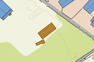
3416 Eidskog | cb003681-7e07-4dee-8fe2-a94386976df3 | 314.21 | N: 6658154.01, Ø: 672668.04 | ![Kartbilde fra WMS-tjeneste av avviket](https://wms.geonorge.no/skwms1/wms.topo?VERSION=1.1.1&SERVICE=WMS&REQUEST=GetMap&LAYERS=topo&STYLES=&FORMAT=image/png&SRS=EPSG:25832&BBOX=672593.0,6658104,672743.0,6658204&WIDTH=300&HEIGHT=200) |
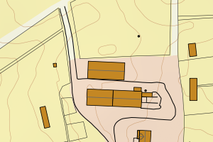
3416 Eidskog | 94cced9c-3db1-495c-a100-46fca297f20f | 305.61 | N: 6650192.78, Ø: 677309.85 | ![Kartbilde fra WMS-tjeneste av avviket](https://wms.geonorge.no/skwms1/wms.topo?VERSION=1.1.1&SERVICE=WMS&REQUEST=GetMap&LAYERS=topo&STYLES=&FORMAT=image/png&SRS=EPSG:25832&BBOX=677234.0,6650142,677384.0,6650242&WIDTH=300&HEIGHT=200) |
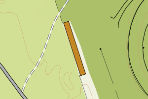
3416 Eidskog | ecd91faa-272c-4a9d-ad76-b7554912e0ab | 300.62 | N: 6661760.19, Ø: 674304.49 | ![Kartbilde fra WMS-tjeneste av avviket](https://wms.geonorge.no/skwms1/wms.topo?VERSION=1.1.1&SERVICE=WMS&REQUEST=GetMap&LAYERS=topo&STYLES=&FORMAT=image/png&SRS=EPSG:25832&BBOX=674229.0,6661710,674379.0,6661810&WIDTH=300&HEIGHT=200) |
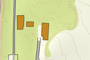
3416 Eidskog | 3f102225-31b3-4747-a3e2-a610af962922 | 286.83 | N: 6645329.05, Ø: 666391.27 | ![Kartbilde fra WMS-tjeneste av avviket](https://wms.geonorge.no/skwms1/wms.topo?VERSION=1.1.1&SERVICE=WMS&REQUEST=GetMap&LAYERS=topo&STYLES=&FORMAT=image/png&SRS=EPSG:25832&BBOX=666316.0,6645279,666466.0,6645379&WIDTH=300&HEIGHT=200) |
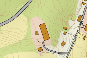
3416 Eidskog | e1b07726-e7ac-4770-8f86-c4c6d8b05680 | 275.24 | N: 6660483.71, Ø: 682595.06 | ![Kartbilde fra WMS-tjeneste av avviket](https://wms.geonorge.no/skwms1/wms.topo?VERSION=1.1.1&SERVICE=WMS&REQUEST=GetMap&LAYERS=topo&STYLES=&FORMAT=image/png&SRS=EPSG:25832&BBOX=682520.0,6660433,682670.0,6660533&WIDTH=300&HEIGHT=200) |
3416 Eidskog | f206f28d-0390-4a48-8eef-de831c01006e | 267.95 | N: 6656449.55, Ø: 671676.90 | ![Kartbilde fra WMS-tjeneste av avviket](https://wms.geonorge.no/skwms1/wms.topo?VERSION=1.1.1&SERVICE=WMS&REQUEST=GetMap&LAYERS=topo&STYLES=&FORMAT=image/png&SRS=EPSG:25832&BBOX=671601.0,6656399,671751.0,6656499&WIDTH=300&HEIGHT=200) |
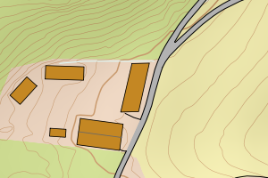
3416 Eidskog | baf58118-2839-4af7-8d35-758a0d53ded1 | 266.04 | N: 6653379.79, Ø: 667398.50 | ![Kartbilde fra WMS-tjeneste av avviket](https://wms.geonorge.no/skwms1/wms.topo?VERSION=1.1.1&SERVICE=WMS&REQUEST=GetMap&LAYERS=topo&STYLES=&FORMAT=image/png&SRS=EPSG:25832&BBOX=667323.0,6653329,667473.0,6653429&WIDTH=300&HEIGHT=200) |
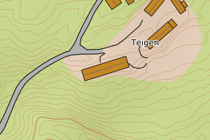
3416 Eidskog | 8aad3810-7cbc-4fcb-b9b3-03b0716903f5 | 262.10 | N: 6655573.79, Ø: 673950.99 | ![Kartbilde fra WMS-tjeneste av avviket](https://wms.geonorge.no/skwms1/wms.topo?VERSION=1.1.1&SERVICE=WMS&REQUEST=GetMap&LAYERS=topo&STYLES=&FORMAT=image/png&SRS=EPSG:25832&BBOX=673875.0,6655523,674025.0,6655623&WIDTH=300&HEIGHT=200) |
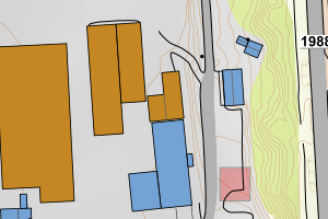
3416 Eidskog | 14d15dbc-bebb-45b1-bd3d-9f8a333566a8 | 255.84 | N: 6661769.22, Ø: 674263.37 | ![Kartbilde fra WMS-tjeneste av avviket](https://wms.geonorge.no/skwms1/wms.topo?VERSION=1.1.1&SERVICE=WMS&REQUEST=GetMap&LAYERS=topo&STYLES=&FORMAT=image/png&SRS=EPSG:25832&BBOX=674188.0,6661719,674338.0,6661819&WIDTH=300&HEIGHT=200) |
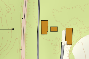
3416 Eidskog | 8b223680-3d2c-4f2a-be0c-fefbc19662b1 | 250.01 | N: 6654277.31, Ø: 673779.39 | ![Kartbilde fra WMS-tjeneste av avviket](https://wms.geonorge.no/skwms1/wms.topo?VERSION=1.1.1&SERVICE=WMS&REQUEST=GetMap&LAYERS=topo&STYLES=&FORMAT=image/png&SRS=EPSG:25832&BBOX=673704.0,6654227,673854.0,6654327&WIDTH=300&HEIGHT=200) |
3416 Eidskog | 95c4082c-9003-4761-bb2a-93a50daefc1d | 249.86 | N: 6660971.48, Ø: 669048.54 | ![Kartbilde fra WMS-tjeneste av avviket](https://wms.geonorge.no/skwms1/wms.topo?VERSION=1.1.1&SERVICE=WMS&REQUEST=GetMap&LAYERS=topo&STYLES=&FORMAT=image/png&SRS=EPSG:25832&BBOX=668973.0,6660921,669123.0,6661021&WIDTH=300&HEIGHT=200) |
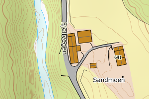
3416 Eidskog | 3f875b3b-eba0-45a1-b611-028417e9ad24 | 234.23 | N: 6656426.53, Ø: 673986.64 | ![Kartbilde fra WMS-tjeneste av avviket](https://wms.geonorge.no/skwms1/wms.topo?VERSION=1.1.1&SERVICE=WMS&REQUEST=GetMap&LAYERS=topo&STYLES=&FORMAT=image/png&SRS=EPSG:25832&BBOX=673911.0,6656376,674061.0,6656476&WIDTH=300&HEIGHT=200) |
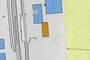
3416 Eidskog | d2faf0ec-2482-4f16-a3ef-14328f4302cb | 232.60 | N: 6655490.25, Ø: 672265.85 | ![Kartbilde fra WMS-tjeneste av avviket](https://wms.geonorge.no/skwms1/wms.topo?VERSION=1.1.1&SERVICE=WMS&REQUEST=GetMap&LAYERS=topo&STYLES=&FORMAT=image/png&SRS=EPSG:25832&BBOX=672190.0,6655440,672340.0,6655540&WIDTH=300&HEIGHT=200) |
3416 Eidskog | 6f07a830-7b32-4bd6-a15e-21223823145a | 222.34 | N: 6669803.45, Ø: 679210.75 | ![Kartbilde fra WMS-tjeneste av avviket](https://wms.geonorge.no/skwms1/wms.topo?VERSION=1.1.1&SERVICE=WMS&REQUEST=GetMap&LAYERS=topo&STYLES=&FORMAT=image/png&SRS=EPSG:25832&BBOX=679135.0,6669753,679285.0,6669853&WIDTH=300&HEIGHT=200) |
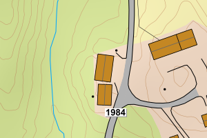
3416 Eidskog | b3eb6c16-9c43-4dcd-809e-ee1567061caf | 216.89 | N: 6664078.35, Ø: 676073.31 | ![Kartbilde fra WMS-tjeneste av avviket](https://wms.geonorge.no/skwms1/wms.topo?VERSION=1.1.1&SERVICE=WMS&REQUEST=GetMap&LAYERS=topo&STYLES=&FORMAT=image/png&SRS=EPSG:25832&BBOX=675998.0,6664028,676148.0,6664128&WIDTH=300&HEIGHT=200) |
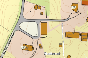
3416 Eidskog | e9559dee-d8da-4fd7-8c0c-ec8a04127f11 | 201.60 | N: 6652951.75, Ø: 675948.81 | ![Kartbilde fra WMS-tjeneste av avviket](https://wms.geonorge.no/skwms1/wms.topo?VERSION=1.1.1&SERVICE=WMS&REQUEST=GetMap&LAYERS=topo&STYLES=&FORMAT=image/png&SRS=EPSG:25832&BBOX=675873.0,6652901,676023.0,6653001&WIDTH=300&HEIGHT=200) |