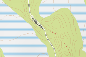
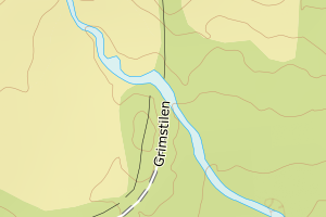
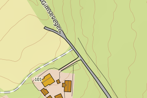
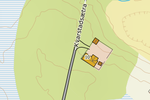
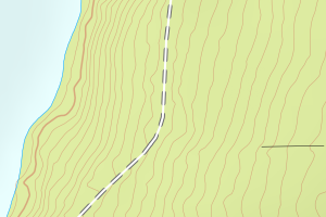
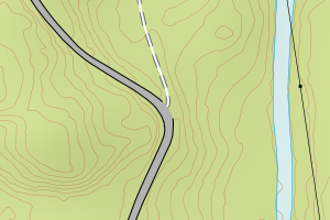
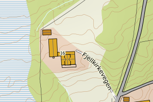
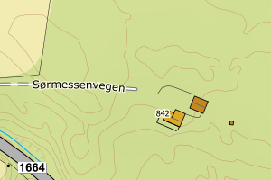
Avviket skyldes enten feilregistrering i FKB-TraktorvegSti eller ev. i vegnettet (NVDB)
Kommune | LokalId | Typeveg | Posisjon | WMS-bilde |
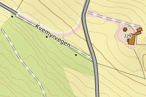
3411 Ringsaker | 220be453-c299-4d1b-a7e0-0bf8146f58fb | traktorveg | N: 6778602.50, Ø: 606097.93 | ![Kartbilde fra WMS-tjeneste av avviket](https://wms.geonorge.no/skwms1/wms.topo?VERSION=1.1.1&SERVICE=WMS&REQUEST=GetMap&LAYERS=topo&STYLES=&FORMAT=image/png&SRS=EPSG:25832&BBOX=606022.0,6778552,606172.0,6778652&WIDTH=300&HEIGHT=200) |
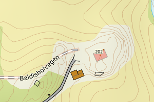
3411 Ringsaker | 358d3bf3-5459-4e3c-ad9b-147e4bf4eb78 | traktorveg | N: 6773894.19, Ø: 603091.70 | ![Kartbilde fra WMS-tjeneste av avviket](https://wms.geonorge.no/skwms1/wms.topo?VERSION=1.1.1&SERVICE=WMS&REQUEST=GetMap&LAYERS=topo&STYLES=&FORMAT=image/png&SRS=EPSG:25832&BBOX=603016.0,6773844,603166.0,6773944&WIDTH=300&HEIGHT=200) |
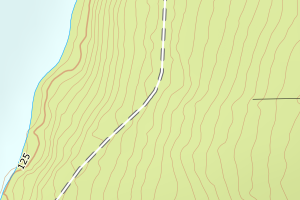
3411 Ringsaker | 38afc0ff-e533-46fd-ace0-6ff96b2aaf06 | traktorveg | N: 6761830.66, Ø: 607900.24 | ![Kartbilde fra WMS-tjeneste av avviket](https://wms.geonorge.no/skwms1/wms.topo?VERSION=1.1.1&SERVICE=WMS&REQUEST=GetMap&LAYERS=topo&STYLES=&FORMAT=image/png&SRS=EPSG:25832&BBOX=607825.0,6761780,607975.0,6761880&WIDTH=300&HEIGHT=200) |
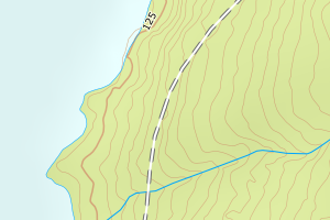
3411 Ringsaker | 41e031a6-a818-4484-8ac6-e5bf3bc2097f | traktorveg | N: 6759164.32, Ø: 608945.48 | ![Kartbilde fra WMS-tjeneste av avviket](https://wms.geonorge.no/skwms1/wms.topo?VERSION=1.1.1&SERVICE=WMS&REQUEST=GetMap&LAYERS=topo&STYLES=&FORMAT=image/png&SRS=EPSG:25832&BBOX=608870.0,6759114,609020.0,6759214&WIDTH=300&HEIGHT=200) |
3411 Ringsaker | 58bcdc54-3ac7-4ef5-b661-2c7897f68988 | traktorveg | N: 6759247.18, Ø: 608645.85 | ![Kartbilde fra WMS-tjeneste av avviket](https://wms.geonorge.no/skwms1/wms.topo?VERSION=1.1.1&SERVICE=WMS&REQUEST=GetMap&LAYERS=topo&STYLES=&FORMAT=image/png&SRS=EPSG:25832&BBOX=608570.0,6759197,608720.0,6759297&WIDTH=300&HEIGHT=200) |
3411 Ringsaker | 8964c301-7ec6-4109-94fd-dde375bfce27 | traktorveg | N: 6785595.77, Ø: 598157.53 | ![Kartbilde fra WMS-tjeneste av avviket](https://wms.geonorge.no/skwms1/wms.topo?VERSION=1.1.1&SERVICE=WMS&REQUEST=GetMap&LAYERS=topo&STYLES=&FORMAT=image/png&SRS=EPSG:25832&BBOX=598082.0,6785545,598232.0,6785645&WIDTH=300&HEIGHT=200) |
3411 Ringsaker | 71f6bf6f-7652-4ec8-86d4-c9852a7364a4 | traktorveg | N: 6786707.82, Ø: 603280.18 | ![Kartbilde fra WMS-tjeneste av avviket](https://wms.geonorge.no/skwms1/wms.topo?VERSION=1.1.1&SERVICE=WMS&REQUEST=GetMap&LAYERS=topo&STYLES=&FORMAT=image/png&SRS=EPSG:25832&BBOX=603205.0,6786657,603355.0,6786757&WIDTH=300&HEIGHT=200) |
3411 Ringsaker | a7eddc5d-9fbd-4093-b5b7-2396c2d0ae5c | traktorveg | N: 6781159.08, Ø: 606792.49 | ![Kartbilde fra WMS-tjeneste av avviket](https://wms.geonorge.no/skwms1/wms.topo?VERSION=1.1.1&SERVICE=WMS&REQUEST=GetMap&LAYERS=topo&STYLES=&FORMAT=image/png&SRS=EPSG:25832&BBOX=606717.0,6781109,606867.0,6781209&WIDTH=300&HEIGHT=200) |
3411 Ringsaker | b87f5a8d-dc78-4797-8474-c7446d839553 | traktorveg | N: 6759226.50, Ø: 608710.56 | ![Kartbilde fra WMS-tjeneste av avviket](https://wms.geonorge.no/skwms1/wms.topo?VERSION=1.1.1&SERVICE=WMS&REQUEST=GetMap&LAYERS=topo&STYLES=&FORMAT=image/png&SRS=EPSG:25832&BBOX=608635.0,6759176,608785.0,6759276&WIDTH=300&HEIGHT=200) |
3411 Ringsaker | c095f8d4-4af4-42ed-a632-4fa2403d5f98 | traktorveg | N: 6778424.22, Ø: 606157.71 | ![Kartbilde fra WMS-tjeneste av avviket](https://wms.geonorge.no/skwms1/wms.topo?VERSION=1.1.1&SERVICE=WMS&REQUEST=GetMap&LAYERS=topo&STYLES=&FORMAT=image/png&SRS=EPSG:25832&BBOX=606082.0,6778374,606232.0,6778474&WIDTH=300&HEIGHT=200) |
3411 Ringsaker | c9bc1baa-6941-4594-8f2e-f24b84176da0 | traktorveg | N: 6785557.25, Ø: 598028.15 | ![Kartbilde fra WMS-tjeneste av avviket](https://wms.geonorge.no/skwms1/wms.topo?VERSION=1.1.1&SERVICE=WMS&REQUEST=GetMap&LAYERS=topo&STYLES=&FORMAT=image/png&SRS=EPSG:25832&BBOX=597953.0,6785507,598103.0,6785607&WIDTH=300&HEIGHT=200) |
3411 Ringsaker | 11492747-beff-4299-a2c3-aad33edb7b7a | traktorveg | N: 6778218.15, Ø: 606838.23 | ![Kartbilde fra WMS-tjeneste av avviket](https://wms.geonorge.no/skwms1/wms.topo?VERSION=1.1.1&SERVICE=WMS&REQUEST=GetMap&LAYERS=topo&STYLES=&FORMAT=image/png&SRS=EPSG:25832&BBOX=606763.0,6778168,606913.0,6778268&WIDTH=300&HEIGHT=200) |
3411 Ringsaker | 2b411a55-8997-4273-b9d5-938ccb0a4f87 | traktorveg | N: 6778711.95, Ø: 606109.73 | ![Kartbilde fra WMS-tjeneste av avviket](https://wms.geonorge.no/skwms1/wms.topo?VERSION=1.1.1&SERVICE=WMS&REQUEST=GetMap&LAYERS=topo&STYLES=&FORMAT=image/png&SRS=EPSG:25832&BBOX=606034.0,6778661,606184.0,6778761&WIDTH=300&HEIGHT=200) |
3411 Ringsaker | 6bc4e77c-d382-4c6b-b4dc-0647c7e001c8 | traktorveg | N: 6784189.20, Ø: 601310.73 | ![Kartbilde fra WMS-tjeneste av avviket](https://wms.geonorge.no/skwms1/wms.topo?VERSION=1.1.1&SERVICE=WMS&REQUEST=GetMap&LAYERS=topo&STYLES=&FORMAT=image/png&SRS=EPSG:25832&BBOX=601235.0,6784139,601385.0,6784239&WIDTH=300&HEIGHT=200) |
3411 Ringsaker | d7759a1a-68e5-4626-8da4-65a871e4fed8 | traktorveg | N: 6759226.68, Ø: 608707.33 | ![Kartbilde fra WMS-tjeneste av avviket](https://wms.geonorge.no/skwms1/wms.topo?VERSION=1.1.1&SERVICE=WMS&REQUEST=GetMap&LAYERS=topo&STYLES=&FORMAT=image/png&SRS=EPSG:25832&BBOX=608632.0,6759176,608782.0,6759276&WIDTH=300&HEIGHT=200) |
3411 Ringsaker | f2dfde2e-e801-4132-ac98-4670a3aa3f1b | traktorveg | N: 6778247.26, Ø: 606422.72 | ![Kartbilde fra WMS-tjeneste av avviket](https://wms.geonorge.no/skwms1/wms.topo?VERSION=1.1.1&SERVICE=WMS&REQUEST=GetMap&LAYERS=topo&STYLES=&FORMAT=image/png&SRS=EPSG:25832&BBOX=606347.0,6778197,606497.0,6778297&WIDTH=300&HEIGHT=200) |
3411 Ringsaker | f04989b1-d8e1-4bae-8799-0e4bc21f0b1a | traktorveg | N: 6772316.88, Ø: 599027.00 | ![Kartbilde fra WMS-tjeneste av avviket](https://wms.geonorge.no/skwms1/wms.topo?VERSION=1.1.1&SERVICE=WMS&REQUEST=GetMap&LAYERS=topo&STYLES=&FORMAT=image/png&SRS=EPSG:25832&BBOX=598951.0,6772266,599101.0,6772366&WIDTH=300&HEIGHT=200) |
3411 Ringsaker | f24b2f68-c8ba-4ed6-9732-d38be55c2512 | traktorveg | N: 6752137.34, Ø: 610931.82 | ![Kartbilde fra WMS-tjeneste av avviket](https://wms.geonorge.no/skwms1/wms.topo?VERSION=1.1.1&SERVICE=WMS&REQUEST=GetMap&LAYERS=topo&STYLES=&FORMAT=image/png&SRS=EPSG:25832&BBOX=610856.0,6752087,611006.0,6752187&WIDTH=300&HEIGHT=200) |
3411 Ringsaker | b1137369-181d-4cca-95e7-a58dfb50badd | traktorveg | N: 6753916.36, Ø: 593380.29 | ![Kartbilde fra WMS-tjeneste av avviket](https://wms.geonorge.no/skwms1/wms.topo?VERSION=1.1.1&SERVICE=WMS&REQUEST=GetMap&LAYERS=topo&STYLES=&FORMAT=image/png&SRS=EPSG:25832&BBOX=593305.0,6753866,593455.0,6753966&WIDTH=300&HEIGHT=200) |
3411 Ringsaker | c859af3f-819f-45ec-8f77-11e1ad8d952c | traktorveg | N: 6738673.65, Ø: 602034.26 | ![Kartbilde fra WMS-tjeneste av avviket](https://wms.geonorge.no/skwms1/wms.topo?VERSION=1.1.1&SERVICE=WMS&REQUEST=GetMap&LAYERS=topo&STYLES=&FORMAT=image/png&SRS=EPSG:25832&BBOX=601959.0,6738623,602109.0,6738723&WIDTH=300&HEIGHT=200) |
3411 Ringsaker | c8cfbbf4-8726-4fc9-802c-df1b84f170eb | traktorveg | N: 6780129.87, Ø: 590896.32 | ![Kartbilde fra WMS-tjeneste av avviket](https://wms.geonorge.no/skwms1/wms.topo?VERSION=1.1.1&SERVICE=WMS&REQUEST=GetMap&LAYERS=topo&STYLES=&FORMAT=image/png&SRS=EPSG:25832&BBOX=590821.0,6780079,590971.0,6780179&WIDTH=300&HEIGHT=200) |
3411 Ringsaker | 9d895093-c69d-4b47-89c9-52972bdf4acb | traktorveg | N: 6748265.93, Ø: 594357.28 | ![Kartbilde fra WMS-tjeneste av avviket](https://wms.geonorge.no/skwms1/wms.topo?VERSION=1.1.1&SERVICE=WMS&REQUEST=GetMap&LAYERS=topo&STYLES=&FORMAT=image/png&SRS=EPSG:25832&BBOX=594282.0,6748215,594432.0,6748315&WIDTH=300&HEIGHT=200) |
3411 Ringsaker | b3f90650-eeaf-403f-8130-2b3a9051afb8 | traktorveg | N: 6748194.93, Ø: 594301.12 | ![Kartbilde fra WMS-tjeneste av avviket](https://wms.geonorge.no/skwms1/wms.topo?VERSION=1.1.1&SERVICE=WMS&REQUEST=GetMap&LAYERS=topo&STYLES=&FORMAT=image/png&SRS=EPSG:25832&BBOX=594226.0,6748144,594376.0,6748244&WIDTH=300&HEIGHT=200) |
3411 Ringsaker | ba3e7eb4-db0f-4657-86a2-930930c98d47 | traktorveg | N: 6747751.51, Ø: 602641.89 | ![Kartbilde fra WMS-tjeneste av avviket](https://wms.geonorge.no/skwms1/wms.topo?VERSION=1.1.1&SERVICE=WMS&REQUEST=GetMap&LAYERS=topo&STYLES=&FORMAT=image/png&SRS=EPSG:25832&BBOX=602566.0,6747701,602716.0,6747801&WIDTH=300&HEIGHT=200) |
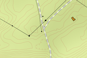
3411 Ringsaker | e7700719-1f46-44b1-9bc6-f44060da819c | traktorveg | N: 6748283.15, Ø: 594363.37 | ![Kartbilde fra WMS-tjeneste av avviket](https://wms.geonorge.no/skwms1/wms.topo?VERSION=1.1.1&SERVICE=WMS&REQUEST=GetMap&LAYERS=topo&STYLES=&FORMAT=image/png&SRS=EPSG:25832&BBOX=594288.0,6748233,594438.0,6748333&WIDTH=300&HEIGHT=200) |
3411 Ringsaker | e7700719-1f46-44b1-9bc6-f44060da819c | traktorveg | N: 6748431.74, Ø: 594388.20 | ![Kartbilde fra WMS-tjeneste av avviket](https://wms.geonorge.no/skwms1/wms.topo?VERSION=1.1.1&SERVICE=WMS&REQUEST=GetMap&LAYERS=topo&STYLES=&FORMAT=image/png&SRS=EPSG:25832&BBOX=594313.0,6748381,594463.0,6748481&WIDTH=300&HEIGHT=200) |
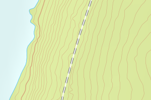
3411 Ringsaker | e7700719-1f46-44b1-9bc6-f44060da819c | traktorveg | N: 6748590.71, Ø: 594458.74 | ![Kartbilde fra WMS-tjeneste av avviket](https://wms.geonorge.no/skwms1/wms.topo?VERSION=1.1.1&SERVICE=WMS&REQUEST=GetMap&LAYERS=topo&STYLES=&FORMAT=image/png&SRS=EPSG:25832&BBOX=594383.0,6748540,594533.0,6748640&WIDTH=300&HEIGHT=200) |
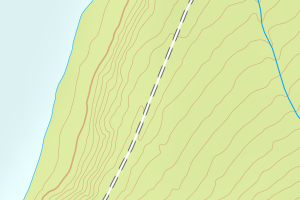
3411 Ringsaker | 7944b84f-b826-48bd-bd73-4f6531ebffb1 | traktorveg | N: 6758582.74, Ø: 595604.67 | ![Kartbilde fra WMS-tjeneste av avviket](https://wms.geonorge.no/skwms1/wms.topo?VERSION=1.1.1&SERVICE=WMS&REQUEST=GetMap&LAYERS=topo&STYLES=&FORMAT=image/png&SRS=EPSG:25832&BBOX=595529.0,6758532,595679.0,6758632&WIDTH=300&HEIGHT=200) |
3411 Ringsaker | 7c865aee-4dd6-486d-af28-fb5ee093f8e1 | traktorveg | N: 6781144.01, Ø: 590821.43 | ![Kartbilde fra WMS-tjeneste av avviket](https://wms.geonorge.no/skwms1/wms.topo?VERSION=1.1.1&SERVICE=WMS&REQUEST=GetMap&LAYERS=topo&STYLES=&FORMAT=image/png&SRS=EPSG:25832&BBOX=590746.0,6781094,590896.0,6781194&WIDTH=300&HEIGHT=200) |
3411 Ringsaker | 57918eea-75d2-4c65-953c-6bfe7c8874e5 | traktorveg | N: 6752631.54, Ø: 609278.17 | ![Kartbilde fra WMS-tjeneste av avviket](https://wms.geonorge.no/skwms1/wms.topo?VERSION=1.1.1&SERVICE=WMS&REQUEST=GetMap&LAYERS=topo&STYLES=&FORMAT=image/png&SRS=EPSG:25832&BBOX=609203.0,6752581,609353.0,6752681&WIDTH=300&HEIGHT=200) |