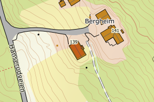
Avvikene kan skyldes enten feil bygningskoordinat eller bygningstype/status i matrikkel eller feil arealtype i AR5. Vær oppmerksom på det er krav om arealer på over 200 m2 før det er krav om endring av arealtype i AR5 så avvikene vil ikke alltid kreve retting i datagrunnlaget. Matrikkel_vedtaksdato angir når bygning er lagt inn i Matrikkelen. Hvis du tidligere har sjekket alle påviste tilfeller, kan du nå se på de som har dato etter siste gjennomgang og rette disse. Det kan i noen tilfeller stå «Ingen vedtaksdato» som betyr at det ikke finnes vedtaksdato i matrikkelen. Dette er ofte gamle registreringer f.eks Mabygg. Mulig byggstat i matrikkelen må endres(revet/brent)
| Kommune | LokalId | Bygningsnummer | Arealtype | Bygningstatus | Bygningstype | matrikkel_vedtaksdato | matrikkel_registreringsdato | Posisjon | WMS-bilde |
|---|
| 3318 Krødsherad | 08ee5219-93ea-4cba-8811-01f8a1908843 | 301277521 | 21 | FA | 111 | 2024-08-14 | 2024-08-14 | N: 6671837.05, Ø: 535332.29 |  |
| 3318 Krødsherad | 1b368611-0715-4671-a583-5ab26c168afd | 160366230 | 21 | TB | 249 | Ingen vedtaksdato | 2008-04-11 | N: 6671610.00, Ø: 531003.00 |  |
| 3318 Krødsherad | 266b8ef6-f0a1-431a-bc06-b97abafd54c1 | 160360356 | 21 | TB | 241 | Ingen vedtaksdato | 2008-04-11 | N: 6676135.00, Ø: 535814.00 |  |
| 3318 Krødsherad | 85bbc260-20e8-4f42-baac-1aed03f43c21 | 160367040 | 21 | TB | 249 | Ingen vedtaksdato | 2008-04-11 | N: 6666154.00, Ø: 541301.00 |  |
| 3318 Krødsherad | 856dc24c-60a4-4dcc-bce7-736d32298af8 | 160347589 | 21 | TB | 241 | Ingen vedtaksdato | 2008-04-11 | N: 6665400.00, Ø: 542003.00 |  |
| 3318 Krødsherad | e7019ee4-6b7d-42e1-96ec-63fa058fb4ef | 160346051 | 21 | TB | 249 | Ingen vedtaksdato | 2008-04-11 | N: 6665928.00, Ø: 541064.00 |  |
| 3318 Krødsherad | 19a27701-24d1-4333-8ea8-e1efe1909585 | 160335629 | 21 | TB | 249 | Ingen vedtaksdato | 2008-04-11 | N: 6676181.00, Ø: 535792.00 |  |
| 3318 Krødsherad | d85e3988-4bf7-440c-a9f7-9d723a9877e3 | 160355417 | 21 | TB | 163 | Ingen vedtaksdato | 2008-04-11 | N: 6674723.00, Ø: 543014.00 |  |
| 3318 Krødsherad | ec969489-e02d-4e3b-8757-e3efbf2036b3 | 160335645 | 21 | TB | 241 | Ingen vedtaksdato | 2008-04-11 | N: 6676157.00, Ø: 535825.00 |  |
| 3318 Krødsherad | e9689400-0ea3-438e-b644-067c7b7ca92c | 160335637 | 21 | TB | 241 | Ingen vedtaksdato | 2008-04-11 | N: 6676145.00, Ø: 535811.00 |  |