Avvikene skyldes vanligvis unøyaktig registrering av bygningspunkt i matrikkelen slik at det har havnet utenfor bygningsomriss. Rettes vanligvis i matrikkelen
Kommune | LokalId | Bygningsnummer | Avstand (m) | Posisjon | WMS-bilde |
3312 Lier | cbf7a315-c0ad-445b-99ba-a48c5faee4c8 | 300759868 | 0.00 | N: 6630497.85, Ø: 572774.72 | ![Kartbilde fra WMS-tjeneste av avviket](https://wms.geonorge.no/skwms1/wms.topo?VERSION=1.1.1&SERVICE=WMS&REQUEST=GetMap&LAYERS=topo&STYLES=&FORMAT=image/png&SRS=EPSG:25832&BBOX=572699.0,6630447,572849.0,6630547&WIDTH=300&HEIGHT=200) |
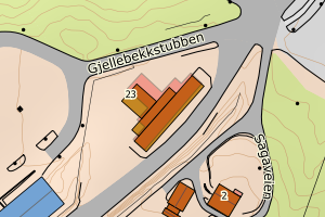
3312 Lier | 1d359e75-64c2-443f-9d03-d5d087717272 | 160918608 | 0.00 | N: 6637724.00, Ø: 571903.00 | ![Kartbilde fra WMS-tjeneste av avviket](https://wms.geonorge.no/skwms1/wms.topo?VERSION=1.1.1&SERVICE=WMS&REQUEST=GetMap&LAYERS=topo&STYLES=&FORMAT=image/png&SRS=EPSG:25832&BBOX=571827.0,6637673,571977.0,6637773&WIDTH=300&HEIGHT=200) |
3312 Lier | a403b7ef-d7e8-4f1d-af78-b3506c8e954d | 160918713 | 0.02 | N: 6644615.00, Ø: 570694.00 | ![Kartbilde fra WMS-tjeneste av avviket](https://wms.geonorge.no/skwms1/wms.topo?VERSION=1.1.1&SERVICE=WMS&REQUEST=GetMap&LAYERS=topo&STYLES=&FORMAT=image/png&SRS=EPSG:25832&BBOX=570618.0,6644564,570768.0,6644664&WIDTH=300&HEIGHT=200) |
3312 Lier | e9fbb63d-1974-453b-898f-ef6fa34a6c1e | 160908432 | 0.03 | N: 6646520.00, Ø: 572203.00 | ![Kartbilde fra WMS-tjeneste av avviket](https://wms.geonorge.no/skwms1/wms.topo?VERSION=1.1.1&SERVICE=WMS&REQUEST=GetMap&LAYERS=topo&STYLES=&FORMAT=image/png&SRS=EPSG:25832&BBOX=572127.0,6646469,572277.0,6646569&WIDTH=300&HEIGHT=200) |
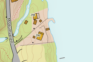
3312 Lier | f8ef1e04-8c75-443b-8a2a-393a88b574e9 | 13034826 | 0.04 | N: 6623980.00, Ø: 573778.00 | ![Kartbilde fra WMS-tjeneste av avviket](https://wms.geonorge.no/skwms1/wms.topo?VERSION=1.1.1&SERVICE=WMS&REQUEST=GetMap&LAYERS=topo&STYLES=&FORMAT=image/png&SRS=EPSG:25832&BBOX=573702.0,6623929,573852.0,6624029&WIDTH=300&HEIGHT=200) |
3312 Lier | 023832c1-c762-4b4e-b614-c036a8645fed | 117763609 | 0.05 | N: 6631543.00, Ø: 573516.00 | ![Kartbilde fra WMS-tjeneste av avviket](https://wms.geonorge.no/skwms1/wms.topo?VERSION=1.1.1&SERVICE=WMS&REQUEST=GetMap&LAYERS=topo&STYLES=&FORMAT=image/png&SRS=EPSG:25832&BBOX=573440.0,6631492,573590.0,6631592&WIDTH=300&HEIGHT=200) |
3312 Lier | e1e1311a-09fd-45da-a915-b851456572f1 | 160889659 | 0.05 | N: 6633111.00, Ø: 569249.00 | ![Kartbilde fra WMS-tjeneste av avviket](https://wms.geonorge.no/skwms1/wms.topo?VERSION=1.1.1&SERVICE=WMS&REQUEST=GetMap&LAYERS=topo&STYLES=&FORMAT=image/png&SRS=EPSG:25832&BBOX=569173.0,6633060,569323.0,6633160&WIDTH=300&HEIGHT=200) |
3312 Lier | c8c64ca2-0ac1-456c-8e2a-9bd2d90021ce | 160916230 | 0.06 | N: 6644542.00, Ø: 569365.00 | ![Kartbilde fra WMS-tjeneste av avviket](https://wms.geonorge.no/skwms1/wms.topo?VERSION=1.1.1&SERVICE=WMS&REQUEST=GetMap&LAYERS=topo&STYLES=&FORMAT=image/png&SRS=EPSG:25832&BBOX=569289.0,6644491,569439.0,6644591&WIDTH=300&HEIGHT=200) |
3312 Lier | da72840f-e509-4d44-8ac2-c09a00f31fd1 | 140434426 | 0.07 | N: 6631666.00, Ø: 570296.00 | ![Kartbilde fra WMS-tjeneste av avviket](https://wms.geonorge.no/skwms1/wms.topo?VERSION=1.1.1&SERVICE=WMS&REQUEST=GetMap&LAYERS=topo&STYLES=&FORMAT=image/png&SRS=EPSG:25832&BBOX=570220.0,6631615,570370.0,6631715&WIDTH=300&HEIGHT=200) |
3312 Lier | 38cb4ea6-4f3b-4456-bf57-b88746376723 | 160820403 | 0.07 | N: 6627877.00, Ø: 569779.00 | ![Kartbilde fra WMS-tjeneste av avviket](https://wms.geonorge.no/skwms1/wms.topo?VERSION=1.1.1&SERVICE=WMS&REQUEST=GetMap&LAYERS=topo&STYLES=&FORMAT=image/png&SRS=EPSG:25832&BBOX=569703.0,6627826,569853.0,6627926&WIDTH=300&HEIGHT=200) |
3312 Lier | 72282a21-9239-4d31-95c8-042bda5e73fd | 160908637 | 0.08 | N: 6646457.00, Ø: 571496.00 | ![Kartbilde fra WMS-tjeneste av avviket](https://wms.geonorge.no/skwms1/wms.topo?VERSION=1.1.1&SERVICE=WMS&REQUEST=GetMap&LAYERS=topo&STYLES=&FORMAT=image/png&SRS=EPSG:25832&BBOX=571420.0,6646406,571570.0,6646506&WIDTH=300&HEIGHT=200) |
3312 Lier | ae4fe734-2bc7-4c5e-bd41-e6be363cf1a1 | 140428833 | 0.09 | N: 6630967.00, Ø: 567453.00 | ![Kartbilde fra WMS-tjeneste av avviket](https://wms.geonorge.no/skwms1/wms.topo?VERSION=1.1.1&SERVICE=WMS&REQUEST=GetMap&LAYERS=topo&STYLES=&FORMAT=image/png&SRS=EPSG:25832&BBOX=567377.0,6630916,567527.0,6631016&WIDTH=300&HEIGHT=200) |
3312 Lier | 9b9fe3fc-ab94-4482-9365-27564aa50141 | 160840064 | 0.14 | N: 6637390.00, Ø: 568735.00 | ![Kartbilde fra WMS-tjeneste av avviket](https://wms.geonorge.no/skwms1/wms.topo?VERSION=1.1.1&SERVICE=WMS&REQUEST=GetMap&LAYERS=topo&STYLES=&FORMAT=image/png&SRS=EPSG:25832&BBOX=568659.0,6637339,568809.0,6637439&WIDTH=300&HEIGHT=200) |
3312 Lier | db52e8c0-42a7-42c2-9809-c88e7725b86a | 160872357 | 0.15 | N: 6632241.00, Ø: 563789.00 | ![Kartbilde fra WMS-tjeneste av avviket](https://wms.geonorge.no/skwms1/wms.topo?VERSION=1.1.1&SERVICE=WMS&REQUEST=GetMap&LAYERS=topo&STYLES=&FORMAT=image/png&SRS=EPSG:25832&BBOX=563713.0,6632190,563863.0,6632290&WIDTH=300&HEIGHT=200) |
3312 Lier | 6967b1aa-6445-4d86-8c82-4a87f6a7e63f | 160821590 | 0.15 | N: 6624666.00, Ø: 570288.00 | ![Kartbilde fra WMS-tjeneste av avviket](https://wms.geonorge.no/skwms1/wms.topo?VERSION=1.1.1&SERVICE=WMS&REQUEST=GetMap&LAYERS=topo&STYLES=&FORMAT=image/png&SRS=EPSG:25832&BBOX=570212.0,6624615,570362.0,6624715&WIDTH=300&HEIGHT=200) |
3312 Lier | afc8b285-17dc-4f2a-8b2e-d5e55f67b769 | 160914572 | 0.16 | N: 6644148.00, Ø: 569347.00 | ![Kartbilde fra WMS-tjeneste av avviket](https://wms.geonorge.no/skwms1/wms.topo?VERSION=1.1.1&SERVICE=WMS&REQUEST=GetMap&LAYERS=topo&STYLES=&FORMAT=image/png&SRS=EPSG:25832&BBOX=569271.0,6644097,569421.0,6644197&WIDTH=300&HEIGHT=200) |
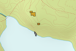
3312 Lier | 9379111d-6949-4122-a704-8e9170c8f046 | 160882905 | 0.17 | N: 6627627.00, Ø: 566892.00 | ![Kartbilde fra WMS-tjeneste av avviket](https://wms.geonorge.no/skwms1/wms.topo?VERSION=1.1.1&SERVICE=WMS&REQUEST=GetMap&LAYERS=topo&STYLES=&FORMAT=image/png&SRS=EPSG:25832&BBOX=566816.0,6627576,566966.0,6627676&WIDTH=300&HEIGHT=200) |
3312 Lier | 666098af-675f-4015-94a9-70b6caa820de | 140431729 | 0.19 | N: 6626977.00, Ø: 567008.00 | ![Kartbilde fra WMS-tjeneste av avviket](https://wms.geonorge.no/skwms1/wms.topo?VERSION=1.1.1&SERVICE=WMS&REQUEST=GetMap&LAYERS=topo&STYLES=&FORMAT=image/png&SRS=EPSG:25832&BBOX=566932.0,6626926,567082.0,6627026&WIDTH=300&HEIGHT=200) |
3312 Lier | 23b2b462-2127-472a-8784-8b3bc26425fd | 160892617 | 0.19 | N: 6638937.00, Ø: 569579.00 | ![Kartbilde fra WMS-tjeneste av avviket](https://wms.geonorge.no/skwms1/wms.topo?VERSION=1.1.1&SERVICE=WMS&REQUEST=GetMap&LAYERS=topo&STYLES=&FORMAT=image/png&SRS=EPSG:25832&BBOX=569503.0,6638886,569653.0,6638986&WIDTH=300&HEIGHT=200) |
3312 Lier | b8abea99-c9c2-4efd-8a0e-59ee3307d72c | 140428477 | 0.20 | N: 6631699.00, Ø: 563253.00 | ![Kartbilde fra WMS-tjeneste av avviket](https://wms.geonorge.no/skwms1/wms.topo?VERSION=1.1.1&SERVICE=WMS&REQUEST=GetMap&LAYERS=topo&STYLES=&FORMAT=image/png&SRS=EPSG:25832&BBOX=563177.0,6631648,563327.0,6631748&WIDTH=300&HEIGHT=200) |
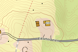
3312 Lier | 92444088-c0ed-4b57-9e4a-4324162a3475 | 160872195 | 0.20 | N: 6632161.00, Ø: 563728.00 | ![Kartbilde fra WMS-tjeneste av avviket](https://wms.geonorge.no/skwms1/wms.topo?VERSION=1.1.1&SERVICE=WMS&REQUEST=GetMap&LAYERS=topo&STYLES=&FORMAT=image/png&SRS=EPSG:25832&BBOX=563652.0,6632110,563802.0,6632210&WIDTH=300&HEIGHT=200) |
3312 Lier | 35ef9e92-2c79-403b-9cb0-4b059630b47a | 160891939 | 0.21 | N: 6638518.00, Ø: 569220.00 | ![Kartbilde fra WMS-tjeneste av avviket](https://wms.geonorge.no/skwms1/wms.topo?VERSION=1.1.1&SERVICE=WMS&REQUEST=GetMap&LAYERS=topo&STYLES=&FORMAT=image/png&SRS=EPSG:25832&BBOX=569144.0,6638467,569294.0,6638567&WIDTH=300&HEIGHT=200) |
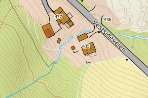
3312 Lier | 72ae1c8d-a156-49c1-8c07-abfbaa617427 | 160871679 | 0.21 | N: 6641733.00, Ø: 570939.00 | ![Kartbilde fra WMS-tjeneste av avviket](https://wms.geonorge.no/skwms1/wms.topo?VERSION=1.1.1&SERVICE=WMS&REQUEST=GetMap&LAYERS=topo&STYLES=&FORMAT=image/png&SRS=EPSG:25832&BBOX=570863.0,6641682,571013.0,6641782&WIDTH=300&HEIGHT=200) |
3312 Lier | c62188cd-52d6-4ad8-873e-d8d5f7a68c8e | 8047480 | 0.22 | N: 6625263.00, Ø: 572464.00 | ![Kartbilde fra WMS-tjeneste av avviket](https://wms.geonorge.no/skwms1/wms.topo?VERSION=1.1.1&SERVICE=WMS&REQUEST=GetMap&LAYERS=topo&STYLES=&FORMAT=image/png&SRS=EPSG:25832&BBOX=572388.0,6625212,572538.0,6625312&WIDTH=300&HEIGHT=200) |
3312 Lier | c5318c65-afb5-49c2-b518-1d777c752f67 | 21948012 | 0.24 | N: 6631642.00, Ø: 567002.00 | ![Kartbilde fra WMS-tjeneste av avviket](https://wms.geonorge.no/skwms1/wms.topo?VERSION=1.1.1&SERVICE=WMS&REQUEST=GetMap&LAYERS=topo&STYLES=&FORMAT=image/png&SRS=EPSG:25832&BBOX=566926.0,6631591,567076.0,6631691&WIDTH=300&HEIGHT=200) |
3312 Lier | 97390c2f-7217-4e82-9e23-be6c06624a08 | 160882042 | 0.25 | N: 6630755.00, Ø: 567499.00 | ![Kartbilde fra WMS-tjeneste av avviket](https://wms.geonorge.no/skwms1/wms.topo?VERSION=1.1.1&SERVICE=WMS&REQUEST=GetMap&LAYERS=topo&STYLES=&FORMAT=image/png&SRS=EPSG:25832&BBOX=567423.0,6630704,567573.0,6630804&WIDTH=300&HEIGHT=200) |
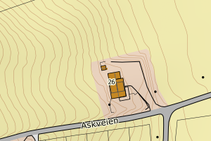
3312 Lier | f67b2b34-09ed-42ae-90cb-f1a805cafa42 | 21941980 | 0.26 | N: 6631073.00, Ø: 570322.00 | ![Kartbilde fra WMS-tjeneste av avviket](https://wms.geonorge.no/skwms1/wms.topo?VERSION=1.1.1&SERVICE=WMS&REQUEST=GetMap&LAYERS=topo&STYLES=&FORMAT=image/png&SRS=EPSG:25832&BBOX=570246.0,6631022,570396.0,6631122&WIDTH=300&HEIGHT=200) |
3312 Lier | fcc3a8de-52ec-4b88-b6b9-79f2fad9e0c9 | 300392800 | 0.26 | N: 6641738.70, Ø: 570997.08 | ![Kartbilde fra WMS-tjeneste av avviket](https://wms.geonorge.no/skwms1/wms.topo?VERSION=1.1.1&SERVICE=WMS&REQUEST=GetMap&LAYERS=topo&STYLES=&FORMAT=image/png&SRS=EPSG:25832&BBOX=570922.0,6641688,571072.0,6641788&WIDTH=300&HEIGHT=200) |
3312 Lier | 34839db1-d4bb-4f53-845f-3d67405083db | 160860146 | 0.27 | N: 6627112.00, Ø: 572059.00 | ![Kartbilde fra WMS-tjeneste av avviket](https://wms.geonorge.no/skwms1/wms.topo?VERSION=1.1.1&SERVICE=WMS&REQUEST=GetMap&LAYERS=topo&STYLES=&FORMAT=image/png&SRS=EPSG:25832&BBOX=571983.0,6627061,572133.0,6627161&WIDTH=300&HEIGHT=200) |
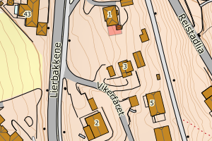
3312 Lier | 017a9d7d-d2e3-40bd-9a19-34a266e1bfe6 | 300902658 | 0.29 | N: 6633236.54, Ø: 571462.29 | ![Kartbilde fra WMS-tjeneste av avviket](https://wms.geonorge.no/skwms1/wms.topo?VERSION=1.1.1&SERVICE=WMS&REQUEST=GetMap&LAYERS=topo&STYLES=&FORMAT=image/png&SRS=EPSG:25832&BBOX=571387.0,6633186,571537.0,6633286&WIDTH=300&HEIGHT=200) |
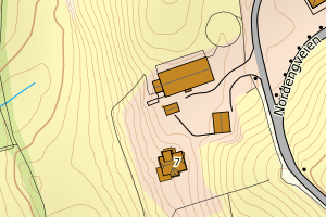
3312 Lier | e91019d4-39f8-4c1c-8515-f8756968c6e4 | 300745937 | 0.32 | N: 6645208.06, Ø: 570595.96 | ![Kartbilde fra WMS-tjeneste av avviket](https://wms.geonorge.no/skwms1/wms.topo?VERSION=1.1.1&SERVICE=WMS&REQUEST=GetMap&LAYERS=topo&STYLES=&FORMAT=image/png&SRS=EPSG:25832&BBOX=570520.0,6645158,570670.0,6645258&WIDTH=300&HEIGHT=200) |
3312 Lier | b0b544b2-9752-4a61-a5ce-aaca41c8d618 | 140424900 | 0.33 | N: 6637908.00, Ø: 572722.00 | ![Kartbilde fra WMS-tjeneste av avviket](https://wms.geonorge.no/skwms1/wms.topo?VERSION=1.1.1&SERVICE=WMS&REQUEST=GetMap&LAYERS=topo&STYLES=&FORMAT=image/png&SRS=EPSG:25832&BBOX=572646.0,6637857,572796.0,6637957&WIDTH=300&HEIGHT=200) |
3312 Lier | 21d27a93-63b2-4db0-8080-e3c40417298d | 300831177 | 0.34 | N: 6644093.20, Ø: 570986.17 | ![Kartbilde fra WMS-tjeneste av avviket](https://wms.geonorge.no/skwms1/wms.topo?VERSION=1.1.1&SERVICE=WMS&REQUEST=GetMap&LAYERS=topo&STYLES=&FORMAT=image/png&SRS=EPSG:25832&BBOX=570911.0,6644043,571061.0,6644143&WIDTH=300&HEIGHT=200) |
3312 Lier | 39e78df1-7ee4-4925-a52f-e880fc4bbddf | 13036861 | 0.34 | N: 6624155.00, Ø: 572964.00 | ![Kartbilde fra WMS-tjeneste av avviket](https://wms.geonorge.no/skwms1/wms.topo?VERSION=1.1.1&SERVICE=WMS&REQUEST=GetMap&LAYERS=topo&STYLES=&FORMAT=image/png&SRS=EPSG:25832&BBOX=572888.0,6624104,573038.0,6624204&WIDTH=300&HEIGHT=200) |
3312 Lier | 1a05a1b0-6c56-4ebb-bad6-17be430068d1 | 160887400 | 0.36 | N: 6634489.00, Ø: 564334.00 | ![Kartbilde fra WMS-tjeneste av avviket](https://wms.geonorge.no/skwms1/wms.topo?VERSION=1.1.1&SERVICE=WMS&REQUEST=GetMap&LAYERS=topo&STYLES=&FORMAT=image/png&SRS=EPSG:25832&BBOX=564258.0,6634438,564408.0,6634538&WIDTH=300&HEIGHT=200) |
3312 Lier | 20d37aed-9cc9-49bc-addf-9004ce6b0650 | 160913983 | 0.36 | N: 6630861.00, Ø: 574308.00 | ![Kartbilde fra WMS-tjeneste av avviket](https://wms.geonorge.no/skwms1/wms.topo?VERSION=1.1.1&SERVICE=WMS&REQUEST=GetMap&LAYERS=topo&STYLES=&FORMAT=image/png&SRS=EPSG:25832&BBOX=574232.0,6630810,574382.0,6630910&WIDTH=300&HEIGHT=200) |
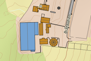
3312 Lier | 6d3e61de-39d6-4fd6-a482-9c25f6d10e5b | 160896027 | 0.38 | N: 6630656.00, Ø: 570854.00 | ![Kartbilde fra WMS-tjeneste av avviket](https://wms.geonorge.no/skwms1/wms.topo?VERSION=1.1.1&SERVICE=WMS&REQUEST=GetMap&LAYERS=topo&STYLES=&FORMAT=image/png&SRS=EPSG:25832&BBOX=570778.0,6630605,570928.0,6630705&WIDTH=300&HEIGHT=200) |
3312 Lier | 160944b0-fd88-4f61-89df-705d082e8eb7 | 160898313 | 0.40 | N: 6627522.00, Ø: 573303.00 | ![Kartbilde fra WMS-tjeneste av avviket](https://wms.geonorge.no/skwms1/wms.topo?VERSION=1.1.1&SERVICE=WMS&REQUEST=GetMap&LAYERS=topo&STYLES=&FORMAT=image/png&SRS=EPSG:25832&BBOX=573227.0,6627471,573377.0,6627571&WIDTH=300&HEIGHT=200) |
3312 Lier | ba415d82-25ed-44ab-bcb1-2067faacd6af | 140427365 | 0.41 | N: 6633366.00, Ø: 568564.00 | ![Kartbilde fra WMS-tjeneste av avviket](https://wms.geonorge.no/skwms1/wms.topo?VERSION=1.1.1&SERVICE=WMS&REQUEST=GetMap&LAYERS=topo&STYLES=&FORMAT=image/png&SRS=EPSG:25832&BBOX=568488.0,6633315,568638.0,6633415&WIDTH=300&HEIGHT=200) |
3312 Lier | 5749080c-bcd9-4387-92b5-36f828f67b5e | 160889810 | 0.45 | N: 6632467.00, Ø: 569460.00 | ![Kartbilde fra WMS-tjeneste av avviket](https://wms.geonorge.no/skwms1/wms.topo?VERSION=1.1.1&SERVICE=WMS&REQUEST=GetMap&LAYERS=topo&STYLES=&FORMAT=image/png&SRS=EPSG:25832&BBOX=569384.0,6632416,569534.0,6632516&WIDTH=300&HEIGHT=200) |
3312 Lier | 8d0f5bea-484b-4f98-a1e4-378ff3e95c72 | 160823755 | 0.46 | N: 6624024.00, Ø: 569801.00 | ![Kartbilde fra WMS-tjeneste av avviket](https://wms.geonorge.no/skwms1/wms.topo?VERSION=1.1.1&SERVICE=WMS&REQUEST=GetMap&LAYERS=topo&STYLES=&FORMAT=image/png&SRS=EPSG:25832&BBOX=569725.0,6623973,569875.0,6624073&WIDTH=300&HEIGHT=200) |
3312 Lier | 915178e8-1ae7-405a-9a34-c8df902c9c58 | 160882727 | 0.48 | N: 6628189.00, Ø: 566357.00 | ![Kartbilde fra WMS-tjeneste av avviket](https://wms.geonorge.no/skwms1/wms.topo?VERSION=1.1.1&SERVICE=WMS&REQUEST=GetMap&LAYERS=topo&STYLES=&FORMAT=image/png&SRS=EPSG:25832&BBOX=566281.0,6628138,566431.0,6628238&WIDTH=300&HEIGHT=200) |
3312 Lier | 3c8bf271-f920-4d3f-808e-7a5e69bc7dd1 | 160899735 | 0.48 | N: 6635090.00, Ø: 574208.00 | ![Kartbilde fra WMS-tjeneste av avviket](https://wms.geonorge.no/skwms1/wms.topo?VERSION=1.1.1&SERVICE=WMS&REQUEST=GetMap&LAYERS=topo&STYLES=&FORMAT=image/png&SRS=EPSG:25832&BBOX=574132.0,6635039,574282.0,6635139&WIDTH=300&HEIGHT=200) |
3312 Lier | 4f56491e-9a4f-4215-906a-9ae3e6731b14 | 160919361 | 0.50 | N: 6631182.00, Ø: 564247.00 | ![Kartbilde fra WMS-tjeneste av avviket](https://wms.geonorge.no/skwms1/wms.topo?VERSION=1.1.1&SERVICE=WMS&REQUEST=GetMap&LAYERS=topo&STYLES=&FORMAT=image/png&SRS=EPSG:25832&BBOX=564171.0,6631131,564321.0,6631231&WIDTH=300&HEIGHT=200) |
3312 Lier | 0d82c7e5-a1e5-442d-82e0-955d73c24220 | 160840137 | 0.52 | N: 6637261.00, Ø: 568766.00 | ![Kartbilde fra WMS-tjeneste av avviket](https://wms.geonorge.no/skwms1/wms.topo?VERSION=1.1.1&SERVICE=WMS&REQUEST=GetMap&LAYERS=topo&STYLES=&FORMAT=image/png&SRS=EPSG:25832&BBOX=568690.0,6637210,568840.0,6637310&WIDTH=300&HEIGHT=200) |
3312 Lier | 9acb23ff-87f8-4c5c-870a-768c60f4196f | 160908750 | 0.54 | N: 6645875.00, Ø: 571502.00 | ![Kartbilde fra WMS-tjeneste av avviket](https://wms.geonorge.no/skwms1/wms.topo?VERSION=1.1.1&SERVICE=WMS&REQUEST=GetMap&LAYERS=topo&STYLES=&FORMAT=image/png&SRS=EPSG:25832&BBOX=571426.0,6645824,571576.0,6645924&WIDTH=300&HEIGHT=200) |
3312 Lier | 502f96f4-1da7-424e-ac18-14e78d413dd9 | 160872152 | 0.55 | N: 6632398.00, Ø: 564152.00 | ![Kartbilde fra WMS-tjeneste av avviket](https://wms.geonorge.no/skwms1/wms.topo?VERSION=1.1.1&SERVICE=WMS&REQUEST=GetMap&LAYERS=topo&STYLES=&FORMAT=image/png&SRS=EPSG:25832&BBOX=564076.0,6632347,564226.0,6632447&WIDTH=300&HEIGHT=200) |
3312 Lier | cbdd378f-b913-4e08-b329-4de078e8179d | 160835796 | 0.55 | N: 6635029.00, Ø: 568415.00 | ![Kartbilde fra WMS-tjeneste av avviket](https://wms.geonorge.no/skwms1/wms.topo?VERSION=1.1.1&SERVICE=WMS&REQUEST=GetMap&LAYERS=topo&STYLES=&FORMAT=image/png&SRS=EPSG:25832&BBOX=568339.0,6634978,568489.0,6635078&WIDTH=300&HEIGHT=200) |
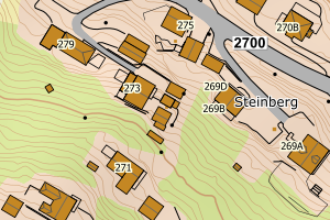
3312 Lier | e54201dc-0640-4238-86c3-c78f5ca74093 | 160893028 | 0.55 | N: 6639153.00, Ø: 569632.00 | ![Kartbilde fra WMS-tjeneste av avviket](https://wms.geonorge.no/skwms1/wms.topo?VERSION=1.1.1&SERVICE=WMS&REQUEST=GetMap&LAYERS=topo&STYLES=&FORMAT=image/png&SRS=EPSG:25832&BBOX=569556.0,6639102,569706.0,6639202&WIDTH=300&HEIGHT=200) |
3312 Lier | 43ee0141-611a-4301-8afb-f199e6a5f9d9 | 160889268 | 0.56 | N: 6633069.00, Ø: 567770.00 | ![Kartbilde fra WMS-tjeneste av avviket](https://wms.geonorge.no/skwms1/wms.topo?VERSION=1.1.1&SERVICE=WMS&REQUEST=GetMap&LAYERS=topo&STYLES=&FORMAT=image/png&SRS=EPSG:25832&BBOX=567694.0,6633018,567844.0,6633118&WIDTH=300&HEIGHT=200) |
3312 Lier | 643137bf-4880-4738-872e-85abba2ccd17 | 160868716 | 0.57 | N: 6631455.00, Ø: 573422.00 | ![Kartbilde fra WMS-tjeneste av avviket](https://wms.geonorge.no/skwms1/wms.topo?VERSION=1.1.1&SERVICE=WMS&REQUEST=GetMap&LAYERS=topo&STYLES=&FORMAT=image/png&SRS=EPSG:25832&BBOX=573346.0,6631404,573496.0,6631504&WIDTH=300&HEIGHT=200) |
3312 Lier | c3aa3032-5dca-49ec-8cb7-2b0d2ff62ce9 | 160872349 | 0.57 | N: 6632152.00, Ø: 562822.00 | ![Kartbilde fra WMS-tjeneste av avviket](https://wms.geonorge.no/skwms1/wms.topo?VERSION=1.1.1&SERVICE=WMS&REQUEST=GetMap&LAYERS=topo&STYLES=&FORMAT=image/png&SRS=EPSG:25832&BBOX=562746.0,6632101,562896.0,6632201&WIDTH=300&HEIGHT=200) |
3312 Lier | 2a050014-aeca-4bdc-b7a4-8326b034528f | 160846682 | 0.58 | N: 6624460.00, Ø: 571449.00 | ![Kartbilde fra WMS-tjeneste av avviket](https://wms.geonorge.no/skwms1/wms.topo?VERSION=1.1.1&SERVICE=WMS&REQUEST=GetMap&LAYERS=topo&STYLES=&FORMAT=image/png&SRS=EPSG:25832&BBOX=571373.0,6624409,571523.0,6624509&WIDTH=300&HEIGHT=200) |
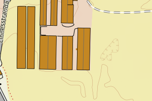
3312 Lier | 46ed1913-14d0-46d7-9ae8-a62423735c27 | 160872306 | 0.58 | N: 6630766.00, Ø: 564269.00 | ![Kartbilde fra WMS-tjeneste av avviket](https://wms.geonorge.no/skwms1/wms.topo?VERSION=1.1.1&SERVICE=WMS&REQUEST=GetMap&LAYERS=topo&STYLES=&FORMAT=image/png&SRS=EPSG:25832&BBOX=564193.0,6630715,564343.0,6630815&WIDTH=300&HEIGHT=200) |
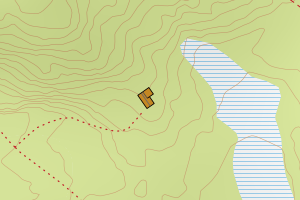
3312 Lier | 9598986c-17cb-4e2d-9fbf-c630807bf703 | 160891165 | 0.59 | N: 6640128.00, Ø: 569180.00 | ![Kartbilde fra WMS-tjeneste av avviket](https://wms.geonorge.no/skwms1/wms.topo?VERSION=1.1.1&SERVICE=WMS&REQUEST=GetMap&LAYERS=topo&STYLES=&FORMAT=image/png&SRS=EPSG:25832&BBOX=569104.0,6640077,569254.0,6640177&WIDTH=300&HEIGHT=200) |
3312 Lier | d225a7cc-ca38-4a32-8fd4-67497b4d47af | 140429945 | 0.60 | N: 6628231.00, Ø: 566827.00 | ![Kartbilde fra WMS-tjeneste av avviket](https://wms.geonorge.no/skwms1/wms.topo?VERSION=1.1.1&SERVICE=WMS&REQUEST=GetMap&LAYERS=topo&STYLES=&FORMAT=image/png&SRS=EPSG:25832&BBOX=566751.0,6628180,566901.0,6628280&WIDTH=300&HEIGHT=200) |
3312 Lier | 5dd89fa8-875b-4f1d-a6e8-de0555caaafc | 301068241 | 0.60 | N: 6632066.40, Ø: 574708.09 | ![Kartbilde fra WMS-tjeneste av avviket](https://wms.geonorge.no/skwms1/wms.topo?VERSION=1.1.1&SERVICE=WMS&REQUEST=GetMap&LAYERS=topo&STYLES=&FORMAT=image/png&SRS=EPSG:25832&BBOX=574633.0,6632016,574783.0,6632116&WIDTH=300&HEIGHT=200) |
3312 Lier | 1a05a1b0-6c56-4ebb-bad6-17be430068d1 | 160887400 | 0.67 | N: 6634489.00, Ø: 564334.00 | ![Kartbilde fra WMS-tjeneste av avviket](https://wms.geonorge.no/skwms1/wms.topo?VERSION=1.1.1&SERVICE=WMS&REQUEST=GetMap&LAYERS=topo&STYLES=&FORMAT=image/png&SRS=EPSG:25832&BBOX=564258.0,6634438,564408.0,6634538&WIDTH=300&HEIGHT=200) |
3312 Lier | 6d3e61de-39d6-4fd6-a482-9c25f6d10e5b | 160896027 | 0.68 | N: 6630656.00, Ø: 570854.00 | ![Kartbilde fra WMS-tjeneste av avviket](https://wms.geonorge.no/skwms1/wms.topo?VERSION=1.1.1&SERVICE=WMS&REQUEST=GetMap&LAYERS=topo&STYLES=&FORMAT=image/png&SRS=EPSG:25832&BBOX=570778.0,6630605,570928.0,6630705&WIDTH=300&HEIGHT=200) |
3312 Lier | 669d04bd-fdfd-4e43-a990-048c4ca535df | 300394725 | 0.72 | N: 6629104.32, Ø: 568472.35 | ![Kartbilde fra WMS-tjeneste av avviket](https://wms.geonorge.no/skwms1/wms.topo?VERSION=1.1.1&SERVICE=WMS&REQUEST=GetMap&LAYERS=topo&STYLES=&FORMAT=image/png&SRS=EPSG:25832&BBOX=568397.0,6629054,568547.0,6629154&WIDTH=300&HEIGHT=200) |
3312 Lier | 6103b5a1-52fc-4982-a57d-5d2110f3a5c2 | 160886889 | 0.80 | N: 6634926.00, Ø: 567026.00 | ![Kartbilde fra WMS-tjeneste av avviket](https://wms.geonorge.no/skwms1/wms.topo?VERSION=1.1.1&SERVICE=WMS&REQUEST=GetMap&LAYERS=topo&STYLES=&FORMAT=image/png&SRS=EPSG:25832&BBOX=566950.0,6634875,567100.0,6634975&WIDTH=300&HEIGHT=200) |
3312 Lier | 257cb968-4046-43fa-b750-44453f9e8623 | 8042721 | 0.85 | N: 6645016.00, Ø: 572437.00 | ![Kartbilde fra WMS-tjeneste av avviket](https://wms.geonorge.no/skwms1/wms.topo?VERSION=1.1.1&SERVICE=WMS&REQUEST=GetMap&LAYERS=topo&STYLES=&FORMAT=image/png&SRS=EPSG:25832&BBOX=572361.0,6644965,572511.0,6645065&WIDTH=300&HEIGHT=200) |
3312 Lier | 7b874346-a5a7-427e-9765-14f160eb1bdd | 13041423 | 0.88 | N: 6644699.00, Ø: 570836.00 | ![Kartbilde fra WMS-tjeneste av avviket](https://wms.geonorge.no/skwms1/wms.topo?VERSION=1.1.1&SERVICE=WMS&REQUEST=GetMap&LAYERS=topo&STYLES=&FORMAT=image/png&SRS=EPSG:25832&BBOX=570760.0,6644648,570910.0,6644748&WIDTH=300&HEIGHT=200) |
3312 Lier | f651f019-db20-41cf-b9c8-944990f52920 | 160851112 | 0.88 | N: 6623237.00, Ø: 572642.00 | ![Kartbilde fra WMS-tjeneste av avviket](https://wms.geonorge.no/skwms1/wms.topo?VERSION=1.1.1&SERVICE=WMS&REQUEST=GetMap&LAYERS=topo&STYLES=&FORMAT=image/png&SRS=EPSG:25832&BBOX=572566.0,6623186,572716.0,6623286&WIDTH=300&HEIGHT=200) |
3312 Lier | 5ee1eacc-4a57-4028-8ccf-c8d2572377bc | 160857161 | 0.89 | N: 6628014.00, Ø: 571799.00 | ![Kartbilde fra WMS-tjeneste av avviket](https://wms.geonorge.no/skwms1/wms.topo?VERSION=1.1.1&SERVICE=WMS&REQUEST=GetMap&LAYERS=topo&STYLES=&FORMAT=image/png&SRS=EPSG:25832&BBOX=571723.0,6627963,571873.0,6628063&WIDTH=300&HEIGHT=200) |
3312 Lier | 2f3b3f17-30e5-4a8e-ba46-e1abcd82b284 | 160872411 | 0.91 | N: 6632059.00, Ø: 563408.00 | ![Kartbilde fra WMS-tjeneste av avviket](https://wms.geonorge.no/skwms1/wms.topo?VERSION=1.1.1&SERVICE=WMS&REQUEST=GetMap&LAYERS=topo&STYLES=&FORMAT=image/png&SRS=EPSG:25832&BBOX=563332.0,6632008,563482.0,6632108&WIDTH=300&HEIGHT=200) |
3312 Lier | ec559f06-54b0-4a64-ba21-320c25630735 | 160917768 | 0.96 | N: 6638102.00, Ø: 572760.00 | ![Kartbilde fra WMS-tjeneste av avviket](https://wms.geonorge.no/skwms1/wms.topo?VERSION=1.1.1&SERVICE=WMS&REQUEST=GetMap&LAYERS=topo&STYLES=&FORMAT=image/png&SRS=EPSG:25832&BBOX=572684.0,6638051,572834.0,6638151&WIDTH=300&HEIGHT=200) |
3312 Lier | 56ad1ed5-2948-49fd-87b4-fdac9c3f7b9f | 140425605 | 0.97 | N: 6639313.00, Ø: 570735.00 | ![Kartbilde fra WMS-tjeneste av avviket](https://wms.geonorge.no/skwms1/wms.topo?VERSION=1.1.1&SERVICE=WMS&REQUEST=GetMap&LAYERS=topo&STYLES=&FORMAT=image/png&SRS=EPSG:25832&BBOX=570659.0,6639262,570809.0,6639362&WIDTH=300&HEIGHT=200) |
3312 Lier | d0dd8276-d42c-437f-9ba1-bb4b3c58a12d | 160872284 | 0.97 | N: 6631804.00, Ø: 562916.00 | ![Kartbilde fra WMS-tjeneste av avviket](https://wms.geonorge.no/skwms1/wms.topo?VERSION=1.1.1&SERVICE=WMS&REQUEST=GetMap&LAYERS=topo&STYLES=&FORMAT=image/png&SRS=EPSG:25832&BBOX=562840.0,6631753,562990.0,6631853&WIDTH=300&HEIGHT=200) |
3312 Lier | 02a9f154-42e2-49f1-bcb6-4fb7c9b99899 | 13032130 | 0.98 | N: 6626640.00, Ø: 572395.00 | ![Kartbilde fra WMS-tjeneste av avviket](https://wms.geonorge.no/skwms1/wms.topo?VERSION=1.1.1&SERVICE=WMS&REQUEST=GetMap&LAYERS=topo&STYLES=&FORMAT=image/png&SRS=EPSG:25832&BBOX=572319.0,6626589,572469.0,6626689&WIDTH=300&HEIGHT=200) |
3312 Lier | 9ce71d9f-825c-4303-a239-dabe0521b861 | 160877766 | 1.00 | N: 6624433.00, Ø: 569014.00 | ![Kartbilde fra WMS-tjeneste av avviket](https://wms.geonorge.no/skwms1/wms.topo?VERSION=1.1.1&SERVICE=WMS&REQUEST=GetMap&LAYERS=topo&STYLES=&FORMAT=image/png&SRS=EPSG:25832&BBOX=568938.0,6624382,569088.0,6624482&WIDTH=300&HEIGHT=200) |