Avvikene skyldes enten feilregistrering i matrikkel eller manglende bygningsdelelinje i FKB-Bygning. Rettes i matrikkelen eller FKB-Bygning
Kommune | LokalId | Bygningsnummer (punkt) | Bygningsnummer (flate) | Posisjon | WMS-bilde |
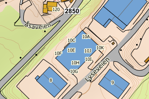
3310 Hole | 35d1501e-fcd7-4866-a777-7f5da9bffad0 | 194797508 | 194797494 | N: 6660769.00, Ø: 565365.00 | ![Kartbilde fra WMS-tjeneste av avviket](https://wms.geonorge.no/skwms1/wms.topo?VERSION=1.1.1&SERVICE=WMS&REQUEST=GetMap&LAYERS=topo&STYLES=&FORMAT=image/png&SRS=EPSG:25832&BBOX=565289.0,6660718,565439.0,6660818&WIDTH=300&HEIGHT=200) |
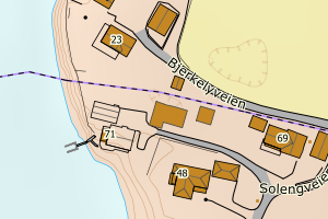
3310 Hole | 161f247d-9485-439a-8bd7-b377b6befdda | 194797567 | 194798377 | N: 6660587.00, Ø: 565471.00 | ![Kartbilde fra WMS-tjeneste av avviket](https://wms.geonorge.no/skwms1/wms.topo?VERSION=1.1.1&SERVICE=WMS&REQUEST=GetMap&LAYERS=topo&STYLES=&FORMAT=image/png&SRS=EPSG:25832&BBOX=565395.0,6660536,565545.0,6660636&WIDTH=300&HEIGHT=200) |
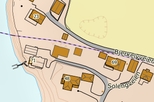
3310 Hole | d4347e58-7094-45f5-9c46-e8282c937378 | 194800959 | 194796552 | N: 6661849.00, Ø: 565227.00 | ![Kartbilde fra WMS-tjeneste av avviket](https://wms.geonorge.no/skwms1/wms.topo?VERSION=1.1.1&SERVICE=WMS&REQUEST=GetMap&LAYERS=topo&STYLES=&FORMAT=image/png&SRS=EPSG:25832&BBOX=565151.0,6661798,565301.0,6661898&WIDTH=300&HEIGHT=200) |
3310 Hole | ee9e2615-8ebe-45ea-ac97-05008bdaf082 | 194802927 | 194802978 | N: 6658899.00, Ø: 573450.00 | ![Kartbilde fra WMS-tjeneste av avviket](https://wms.geonorge.no/skwms1/wms.topo?VERSION=1.1.1&SERVICE=WMS&REQUEST=GetMap&LAYERS=topo&STYLES=&FORMAT=image/png&SRS=EPSG:25832&BBOX=573374.0,6658848,573524.0,6658948&WIDTH=300&HEIGHT=200) |
3310 Hole | ca423a76-e88d-4558-afe5-34b5d8e6c109 | 7904479 | 7904479 | N: 6661797.00, Ø: 574593.00 | ![Kartbilde fra WMS-tjeneste av avviket](https://wms.geonorge.no/skwms1/wms.topo?VERSION=1.1.1&SERVICE=WMS&REQUEST=GetMap&LAYERS=topo&STYLES=&FORMAT=image/png&SRS=EPSG:25832&BBOX=574517.0,6661746,574667.0,6661846&WIDTH=300&HEIGHT=200) |
3310 Hole | 4fe1797c-ffdd-4790-be3b-5a64bb593edd | 7905203 | 7904479 | N: 6661797.00, Ø: 574593.00 | ![Kartbilde fra WMS-tjeneste av avviket](https://wms.geonorge.no/skwms1/wms.topo?VERSION=1.1.1&SERVICE=WMS&REQUEST=GetMap&LAYERS=topo&STYLES=&FORMAT=image/png&SRS=EPSG:25832&BBOX=574517.0,6661746,574667.0,6661846&WIDTH=300&HEIGHT=200) |
3310 Hole | ea4692ca-8570-4cf7-ab4a-59d51efa2dfa | 7904479 | 7904479 | N: 6661797.00, Ø: 574593.00 | ![Kartbilde fra WMS-tjeneste av avviket](https://wms.geonorge.no/skwms1/wms.topo?VERSION=1.1.1&SERVICE=WMS&REQUEST=GetMap&LAYERS=topo&STYLES=&FORMAT=image/png&SRS=EPSG:25832&BBOX=574517.0,6661746,574667.0,6661846&WIDTH=300&HEIGHT=200) |
3310 Hole | 7f364356-e7c5-41e0-9b2f-7c55d0a262ce | 194777043 | 194777035 | N: 6660497.00, Ø: 572234.00 | ![Kartbilde fra WMS-tjeneste av avviket](https://wms.geonorge.no/skwms1/wms.topo?VERSION=1.1.1&SERVICE=WMS&REQUEST=GetMap&LAYERS=topo&STYLES=&FORMAT=image/png&SRS=EPSG:25832&BBOX=572158.0,6660446,572308.0,6660546&WIDTH=300&HEIGHT=200) |
3310 Hole | af6a3fac-c45e-42ca-b5a4-6feab3eb8549 | 194783957 | 15098775 | N: 6656507.00, Ø: 570624.00 | ![Kartbilde fra WMS-tjeneste av avviket](https://wms.geonorge.no/skwms1/wms.topo?VERSION=1.1.1&SERVICE=WMS&REQUEST=GetMap&LAYERS=topo&STYLES=&FORMAT=image/png&SRS=EPSG:25832&BBOX=570548.0,6656456,570698.0,6656556&WIDTH=300&HEIGHT=200) |
3310 Hole | 9538397f-1bff-46c9-8ffd-58ba53e0b747 | 301049400 | 301049400 | N: 6654367.37, Ø: 570414.19 | ![Kartbilde fra WMS-tjeneste av avviket](https://wms.geonorge.no/skwms1/wms.topo?VERSION=1.1.1&SERVICE=WMS&REQUEST=GetMap&LAYERS=topo&STYLES=&FORMAT=image/png&SRS=EPSG:25832&BBOX=570339.0,6654317,570489.0,6654417&WIDTH=300&HEIGHT=200) |
3310 Hole | 85073b38-ece1-4e71-b9e0-9262c4f5b809 | 301286686 | 194785801 | N: 6657646.00, Ø: 571554.22 | ![Kartbilde fra WMS-tjeneste av avviket](https://wms.geonorge.no/skwms1/wms.topo?VERSION=1.1.1&SERVICE=WMS&REQUEST=GetMap&LAYERS=topo&STYLES=&FORMAT=image/png&SRS=EPSG:25832&BBOX=571479.0,6657595,571629.0,6657695&WIDTH=300&HEIGHT=200) |