Avvikene skyldes oftest manglende eller unøyaktig registrering av bygningspunkt i matrikkelen. Rettes vanligvis i matrikkelen
Kommune | LokalId | Areal (m2) | Posisjon | WMS-bilde |
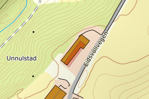
3228 Nes | 5bdd4409-07e0-4622-9bca-b24b5b0823a7 | 517.15 | N: 6670994.80, Ø: 633744.41 | ![Kartbilde fra WMS-tjeneste av avviket](https://wms.geonorge.no/skwms1/wms.topo?VERSION=1.1.1&SERVICE=WMS&REQUEST=GetMap&LAYERS=topo&STYLES=&FORMAT=image/png&SRS=EPSG:25832&BBOX=633669.0,6670944,633819.0,6671044&WIDTH=300&HEIGHT=200) |
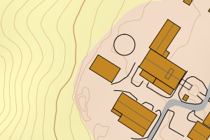
3228 Nes | 87e0bbf6-5c55-4947-9b4f-ca198d5a9f81 | 396.48 | N: 6661448.51, Ø: 630902.37 | ![Kartbilde fra WMS-tjeneste av avviket](https://wms.geonorge.no/skwms1/wms.topo?VERSION=1.1.1&SERVICE=WMS&REQUEST=GetMap&LAYERS=topo&STYLES=&FORMAT=image/png&SRS=EPSG:25832&BBOX=630827.0,6661398,630977.0,6661498&WIDTH=300&HEIGHT=200) |
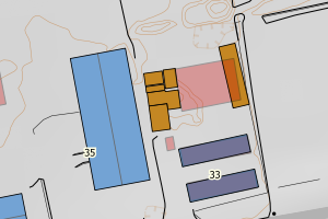
3228 Nes | d238aa8c-3127-418e-9312-bc50babb8a1c | 307.30 | N: 6666488.27, Ø: 636755.26 | ![Kartbilde fra WMS-tjeneste av avviket](https://wms.geonorge.no/skwms1/wms.topo?VERSION=1.1.1&SERVICE=WMS&REQUEST=GetMap&LAYERS=topo&STYLES=&FORMAT=image/png&SRS=EPSG:25832&BBOX=636680.0,6666438,636830.0,6666538&WIDTH=300&HEIGHT=200) |
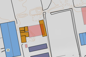
3228 Nes | d3f8aad2-7cca-4431-b5e4-6c586035e1ed | 260.07 | N: 6676793.77, Ø: 643078.59 | ![Kartbilde fra WMS-tjeneste av avviket](https://wms.geonorge.no/skwms1/wms.topo?VERSION=1.1.1&SERVICE=WMS&REQUEST=GetMap&LAYERS=topo&STYLES=&FORMAT=image/png&SRS=EPSG:25832&BBOX=643003.0,6676743,643153.0,6676843&WIDTH=300&HEIGHT=200) |
3228 Nes | e2283094-7871-4805-85b5-c41f8686f3bc | 256.18 | N: 6658836.68, Ø: 632229.89 | ![Kartbilde fra WMS-tjeneste av avviket](https://wms.geonorge.no/skwms1/wms.topo?VERSION=1.1.1&SERVICE=WMS&REQUEST=GetMap&LAYERS=topo&STYLES=&FORMAT=image/png&SRS=EPSG:25832&BBOX=632154.0,6658786,632304.0,6658886&WIDTH=300&HEIGHT=200) |
3228 Nes | dc4400ad-6068-4b6a-9bba-81fa7a6753ea | 241.10 | N: 6675230.55, Ø: 641036.25 | ![Kartbilde fra WMS-tjeneste av avviket](https://wms.geonorge.no/skwms1/wms.topo?VERSION=1.1.1&SERVICE=WMS&REQUEST=GetMap&LAYERS=topo&STYLES=&FORMAT=image/png&SRS=EPSG:25832&BBOX=640961.0,6675180,641111.0,6675280&WIDTH=300&HEIGHT=200) |
3228 Nes | 948ca234-ecd5-40c6-b291-1cea942eaa9b | 236.31 | N: 6673528.42, Ø: 641852.72 | ![Kartbilde fra WMS-tjeneste av avviket](https://wms.geonorge.no/skwms1/wms.topo?VERSION=1.1.1&SERVICE=WMS&REQUEST=GetMap&LAYERS=topo&STYLES=&FORMAT=image/png&SRS=EPSG:25832&BBOX=641777.0,6673478,641927.0,6673578&WIDTH=300&HEIGHT=200) |
3228 Nes | ce7904e2-8fac-4235-9d82-6e7c50e35722 | 203.28 | N: 6668795.37, Ø: 630237.57 | ![Kartbilde fra WMS-tjeneste av avviket](https://wms.geonorge.no/skwms1/wms.topo?VERSION=1.1.1&SERVICE=WMS&REQUEST=GetMap&LAYERS=topo&STYLES=&FORMAT=image/png&SRS=EPSG:25832&BBOX=630162.0,6668745,630312.0,6668845&WIDTH=300&HEIGHT=200) |