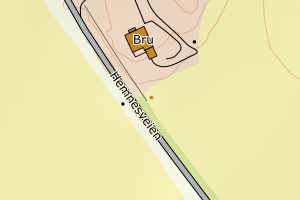
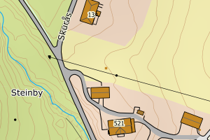
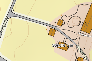
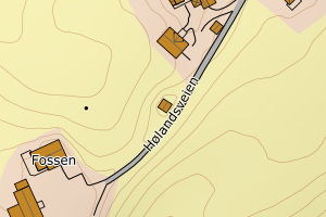
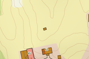
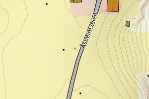
Avvikene kan skyldes enten feil bygningskoordinat eller bygningstype/status i matrikkel eller feil arealtype i AR5. Vær oppmerksom på det er krav om arealer på over 200 m2 før det er krav om endring av arealtype i AR5 så avvikene vil ikke alltid kreve retting i datagrunnlaget
Kommune | LokalId | Bygningsnummer | Arealtype | Bygningstatus | Bygningstype | matrikkel_vedtaksdato | Posisjon | WMS-bilde |
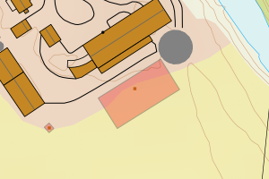
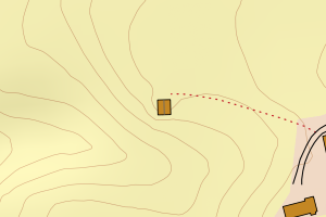
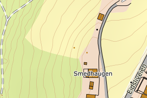
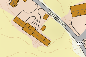
3226 Aurskog-Høland | 8903834d-7d88-4036-81a6-17d6c17ec658 | 150172535 | 21 | TB | 249 | None | N: 6648078.00, Ø: 652855.00 | ![Kartbilde fra WMS-tjeneste av avviket](https://wms.geonorge.no/skwms1/wms.topo?VERSION=1.1.1&SERVICE=WMS&REQUEST=GetMap&LAYERS=topo&STYLES=&FORMAT=image/png&SRS=EPSG:25832&BBOX=652779.0,6648027,652929.0,6648127&WIDTH=300&HEIGHT=200) |
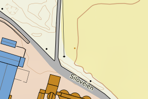
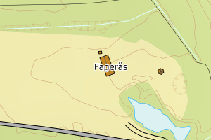
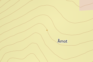
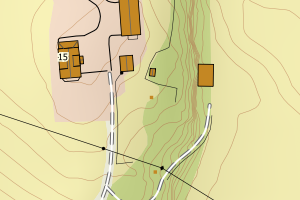
3226 Aurskog-Høland | e316eede-09d6-4072-8d9c-6672279878f3 | 150140544 | 21 | TB | 249 | None | N: 6650819.00, Ø: 639903.00 | ![Kartbilde fra WMS-tjeneste av avviket](https://wms.geonorge.no/skwms1/wms.topo?VERSION=1.1.1&SERVICE=WMS&REQUEST=GetMap&LAYERS=topo&STYLES=&FORMAT=image/png&SRS=EPSG:25832&BBOX=639827.0,6650768,639977.0,6650868&WIDTH=300&HEIGHT=200) |
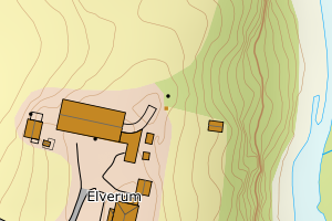
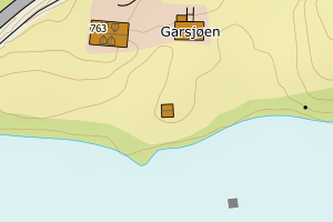
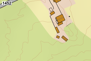
3226 Aurskog-Høland | d161da32-be18-457e-9289-8a4f0aa55348 | 150165954 | 21 | TB | 161 | None | N: 6631827.00, Ø: 651237.00 | ![Kartbilde fra WMS-tjeneste av avviket](https://wms.geonorge.no/skwms1/wms.topo?VERSION=1.1.1&SERVICE=WMS&REQUEST=GetMap&LAYERS=topo&STYLES=&FORMAT=image/png&SRS=EPSG:25832&BBOX=651161.0,6631776,651311.0,6631876&WIDTH=300&HEIGHT=200) |
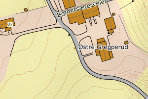
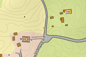
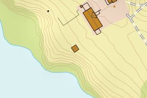
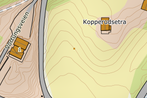
3226 Aurskog-Høland | c2b56bc3-74c9-4884-9187-17074353a40a | 150151481 | 21 | TB | 181 | None | N: 6630858.00, Ø: 643033.00 | ![Kartbilde fra WMS-tjeneste av avviket](https://wms.geonorge.no/skwms1/wms.topo?VERSION=1.1.1&SERVICE=WMS&REQUEST=GetMap&LAYERS=topo&STYLES=&FORMAT=image/png&SRS=EPSG:25832&BBOX=642957.0,6630807,643107.0,6630907&WIDTH=300&HEIGHT=200) |
3226 Aurskog-Høland | 05a92d1c-0b89-4d95-8fc0-9455ac339843 | 150104610 | 21 | TB | 241 | None | N: 6624719.00, Ø: 633954.00 | ![Kartbilde fra WMS-tjeneste av avviket](https://wms.geonorge.no/skwms1/wms.topo?VERSION=1.1.1&SERVICE=WMS&REQUEST=GetMap&LAYERS=topo&STYLES=&FORMAT=image/png&SRS=EPSG:25832&BBOX=633878.0,6624668,634028.0,6624768&WIDTH=300&HEIGHT=200) |
3226 Aurskog-Høland | a58ee3f8-0ef2-477c-b0d0-f87681bb6449 | 150052270 | 21 | TB | 181 | None | N: 6632585.00, Ø: 633308.00 | ![Kartbilde fra WMS-tjeneste av avviket](https://wms.geonorge.no/skwms1/wms.topo?VERSION=1.1.1&SERVICE=WMS&REQUEST=GetMap&LAYERS=topo&STYLES=&FORMAT=image/png&SRS=EPSG:25832&BBOX=633232.0,6632534,633382.0,6632634&WIDTH=300&HEIGHT=200) |
3226 Aurskog-Høland | 1d572da6-7d05-469d-8431-1bd907a6f587 | 300331550 | 21 | TB | 249 | None | N: 6623589.59, Ø: 640354.10 | ![Kartbilde fra WMS-tjeneste av avviket](https://wms.geonorge.no/skwms1/wms.topo?VERSION=1.1.1&SERVICE=WMS&REQUEST=GetMap&LAYERS=topo&STYLES=&FORMAT=image/png&SRS=EPSG:25832&BBOX=640279.0,6623539,640429.0,6623639&WIDTH=300&HEIGHT=200) |
3226 Aurskog-Høland | 1fcb78a8-53e4-4596-9eff-18a3d735f994 | 300256241 | 21 | TB | 249 | None | N: 6632396.73, Ø: 632917.20 | ![Kartbilde fra WMS-tjeneste av avviket](https://wms.geonorge.no/skwms1/wms.topo?VERSION=1.1.1&SERVICE=WMS&REQUEST=GetMap&LAYERS=topo&STYLES=&FORMAT=image/png&SRS=EPSG:25832&BBOX=632842.0,6632346,632992.0,6632446&WIDTH=300&HEIGHT=200) |
3226 Aurskog-Høland | 3f25fbe6-7728-4d94-bf92-449bc9c587b7 | 150186021 | 21 | TB | 249 | None | N: 6649653.00, Ø: 638655.00 | ![Kartbilde fra WMS-tjeneste av avviket](https://wms.geonorge.no/skwms1/wms.topo?VERSION=1.1.1&SERVICE=WMS&REQUEST=GetMap&LAYERS=topo&STYLES=&FORMAT=image/png&SRS=EPSG:25832&BBOX=638579.0,6649602,638729.0,6649702&WIDTH=300&HEIGHT=200) |
3226 Aurskog-Høland | c1c5f8df-8cc1-42f8-bd46-d6c108e58756 | 150118476 | 21 | TB | 241 | None | N: 6620235.00, Ø: 635825.00 | ![Kartbilde fra WMS-tjeneste av avviket](https://wms.geonorge.no/skwms1/wms.topo?VERSION=1.1.1&SERVICE=WMS&REQUEST=GetMap&LAYERS=topo&STYLES=&FORMAT=image/png&SRS=EPSG:25832&BBOX=635749.0,6620184,635899.0,6620284&WIDTH=300&HEIGHT=200) |
3226 Aurskog-Høland | 181e8cbc-c907-4230-a0c0-00e81b36db04 | 150149304 | 21 | TB | 241 | None | N: 6619619.00, Ø: 642487.00 | ![Kartbilde fra WMS-tjeneste av avviket](https://wms.geonorge.no/skwms1/wms.topo?VERSION=1.1.1&SERVICE=WMS&REQUEST=GetMap&LAYERS=topo&STYLES=&FORMAT=image/png&SRS=EPSG:25832&BBOX=642411.0,6619568,642561.0,6619668&WIDTH=300&HEIGHT=200) |
3226 Aurskog-Høland | a177a872-9c60-43fa-9019-49fe7f8e3f8b | 150171067 | 21 | TB | 249 | None | N: 6646523.84, Ø: 651067.44 | ![Kartbilde fra WMS-tjeneste av avviket](https://wms.geonorge.no/skwms1/wms.topo?VERSION=1.1.1&SERVICE=WMS&REQUEST=GetMap&LAYERS=topo&STYLES=&FORMAT=image/png&SRS=EPSG:25832&BBOX=650992.0,6646473,651142.0,6646573&WIDTH=300&HEIGHT=200) |
3226 Aurskog-Høland | 000c7713-c8e7-47f9-bc58-f5448f7bb410 | 150111293 | 21 | TB | 249 | None | N: 6647176.00, Ø: 632465.00 | ![Kartbilde fra WMS-tjeneste av avviket](https://wms.geonorge.no/skwms1/wms.topo?VERSION=1.1.1&SERVICE=WMS&REQUEST=GetMap&LAYERS=topo&STYLES=&FORMAT=image/png&SRS=EPSG:25832&BBOX=632389.0,6647125,632539.0,6647225&WIDTH=300&HEIGHT=200) |
3226 Aurskog-Høland | 0fc0abef-451a-442e-85ec-db8813d2a540 | 150109752 | 21 | TB | 249 | None | N: 6644572.00, Ø: 632876.00 | ![Kartbilde fra WMS-tjeneste av avviket](https://wms.geonorge.no/skwms1/wms.topo?VERSION=1.1.1&SERVICE=WMS&REQUEST=GetMap&LAYERS=topo&STYLES=&FORMAT=image/png&SRS=EPSG:25832&BBOX=632800.0,6644521,632950.0,6644621&WIDTH=300&HEIGHT=200) |
3226 Aurskog-Høland | 3667e875-f22a-4ea1-8d43-81eab4329f39 | 150148405 | 21 | TB | 181 | None | N: 6622923.00, Ø: 646658.00 | ![Kartbilde fra WMS-tjeneste av avviket](https://wms.geonorge.no/skwms1/wms.topo?VERSION=1.1.1&SERVICE=WMS&REQUEST=GetMap&LAYERS=topo&STYLES=&FORMAT=image/png&SRS=EPSG:25832&BBOX=646582.0,6622872,646732.0,6622972&WIDTH=300&HEIGHT=200) |
3226 Aurskog-Høland | 4ee41af2-734f-4f00-9273-0b4c7e83ab69 | 150089778 | 21 | TB | 249 | None | N: 6639707.00, Ø: 643033.00 | ![Kartbilde fra WMS-tjeneste av avviket](https://wms.geonorge.no/skwms1/wms.topo?VERSION=1.1.1&SERVICE=WMS&REQUEST=GetMap&LAYERS=topo&STYLES=&FORMAT=image/png&SRS=EPSG:25832&BBOX=642957.0,6639656,643107.0,6639756&WIDTH=300&HEIGHT=200) |
3226 Aurskog-Høland | 797949b1-4937-42c6-b116-faa7c66d3aa0 | 150110777 | 21 | TB | 999 | None | N: 6644452.00, Ø: 632767.00 | ![Kartbilde fra WMS-tjeneste av avviket](https://wms.geonorge.no/skwms1/wms.topo?VERSION=1.1.1&SERVICE=WMS&REQUEST=GetMap&LAYERS=topo&STYLES=&FORMAT=image/png&SRS=EPSG:25832&BBOX=632691.0,6644401,632841.0,6644501&WIDTH=300&HEIGHT=200) |
3226 Aurskog-Høland | e7cf8fed-d4b8-4998-9d14-03781e7dd6f5 | 147156405 | 21 | TB | 249 | None | N: 6624834.10, Ø: 655947.00 | ![Kartbilde fra WMS-tjeneste av avviket](https://wms.geonorge.no/skwms1/wms.topo?VERSION=1.1.1&SERVICE=WMS&REQUEST=GetMap&LAYERS=topo&STYLES=&FORMAT=image/png&SRS=EPSG:25832&BBOX=655871.0,6624784,656021.0,6624884&WIDTH=300&HEIGHT=200) |
3226 Aurskog-Høland | ce77557f-24f7-409a-aad7-4f67bc46b6ea | 150102545 | 21 | TB | 249 | None | N: 6632899.00, Ø: 627929.60 | ![Kartbilde fra WMS-tjeneste av avviket](https://wms.geonorge.no/skwms1/wms.topo?VERSION=1.1.1&SERVICE=WMS&REQUEST=GetMap&LAYERS=topo&STYLES=&FORMAT=image/png&SRS=EPSG:25832&BBOX=627854.0,6632848,628004.0,6632948&WIDTH=300&HEIGHT=200) |
3226 Aurskog-Høland | d8074c02-1dd8-478a-b877-aa9cf354e559 | 150125537 | 21 | TB | 249 | None | N: 6631874.00, Ø: 639721.00 | ![Kartbilde fra WMS-tjeneste av avviket](https://wms.geonorge.no/skwms1/wms.topo?VERSION=1.1.1&SERVICE=WMS&REQUEST=GetMap&LAYERS=topo&STYLES=&FORMAT=image/png&SRS=EPSG:25832&BBOX=639645.0,6631823,639795.0,6631923&WIDTH=300&HEIGHT=200) |
3226 Aurskog-Høland | b2e224d3-1bf5-49c9-a0ad-0853bc354709 | 150180325 | 21 | TB | 239 | None | N: 6622925.00, Ø: 638921.00 | ![Kartbilde fra WMS-tjeneste av avviket](https://wms.geonorge.no/skwms1/wms.topo?VERSION=1.1.1&SERVICE=WMS&REQUEST=GetMap&LAYERS=topo&STYLES=&FORMAT=image/png&SRS=EPSG:25832&BBOX=638845.0,6622874,638995.0,6622974&WIDTH=300&HEIGHT=200) |
3226 Aurskog-Høland | 2da5594f-0b20-46e1-80c6-b3c2b9df210e | 150131766 | 21 | TB | 181 | None | N: 6636855.27, Ø: 639650.84 | ![Kartbilde fra WMS-tjeneste av avviket](https://wms.geonorge.no/skwms1/wms.topo?VERSION=1.1.1&SERVICE=WMS&REQUEST=GetMap&LAYERS=topo&STYLES=&FORMAT=image/png&SRS=EPSG:25832&BBOX=639575.0,6636805,639725.0,6636905&WIDTH=300&HEIGHT=200) |
3226 Aurskog-Høland | fe851d4e-0ac6-4382-8ccd-3a4da4c6d175 | 300069816 | 21 | TB | 249 | None | N: 6645380.00, Ø: 635554.00 | ![Kartbilde fra WMS-tjeneste av avviket](https://wms.geonorge.no/skwms1/wms.topo?VERSION=1.1.1&SERVICE=WMS&REQUEST=GetMap&LAYERS=topo&STYLES=&FORMAT=image/png&SRS=EPSG:25832&BBOX=635478.0,6645329,635628.0,6645429&WIDTH=300&HEIGHT=200) |
3226 Aurskog-Høland | adb30d9b-b349-4579-8584-53b0fb3d0cbd | 150114179 | 21 | TB | 249 | None | N: 6615571.00, Ø: 641524.00 | ![Kartbilde fra WMS-tjeneste av avviket](https://wms.geonorge.no/skwms1/wms.topo?VERSION=1.1.1&SERVICE=WMS&REQUEST=GetMap&LAYERS=topo&STYLES=&FORMAT=image/png&SRS=EPSG:25832&BBOX=641448.0,6615520,641598.0,6615620&WIDTH=300&HEIGHT=200) |
3226 Aurskog-Høland | cb7708fb-6af4-4f2e-a83f-45cc86de8647 | 150119715 | 21 | TB | 241 | None | N: 6619983.00, Ø: 639475.00 | ![Kartbilde fra WMS-tjeneste av avviket](https://wms.geonorge.no/skwms1/wms.topo?VERSION=1.1.1&SERVICE=WMS&REQUEST=GetMap&LAYERS=topo&STYLES=&FORMAT=image/png&SRS=EPSG:25832&BBOX=639399.0,6619932,639549.0,6620032&WIDTH=300&HEIGHT=200) |
3226 Aurskog-Høland | d0080314-32e6-4f72-b011-a00dfa2f90dc | 150184142 | 21 | TB | 241 | None | N: 6623636.00, Ø: 635179.00 | ![Kartbilde fra WMS-tjeneste av avviket](https://wms.geonorge.no/skwms1/wms.topo?VERSION=1.1.1&SERVICE=WMS&REQUEST=GetMap&LAYERS=topo&STYLES=&FORMAT=image/png&SRS=EPSG:25832&BBOX=635103.0,6623585,635253.0,6623685&WIDTH=300&HEIGHT=200) |
3226 Aurskog-Høland | 83f76830-1933-4f8a-b20f-430aa6901269 | 147159412 | 21 | TB | 241 | None | N: 6626381.00, Ø: 657674.00 | ![Kartbilde fra WMS-tjeneste av avviket](https://wms.geonorge.no/skwms1/wms.topo?VERSION=1.1.1&SERVICE=WMS&REQUEST=GetMap&LAYERS=topo&STYLES=&FORMAT=image/png&SRS=EPSG:25832&BBOX=657598.0,6626330,657748.0,6626430&WIDTH=300&HEIGHT=200) |
3226 Aurskog-Høland | 7a963c24-8ac0-42d3-9ed8-ee87a387b526 | 150093651 | 21 | TB | 249 | None | N: 6644704.00, Ø: 642383.00 | ![Kartbilde fra WMS-tjeneste av avviket](https://wms.geonorge.no/skwms1/wms.topo?VERSION=1.1.1&SERVICE=WMS&REQUEST=GetMap&LAYERS=topo&STYLES=&FORMAT=image/png&SRS=EPSG:25832&BBOX=642307.0,6644653,642457.0,6644753&WIDTH=300&HEIGHT=200) |
3226 Aurskog-Høland | da3dd789-d3a8-4a0c-beae-d8117cd050a5 | 150112532 | 21 | TB | 249 | None | N: 6647869.00, Ø: 634301.00 | ![Kartbilde fra WMS-tjeneste av avviket](https://wms.geonorge.no/skwms1/wms.topo?VERSION=1.1.1&SERVICE=WMS&REQUEST=GetMap&LAYERS=topo&STYLES=&FORMAT=image/png&SRS=EPSG:25832&BBOX=634225.0,6647818,634375.0,6647918&WIDTH=300&HEIGHT=200) |
3226 Aurskog-Høland | 2c1332f1-cc83-45d6-ac41-6d8479b53570 | 150145775 | 21 | TB | 241 | None | N: 6616105.00, Ø: 644707.00 | ![Kartbilde fra WMS-tjeneste av avviket](https://wms.geonorge.no/skwms1/wms.topo?VERSION=1.1.1&SERVICE=WMS&REQUEST=GetMap&LAYERS=topo&STYLES=&FORMAT=image/png&SRS=EPSG:25832&BBOX=644631.0,6616054,644781.0,6616154&WIDTH=300&HEIGHT=200) |
3226 Aurskog-Høland | 82ce80fa-9e95-48cf-ba4c-835282415c75 | 150147158 | 21 | TB | 241 | None | N: 6614843.00, Ø: 645145.00 | ![Kartbilde fra WMS-tjeneste av avviket](https://wms.geonorge.no/skwms1/wms.topo?VERSION=1.1.1&SERVICE=WMS&REQUEST=GetMap&LAYERS=topo&STYLES=&FORMAT=image/png&SRS=EPSG:25832&BBOX=645069.0,6614792,645219.0,6614892&WIDTH=300&HEIGHT=200) |
3226 Aurskog-Høland | 87161068-5c62-4d24-ab2c-3c1f8c8b1ce9 | 150161460 | 21 | TB | 241 | None | N: 6644636.00, Ø: 645665.00 | ![Kartbilde fra WMS-tjeneste av avviket](https://wms.geonorge.no/skwms1/wms.topo?VERSION=1.1.1&SERVICE=WMS&REQUEST=GetMap&LAYERS=topo&STYLES=&FORMAT=image/png&SRS=EPSG:25832&BBOX=645589.0,6644585,645739.0,6644685&WIDTH=300&HEIGHT=200) |
3226 Aurskog-Høland | 457dbb05-6f80-4570-8616-9e139fa5aad4 | 150167558 | 21 | TB | 241 | None | N: 6637541.00, Ø: 651895.00 | ![Kartbilde fra WMS-tjeneste av avviket](https://wms.geonorge.no/skwms1/wms.topo?VERSION=1.1.1&SERVICE=WMS&REQUEST=GetMap&LAYERS=topo&STYLES=&FORMAT=image/png&SRS=EPSG:25832&BBOX=651819.0,6637490,651969.0,6637590&WIDTH=300&HEIGHT=200) |
3226 Aurskog-Høland | 58153873-1fd1-4667-b1ce-c5b30ebe7eb8 | 150166853 | 21 | TB | 181 | None | N: 6637366.00, Ø: 649615.00 | ![Kartbilde fra WMS-tjeneste av avviket](https://wms.geonorge.no/skwms1/wms.topo?VERSION=1.1.1&SERVICE=WMS&REQUEST=GetMap&LAYERS=topo&STYLES=&FORMAT=image/png&SRS=EPSG:25832&BBOX=649539.0,6637315,649689.0,6637415&WIDTH=300&HEIGHT=200) |
3226 Aurskog-Høland | 79a7c9d9-70c8-4ade-92dd-208c8ba08064 | 150188199 | 21 | TB | 241 | None | N: 6617708.00, Ø: 641058.00 | ![Kartbilde fra WMS-tjeneste av avviket](https://wms.geonorge.no/skwms1/wms.topo?VERSION=1.1.1&SERVICE=WMS&REQUEST=GetMap&LAYERS=topo&STYLES=&FORMAT=image/png&SRS=EPSG:25832&BBOX=640982.0,6617657,641132.0,6617757&WIDTH=300&HEIGHT=200) |
3226 Aurskog-Høland | 242dbe10-0a2e-4031-92ad-8f757da080b2 | 150186447 | 21 | TB | 249 | None | N: 6649066.00, Ø: 644849.00 | ![Kartbilde fra WMS-tjeneste av avviket](https://wms.geonorge.no/skwms1/wms.topo?VERSION=1.1.1&SERVICE=WMS&REQUEST=GetMap&LAYERS=topo&STYLES=&FORMAT=image/png&SRS=EPSG:25832&BBOX=644773.0,6649015,644923.0,6649115&WIDTH=300&HEIGHT=200) |
3226 Aurskog-Høland | ea0c4a0f-564d-4fea-b487-4a0f36d22fd3 | 150186536 | 21 | TB | 241 | None | N: 6632909.00, Ø: 652937.00 | ![Kartbilde fra WMS-tjeneste av avviket](https://wms.geonorge.no/skwms1/wms.topo?VERSION=1.1.1&SERVICE=WMS&REQUEST=GetMap&LAYERS=topo&STYLES=&FORMAT=image/png&SRS=EPSG:25832&BBOX=652861.0,6632858,653011.0,6632958&WIDTH=300&HEIGHT=200) |
3226 Aurskog-Høland | 93777ef7-478a-447b-a558-833d295d6a50 | 150189675 | 21 | TB | 241 | None | N: 6622893.00, Ø: 641044.00 | ![Kartbilde fra WMS-tjeneste av avviket](https://wms.geonorge.no/skwms1/wms.topo?VERSION=1.1.1&SERVICE=WMS&REQUEST=GetMap&LAYERS=topo&STYLES=&FORMAT=image/png&SRS=EPSG:25832&BBOX=640968.0,6622842,641118.0,6622942&WIDTH=300&HEIGHT=200) |
3226 Aurskog-Høland | a5499e00-ee51-4c72-a1ad-77abe42b53a5 | 150185904 | 21 | TB | 248 | None | N: 6633988.00, Ø: 640084.00 | ![Kartbilde fra WMS-tjeneste av avviket](https://wms.geonorge.no/skwms1/wms.topo?VERSION=1.1.1&SERVICE=WMS&REQUEST=GetMap&LAYERS=topo&STYLES=&FORMAT=image/png&SRS=EPSG:25832&BBOX=640008.0,6633937,640158.0,6634037&WIDTH=300&HEIGHT=200) |
3226 Aurskog-Høland | 5f52ded1-01bd-412b-8aa7-54d99d90b826 | 150186013 | 21 | TB | 219 | None | N: 6651079.00, Ø: 639479.00 | ![Kartbilde fra WMS-tjeneste av avviket](https://wms.geonorge.no/skwms1/wms.topo?VERSION=1.1.1&SERVICE=WMS&REQUEST=GetMap&LAYERS=topo&STYLES=&FORMAT=image/png&SRS=EPSG:25832&BBOX=639403.0,6651028,639553.0,6651128&WIDTH=300&HEIGHT=200) |
3226 Aurskog-Høland | a08a77f6-5f81-4e8f-930e-10ad3cff9adf | 150189373 | 21 | TB | 241 | None | N: 6630599.00, Ø: 651624.00 | ![Kartbilde fra WMS-tjeneste av avviket](https://wms.geonorge.no/skwms1/wms.topo?VERSION=1.1.1&SERVICE=WMS&REQUEST=GetMap&LAYERS=topo&STYLES=&FORMAT=image/png&SRS=EPSG:25832&BBOX=651548.0,6630548,651698.0,6630648&WIDTH=300&HEIGHT=200) |
3226 Aurskog-Høland | 756b61fd-c8b2-43c3-a18b-ca0bd18322b5 | 150114160 | 21 | TB | 111 | None | N: 6615532.00, Ø: 641570.00 | ![Kartbilde fra WMS-tjeneste av avviket](https://wms.geonorge.no/skwms1/wms.topo?VERSION=1.1.1&SERVICE=WMS&REQUEST=GetMap&LAYERS=topo&STYLES=&FORMAT=image/png&SRS=EPSG:25832&BBOX=641494.0,6615481,641644.0,6615581&WIDTH=300&HEIGHT=200) |
3226 Aurskog-Høland | 4469a92a-d80d-41a5-8221-d88622e0efd9 | 150120543 | 21 | TB | 241 | None | N: 6627049.00, Ø: 636186.00 | ![Kartbilde fra WMS-tjeneste av avviket](https://wms.geonorge.no/skwms1/wms.topo?VERSION=1.1.1&SERVICE=WMS&REQUEST=GetMap&LAYERS=topo&STYLES=&FORMAT=image/png&SRS=EPSG:25832&BBOX=636110.0,6626998,636260.0,6627098&WIDTH=300&HEIGHT=200) |
3226 Aurskog-Høland | 5ba50ccb-a233-48dd-b64e-12bb5fe34674 | 150115051 | 21 | TB | 241 | None | N: 6621735.00, Ø: 636035.00 | ![Kartbilde fra WMS-tjeneste av avviket](https://wms.geonorge.no/skwms1/wms.topo?VERSION=1.1.1&SERVICE=WMS&REQUEST=GetMap&LAYERS=topo&STYLES=&FORMAT=image/png&SRS=EPSG:25832&BBOX=635959.0,6621684,636109.0,6621784&WIDTH=300&HEIGHT=200) |
3226 Aurskog-Høland | 71a00df7-7743-4a03-b4fd-8955f60f8fa9 | 150188512 | 21 | TB | 249 | None | N: 6623783.00, Ø: 640925.00 | ![Kartbilde fra WMS-tjeneste av avviket](https://wms.geonorge.no/skwms1/wms.topo?VERSION=1.1.1&SERVICE=WMS&REQUEST=GetMap&LAYERS=topo&STYLES=&FORMAT=image/png&SRS=EPSG:25832&BBOX=640849.0,6623732,640999.0,6623832&WIDTH=300&HEIGHT=200) |
3226 Aurskog-Høland | 813df72f-537a-4c0e-92e8-98f51db144a9 | 150136768 | 21 | TB | 249 | None | N: 6645393.00, Ø: 635556.00 | ![Kartbilde fra WMS-tjeneste av avviket](https://wms.geonorge.no/skwms1/wms.topo?VERSION=1.1.1&SERVICE=WMS&REQUEST=GetMap&LAYERS=topo&STYLES=&FORMAT=image/png&SRS=EPSG:25832&BBOX=635480.0,6645342,635630.0,6645442&WIDTH=300&HEIGHT=200) |
3226 Aurskog-Høland | 8ed4648e-9d55-42ac-a997-b251d37d6d72 | 150108748 | 21 | TB | 181 | None | N: 6646834.00, Ø: 631937.00 | ![Kartbilde fra WMS-tjeneste av avviket](https://wms.geonorge.no/skwms1/wms.topo?VERSION=1.1.1&SERVICE=WMS&REQUEST=GetMap&LAYERS=topo&STYLES=&FORMAT=image/png&SRS=EPSG:25832&BBOX=631861.0,6646783,632011.0,6646883&WIDTH=300&HEIGHT=200) |
3226 Aurskog-Høland | a65e888b-90af-49e5-a234-abee1b1bdda2 | 150141958 | 21 | TB | 241 | None | N: 6648559.00, Ø: 636647.00 | ![Kartbilde fra WMS-tjeneste av avviket](https://wms.geonorge.no/skwms1/wms.topo?VERSION=1.1.1&SERVICE=WMS&REQUEST=GetMap&LAYERS=topo&STYLES=&FORMAT=image/png&SRS=EPSG:25832&BBOX=636571.0,6648508,636721.0,6648608&WIDTH=300&HEIGHT=200) |
3226 Aurskog-Høland | c65f0cb0-0e1e-4509-8c1c-34184f224267 | 150173833 | 21 | TB | 249 | None | N: 6635333.00, Ø: 655849.00 | ![Kartbilde fra WMS-tjeneste av avviket](https://wms.geonorge.no/skwms1/wms.topo?VERSION=1.1.1&SERVICE=WMS&REQUEST=GetMap&LAYERS=topo&STYLES=&FORMAT=image/png&SRS=EPSG:25832&BBOX=655773.0,6635282,655923.0,6635382&WIDTH=300&HEIGHT=200) |
3226 Aurskog-Høland | d47602cd-61e3-4069-a3a6-3088948cbae0 | 150139597 | 21 | TB | 999 | None | N: 6650025.00, Ø: 639007.00 | ![Kartbilde fra WMS-tjeneste av avviket](https://wms.geonorge.no/skwms1/wms.topo?VERSION=1.1.1&SERVICE=WMS&REQUEST=GetMap&LAYERS=topo&STYLES=&FORMAT=image/png&SRS=EPSG:25832&BBOX=638931.0,6649974,639081.0,6650074&WIDTH=300&HEIGHT=200) |
3226 Aurskog-Høland | e0b6f3fe-db1f-489b-afda-c6e3efa6f731 | 150085586 | 21 | TB | 181 | None | N: 6641204.00, Ø: 644743.00 | ![Kartbilde fra WMS-tjeneste av avviket](https://wms.geonorge.no/skwms1/wms.topo?VERSION=1.1.1&SERVICE=WMS&REQUEST=GetMap&LAYERS=topo&STYLES=&FORMAT=image/png&SRS=EPSG:25832&BBOX=644667.0,6641153,644817.0,6641253&WIDTH=300&HEIGHT=200) |
3226 Aurskog-Høland | e9f92a30-9195-4e88-a863-e0673e82a153 | 150093740 | 21 | TB | 249 | None | N: 6644632.00, Ø: 642482.00 | ![Kartbilde fra WMS-tjeneste av avviket](https://wms.geonorge.no/skwms1/wms.topo?VERSION=1.1.1&SERVICE=WMS&REQUEST=GetMap&LAYERS=topo&STYLES=&FORMAT=image/png&SRS=EPSG:25832&BBOX=642406.0,6644581,642556.0,6644681&WIDTH=300&HEIGHT=200) |
3226 Aurskog-Høland | ed709833-f5a1-48df-a9d4-79c6e686f988 | 150087635 | 21 | TB | 249 | None | N: 6640246.00, Ø: 642773.00 | ![Kartbilde fra WMS-tjeneste av avviket](https://wms.geonorge.no/skwms1/wms.topo?VERSION=1.1.1&SERVICE=WMS&REQUEST=GetMap&LAYERS=topo&STYLES=&FORMAT=image/png&SRS=EPSG:25832&BBOX=642697.0,6640195,642847.0,6640295&WIDTH=300&HEIGHT=200) |
3226 Aurskog-Høland | f55a5db6-165a-41c3-860d-f93f8164b708 | 150176980 | 21 | TB | 111 | None | N: 6644606.00, Ø: 635434.00 | ![Kartbilde fra WMS-tjeneste av avviket](https://wms.geonorge.no/skwms1/wms.topo?VERSION=1.1.1&SERVICE=WMS&REQUEST=GetMap&LAYERS=topo&STYLES=&FORMAT=image/png&SRS=EPSG:25832&BBOX=635358.0,6644555,635508.0,6644655&WIDTH=300&HEIGHT=200) |
3226 Aurskog-Høland | fb6a48b2-7bdc-4c7d-a448-a4efa3538e02 | 150137063 | 21 | TB | 181 | None | N: 6646706.00, Ø: 638702.00 | ![Kartbilde fra WMS-tjeneste av avviket](https://wms.geonorge.no/skwms1/wms.topo?VERSION=1.1.1&SERVICE=WMS&REQUEST=GetMap&LAYERS=topo&STYLES=&FORMAT=image/png&SRS=EPSG:25832&BBOX=638626.0,6646655,638776.0,6646755&WIDTH=300&HEIGHT=200) |
3226 Aurskog-Høland | fcf6ab9b-cf5f-4151-9c61-67982e467221 | 150147514 | 21 | TB | 239 | None | N: 6622714.00, Ø: 644532.00 | ![Kartbilde fra WMS-tjeneste av avviket](https://wms.geonorge.no/skwms1/wms.topo?VERSION=1.1.1&SERVICE=WMS&REQUEST=GetMap&LAYERS=topo&STYLES=&FORMAT=image/png&SRS=EPSG:25832&BBOX=644456.0,6622663,644606.0,6622763&WIDTH=300&HEIGHT=200) |
3226 Aurskog-Høland | 519a99b9-b471-4f75-8684-b52c426274f3 | 150105684 | 21 | TB | 239 | None | N: 6630961.00, Ø: 634775.00 | ![Kartbilde fra WMS-tjeneste av avviket](https://wms.geonorge.no/skwms1/wms.topo?VERSION=1.1.1&SERVICE=WMS&REQUEST=GetMap&LAYERS=topo&STYLES=&FORMAT=image/png&SRS=EPSG:25832&BBOX=634699.0,6630910,634849.0,6631010&WIDTH=300&HEIGHT=200) |
3226 Aurskog-Høland | 5a82e01a-7886-46a8-8a3c-290ed2269bca | 150153239 | 21 | TB | 249 | None | N: 6635668.00, Ø: 642961.00 | ![Kartbilde fra WMS-tjeneste av avviket](https://wms.geonorge.no/skwms1/wms.topo?VERSION=1.1.1&SERVICE=WMS&REQUEST=GetMap&LAYERS=topo&STYLES=&FORMAT=image/png&SRS=EPSG:25832&BBOX=642885.0,6635617,643035.0,6635717&WIDTH=300&HEIGHT=200) |
3226 Aurskog-Høland | a50ffd48-080f-4a30-a3bd-13488fdb2b70 | 150140595 | 21 | TB | 249 | None | N: 6651068.00, Ø: 640108.00 | ![Kartbilde fra WMS-tjeneste av avviket](https://wms.geonorge.no/skwms1/wms.topo?VERSION=1.1.1&SERVICE=WMS&REQUEST=GetMap&LAYERS=topo&STYLES=&FORMAT=image/png&SRS=EPSG:25832&BBOX=640032.0,6651017,640182.0,6651117&WIDTH=300&HEIGHT=200) |
3226 Aurskog-Høland | e8c11875-9dbd-44b9-a83d-2ea2bcc05938 | 150157161 | 21 | TB | 999 | None | N: 6646571.00, Ø: 642662.00 | ![Kartbilde fra WMS-tjeneste av avviket](https://wms.geonorge.no/skwms1/wms.topo?VERSION=1.1.1&SERVICE=WMS&REQUEST=GetMap&LAYERS=topo&STYLES=&FORMAT=image/png&SRS=EPSG:25832&BBOX=642586.0,6646520,642736.0,6646620&WIDTH=300&HEIGHT=200) |
3226 Aurskog-Høland | 16457260-d1b2-4139-9277-561b4ed1821d | 150116759 | 21 | TB | 181 | None | N: 6623128.00, Ø: 641163.00 | ![Kartbilde fra WMS-tjeneste av avviket](https://wms.geonorge.no/skwms1/wms.topo?VERSION=1.1.1&SERVICE=WMS&REQUEST=GetMap&LAYERS=topo&STYLES=&FORMAT=image/png&SRS=EPSG:25832&BBOX=641087.0,6623077,641237.0,6623177&WIDTH=300&HEIGHT=200) |
3226 Aurskog-Høland | 18dec811-e63f-4043-af24-73f56df4cce7 | 150055016 | 21 | TB | 249 | None | N: 6631613.00, Ø: 637438.00 | ![Kartbilde fra WMS-tjeneste av avviket](https://wms.geonorge.no/skwms1/wms.topo?VERSION=1.1.1&SERVICE=WMS&REQUEST=GetMap&LAYERS=topo&STYLES=&FORMAT=image/png&SRS=EPSG:25832&BBOX=637362.0,6631562,637512.0,6631662&WIDTH=300&HEIGHT=200) |
3226 Aurskog-Høland | 3bbf5e02-65ae-4c48-b991-ca33225e4b3b | 150123399 | 21 | TB | 249 | None | N: 6624096.00, Ø: 638443.00 | ![Kartbilde fra WMS-tjeneste av avviket](https://wms.geonorge.no/skwms1/wms.topo?VERSION=1.1.1&SERVICE=WMS&REQUEST=GetMap&LAYERS=topo&STYLES=&FORMAT=image/png&SRS=EPSG:25832&BBOX=638367.0,6624045,638517.0,6624145&WIDTH=300&HEIGHT=200) |
3226 Aurskog-Høland | 407b7679-2bec-4ade-b6e0-f48e132d511b | 150124328 | 21 | TB | 241 | None | N: 6630563.00, Ø: 637507.00 | ![Kartbilde fra WMS-tjeneste av avviket](https://wms.geonorge.no/skwms1/wms.topo?VERSION=1.1.1&SERVICE=WMS&REQUEST=GetMap&LAYERS=topo&STYLES=&FORMAT=image/png&SRS=EPSG:25832&BBOX=637431.0,6630512,637581.0,6630612&WIDTH=300&HEIGHT=200) |
3226 Aurskog-Høland | 54da11da-0a9e-4b55-9114-9f7fdc9bb77f | 150128803 | 21 | TB | 249 | None | N: 6629815.00, Ø: 640038.00 | ![Kartbilde fra WMS-tjeneste av avviket](https://wms.geonorge.no/skwms1/wms.topo?VERSION=1.1.1&SERVICE=WMS&REQUEST=GetMap&LAYERS=topo&STYLES=&FORMAT=image/png&SRS=EPSG:25832&BBOX=639962.0,6629764,640112.0,6629864&WIDTH=300&HEIGHT=200) |
3226 Aurskog-Høland | 5ee296b3-1795-4791-989a-d1646602b4b7 | 150116716 | 21 | TB | 249 | None | N: 6623038.56, Ø: 640990.72 | ![Kartbilde fra WMS-tjeneste av avviket](https://wms.geonorge.no/skwms1/wms.topo?VERSION=1.1.1&SERVICE=WMS&REQUEST=GetMap&LAYERS=topo&STYLES=&FORMAT=image/png&SRS=EPSG:25832&BBOX=640915.0,6622988,641065.0,6623088&WIDTH=300&HEIGHT=200) |
3226 Aurskog-Høland | 6928f302-03f4-499e-a2bd-231978611e5d | 150145406 | 21 | TB | 241 | None | N: 6617804.00, Ø: 642507.00 | ![Kartbilde fra WMS-tjeneste av avviket](https://wms.geonorge.no/skwms1/wms.topo?VERSION=1.1.1&SERVICE=WMS&REQUEST=GetMap&LAYERS=topo&STYLES=&FORMAT=image/png&SRS=EPSG:25832&BBOX=642431.0,6617753,642581.0,6617853&WIDTH=300&HEIGHT=200) |
3226 Aurskog-Høland | 736f1047-07cb-463c-bb9c-df3f12d9ef9e | 150123704 | 21 | TB | 172 | None | N: 6623625.00, Ø: 640714.00 | ![Kartbilde fra WMS-tjeneste av avviket](https://wms.geonorge.no/skwms1/wms.topo?VERSION=1.1.1&SERVICE=WMS&REQUEST=GetMap&LAYERS=topo&STYLES=&FORMAT=image/png&SRS=EPSG:25832&BBOX=640638.0,6623574,640788.0,6623674&WIDTH=300&HEIGHT=200) |
3226 Aurskog-Høland | 7be40c71-bae9-4cfe-b45d-f5b4f5c16f79 | 150125588 | 21 | TB | 249 | None | N: 6631881.71, Ø: 639698.37 | ![Kartbilde fra WMS-tjeneste av avviket](https://wms.geonorge.no/skwms1/wms.topo?VERSION=1.1.1&SERVICE=WMS&REQUEST=GetMap&LAYERS=topo&STYLES=&FORMAT=image/png&SRS=EPSG:25832&BBOX=639623.0,6631831,639773.0,6631931&WIDTH=300&HEIGHT=200) |
3226 Aurskog-Høland | 7c54f614-f9bb-4722-baa5-ef8d793fa8bd | 150131030 | 21 | TB | 241 | None | N: 6635652.00, Ø: 639133.00 | ![Kartbilde fra WMS-tjeneste av avviket](https://wms.geonorge.no/skwms1/wms.topo?VERSION=1.1.1&SERVICE=WMS&REQUEST=GetMap&LAYERS=topo&STYLES=&FORMAT=image/png&SRS=EPSG:25832&BBOX=639057.0,6635601,639207.0,6635701&WIDTH=300&HEIGHT=200) |
3226 Aurskog-Høland | 7ef0f938-8122-49fd-b3a7-755016c654e0 | 150105935 | 21 | TB | 249 | None | N: 6629563.00, Ø: 630613.00 | ![Kartbilde fra WMS-tjeneste av avviket](https://wms.geonorge.no/skwms1/wms.topo?VERSION=1.1.1&SERVICE=WMS&REQUEST=GetMap&LAYERS=topo&STYLES=&FORMAT=image/png&SRS=EPSG:25832&BBOX=630537.0,6629512,630687.0,6629612&WIDTH=300&HEIGHT=200) |
3226 Aurskog-Høland | 92764a51-9fea-40bb-8f9d-11c72763c4bd | 150125146 | 21 | TB | 249 | None | N: 6632650.00, Ø: 637834.00 | ![Kartbilde fra WMS-tjeneste av avviket](https://wms.geonorge.no/skwms1/wms.topo?VERSION=1.1.1&SERVICE=WMS&REQUEST=GetMap&LAYERS=topo&STYLES=&FORMAT=image/png&SRS=EPSG:25832&BBOX=637758.0,6632599,637908.0,6632699&WIDTH=300&HEIGHT=200) |
3226 Aurskog-Høland | 937a38e9-ac1f-4be6-9265-7b981e44cd52 | 300255127 | 21 | TB | 249 | None | N: 6624104.60, Ø: 638463.67 | ![Kartbilde fra WMS-tjeneste av avviket](https://wms.geonorge.no/skwms1/wms.topo?VERSION=1.1.1&SERVICE=WMS&REQUEST=GetMap&LAYERS=topo&STYLES=&FORMAT=image/png&SRS=EPSG:25832&BBOX=638388.0,6624054,638538.0,6624154&WIDTH=300&HEIGHT=200) |
3226 Aurskog-Høland | a2220a9c-1b7e-473c-ae10-6b6397eece6e | 150185106 | 21 | TB | 241 | None | N: 6623153.00, Ø: 638422.00 | ![Kartbilde fra WMS-tjeneste av avviket](https://wms.geonorge.no/skwms1/wms.topo?VERSION=1.1.1&SERVICE=WMS&REQUEST=GetMap&LAYERS=topo&STYLES=&FORMAT=image/png&SRS=EPSG:25832&BBOX=638346.0,6623102,638496.0,6623202&WIDTH=300&HEIGHT=200) |
3226 Aurskog-Høland | 4f3f1554-a0e5-4cb0-a24b-990a42d755c0 | 150186749 | 21 | TB | 241 | None | N: 6638314.00, Ø: 650515.00 | ![Kartbilde fra WMS-tjeneste av avviket](https://wms.geonorge.no/skwms1/wms.topo?VERSION=1.1.1&SERVICE=WMS&REQUEST=GetMap&LAYERS=topo&STYLES=&FORMAT=image/png&SRS=EPSG:25832&BBOX=650439.0,6638263,650589.0,6638363&WIDTH=300&HEIGHT=200) |
3226 Aurskog-Høland | 657ba9a0-e631-4a5c-9f1b-6fd64e6985a4 | 300263610 | 21 | TB | 249 | None | N: 6617503.27, Ø: 640080.19 | ![Kartbilde fra WMS-tjeneste av avviket](https://wms.geonorge.no/skwms1/wms.topo?VERSION=1.1.1&SERVICE=WMS&REQUEST=GetMap&LAYERS=topo&STYLES=&FORMAT=image/png&SRS=EPSG:25832&BBOX=640005.0,6617453,640155.0,6617553&WIDTH=300&HEIGHT=200) |
3226 Aurskog-Høland | d3f0d6e5-93ba-494d-bd2e-b8f1f29f014e | 301407562 | 21 | FA | 241 | 2024-12-19 | N: 6632591.95, Ø: 638836.29 | ![Kartbilde fra WMS-tjeneste av avviket](https://wms.geonorge.no/skwms1/wms.topo?VERSION=1.1.1&SERVICE=WMS&REQUEST=GetMap&LAYERS=topo&STYLES=&FORMAT=image/png&SRS=EPSG:25832&BBOX=638761.0,6632541,638911.0,6632641&WIDTH=300&HEIGHT=200) |
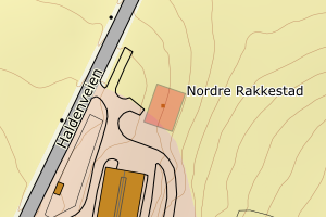
3226 Aurskog-Høland | 62567825-07cf-4877-bfb4-e7fb2e4ea09d | 301292131 | 21 | FA | 111 | 2024-08-27 | N: 6645814.65, Ø: 643881.83 | ![Kartbilde fra WMS-tjeneste av avviket](https://wms.geonorge.no/skwms1/wms.topo?VERSION=1.1.1&SERVICE=WMS&REQUEST=GetMap&LAYERS=topo&STYLES=&FORMAT=image/png&SRS=EPSG:25832&BBOX=643806.0,6645764,643956.0,6645864&WIDTH=300&HEIGHT=200) |
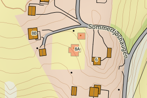
3226 Aurskog-Høland | 15ee9d24-17b6-4b67-948f-1ec385d48912 | 301299028 | 21 | FA | 181 | 2024-08-27 | N: 6645827.56, Ø: 643888.56 | ![Kartbilde fra WMS-tjeneste av avviket](https://wms.geonorge.no/skwms1/wms.topo?VERSION=1.1.1&SERVICE=WMS&REQUEST=GetMap&LAYERS=topo&STYLES=&FORMAT=image/png&SRS=EPSG:25832&BBOX=643813.0,6645777,643963.0,6645877&WIDTH=300&HEIGHT=200) |
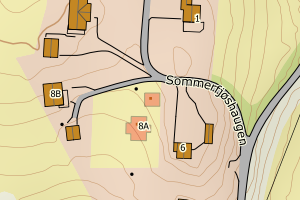
3226 Aurskog-Høland | 73bc9736-3411-45a4-b576-f277aecb58e6 | 300840019 | 21 | FA | 241 | 2021-09-08 | N: 6626293.53, Ø: 638758.71 | ![Kartbilde fra WMS-tjeneste av avviket](https://wms.geonorge.no/skwms1/wms.topo?VERSION=1.1.1&SERVICE=WMS&REQUEST=GetMap&LAYERS=topo&STYLES=&FORMAT=image/png&SRS=EPSG:25832&BBOX=638683.0,6626243,638833.0,6626343&WIDTH=300&HEIGHT=200) |
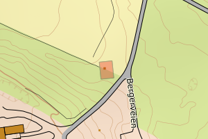
3226 Aurskog-Høland | 4c33d7eb-e17b-4532-a7a7-358a7e4e8cad | 25552547 | 21 | TB | 241 | 2007-10-17 | N: 6646938.00, Ø: 636999.00 | ![Kartbilde fra WMS-tjeneste av avviket](https://wms.geonorge.no/skwms1/wms.topo?VERSION=1.1.1&SERVICE=WMS&REQUEST=GetMap&LAYERS=topo&STYLES=&FORMAT=image/png&SRS=EPSG:25832&BBOX=636923.0,6646887,637073.0,6646987&WIDTH=300&HEIGHT=200) |
3226 Aurskog-Høland | c5c8b555-56c9-41dc-9a18-0a0bf1d5acd1 | 15298898 | 21 | TB | 181 | 2002-02-04 | N: 6640602.00, Ø: 644563.00 | ![Kartbilde fra WMS-tjeneste av avviket](https://wms.geonorge.no/skwms1/wms.topo?VERSION=1.1.1&SERVICE=WMS&REQUEST=GetMap&LAYERS=topo&STYLES=&FORMAT=image/png&SRS=EPSG:25832&BBOX=644487.0,6640551,644637.0,6640651&WIDTH=300&HEIGHT=200) |
3226 Aurskog-Høland | 069652f8-257a-4eb0-8d2b-4ab6b2ab90d5 | 15289554 | 21 | TB | 241 | 1996-02-05 | N: 6622691.00, Ø: 640162.00 | ![Kartbilde fra WMS-tjeneste av avviket](https://wms.geonorge.no/skwms1/wms.topo?VERSION=1.1.1&SERVICE=WMS&REQUEST=GetMap&LAYERS=topo&STYLES=&FORMAT=image/png&SRS=EPSG:25832&BBOX=640086.0,6622640,640236.0,6622740&WIDTH=300&HEIGHT=200) |
3226 Aurskog-Høland | 82f218d1-cda1-492d-aa6e-f41df1ed62c2 | 15286938 | 21 | TB | 181 | 1992-12-31 | N: 6641666.00, Ø: 643925.00 | ![Kartbilde fra WMS-tjeneste av avviket](https://wms.geonorge.no/skwms1/wms.topo?VERSION=1.1.1&SERVICE=WMS&REQUEST=GetMap&LAYERS=topo&STYLES=&FORMAT=image/png&SRS=EPSG:25832&BBOX=643849.0,6641615,643999.0,6641715&WIDTH=300&HEIGHT=200) |
3226 Aurskog-Høland | d7c7f74f-8c5b-4ca6-b8eb-75becfa72e61 | 6789196 | 21 | TB | 181 | 1987-11-03 | N: 6638433.00, Ø: 641999.00 | ![Kartbilde fra WMS-tjeneste av avviket](https://wms.geonorge.no/skwms1/wms.topo?VERSION=1.1.1&SERVICE=WMS&REQUEST=GetMap&LAYERS=topo&STYLES=&FORMAT=image/png&SRS=EPSG:25832&BBOX=641923.0,6638382,642073.0,6638482&WIDTH=300&HEIGHT=200) |