Avvikene skyldes oftest manglende sletting av bygningslinjer når bygningsflate er slettet i FKB-Bygning. Rettes i FKB-Bygning
Kommune | LokalId | Objekttype | Posisjon | WMS-bilde |
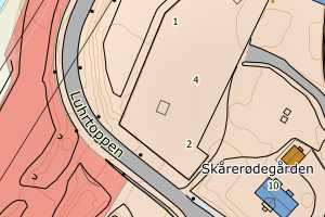
3222 Lørenskog | 1f1646d5-77e6-49f8-836e-ff34a2be924b | Taksprang | N: 6644568.78, Ø: 608812.12 | ![Kartbilde fra WMS-tjeneste av avviket](https://wms.geonorge.no/skwms1/wms.topo?VERSION=1.1.1&SERVICE=WMS&REQUEST=GetMap&LAYERS=topo&STYLES=&FORMAT=image/png&SRS=EPSG:25832&BBOX=608737.0,6644518,608887.0,6644618&WIDTH=300&HEIGHT=200) |
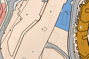
3222 Lørenskog | 95ac4ffb-7129-4625-b331-b06588a69051 | Taksprang | N: 6643856.92, Ø: 609177.35 | ![Kartbilde fra WMS-tjeneste av avviket](https://wms.geonorge.no/skwms1/wms.topo?VERSION=1.1.1&SERVICE=WMS&REQUEST=GetMap&LAYERS=topo&STYLES=&FORMAT=image/png&SRS=EPSG:25832&BBOX=609102.0,6643806,609252.0,6643906&WIDTH=300&HEIGHT=200) |
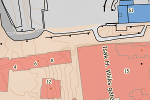
3222 Lørenskog | faf2f5d8-5176-4f53-b102-8a18d2a44c98 | Taksprang | N: 6643891.82, Ø: 609137.42 | ![Kartbilde fra WMS-tjeneste av avviket](https://wms.geonorge.no/skwms1/wms.topo?VERSION=1.1.1&SERVICE=WMS&REQUEST=GetMap&LAYERS=topo&STYLES=&FORMAT=image/png&SRS=EPSG:25832&BBOX=609062.0,6643841,609212.0,6643941&WIDTH=300&HEIGHT=200) |
3222 Lørenskog | 7436bfe3-f884-448a-aa62-a077ee5be459 | Taksprang | N: 6643882.30, Ø: 609134.92 | ![Kartbilde fra WMS-tjeneste av avviket](https://wms.geonorge.no/skwms1/wms.topo?VERSION=1.1.1&SERVICE=WMS&REQUEST=GetMap&LAYERS=topo&STYLES=&FORMAT=image/png&SRS=EPSG:25832&BBOX=609059.0,6643832,609209.0,6643932&WIDTH=300&HEIGHT=200) |
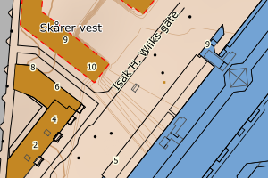
3222 Lørenskog | 33f54f38-0c76-4da5-b025-c585f37214fc | Taksprang | N: 6643809.76, Ø: 609293.00 | ![Kartbilde fra WMS-tjeneste av avviket](https://wms.geonorge.no/skwms1/wms.topo?VERSION=1.1.1&SERVICE=WMS&REQUEST=GetMap&LAYERS=topo&STYLES=&FORMAT=image/png&SRS=EPSG:25832&BBOX=609218.0,6643759,609368.0,6643859&WIDTH=300&HEIGHT=200) |
3222 Lørenskog | 8c9dc46b-eee8-491c-b195-af6941ee56e0 | Taksprang | N: 6643775.05, Ø: 609280.72 | ![Kartbilde fra WMS-tjeneste av avviket](https://wms.geonorge.no/skwms1/wms.topo?VERSION=1.1.1&SERVICE=WMS&REQUEST=GetMap&LAYERS=topo&STYLES=&FORMAT=image/png&SRS=EPSG:25832&BBOX=609205.0,6643725,609355.0,6643825&WIDTH=300&HEIGHT=200) |
3222 Lørenskog | 6710383c-7c43-4cbc-9b4f-affd33552def | Taksprang | N: 6644591.72, Ø: 608805.03 | ![Kartbilde fra WMS-tjeneste av avviket](https://wms.geonorge.no/skwms1/wms.topo?VERSION=1.1.1&SERVICE=WMS&REQUEST=GetMap&LAYERS=topo&STYLES=&FORMAT=image/png&SRS=EPSG:25832&BBOX=608730.0,6644541,608880.0,6644641&WIDTH=300&HEIGHT=200) |
3222 Lørenskog | 5999210b-5d26-4aa6-8797-2840d20b3f69 | Taksprang | N: 6643855.72, Ø: 609176.60 | ![Kartbilde fra WMS-tjeneste av avviket](https://wms.geonorge.no/skwms1/wms.topo?VERSION=1.1.1&SERVICE=WMS&REQUEST=GetMap&LAYERS=topo&STYLES=&FORMAT=image/png&SRS=EPSG:25832&BBOX=609101.0,6643805,609251.0,6643905&WIDTH=300&HEIGHT=200) |
3222 Lørenskog | 780d6a55-eb60-4e82-aeef-1ccd0113bfb7 | Taksprang | N: 6643882.40, Ø: 609135.08 | ![Kartbilde fra WMS-tjeneste av avviket](https://wms.geonorge.no/skwms1/wms.topo?VERSION=1.1.1&SERVICE=WMS&REQUEST=GetMap&LAYERS=topo&STYLES=&FORMAT=image/png&SRS=EPSG:25832&BBOX=609060.0,6643832,609210.0,6643932&WIDTH=300&HEIGHT=200) |
3222 Lørenskog | 33d8f5b9-a651-41b4-a47c-a7864482c6db | Taksprang | N: 6643880.80, Ø: 609142.17 | ![Kartbilde fra WMS-tjeneste av avviket](https://wms.geonorge.no/skwms1/wms.topo?VERSION=1.1.1&SERVICE=WMS&REQUEST=GetMap&LAYERS=topo&STYLES=&FORMAT=image/png&SRS=EPSG:25832&BBOX=609067.0,6643830,609217.0,6643930&WIDTH=300&HEIGHT=200) |
3222 Lørenskog | 14b224a0-99f6-4d16-b3b0-f9bd7b95bc28 | Taksprang | N: 6643774.21, Ø: 609280.78 | ![Kartbilde fra WMS-tjeneste av avviket](https://wms.geonorge.no/skwms1/wms.topo?VERSION=1.1.1&SERVICE=WMS&REQUEST=GetMap&LAYERS=topo&STYLES=&FORMAT=image/png&SRS=EPSG:25832&BBOX=609205.0,6643724,609355.0,6643824&WIDTH=300&HEIGHT=200) |
3222 Lørenskog | c82a78f0-db81-45b0-bedb-46f11262abc2 | TaksprangBunn | N: 6643855.72, Ø: 609176.60 | ![Kartbilde fra WMS-tjeneste av avviket](https://wms.geonorge.no/skwms1/wms.topo?VERSION=1.1.1&SERVICE=WMS&REQUEST=GetMap&LAYERS=topo&STYLES=&FORMAT=image/png&SRS=EPSG:25832&BBOX=609101.0,6643805,609251.0,6643905&WIDTH=300&HEIGHT=200) |
3222 Lørenskog | 250f4b75-0e4c-4647-ae55-a001dd4fef2f | TaksprangBunn | N: 6643856.92, Ø: 609177.35 | ![Kartbilde fra WMS-tjeneste av avviket](https://wms.geonorge.no/skwms1/wms.topo?VERSION=1.1.1&SERVICE=WMS&REQUEST=GetMap&LAYERS=topo&STYLES=&FORMAT=image/png&SRS=EPSG:25832&BBOX=609102.0,6643806,609252.0,6643906&WIDTH=300&HEIGHT=200) |
3222 Lørenskog | 0148a69c-b6f9-4696-8ec1-554705030ace | TaksprangBunn | N: 6643891.82, Ø: 609137.42 | ![Kartbilde fra WMS-tjeneste av avviket](https://wms.geonorge.no/skwms1/wms.topo?VERSION=1.1.1&SERVICE=WMS&REQUEST=GetMap&LAYERS=topo&STYLES=&FORMAT=image/png&SRS=EPSG:25832&BBOX=609062.0,6643841,609212.0,6643941&WIDTH=300&HEIGHT=200) |
3222 Lørenskog | d99358d4-bdda-4575-9d4c-a52cf5693bde | TaksprangBunn | N: 6643880.80, Ø: 609142.17 | ![Kartbilde fra WMS-tjeneste av avviket](https://wms.geonorge.no/skwms1/wms.topo?VERSION=1.1.1&SERVICE=WMS&REQUEST=GetMap&LAYERS=topo&STYLES=&FORMAT=image/png&SRS=EPSG:25832&BBOX=609067.0,6643830,609217.0,6643930&WIDTH=300&HEIGHT=200) |
3222 Lørenskog | 8b9cbcf9-1ecb-425e-96e5-482a3fec851d | TaksprangBunn | N: 6643779.59, Ø: 609283.90 | ![Kartbilde fra WMS-tjeneste av avviket](https://wms.geonorge.no/skwms1/wms.topo?VERSION=1.1.1&SERVICE=WMS&REQUEST=GetMap&LAYERS=topo&STYLES=&FORMAT=image/png&SRS=EPSG:25832&BBOX=609208.0,6643729,609358.0,6643829&WIDTH=300&HEIGHT=200) |
3222 Lørenskog | 13a7509f-d449-446e-9119-b694b4ade9b1 | TaksprangBunn | N: 6643779.62, Ø: 609284.58 | ![Kartbilde fra WMS-tjeneste av avviket](https://wms.geonorge.no/skwms1/wms.topo?VERSION=1.1.1&SERVICE=WMS&REQUEST=GetMap&LAYERS=topo&STYLES=&FORMAT=image/png&SRS=EPSG:25832&BBOX=609209.0,6643729,609359.0,6643829&WIDTH=300&HEIGHT=200) |
3222 Lørenskog | 469853fa-8e93-489f-a1a5-a7695345fd61 | TaksprangBunn | N: 6643780.81, Ø: 609285.08 | ![Kartbilde fra WMS-tjeneste av avviket](https://wms.geonorge.no/skwms1/wms.topo?VERSION=1.1.1&SERVICE=WMS&REQUEST=GetMap&LAYERS=topo&STYLES=&FORMAT=image/png&SRS=EPSG:25832&BBOX=609210.0,6643730,609360.0,6643830&WIDTH=300&HEIGHT=200) |
3222 Lørenskog | d96d380e-00f3-492b-9588-e26a6b1f611e | TaksprangBunn | N: 6643809.76, Ø: 609293.00 | ![Kartbilde fra WMS-tjeneste av avviket](https://wms.geonorge.no/skwms1/wms.topo?VERSION=1.1.1&SERVICE=WMS&REQUEST=GetMap&LAYERS=topo&STYLES=&FORMAT=image/png&SRS=EPSG:25832&BBOX=609218.0,6643759,609368.0,6643859&WIDTH=300&HEIGHT=200) |
3222 Lørenskog | d546e2a3-b9d2-4afd-96b3-64d67a7ab685 | TaksprangBunn | N: 6643882.40, Ø: 609135.08 | ![Kartbilde fra WMS-tjeneste av avviket](https://wms.geonorge.no/skwms1/wms.topo?VERSION=1.1.1&SERVICE=WMS&REQUEST=GetMap&LAYERS=topo&STYLES=&FORMAT=image/png&SRS=EPSG:25832&BBOX=609060.0,6643832,609210.0,6643932&WIDTH=300&HEIGHT=200) |
3222 Lørenskog | 64f15843-4f98-4ff0-b830-e72c6e3f59dc | TaksprangBunn | N: 6643882.30, Ø: 609134.92 | ![Kartbilde fra WMS-tjeneste av avviket](https://wms.geonorge.no/skwms1/wms.topo?VERSION=1.1.1&SERVICE=WMS&REQUEST=GetMap&LAYERS=topo&STYLES=&FORMAT=image/png&SRS=EPSG:25832&BBOX=609059.0,6643832,609209.0,6643932&WIDTH=300&HEIGHT=200) |
3222 Lørenskog | a8275fad-147a-4a82-b9f2-83d3d91bb3b0 | TaksprangBunn | N: 6644591.07, Ø: 608805.23 | ![Kartbilde fra WMS-tjeneste av avviket](https://wms.geonorge.no/skwms1/wms.topo?VERSION=1.1.1&SERVICE=WMS&REQUEST=GetMap&LAYERS=topo&STYLES=&FORMAT=image/png&SRS=EPSG:25832&BBOX=608730.0,6644541,608880.0,6644641&WIDTH=300&HEIGHT=200) |
3222 Lørenskog | 3016ebeb-a71d-4e20-acf1-9c7d901b3e7e | TaksprangBunn | N: 6643774.77, Ø: 609280.74 | ![Kartbilde fra WMS-tjeneste av avviket](https://wms.geonorge.no/skwms1/wms.topo?VERSION=1.1.1&SERVICE=WMS&REQUEST=GetMap&LAYERS=topo&STYLES=&FORMAT=image/png&SRS=EPSG:25832&BBOX=609205.0,6643724,609355.0,6643824&WIDTH=300&HEIGHT=200) |