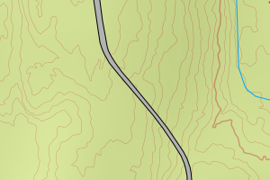
Avviket skyldes enten mangler i vegnettet (NVDB) eller objekter som skulle ha vært slettet i FKB-Veg
Kommune | LokalId | Objekttype | Posisjon | WMS-bilde |
3205 Lillestrøm | d1a5684a-8e3c-492c-b8a1-25a3e4e316b5 | Vegdekkekant | N: 6655297.30, Ø: 612210.45 | ![Kartbilde fra WMS-tjeneste av avviket](https://wms.geonorge.no/skwms1/wms.topo?VERSION=1.1.1&SERVICE=WMS&REQUEST=GetMap&LAYERS=topo&STYLES=&FORMAT=image/png&SRS=EPSG:25832&BBOX=612135.0,6655247,612285.0,6655347&WIDTH=300&HEIGHT=200) |
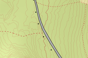
3205 Lillestrøm | d70f1780-5a0c-470a-971b-62d8ecf67477 | Vegdekkekant | N: 6654877.21, Ø: 612395.69 | ![Kartbilde fra WMS-tjeneste av avviket](https://wms.geonorge.no/skwms1/wms.topo?VERSION=1.1.1&SERVICE=WMS&REQUEST=GetMap&LAYERS=topo&STYLES=&FORMAT=image/png&SRS=EPSG:25832&BBOX=612320.0,6654827,612470.0,6654927&WIDTH=300&HEIGHT=200) |
3205 Lillestrøm | aba13faf-03e7-4690-b224-8e3efecc4ce9 | Vegdekkekant | N: 6655519.09, Ø: 612033.05 | ![Kartbilde fra WMS-tjeneste av avviket](https://wms.geonorge.no/skwms1/wms.topo?VERSION=1.1.1&SERVICE=WMS&REQUEST=GetMap&LAYERS=topo&STYLES=&FORMAT=image/png&SRS=EPSG:25832&BBOX=611958.0,6655469,612108.0,6655569&WIDTH=300&HEIGHT=200) |
3205 Lillestrøm | e9ed0682-eea7-43da-8e87-ef63f80e07f0 | Vegdekkekant | N: 6655345.65, Ø: 612196.44 | ![Kartbilde fra WMS-tjeneste av avviket](https://wms.geonorge.no/skwms1/wms.topo?VERSION=1.1.1&SERVICE=WMS&REQUEST=GetMap&LAYERS=topo&STYLES=&FORMAT=image/png&SRS=EPSG:25832&BBOX=612121.0,6655295,612271.0,6655395&WIDTH=300&HEIGHT=200) |
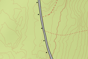
3205 Lillestrøm | d1c3beb6-4fa9-4746-9dab-b723012b72bc | Vegdekkekant | N: 6654877.21, Ø: 612395.69 | ![Kartbilde fra WMS-tjeneste av avviket](https://wms.geonorge.no/skwms1/wms.topo?VERSION=1.1.1&SERVICE=WMS&REQUEST=GetMap&LAYERS=topo&STYLES=&FORMAT=image/png&SRS=EPSG:25832&BBOX=612320.0,6654827,612470.0,6654927&WIDTH=300&HEIGHT=200) |
3205 Lillestrøm | 82426964-76bf-4c02-a8e3-db98d3e30d69 | Vegdekkekant | N: 6655520.56, Ø: 612016.52 | ![Kartbilde fra WMS-tjeneste av avviket](https://wms.geonorge.no/skwms1/wms.topo?VERSION=1.1.1&SERVICE=WMS&REQUEST=GetMap&LAYERS=topo&STYLES=&FORMAT=image/png&SRS=EPSG:25832&BBOX=611941.0,6655470,612091.0,6655570&WIDTH=300&HEIGHT=200) |
3205 Lillestrøm | 25f71a9c-3ab9-4201-98e4-66864cf06dc1 | Vegdekkekant | N: 6655802.31, Ø: 611922.99 | ![Kartbilde fra WMS-tjeneste av avviket](https://wms.geonorge.no/skwms1/wms.topo?VERSION=1.1.1&SERVICE=WMS&REQUEST=GetMap&LAYERS=topo&STYLES=&FORMAT=image/png&SRS=EPSG:25832&BBOX=611847.0,6655752,611997.0,6655852&WIDTH=300&HEIGHT=200) |
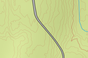
3205 Lillestrøm | 8a5f49b1-ca0b-4e1f-a8f1-9cd2c3cda70d | Vegdekkekant | N: 6655520.56, Ø: 612016.52 | ![Kartbilde fra WMS-tjeneste av avviket](https://wms.geonorge.no/skwms1/wms.topo?VERSION=1.1.1&SERVICE=WMS&REQUEST=GetMap&LAYERS=topo&STYLES=&FORMAT=image/png&SRS=EPSG:25832&BBOX=611941.0,6655470,612091.0,6655570&WIDTH=300&HEIGHT=200) |
3205 Lillestrøm | 22cadcc4-411b-437e-9eaf-4c8231c462ab | Vegdekkekant | N: 6649085.46, Ø: 612211.80 | ![Kartbilde fra WMS-tjeneste av avviket](https://wms.geonorge.no/skwms1/wms.topo?VERSION=1.1.1&SERVICE=WMS&REQUEST=GetMap&LAYERS=topo&STYLES=&FORMAT=image/png&SRS=EPSG:25832&BBOX=612136.0,6649035,612286.0,6649135&WIDTH=300&HEIGHT=200) |
3205 Lillestrøm | 4690bac0-d477-4d90-99a1-ff1b3b6595e4 | Vegdekkekant | N: 6657492.77, Ø: 623612.65 | ![Kartbilde fra WMS-tjeneste av avviket](https://wms.geonorge.no/skwms1/wms.topo?VERSION=1.1.1&SERVICE=WMS&REQUEST=GetMap&LAYERS=topo&STYLES=&FORMAT=image/png&SRS=EPSG:25832&BBOX=623537.0,6657442,623687.0,6657542&WIDTH=300&HEIGHT=200) |
3205 Lillestrøm | 3d32c336-3693-4eb4-bb00-7b64bec05975 | Vegdekkekant | N: 6651504.41, Ø: 609982.12 | ![Kartbilde fra WMS-tjeneste av avviket](https://wms.geonorge.no/skwms1/wms.topo?VERSION=1.1.1&SERVICE=WMS&REQUEST=GetMap&LAYERS=topo&STYLES=&FORMAT=image/png&SRS=EPSG:25832&BBOX=609907.0,6651454,610057.0,6651554&WIDTH=300&HEIGHT=200) |
3205 Lillestrøm | 3c4c9cf3-da00-4952-9cbc-053faf575d3e | Vegdekkekant | N: 6637854.99, Ø: 631007.79 | ![Kartbilde fra WMS-tjeneste av avviket](https://wms.geonorge.no/skwms1/wms.topo?VERSION=1.1.1&SERVICE=WMS&REQUEST=GetMap&LAYERS=topo&STYLES=&FORMAT=image/png&SRS=EPSG:25832&BBOX=630932.0,6637804,631082.0,6637904&WIDTH=300&HEIGHT=200) |
3205 Lillestrøm | 3a03afcc-1260-45dc-9941-2859d31a7b55 | Vegdekkekant | N: 6652964.25, Ø: 632118.64 | ![Kartbilde fra WMS-tjeneste av avviket](https://wms.geonorge.no/skwms1/wms.topo?VERSION=1.1.1&SERVICE=WMS&REQUEST=GetMap&LAYERS=topo&STYLES=&FORMAT=image/png&SRS=EPSG:25832&BBOX=632043.0,6652914,632193.0,6653014&WIDTH=300&HEIGHT=200) |
3205 Lillestrøm | e5d24e3c-e944-48d2-8935-f8c71846411b | Vegdekkekant | N: 6651121.99, Ø: 612891.34 | ![Kartbilde fra WMS-tjeneste av avviket](https://wms.geonorge.no/skwms1/wms.topo?VERSION=1.1.1&SERVICE=WMS&REQUEST=GetMap&LAYERS=topo&STYLES=&FORMAT=image/png&SRS=EPSG:25832&BBOX=612816.0,6651071,612966.0,6651171&WIDTH=300&HEIGHT=200) |
3205 Lillestrøm | d76a7098-2681-46b0-8bcc-03a59a82b2ee | Vegdekkekant | N: 6651127.23, Ø: 612893.37 | ![Kartbilde fra WMS-tjeneste av avviket](https://wms.geonorge.no/skwms1/wms.topo?VERSION=1.1.1&SERVICE=WMS&REQUEST=GetMap&LAYERS=topo&STYLES=&FORMAT=image/png&SRS=EPSG:25832&BBOX=612818.0,6651077,612968.0,6651177&WIDTH=300&HEIGHT=200) |
3205 Lillestrøm | d12fb24b-d6fd-42fe-a123-775a0ef47c37 | Vegdekkekant | N: 6655660.01, Ø: 611950.49 | ![Kartbilde fra WMS-tjeneste av avviket](https://wms.geonorge.no/skwms1/wms.topo?VERSION=1.1.1&SERVICE=WMS&REQUEST=GetMap&LAYERS=topo&STYLES=&FORMAT=image/png&SRS=EPSG:25832&BBOX=611875.0,6655610,612025.0,6655710&WIDTH=300&HEIGHT=200) |
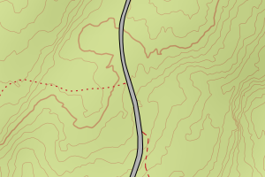
3205 Lillestrøm | 1fe58ef9-1cda-431e-8807-97f758efbb2d | Vegdekkekant | N: 6655522.09, Ø: 612129.69 | ![Kartbilde fra WMS-tjeneste av avviket](https://wms.geonorge.no/skwms1/wms.topo?VERSION=1.1.1&SERVICE=WMS&REQUEST=GetMap&LAYERS=topo&STYLES=&FORMAT=image/png&SRS=EPSG:25832&BBOX=612054.0,6655472,612204.0,6655572&WIDTH=300&HEIGHT=200) |
3205 Lillestrøm | 169ebcc6-f4ec-4afb-8925-a97ae9de1a8f | Vegdekkekant | N: 6655973.85, Ø: 611796.00 | ![Kartbilde fra WMS-tjeneste av avviket](https://wms.geonorge.no/skwms1/wms.topo?VERSION=1.1.1&SERVICE=WMS&REQUEST=GetMap&LAYERS=topo&STYLES=&FORMAT=image/png&SRS=EPSG:25832&BBOX=611720.0,6655923,611870.0,6656023&WIDTH=300&HEIGHT=200) |
3205 Lillestrøm | 546f7cc2-9802-4fbb-8a32-83dc972c304a | Vegdekkekant | N: 6655802.17, Ø: 611926.00 | ![Kartbilde fra WMS-tjeneste av avviket](https://wms.geonorge.no/skwms1/wms.topo?VERSION=1.1.1&SERVICE=WMS&REQUEST=GetMap&LAYERS=topo&STYLES=&FORMAT=image/png&SRS=EPSG:25832&BBOX=611850.0,6655752,612000.0,6655852&WIDTH=300&HEIGHT=200) |