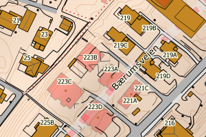
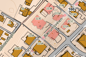
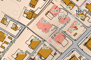
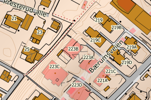
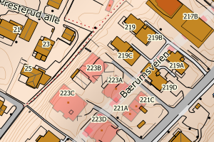
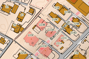
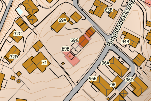
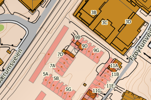
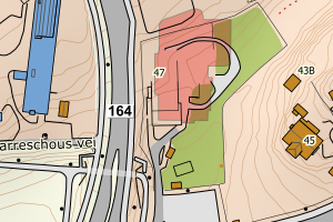
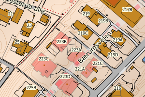
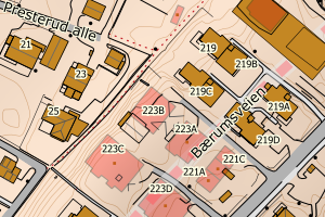
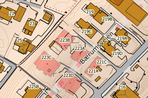
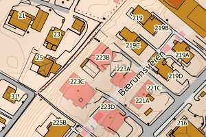
Avvikene skyldes oftest manglende sletting av bygningslinjer når bygningsflate er slettet i FKB-Bygning. Rettes i FKB-Bygning
Kommune | LokalId | Objekttype | Posisjon | WMS-bilde |
3201 Bærum | 227c3a38-a8de-4c83-b7a6-66ff86a06e12 | Bygningslinje | N: 6642399.56, Ø: 588367.37 | ![Kartbilde fra WMS-tjeneste av avviket](https://wms.geonorge.no/skwms1/wms.topo?VERSION=1.1.1&SERVICE=WMS&REQUEST=GetMap&LAYERS=topo&STYLES=&FORMAT=image/png&SRS=EPSG:25832&BBOX=588292.0,6642349,588442.0,6642449&WIDTH=300&HEIGHT=200) |
3201 Bærum | 2b44a175-07c5-4825-8a58-f6b533cc0db7 | Bygningslinje | N: 6642335.73, Ø: 588383.76 | ![Kartbilde fra WMS-tjeneste av avviket](https://wms.geonorge.no/skwms1/wms.topo?VERSION=1.1.1&SERVICE=WMS&REQUEST=GetMap&LAYERS=topo&STYLES=&FORMAT=image/png&SRS=EPSG:25832&BBOX=588308.0,6642285,588458.0,6642385&WIDTH=300&HEIGHT=200) |
3201 Bærum | 74cb712c-ef5f-4a39-98b8-450cfa5bb0b7 | Bygningslinje | N: 6642344.35, Ø: 588389.66 | ![Kartbilde fra WMS-tjeneste av avviket](https://wms.geonorge.no/skwms1/wms.topo?VERSION=1.1.1&SERVICE=WMS&REQUEST=GetMap&LAYERS=topo&STYLES=&FORMAT=image/png&SRS=EPSG:25832&BBOX=588314.0,6642294,588464.0,6642394&WIDTH=300&HEIGHT=200) |
3201 Bærum | 95883156-9469-4eb3-97f4-5efb226ef8fe | Bygningslinje | N: 6642323.32, Ø: 588367.14 | ![Kartbilde fra WMS-tjeneste av avviket](https://wms.geonorge.no/skwms1/wms.topo?VERSION=1.1.1&SERVICE=WMS&REQUEST=GetMap&LAYERS=topo&STYLES=&FORMAT=image/png&SRS=EPSG:25832&BBOX=588292.0,6642273,588442.0,6642373&WIDTH=300&HEIGHT=200) |
3201 Bærum | d287bc9e-a2c5-4506-98b6-2521f873eb5e | Bygningslinje | N: 6642379.06, Ø: 588352.52 | ![Kartbilde fra WMS-tjeneste av avviket](https://wms.geonorge.no/skwms1/wms.topo?VERSION=1.1.1&SERVICE=WMS&REQUEST=GetMap&LAYERS=topo&STYLES=&FORMAT=image/png&SRS=EPSG:25832&BBOX=588277.0,6642329,588427.0,6642429&WIDTH=300&HEIGHT=200) |
3201 Bærum | bec50b35-3e80-4221-b026-b4cb334ae309 | Bygningslinje | N: 6643622.65, Ø: 581057.20 | ![Kartbilde fra WMS-tjeneste av avviket](https://wms.geonorge.no/skwms1/wms.topo?VERSION=1.1.1&SERVICE=WMS&REQUEST=GetMap&LAYERS=topo&STYLES=&FORMAT=image/png&SRS=EPSG:25832&BBOX=580982.0,6643572,581132.0,6643672&WIDTH=300&HEIGHT=200) |
3201 Bærum | 36c7bf4e-e43d-4716-a6ef-7fef4f439f7b | Taksprang | N: 6642358.46, Ø: 588343.80 | ![Kartbilde fra WMS-tjeneste av avviket](https://wms.geonorge.no/skwms1/wms.topo?VERSION=1.1.1&SERVICE=WMS&REQUEST=GetMap&LAYERS=topo&STYLES=&FORMAT=image/png&SRS=EPSG:25832&BBOX=588268.0,6642308,588418.0,6642408&WIDTH=300&HEIGHT=200) |
3201 Bærum | 449bfe9d-0641-4208-8555-30d27a01c3a1 | Taksprang | N: 6642362.39, Ø: 588408.98 | ![Kartbilde fra WMS-tjeneste av avviket](https://wms.geonorge.no/skwms1/wms.topo?VERSION=1.1.1&SERVICE=WMS&REQUEST=GetMap&LAYERS=topo&STYLES=&FORMAT=image/png&SRS=EPSG:25832&BBOX=588333.0,6642312,588483.0,6642412&WIDTH=300&HEIGHT=200) |
3201 Bærum | 4533915f-99f6-4e12-9fe3-817afe639026 | Taksprang | N: 6642336.49, Ø: 588384.04 | ![Kartbilde fra WMS-tjeneste av avviket](https://wms.geonorge.no/skwms1/wms.topo?VERSION=1.1.1&SERVICE=WMS&REQUEST=GetMap&LAYERS=topo&STYLES=&FORMAT=image/png&SRS=EPSG:25832&BBOX=588309.0,6642286,588459.0,6642386&WIDTH=300&HEIGHT=200) |
3201 Bærum | 489bdf13-3c9a-4f2b-af77-6e3316d83347 | Taksprang | N: 6642401.28, Ø: 588422.72 | ![Kartbilde fra WMS-tjeneste av avviket](https://wms.geonorge.no/skwms1/wms.topo?VERSION=1.1.1&SERVICE=WMS&REQUEST=GetMap&LAYERS=topo&STYLES=&FORMAT=image/png&SRS=EPSG:25832&BBOX=588347.0,6642351,588497.0,6642451&WIDTH=300&HEIGHT=200) |
3201 Bærum | 7064e6cf-d9f9-4e09-b3da-62c427509ddc | Taksprang | N: 6642323.24, Ø: 588369.55 | ![Kartbilde fra WMS-tjeneste av avviket](https://wms.geonorge.no/skwms1/wms.topo?VERSION=1.1.1&SERVICE=WMS&REQUEST=GetMap&LAYERS=topo&STYLES=&FORMAT=image/png&SRS=EPSG:25832&BBOX=588294.0,6642273,588444.0,6642373&WIDTH=300&HEIGHT=200) |
3201 Bærum | 7c3d17ac-297d-4ed8-8a4a-5fb6abfe3b25 | Taksprang | N: 6642369.73, Ø: 588378.95 | ![Kartbilde fra WMS-tjeneste av avviket](https://wms.geonorge.no/skwms1/wms.topo?VERSION=1.1.1&SERVICE=WMS&REQUEST=GetMap&LAYERS=topo&STYLES=&FORMAT=image/png&SRS=EPSG:25832&BBOX=588303.0,6642319,588453.0,6642419&WIDTH=300&HEIGHT=200) |
3201 Bærum | 7d0c52c4-8688-49b0-87ac-94cc234d448a | Taksprang | N: 6642390.51, Ø: 588359.55 | ![Kartbilde fra WMS-tjeneste av avviket](https://wms.geonorge.no/skwms1/wms.topo?VERSION=1.1.1&SERVICE=WMS&REQUEST=GetMap&LAYERS=topo&STYLES=&FORMAT=image/png&SRS=EPSG:25832&BBOX=588284.0,6642340,588434.0,6642440&WIDTH=300&HEIGHT=200) |
3201 Bærum | 9010c002-4697-4cc8-afae-8b3eb024ccaa | Taksprang | N: 6642367.26, Ø: 588345.83 | ![Kartbilde fra WMS-tjeneste av avviket](https://wms.geonorge.no/skwms1/wms.topo?VERSION=1.1.1&SERVICE=WMS&REQUEST=GetMap&LAYERS=topo&STYLES=&FORMAT=image/png&SRS=EPSG:25832&BBOX=588270.0,6642317,588420.0,6642417&WIDTH=300&HEIGHT=200) |
3201 Bærum | 92445eef-4464-4718-a41b-02c8e77cacdb | Taksprang | N: 6642336.54, Ø: 588381.30 | ![Kartbilde fra WMS-tjeneste av avviket](https://wms.geonorge.no/skwms1/wms.topo?VERSION=1.1.1&SERVICE=WMS&REQUEST=GetMap&LAYERS=topo&STYLES=&FORMAT=image/png&SRS=EPSG:25832&BBOX=588306.0,6642286,588456.0,6642386&WIDTH=300&HEIGHT=200) |
3201 Bærum | 9f02879f-a643-4198-a91b-52bd9c030283 | Taksprang | N: 6642374.93, Ø: 588338.67 | ![Kartbilde fra WMS-tjeneste av avviket](https://wms.geonorge.no/skwms1/wms.topo?VERSION=1.1.1&SERVICE=WMS&REQUEST=GetMap&LAYERS=topo&STYLES=&FORMAT=image/png&SRS=EPSG:25832&BBOX=588263.0,6642324,588413.0,6642424&WIDTH=300&HEIGHT=200) |
3201 Bærum | bc4f4078-d56b-4301-b7f9-748c81f36354 | Taksprang | N: 6642330.09, Ø: 588374.39 | ![Kartbilde fra WMS-tjeneste av avviket](https://wms.geonorge.no/skwms1/wms.topo?VERSION=1.1.1&SERVICE=WMS&REQUEST=GetMap&LAYERS=topo&STYLES=&FORMAT=image/png&SRS=EPSG:25832&BBOX=588299.0,6642280,588449.0,6642380&WIDTH=300&HEIGHT=200) |
3201 Bærum | c0030917-8b49-41ff-888e-10fb37d72d46 | Taksprang | N: 6642337.63, Ø: 588382.46 | ![Kartbilde fra WMS-tjeneste av avviket](https://wms.geonorge.no/skwms1/wms.topo?VERSION=1.1.1&SERVICE=WMS&REQUEST=GetMap&LAYERS=topo&STYLES=&FORMAT=image/png&SRS=EPSG:25832&BBOX=588307.0,6642287,588457.0,6642387&WIDTH=300&HEIGHT=200) |
3201 Bærum | e0b94f54-2370-44dd-b293-f4c067d16235 | Taksprang | N: 6642409.77, Ø: 588374.10 | ![Kartbilde fra WMS-tjeneste av avviket](https://wms.geonorge.no/skwms1/wms.topo?VERSION=1.1.1&SERVICE=WMS&REQUEST=GetMap&LAYERS=topo&STYLES=&FORMAT=image/png&SRS=EPSG:25832&BBOX=588299.0,6642359,588449.0,6642459&WIDTH=300&HEIGHT=200) |
3201 Bærum | eb749bae-0b12-4a9d-bb47-33eaacfab331 | Taksprang | N: 6642333.61, Ø: 588382.33 | ![Kartbilde fra WMS-tjeneste av avviket](https://wms.geonorge.no/skwms1/wms.topo?VERSION=1.1.1&SERVICE=WMS&REQUEST=GetMap&LAYERS=topo&STYLES=&FORMAT=image/png&SRS=EPSG:25832&BBOX=588307.0,6642283,588457.0,6642383&WIDTH=300&HEIGHT=200) |
3201 Bærum | 14dbf7af-6b7f-443b-bf56-09a05fbe667a | Mønelinje | N: 6642365.32, Ø: 588335.78 | ![Kartbilde fra WMS-tjeneste av avviket](https://wms.geonorge.no/skwms1/wms.topo?VERSION=1.1.1&SERVICE=WMS&REQUEST=GetMap&LAYERS=topo&STYLES=&FORMAT=image/png&SRS=EPSG:25832&BBOX=588260.0,6642315,588410.0,6642415&WIDTH=300&HEIGHT=200) |
3201 Bærum | 4bd6cb43-992a-47a1-80a8-36bb289ae92c | Mønelinje | N: 6642320.72, Ø: 588383.23 | ![Kartbilde fra WMS-tjeneste av avviket](https://wms.geonorge.no/skwms1/wms.topo?VERSION=1.1.1&SERVICE=WMS&REQUEST=GetMap&LAYERS=topo&STYLES=&FORMAT=image/png&SRS=EPSG:25832&BBOX=588308.0,6642270,588458.0,6642370&WIDTH=300&HEIGHT=200) |
3201 Bærum | 65ec031e-ad05-402e-a6ad-c013219120d9 | Mønelinje | N: 6642391.67, Ø: 588357.02 | ![Kartbilde fra WMS-tjeneste av avviket](https://wms.geonorge.no/skwms1/wms.topo?VERSION=1.1.1&SERVICE=WMS&REQUEST=GetMap&LAYERS=topo&STYLES=&FORMAT=image/png&SRS=EPSG:25832&BBOX=588282.0,6642341,588432.0,6642441&WIDTH=300&HEIGHT=200) |
3201 Bærum | 573dcaad-6e89-4db9-ad83-1886f038d09f | TaksprangBunn | N: 6642368.17, Ø: 588389.07 | ![Kartbilde fra WMS-tjeneste av avviket](https://wms.geonorge.no/skwms1/wms.topo?VERSION=1.1.1&SERVICE=WMS&REQUEST=GetMap&LAYERS=topo&STYLES=&FORMAT=image/png&SRS=EPSG:25832&BBOX=588314.0,6642318,588464.0,6642418&WIDTH=300&HEIGHT=200) |
3201 Bærum | ad9d2a75-dbf5-4698-bbfe-af1f8cedc86b | TaksprangBunn | N: 6642401.28, Ø: 588422.72 | ![Kartbilde fra WMS-tjeneste av avviket](https://wms.geonorge.no/skwms1/wms.topo?VERSION=1.1.1&SERVICE=WMS&REQUEST=GetMap&LAYERS=topo&STYLES=&FORMAT=image/png&SRS=EPSG:25832&BBOX=588347.0,6642351,588497.0,6642451&WIDTH=300&HEIGHT=200) |
3201 Bærum | af4c0ac4-3b63-4d89-9e94-66ca76362e55 | TaksprangBunn | N: 6642336.49, Ø: 588384.04 | ![Kartbilde fra WMS-tjeneste av avviket](https://wms.geonorge.no/skwms1/wms.topo?VERSION=1.1.1&SERVICE=WMS&REQUEST=GetMap&LAYERS=topo&STYLES=&FORMAT=image/png&SRS=EPSG:25832&BBOX=588309.0,6642286,588459.0,6642386&WIDTH=300&HEIGHT=200) |
3201 Bærum | bb92bb00-37d4-43ec-bd8b-ae8dffb1a9de | TaksprangBunn | N: 6642328.92, Ø: 588373.56 | ![Kartbilde fra WMS-tjeneste av avviket](https://wms.geonorge.no/skwms1/wms.topo?VERSION=1.1.1&SERVICE=WMS&REQUEST=GetMap&LAYERS=topo&STYLES=&FORMAT=image/png&SRS=EPSG:25832&BBOX=588298.0,6642278,588448.0,6642378&WIDTH=300&HEIGHT=200) |
3201 Bærum | c45915c2-02e0-4006-9e7b-3c5ef8865c03 | TaksprangBunn | N: 6642385.31, Ø: 588418.46 | ![Kartbilde fra WMS-tjeneste av avviket](https://wms.geonorge.no/skwms1/wms.topo?VERSION=1.1.1&SERVICE=WMS&REQUEST=GetMap&LAYERS=topo&STYLES=&FORMAT=image/png&SRS=EPSG:25832&BBOX=588343.0,6642335,588493.0,6642435&WIDTH=300&HEIGHT=200) |
3201 Bærum | cad09358-5f0f-4d23-89c1-08cf065d7c69 | TaksprangBunn | N: 6642334.75, Ø: 588382.05 | ![Kartbilde fra WMS-tjeneste av avviket](https://wms.geonorge.no/skwms1/wms.topo?VERSION=1.1.1&SERVICE=WMS&REQUEST=GetMap&LAYERS=topo&STYLES=&FORMAT=image/png&SRS=EPSG:25832&BBOX=588307.0,6642284,588457.0,6642384&WIDTH=300&HEIGHT=200) |
3201 Bærum | ce6c380a-11df-4ea6-878a-a11b36f9a090 | TaksprangBunn | N: 6642365.91, Ø: 588342.82 | ![Kartbilde fra WMS-tjeneste av avviket](https://wms.geonorge.no/skwms1/wms.topo?VERSION=1.1.1&SERVICE=WMS&REQUEST=GetMap&LAYERS=topo&STYLES=&FORMAT=image/png&SRS=EPSG:25832&BBOX=588267.0,6642315,588417.0,6642415&WIDTH=300&HEIGHT=200) |
3201 Bærum | f6d18425-f283-4c95-bf0d-2f5d76b7a69f | TaksprangBunn | N: 6642409.77, Ø: 588374.10 | ![Kartbilde fra WMS-tjeneste av avviket](https://wms.geonorge.no/skwms1/wms.topo?VERSION=1.1.1&SERVICE=WMS&REQUEST=GetMap&LAYERS=topo&STYLES=&FORMAT=image/png&SRS=EPSG:25832&BBOX=588299.0,6642359,588449.0,6642459&WIDTH=300&HEIGHT=200) |