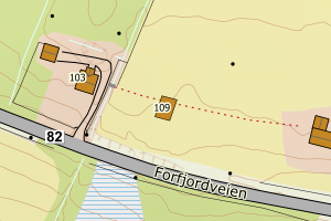
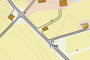
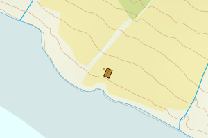
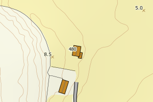
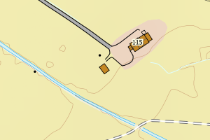
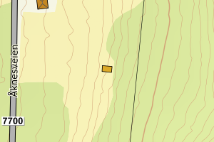
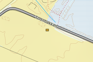
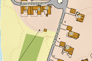
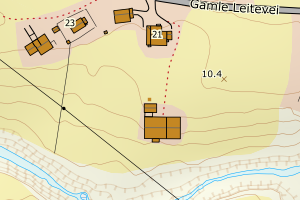
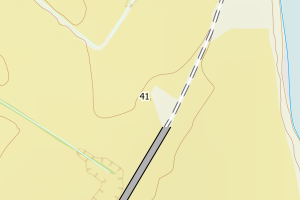
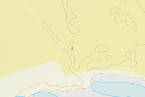
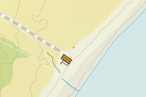
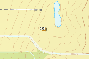
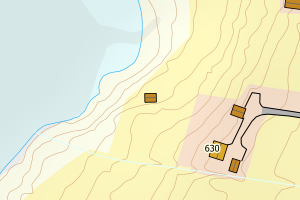
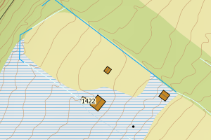
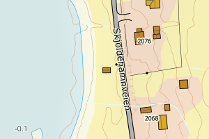
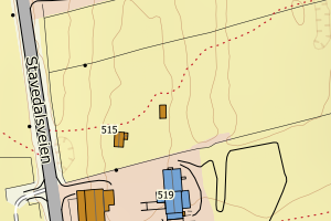
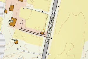
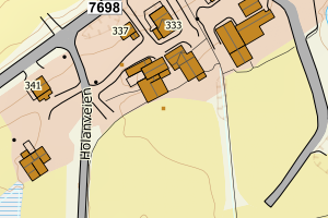
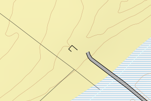
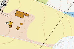
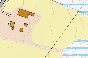
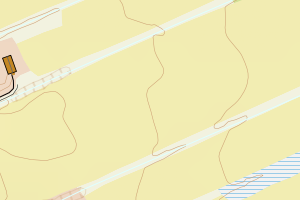
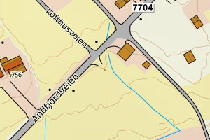
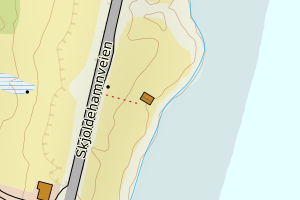
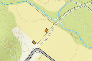
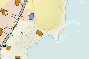
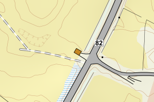
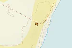
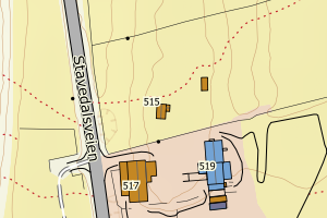
Avvikene kan skyldes enten feil bygningskoordinat eller bygningstype/status i matrikkel eller feil arealtype i AR5. Vær oppmerksom på det er krav om arealer på over 200 m2 før det er krav om endring av arealtype i AR5 så avvikene vil ikke alltid kreve retting i datagrunnlaget
Kommune | LokalId | Bygningsnummer | Arealtype | Bygningstatus | Bygningstype | matrikkel_vedtaksdato | Posisjon | WMS-bilde |
1871 Andøy | cb4ee76d-4002-4843-9f36-2723ef57a6d0 | 190270734 | 21 | TB | 171 | None | N: 7651621.00, Ø: 517611.00 | ![Kartbilde fra WMS-tjeneste av avviket](https://wms.geonorge.no/skwms1/wms.topo?VERSION=1.1.1&SERVICE=WMS&REQUEST=GetMap&LAYERS=topo&STYLES=&FORMAT=image/png&SRS=EPSG:25833&BBOX=517536.0,7651571,517686.0,7651671&WIDTH=300&HEIGHT=200) |
1871 Andøy | 88276eca-5c92-47bd-8143-8c5d9fc0b272 | 190291138 | 21 | TB | 241 | None | N: 7669539.00, Ø: 527109.00 | ![Kartbilde fra WMS-tjeneste av avviket](https://wms.geonorge.no/skwms1/wms.topo?VERSION=1.1.1&SERVICE=WMS&REQUEST=GetMap&LAYERS=topo&STYLES=&FORMAT=image/png&SRS=EPSG:25833&BBOX=527034.0,7669489,527184.0,7669589&WIDTH=300&HEIGHT=200) |
1871 Andøy | a47b3823-4850-4e36-b2cd-02e76fdd200b | 190295427 | 21 | TB | 111 | None | N: 7660344.00, Ø: 535242.00 | ![Kartbilde fra WMS-tjeneste av avviket](https://wms.geonorge.no/skwms1/wms.topo?VERSION=1.1.1&SERVICE=WMS&REQUEST=GetMap&LAYERS=topo&STYLES=&FORMAT=image/png&SRS=EPSG:25833&BBOX=535167.0,7660294,535317.0,7660394&WIDTH=300&HEIGHT=200) |
1871 Andøy | b42be72f-40b6-4646-823f-c373cae4ca12 | 190301222 | 21 | TB | 241 | None | N: 7669699.00, Ø: 541259.00 | ![Kartbilde fra WMS-tjeneste av avviket](https://wms.geonorge.no/skwms1/wms.topo?VERSION=1.1.1&SERVICE=WMS&REQUEST=GetMap&LAYERS=topo&STYLES=&FORMAT=image/png&SRS=EPSG:25833&BBOX=541184.0,7669649,541334.0,7669749&WIDTH=300&HEIGHT=200) |
1871 Andøy | 81ca35d6-8c4d-4e49-a6a7-ebc12893fa8e | 300101916 | 21 | FA | 183 | None | N: 7656549.80, Ø: 533091.80 | ![Kartbilde fra WMS-tjeneste av avviket](https://wms.geonorge.no/skwms1/wms.topo?VERSION=1.1.1&SERVICE=WMS&REQUEST=GetMap&LAYERS=topo&STYLES=&FORMAT=image/png&SRS=EPSG:25833&BBOX=533016.0,7656499,533166.0,7656599&WIDTH=300&HEIGHT=200) |
1871 Andøy | b8bcd484-a60b-429d-a694-989de6a050dd | 190331326 | 21 | TB | 171 | None | N: 7663493.00, Ø: 522762.00 | ![Kartbilde fra WMS-tjeneste av avviket](https://wms.geonorge.no/skwms1/wms.topo?VERSION=1.1.1&SERVICE=WMS&REQUEST=GetMap&LAYERS=topo&STYLES=&FORMAT=image/png&SRS=EPSG:25833&BBOX=522687.0,7663443,522837.0,7663543&WIDTH=300&HEIGHT=200) |
1871 Andøy | 6a0ddeb7-2217-4688-8671-5602ac17a579 | 190295931 | 21 | TB | 181 | None | N: 7657024.00, Ø: 533263.00 | ![Kartbilde fra WMS-tjeneste av avviket](https://wms.geonorge.no/skwms1/wms.topo?VERSION=1.1.1&SERVICE=WMS&REQUEST=GetMap&LAYERS=topo&STYLES=&FORMAT=image/png&SRS=EPSG:25833&BBOX=533188.0,7656974,533338.0,7657074&WIDTH=300&HEIGHT=200) |
1871 Andøy | b6728d35-2435-42f7-b0c4-93164d8aef09 | 190302628 | 21 | TB | 181 | None | N: 7667192.00, Ø: 537890.00 | ![Kartbilde fra WMS-tjeneste av avviket](https://wms.geonorge.no/skwms1/wms.topo?VERSION=1.1.1&SERVICE=WMS&REQUEST=GetMap&LAYERS=topo&STYLES=&FORMAT=image/png&SRS=EPSG:25833&BBOX=537815.0,7667142,537965.0,7667242&WIDTH=300&HEIGHT=200) |
1871 Andøy | 4ab4dd55-600d-4679-961d-747c50105239 | 190274969 | 21 | TB | 183 | None | N: 7646403.00, Ø: 522946.00 | ![Kartbilde fra WMS-tjeneste av avviket](https://wms.geonorge.no/skwms1/wms.topo?VERSION=1.1.1&SERVICE=WMS&REQUEST=GetMap&LAYERS=topo&STYLES=&FORMAT=image/png&SRS=EPSG:25833&BBOX=522871.0,7646353,523021.0,7646453&WIDTH=300&HEIGHT=200) |
1871 Andøy | 86bc1f8e-97e3-423a-86a7-197f86ffc41b | 190271005 | 21 | TB | 183 | None | N: 7651121.00, Ø: 517654.00 | ![Kartbilde fra WMS-tjeneste av avviket](https://wms.geonorge.no/skwms1/wms.topo?VERSION=1.1.1&SERVICE=WMS&REQUEST=GetMap&LAYERS=topo&STYLES=&FORMAT=image/png&SRS=EPSG:25833&BBOX=517579.0,7651071,517729.0,7651171&WIDTH=300&HEIGHT=200) |
1871 Andøy | 0d95d356-a743-41ba-a6fe-87c21f81423f | 190298256 | 21 | TB | 181 | None | N: 7677483.00, Ø: 534226.00 | ![Kartbilde fra WMS-tjeneste av avviket](https://wms.geonorge.no/skwms1/wms.topo?VERSION=1.1.1&SERVICE=WMS&REQUEST=GetMap&LAYERS=topo&STYLES=&FORMAT=image/png&SRS=EPSG:25833&BBOX=534151.0,7677433,534301.0,7677533&WIDTH=300&HEIGHT=200) |
1871 Andøy | be3dbc86-6b72-4843-a1a9-fccc24332544 | 190301893 | 21 | TB | 181 | None | N: 7667903.00, Ø: 539020.00 | ![Kartbilde fra WMS-tjeneste av avviket](https://wms.geonorge.no/skwms1/wms.topo?VERSION=1.1.1&SERVICE=WMS&REQUEST=GetMap&LAYERS=topo&STYLES=&FORMAT=image/png&SRS=EPSG:25833&BBOX=538945.0,7667853,539095.0,7667953&WIDTH=300&HEIGHT=200) |
1871 Andøy | 6b62b14e-e145-4339-b096-ca10575f12de | 190275833 | 21 | TB | 171 | None | N: 7650850.60, Ø: 517818.50 | ![Kartbilde fra WMS-tjeneste av avviket](https://wms.geonorge.no/skwms1/wms.topo?VERSION=1.1.1&SERVICE=WMS&REQUEST=GetMap&LAYERS=topo&STYLES=&FORMAT=image/png&SRS=EPSG:25833&BBOX=517743.0,7650800,517893.0,7650900&WIDTH=300&HEIGHT=200) |
1871 Andøy | 2bd69f81-e073-4206-b724-710060659901 | 190277844 | 21 | TB | 241 | None | N: 7659064.00, Ø: 520900.00 | ![Kartbilde fra WMS-tjeneste av avviket](https://wms.geonorge.no/skwms1/wms.topo?VERSION=1.1.1&SERVICE=WMS&REQUEST=GetMap&LAYERS=topo&STYLES=&FORMAT=image/png&SRS=EPSG:25833&BBOX=520825.0,7659014,520975.0,7659114&WIDTH=300&HEIGHT=200) |
1871 Andøy | c9381c86-0a1c-44d1-99b2-64384ac00caf | 190275175 | 21 | TB | 181 | None | N: 7642609.00, Ø: 521035.00 | ![Kartbilde fra WMS-tjeneste av avviket](https://wms.geonorge.no/skwms1/wms.topo?VERSION=1.1.1&SERVICE=WMS&REQUEST=GetMap&LAYERS=topo&STYLES=&FORMAT=image/png&SRS=EPSG:25833&BBOX=520960.0,7642559,521110.0,7642659&WIDTH=300&HEIGHT=200) |
1871 Andøy | e35ecd20-65a6-47e8-9756-3470040a401f | 190270564 | 21 | TB | 183 | None | N: 7643075.00, Ø: 516822.00 | ![Kartbilde fra WMS-tjeneste av avviket](https://wms.geonorge.no/skwms1/wms.topo?VERSION=1.1.1&SERVICE=WMS&REQUEST=GetMap&LAYERS=topo&STYLES=&FORMAT=image/png&SRS=EPSG:25833&BBOX=516747.0,7643025,516897.0,7643125&WIDTH=300&HEIGHT=200) |
1871 Andøy | 57d58d61-df57-4c62-bff5-7d17f971b4a3 | 190276236 | 21 | TB | 171 | None | N: 7653733.00, Ø: 518191.00 | ![Kartbilde fra WMS-tjeneste av avviket](https://wms.geonorge.no/skwms1/wms.topo?VERSION=1.1.1&SERVICE=WMS&REQUEST=GetMap&LAYERS=topo&STYLES=&FORMAT=image/png&SRS=EPSG:25833&BBOX=518116.0,7653683,518266.0,7653783&WIDTH=300&HEIGHT=200) |
1871 Andøy | 7099d6a1-ed59-44f5-817a-8b6559c02b92 | 190276368 | 21 | TB | 171 | None | N: 7653064.00, Ø: 518008.00 | ![Kartbilde fra WMS-tjeneste av avviket](https://wms.geonorge.no/skwms1/wms.topo?VERSION=1.1.1&SERVICE=WMS&REQUEST=GetMap&LAYERS=topo&STYLES=&FORMAT=image/png&SRS=EPSG:25833&BBOX=517933.0,7653014,518083.0,7653114&WIDTH=300&HEIGHT=200) |
1871 Andøy | b9acd4ff-4376-446f-8002-5768c79e9131 | 190276376 | 21 | TB | 171 | None | N: 7653058.00, Ø: 518008.00 | ![Kartbilde fra WMS-tjeneste av avviket](https://wms.geonorge.no/skwms1/wms.topo?VERSION=1.1.1&SERVICE=WMS&REQUEST=GetMap&LAYERS=topo&STYLES=&FORMAT=image/png&SRS=EPSG:25833&BBOX=517933.0,7653008,518083.0,7653108&WIDTH=300&HEIGHT=200) |
1871 Andøy | 86d04b34-302f-4ba3-84f9-962d047c7eeb | 190271331 | 21 | TB | 111 | None | N: 7652548.00, Ø: 517452.00 | ![Kartbilde fra WMS-tjeneste av avviket](https://wms.geonorge.no/skwms1/wms.topo?VERSION=1.1.1&SERVICE=WMS&REQUEST=GetMap&LAYERS=topo&STYLES=&FORMAT=image/png&SRS=EPSG:25833&BBOX=517377.0,7652498,517527.0,7652598&WIDTH=300&HEIGHT=200) |
1871 Andøy | 6216fe45-b84a-4a37-b00e-73d8b106f426 | 190313441 | 21 | TB | 181 | None | N: 7682406.00, Ø: 544629.00 | ![Kartbilde fra WMS-tjeneste av avviket](https://wms.geonorge.no/skwms1/wms.topo?VERSION=1.1.1&SERVICE=WMS&REQUEST=GetMap&LAYERS=topo&STYLES=&FORMAT=image/png&SRS=EPSG:25833&BBOX=544554.0,7682356,544704.0,7682456&WIDTH=300&HEIGHT=200) |
1871 Andøy | d2f9d660-885b-40fa-8720-56e0d261d4e4 | 190296415 | 21 | TB | 183 | None | N: 7662734.30, Ø: 536397.20 | ![Kartbilde fra WMS-tjeneste av avviket](https://wms.geonorge.no/skwms1/wms.topo?VERSION=1.1.1&SERVICE=WMS&REQUEST=GetMap&LAYERS=topo&STYLES=&FORMAT=image/png&SRS=EPSG:25833&BBOX=536322.0,7662684,536472.0,7662784&WIDTH=300&HEIGHT=200) |
1871 Andøy | ca353d94-774b-4493-95cd-ddc381a03cd9 | 190326829 | 21 | TB | 999 | None | N: 7688472.00, Ø: 542322.00 | ![Kartbilde fra WMS-tjeneste av avviket](https://wms.geonorge.no/skwms1/wms.topo?VERSION=1.1.1&SERVICE=WMS&REQUEST=GetMap&LAYERS=topo&STYLES=&FORMAT=image/png&SRS=EPSG:25833&BBOX=542247.0,7688422,542397.0,7688522&WIDTH=300&HEIGHT=200) |
1871 Andøy | 2e0b7104-7afc-44a9-8aee-fcb970611d98 | 190298264 | 21 | TB | 111 | None | N: 7677471.00, Ø: 534206.00 | ![Kartbilde fra WMS-tjeneste av avviket](https://wms.geonorge.no/skwms1/wms.topo?VERSION=1.1.1&SERVICE=WMS&REQUEST=GetMap&LAYERS=topo&STYLES=&FORMAT=image/png&SRS=EPSG:25833&BBOX=534131.0,7677421,534281.0,7677521&WIDTH=300&HEIGHT=200) |
1871 Andøy | c5679ee7-298d-4bea-b046-86cd8252608e | 190283887 | 21 | TB | 183 | None | N: 7650902.00, Ø: 529423.00 | ![Kartbilde fra WMS-tjeneste av avviket](https://wms.geonorge.no/skwms1/wms.topo?VERSION=1.1.1&SERVICE=WMS&REQUEST=GetMap&LAYERS=topo&STYLES=&FORMAT=image/png&SRS=EPSG:25833&BBOX=529348.0,7650852,529498.0,7650952&WIDTH=300&HEIGHT=200) |
1871 Andøy | 849b139f-b2cd-4540-9951-970aeb156a17 | 190311767 | 21 | TB | 181 | None | N: 7681285.00, Ø: 544006.00 | ![Kartbilde fra WMS-tjeneste av avviket](https://wms.geonorge.no/skwms1/wms.topo?VERSION=1.1.1&SERVICE=WMS&REQUEST=GetMap&LAYERS=topo&STYLES=&FORMAT=image/png&SRS=EPSG:25833&BBOX=543931.0,7681235,544081.0,7681335&WIDTH=300&HEIGHT=200) |
1871 Andøy | 9f147a35-5e9d-4568-8d64-ef7974830e16 | 190279138 | 21 | TB | 241 | None | N: 7663147.00, Ø: 522465.00 | ![Kartbilde fra WMS-tjeneste av avviket](https://wms.geonorge.no/skwms1/wms.topo?VERSION=1.1.1&SERVICE=WMS&REQUEST=GetMap&LAYERS=topo&STYLES=&FORMAT=image/png&SRS=EPSG:25833&BBOX=522390.0,7663097,522540.0,7663197&WIDTH=300&HEIGHT=200) |
1871 Andøy | 57ba9ca2-27bd-4a4f-bd1e-77388d8087f5 | 11380778 | 21 | TB | 219 | 1994-11-04 | N: 7678041.00, Ø: 543477.00 | ![Kartbilde fra WMS-tjeneste av avviket](https://wms.geonorge.no/skwms1/wms.topo?VERSION=1.1.1&SERVICE=WMS&REQUEST=GetMap&LAYERS=topo&STYLES=&FORMAT=image/png&SRS=EPSG:25833&BBOX=543402.0,7677991,543552.0,7678091&WIDTH=300&HEIGHT=200) |
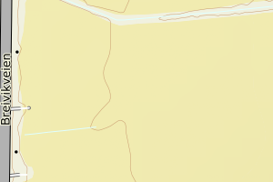
1871 Andøy | fa4bae9d-32a1-45df-bdbe-c9253890c8bb | 190270688 | 21 | TB | 181 | 1960-01-01 | N: 7651695.00, Ø: 517409.00 | ![Kartbilde fra WMS-tjeneste av avviket](https://wms.geonorge.no/skwms1/wms.topo?VERSION=1.1.1&SERVICE=WMS&REQUEST=GetMap&LAYERS=topo&STYLES=&FORMAT=image/png&SRS=EPSG:25833&BBOX=517334.0,7651645,517484.0,7651745&WIDTH=300&HEIGHT=200) |
1871 Andøy | 50bcc82d-6ebd-43a0-8760-dc460b6e631e | 190272109 | 21 | TB | 183 | 1925-12-01 | N: 7640563.00, Ø: 518952.00 | ![Kartbilde fra WMS-tjeneste av avviket](https://wms.geonorge.no/skwms1/wms.topo?VERSION=1.1.1&SERVICE=WMS&REQUEST=GetMap&LAYERS=topo&STYLES=&FORMAT=image/png&SRS=EPSG:25833&BBOX=518877.0,7640513,519027.0,7640613&WIDTH=300&HEIGHT=200) |