Avvikene skyldes oftest manglende eller unøyaktig registrering av bygningspunkt i matrikkelen. Rettes vanligvis i matrikkelen
Kommune | LokalId | Areal (m2) | Posisjon | WMS-bilde |
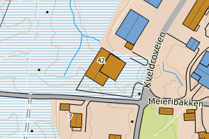
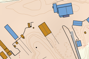
1871 Andøy | 3f45bab4-6ba1-4ec4-92b0-b658dd559d27 | 1787.04 | N: 7672196.99, Ø: 543220.30 | ![Kartbilde fra WMS-tjeneste av avviket](https://wms.geonorge.no/skwms1/wms.topo?VERSION=1.1.1&SERVICE=WMS&REQUEST=GetMap&LAYERS=topo&STYLES=&FORMAT=image/png&SRS=EPSG:25833&BBOX=543145.0,7672146,543295.0,7672246&WIDTH=300&HEIGHT=200) |
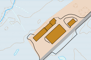
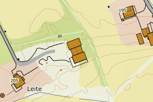
1871 Andøy | beb38e25-53cb-4c0e-8b25-cd4eae98b3d1 | 1737.42 | N: 7688590.91, Ø: 544828.87 | ![Kartbilde fra WMS-tjeneste av avviket](https://wms.geonorge.no/skwms1/wms.topo?VERSION=1.1.1&SERVICE=WMS&REQUEST=GetMap&LAYERS=topo&STYLES=&FORMAT=image/png&SRS=EPSG:25833&BBOX=544753.0,7688540,544903.0,7688640&WIDTH=300&HEIGHT=200) |
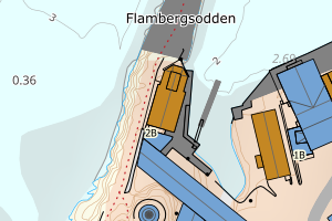
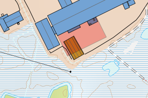
1871 Andøy | d11ba698-b789-4bcd-82a6-8aa50ad96ed6 | 1546.28 | N: 7688281.94, Ø: 543875.12 | ![Kartbilde fra WMS-tjeneste av avviket](https://wms.geonorge.no/skwms1/wms.topo?VERSION=1.1.1&SERVICE=WMS&REQUEST=GetMap&LAYERS=topo&STYLES=&FORMAT=image/png&SRS=EPSG:25833&BBOX=543800.0,7688231,543950.0,7688331&WIDTH=300&HEIGHT=200) |
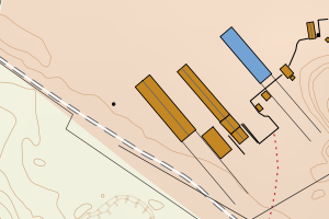
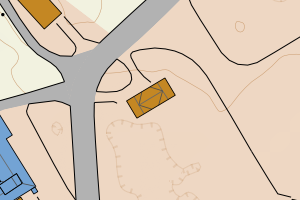
1871 Andøy | 613a55bf-0203-458d-931e-b2621c319722 | 1477.55 | N: 7688410.67, Ø: 544822.33 | ![Kartbilde fra WMS-tjeneste av avviket](https://wms.geonorge.no/skwms1/wms.topo?VERSION=1.1.1&SERVICE=WMS&REQUEST=GetMap&LAYERS=topo&STYLES=&FORMAT=image/png&SRS=EPSG:25833&BBOX=544747.0,7688360,544897.0,7688460&WIDTH=300&HEIGHT=200) |
1871 Andøy | 4b3294f6-ce8b-48bd-87c1-0c3cd567e9f5 | 1399.08 | N: 7687025.60, Ø: 545800.92 | ![Kartbilde fra WMS-tjeneste av avviket](https://wms.geonorge.no/skwms1/wms.topo?VERSION=1.1.1&SERVICE=WMS&REQUEST=GetMap&LAYERS=topo&STYLES=&FORMAT=image/png&SRS=EPSG:25833&BBOX=545725.0,7686975,545875.0,7687075&WIDTH=300&HEIGHT=200) |
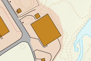
1871 Andøy | 7dc317bf-92c3-431a-a2c9-71862c5df34b | 1206.45 | N: 7687678.37, Ø: 540651.22 | ![Kartbilde fra WMS-tjeneste av avviket](https://wms.geonorge.no/skwms1/wms.topo?VERSION=1.1.1&SERVICE=WMS&REQUEST=GetMap&LAYERS=topo&STYLES=&FORMAT=image/png&SRS=EPSG:25833&BBOX=540576.0,7687628,540726.0,7687728&WIDTH=300&HEIGHT=200) |
1871 Andøy | d56518b2-56e0-44ae-a4fb-48a267120884 | 1169.38 | N: 7670170.89, Ø: 527069.73 | ![Kartbilde fra WMS-tjeneste av avviket](https://wms.geonorge.no/skwms1/wms.topo?VERSION=1.1.1&SERVICE=WMS&REQUEST=GetMap&LAYERS=topo&STYLES=&FORMAT=image/png&SRS=EPSG:25833&BBOX=526994.0,7670120,527144.0,7670220&WIDTH=300&HEIGHT=200) |
1871 Andøy | 44b39176-e36e-4050-93ef-165864e05f82 | 1061.70 | N: 7689139.21, Ø: 543509.29 | ![Kartbilde fra WMS-tjeneste av avviket](https://wms.geonorge.no/skwms1/wms.topo?VERSION=1.1.1&SERVICE=WMS&REQUEST=GetMap&LAYERS=topo&STYLES=&FORMAT=image/png&SRS=EPSG:25833&BBOX=543434.0,7689089,543584.0,7689189&WIDTH=300&HEIGHT=200) |
1871 Andøy | 772d4105-4094-4f30-a9a7-b8e91b60f385 | 955.09 | N: 7672271.01, Ø: 543248.10 | ![Kartbilde fra WMS-tjeneste av avviket](https://wms.geonorge.no/skwms1/wms.topo?VERSION=1.1.1&SERVICE=WMS&REQUEST=GetMap&LAYERS=topo&STYLES=&FORMAT=image/png&SRS=EPSG:25833&BBOX=543173.0,7672221,543323.0,7672321&WIDTH=300&HEIGHT=200) |
1871 Andøy | 8360fb68-2dc7-427c-be73-2e94db919487 | 777.27 | N: 7687599.44, Ø: 544220.02 | ![Kartbilde fra WMS-tjeneste av avviket](https://wms.geonorge.no/skwms1/wms.topo?VERSION=1.1.1&SERVICE=WMS&REQUEST=GetMap&LAYERS=topo&STYLES=&FORMAT=image/png&SRS=EPSG:25833&BBOX=544145.0,7687549,544295.0,7687649&WIDTH=300&HEIGHT=200) |
1871 Andøy | 68a865e0-6128-4275-be41-262d336458aa | 769.24 | N: 7687439.56, Ø: 543668.26 | ![Kartbilde fra WMS-tjeneste av avviket](https://wms.geonorge.no/skwms1/wms.topo?VERSION=1.1.1&SERVICE=WMS&REQUEST=GetMap&LAYERS=topo&STYLES=&FORMAT=image/png&SRS=EPSG:25833&BBOX=543593.0,7687389,543743.0,7687489&WIDTH=300&HEIGHT=200) |
1871 Andøy | ef9ce7e1-296f-41d3-a234-1aa0b9f39dbd | 749.30 | N: 7688268.19, Ø: 543749.83 | ![Kartbilde fra WMS-tjeneste av avviket](https://wms.geonorge.no/skwms1/wms.topo?VERSION=1.1.1&SERVICE=WMS&REQUEST=GetMap&LAYERS=topo&STYLES=&FORMAT=image/png&SRS=EPSG:25833&BBOX=543674.0,7688218,543824.0,7688318&WIDTH=300&HEIGHT=200) |
1871 Andøy | ebdb6d94-41cf-4a72-94fc-89545faa18ec | 736.71 | N: 7687306.07, Ø: 543976.16 | ![Kartbilde fra WMS-tjeneste av avviket](https://wms.geonorge.no/skwms1/wms.topo?VERSION=1.1.1&SERVICE=WMS&REQUEST=GetMap&LAYERS=topo&STYLES=&FORMAT=image/png&SRS=EPSG:25833&BBOX=543901.0,7687256,544051.0,7687356&WIDTH=300&HEIGHT=200) |
1871 Andøy | 4d48f195-4824-4f05-9aa0-31e258a31d1c | 731.82 | N: 7687036.46, Ø: 545722.15 | ![Kartbilde fra WMS-tjeneste av avviket](https://wms.geonorge.no/skwms1/wms.topo?VERSION=1.1.1&SERVICE=WMS&REQUEST=GetMap&LAYERS=topo&STYLES=&FORMAT=image/png&SRS=EPSG:25833&BBOX=545647.0,7686986,545797.0,7687086&WIDTH=300&HEIGHT=200) |
1871 Andøy | 6b4b46ba-3062-4589-9f9b-286a210bf48e | 649.31 | N: 7668687.36, Ø: 525196.69 | ![Kartbilde fra WMS-tjeneste av avviket](https://wms.geonorge.no/skwms1/wms.topo?VERSION=1.1.1&SERVICE=WMS&REQUEST=GetMap&LAYERS=topo&STYLES=&FORMAT=image/png&SRS=EPSG:25833&BBOX=525121.0,7668637,525271.0,7668737&WIDTH=300&HEIGHT=200) |
1871 Andøy | d797f432-fd38-43b8-b1e2-7e7fb123ad79 | 630.77 | N: 7688087.61, Ø: 544072.26 | ![Kartbilde fra WMS-tjeneste av avviket](https://wms.geonorge.no/skwms1/wms.topo?VERSION=1.1.1&SERVICE=WMS&REQUEST=GetMap&LAYERS=topo&STYLES=&FORMAT=image/png&SRS=EPSG:25833&BBOX=543997.0,7688037,544147.0,7688137&WIDTH=300&HEIGHT=200) |
1871 Andøy | 0c3575a7-ff58-4d0a-8cba-48e2f6487217 | 615.32 | N: 7687694.64, Ø: 540705.82 | ![Kartbilde fra WMS-tjeneste av avviket](https://wms.geonorge.no/skwms1/wms.topo?VERSION=1.1.1&SERVICE=WMS&REQUEST=GetMap&LAYERS=topo&STYLES=&FORMAT=image/png&SRS=EPSG:25833&BBOX=540630.0,7687644,540780.0,7687744&WIDTH=300&HEIGHT=200) |
1871 Andøy | 771dc64f-6c3c-4e2c-a14b-e0ec1558b97b | 570.93 | N: 7688920.38, Ø: 543366.50 | ![Kartbilde fra WMS-tjeneste av avviket](https://wms.geonorge.no/skwms1/wms.topo?VERSION=1.1.1&SERVICE=WMS&REQUEST=GetMap&LAYERS=topo&STYLES=&FORMAT=image/png&SRS=EPSG:25833&BBOX=543291.0,7688870,543441.0,7688970&WIDTH=300&HEIGHT=200) |
1871 Andøy | eb3e9b82-d019-491d-96ec-1b2704e9e3bc | 557.28 | N: 7688777.11, Ø: 544744.29 | ![Kartbilde fra WMS-tjeneste av avviket](https://wms.geonorge.no/skwms1/wms.topo?VERSION=1.1.1&SERVICE=WMS&REQUEST=GetMap&LAYERS=topo&STYLES=&FORMAT=image/png&SRS=EPSG:25833&BBOX=544669.0,7688727,544819.0,7688827&WIDTH=300&HEIGHT=200) |
1871 Andøy | 85b40f44-d198-44eb-b505-53e73c924fd4 | 517.55 | N: 7687459.93, Ø: 544087.16 | ![Kartbilde fra WMS-tjeneste av avviket](https://wms.geonorge.no/skwms1/wms.topo?VERSION=1.1.1&SERVICE=WMS&REQUEST=GetMap&LAYERS=topo&STYLES=&FORMAT=image/png&SRS=EPSG:25833&BBOX=544012.0,7687409,544162.0,7687509&WIDTH=300&HEIGHT=200) |
1871 Andøy | 0c8119d9-6776-421d-a6a7-8ee3e5bfa31c | 477.14 | N: 7680916.28, Ø: 541067.96 | ![Kartbilde fra WMS-tjeneste av avviket](https://wms.geonorge.no/skwms1/wms.topo?VERSION=1.1.1&SERVICE=WMS&REQUEST=GetMap&LAYERS=topo&STYLES=&FORMAT=image/png&SRS=EPSG:25833&BBOX=540992.0,7680866,541142.0,7680966&WIDTH=300&HEIGHT=200) |
1871 Andøy | 9c6f4a0f-bd15-40f1-af44-e2c7890433d9 | 471.91 | N: 7676145.49, Ø: 532792.42 | ![Kartbilde fra WMS-tjeneste av avviket](https://wms.geonorge.no/skwms1/wms.topo?VERSION=1.1.1&SERVICE=WMS&REQUEST=GetMap&LAYERS=topo&STYLES=&FORMAT=image/png&SRS=EPSG:25833&BBOX=532717.0,7676095,532867.0,7676195&WIDTH=300&HEIGHT=200) |
1871 Andøy | cb3724fe-cbac-47e9-9ff7-b66914980e2c | 461.32 | N: 7646017.56, Ø: 522524.34 | ![Kartbilde fra WMS-tjeneste av avviket](https://wms.geonorge.no/skwms1/wms.topo?VERSION=1.1.1&SERVICE=WMS&REQUEST=GetMap&LAYERS=topo&STYLES=&FORMAT=image/png&SRS=EPSG:25833&BBOX=522449.0,7645967,522599.0,7646067&WIDTH=300&HEIGHT=200) |
1871 Andøy | b1f70c54-6eb1-42df-98da-81e56e77abd9 | 457.24 | N: 7663690.60, Ø: 522609.35 | ![Kartbilde fra WMS-tjeneste av avviket](https://wms.geonorge.no/skwms1/wms.topo?VERSION=1.1.1&SERVICE=WMS&REQUEST=GetMap&LAYERS=topo&STYLES=&FORMAT=image/png&SRS=EPSG:25833&BBOX=522534.0,7663640,522684.0,7663740&WIDTH=300&HEIGHT=200) |
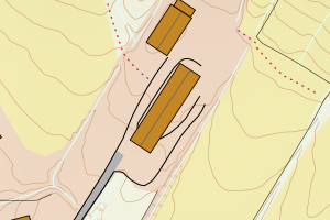
1871 Andøy | 36387319-6efb-476c-9a98-279264303727 | 456.67 | N: 7688301.56, Ø: 545069.68 | ![Kartbilde fra WMS-tjeneste av avviket](https://wms.geonorge.no/skwms1/wms.topo?VERSION=1.1.1&SERVICE=WMS&REQUEST=GetMap&LAYERS=topo&STYLES=&FORMAT=image/png&SRS=EPSG:25833&BBOX=544994.0,7688251,545144.0,7688351&WIDTH=300&HEIGHT=200) |
1871 Andøy | c829222a-59b6-4dc1-bf31-5f5d6499f722 | 453.89 | N: 7664018.26, Ø: 536621.79 | ![Kartbilde fra WMS-tjeneste av avviket](https://wms.geonorge.no/skwms1/wms.topo?VERSION=1.1.1&SERVICE=WMS&REQUEST=GetMap&LAYERS=topo&STYLES=&FORMAT=image/png&SRS=EPSG:25833&BBOX=536546.0,7663968,536696.0,7664068&WIDTH=300&HEIGHT=200) |
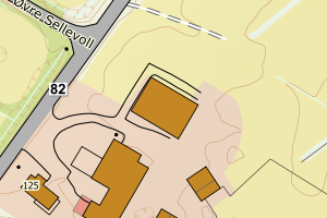
1871 Andøy | 5f8849b0-fcda-467b-b12e-5a441394cf60 | 409.43 | N: 7675329.62, Ø: 536272.33 | ![Kartbilde fra WMS-tjeneste av avviket](https://wms.geonorge.no/skwms1/wms.topo?VERSION=1.1.1&SERVICE=WMS&REQUEST=GetMap&LAYERS=topo&STYLES=&FORMAT=image/png&SRS=EPSG:25833&BBOX=536197.0,7675279,536347.0,7675379&WIDTH=300&HEIGHT=200) |
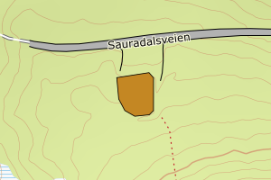
1871 Andøy | 0367b9ed-aa10-40bb-bfdf-f05b77d8c030 | 407.43 | N: 7638019.00, Ø: 523013.68 | ![Kartbilde fra WMS-tjeneste av avviket](https://wms.geonorge.no/skwms1/wms.topo?VERSION=1.1.1&SERVICE=WMS&REQUEST=GetMap&LAYERS=topo&STYLES=&FORMAT=image/png&SRS=EPSG:25833&BBOX=522938.0,7637969,523088.0,7638069&WIDTH=300&HEIGHT=200) |
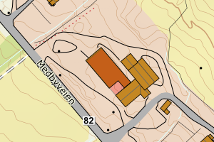
1871 Andøy | 261ab0d0-728c-4343-94ff-b08150b7d908 | 390.84 | N: 7687996.71, Ø: 544128.02 | ![Kartbilde fra WMS-tjeneste av avviket](https://wms.geonorge.no/skwms1/wms.topo?VERSION=1.1.1&SERVICE=WMS&REQUEST=GetMap&LAYERS=topo&STYLES=&FORMAT=image/png&SRS=EPSG:25833&BBOX=544053.0,7687946,544203.0,7688046&WIDTH=300&HEIGHT=200) |
1871 Andøy | 5939d743-ff9d-4ee9-9b68-3032a73aa580 | 371.77 | N: 7687467.93, Ø: 544070.37 | ![Kartbilde fra WMS-tjeneste av avviket](https://wms.geonorge.no/skwms1/wms.topo?VERSION=1.1.1&SERVICE=WMS&REQUEST=GetMap&LAYERS=topo&STYLES=&FORMAT=image/png&SRS=EPSG:25833&BBOX=543995.0,7687417,544145.0,7687517&WIDTH=300&HEIGHT=200) |
1871 Andøy | 24d85131-bc34-40d0-a458-cc5df93e5a76 | 359.42 | N: 7672432.42, Ø: 543259.02 | ![Kartbilde fra WMS-tjeneste av avviket](https://wms.geonorge.no/skwms1/wms.topo?VERSION=1.1.1&SERVICE=WMS&REQUEST=GetMap&LAYERS=topo&STYLES=&FORMAT=image/png&SRS=EPSG:25833&BBOX=543184.0,7672382,543334.0,7672482&WIDTH=300&HEIGHT=200) |
1871 Andøy | 990512ea-66b4-4c86-b1b3-17bbbbb05fe3 | 351.66 | N: 7690927.75, Ø: 544024.60 | ![Kartbilde fra WMS-tjeneste av avviket](https://wms.geonorge.no/skwms1/wms.topo?VERSION=1.1.1&SERVICE=WMS&REQUEST=GetMap&LAYERS=topo&STYLES=&FORMAT=image/png&SRS=EPSG:25833&BBOX=543949.0,7690877,544099.0,7690977&WIDTH=300&HEIGHT=200) |
1871 Andøy | 9e44fc16-e328-415e-a571-7aa550068aa8 | 349.14 | N: 7690939.74, Ø: 543978.29 | ![Kartbilde fra WMS-tjeneste av avviket](https://wms.geonorge.no/skwms1/wms.topo?VERSION=1.1.1&SERVICE=WMS&REQUEST=GetMap&LAYERS=topo&STYLES=&FORMAT=image/png&SRS=EPSG:25833&BBOX=543903.0,7690889,544053.0,7690989&WIDTH=300&HEIGHT=200) |
1871 Andøy | cc09ef3e-32d9-47bb-a103-4d926dc01a0b | 329.85 | N: 7688408.97, Ø: 544970.49 | ![Kartbilde fra WMS-tjeneste av avviket](https://wms.geonorge.no/skwms1/wms.topo?VERSION=1.1.1&SERVICE=WMS&REQUEST=GetMap&LAYERS=topo&STYLES=&FORMAT=image/png&SRS=EPSG:25833&BBOX=544895.0,7688358,545045.0,7688458&WIDTH=300&HEIGHT=200) |
1871 Andøy | 30c17bd6-962f-4580-835e-5ac46f9e57e4 | 326.39 | N: 7656202.99, Ø: 529905.84 | ![Kartbilde fra WMS-tjeneste av avviket](https://wms.geonorge.no/skwms1/wms.topo?VERSION=1.1.1&SERVICE=WMS&REQUEST=GetMap&LAYERS=topo&STYLES=&FORMAT=image/png&SRS=EPSG:25833&BBOX=529830.0,7656152,529980.0,7656252&WIDTH=300&HEIGHT=200) |
1871 Andøy | 72bc4c62-30a6-44b3-a484-c961164ad9d9 | 321.76 | N: 7656209.54, Ø: 529903.69 | ![Kartbilde fra WMS-tjeneste av avviket](https://wms.geonorge.no/skwms1/wms.topo?VERSION=1.1.1&SERVICE=WMS&REQUEST=GetMap&LAYERS=topo&STYLES=&FORMAT=image/png&SRS=EPSG:25833&BBOX=529828.0,7656159,529978.0,7656259&WIDTH=300&HEIGHT=200) |
1871 Andøy | a945832c-4951-408d-aca6-dfeb51199cb6 | 317.60 | N: 7688960.91, Ø: 544665.58 | ![Kartbilde fra WMS-tjeneste av avviket](https://wms.geonorge.no/skwms1/wms.topo?VERSION=1.1.1&SERVICE=WMS&REQUEST=GetMap&LAYERS=topo&STYLES=&FORMAT=image/png&SRS=EPSG:25833&BBOX=544590.0,7688910,544740.0,7689010&WIDTH=300&HEIGHT=200) |
1871 Andøy | 8ecdd757-ab7f-404f-a4b5-c530dd08e154 | 302.93 | N: 7687776.35, Ø: 544157.94 | ![Kartbilde fra WMS-tjeneste av avviket](https://wms.geonorge.no/skwms1/wms.topo?VERSION=1.1.1&SERVICE=WMS&REQUEST=GetMap&LAYERS=topo&STYLES=&FORMAT=image/png&SRS=EPSG:25833&BBOX=544082.0,7687726,544232.0,7687826&WIDTH=300&HEIGHT=200) |
1871 Andøy | ab86ec84-e0be-404c-9b9c-43df101ecebe | 299.20 | N: 7688381.02, Ø: 544845.48 | ![Kartbilde fra WMS-tjeneste av avviket](https://wms.geonorge.no/skwms1/wms.topo?VERSION=1.1.1&SERVICE=WMS&REQUEST=GetMap&LAYERS=topo&STYLES=&FORMAT=image/png&SRS=EPSG:25833&BBOX=544770.0,7688331,544920.0,7688431&WIDTH=300&HEIGHT=200) |
1871 Andøy | 7321164b-897c-4abf-b046-0770f061491e | 285.42 | N: 7654516.23, Ø: 525561.87 | ![Kartbilde fra WMS-tjeneste av avviket](https://wms.geonorge.no/skwms1/wms.topo?VERSION=1.1.1&SERVICE=WMS&REQUEST=GetMap&LAYERS=topo&STYLES=&FORMAT=image/png&SRS=EPSG:25833&BBOX=525486.0,7654466,525636.0,7654566&WIDTH=300&HEIGHT=200) |
1871 Andøy | 14b4a140-757a-470f-9e7e-6e041d270e0f | 279.98 | N: 7687147.61, Ø: 544527.64 | ![Kartbilde fra WMS-tjeneste av avviket](https://wms.geonorge.no/skwms1/wms.topo?VERSION=1.1.1&SERVICE=WMS&REQUEST=GetMap&LAYERS=topo&STYLES=&FORMAT=image/png&SRS=EPSG:25833&BBOX=544452.0,7687097,544602.0,7687197&WIDTH=300&HEIGHT=200) |
1871 Andøy | 8a3488b9-b996-4816-acf5-07f0a20506c3 | 278.09 | N: 7688120.67, Ø: 543796.93 | ![Kartbilde fra WMS-tjeneste av avviket](https://wms.geonorge.no/skwms1/wms.topo?VERSION=1.1.1&SERVICE=WMS&REQUEST=GetMap&LAYERS=topo&STYLES=&FORMAT=image/png&SRS=EPSG:25833&BBOX=543721.0,7688070,543871.0,7688170&WIDTH=300&HEIGHT=200) |
1871 Andøy | 94917c87-2981-4078-a504-be4e4eb1f50d | 273.29 | N: 7687336.18, Ø: 545585.54 | ![Kartbilde fra WMS-tjeneste av avviket](https://wms.geonorge.no/skwms1/wms.topo?VERSION=1.1.1&SERVICE=WMS&REQUEST=GetMap&LAYERS=topo&STYLES=&FORMAT=image/png&SRS=EPSG:25833&BBOX=545510.0,7687286,545660.0,7687386&WIDTH=300&HEIGHT=200) |
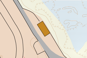
1871 Andøy | a26432df-4c9d-4569-b0b5-02af0d7208b2 | 273.16 | N: 7688403.79, Ø: 543733.89 | ![Kartbilde fra WMS-tjeneste av avviket](https://wms.geonorge.no/skwms1/wms.topo?VERSION=1.1.1&SERVICE=WMS&REQUEST=GetMap&LAYERS=topo&STYLES=&FORMAT=image/png&SRS=EPSG:25833&BBOX=543658.0,7688353,543808.0,7688453&WIDTH=300&HEIGHT=200) |
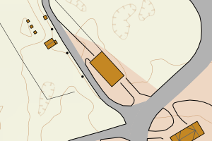
1871 Andøy | 35a9673c-6217-4d23-8237-4c92b88001fb | 268.23 | N: 7663726.08, Ø: 522611.10 | ![Kartbilde fra WMS-tjeneste av avviket](https://wms.geonorge.no/skwms1/wms.topo?VERSION=1.1.1&SERVICE=WMS&REQUEST=GetMap&LAYERS=topo&STYLES=&FORMAT=image/png&SRS=EPSG:25833&BBOX=522536.0,7663676,522686.0,7663776&WIDTH=300&HEIGHT=200) |
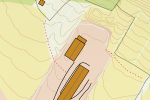
1871 Andøy | 1c21b6a7-b616-4868-afa1-9ae51dc980d2 | 268.10 | N: 7688355.64, Ø: 543788.93 | ![Kartbilde fra WMS-tjeneste av avviket](https://wms.geonorge.no/skwms1/wms.topo?VERSION=1.1.1&SERVICE=WMS&REQUEST=GetMap&LAYERS=topo&STYLES=&FORMAT=image/png&SRS=EPSG:25833&BBOX=543713.0,7688305,543863.0,7688405&WIDTH=300&HEIGHT=200) |
1871 Andøy | 1a7d5bda-9539-4a24-a23d-15970e56a50e | 263.46 | N: 7688205.54, Ø: 543944.70 | ![Kartbilde fra WMS-tjeneste av avviket](https://wms.geonorge.no/skwms1/wms.topo?VERSION=1.1.1&SERVICE=WMS&REQUEST=GetMap&LAYERS=topo&STYLES=&FORMAT=image/png&SRS=EPSG:25833&BBOX=543869.0,7688155,544019.0,7688255&WIDTH=300&HEIGHT=200) |
1871 Andøy | 5773683b-44eb-4ad3-acfc-58635afbc6a0 | 262.21 | N: 7685745.16, Ø: 539875.60 | ![Kartbilde fra WMS-tjeneste av avviket](https://wms.geonorge.no/skwms1/wms.topo?VERSION=1.1.1&SERVICE=WMS&REQUEST=GetMap&LAYERS=topo&STYLES=&FORMAT=image/png&SRS=EPSG:25833&BBOX=539800.0,7685695,539950.0,7685795&WIDTH=300&HEIGHT=200) |
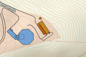
1871 Andøy | 5fa4a39f-155c-4f8b-a38b-cc33b5e2d9f6 | 262.12 | N: 7685778.04, Ø: 545170.25 | ![Kartbilde fra WMS-tjeneste av avviket](https://wms.geonorge.no/skwms1/wms.topo?VERSION=1.1.1&SERVICE=WMS&REQUEST=GetMap&LAYERS=topo&STYLES=&FORMAT=image/png&SRS=EPSG:25833&BBOX=545095.0,7685728,545245.0,7685828&WIDTH=300&HEIGHT=200) |
1871 Andøy | b1788ec5-f9a9-4f70-8708-e5fbf372e9c7 | 261.61 | N: 7687749.44, Ø: 544223.91 | ![Kartbilde fra WMS-tjeneste av avviket](https://wms.geonorge.no/skwms1/wms.topo?VERSION=1.1.1&SERVICE=WMS&REQUEST=GetMap&LAYERS=topo&STYLES=&FORMAT=image/png&SRS=EPSG:25833&BBOX=544148.0,7687699,544298.0,7687799&WIDTH=300&HEIGHT=200) |
1871 Andøy | 88ff7a1c-205f-429c-94ab-86966c75657e | 258.10 | N: 7682023.43, Ø: 543972.66 | ![Kartbilde fra WMS-tjeneste av avviket](https://wms.geonorge.no/skwms1/wms.topo?VERSION=1.1.1&SERVICE=WMS&REQUEST=GetMap&LAYERS=topo&STYLES=&FORMAT=image/png&SRS=EPSG:25833&BBOX=543897.0,7681973,544047.0,7682073&WIDTH=300&HEIGHT=200) |
1871 Andøy | cc6883e6-3d6d-4b7c-9185-e24c42bb2854 | 256.01 | N: 7687495.28, Ø: 544400.85 | ![Kartbilde fra WMS-tjeneste av avviket](https://wms.geonorge.no/skwms1/wms.topo?VERSION=1.1.1&SERVICE=WMS&REQUEST=GetMap&LAYERS=topo&STYLES=&FORMAT=image/png&SRS=EPSG:25833&BBOX=544325.0,7687445,544475.0,7687545&WIDTH=300&HEIGHT=200) |
1871 Andøy | 79eafb8a-82f0-49f0-8fbe-244a433ab317 | 254.42 | N: 7688522.47, Ø: 544835.90 | ![Kartbilde fra WMS-tjeneste av avviket](https://wms.geonorge.no/skwms1/wms.topo?VERSION=1.1.1&SERVICE=WMS&REQUEST=GetMap&LAYERS=topo&STYLES=&FORMAT=image/png&SRS=EPSG:25833&BBOX=544760.0,7688472,544910.0,7688572&WIDTH=300&HEIGHT=200) |
1871 Andøy | ae304f7d-2df1-4d91-8da0-52a55d1121a0 | 254.19 | N: 7656294.30, Ø: 529829.33 | ![Kartbilde fra WMS-tjeneste av avviket](https://wms.geonorge.no/skwms1/wms.topo?VERSION=1.1.1&SERVICE=WMS&REQUEST=GetMap&LAYERS=topo&STYLES=&FORMAT=image/png&SRS=EPSG:25833&BBOX=529754.0,7656244,529904.0,7656344&WIDTH=300&HEIGHT=200) |
1871 Andøy | bf08ccd9-0898-45ce-9000-e2e94f4b3639 | 251.69 | N: 7648853.84, Ø: 526315.08 | ![Kartbilde fra WMS-tjeneste av avviket](https://wms.geonorge.no/skwms1/wms.topo?VERSION=1.1.1&SERVICE=WMS&REQUEST=GetMap&LAYERS=topo&STYLES=&FORMAT=image/png&SRS=EPSG:25833&BBOX=526240.0,7648803,526390.0,7648903&WIDTH=300&HEIGHT=200) |
1871 Andøy | 1d7dd622-6502-4ee9-a42b-cf55ea65dce9 | 250.28 | N: 7640527.14, Ø: 519243.55 | ![Kartbilde fra WMS-tjeneste av avviket](https://wms.geonorge.no/skwms1/wms.topo?VERSION=1.1.1&SERVICE=WMS&REQUEST=GetMap&LAYERS=topo&STYLES=&FORMAT=image/png&SRS=EPSG:25833&BBOX=519168.0,7640477,519318.0,7640577&WIDTH=300&HEIGHT=200) |
1871 Andøy | 32b26850-d7ee-4b76-979d-20fc48ba7573 | 248.95 | N: 7687858.14, Ø: 544153.22 | ![Kartbilde fra WMS-tjeneste av avviket](https://wms.geonorge.no/skwms1/wms.topo?VERSION=1.1.1&SERVICE=WMS&REQUEST=GetMap&LAYERS=topo&STYLES=&FORMAT=image/png&SRS=EPSG:25833&BBOX=544078.0,7687808,544228.0,7687908&WIDTH=300&HEIGHT=200) |
1871 Andøy | f0bb5770-1271-4efe-bec3-e8cfaac7de0c | 242.67 | N: 7687534.13, Ø: 544168.16 | ![Kartbilde fra WMS-tjeneste av avviket](https://wms.geonorge.no/skwms1/wms.topo?VERSION=1.1.1&SERVICE=WMS&REQUEST=GetMap&LAYERS=topo&STYLES=&FORMAT=image/png&SRS=EPSG:25833&BBOX=544093.0,7687484,544243.0,7687584&WIDTH=300&HEIGHT=200) |
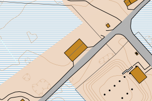
1871 Andøy | 45e79496-1bb7-4785-a459-0cacb72cf6bf | 240.99 | N: 7687685.55, Ø: 544188.05 | ![Kartbilde fra WMS-tjeneste av avviket](https://wms.geonorge.no/skwms1/wms.topo?VERSION=1.1.1&SERVICE=WMS&REQUEST=GetMap&LAYERS=topo&STYLES=&FORMAT=image/png&SRS=EPSG:25833&BBOX=544113.0,7687635,544263.0,7687735&WIDTH=300&HEIGHT=200) |
1871 Andøy | 272c75ce-ff0c-4ee8-bf75-92bc9bcd1d46 | 234.88 | N: 7687717.19, Ø: 540717.85 | ![Kartbilde fra WMS-tjeneste av avviket](https://wms.geonorge.no/skwms1/wms.topo?VERSION=1.1.1&SERVICE=WMS&REQUEST=GetMap&LAYERS=topo&STYLES=&FORMAT=image/png&SRS=EPSG:25833&BBOX=540642.0,7687667,540792.0,7687767&WIDTH=300&HEIGHT=200) |
1871 Andøy | 98dc4ff4-893d-4914-a925-a45a57acc87c | 233.99 | N: 7686902.33, Ø: 545690.39 | ![Kartbilde fra WMS-tjeneste av avviket](https://wms.geonorge.no/skwms1/wms.topo?VERSION=1.1.1&SERVICE=WMS&REQUEST=GetMap&LAYERS=topo&STYLES=&FORMAT=image/png&SRS=EPSG:25833&BBOX=545615.0,7686852,545765.0,7686952&WIDTH=300&HEIGHT=200) |
1871 Andøy | af220f43-3769-4a13-8b90-fe867f47d4b9 | 233.53 | N: 7665457.96, Ø: 526610.08 | ![Kartbilde fra WMS-tjeneste av avviket](https://wms.geonorge.no/skwms1/wms.topo?VERSION=1.1.1&SERVICE=WMS&REQUEST=GetMap&LAYERS=topo&STYLES=&FORMAT=image/png&SRS=EPSG:25833&BBOX=526535.0,7665407,526685.0,7665507&WIDTH=300&HEIGHT=200) |
1871 Andøy | 82049a44-3dfd-4a4b-92e2-7a8eae0419a4 | 228.29 | N: 7656288.12, Ø: 529832.30 | ![Kartbilde fra WMS-tjeneste av avviket](https://wms.geonorge.no/skwms1/wms.topo?VERSION=1.1.1&SERVICE=WMS&REQUEST=GetMap&LAYERS=topo&STYLES=&FORMAT=image/png&SRS=EPSG:25833&BBOX=529757.0,7656238,529907.0,7656338&WIDTH=300&HEIGHT=200) |
1871 Andøy | e4abeb1e-d3e3-4415-913f-8934bad4f008 | 226.58 | N: 7656219.09, Ø: 529889.39 | ![Kartbilde fra WMS-tjeneste av avviket](https://wms.geonorge.no/skwms1/wms.topo?VERSION=1.1.1&SERVICE=WMS&REQUEST=GetMap&LAYERS=topo&STYLES=&FORMAT=image/png&SRS=EPSG:25833&BBOX=529814.0,7656169,529964.0,7656269&WIDTH=300&HEIGHT=200) |
1871 Andøy | 62351d1a-4b05-4199-94b2-67c3c49b1d7a | 226.36 | N: 7656211.40, Ø: 529892.27 | ![Kartbilde fra WMS-tjeneste av avviket](https://wms.geonorge.no/skwms1/wms.topo?VERSION=1.1.1&SERVICE=WMS&REQUEST=GetMap&LAYERS=topo&STYLES=&FORMAT=image/png&SRS=EPSG:25833&BBOX=529817.0,7656161,529967.0,7656261&WIDTH=300&HEIGHT=200) |
1871 Andøy | 12cbf551-a7c5-44bf-ba51-94b13f85b486 | 224.22 | N: 7656238.93, Ø: 529882.48 | ![Kartbilde fra WMS-tjeneste av avviket](https://wms.geonorge.no/skwms1/wms.topo?VERSION=1.1.1&SERVICE=WMS&REQUEST=GetMap&LAYERS=topo&STYLES=&FORMAT=image/png&SRS=EPSG:25833&BBOX=529807.0,7656188,529957.0,7656288&WIDTH=300&HEIGHT=200) |
1871 Andøy | cad7ec76-21b7-4f52-b919-b9f70222b6d7 | 220.85 | N: 7672257.00, Ø: 543092.20 | ![Kartbilde fra WMS-tjeneste av avviket](https://wms.geonorge.no/skwms1/wms.topo?VERSION=1.1.1&SERVICE=WMS&REQUEST=GetMap&LAYERS=topo&STYLES=&FORMAT=image/png&SRS=EPSG:25833&BBOX=543017.0,7672207,543167.0,7672307&WIDTH=300&HEIGHT=200) |
1871 Andøy | c5993bb7-f5f9-4a70-a96e-9a60174fe6c8 | 216.71 | N: 7689096.41, Ø: 543430.92 | ![Kartbilde fra WMS-tjeneste av avviket](https://wms.geonorge.no/skwms1/wms.topo?VERSION=1.1.1&SERVICE=WMS&REQUEST=GetMap&LAYERS=topo&STYLES=&FORMAT=image/png&SRS=EPSG:25833&BBOX=543355.0,7689046,543505.0,7689146&WIDTH=300&HEIGHT=200) |
1871 Andøy | 09371cd6-deae-4f36-8221-ce545f4d51d0 | 208.41 | N: 7686909.52, Ø: 545712.69 | ![Kartbilde fra WMS-tjeneste av avviket](https://wms.geonorge.no/skwms1/wms.topo?VERSION=1.1.1&SERVICE=WMS&REQUEST=GetMap&LAYERS=topo&STYLES=&FORMAT=image/png&SRS=EPSG:25833&BBOX=545637.0,7686859,545787.0,7686959&WIDTH=300&HEIGHT=200) |
1871 Andøy | c2c484c2-34f5-41fa-9fe0-81abb878df46 | 202.88 | N: 7674188.33, Ø: 537714.95 | ![Kartbilde fra WMS-tjeneste av avviket](https://wms.geonorge.no/skwms1/wms.topo?VERSION=1.1.1&SERVICE=WMS&REQUEST=GetMap&LAYERS=topo&STYLES=&FORMAT=image/png&SRS=EPSG:25833&BBOX=537639.0,7674138,537789.0,7674238&WIDTH=300&HEIGHT=200) |
1871 Andøy | 4364c219-bf30-4059-9846-ee0a5d770434 | 201.62 | N: 7687716.35, Ø: 544172.20 | ![Kartbilde fra WMS-tjeneste av avviket](https://wms.geonorge.no/skwms1/wms.topo?VERSION=1.1.1&SERVICE=WMS&REQUEST=GetMap&LAYERS=topo&STYLES=&FORMAT=image/png&SRS=EPSG:25833&BBOX=544097.0,7687666,544247.0,7687766&WIDTH=300&HEIGHT=200) |