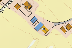
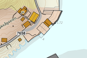
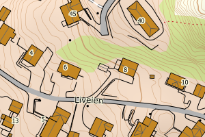
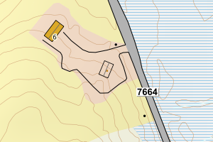
Avvikene skyldes oftest manglende sletting av bygningslinjer når bygningsflate er slettet i FKB-Bygning. Rettes i FKB-Bygning
Kommune | LokalId | Objekttype | Posisjon | WMS-bilde |
1867 Bø | 451fe5af-2658-4138-aa32-cdd7b221270e | Bygningslinje | N: 7611605.17, Ø: 478677.65 | ![Kartbilde fra WMS-tjeneste av avviket](https://wms.geonorge.no/skwms1/wms.topo?VERSION=1.1.1&SERVICE=WMS&REQUEST=GetMap&LAYERS=topo&STYLES=&FORMAT=image/png&SRS=EPSG:25833&BBOX=478602.0,7611555,478752.0,7611655&WIDTH=300&HEIGHT=200) |
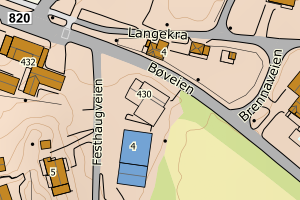
1867 Bø | d223c3e1-d18a-4df6-9cfa-bb6290afebee | Bygningslinje | N: 7611604.24, Ø: 478673.29 | ![Kartbilde fra WMS-tjeneste av avviket](https://wms.geonorge.no/skwms1/wms.topo?VERSION=1.1.1&SERVICE=WMS&REQUEST=GetMap&LAYERS=topo&STYLES=&FORMAT=image/png&SRS=EPSG:25833&BBOX=478598.0,7611554,478748.0,7611654&WIDTH=300&HEIGHT=200) |
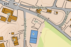
1867 Bø | 1e6baba8-0a9c-4937-946a-81784f7274f6 | Taksprang | N: 7612059.18, Ø: 477462.25 | ![Kartbilde fra WMS-tjeneste av avviket](https://wms.geonorge.no/skwms1/wms.topo?VERSION=1.1.1&SERVICE=WMS&REQUEST=GetMap&LAYERS=topo&STYLES=&FORMAT=image/png&SRS=EPSG:25833&BBOX=477387.0,7612009,477537.0,7612109&WIDTH=300&HEIGHT=200) |
1867 Bø | 76747eff-0ee1-447a-8cc2-51d38ac7e41c | Taksprang | N: 7611610.82, Ø: 478672.43 | ![Kartbilde fra WMS-tjeneste av avviket](https://wms.geonorge.no/skwms1/wms.topo?VERSION=1.1.1&SERVICE=WMS&REQUEST=GetMap&LAYERS=topo&STYLES=&FORMAT=image/png&SRS=EPSG:25833&BBOX=478597.0,7611560,478747.0,7611660&WIDTH=300&HEIGHT=200) |
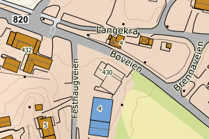
1867 Bø | 5bad2d9c-7de2-4d1f-a20f-c061061b44fb | Taksprang | N: 7629711.72, Ø: 478518.31 | ![Kartbilde fra WMS-tjeneste av avviket](https://wms.geonorge.no/skwms1/wms.topo?VERSION=1.1.1&SERVICE=WMS&REQUEST=GetMap&LAYERS=topo&STYLES=&FORMAT=image/png&SRS=EPSG:25833&BBOX=478443.0,7629661,478593.0,7629761&WIDTH=300&HEIGHT=200) |
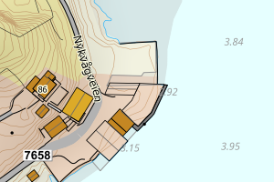
1867 Bø | 3406ea2a-cea3-4cf4-aae3-7b87b503abb1 | Mønelinje | N: 7619839.46, Ø: 479302.81 | ![Kartbilde fra WMS-tjeneste av avviket](https://wms.geonorge.no/skwms1/wms.topo?VERSION=1.1.1&SERVICE=WMS&REQUEST=GetMap&LAYERS=topo&STYLES=&FORMAT=image/png&SRS=EPSG:25833&BBOX=479227.0,7619789,479377.0,7619889&WIDTH=300&HEIGHT=200) |
1867 Bø | 47fb2585-3da9-48d8-b56b-8c0fe6218c4a | Mønelinje | N: 7629711.86, Ø: 478510.11 | ![Kartbilde fra WMS-tjeneste av avviket](https://wms.geonorge.no/skwms1/wms.topo?VERSION=1.1.1&SERVICE=WMS&REQUEST=GetMap&LAYERS=topo&STYLES=&FORMAT=image/png&SRS=EPSG:25833&BBOX=478435.0,7629661,478585.0,7629761&WIDTH=300&HEIGHT=200) |
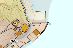
1867 Bø | c578bfc3-00f5-4dfe-b39b-7c1a95b0d01f | Mønelinje | N: 7629683.49, Ø: 478502.00 | ![Kartbilde fra WMS-tjeneste av avviket](https://wms.geonorge.no/skwms1/wms.topo?VERSION=1.1.1&SERVICE=WMS&REQUEST=GetMap&LAYERS=topo&STYLES=&FORMAT=image/png&SRS=EPSG:25833&BBOX=478427.0,7629633,478577.0,7629733&WIDTH=300&HEIGHT=200) |
1867 Bø | c37ac8d4-372d-48f7-bf21-d588800b8150 | Mønelinje | N: 7612060.60, Ø: 477460.66 | ![Kartbilde fra WMS-tjeneste av avviket](https://wms.geonorge.no/skwms1/wms.topo?VERSION=1.1.1&SERVICE=WMS&REQUEST=GetMap&LAYERS=topo&STYLES=&FORMAT=image/png&SRS=EPSG:25833&BBOX=477385.0,7612010,477535.0,7612110&WIDTH=300&HEIGHT=200) |
1867 Bø | b10c7b1d-d990-4d4a-aa85-0075930ca472 | Mønelinje | N: 7611609.70, Ø: 478669.08 | ![Kartbilde fra WMS-tjeneste av avviket](https://wms.geonorge.no/skwms1/wms.topo?VERSION=1.1.1&SERVICE=WMS&REQUEST=GetMap&LAYERS=topo&STYLES=&FORMAT=image/png&SRS=EPSG:25833&BBOX=478594.0,7611559,478744.0,7611659&WIDTH=300&HEIGHT=200) |
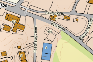
1867 Bø | f0328a48-6ea9-4541-b0db-7ece7747b1b6 | Mønelinje | N: 7611606.71, Ø: 478678.65 | ![Kartbilde fra WMS-tjeneste av avviket](https://wms.geonorge.no/skwms1/wms.topo?VERSION=1.1.1&SERVICE=WMS&REQUEST=GetMap&LAYERS=topo&STYLES=&FORMAT=image/png&SRS=EPSG:25833&BBOX=478603.0,7611556,478753.0,7611656&WIDTH=300&HEIGHT=200) |
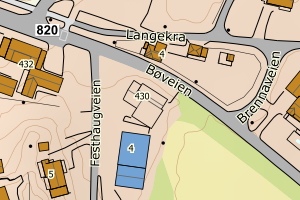
1867 Bø | 7c6a0ad1-eed9-43a6-a79b-207e52f3cea1 | Mønelinje | N: 7611221.25, Ø: 478658.88 | ![Kartbilde fra WMS-tjeneste av avviket](https://wms.geonorge.no/skwms1/wms.topo?VERSION=1.1.1&SERVICE=WMS&REQUEST=GetMap&LAYERS=topo&STYLES=&FORMAT=image/png&SRS=EPSG:25833&BBOX=478583.0,7611171,478733.0,7611271&WIDTH=300&HEIGHT=200) |
1867 Bø | dd67b8b2-ee18-432b-a528-704f3d73ad4a | Mønelinje | N: 7610720.91, Ø: 479240.33 | ![Kartbilde fra WMS-tjeneste av avviket](https://wms.geonorge.no/skwms1/wms.topo?VERSION=1.1.1&SERVICE=WMS&REQUEST=GetMap&LAYERS=topo&STYLES=&FORMAT=image/png&SRS=EPSG:25833&BBOX=479165.0,7610670,479315.0,7610770&WIDTH=300&HEIGHT=200) |
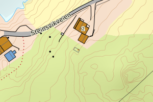
1867 Bø | 31f8905e-54d2-46b8-b976-68d9ed44cfcb | TaksprangBunn | N: 7611610.82, Ø: 478672.43 | ![Kartbilde fra WMS-tjeneste av avviket](https://wms.geonorge.no/skwms1/wms.topo?VERSION=1.1.1&SERVICE=WMS&REQUEST=GetMap&LAYERS=topo&STYLES=&FORMAT=image/png&SRS=EPSG:25833&BBOX=478597.0,7611560,478747.0,7611660&WIDTH=300&HEIGHT=200) |
1867 Bø | f74ffdbf-9c41-41ac-8682-92dbda29fbbb | TaksprangBunn | N: 7629711.72, Ø: 478518.30 | ![Kartbilde fra WMS-tjeneste av avviket](https://wms.geonorge.no/skwms1/wms.topo?VERSION=1.1.1&SERVICE=WMS&REQUEST=GetMap&LAYERS=topo&STYLES=&FORMAT=image/png&SRS=EPSG:25833&BBOX=478443.0,7629661,478593.0,7629761&WIDTH=300&HEIGHT=200) |
1867 Bø | a5a5c29d-b771-47bd-bb5f-ac1b265c2a83 | TaksprangBunn | N: 7612059.18, Ø: 477462.25 | ![Kartbilde fra WMS-tjeneste av avviket](https://wms.geonorge.no/skwms1/wms.topo?VERSION=1.1.1&SERVICE=WMS&REQUEST=GetMap&LAYERS=topo&STYLES=&FORMAT=image/png&SRS=EPSG:25833&BBOX=477387.0,7612009,477537.0,7612109&WIDTH=300&HEIGHT=200) |