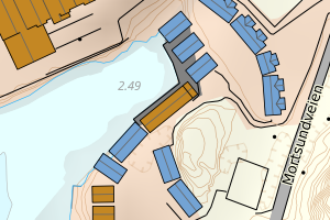
Avvikene skyldes oftest manglende eller unøyaktig registrering av bygningspunkt i matrikkelen. Rettes vanligvis i matrikkelen
Kommune | LokalId | Areal (m2) | Posisjon | WMS-bilde |
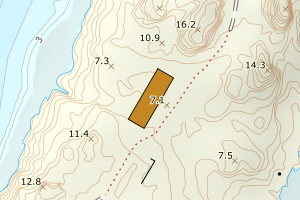
1860 Vestvågøy | 2905b057-acd9-4839-b574-b121f90feaa5 | 726.71 | N: 7570103.02, Ø: 448391.38 | ![Kartbilde fra WMS-tjeneste av avviket](https://wms.geonorge.no/skwms1/wms.topo?VERSION=1.1.1&SERVICE=WMS&REQUEST=GetMap&LAYERS=topo&STYLES=&FORMAT=image/png&SRS=EPSG:25833&BBOX=448316.0,7570053,448466.0,7570153&WIDTH=300&HEIGHT=200) |
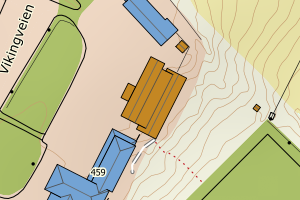
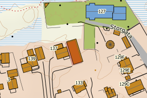
1860 Vestvågøy | de83a362-4559-4a55-ad9b-9ad5ee9ab97c | 296.90 | N: 7567937.42, Ø: 455414.10 | ![Kartbilde fra WMS-tjeneste av avviket](https://wms.geonorge.no/skwms1/wms.topo?VERSION=1.1.1&SERVICE=WMS&REQUEST=GetMap&LAYERS=topo&STYLES=&FORMAT=image/png&SRS=EPSG:25833&BBOX=455339.0,7567887,455489.0,7567987&WIDTH=300&HEIGHT=200) |
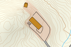
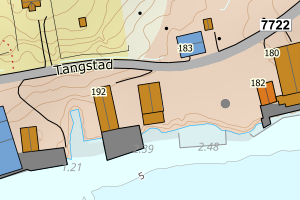
1860 Vestvågøy | 69bd65f0-3c71-428d-9988-f09c52401934 | 290.82 | N: 7574149.61, Ø: 463193.04 | ![Kartbilde fra WMS-tjeneste av avviket](https://wms.geonorge.no/skwms1/wms.topo?VERSION=1.1.1&SERVICE=WMS&REQUEST=GetMap&LAYERS=topo&STYLES=&FORMAT=image/png&SRS=EPSG:25833&BBOX=463118.0,7574099,463268.0,7574199&WIDTH=300&HEIGHT=200) |
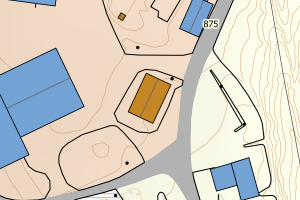
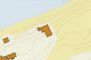
1860 Vestvågøy | a4f46ec9-f283-4cef-86be-5c226aebcea4 | 259.43 | N: 7563447.81, Ø: 440730.70 | ![Kartbilde fra WMS-tjeneste av avviket](https://wms.geonorge.no/skwms1/wms.topo?VERSION=1.1.1&SERVICE=WMS&REQUEST=GetMap&LAYERS=topo&STYLES=&FORMAT=image/png&SRS=EPSG:25833&BBOX=440655.0,7563397,440805.0,7563497&WIDTH=300&HEIGHT=200) |
1860 Vestvågøy | e5f4be1b-b24e-4a70-b2fb-76788fb78276 | 252.73 | N: 7559501.88, Ø: 442858.37 | ![Kartbilde fra WMS-tjeneste av avviket](https://wms.geonorge.no/skwms1/wms.topo?VERSION=1.1.1&SERVICE=WMS&REQUEST=GetMap&LAYERS=topo&STYLES=&FORMAT=image/png&SRS=EPSG:25833&BBOX=442783.0,7559451,442933.0,7559551&WIDTH=300&HEIGHT=200) |
1860 Vestvågøy | 73bc0d26-9e12-465a-9922-aff73d590e05 | 235.94 | N: 7561566.09, Ø: 441104.91 | ![Kartbilde fra WMS-tjeneste av avviket](https://wms.geonorge.no/skwms1/wms.topo?VERSION=1.1.1&SERVICE=WMS&REQUEST=GetMap&LAYERS=topo&STYLES=&FORMAT=image/png&SRS=EPSG:25833&BBOX=441029.0,7561516,441179.0,7561616&WIDTH=300&HEIGHT=200) |
1860 Vestvågøy | 6441d51f-a5af-4ac6-a95e-4775fdf49b7a | 230.50 | N: 7563621.54, Ø: 456783.14 | ![Kartbilde fra WMS-tjeneste av avviket](https://wms.geonorge.no/skwms1/wms.topo?VERSION=1.1.1&SERVICE=WMS&REQUEST=GetMap&LAYERS=topo&STYLES=&FORMAT=image/png&SRS=EPSG:25833&BBOX=456708.0,7563571,456858.0,7563671&WIDTH=300&HEIGHT=200) |
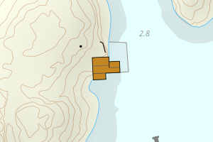
1860 Vestvågøy | 7436011c-2765-441f-a53a-fa0f9c8988a2 | 209.12 | N: 7559671.44, Ø: 451637.06 | ![Kartbilde fra WMS-tjeneste av avviket](https://wms.geonorge.no/skwms1/wms.topo?VERSION=1.1.1&SERVICE=WMS&REQUEST=GetMap&LAYERS=topo&STYLES=&FORMAT=image/png&SRS=EPSG:25833&BBOX=451562.0,7559621,451712.0,7559721&WIDTH=300&HEIGHT=200) |
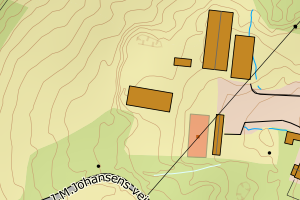
1860 Vestvågøy | 3e6d6e57-f4bc-42a6-9005-3a299c958190 | 206.20 | N: 7556659.12, Ø: 451816.11 | ![Kartbilde fra WMS-tjeneste av avviket](https://wms.geonorge.no/skwms1/wms.topo?VERSION=1.1.1&SERVICE=WMS&REQUEST=GetMap&LAYERS=topo&STYLES=&FORMAT=image/png&SRS=EPSG:25833&BBOX=451741.0,7556609,451891.0,7556709&WIDTH=300&HEIGHT=200) |
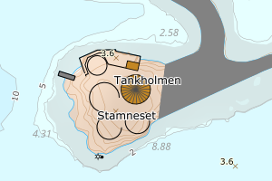
1860 Vestvågøy | 34ba2c6e-05d0-4104-9572-50253492a1ea | 202.16 | N: 7553006.09, Ø: 443172.86 | ![Kartbilde fra WMS-tjeneste av avviket](https://wms.geonorge.no/skwms1/wms.topo?VERSION=1.1.1&SERVICE=WMS&REQUEST=GetMap&LAYERS=topo&STYLES=&FORMAT=image/png&SRS=EPSG:25833&BBOX=443097.0,7552956,443247.0,7553056&WIDTH=300&HEIGHT=200) |