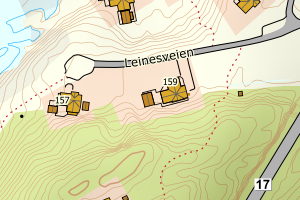
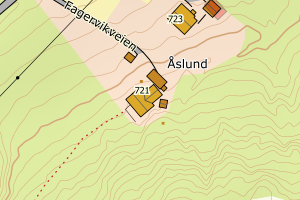
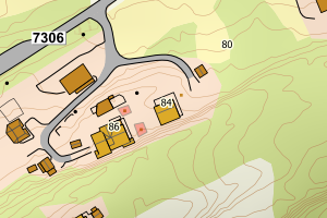
Avvikene skyldes enten feilregistrering i matrikkel eller manglende bygningsdelelinje i FKB-Bygning. Rettes i matrikkelen eller FKB-Bygning
Kommune | LokalId | Bygningsnummer (punkt) | Bygningsnummer (flate) | Posisjon | WMS-bilde |
1822 Leirfjord | 4e6a060f-f9f4-4a0a-84d0-fd4ef38ac1db | 187899990 | 187900018 | N: 7338366.00, Ø: 414273.00 | ![Kartbilde fra WMS-tjeneste av avviket](https://wms.geonorge.no/skwms1/wms.topo?VERSION=1.1.1&SERVICE=WMS&REQUEST=GetMap&LAYERS=topo&STYLES=&FORMAT=image/png&SRS=EPSG:25833&BBOX=414198.0,7338316,414348.0,7338416&WIDTH=300&HEIGHT=200) |
1822 Leirfjord | 7eb339e8-62e2-45bd-9f2b-bbac106aec4b | 11082769 | 11082777 | N: 7334858.00, Ø: 402074.00 | ![Kartbilde fra WMS-tjeneste av avviket](https://wms.geonorge.no/skwms1/wms.topo?VERSION=1.1.1&SERVICE=WMS&REQUEST=GetMap&LAYERS=topo&STYLES=&FORMAT=image/png&SRS=EPSG:25833&BBOX=401999.0,7334808,402149.0,7334908&WIDTH=300&HEIGHT=200) |
1822 Leirfjord | 0ebd81b2-5399-49bc-baa4-f3ed0d051aff | 20403888 | 20403853 | N: 7328522.00, Ø: 407335.00 | ![Kartbilde fra WMS-tjeneste av avviket](https://wms.geonorge.no/skwms1/wms.topo?VERSION=1.1.1&SERVICE=WMS&REQUEST=GetMap&LAYERS=topo&STYLES=&FORMAT=image/png&SRS=EPSG:25833&BBOX=407260.0,7328472,407410.0,7328572&WIDTH=300&HEIGHT=200) |
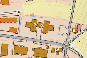
1822 Leirfjord | 0ebd81b2-5399-49bc-baa4-f3ed0d051aff | 20403888 | 20403861 | N: 7328522.00, Ø: 407335.00 | ![Kartbilde fra WMS-tjeneste av avviket](https://wms.geonorge.no/skwms1/wms.topo?VERSION=1.1.1&SERVICE=WMS&REQUEST=GetMap&LAYERS=topo&STYLES=&FORMAT=image/png&SRS=EPSG:25833&BBOX=407260.0,7328472,407410.0,7328572&WIDTH=300&HEIGHT=200) |
1822 Leirfjord | ff1aec66-b82d-4a52-b1fe-24a63ae297b6 | 300117115 | 300117115 | N: 7323630.00, Ø: 405601.00 | ![Kartbilde fra WMS-tjeneste av avviket](https://wms.geonorge.no/skwms1/wms.topo?VERSION=1.1.1&SERVICE=WMS&REQUEST=GetMap&LAYERS=topo&STYLES=&FORMAT=image/png&SRS=EPSG:25833&BBOX=405526.0,7323580,405676.0,7323680&WIDTH=300&HEIGHT=200) |
1822 Leirfjord | 5f994cfd-40ef-4fe7-b8ba-06d088726417 | 11082971 | 20406046 | N: 7325745.00, Ø: 394106.00 | ![Kartbilde fra WMS-tjeneste av avviket](https://wms.geonorge.no/skwms1/wms.topo?VERSION=1.1.1&SERVICE=WMS&REQUEST=GetMap&LAYERS=topo&STYLES=&FORMAT=image/png&SRS=EPSG:25833&BBOX=394031.0,7325695,394181.0,7325795&WIDTH=300&HEIGHT=200) |
1822 Leirfjord | 6907833e-a6e0-49b7-a383-69f6703c8fed | 20404981 | 20405783 | N: 7325633.00, Ø: 394041.00 | ![Kartbilde fra WMS-tjeneste av avviket](https://wms.geonorge.no/skwms1/wms.topo?VERSION=1.1.1&SERVICE=WMS&REQUEST=GetMap&LAYERS=topo&STYLES=&FORMAT=image/png&SRS=EPSG:25833&BBOX=393966.0,7325583,394116.0,7325683&WIDTH=300&HEIGHT=200) |
1822 Leirfjord | b6e74ae7-8af4-4756-b035-210b6b0dca65 | 20403861 | 20403853 | N: 7328522.00, Ø: 407335.00 | ![Kartbilde fra WMS-tjeneste av avviket](https://wms.geonorge.no/skwms1/wms.topo?VERSION=1.1.1&SERVICE=WMS&REQUEST=GetMap&LAYERS=topo&STYLES=&FORMAT=image/png&SRS=EPSG:25833&BBOX=407260.0,7328472,407410.0,7328572&WIDTH=300&HEIGHT=200) |
1822 Leirfjord | b6e74ae7-8af4-4756-b035-210b6b0dca65 | 20403861 | 20403861 | N: 7328522.00, Ø: 407335.00 | ![Kartbilde fra WMS-tjeneste av avviket](https://wms.geonorge.no/skwms1/wms.topo?VERSION=1.1.1&SERVICE=WMS&REQUEST=GetMap&LAYERS=topo&STYLES=&FORMAT=image/png&SRS=EPSG:25833&BBOX=407260.0,7328472,407410.0,7328572&WIDTH=300&HEIGHT=200) |
1822 Leirfjord | 19fbbae1-c23b-446b-9b69-c182164def6c | 20405783 | 20405783 | N: 7325633.00, Ø: 394041.00 | ![Kartbilde fra WMS-tjeneste av avviket](https://wms.geonorge.no/skwms1/wms.topo?VERSION=1.1.1&SERVICE=WMS&REQUEST=GetMap&LAYERS=topo&STYLES=&FORMAT=image/png&SRS=EPSG:25833&BBOX=393966.0,7325583,394116.0,7325683&WIDTH=300&HEIGHT=200) |
1822 Leirfjord | cb88b6c5-7340-4852-a021-2489c76d973e | 20406046 | 20406046 | N: 7325745.00, Ø: 394106.00 | ![Kartbilde fra WMS-tjeneste av avviket](https://wms.geonorge.no/skwms1/wms.topo?VERSION=1.1.1&SERVICE=WMS&REQUEST=GetMap&LAYERS=topo&STYLES=&FORMAT=image/png&SRS=EPSG:25833&BBOX=394031.0,7325695,394181.0,7325795&WIDTH=300&HEIGHT=200) |
1822 Leirfjord | 91f4e764-8f12-4f42-94f9-8e57cffe3a86 | 11081207 | 11081207 | N: 7327917.00, Ø: 396960.00 | ![Kartbilde fra WMS-tjeneste av avviket](https://wms.geonorge.no/skwms1/wms.topo?VERSION=1.1.1&SERVICE=WMS&REQUEST=GetMap&LAYERS=topo&STYLES=&FORMAT=image/png&SRS=EPSG:25833&BBOX=396885.0,7327867,397035.0,7327967&WIDTH=300&HEIGHT=200) |
1822 Leirfjord | 91f4e764-8f12-4f42-94f9-8e57cffe3a86 | 11081207 | 11082963 | N: 7327917.00, Ø: 396960.00 | ![Kartbilde fra WMS-tjeneste av avviket](https://wms.geonorge.no/skwms1/wms.topo?VERSION=1.1.1&SERVICE=WMS&REQUEST=GetMap&LAYERS=topo&STYLES=&FORMAT=image/png&SRS=EPSG:25833&BBOX=396885.0,7327867,397035.0,7327967&WIDTH=300&HEIGHT=200) |
1822 Leirfjord | ac42402d-ee1e-43c5-8e08-ec782ad8561d | 20403888 | 20403853 | N: 7328522.00, Ø: 407335.00 | ![Kartbilde fra WMS-tjeneste av avviket](https://wms.geonorge.no/skwms1/wms.topo?VERSION=1.1.1&SERVICE=WMS&REQUEST=GetMap&LAYERS=topo&STYLES=&FORMAT=image/png&SRS=EPSG:25833&BBOX=407260.0,7328472,407410.0,7328572&WIDTH=300&HEIGHT=200) |
1822 Leirfjord | ac42402d-ee1e-43c5-8e08-ec782ad8561d | 20403888 | 20403861 | N: 7328522.00, Ø: 407335.00 | ![Kartbilde fra WMS-tjeneste av avviket](https://wms.geonorge.no/skwms1/wms.topo?VERSION=1.1.1&SERVICE=WMS&REQUEST=GetMap&LAYERS=topo&STYLES=&FORMAT=image/png&SRS=EPSG:25833&BBOX=407260.0,7328472,407410.0,7328572&WIDTH=300&HEIGHT=200) |
1822 Leirfjord | a6dd2507-7b03-478f-9d36-b147eacceec4 | 11082769 | 11082777 | N: 7334858.00, Ø: 402074.00 | ![Kartbilde fra WMS-tjeneste av avviket](https://wms.geonorge.no/skwms1/wms.topo?VERSION=1.1.1&SERVICE=WMS&REQUEST=GetMap&LAYERS=topo&STYLES=&FORMAT=image/png&SRS=EPSG:25833&BBOX=401999.0,7334808,402149.0,7334908&WIDTH=300&HEIGHT=200) |
1822 Leirfjord | 134bdc51-4bfa-4871-bd62-13ac8cb74c11 | 11082777 | 11082777 | N: 7334858.00, Ø: 402074.00 | ![Kartbilde fra WMS-tjeneste av avviket](https://wms.geonorge.no/skwms1/wms.topo?VERSION=1.1.1&SERVICE=WMS&REQUEST=GetMap&LAYERS=topo&STYLES=&FORMAT=image/png&SRS=EPSG:25833&BBOX=401999.0,7334808,402149.0,7334908&WIDTH=300&HEIGHT=200) |
1822 Leirfjord | cd29c153-c96a-4f1c-875b-6512ecc77630 | 20404760 | 11082777 | N: 7334858.00, Ø: 402074.00 | ![Kartbilde fra WMS-tjeneste av avviket](https://wms.geonorge.no/skwms1/wms.topo?VERSION=1.1.1&SERVICE=WMS&REQUEST=GetMap&LAYERS=topo&STYLES=&FORMAT=image/png&SRS=EPSG:25833&BBOX=401999.0,7334808,402149.0,7334908&WIDTH=300&HEIGHT=200) |
1822 Leirfjord | 951d73bb-1758-496f-8656-4e1e3467b736 | 187890071 | 187890101 | N: 7327616.00, Ø: 401418.00 | ![Kartbilde fra WMS-tjeneste av avviket](https://wms.geonorge.no/skwms1/wms.topo?VERSION=1.1.1&SERVICE=WMS&REQUEST=GetMap&LAYERS=topo&STYLES=&FORMAT=image/png&SRS=EPSG:25833&BBOX=401343.0,7327566,401493.0,7327666&WIDTH=300&HEIGHT=200) |
1822 Leirfjord | e3a27f28-88b7-4bab-a073-45ceba9a3650 | 187894956 | 187894948 | N: 7344822.50, Ø: 427014.30 | ![Kartbilde fra WMS-tjeneste av avviket](https://wms.geonorge.no/skwms1/wms.topo?VERSION=1.1.1&SERVICE=WMS&REQUEST=GetMap&LAYERS=topo&STYLES=&FORMAT=image/png&SRS=EPSG:25833&BBOX=426939.0,7344772,427089.0,7344872&WIDTH=300&HEIGHT=200) |