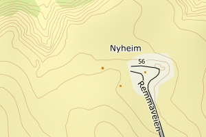
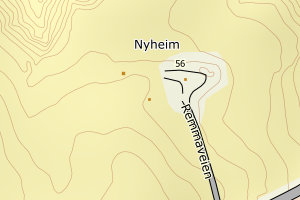
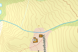
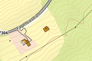
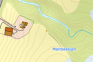
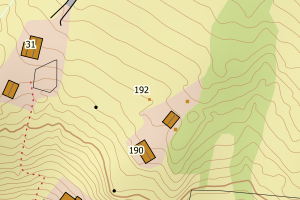
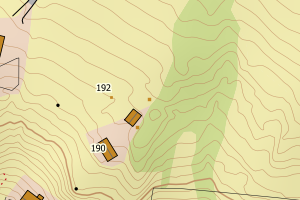
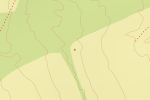
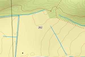
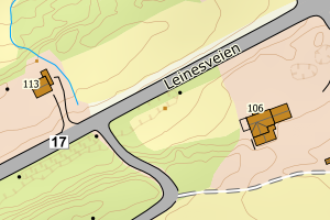
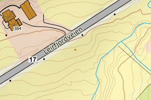
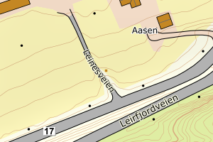
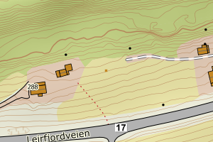
Avvikene kan skyldes enten feil bygningskoordinat eller bygningstype/status i matrikkel eller feil arealtype i AR5. Vær oppmerksom på det er krav om arealer på over 200 m2 før det er krav om endring av arealtype i AR5 så avvikene vil ikke alltid kreve retting i datagrunnlaget
Kommune | LokalId | Bygningsnummer | Arealtype | Bygningstatus | Bygningstype | matrikkel_vedtaksdato | Posisjon | WMS-bilde |
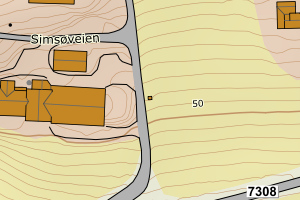
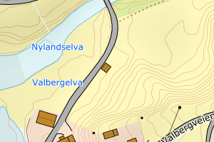
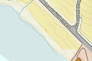
1822 Leirfjord | edd8fe56-3cf3-4d13-a697-a1e2b336de3b | 187917425 | 21 | TB | 241 | None | N: 7329187.00, Ø: 408816.00 | ![Kartbilde fra WMS-tjeneste av avviket](https://wms.geonorge.no/skwms1/wms.topo?VERSION=1.1.1&SERVICE=WMS&REQUEST=GetMap&LAYERS=topo&STYLES=&FORMAT=image/png&SRS=EPSG:25833&BBOX=408741.0,7329137,408891.0,7329237&WIDTH=300&HEIGHT=200) |
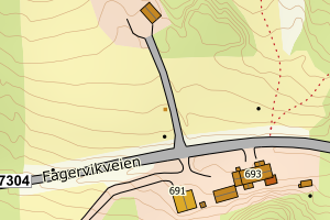
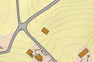
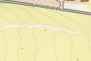
1822 Leirfjord | a52c9ea5-0211-4746-b93f-6936f80a26d9 | 187891752 | 21 | TB | 241 | None | N: 7327450.00, Ø: 397535.00 | ![Kartbilde fra WMS-tjeneste av avviket](https://wms.geonorge.no/skwms1/wms.topo?VERSION=1.1.1&SERVICE=WMS&REQUEST=GetMap&LAYERS=topo&STYLES=&FORMAT=image/png&SRS=EPSG:25833&BBOX=397460.0,7327400,397610.0,7327500&WIDTH=300&HEIGHT=200) |
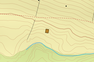
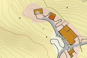
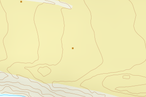
1822 Leirfjord | fde23de1-c80a-40be-920a-1cdf5dacb9a6 | 187913683 | 21 | TB | 249 | None | N: 7330039.00, Ø: 407013.00 | ![Kartbilde fra WMS-tjeneste av avviket](https://wms.geonorge.no/skwms1/wms.topo?VERSION=1.1.1&SERVICE=WMS&REQUEST=GetMap&LAYERS=topo&STYLES=&FORMAT=image/png&SRS=EPSG:25833&BBOX=406938.0,7329989,407088.0,7330089&WIDTH=300&HEIGHT=200) |
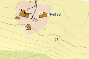
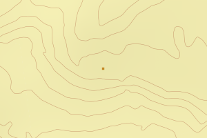
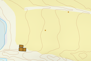
1822 Leirfjord | 636ccff2-a303-4cd9-994b-58b062b79c03 | 187918405 | 21 | TB | 241 | None | N: 7326801.50, Ø: 395987.30 | ![Kartbilde fra WMS-tjeneste av avviket](https://wms.geonorge.no/skwms1/wms.topo?VERSION=1.1.1&SERVICE=WMS&REQUEST=GetMap&LAYERS=topo&STYLES=&FORMAT=image/png&SRS=EPSG:25833&BBOX=395912.0,7326751,396062.0,7326851&WIDTH=300&HEIGHT=200) |
1822 Leirfjord | 87b1b9b8-5532-42a5-813b-cc6ae3311650 | 187913861 | 21 | TB | 241 | None | N: 7330044.00, Ø: 410765.00 | ![Kartbilde fra WMS-tjeneste av avviket](https://wms.geonorge.no/skwms1/wms.topo?VERSION=1.1.1&SERVICE=WMS&REQUEST=GetMap&LAYERS=topo&STYLES=&FORMAT=image/png&SRS=EPSG:25833&BBOX=410690.0,7329994,410840.0,7330094&WIDTH=300&HEIGHT=200) |
1822 Leirfjord | a7d9ed77-f253-4844-98ac-004f2cb53409 | 187891795 | 21 | TB | 241 | None | N: 7327492.00, Ø: 397681.00 | ![Kartbilde fra WMS-tjeneste av avviket](https://wms.geonorge.no/skwms1/wms.topo?VERSION=1.1.1&SERVICE=WMS&REQUEST=GetMap&LAYERS=topo&STYLES=&FORMAT=image/png&SRS=EPSG:25833&BBOX=397606.0,7327442,397756.0,7327542&WIDTH=300&HEIGHT=200) |
1822 Leirfjord | a756abc3-68bf-4356-ad10-2efb6e599962 | 187911257 | 21 | TB | 249 | None | N: 7325604.70, Ø: 407293.40 | ![Kartbilde fra WMS-tjeneste av avviket](https://wms.geonorge.no/skwms1/wms.topo?VERSION=1.1.1&SERVICE=WMS&REQUEST=GetMap&LAYERS=topo&STYLES=&FORMAT=image/png&SRS=EPSG:25833&BBOX=407218.0,7325554,407368.0,7325654&WIDTH=300&HEIGHT=200) |
1822 Leirfjord | 3a0ab1de-15b9-4b3a-a66e-c26f4b02a8a9 | 187911559 | 21 | TB | 241 | None | N: 7325756.00, Ø: 407127.00 | ![Kartbilde fra WMS-tjeneste av avviket](https://wms.geonorge.no/skwms1/wms.topo?VERSION=1.1.1&SERVICE=WMS&REQUEST=GetMap&LAYERS=topo&STYLES=&FORMAT=image/png&SRS=EPSG:25833&BBOX=407052.0,7325706,407202.0,7325806&WIDTH=300&HEIGHT=200) |
1822 Leirfjord | d4a59ab5-3b05-47d9-9873-2b1001f76498 | 187894794 | 21 | TB | 249 | None | N: 7345154.00, Ø: 428245.00 | ![Kartbilde fra WMS-tjeneste av avviket](https://wms.geonorge.no/skwms1/wms.topo?VERSION=1.1.1&SERVICE=WMS&REQUEST=GetMap&LAYERS=topo&STYLES=&FORMAT=image/png&SRS=EPSG:25833&BBOX=428170.0,7345104,428320.0,7345204&WIDTH=300&HEIGHT=200) |
1822 Leirfjord | a77d8367-abbf-4494-9e53-9bea65d75ce2 | 187898986 | 21 | TB | 241 | None | N: 7334290.40, Ø: 401412.20 | ![Kartbilde fra WMS-tjeneste av avviket](https://wms.geonorge.no/skwms1/wms.topo?VERSION=1.1.1&SERVICE=WMS&REQUEST=GetMap&LAYERS=topo&STYLES=&FORMAT=image/png&SRS=EPSG:25833&BBOX=401337.0,7334240,401487.0,7334340&WIDTH=300&HEIGHT=200) |
1822 Leirfjord | 0b065349-91f8-4988-98b1-e86f5ad4dd2c | 187904889 | 21 | TB | 249 | None | N: 7330693.00, Ø: 413284.00 | ![Kartbilde fra WMS-tjeneste av avviket](https://wms.geonorge.no/skwms1/wms.topo?VERSION=1.1.1&SERVICE=WMS&REQUEST=GetMap&LAYERS=topo&STYLES=&FORMAT=image/png&SRS=EPSG:25833&BBOX=413209.0,7330643,413359.0,7330743&WIDTH=300&HEIGHT=200) |
1822 Leirfjord | 5b381b36-9940-42d8-a4fa-327d9aea57c5 | 187899710 | 21 | TB | 241 | None | N: 7341484.00, Ø: 420244.00 | ![Kartbilde fra WMS-tjeneste av avviket](https://wms.geonorge.no/skwms1/wms.topo?VERSION=1.1.1&SERVICE=WMS&REQUEST=GetMap&LAYERS=topo&STYLES=&FORMAT=image/png&SRS=EPSG:25833&BBOX=420169.0,7341434,420319.0,7341534&WIDTH=300&HEIGHT=200) |
1822 Leirfjord | a581ce15-1ed1-4e78-ad2d-af2ddb02d585 | 187894336 | 21 | TB | 249 | None | N: 7344616.00, Ø: 427888.00 | ![Kartbilde fra WMS-tjeneste av avviket](https://wms.geonorge.no/skwms1/wms.topo?VERSION=1.1.1&SERVICE=WMS&REQUEST=GetMap&LAYERS=topo&STYLES=&FORMAT=image/png&SRS=EPSG:25833&BBOX=427813.0,7344566,427963.0,7344666&WIDTH=300&HEIGHT=200) |
1822 Leirfjord | a70ae1b4-aa1a-4d30-b5ca-34e473a50942 | 187902487 | 21 | TB | 249 | None | N: 7332580.00, Ø: 413128.00 | ![Kartbilde fra WMS-tjeneste av avviket](https://wms.geonorge.no/skwms1/wms.topo?VERSION=1.1.1&SERVICE=WMS&REQUEST=GetMap&LAYERS=topo&STYLES=&FORMAT=image/png&SRS=EPSG:25833&BBOX=413053.0,7332530,413203.0,7332630&WIDTH=300&HEIGHT=200) |
1822 Leirfjord | c9f90339-ddec-41e9-bf5d-a26beed30a2b | 187917875 | 21 | TB | 113 | None | N: 7323765.00, Ø: 406994.00 | ![Kartbilde fra WMS-tjeneste av avviket](https://wms.geonorge.no/skwms1/wms.topo?VERSION=1.1.1&SERVICE=WMS&REQUEST=GetMap&LAYERS=topo&STYLES=&FORMAT=image/png&SRS=EPSG:25833&BBOX=406919.0,7323715,407069.0,7323815&WIDTH=300&HEIGHT=200) |
1822 Leirfjord | e8f3b023-23c7-4516-b688-bc03f98d35eb | 187908655 | 21 | TB | 249 | None | N: 7322761.00, Ø: 404016.00 | ![Kartbilde fra WMS-tjeneste av avviket](https://wms.geonorge.no/skwms1/wms.topo?VERSION=1.1.1&SERVICE=WMS&REQUEST=GetMap&LAYERS=topo&STYLES=&FORMAT=image/png&SRS=EPSG:25833&BBOX=403941.0,7322711,404091.0,7322811&WIDTH=300&HEIGHT=200) |
1822 Leirfjord | eb54fdf5-e0f3-4519-b814-ad6f1320aeec | 187911141 | 21 | TB | 183 | None | N: 7322746.00, Ø: 406990.00 | ![Kartbilde fra WMS-tjeneste av avviket](https://wms.geonorge.no/skwms1/wms.topo?VERSION=1.1.1&SERVICE=WMS&REQUEST=GetMap&LAYERS=topo&STYLES=&FORMAT=image/png&SRS=EPSG:25833&BBOX=406915.0,7322696,407065.0,7322796&WIDTH=300&HEIGHT=200) |
1822 Leirfjord | eb7777aa-b45f-4f32-85c8-71ada38b2be9 | 187918251 | 21 | TB | 249 | None | N: 7323516.00, Ø: 404342.00 | ![Kartbilde fra WMS-tjeneste av avviket](https://wms.geonorge.no/skwms1/wms.topo?VERSION=1.1.1&SERVICE=WMS&REQUEST=GetMap&LAYERS=topo&STYLES=&FORMAT=image/png&SRS=EPSG:25833&BBOX=404267.0,7323466,404417.0,7323566&WIDTH=300&HEIGHT=200) |
1822 Leirfjord | 4936ce80-67fe-4efc-8a99-459a9c82499e | 187919037 | 21 | TB | 241 | None | N: 7345165.00, Ø: 427875.00 | ![Kartbilde fra WMS-tjeneste av avviket](https://wms.geonorge.no/skwms1/wms.topo?VERSION=1.1.1&SERVICE=WMS&REQUEST=GetMap&LAYERS=topo&STYLES=&FORMAT=image/png&SRS=EPSG:25833&BBOX=427800.0,7345115,427950.0,7345215&WIDTH=300&HEIGHT=200) |
1822 Leirfjord | 60ae1e19-cc81-4e49-baca-0eb674537309 | 187918626 | 21 | TB | 241 | None | N: 7327588.00, Ø: 402019.00 | ![Kartbilde fra WMS-tjeneste av avviket](https://wms.geonorge.no/skwms1/wms.topo?VERSION=1.1.1&SERVICE=WMS&REQUEST=GetMap&LAYERS=topo&STYLES=&FORMAT=image/png&SRS=EPSG:25833&BBOX=401944.0,7327538,402094.0,7327638&WIDTH=300&HEIGHT=200) |
1822 Leirfjord | bd0d10ed-0a7a-486e-924c-718636c3622c | 187918596 | 21 | TB | 241 | None | N: 7327540.00, Ø: 402072.00 | ![Kartbilde fra WMS-tjeneste av avviket](https://wms.geonorge.no/skwms1/wms.topo?VERSION=1.1.1&SERVICE=WMS&REQUEST=GetMap&LAYERS=topo&STYLES=&FORMAT=image/png&SRS=EPSG:25833&BBOX=401997.0,7327490,402147.0,7327590&WIDTH=300&HEIGHT=200) |
1822 Leirfjord | d453844b-308a-4214-a8a6-fb22d5107b86 | 187918677 | 21 | TB | 241 | None | N: 7329175.00, Ø: 401451.00 | ![Kartbilde fra WMS-tjeneste av avviket](https://wms.geonorge.no/skwms1/wms.topo?VERSION=1.1.1&SERVICE=WMS&REQUEST=GetMap&LAYERS=topo&STYLES=&FORMAT=image/png&SRS=EPSG:25833&BBOX=401376.0,7329125,401526.0,7329225&WIDTH=300&HEIGHT=200) |
1822 Leirfjord | d4b89d5d-9c84-49a5-9a16-130367a7e7e7 | 187918618 | 21 | TB | 241 | None | N: 7327558.00, Ø: 401981.00 | ![Kartbilde fra WMS-tjeneste av avviket](https://wms.geonorge.no/skwms1/wms.topo?VERSION=1.1.1&SERVICE=WMS&REQUEST=GetMap&LAYERS=topo&STYLES=&FORMAT=image/png&SRS=EPSG:25833&BBOX=401906.0,7327508,402056.0,7327608&WIDTH=300&HEIGHT=200) |
1822 Leirfjord | 4fc99296-bbd3-4368-b833-fe0f23f6a327 | 187917336 | 21 | TB | 113 | None | N: 7329315.00, Ø: 408244.00 | ![Kartbilde fra WMS-tjeneste av avviket](https://wms.geonorge.no/skwms1/wms.topo?VERSION=1.1.1&SERVICE=WMS&REQUEST=GetMap&LAYERS=topo&STYLES=&FORMAT=image/png&SRS=EPSG:25833&BBOX=408169.0,7329265,408319.0,7329365&WIDTH=300&HEIGHT=200) |
1822 Leirfjord | 8b1d022a-c93e-4493-a65b-b354d0bfa240 | 301127401 | 21 | FA | 181 | 2024-07-08 | N: 7323169.40, Ø: 404134.80 | ![Kartbilde fra WMS-tjeneste av avviket](https://wms.geonorge.no/skwms1/wms.topo?VERSION=1.1.1&SERVICE=WMS&REQUEST=GetMap&LAYERS=topo&STYLES=&FORMAT=image/png&SRS=EPSG:25833&BBOX=404059.0,7323119,404209.0,7323219&WIDTH=300&HEIGHT=200) |
1822 Leirfjord | e411e0c8-7e4e-4245-bf7f-8d69a0491218 | 301132927 | 21 | MB | 161 | 2022-11-23 | N: 7319398.60, Ø: 399843.30 | ![Kartbilde fra WMS-tjeneste av avviket](https://wms.geonorge.no/skwms1/wms.topo?VERSION=1.1.1&SERVICE=WMS&REQUEST=GetMap&LAYERS=topo&STYLES=&FORMAT=image/png&SRS=EPSG:25833&BBOX=399768.0,7319348,399918.0,7319448&WIDTH=300&HEIGHT=200) |
1822 Leirfjord | a3dc863c-5679-48d9-8dce-feeea7c1f473 | 20403527 | 21 | TB | 999 | 1998-07-25 | N: 7329676.70, Ø: 403942.30 | ![Kartbilde fra WMS-tjeneste av avviket](https://wms.geonorge.no/skwms1/wms.topo?VERSION=1.1.1&SERVICE=WMS&REQUEST=GetMap&LAYERS=topo&STYLES=&FORMAT=image/png&SRS=EPSG:25833&BBOX=403867.0,7329626,404017.0,7329726&WIDTH=300&HEIGHT=200) |