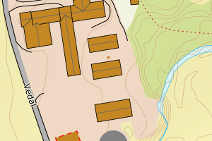
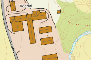
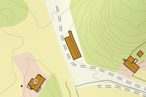
Avvikene skyldes oftest manglende eller unøyaktig registrering av bygningspunkt i matrikkelen. Rettes vanligvis i matrikkelen
Kommune | LokalId | Areal (m2) | Posisjon | WMS-bilde |
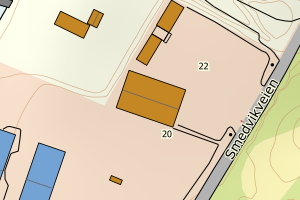
1813 Brønnøy | d7599c17-f756-4e7e-9d9f-ab018d7ca30e | 1952.45 | N: 7264145.44, Ø: 368067.68 | ![Kartbilde fra WMS-tjeneste av avviket](https://wms.geonorge.no/skwms1/wms.topo?VERSION=1.1.1&SERVICE=WMS&REQUEST=GetMap&LAYERS=topo&STYLES=&FORMAT=image/png&SRS=EPSG:25833&BBOX=367992.0,7264095,368142.0,7264195&WIDTH=300&HEIGHT=200) |
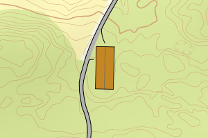
1813 Brønnøy | 18246177-da0e-4418-ad84-eef3d74d6285 | 874.27 | N: 7264023.85, Ø: 377672.63 | ![Kartbilde fra WMS-tjeneste av avviket](https://wms.geonorge.no/skwms1/wms.topo?VERSION=1.1.1&SERVICE=WMS&REQUEST=GetMap&LAYERS=topo&STYLES=&FORMAT=image/png&SRS=EPSG:25833&BBOX=377597.0,7263973,377747.0,7264073&WIDTH=300&HEIGHT=200) |
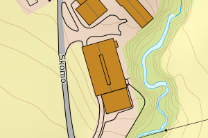
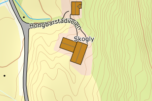
1813 Brønnøy | 913fb2b5-0894-4d60-ae6f-243293c97345 | 794.04 | N: 7260727.31, Ø: 376249.84 | ![Kartbilde fra WMS-tjeneste av avviket](https://wms.geonorge.no/skwms1/wms.topo?VERSION=1.1.1&SERVICE=WMS&REQUEST=GetMap&LAYERS=topo&STYLES=&FORMAT=image/png&SRS=EPSG:25833&BBOX=376174.0,7260677,376324.0,7260777&WIDTH=300&HEIGHT=200) |
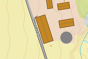
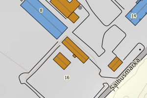
1813 Brønnøy | a1b6b858-ccb1-4a4c-9462-eb604c381100 | 589.75 | N: 7266731.31, Ø: 375807.92 | ![Kartbilde fra WMS-tjeneste av avviket](https://wms.geonorge.no/skwms1/wms.topo?VERSION=1.1.1&SERVICE=WMS&REQUEST=GetMap&LAYERS=topo&STYLES=&FORMAT=image/png&SRS=EPSG:25833&BBOX=375732.0,7266681,375882.0,7266781&WIDTH=300&HEIGHT=200) |
1813 Brønnøy | 42c50b6b-9668-41ff-9f9c-847c7c8baacd | 436.52 | N: 7257689.76, Ø: 370291.74 | ![Kartbilde fra WMS-tjeneste av avviket](https://wms.geonorge.no/skwms1/wms.topo?VERSION=1.1.1&SERVICE=WMS&REQUEST=GetMap&LAYERS=topo&STYLES=&FORMAT=image/png&SRS=EPSG:25833&BBOX=370216.0,7257639,370366.0,7257739&WIDTH=300&HEIGHT=200) |
1813 Brønnøy | 5dfd70bf-b772-48aa-a5dc-a1278bf0fb2e | 436.16 | N: 7270906.43, Ø: 373894.82 | ![Kartbilde fra WMS-tjeneste av avviket](https://wms.geonorge.no/skwms1/wms.topo?VERSION=1.1.1&SERVICE=WMS&REQUEST=GetMap&LAYERS=topo&STYLES=&FORMAT=image/png&SRS=EPSG:25833&BBOX=373819.0,7270856,373969.0,7270956&WIDTH=300&HEIGHT=200) |
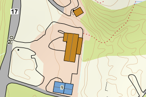
1813 Brønnøy | 385f1da1-357d-40cb-8e2a-b1633c5e1dd0 | 401.77 | N: 7264287.15, Ø: 378224.84 | ![Kartbilde fra WMS-tjeneste av avviket](https://wms.geonorge.no/skwms1/wms.topo?VERSION=1.1.1&SERVICE=WMS&REQUEST=GetMap&LAYERS=topo&STYLES=&FORMAT=image/png&SRS=EPSG:25833&BBOX=378149.0,7264237,378299.0,7264337&WIDTH=300&HEIGHT=200) |
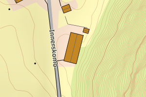
1813 Brønnøy | adfa91e0-2408-42c7-8c66-7d8e3d62d093 | 399.54 | N: 7248326.57, Ø: 383660.88 | ![Kartbilde fra WMS-tjeneste av avviket](https://wms.geonorge.no/skwms1/wms.topo?VERSION=1.1.1&SERVICE=WMS&REQUEST=GetMap&LAYERS=topo&STYLES=&FORMAT=image/png&SRS=EPSG:25833&BBOX=383585.0,7248276,383735.0,7248376&WIDTH=300&HEIGHT=200) |
1813 Brønnøy | 46c37ad7-a92c-4c39-88ab-a452bcf546d5 | 380.28 | N: 7238251.26, Ø: 392949.43 | ![Kartbilde fra WMS-tjeneste av avviket](https://wms.geonorge.no/skwms1/wms.topo?VERSION=1.1.1&SERVICE=WMS&REQUEST=GetMap&LAYERS=topo&STYLES=&FORMAT=image/png&SRS=EPSG:25833&BBOX=392874.0,7238201,393024.0,7238301&WIDTH=300&HEIGHT=200) |
1813 Brønnøy | 48158bf2-8e90-42dd-bfbb-3cea971ff464 | 367.77 | N: 7255569.64, Ø: 386248.99 | ![Kartbilde fra WMS-tjeneste av avviket](https://wms.geonorge.no/skwms1/wms.topo?VERSION=1.1.1&SERVICE=WMS&REQUEST=GetMap&LAYERS=topo&STYLES=&FORMAT=image/png&SRS=EPSG:25833&BBOX=386173.0,7255519,386323.0,7255619&WIDTH=300&HEIGHT=200) |
1813 Brønnøy | bf45fe43-9ce3-4505-b723-2abf1e788439 | 319.88 | N: 7271789.15, Ø: 373163.81 | ![Kartbilde fra WMS-tjeneste av avviket](https://wms.geonorge.no/skwms1/wms.topo?VERSION=1.1.1&SERVICE=WMS&REQUEST=GetMap&LAYERS=topo&STYLES=&FORMAT=image/png&SRS=EPSG:25833&BBOX=373088.0,7271739,373238.0,7271839&WIDTH=300&HEIGHT=200) |
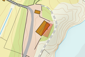
1813 Brønnøy | c9435346-e1d3-419f-9e98-4b133c23b0ed | 311.51 | N: 7273810.62, Ø: 376369.51 | ![Kartbilde fra WMS-tjeneste av avviket](https://wms.geonorge.no/skwms1/wms.topo?VERSION=1.1.1&SERVICE=WMS&REQUEST=GetMap&LAYERS=topo&STYLES=&FORMAT=image/png&SRS=EPSG:25833&BBOX=376294.0,7273760,376444.0,7273860&WIDTH=300&HEIGHT=200) |
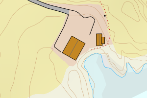
1813 Brønnøy | 8ea5787a-6277-4873-bb57-be0caeebab62 | 300.15 | N: 7258090.78, Ø: 387026.65 | ![Kartbilde fra WMS-tjeneste av avviket](https://wms.geonorge.no/skwms1/wms.topo?VERSION=1.1.1&SERVICE=WMS&REQUEST=GetMap&LAYERS=topo&STYLES=&FORMAT=image/png&SRS=EPSG:25833&BBOX=386951.0,7258040,387101.0,7258140&WIDTH=300&HEIGHT=200) |
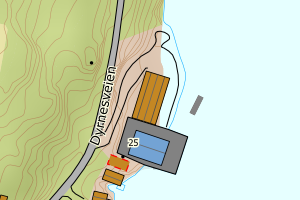
1813 Brønnøy | 341739b5-fb7a-4f66-b0d1-e5e64d69d9c0 | 300.12 | N: 7248230.92, Ø: 384531.73 | ![Kartbilde fra WMS-tjeneste av avviket](https://wms.geonorge.no/skwms1/wms.topo?VERSION=1.1.1&SERVICE=WMS&REQUEST=GetMap&LAYERS=topo&STYLES=&FORMAT=image/png&SRS=EPSG:25833&BBOX=384456.0,7248180,384606.0,7248280&WIDTH=300&HEIGHT=200) |
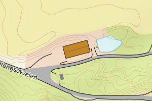
1813 Brønnøy | 6661e21c-f3cb-4af1-abe9-c7d7fc3ca21d | 284.56 | N: 7256012.62, Ø: 372961.36 | ![Kartbilde fra WMS-tjeneste av avviket](https://wms.geonorge.no/skwms1/wms.topo?VERSION=1.1.1&SERVICE=WMS&REQUEST=GetMap&LAYERS=topo&STYLES=&FORMAT=image/png&SRS=EPSG:25833&BBOX=372886.0,7255962,373036.0,7256062&WIDTH=300&HEIGHT=200) |
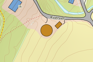
1813 Brønnøy | 57931338-c064-4a2e-bdf8-1865c52ddd71 | 276.53 | N: 7250151.11, Ø: 384625.01 | ![Kartbilde fra WMS-tjeneste av avviket](https://wms.geonorge.no/skwms1/wms.topo?VERSION=1.1.1&SERVICE=WMS&REQUEST=GetMap&LAYERS=topo&STYLES=&FORMAT=image/png&SRS=EPSG:25833&BBOX=384550.0,7250101,384700.0,7250201&WIDTH=300&HEIGHT=200) |
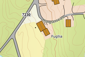
1813 Brønnøy | ee1fdf29-714c-4ca2-8100-58e06d960dfc | 271.93 | N: 7263999.76, Ø: 377681.18 | ![Kartbilde fra WMS-tjeneste av avviket](https://wms.geonorge.no/skwms1/wms.topo?VERSION=1.1.1&SERVICE=WMS&REQUEST=GetMap&LAYERS=topo&STYLES=&FORMAT=image/png&SRS=EPSG:25833&BBOX=377606.0,7263949,377756.0,7264049&WIDTH=300&HEIGHT=200) |
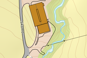
1813 Brønnøy | 080f0798-102a-41bc-82de-d8a55361e4d1 | 267.82 | N: 7275373.22, Ø: 376164.13 | ![Kartbilde fra WMS-tjeneste av avviket](https://wms.geonorge.no/skwms1/wms.topo?VERSION=1.1.1&SERVICE=WMS&REQUEST=GetMap&LAYERS=topo&STYLES=&FORMAT=image/png&SRS=EPSG:25833&BBOX=376089.0,7275323,376239.0,7275423&WIDTH=300&HEIGHT=200) |
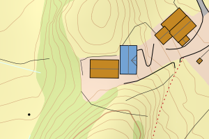
1813 Brønnøy | 7417e119-e176-4f6d-8402-24c7d3d757dd | 262.18 | N: 7246505.41, Ø: 403049.38 | ![Kartbilde fra WMS-tjeneste av avviket](https://wms.geonorge.no/skwms1/wms.topo?VERSION=1.1.1&SERVICE=WMS&REQUEST=GetMap&LAYERS=topo&STYLES=&FORMAT=image/png&SRS=EPSG:25833&BBOX=402974.0,7246455,403124.0,7246555&WIDTH=300&HEIGHT=200) |
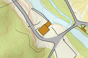
1813 Brønnøy | 5d97c154-eec5-4ce9-8e39-1a1ce36e7d8f | 261.62 | N: 7265739.36, Ø: 372447.22 | ![Kartbilde fra WMS-tjeneste av avviket](https://wms.geonorge.no/skwms1/wms.topo?VERSION=1.1.1&SERVICE=WMS&REQUEST=GetMap&LAYERS=topo&STYLES=&FORMAT=image/png&SRS=EPSG:25833&BBOX=372372.0,7265689,372522.0,7265789&WIDTH=300&HEIGHT=200) |
1813 Brønnøy | ab0f07e9-ed0a-4704-8917-3e8d2be5bfec | 250.91 | N: 7245944.93, Ø: 406621.20 | ![Kartbilde fra WMS-tjeneste av avviket](https://wms.geonorge.no/skwms1/wms.topo?VERSION=1.1.1&SERVICE=WMS&REQUEST=GetMap&LAYERS=topo&STYLES=&FORMAT=image/png&SRS=EPSG:25833&BBOX=406546.0,7245894,406696.0,7245994&WIDTH=300&HEIGHT=200) |
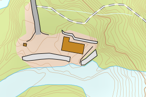
1813 Brønnøy | c7540a7d-cfe7-479b-95ae-b5421587b924 | 226.23 | N: 7246741.95, Ø: 405542.20 | ![Kartbilde fra WMS-tjeneste av avviket](https://wms.geonorge.no/skwms1/wms.topo?VERSION=1.1.1&SERVICE=WMS&REQUEST=GetMap&LAYERS=topo&STYLES=&FORMAT=image/png&SRS=EPSG:25833&BBOX=405467.0,7246691,405617.0,7246791&WIDTH=300&HEIGHT=200) |
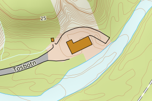
1813 Brønnøy | b570ee02-dbb4-4f15-a7bb-13066cc0fbea | 225.38 | N: 7246077.96, Ø: 405804.67 | ![Kartbilde fra WMS-tjeneste av avviket](https://wms.geonorge.no/skwms1/wms.topo?VERSION=1.1.1&SERVICE=WMS&REQUEST=GetMap&LAYERS=topo&STYLES=&FORMAT=image/png&SRS=EPSG:25833&BBOX=405729.0,7246027,405879.0,7246127&WIDTH=300&HEIGHT=200) |
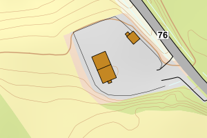
1813 Brønnøy | 86f57009-b027-4ac4-be38-dd442a5e264b | 221.10 | N: 7252553.24, Ø: 392201.24 | ![Kartbilde fra WMS-tjeneste av avviket](https://wms.geonorge.no/skwms1/wms.topo?VERSION=1.1.1&SERVICE=WMS&REQUEST=GetMap&LAYERS=topo&STYLES=&FORMAT=image/png&SRS=EPSG:25833&BBOX=392126.0,7252503,392276.0,7252603&WIDTH=300&HEIGHT=200) |
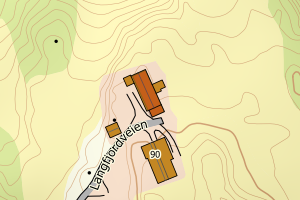
1813 Brønnøy | c57eab1d-8ebb-4b55-a8dd-cabdf1afbdeb | 221.02 | N: 7260766.42, Ø: 376282.68 | ![Kartbilde fra WMS-tjeneste av avviket](https://wms.geonorge.no/skwms1/wms.topo?VERSION=1.1.1&SERVICE=WMS&REQUEST=GetMap&LAYERS=topo&STYLES=&FORMAT=image/png&SRS=EPSG:25833&BBOX=376207.0,7260716,376357.0,7260816&WIDTH=300&HEIGHT=200) |
1813 Brønnøy | cd5e99cb-fc21-46c2-9338-a11460edfba2 | 208.84 | N: 7254718.30, Ø: 385132.79 | ![Kartbilde fra WMS-tjeneste av avviket](https://wms.geonorge.no/skwms1/wms.topo?VERSION=1.1.1&SERVICE=WMS&REQUEST=GetMap&LAYERS=topo&STYLES=&FORMAT=image/png&SRS=EPSG:25833&BBOX=385057.0,7254668,385207.0,7254768&WIDTH=300&HEIGHT=200) |
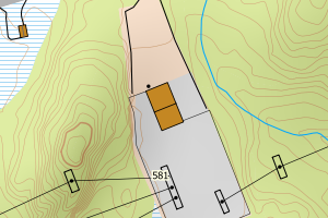
1813 Brønnøy | eb66916a-1b97-471d-8702-b2a74acd93a4 | 208.68 | N: 7259651.08, Ø: 373372.01 | ![Kartbilde fra WMS-tjeneste av avviket](https://wms.geonorge.no/skwms1/wms.topo?VERSION=1.1.1&SERVICE=WMS&REQUEST=GetMap&LAYERS=topo&STYLES=&FORMAT=image/png&SRS=EPSG:25833&BBOX=373297.0,7259601,373447.0,7259701&WIDTH=300&HEIGHT=200) |
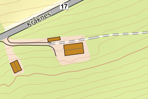
1813 Brønnøy | 95ea4afd-2bc5-4b4e-8413-e789e26ea815 | 205.70 | N: 7243937.04, Ø: 390153.11 | ![Kartbilde fra WMS-tjeneste av avviket](https://wms.geonorge.no/skwms1/wms.topo?VERSION=1.1.1&SERVICE=WMS&REQUEST=GetMap&LAYERS=topo&STYLES=&FORMAT=image/png&SRS=EPSG:25833&BBOX=390078.0,7243887,390228.0,7243987&WIDTH=300&HEIGHT=200) |
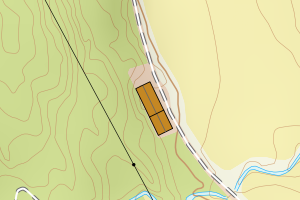
1813 Brønnøy | b4be4cae-8507-4bee-a2ee-f4e32f45f4ac | 205.12 | N: 7260785.18, Ø: 376280.16 | ![Kartbilde fra WMS-tjeneste av avviket](https://wms.geonorge.no/skwms1/wms.topo?VERSION=1.1.1&SERVICE=WMS&REQUEST=GetMap&LAYERS=topo&STYLES=&FORMAT=image/png&SRS=EPSG:25833&BBOX=376205.0,7260735,376355.0,7260835&WIDTH=300&HEIGHT=200) |
1813 Brønnøy | 47d0893e-16e9-4f05-8932-de6d1d297cf9 | 203.79 | N: 7267361.67, Ø: 373129.16 | ![Kartbilde fra WMS-tjeneste av avviket](https://wms.geonorge.no/skwms1/wms.topo?VERSION=1.1.1&SERVICE=WMS&REQUEST=GetMap&LAYERS=topo&STYLES=&FORMAT=image/png&SRS=EPSG:25833&BBOX=373054.0,7267311,373204.0,7267411&WIDTH=300&HEIGHT=200) |