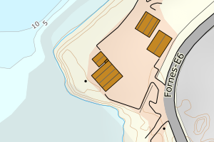
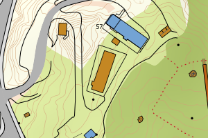
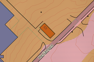
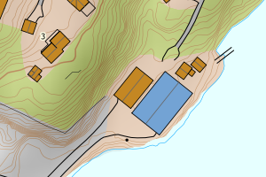
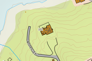
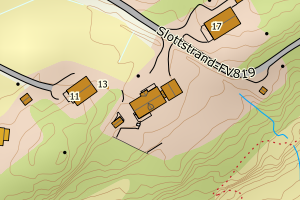
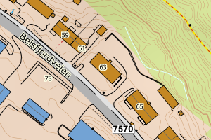
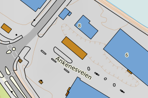
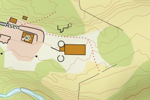
Avvikene skyldes oftest manglende eller unøyaktig registrering av bygningspunkt i matrikkelen. Rettes vanligvis i matrikkelen
Kommune | LokalId | Areal (m2) | Posisjon | WMS-bilde |
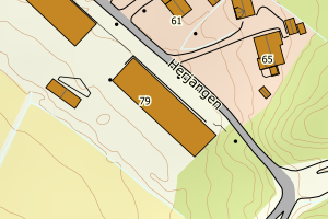
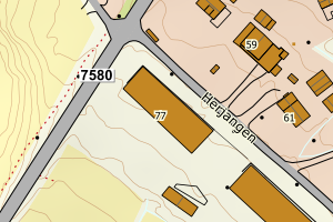
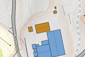
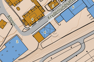
1806 Narvik | 188490f3-f78a-4394-88fc-f89bb7b8df57 | 1498.09 | N: 7592980.89, Ø: 598559.32 | ![Kartbilde fra WMS-tjeneste av avviket](https://wms.geonorge.no/skwms1/wms.topo?VERSION=1.1.1&SERVICE=WMS&REQUEST=GetMap&LAYERS=topo&STYLES=&FORMAT=image/png&SRS=EPSG:25833&BBOX=598484.0,7592930,598634.0,7593030&WIDTH=300&HEIGHT=200) |
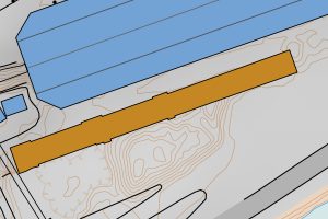
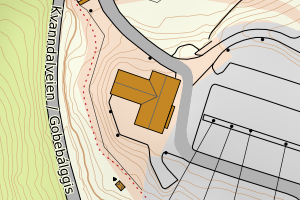
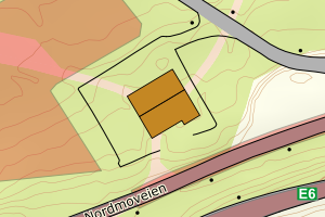
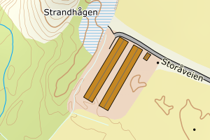
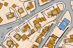
1806 Narvik | 1c0d9c7f-2d08-42eb-be7b-38eaf2db3183 | 1289.77 | N: 7554226.75, Ø: 556706.67 | ![Kartbilde fra WMS-tjeneste av avviket](https://wms.geonorge.no/skwms1/wms.topo?VERSION=1.1.1&SERVICE=WMS&REQUEST=GetMap&LAYERS=topo&STYLES=&FORMAT=image/png&SRS=EPSG:25833&BBOX=556631.0,7554176,556781.0,7554276&WIDTH=300&HEIGHT=200) |
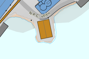
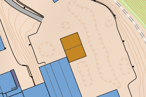
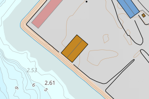
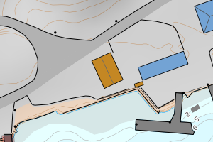
1806 Narvik | 23081953-f191-431c-a31f-3b9237f5195d | 865.74 | N: 7590825.07, Ø: 599266.32 | ![Kartbilde fra WMS-tjeneste av avviket](https://wms.geonorge.no/skwms1/wms.topo?VERSION=1.1.1&SERVICE=WMS&REQUEST=GetMap&LAYERS=topo&STYLES=&FORMAT=image/png&SRS=EPSG:25833&BBOX=599191.0,7590775,599341.0,7590875&WIDTH=300&HEIGHT=200) |
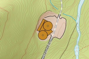
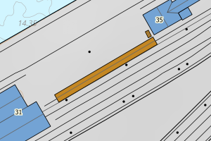
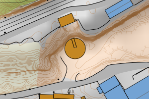
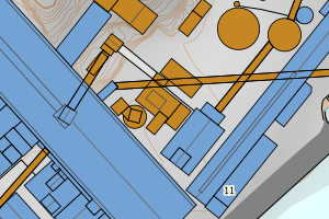
1806 Narvik | 43d2483b-3d84-4fa5-ad39-4b817424a7f1 | 785.70 | N: 7592710.04, Ø: 598104.20 | ![Kartbilde fra WMS-tjeneste av avviket](https://wms.geonorge.no/skwms1/wms.topo?VERSION=1.1.1&SERVICE=WMS&REQUEST=GetMap&LAYERS=topo&STYLES=&FORMAT=image/png&SRS=EPSG:25833&BBOX=598029.0,7592660,598179.0,7592760&WIDTH=300&HEIGHT=200) |
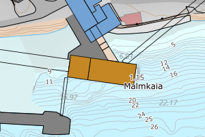
1806 Narvik | 1435d862-a615-4a1a-a23e-c439fa5384f0 | 697.46 | N: 7554072.78, Ø: 557250.32 | ![Kartbilde fra WMS-tjeneste av avviket](https://wms.geonorge.no/skwms1/wms.topo?VERSION=1.1.1&SERVICE=WMS&REQUEST=GetMap&LAYERS=topo&STYLES=&FORMAT=image/png&SRS=EPSG:25833&BBOX=557175.0,7554022,557325.0,7554122&WIDTH=300&HEIGHT=200) |
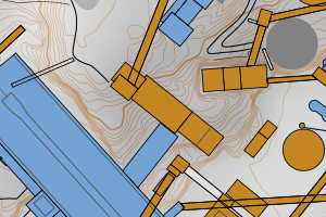
1806 Narvik | a9f8cb4c-461c-4917-9d3b-5fefacabd929 | 645.17 | N: 7609538.24, Ø: 606291.23 | ![Kartbilde fra WMS-tjeneste av avviket](https://wms.geonorge.no/skwms1/wms.topo?VERSION=1.1.1&SERVICE=WMS&REQUEST=GetMap&LAYERS=topo&STYLES=&FORMAT=image/png&SRS=EPSG:25833&BBOX=606216.0,7609488,606366.0,7609588&WIDTH=300&HEIGHT=200) |
1806 Narvik | 9ca5eeeb-6f16-411d-be00-b2b6f01c62d3 | 607.07 | N: 7553891.32, Ø: 557221.00 | ![Kartbilde fra WMS-tjeneste av avviket](https://wms.geonorge.no/skwms1/wms.topo?VERSION=1.1.1&SERVICE=WMS&REQUEST=GetMap&LAYERS=topo&STYLES=&FORMAT=image/png&SRS=EPSG:25833&BBOX=557145.0,7553841,557295.0,7553941&WIDTH=300&HEIGHT=200) |
1806 Narvik | 930e5f84-1eb9-4592-b286-e4a709b4693b | 604.74 | N: 7555977.32, Ø: 557759.11 | ![Kartbilde fra WMS-tjeneste av avviket](https://wms.geonorge.no/skwms1/wms.topo?VERSION=1.1.1&SERVICE=WMS&REQUEST=GetMap&LAYERS=topo&STYLES=&FORMAT=image/png&SRS=EPSG:25833&BBOX=557684.0,7555927,557834.0,7556027&WIDTH=300&HEIGHT=200) |
1806 Narvik | d5609a09-60cb-4352-a97d-49648231aa9e | 494.80 | N: 7595363.70, Ø: 603968.78 | ![Kartbilde fra WMS-tjeneste av avviket](https://wms.geonorge.no/skwms1/wms.topo?VERSION=1.1.1&SERVICE=WMS&REQUEST=GetMap&LAYERS=topo&STYLES=&FORMAT=image/png&SRS=EPSG:25833&BBOX=603893.0,7595313,604043.0,7595413&WIDTH=300&HEIGHT=200) |
1806 Narvik | 83f76491-efbb-41fd-acbf-8e2170cd8d34 | 494.54 | N: 7605926.80, Ø: 605316.45 | ![Kartbilde fra WMS-tjeneste av avviket](https://wms.geonorge.no/skwms1/wms.topo?VERSION=1.1.1&SERVICE=WMS&REQUEST=GetMap&LAYERS=topo&STYLES=&FORMAT=image/png&SRS=EPSG:25833&BBOX=605241.0,7605876,605391.0,7605976&WIDTH=300&HEIGHT=200) |
1806 Narvik | f6f39def-06be-4651-b577-cbfb3141f504 | 447.56 | N: 7562726.18, Ø: 606192.73 | ![Kartbilde fra WMS-tjeneste av avviket](https://wms.geonorge.no/skwms1/wms.topo?VERSION=1.1.1&SERVICE=WMS&REQUEST=GetMap&LAYERS=topo&STYLES=&FORMAT=image/png&SRS=EPSG:25833&BBOX=606117.0,7562676,606267.0,7562776&WIDTH=300&HEIGHT=200) |
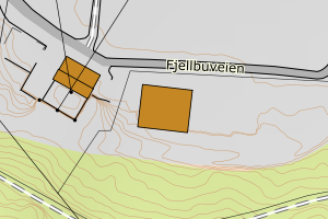
1806 Narvik | 85de7aac-7c4d-4d1a-a6fe-c50605e951c0 | 370.21 | N: 7581297.94, Ø: 579995.38 | ![Kartbilde fra WMS-tjeneste av avviket](https://wms.geonorge.no/skwms1/wms.topo?VERSION=1.1.1&SERVICE=WMS&REQUEST=GetMap&LAYERS=topo&STYLES=&FORMAT=image/png&SRS=EPSG:25833&BBOX=579920.0,7581247,580070.0,7581347&WIDTH=300&HEIGHT=200) |
1806 Narvik | 8913435a-2c98-4784-8d2b-b036220546af | 362.58 | N: 7551246.02, Ø: 557554.97 | ![Kartbilde fra WMS-tjeneste av avviket](https://wms.geonorge.no/skwms1/wms.topo?VERSION=1.1.1&SERVICE=WMS&REQUEST=GetMap&LAYERS=topo&STYLES=&FORMAT=image/png&SRS=EPSG:25833&BBOX=557479.0,7551196,557629.0,7551296&WIDTH=300&HEIGHT=200) |
1806 Narvik | 62bfc80e-03ea-4746-9d74-03fb6e56c5dc | 307.99 | N: 7554016.84, Ø: 557281.50 | ![Kartbilde fra WMS-tjeneste av avviket](https://wms.geonorge.no/skwms1/wms.topo?VERSION=1.1.1&SERVICE=WMS&REQUEST=GetMap&LAYERS=topo&STYLES=&FORMAT=image/png&SRS=EPSG:25833&BBOX=557206.0,7553966,557356.0,7554066&WIDTH=300&HEIGHT=200) |
1806 Narvik | 1a23ff0f-828c-44b8-8500-78192e801c21 | 305.55 | N: 7590481.82, Ø: 599764.97 | ![Kartbilde fra WMS-tjeneste av avviket](https://wms.geonorge.no/skwms1/wms.topo?VERSION=1.1.1&SERVICE=WMS&REQUEST=GetMap&LAYERS=topo&STYLES=&FORMAT=image/png&SRS=EPSG:25833&BBOX=599689.0,7590431,599839.0,7590531&WIDTH=300&HEIGHT=200) |
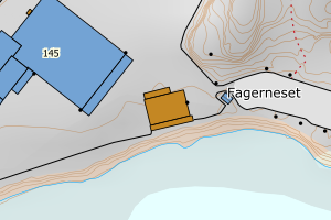
1806 Narvik | 15ae28bc-0c5f-4798-8162-73cac33a0b32 | 292.67 | N: 7554120.35, Ø: 557250.14 | ![Kartbilde fra WMS-tjeneste av avviket](https://wms.geonorge.no/skwms1/wms.topo?VERSION=1.1.1&SERVICE=WMS&REQUEST=GetMap&LAYERS=topo&STYLES=&FORMAT=image/png&SRS=EPSG:25833&BBOX=557175.0,7554070,557325.0,7554170&WIDTH=300&HEIGHT=200) |
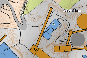
1806 Narvik | 3a64387e-69e7-4f7a-8807-8ffc7dd5c802 | 274.12 | N: 7590505.70, Ø: 599465.09 | ![Kartbilde fra WMS-tjeneste av avviket](https://wms.geonorge.no/skwms1/wms.topo?VERSION=1.1.1&SERVICE=WMS&REQUEST=GetMap&LAYERS=topo&STYLES=&FORMAT=image/png&SRS=EPSG:25833&BBOX=599390.0,7590455,599540.0,7590555&WIDTH=300&HEIGHT=200) |
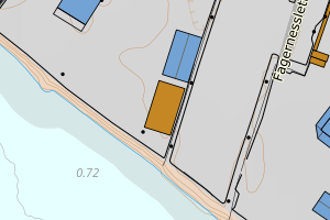
1806 Narvik | f4567e97-42ca-4445-8836-554c5f38fa7d | 273.65 | N: 7593517.52, Ø: 599425.39 | ![Kartbilde fra WMS-tjeneste av avviket](https://wms.geonorge.no/skwms1/wms.topo?VERSION=1.1.1&SERVICE=WMS&REQUEST=GetMap&LAYERS=topo&STYLES=&FORMAT=image/png&SRS=EPSG:25833&BBOX=599350.0,7593467,599500.0,7593567&WIDTH=300&HEIGHT=200) |
1806 Narvik | d6256bc3-c7cc-4893-a294-77d0ab24e0af | 272.48 | N: 7565160.29, Ø: 621075.40 | ![Kartbilde fra WMS-tjeneste av avviket](https://wms.geonorge.no/skwms1/wms.topo?VERSION=1.1.1&SERVICE=WMS&REQUEST=GetMap&LAYERS=topo&STYLES=&FORMAT=image/png&SRS=EPSG:25833&BBOX=621000.0,7565110,621150.0,7565210&WIDTH=300&HEIGHT=200) |
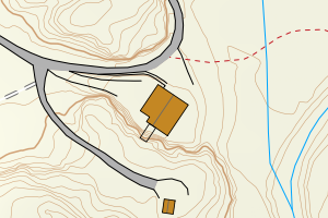
1806 Narvik | 1279af0b-32a6-4963-b2be-ffb010a901e8 | 272.34 | N: 7594692.85, Ø: 601003.51 | ![Kartbilde fra WMS-tjeneste av avviket](https://wms.geonorge.no/skwms1/wms.topo?VERSION=1.1.1&SERVICE=WMS&REQUEST=GetMap&LAYERS=topo&STYLES=&FORMAT=image/png&SRS=EPSG:25833&BBOX=600928.0,7594642,601078.0,7594742&WIDTH=300&HEIGHT=200) |
1806 Narvik | f38a9c4b-847f-4012-8932-a9230eac6b44 | 265.73 | N: 7594679.62, Ø: 601007.49 | ![Kartbilde fra WMS-tjeneste av avviket](https://wms.geonorge.no/skwms1/wms.topo?VERSION=1.1.1&SERVICE=WMS&REQUEST=GetMap&LAYERS=topo&STYLES=&FORMAT=image/png&SRS=EPSG:25833&BBOX=600932.0,7594629,601082.0,7594729&WIDTH=300&HEIGHT=200) |
1806 Narvik | af575aae-a515-4825-8bfc-6b6cbeecc01a | 263.07 | N: 7588359.81, Ø: 575219.75 | ![Kartbilde fra WMS-tjeneste av avviket](https://wms.geonorge.no/skwms1/wms.topo?VERSION=1.1.1&SERVICE=WMS&REQUEST=GetMap&LAYERS=topo&STYLES=&FORMAT=image/png&SRS=EPSG:25833&BBOX=575144.0,7588309,575294.0,7588409&WIDTH=300&HEIGHT=200) |
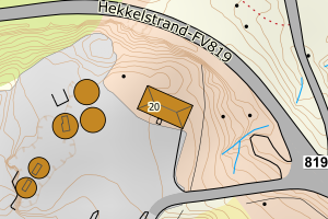
1806 Narvik | f9abac6b-b873-48d6-9e71-de81bf473186 | 258.36 | N: 7609087.65, Ø: 604881.57 | ![Kartbilde fra WMS-tjeneste av avviket](https://wms.geonorge.no/skwms1/wms.topo?VERSION=1.1.1&SERVICE=WMS&REQUEST=GetMap&LAYERS=topo&STYLES=&FORMAT=image/png&SRS=EPSG:25833&BBOX=604806.0,7609037,604956.0,7609137&WIDTH=300&HEIGHT=200) |
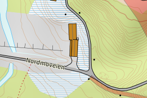
1806 Narvik | 39cad229-991b-4c84-a221-68a0e8418cf1 | 250.04 | N: 7589941.88, Ø: 599451.76 | ![Kartbilde fra WMS-tjeneste av avviket](https://wms.geonorge.no/skwms1/wms.topo?VERSION=1.1.1&SERVICE=WMS&REQUEST=GetMap&LAYERS=topo&STYLES=&FORMAT=image/png&SRS=EPSG:25833&BBOX=599376.0,7589891,599526.0,7589991&WIDTH=300&HEIGHT=200) |
1806 Narvik | c5bf94bb-0082-4510-9e59-a17017c1c130 | 249.30 | N: 7580366.28, Ø: 556191.74 | ![Kartbilde fra WMS-tjeneste av avviket](https://wms.geonorge.no/skwms1/wms.topo?VERSION=1.1.1&SERVICE=WMS&REQUEST=GetMap&LAYERS=topo&STYLES=&FORMAT=image/png&SRS=EPSG:25833&BBOX=556116.0,7580316,556266.0,7580416&WIDTH=300&HEIGHT=200) |
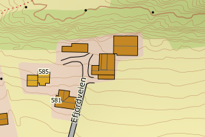
1806 Narvik | 18eb8a98-65ca-4000-9024-9c6761a0d7aa | 248.64 | N: 7554199.21, Ø: 557512.58 | ![Kartbilde fra WMS-tjeneste av avviket](https://wms.geonorge.no/skwms1/wms.topo?VERSION=1.1.1&SERVICE=WMS&REQUEST=GetMap&LAYERS=topo&STYLES=&FORMAT=image/png&SRS=EPSG:25833&BBOX=557437.0,7554149,557587.0,7554249&WIDTH=300&HEIGHT=200) |
1806 Narvik | 64f01260-d66f-47f0-b77d-bb3b95818af9 | 239.62 | N: 7609384.80, Ø: 606388.72 | ![Kartbilde fra WMS-tjeneste av avviket](https://wms.geonorge.no/skwms1/wms.topo?VERSION=1.1.1&SERVICE=WMS&REQUEST=GetMap&LAYERS=topo&STYLES=&FORMAT=image/png&SRS=EPSG:25833&BBOX=606313.0,7609334,606463.0,7609434&WIDTH=300&HEIGHT=200) |
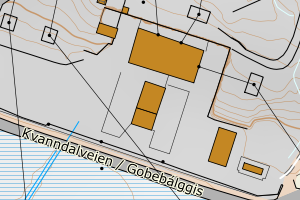
1806 Narvik | c863fdd5-2ae5-467f-86a5-db50068c98b5 | 239.04 | N: 7591858.22, Ø: 601804.39 | ![Kartbilde fra WMS-tjeneste av avviket](https://wms.geonorge.no/skwms1/wms.topo?VERSION=1.1.1&SERVICE=WMS&REQUEST=GetMap&LAYERS=topo&STYLES=&FORMAT=image/png&SRS=EPSG:25833&BBOX=601729.0,7591808,601879.0,7591908&WIDTH=300&HEIGHT=200) |
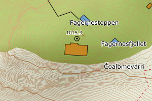
1806 Narvik | 0e56f6d3-6a76-4d58-a03e-5978c725c65a | 237.24 | N: 7582958.58, Ø: 577818.78 | ![Kartbilde fra WMS-tjeneste av avviket](https://wms.geonorge.no/skwms1/wms.topo?VERSION=1.1.1&SERVICE=WMS&REQUEST=GetMap&LAYERS=topo&STYLES=&FORMAT=image/png&SRS=EPSG:25833&BBOX=577743.0,7582908,577893.0,7583008&WIDTH=300&HEIGHT=200) |
1806 Narvik | ee2206b3-3c5a-44d7-b80f-445d309bea27 | 227.21 | N: 7565256.46, Ø: 621040.48 | ![Kartbilde fra WMS-tjeneste av avviket](https://wms.geonorge.no/skwms1/wms.topo?VERSION=1.1.1&SERVICE=WMS&REQUEST=GetMap&LAYERS=topo&STYLES=&FORMAT=image/png&SRS=EPSG:25833&BBOX=620965.0,7565206,621115.0,7565306&WIDTH=300&HEIGHT=200) |
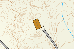
1806 Narvik | 5cd82804-2a68-4316-a961-db94c622e237 | 227.13 | N: 7593824.56, Ø: 599565.87 | ![Kartbilde fra WMS-tjeneste av avviket](https://wms.geonorge.no/skwms1/wms.topo?VERSION=1.1.1&SERVICE=WMS&REQUEST=GetMap&LAYERS=topo&STYLES=&FORMAT=image/png&SRS=EPSG:25833&BBOX=599490.0,7593774,599640.0,7593874&WIDTH=300&HEIGHT=200) |
1806 Narvik | d883d267-0a1b-4f17-95bc-79795f7b6de7 | 225.99 | N: 7583977.67, Ø: 576703.63 | ![Kartbilde fra WMS-tjeneste av avviket](https://wms.geonorge.no/skwms1/wms.topo?VERSION=1.1.1&SERVICE=WMS&REQUEST=GetMap&LAYERS=topo&STYLES=&FORMAT=image/png&SRS=EPSG:25833&BBOX=576628.0,7583927,576778.0,7584027&WIDTH=300&HEIGHT=200) |
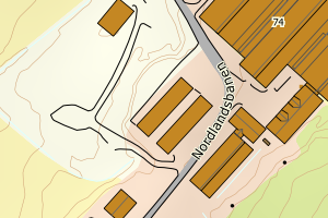
1806 Narvik | 2c0de914-ff9d-4200-9fec-2d1cfacaa970 | 219.74 | N: 7562740.49, Ø: 606152.28 | ![Kartbilde fra WMS-tjeneste av avviket](https://wms.geonorge.no/skwms1/wms.topo?VERSION=1.1.1&SERVICE=WMS&REQUEST=GetMap&LAYERS=topo&STYLES=&FORMAT=image/png&SRS=EPSG:25833&BBOX=606077.0,7562690,606227.0,7562790&WIDTH=300&HEIGHT=200) |
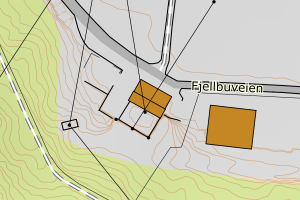
1806 Narvik | 934307f1-7f51-4d98-8ed1-466d63cb2d50 | 219.69 | N: 7583969.58, Ø: 576712.62 | ![Kartbilde fra WMS-tjeneste av avviket](https://wms.geonorge.no/skwms1/wms.topo?VERSION=1.1.1&SERVICE=WMS&REQUEST=GetMap&LAYERS=topo&STYLES=&FORMAT=image/png&SRS=EPSG:25833&BBOX=576637.0,7583919,576787.0,7584019&WIDTH=300&HEIGHT=200) |
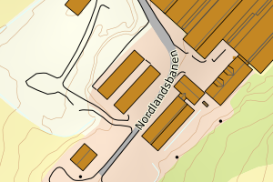
1806 Narvik | 65cd3e5d-ab9a-4fc0-bb0b-50492785d011 | 217.75 | N: 7586495.24, Ø: 577925.67 | ![Kartbilde fra WMS-tjeneste av avviket](https://wms.geonorge.no/skwms1/wms.topo?VERSION=1.1.1&SERVICE=WMS&REQUEST=GetMap&LAYERS=topo&STYLES=&FORMAT=image/png&SRS=EPSG:25833&BBOX=577850.0,7586445,578000.0,7586545&WIDTH=300&HEIGHT=200) |
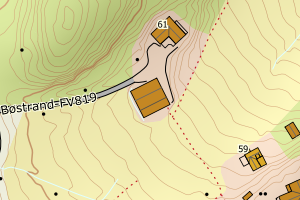
1806 Narvik | d5857f0c-cac8-45ac-b267-fc8ca7d840f9 | 215.89 | N: 7606037.45, Ø: 605843.29 | ![Kartbilde fra WMS-tjeneste av avviket](https://wms.geonorge.no/skwms1/wms.topo?VERSION=1.1.1&SERVICE=WMS&REQUEST=GetMap&LAYERS=topo&STYLES=&FORMAT=image/png&SRS=EPSG:25833&BBOX=605768.0,7605987,605918.0,7606087&WIDTH=300&HEIGHT=200) |
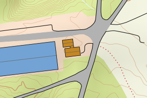
1806 Narvik | cf486a50-75c6-4346-8c18-f4210979e471 | 212.34 | N: 7602960.91, Ø: 605224.40 | ![Kartbilde fra WMS-tjeneste av avviket](https://wms.geonorge.no/skwms1/wms.topo?VERSION=1.1.1&SERVICE=WMS&REQUEST=GetMap&LAYERS=topo&STYLES=&FORMAT=image/png&SRS=EPSG:25833&BBOX=605149.0,7602910,605299.0,7603010&WIDTH=300&HEIGHT=200) |
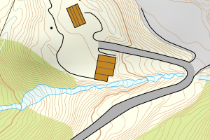
1806 Narvik | 1997da5a-8e4c-4112-a975-29d5f0afb071 | 207.63 | N: 7590165.74, Ø: 599171.57 | ![Kartbilde fra WMS-tjeneste av avviket](https://wms.geonorge.no/skwms1/wms.topo?VERSION=1.1.1&SERVICE=WMS&REQUEST=GetMap&LAYERS=topo&STYLES=&FORMAT=image/png&SRS=EPSG:25833&BBOX=599096.0,7590115,599246.0,7590215&WIDTH=300&HEIGHT=200) |