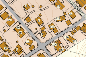
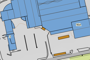
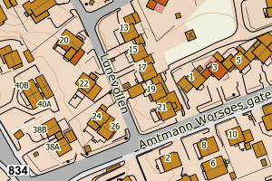
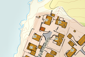
Avvikene skyldes vanligvis at takoverbygget er klassifisert feil (skal være bygning), men kan også skyldes feil registrering i matrikkelen. Rettes i matrikkelen eller FKB-Bygning
Kommune | LokalId | Bygningsnummer | Takoverbygg_lokalid | Posisjon | WMS-bilde |
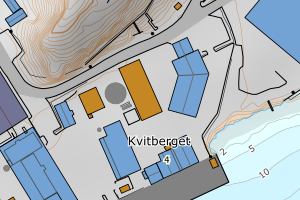
1804 Bodø | 43c6157e-2630-4ca7-86c8-2bdb8fbf0989 | 187004683 | 82001192-73ef-409f-b4cf-18d4b26a11d1 | N: 7464618.00, Ø: 474556.00 | ![Kartbilde fra WMS-tjeneste av avviket](https://wms.geonorge.no/skwms1/wms.topo?VERSION=1.1.1&SERVICE=WMS&REQUEST=GetMap&LAYERS=topo&STYLES=&FORMAT=image/png&SRS=EPSG:25833&BBOX=474481.0,7464568,474631.0,7464668&WIDTH=300&HEIGHT=200) |
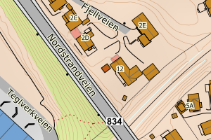
1804 Bodø | 541a78c1-43bb-4075-8a7c-7ff722f31485 | 300008213 | 444ff23d-f45f-441a-b2a2-31f9d09158b0 | N: 7462190.60, Ø: 476005.50 | ![Kartbilde fra WMS-tjeneste av avviket](https://wms.geonorge.no/skwms1/wms.topo?VERSION=1.1.1&SERVICE=WMS&REQUEST=GetMap&LAYERS=topo&STYLES=&FORMAT=image/png&SRS=EPSG:25833&BBOX=475930.0,7462140,476080.0,7462240&WIDTH=300&HEIGHT=200) |
1804 Bodø | afa658fb-77ae-4f55-82af-e854dbf4b838 | 19545326 | 47ffaa45-b68a-4383-b30f-4a93880504b5 | N: 7462051.00, Ø: 473996.00 | ![Kartbilde fra WMS-tjeneste av avviket](https://wms.geonorge.no/skwms1/wms.topo?VERSION=1.1.1&SERVICE=WMS&REQUEST=GetMap&LAYERS=topo&STYLES=&FORMAT=image/png&SRS=EPSG:25833&BBOX=473921.0,7462001,474071.0,7462101&WIDTH=300&HEIGHT=200) |
1804 Bodø | 9a5f03b7-dbf0-4298-bc3f-7788da033397 | 300570087 | 6c3c1590-9f44-48d7-87a4-c503b82915db | N: 7464286.90, Ø: 488780.30 | ![Kartbilde fra WMS-tjeneste av avviket](https://wms.geonorge.no/skwms1/wms.topo?VERSION=1.1.1&SERVICE=WMS&REQUEST=GetMap&LAYERS=topo&STYLES=&FORMAT=image/png&SRS=EPSG:25833&BBOX=488705.0,7464236,488855.0,7464336&WIDTH=300&HEIGHT=200) |
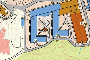
1804 Bodø | 03d05e59-26ec-4ff4-8292-9674a5352743 | 300566533 | 3e708170-7ae9-402d-b82f-0231f4f37f1c | N: 7464550.60, Ø: 474511.60 | ![Kartbilde fra WMS-tjeneste av avviket](https://wms.geonorge.no/skwms1/wms.topo?VERSION=1.1.1&SERVICE=WMS&REQUEST=GetMap&LAYERS=topo&STYLES=&FORMAT=image/png&SRS=EPSG:25833&BBOX=474436.0,7464500,474586.0,7464600&WIDTH=300&HEIGHT=200) |
1804 Bodø | 656887ea-40c4-4ab8-a474-517cb73e9921 | 300247120 | cf98bb64-17a4-43de-9dd3-44fadc0905e3 | N: 7464428.30, Ø: 474670.70 | ![Kartbilde fra WMS-tjeneste av avviket](https://wms.geonorge.no/skwms1/wms.topo?VERSION=1.1.1&SERVICE=WMS&REQUEST=GetMap&LAYERS=topo&STYLES=&FORMAT=image/png&SRS=EPSG:25833&BBOX=474595.0,7464378,474745.0,7464478&WIDTH=300&HEIGHT=200) |
1804 Bodø | b6f012af-3190-4dac-a241-229e6a1ae53b | 186988272 | ff44b915-8b8a-48eb-8f25-5d295553db9d | N: 7463868.00, Ø: 473339.00 | ![Kartbilde fra WMS-tjeneste av avviket](https://wms.geonorge.no/skwms1/wms.topo?VERSION=1.1.1&SERVICE=WMS&REQUEST=GetMap&LAYERS=topo&STYLES=&FORMAT=image/png&SRS=EPSG:25833&BBOX=473264.0,7463818,473414.0,7463918&WIDTH=300&HEIGHT=200) |
1804 Bodø | 753d9907-21d5-4a1f-8bf3-701c76f2e57e | 300804953 | b0fc86cb-d111-43e7-9069-65e95f70ccfb | N: 7466878.70, Ø: 488441.90 | ![Kartbilde fra WMS-tjeneste av avviket](https://wms.geonorge.no/skwms1/wms.topo?VERSION=1.1.1&SERVICE=WMS&REQUEST=GetMap&LAYERS=topo&STYLES=&FORMAT=image/png&SRS=EPSG:25833&BBOX=488366.0,7466828,488516.0,7466928&WIDTH=300&HEIGHT=200) |
1804 Bodø | d32fd8ad-1b90-4325-abb8-58840c892527 | 300804954 | b0fc86cb-d111-43e7-9069-65e95f70ccfb | N: 7466876.10, Ø: 488448.80 | ![Kartbilde fra WMS-tjeneste av avviket](https://wms.geonorge.no/skwms1/wms.topo?VERSION=1.1.1&SERVICE=WMS&REQUEST=GetMap&LAYERS=topo&STYLES=&FORMAT=image/png&SRS=EPSG:25833&BBOX=488373.0,7466826,488523.0,7466926&WIDTH=300&HEIGHT=200) |
1804 Bodø | 7d8c5490-d658-45e1-bb06-914d1ce30f9a | 300988668 | d67bea7a-88d3-4a49-baf0-8037747af991 | N: 7464137.00, Ø: 474814.10 | ![Kartbilde fra WMS-tjeneste av avviket](https://wms.geonorge.no/skwms1/wms.topo?VERSION=1.1.1&SERVICE=WMS&REQUEST=GetMap&LAYERS=topo&STYLES=&FORMAT=image/png&SRS=EPSG:25833&BBOX=474739.0,7464087,474889.0,7464187&WIDTH=300&HEIGHT=200) |
1804 Bodø | efe1f521-395d-4cbb-88fe-f4f2a9fbeaa9 | 300663684 | aa6cf3a0-b92b-4450-a992-73b50e9ca0e2 | N: 7463687.80, Ø: 482417.20 | ![Kartbilde fra WMS-tjeneste av avviket](https://wms.geonorge.no/skwms1/wms.topo?VERSION=1.1.1&SERVICE=WMS&REQUEST=GetMap&LAYERS=topo&STYLES=&FORMAT=image/png&SRS=EPSG:25833&BBOX=482342.0,7463637,482492.0,7463737&WIDTH=300&HEIGHT=200) |
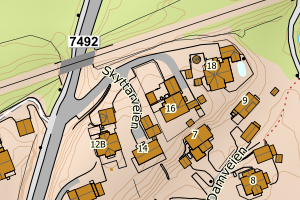
1804 Bodø | de667c49-064a-4227-9f7c-8761b290539b | 300824370 | a94fb9b8-614b-4a7c-a91f-e98737c49233 | N: 7464485.00, Ø: 489009.10 | ![Kartbilde fra WMS-tjeneste av avviket](https://wms.geonorge.no/skwms1/wms.topo?VERSION=1.1.1&SERVICE=WMS&REQUEST=GetMap&LAYERS=topo&STYLES=&FORMAT=image/png&SRS=EPSG:25833&BBOX=488934.0,7464435,489084.0,7464535&WIDTH=300&HEIGHT=200) |
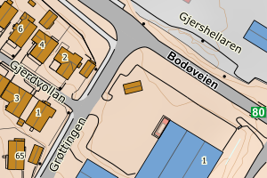
1804 Bodø | e92f382e-4d95-47e2-afbf-64bace82c544 | 300967489 | 9e56b178-b98f-457e-8960-7ce237890be0 | N: 7465055.70, Ø: 488467.60 | ![Kartbilde fra WMS-tjeneste av avviket](https://wms.geonorge.no/skwms1/wms.topo?VERSION=1.1.1&SERVICE=WMS&REQUEST=GetMap&LAYERS=topo&STYLES=&FORMAT=image/png&SRS=EPSG:25833&BBOX=488392.0,7465005,488542.0,7465105&WIDTH=300&HEIGHT=200) |