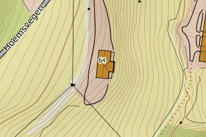
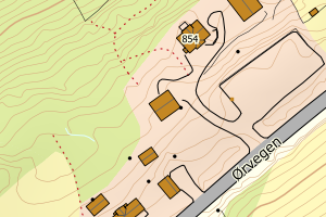
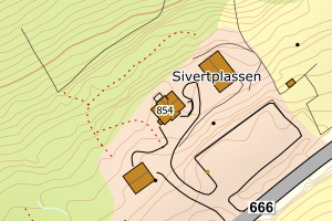
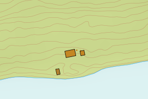
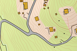
Avvikene skyldes vanligvis unøyaktig registrering av bygningspunkt i matrikkelen slik at det har havnet utenfor bygningsomriss. Rettes vanligvis i matrikkelen
Kommune | LokalId | Bygningsnummer | Avstand (m) | Posisjon | WMS-bilde |
1557 Gjemnes | d23fd443-603d-4098-a359-55407becd067 | 301014325 | 0.00 | N: 6971021.57, Ø: 433043.39 | ![Kartbilde fra WMS-tjeneste av avviket](https://wms.geonorge.no/skwms1/wms.topo?VERSION=1.1.1&SERVICE=WMS&REQUEST=GetMap&LAYERS=topo&STYLES=&FORMAT=image/png&SRS=EPSG:25832&BBOX=432968.0,6970971,433118.0,6971071&WIDTH=300&HEIGHT=200) |
1557 Gjemnes | 8cc4d63d-4eee-41fe-9631-5c0bfab4a64a | 300326195 | 0.00 | N: 6982264.11, Ø: 432425.78 | ![Kartbilde fra WMS-tjeneste av avviket](https://wms.geonorge.no/skwms1/wms.topo?VERSION=1.1.1&SERVICE=WMS&REQUEST=GetMap&LAYERS=topo&STYLES=&FORMAT=image/png&SRS=EPSG:25832&BBOX=432350.0,6982214,432500.0,6982314&WIDTH=300&HEIGHT=200) |
1557 Gjemnes | 2feb4792-10f2-4c1e-b02b-eaf5a4bed914 | 181350067 | 0.00 | N: 6968559.95, Ø: 422231.87 | ![Kartbilde fra WMS-tjeneste av avviket](https://wms.geonorge.no/skwms1/wms.topo?VERSION=1.1.1&SERVICE=WMS&REQUEST=GetMap&LAYERS=topo&STYLES=&FORMAT=image/png&SRS=EPSG:25832&BBOX=422156.0,6968509,422306.0,6968609&WIDTH=300&HEIGHT=200) |
1557 Gjemnes | 05c8363a-0fa5-4007-a139-88aa62c8743c | 301369005 | 0.00 | N: 6978993.89, Ø: 448543.82 | ![Kartbilde fra WMS-tjeneste av avviket](https://wms.geonorge.no/skwms1/wms.topo?VERSION=1.1.1&SERVICE=WMS&REQUEST=GetMap&LAYERS=topo&STYLES=&FORMAT=image/png&SRS=EPSG:25832&BBOX=448468.0,6978943,448618.0,6979043&WIDTH=300&HEIGHT=200) |
1557 Gjemnes | c9973e39-76b2-4c65-8f03-501702afc824 | 300854345 | 0.00 | N: 6974562.36, Ø: 452074.66 | ![Kartbilde fra WMS-tjeneste av avviket](https://wms.geonorge.no/skwms1/wms.topo?VERSION=1.1.1&SERVICE=WMS&REQUEST=GetMap&LAYERS=topo&STYLES=&FORMAT=image/png&SRS=EPSG:25832&BBOX=451999.0,6974512,452149.0,6974612&WIDTH=300&HEIGHT=200) |
1557 Gjemnes | 744c2ffd-8088-4f12-adb4-596b5725820b | 181351799 | 0.00 | N: 6967564.62, Ø: 428685.21 | ![Kartbilde fra WMS-tjeneste av avviket](https://wms.geonorge.no/skwms1/wms.topo?VERSION=1.1.1&SERVICE=WMS&REQUEST=GetMap&LAYERS=topo&STYLES=&FORMAT=image/png&SRS=EPSG:25832&BBOX=428610.0,6967514,428760.0,6967614&WIDTH=300&HEIGHT=200) |
1557 Gjemnes | af25ef1c-bb1d-4dba-8cd3-00b96c5d7db1 | 181363428 | 0.02 | N: 6982739.00, Ø: 435361.00 | ![Kartbilde fra WMS-tjeneste av avviket](https://wms.geonorge.no/skwms1/wms.topo?VERSION=1.1.1&SERVICE=WMS&REQUEST=GetMap&LAYERS=topo&STYLES=&FORMAT=image/png&SRS=EPSG:25832&BBOX=435285.0,6982689,435435.0,6982789&WIDTH=300&HEIGHT=200) |
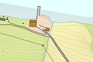
1557 Gjemnes | 87d63b2c-314b-4f0c-bed3-9d9693df3a3e | 181388641 | 0.06 | N: 6974662.00, Ø: 431961.00 | ![Kartbilde fra WMS-tjeneste av avviket](https://wms.geonorge.no/skwms1/wms.topo?VERSION=1.1.1&SERVICE=WMS&REQUEST=GetMap&LAYERS=topo&STYLES=&FORMAT=image/png&SRS=EPSG:25832&BBOX=431885.0,6974612,432035.0,6974712&WIDTH=300&HEIGHT=200) |
1557 Gjemnes | f126ec32-16ab-4ba3-ae46-d329632f325c | 181374926 | 0.14 | N: 6970430.00, Ø: 444871.00 | ![Kartbilde fra WMS-tjeneste av avviket](https://wms.geonorge.no/skwms1/wms.topo?VERSION=1.1.1&SERVICE=WMS&REQUEST=GetMap&LAYERS=topo&STYLES=&FORMAT=image/png&SRS=EPSG:25832&BBOX=444795.0,6970380,444945.0,6970480&WIDTH=300&HEIGHT=200) |
1557 Gjemnes | 1de033f7-d746-4f0f-be7b-aae246cf852c | 300263567 | 0.29 | N: 6970428.50, Ø: 444877.00 | ![Kartbilde fra WMS-tjeneste av avviket](https://wms.geonorge.no/skwms1/wms.topo?VERSION=1.1.1&SERVICE=WMS&REQUEST=GetMap&LAYERS=topo&STYLES=&FORMAT=image/png&SRS=EPSG:25832&BBOX=444801.0,6970378,444951.0,6970478&WIDTH=300&HEIGHT=200) |
1557 Gjemnes | 43ed5bb4-6454-42ab-99a8-532bc6f2bbf9 | 21143642 | 0.33 | N: 6977340.00, Ø: 434115.00 | ![Kartbilde fra WMS-tjeneste av avviket](https://wms.geonorge.no/skwms1/wms.topo?VERSION=1.1.1&SERVICE=WMS&REQUEST=GetMap&LAYERS=topo&STYLES=&FORMAT=image/png&SRS=EPSG:25832&BBOX=434039.0,6977290,434189.0,6977390&WIDTH=300&HEIGHT=200) |
1557 Gjemnes | 2653a2d4-c1ef-4c0e-8438-00b80e0f7172 | 181361085 | 0.34 | N: 6977377.00, Ø: 434367.00 | ![Kartbilde fra WMS-tjeneste av avviket](https://wms.geonorge.no/skwms1/wms.topo?VERSION=1.1.1&SERVICE=WMS&REQUEST=GetMap&LAYERS=topo&STYLES=&FORMAT=image/png&SRS=EPSG:25832&BBOX=434291.0,6977327,434441.0,6977427&WIDTH=300&HEIGHT=200) |
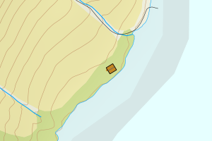
1557 Gjemnes | d9fc3754-1a24-4a96-b50b-b272f8f2a039 | 181351713 | 0.39 | N: 6967602.00, Ø: 428656.00 | ![Kartbilde fra WMS-tjeneste av avviket](https://wms.geonorge.no/skwms1/wms.topo?VERSION=1.1.1&SERVICE=WMS&REQUEST=GetMap&LAYERS=topo&STYLES=&FORMAT=image/png&SRS=EPSG:25832&BBOX=428580.0,6967552,428730.0,6967652&WIDTH=300&HEIGHT=200) |
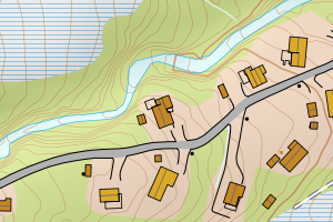
1557 Gjemnes | d3a7042f-49c0-490c-b496-5cc0ba722f10 | 10383285 | 0.52 | N: 6980061.00, Ø: 442665.00 | ![Kartbilde fra WMS-tjeneste av avviket](https://wms.geonorge.no/skwms1/wms.topo?VERSION=1.1.1&SERVICE=WMS&REQUEST=GetMap&LAYERS=topo&STYLES=&FORMAT=image/png&SRS=EPSG:25832&BBOX=442589.0,6980011,442739.0,6980111&WIDTH=300&HEIGHT=200) |
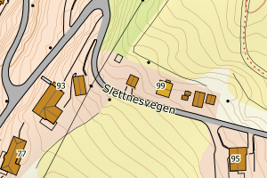
1557 Gjemnes | baab14f5-d430-4b18-a34b-3ced68c33ea4 | 21143669 | 0.52 | N: 6985333.00, Ø: 440433.00 | ![Kartbilde fra WMS-tjeneste av avviket](https://wms.geonorge.no/skwms1/wms.topo?VERSION=1.1.1&SERVICE=WMS&REQUEST=GetMap&LAYERS=topo&STYLES=&FORMAT=image/png&SRS=EPSG:25832&BBOX=440357.0,6985283,440507.0,6985383&WIDTH=300&HEIGHT=200) |
1557 Gjemnes | c033c21f-847c-45cd-b0ac-88425440d4b8 | 181368543 | 0.67 | N: 6979841.00, Ø: 442361.00 | ![Kartbilde fra WMS-tjeneste av avviket](https://wms.geonorge.no/skwms1/wms.topo?VERSION=1.1.1&SERVICE=WMS&REQUEST=GetMap&LAYERS=topo&STYLES=&FORMAT=image/png&SRS=EPSG:25832&BBOX=442285.0,6979791,442435.0,6979891&WIDTH=300&HEIGHT=200) |
1557 Gjemnes | 4f609b91-fc05-4b4b-b513-e76aa308e99f | 181358599 | 0.69 | N: 6972861.00, Ø: 432039.50 | ![Kartbilde fra WMS-tjeneste av avviket](https://wms.geonorge.no/skwms1/wms.topo?VERSION=1.1.1&SERVICE=WMS&REQUEST=GetMap&LAYERS=topo&STYLES=&FORMAT=image/png&SRS=EPSG:25832&BBOX=431964.0,6972811,432114.0,6972911&WIDTH=300&HEIGHT=200) |
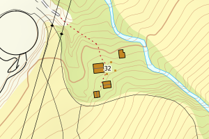
1557 Gjemnes | 5052c473-c253-4cc0-8c77-3546ed15a829 | 181364378 | 0.71 | N: 6969905.00, Ø: 441639.00 | ![Kartbilde fra WMS-tjeneste av avviket](https://wms.geonorge.no/skwms1/wms.topo?VERSION=1.1.1&SERVICE=WMS&REQUEST=GetMap&LAYERS=topo&STYLES=&FORMAT=image/png&SRS=EPSG:25832&BBOX=441563.0,6969855,441713.0,6969955&WIDTH=300&HEIGHT=200) |
1557 Gjemnes | 6cc2d5e7-dcc6-4e24-8f2a-1f7a20626f2c | 181378352 | 0.72 | N: 6981179.00, Ø: 443533.00 | ![Kartbilde fra WMS-tjeneste av avviket](https://wms.geonorge.no/skwms1/wms.topo?VERSION=1.1.1&SERVICE=WMS&REQUEST=GetMap&LAYERS=topo&STYLES=&FORMAT=image/png&SRS=EPSG:25832&BBOX=443457.0,6981129,443607.0,6981229&WIDTH=300&HEIGHT=200) |
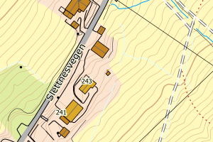
1557 Gjemnes | 48498b4b-5022-40fd-a6a3-28615d1e9d41 | 300271980 | 0.76 | N: 6977286.00, Ø: 434077.00 | ![Kartbilde fra WMS-tjeneste av avviket](https://wms.geonorge.no/skwms1/wms.topo?VERSION=1.1.1&SERVICE=WMS&REQUEST=GetMap&LAYERS=topo&STYLES=&FORMAT=image/png&SRS=EPSG:25832&BBOX=434001.0,6977236,434151.0,6977336&WIDTH=300&HEIGHT=200) |
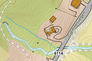
1557 Gjemnes | 6322a1eb-920e-4acb-96f9-d8b25a027098 | 181354267 | 0.79 | N: 6976083.00, Ø: 433218.00 | ![Kartbilde fra WMS-tjeneste av avviket](https://wms.geonorge.no/skwms1/wms.topo?VERSION=1.1.1&SERVICE=WMS&REQUEST=GetMap&LAYERS=topo&STYLES=&FORMAT=image/png&SRS=EPSG:25832&BBOX=433142.0,6976033,433292.0,6976133&WIDTH=300&HEIGHT=200) |
1557 Gjemnes | 4079494a-226d-4263-ba93-77dcfedf0201 | 181357444 | 0.82 | N: 6974313.00, Ø: 433180.00 | ![Kartbilde fra WMS-tjeneste av avviket](https://wms.geonorge.no/skwms1/wms.topo?VERSION=1.1.1&SERVICE=WMS&REQUEST=GetMap&LAYERS=topo&STYLES=&FORMAT=image/png&SRS=EPSG:25832&BBOX=433104.0,6974263,433254.0,6974363&WIDTH=300&HEIGHT=200) |
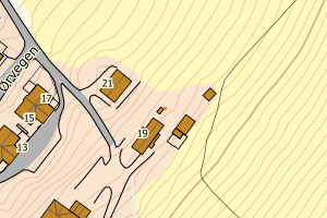
1557 Gjemnes | 01c72975-3114-4da9-bd92-7d0c7e59563e | 21144681 | 0.87 | N: 6981778.00, Ø: 446199.00 | ![Kartbilde fra WMS-tjeneste av avviket](https://wms.geonorge.no/skwms1/wms.topo?VERSION=1.1.1&SERVICE=WMS&REQUEST=GetMap&LAYERS=topo&STYLES=&FORMAT=image/png&SRS=EPSG:25832&BBOX=446123.0,6981728,446273.0,6981828&WIDTH=300&HEIGHT=200) |
1557 Gjemnes | 74a21ee9-9560-4e82-91a0-0d06c5e82d5b | 181351608 | 0.87 | N: 6968019.00, Ø: 428829.00 | ![Kartbilde fra WMS-tjeneste av avviket](https://wms.geonorge.no/skwms1/wms.topo?VERSION=1.1.1&SERVICE=WMS&REQUEST=GetMap&LAYERS=topo&STYLES=&FORMAT=image/png&SRS=EPSG:25832&BBOX=428753.0,6967969,428903.0,6968069&WIDTH=300&HEIGHT=200) |