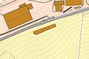
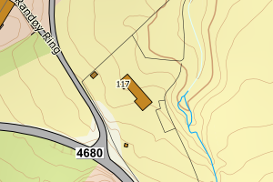
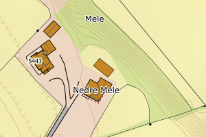
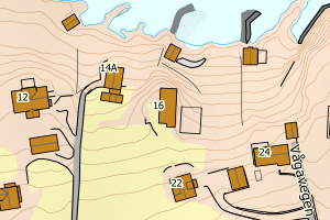
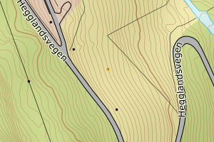
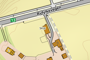
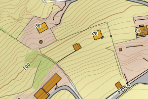
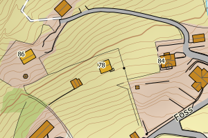
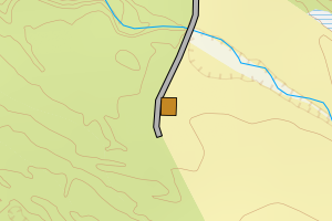
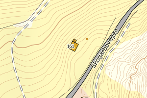
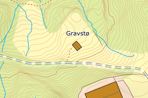
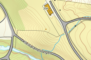
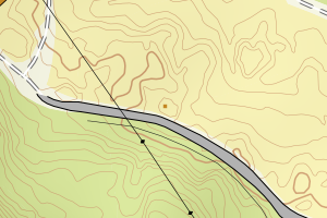
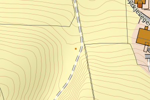
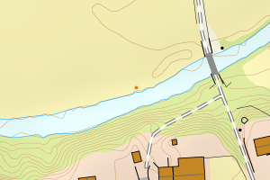
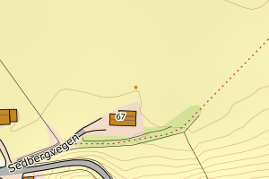
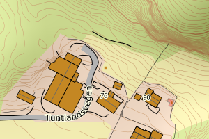
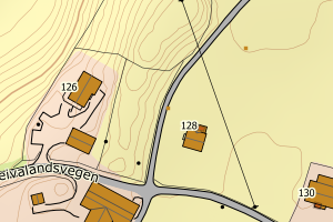
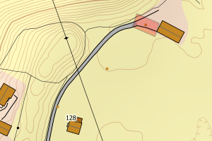
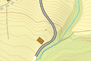
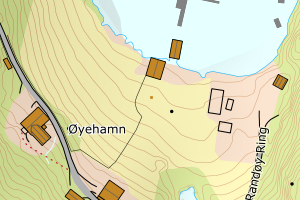
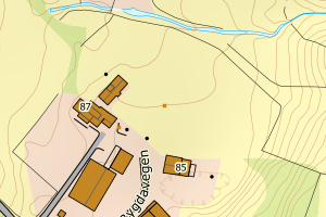
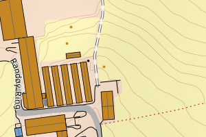
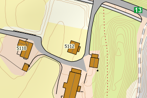
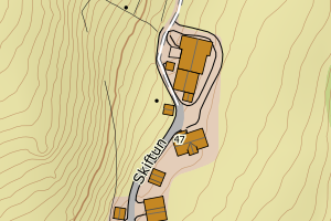
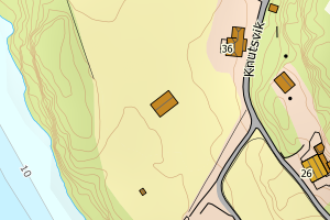
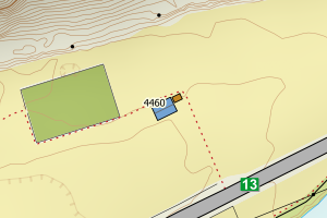
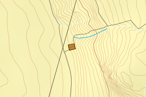
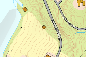
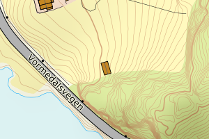
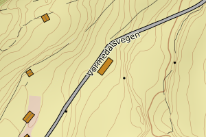
Avvikene kan skyldes enten feil bygningskoordinat eller bygningstype/status i matrikkel eller feil arealtype i AR5. Vær oppmerksom på det er krav om arealer på over 200 m2 før det er krav om endring av arealtype i AR5 så avvikene vil ikke alltid kreve retting i datagrunnlaget
Kommune | LokalId | Bygningsnummer | Arealtype | Bygningstatus | Bygningstype | matrikkel_vedtaksdato | Posisjon | WMS-bilde |
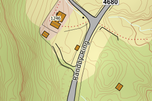
1133 Hjelmeland | 7c5364be-7f72-4bef-83bc-f67546fff082 | 172266835 | 21 | TB | 249 | None | N: 6574183.00, Ø: 338291.00 | ![Kartbilde fra WMS-tjeneste av avviket](https://wms.geonorge.no/skwms1/wms.topo?VERSION=1.1.1&SERVICE=WMS&REQUEST=GetMap&LAYERS=topo&STYLES=&FORMAT=image/png&SRS=EPSG:25832&BBOX=338215.0,6574132,338365.0,6574232&WIDTH=300&HEIGHT=200) |
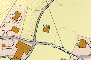
1133 Hjelmeland | a4d3cc42-be2f-4130-8b75-ffe93a915e8a | 172238378 | 21 | TB | 249 | None | N: 6574837.00, Ø: 337262.00 | ![Kartbilde fra WMS-tjeneste av avviket](https://wms.geonorge.no/skwms1/wms.topo?VERSION=1.1.1&SERVICE=WMS&REQUEST=GetMap&LAYERS=topo&STYLES=&FORMAT=image/png&SRS=EPSG:25832&BBOX=337186.0,6574786,337336.0,6574886&WIDTH=300&HEIGHT=200) |
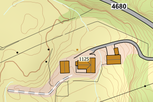
1133 Hjelmeland | e3ac3cf5-58bb-4bad-8b0a-fb1c91259533 | 172266819 | 21 | TB | 249 | None | N: 6574539.00, Ø: 338212.00 | ![Kartbilde fra WMS-tjeneste av avviket](https://wms.geonorge.no/skwms1/wms.topo?VERSION=1.1.1&SERVICE=WMS&REQUEST=GetMap&LAYERS=topo&STYLES=&FORMAT=image/png&SRS=EPSG:25832&BBOX=338136.0,6574488,338286.0,6574588&WIDTH=300&HEIGHT=200) |
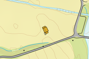
1133 Hjelmeland | bb99de61-ed29-4fe2-92b5-e673831aa39d | 172241778 | 21 | TB | 619 | None | N: 6555856.00, Ø: 339506.00 | ![Kartbilde fra WMS-tjeneste av avviket](https://wms.geonorge.no/skwms1/wms.topo?VERSION=1.1.1&SERVICE=WMS&REQUEST=GetMap&LAYERS=topo&STYLES=&FORMAT=image/png&SRS=EPSG:25832&BBOX=339430.0,6555805,339580.0,6555905&WIDTH=300&HEIGHT=200) |
1133 Hjelmeland | bd9e72d1-caf9-44e5-b175-ca85a3d9f53e | 172226647 | 21 | TB | 249 | None | N: 6560277.00, Ø: 335010.00 | ![Kartbilde fra WMS-tjeneste av avviket](https://wms.geonorge.no/skwms1/wms.topo?VERSION=1.1.1&SERVICE=WMS&REQUEST=GetMap&LAYERS=topo&STYLES=&FORMAT=image/png&SRS=EPSG:25832&BBOX=334934.0,6560226,335084.0,6560326&WIDTH=300&HEIGHT=200) |
1133 Hjelmeland | e600a253-df7d-4ca4-bf4c-b398330c90e5 | 172233058 | 21 | TB | 249 | None | N: 6567319.00, Ø: 332946.00 | ![Kartbilde fra WMS-tjeneste av avviket](https://wms.geonorge.no/skwms1/wms.topo?VERSION=1.1.1&SERVICE=WMS&REQUEST=GetMap&LAYERS=topo&STYLES=&FORMAT=image/png&SRS=EPSG:25832&BBOX=332870.0,6567268,333020.0,6567368&WIDTH=300&HEIGHT=200) |
1133 Hjelmeland | 8a2a12ba-2e8a-4548-9af5-af6febfff4cd | 172252133 | 21 | TB | 241 | None | N: 6569264.00, Ø: 339747.00 | ![Kartbilde fra WMS-tjeneste av avviket](https://wms.geonorge.no/skwms1/wms.topo?VERSION=1.1.1&SERVICE=WMS&REQUEST=GetMap&LAYERS=topo&STYLES=&FORMAT=image/png&SRS=EPSG:25832&BBOX=339671.0,6569213,339821.0,6569313&WIDTH=300&HEIGHT=200) |
1133 Hjelmeland | 68e3cdc7-47ba-425c-a9da-b7e5b9bf4d7d | 172237819 | 21 | TB | 241 | None | N: 6574596.00, Ø: 338290.00 | ![Kartbilde fra WMS-tjeneste av avviket](https://wms.geonorge.no/skwms1/wms.topo?VERSION=1.1.1&SERVICE=WMS&REQUEST=GetMap&LAYERS=topo&STYLES=&FORMAT=image/png&SRS=EPSG:25832&BBOX=338214.0,6574545,338364.0,6574645&WIDTH=300&HEIGHT=200) |
1133 Hjelmeland | ae7b6a1d-9413-45eb-99ce-2516736e9762 | 172237827 | 21 | TB | 163 | None | N: 6574609.00, Ø: 338313.00 | ![Kartbilde fra WMS-tjeneste av avviket](https://wms.geonorge.no/skwms1/wms.topo?VERSION=1.1.1&SERVICE=WMS&REQUEST=GetMap&LAYERS=topo&STYLES=&FORMAT=image/png&SRS=EPSG:25832&BBOX=338237.0,6574558,338387.0,6574658&WIDTH=300&HEIGHT=200) |
1133 Hjelmeland | a9025e5f-5e80-44f6-8f9d-a668deb21d2e | 172249922 | 21 | TB | 249 | None | N: 6570265.00, Ø: 344452.00 | ![Kartbilde fra WMS-tjeneste av avviket](https://wms.geonorge.no/skwms1/wms.topo?VERSION=1.1.1&SERVICE=WMS&REQUEST=GetMap&LAYERS=topo&STYLES=&FORMAT=image/png&SRS=EPSG:25832&BBOX=344376.0,6570214,344526.0,6570314&WIDTH=300&HEIGHT=200) |
1133 Hjelmeland | 424c5201-8c9a-47af-aeca-7fb18627554e | 172264204 | 21 | TB | 249 | None | N: 6568934.00, Ø: 349291.00 | ![Kartbilde fra WMS-tjeneste av avviket](https://wms.geonorge.no/skwms1/wms.topo?VERSION=1.1.1&SERVICE=WMS&REQUEST=GetMap&LAYERS=topo&STYLES=&FORMAT=image/png&SRS=EPSG:25832&BBOX=349215.0,6568883,349365.0,6568983&WIDTH=300&HEIGHT=200) |
1133 Hjelmeland | 3fcd2ec8-c8db-4ef3-932e-8bf17428bd5e | 172238386 | 21 | TB | 249 | None | N: 6574850.00, Ø: 337257.00 | ![Kartbilde fra WMS-tjeneste av avviket](https://wms.geonorge.no/skwms1/wms.topo?VERSION=1.1.1&SERVICE=WMS&REQUEST=GetMap&LAYERS=topo&STYLES=&FORMAT=image/png&SRS=EPSG:25832&BBOX=337181.0,6574799,337331.0,6574899&WIDTH=300&HEIGHT=200) |
1133 Hjelmeland | 560a0600-2f9b-48db-ba50-22c4cbe83a69 | 172270700 | 21 | TB | 241 | None | N: 6566052.00, Ø: 335245.00 | ![Kartbilde fra WMS-tjeneste av avviket](https://wms.geonorge.no/skwms1/wms.topo?VERSION=1.1.1&SERVICE=WMS&REQUEST=GetMap&LAYERS=topo&STYLES=&FORMAT=image/png&SRS=EPSG:25832&BBOX=335169.0,6566001,335319.0,6566101&WIDTH=300&HEIGHT=200) |
1133 Hjelmeland | 10174343-69c7-4469-a01c-60e34386c7bd | 172246052 | 21 | TB | 249 | None | N: 6559035.00, Ø: 340488.00 | ![Kartbilde fra WMS-tjeneste av avviket](https://wms.geonorge.no/skwms1/wms.topo?VERSION=1.1.1&SERVICE=WMS&REQUEST=GetMap&LAYERS=topo&STYLES=&FORMAT=image/png&SRS=EPSG:25832&BBOX=340412.0,6558984,340562.0,6559084&WIDTH=300&HEIGHT=200) |
1133 Hjelmeland | 40c2240f-dc10-4e84-bbcd-3e2851458aec | 172245234 | 21 | TB | 249 | None | N: 6560959.00, Ø: 341476.00 | ![Kartbilde fra WMS-tjeneste av avviket](https://wms.geonorge.no/skwms1/wms.topo?VERSION=1.1.1&SERVICE=WMS&REQUEST=GetMap&LAYERS=topo&STYLES=&FORMAT=image/png&SRS=EPSG:25832&BBOX=341400.0,6560908,341550.0,6561008&WIDTH=300&HEIGHT=200) |
1133 Hjelmeland | be57c676-dd84-4aea-b632-9c13da110c65 | 172246028 | 21 | TB | 241 | None | N: 6559066.00, Ø: 340438.00 | ![Kartbilde fra WMS-tjeneste av avviket](https://wms.geonorge.no/skwms1/wms.topo?VERSION=1.1.1&SERVICE=WMS&REQUEST=GetMap&LAYERS=topo&STYLES=&FORMAT=image/png&SRS=EPSG:25832&BBOX=340362.0,6559015,340512.0,6559115&WIDTH=300&HEIGHT=200) |
1133 Hjelmeland | 5d0fae82-6642-40d1-9244-543742d35015 | 172246842 | 21 | TB | 241 | None | N: 6557506.00, Ø: 343885.00 | ![Kartbilde fra WMS-tjeneste av avviket](https://wms.geonorge.no/skwms1/wms.topo?VERSION=1.1.1&SERVICE=WMS&REQUEST=GetMap&LAYERS=topo&STYLES=&FORMAT=image/png&SRS=EPSG:25832&BBOX=343809.0,6557455,343959.0,6557555&WIDTH=300&HEIGHT=200) |
1133 Hjelmeland | 7a345c7a-e3f7-459d-a1c5-1675c17a1ce4 | 172246788 | 21 | TB | 249 | None | N: 6557459.00, Ø: 343701.00 | ![Kartbilde fra WMS-tjeneste av avviket](https://wms.geonorge.no/skwms1/wms.topo?VERSION=1.1.1&SERVICE=WMS&REQUEST=GetMap&LAYERS=topo&STYLES=&FORMAT=image/png&SRS=EPSG:25832&BBOX=343625.0,6557408,343775.0,6557508&WIDTH=300&HEIGHT=200) |
1133 Hjelmeland | bd1e0ff9-199c-48dc-9db0-d1b1e7d4556d | 172246311 | 21 | TB | 249 | None | N: 6559331.00, Ø: 342194.00 | ![Kartbilde fra WMS-tjeneste av avviket](https://wms.geonorge.no/skwms1/wms.topo?VERSION=1.1.1&SERVICE=WMS&REQUEST=GetMap&LAYERS=topo&STYLES=&FORMAT=image/png&SRS=EPSG:25832&BBOX=342118.0,6559280,342268.0,6559380&WIDTH=300&HEIGHT=200) |
1133 Hjelmeland | 4158eb9d-b4df-4bdc-b558-27e6c6780e40 | 172222145 | 21 | TB | 241 | None | N: 6565409.00, Ø: 331481.00 | ![Kartbilde fra WMS-tjeneste av avviket](https://wms.geonorge.no/skwms1/wms.topo?VERSION=1.1.1&SERVICE=WMS&REQUEST=GetMap&LAYERS=topo&STYLES=&FORMAT=image/png&SRS=EPSG:25832&BBOX=331405.0,6565358,331555.0,6565458&WIDTH=300&HEIGHT=200) |
1133 Hjelmeland | 891cd16d-ce5f-4cb8-bbd9-7f1192482185 | 172228283 | 21 | TB | 249 | None | N: 6566578.00, Ø: 332101.00 | ![Kartbilde fra WMS-tjeneste av avviket](https://wms.geonorge.no/skwms1/wms.topo?VERSION=1.1.1&SERVICE=WMS&REQUEST=GetMap&LAYERS=topo&STYLES=&FORMAT=image/png&SRS=EPSG:25832&BBOX=332025.0,6566527,332175.0,6566627&WIDTH=300&HEIGHT=200) |
1133 Hjelmeland | 48894c3c-7649-4bc3-8598-1e7dad8f9e7f | 172232264 | 21 | TB | 241 | None | N: 6569449.00, Ø: 333864.00 | ![Kartbilde fra WMS-tjeneste av avviket](https://wms.geonorge.no/skwms1/wms.topo?VERSION=1.1.1&SERVICE=WMS&REQUEST=GetMap&LAYERS=topo&STYLES=&FORMAT=image/png&SRS=EPSG:25832&BBOX=333788.0,6569398,333938.0,6569498&WIDTH=300&HEIGHT=200) |
1133 Hjelmeland | 2a81a953-0b5b-4a1c-8262-b6af1fefe6ad | 172234690 | 21 | TB | 249 | None | N: 6568771.00, Ø: 333778.00 | ![Kartbilde fra WMS-tjeneste av avviket](https://wms.geonorge.no/skwms1/wms.topo?VERSION=1.1.1&SERVICE=WMS&REQUEST=GetMap&LAYERS=topo&STYLES=&FORMAT=image/png&SRS=EPSG:25832&BBOX=333702.0,6568720,333852.0,6568820&WIDTH=300&HEIGHT=200) |
1133 Hjelmeland | c71456c4-389d-4bd4-90f3-e91749e6d37e | 172232442 | 21 | TB | 241 | None | N: 6569461.00, Ø: 333867.00 | ![Kartbilde fra WMS-tjeneste av avviket](https://wms.geonorge.no/skwms1/wms.topo?VERSION=1.1.1&SERVICE=WMS&REQUEST=GetMap&LAYERS=topo&STYLES=&FORMAT=image/png&SRS=EPSG:25832&BBOX=333791.0,6569410,333941.0,6569510&WIDTH=300&HEIGHT=200) |
1133 Hjelmeland | d09ed30c-cce7-4d83-a514-6f6f69a5e167 | 172243827 | 21 | TB | 249 | None | N: 6560610.00, Ø: 340361.00 | ![Kartbilde fra WMS-tjeneste av avviket](https://wms.geonorge.no/skwms1/wms.topo?VERSION=1.1.1&SERVICE=WMS&REQUEST=GetMap&LAYERS=topo&STYLES=&FORMAT=image/png&SRS=EPSG:25832&BBOX=340285.0,6560559,340435.0,6560659&WIDTH=300&HEIGHT=200) |
1133 Hjelmeland | 1d265998-da92-40f9-9493-cb5ca06ea607 | 172243177 | 21 | TB | 249 | None | N: 6561027.00, Ø: 339782.00 | ![Kartbilde fra WMS-tjeneste av avviket](https://wms.geonorge.no/skwms1/wms.topo?VERSION=1.1.1&SERVICE=WMS&REQUEST=GetMap&LAYERS=topo&STYLES=&FORMAT=image/png&SRS=EPSG:25832&BBOX=339706.0,6560976,339856.0,6561076&WIDTH=300&HEIGHT=200) |
1133 Hjelmeland | f7b9e563-e04d-4d8f-84bc-50fbde5c4a41 | 172242820 | 21 | TB | 249 | None | N: 6560750.00, Ø: 340181.00 | ![Kartbilde fra WMS-tjeneste av avviket](https://wms.geonorge.no/skwms1/wms.topo?VERSION=1.1.1&SERVICE=WMS&REQUEST=GetMap&LAYERS=topo&STYLES=&FORMAT=image/png&SRS=EPSG:25832&BBOX=340105.0,6560699,340255.0,6560799&WIDTH=300&HEIGHT=200) |
1133 Hjelmeland | aeaa64ca-054a-4c9a-8172-87ae9c364281 | 172253059 | 21 | TB | 249 | None | N: 6568729.00, Ø: 338886.00 | ![Kartbilde fra WMS-tjeneste av avviket](https://wms.geonorge.no/skwms1/wms.topo?VERSION=1.1.1&SERVICE=WMS&REQUEST=GetMap&LAYERS=topo&STYLES=&FORMAT=image/png&SRS=EPSG:25832&BBOX=338810.0,6568678,338960.0,6568778&WIDTH=300&HEIGHT=200) |
1133 Hjelmeland | 26599591-95fa-4abf-b418-b61d1a6ef264 | 172257003 | 21 | TB | 241 | None | N: 6569732.00, Ø: 350507.00 | ![Kartbilde fra WMS-tjeneste av avviket](https://wms.geonorge.no/skwms1/wms.topo?VERSION=1.1.1&SERVICE=WMS&REQUEST=GetMap&LAYERS=topo&STYLES=&FORMAT=image/png&SRS=EPSG:25832&BBOX=350431.0,6569681,350581.0,6569781&WIDTH=300&HEIGHT=200) |
1133 Hjelmeland | 709a8782-45ae-46c8-88d5-464107d9b23d | 172256996 | 21 | TB | 249 | None | N: 6569759.00, Ø: 350542.00 | ![Kartbilde fra WMS-tjeneste av avviket](https://wms.geonorge.no/skwms1/wms.topo?VERSION=1.1.1&SERVICE=WMS&REQUEST=GetMap&LAYERS=topo&STYLES=&FORMAT=image/png&SRS=EPSG:25832&BBOX=350466.0,6569708,350616.0,6569808&WIDTH=300&HEIGHT=200) |
1133 Hjelmeland | 466a4eb3-64fb-4c48-add8-3f938a66cac5 | 172253342 | 21 | TB | 249 | None | N: 6568463.00, Ø: 338510.00 | ![Kartbilde fra WMS-tjeneste av avviket](https://wms.geonorge.no/skwms1/wms.topo?VERSION=1.1.1&SERVICE=WMS&REQUEST=GetMap&LAYERS=topo&STYLES=&FORMAT=image/png&SRS=EPSG:25832&BBOX=338434.0,6568412,338584.0,6568512&WIDTH=300&HEIGHT=200) |
1133 Hjelmeland | c20323cb-1079-41fe-86f0-ba72fdcec6c5 | 172264069 | 21 | TB | 183 | None | N: 6569111.00, Ø: 332875.00 | ![Kartbilde fra WMS-tjeneste av avviket](https://wms.geonorge.no/skwms1/wms.topo?VERSION=1.1.1&SERVICE=WMS&REQUEST=GetMap&LAYERS=topo&STYLES=&FORMAT=image/png&SRS=EPSG:25832&BBOX=332799.0,6569060,332949.0,6569160&WIDTH=300&HEIGHT=200) |
1133 Hjelmeland | 3b947cc2-14f1-48d7-aa9c-7f0b911e4ffa | 172265731 | 21 | TB | 249 | None | N: 6568056.00, Ø: 341269.00 | ![Kartbilde fra WMS-tjeneste av avviket](https://wms.geonorge.no/skwms1/wms.topo?VERSION=1.1.1&SERVICE=WMS&REQUEST=GetMap&LAYERS=topo&STYLES=&FORMAT=image/png&SRS=EPSG:25832&BBOX=341193.0,6568005,341343.0,6568105&WIDTH=300&HEIGHT=200) |
1133 Hjelmeland | 6ebdd75b-0140-4270-b84e-ea87b699eb44 | 172268900 | 21 | TB | 249 | None | N: 6569432.00, Ø: 333891.00 | ![Kartbilde fra WMS-tjeneste av avviket](https://wms.geonorge.no/skwms1/wms.topo?VERSION=1.1.1&SERVICE=WMS&REQUEST=GetMap&LAYERS=topo&STYLES=&FORMAT=image/png&SRS=EPSG:25832&BBOX=333815.0,6569381,333965.0,6569481&WIDTH=300&HEIGHT=200) |
1133 Hjelmeland | d714886f-4ac6-4881-84a7-7fa96d740d5e | 172264298 | 21 | TB | 249 | None | N: 6569253.00, Ø: 350864.00 | ![Kartbilde fra WMS-tjeneste av avviket](https://wms.geonorge.no/skwms1/wms.topo?VERSION=1.1.1&SERVICE=WMS&REQUEST=GetMap&LAYERS=topo&STYLES=&FORMAT=image/png&SRS=EPSG:25832&BBOX=350788.0,6569202,350938.0,6569302&WIDTH=300&HEIGHT=200) |
1133 Hjelmeland | 66ab61bb-ad44-4a82-ad1e-3bb875372c51 | 172224814 | 21 | TB | 249 | None | N: 6568261.00, Ø: 331570.00 | ![Kartbilde fra WMS-tjeneste av avviket](https://wms.geonorge.no/skwms1/wms.topo?VERSION=1.1.1&SERVICE=WMS&REQUEST=GetMap&LAYERS=topo&STYLES=&FORMAT=image/png&SRS=EPSG:25832&BBOX=331494.0,6568210,331644.0,6568310&WIDTH=300&HEIGHT=200) |
1133 Hjelmeland | 818a41b4-0f9b-420d-9f57-5e641677ca58 | 172225101 | 21 | TB | 249 | None | N: 6568051.00, Ø: 330280.00 | ![Kartbilde fra WMS-tjeneste av avviket](https://wms.geonorge.no/skwms1/wms.topo?VERSION=1.1.1&SERVICE=WMS&REQUEST=GetMap&LAYERS=topo&STYLES=&FORMAT=image/png&SRS=EPSG:25832&BBOX=330204.0,6568000,330354.0,6568100&WIDTH=300&HEIGHT=200) |
1133 Hjelmeland | fc9bdc06-fece-4d73-9b49-bc09979412e1 | 172232280 | 21 | TB | 241 | None | N: 6569441.00, Ø: 333867.00 | ![Kartbilde fra WMS-tjeneste av avviket](https://wms.geonorge.no/skwms1/wms.topo?VERSION=1.1.1&SERVICE=WMS&REQUEST=GetMap&LAYERS=topo&STYLES=&FORMAT=image/png&SRS=EPSG:25832&BBOX=333791.0,6569390,333941.0,6569490&WIDTH=300&HEIGHT=200) |
1133 Hjelmeland | df7b3a33-a025-4aac-95b6-0d0febdc2812 | 172257526 | 21 | TB | 171 | None | N: 6570594.00, Ø: 349338.00 | ![Kartbilde fra WMS-tjeneste av avviket](https://wms.geonorge.no/skwms1/wms.topo?VERSION=1.1.1&SERVICE=WMS&REQUEST=GetMap&LAYERS=topo&STYLES=&FORMAT=image/png&SRS=EPSG:25832&BBOX=349262.0,6570543,349412.0,6570643&WIDTH=300&HEIGHT=200) |
1133 Hjelmeland | eaec5367-9c86-44c8-a2c4-75a772ba7411 | 172256988 | 21 | TB | 113 | None | N: 6569718.00, Ø: 350518.00 | ![Kartbilde fra WMS-tjeneste av avviket](https://wms.geonorge.no/skwms1/wms.topo?VERSION=1.1.1&SERVICE=WMS&REQUEST=GetMap&LAYERS=topo&STYLES=&FORMAT=image/png&SRS=EPSG:25832&BBOX=350442.0,6569667,350592.0,6569767&WIDTH=300&HEIGHT=200) |
1133 Hjelmeland | 1d8712dd-41ad-4f00-9b10-8bbf1c477906 | 172238297 | 21 | TB | 249 | None | N: 6574662.00, Ø: 337085.00 | ![Kartbilde fra WMS-tjeneste av avviket](https://wms.geonorge.no/skwms1/wms.topo?VERSION=1.1.1&SERVICE=WMS&REQUEST=GetMap&LAYERS=topo&STYLES=&FORMAT=image/png&SRS=EPSG:25832&BBOX=337009.0,6574611,337159.0,6574711&WIDTH=300&HEIGHT=200) |
1133 Hjelmeland | 247a54c5-597b-4b75-b848-713890b013fb | 172239471 | 21 | TB | 249 | None | N: 6575413.00, Ø: 336056.00 | ![Kartbilde fra WMS-tjeneste av avviket](https://wms.geonorge.no/skwms1/wms.topo?VERSION=1.1.1&SERVICE=WMS&REQUEST=GetMap&LAYERS=topo&STYLES=&FORMAT=image/png&SRS=EPSG:25832&BBOX=335980.0,6575362,336130.0,6575462&WIDTH=300&HEIGHT=200) |
1133 Hjelmeland | 9a02c2a7-556a-4dec-aae3-91c2e173c1cc | 172247342 | 21 | TB | 113 | None | N: 6558953.00, Ø: 340994.00 | ![Kartbilde fra WMS-tjeneste av avviket](https://wms.geonorge.no/skwms1/wms.topo?VERSION=1.1.1&SERVICE=WMS&REQUEST=GetMap&LAYERS=topo&STYLES=&FORMAT=image/png&SRS=EPSG:25832&BBOX=340918.0,6558902,341068.0,6559002&WIDTH=300&HEIGHT=200) |
1133 Hjelmeland | ab190b25-4d0f-4385-bfae-ffd623d01231 | 172245250 | 21 | TB | 163 | None | N: 6560950.00, Ø: 341463.00 | ![Kartbilde fra WMS-tjeneste av avviket](https://wms.geonorge.no/skwms1/wms.topo?VERSION=1.1.1&SERVICE=WMS&REQUEST=GetMap&LAYERS=topo&STYLES=&FORMAT=image/png&SRS=EPSG:25832&BBOX=341387.0,6560899,341537.0,6560999&WIDTH=300&HEIGHT=200) |
1133 Hjelmeland | 6820df16-35de-4309-af0f-d2baff834f3f | 301288309 | 21 | MB | 111 | 2024-12-11 | N: 6560152.30, Ø: 337807.10 | ![Kartbilde fra WMS-tjeneste av avviket](https://wms.geonorge.no/skwms1/wms.topo?VERSION=1.1.1&SERVICE=WMS&REQUEST=GetMap&LAYERS=topo&STYLES=&FORMAT=image/png&SRS=EPSG:25832&BBOX=337732.0,6560102,337882.0,6560202&WIDTH=300&HEIGHT=200) |
1133 Hjelmeland | b3aad443-07d3-44f1-a368-b1cb32b3a219 | 301428440 | 21 | FA | 619 | 2024-11-14 | N: 6568980.00, Ø: 338722.80 | ![Kartbilde fra WMS-tjeneste av avviket](https://wms.geonorge.no/skwms1/wms.topo?VERSION=1.1.1&SERVICE=WMS&REQUEST=GetMap&LAYERS=topo&STYLES=&FORMAT=image/png&SRS=EPSG:25832&BBOX=338647.0,6568930,338797.0,6569030&WIDTH=300&HEIGHT=200) |
1133 Hjelmeland | 9c7bcf01-036d-4c0e-8acf-83331566e770 | 301156698 | 21 | FA | 111 | 2024-06-24 | N: 6569180.30, Ø: 334345.00 | ![Kartbilde fra WMS-tjeneste av avviket](https://wms.geonorge.no/skwms1/wms.topo?VERSION=1.1.1&SERVICE=WMS&REQUEST=GetMap&LAYERS=topo&STYLES=&FORMAT=image/png&SRS=EPSG:25832&BBOX=334269.0,6569130,334419.0,6569230&WIDTH=300&HEIGHT=200) |
1133 Hjelmeland | b442d542-655e-4df0-957c-7ee629b55756 | 301228944 | 21 | FA | 111 | 2023-09-07 | N: 6569139.30, Ø: 334250.10 | ![Kartbilde fra WMS-tjeneste av avviket](https://wms.geonorge.no/skwms1/wms.topo?VERSION=1.1.1&SERVICE=WMS&REQUEST=GetMap&LAYERS=topo&STYLES=&FORMAT=image/png&SRS=EPSG:25832&BBOX=334175.0,6569089,334325.0,6569189&WIDTH=300&HEIGHT=200) |
1133 Hjelmeland | b93f378d-09d9-424a-83af-92b5b2d1f158 | 301240519 | 21 | FA | 181 | 2023-08-25 | N: 6560238.20, Ø: 338300.80 | ![Kartbilde fra WMS-tjeneste av avviket](https://wms.geonorge.no/skwms1/wms.topo?VERSION=1.1.1&SERVICE=WMS&REQUEST=GetMap&LAYERS=topo&STYLES=&FORMAT=image/png&SRS=EPSG:25832&BBOX=338225.0,6560188,338375.0,6560288&WIDTH=300&HEIGHT=200) |
1133 Hjelmeland | e4b54ce0-7c65-4507-8dea-a35cdeb4c8d9 | 300951429 | 21 | FA | 111 | 2023-04-03 | N: 6569478.40, Ø: 338452.20 | ![Kartbilde fra WMS-tjeneste av avviket](https://wms.geonorge.no/skwms1/wms.topo?VERSION=1.1.1&SERVICE=WMS&REQUEST=GetMap&LAYERS=topo&STYLES=&FORMAT=image/png&SRS=EPSG:25832&BBOX=338377.0,6569428,338527.0,6569528&WIDTH=300&HEIGHT=200) |
1133 Hjelmeland | 4ae152a1-fa46-45a0-b541-84445b34f90e | 15809507 | 21 | TB | 999 | 2004-05-12 | N: 6568064.00, Ø: 336285.00 | ![Kartbilde fra WMS-tjeneste av avviket](https://wms.geonorge.no/skwms1/wms.topo?VERSION=1.1.1&SERVICE=WMS&REQUEST=GetMap&LAYERS=topo&STYLES=&FORMAT=image/png&SRS=EPSG:25832&BBOX=336209.0,6568013,336359.0,6568113&WIDTH=300&HEIGHT=200) |
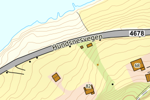
1133 Hjelmeland | c3613632-d6a7-44a7-8f81-6694d90ea6b2 | 15803851 | 21 | TB | 241 | 2001-01-05 | N: 6569982.00, Ø: 343002.00 | ![Kartbilde fra WMS-tjeneste av avviket](https://wms.geonorge.no/skwms1/wms.topo?VERSION=1.1.1&SERVICE=WMS&REQUEST=GetMap&LAYERS=topo&STYLES=&FORMAT=image/png&SRS=EPSG:25832&BBOX=342926.0,6569931,343076.0,6570031&WIDTH=300&HEIGHT=200) |
1133 Hjelmeland | 8e5a5112-945a-4bea-934d-e7af97390c6b | 15802391 | 21 | TB | 249 | 1994-10-24 | N: 6560170.00, Ø: 338503.00 | ![Kartbilde fra WMS-tjeneste av avviket](https://wms.geonorge.no/skwms1/wms.topo?VERSION=1.1.1&SERVICE=WMS&REQUEST=GetMap&LAYERS=topo&STYLES=&FORMAT=image/png&SRS=EPSG:25832&BBOX=338427.0,6560119,338577.0,6560219&WIDTH=300&HEIGHT=200) |