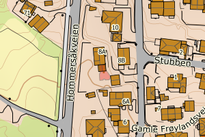
Avvikene skyldes oftest manglende oppdatering av kartreg-egenskapen i FKB-Tiltak. Rettes vanligvis i FKB-Tiltak
Kommune | LokalId | Tiltak_Byggnr | Saksreferanse | Byggstatus | Tiltak_Avgjørelsesdato | Matrikkel_Bygningsstatus | Matrikkel_Vedtaksdato | Posisjon | WMS-bilde |
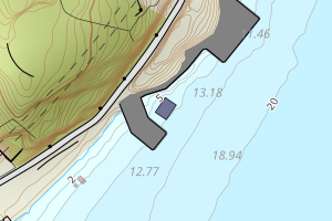
1108 Sandnes | 1210583b-3ffa-4dc0-b93c-89599abcf070 | 300573418 | 2016008729 | 181 | 2016-07-01 00:00:00 | FA | 2017-11-09 | N: 6526048.65, Ø: 313612.52 | ![Kartbilde fra WMS-tjeneste av avviket](https://wms.geonorge.no/skwms1/wms.topo?VERSION=1.1.1&SERVICE=WMS&REQUEST=GetMap&LAYERS=topo&STYLES=&FORMAT=image/png&SRS=EPSG:25832&BBOX=313537.0,6525998,313687.0,6526098&WIDTH=300&HEIGHT=200) |
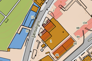
1108 Sandnes | 3085f9ef-bb02-431f-ab97-36d426d82a13 | 300798722 | 201922150 | 121 | 2020-03-26 00:00:00 | FA | 2021-03-24 | N: 6564194.04, Ø: 610781.90 | ![Kartbilde fra WMS-tjeneste av avviket](https://wms.geonorge.no/skwms1/wms.topo?VERSION=1.1.1&SERVICE=WMS&REQUEST=GetMap&LAYERS=topo&STYLES=&FORMAT=image/png&SRS=EPSG:25832&BBOX=610706.0,6564144,610856.0,6564244&WIDTH=300&HEIGHT=200) |
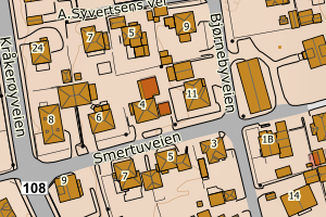
1108 Sandnes | 03a4dcc5-68b0-41bc-b1ae-e9fb1fc9bfe1 | 300614799 | 2017005061 | 181 | 2017-03-29 00:00:00 | FA | 2018-09-20 | N: 6526071.94, Ø: 313966.12 | ![Kartbilde fra WMS-tjeneste av avviket](https://wms.geonorge.no/skwms1/wms.topo?VERSION=1.1.1&SERVICE=WMS&REQUEST=GetMap&LAYERS=topo&STYLES=&FORMAT=image/png&SRS=EPSG:25832&BBOX=313891.0,6526021,314041.0,6526121&WIDTH=300&HEIGHT=200) |
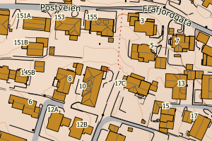
1108 Sandnes | 3664022d-70cc-4d98-9102-704ee3c5b6d0 | 300638669 | 2017011844 | 181 | 2017-08-16 00:00:00 | FA | 2018-06-29 | N: 6526089.13, Ø: 313985.77 | ![Kartbilde fra WMS-tjeneste av avviket](https://wms.geonorge.no/skwms1/wms.topo?VERSION=1.1.1&SERVICE=WMS&REQUEST=GetMap&LAYERS=topo&STYLES=&FORMAT=image/png&SRS=EPSG:25832&BBOX=313910.0,6526039,314060.0,6526139&WIDTH=300&HEIGHT=200) |
1108 Sandnes | 40cb87e5-0bbf-4aec-8d36-b96cbc168b33 | 300638665 | 2017011845 | 181 | 2017-08-16 00:00:00 | FA | 2018-06-29 | N: 6526103.23, Ø: 313995.34 | ![Kartbilde fra WMS-tjeneste av avviket](https://wms.geonorge.no/skwms1/wms.topo?VERSION=1.1.1&SERVICE=WMS&REQUEST=GetMap&LAYERS=topo&STYLES=&FORMAT=image/png&SRS=EPSG:25832&BBOX=313920.0,6526053,314070.0,6526153&WIDTH=300&HEIGHT=200) |
1108 Sandnes | 5e60e6f5-1401-44bd-9b19-2d75b99a8b5f | 300573417 | 2016008729 | 181 | 2016-07-01 00:00:00 | FA | 2017-11-09 | N: 6526052.77, Ø: 313609.47 | ![Kartbilde fra WMS-tjeneste av avviket](https://wms.geonorge.no/skwms1/wms.topo?VERSION=1.1.1&SERVICE=WMS&REQUEST=GetMap&LAYERS=topo&STYLES=&FORMAT=image/png&SRS=EPSG:25832&BBOX=313534.0,6526002,313684.0,6526102&WIDTH=300&HEIGHT=200) |
1108 Sandnes | 64a5d1f9-d4ce-4736-91a1-537e2a9d5181 | 300654545 | 2016014171 | 181 | 2017-04-07 00:00:00 | FA | 2019-01-01 | N: 6527162.33, Ø: 313761.70 | ![Kartbilde fra WMS-tjeneste av avviket](https://wms.geonorge.no/skwms1/wms.topo?VERSION=1.1.1&SERVICE=WMS&REQUEST=GetMap&LAYERS=topo&STYLES=&FORMAT=image/png&SRS=EPSG:25832&BBOX=313686.0,6527112,313836.0,6527212&WIDTH=300&HEIGHT=200) |
1108 Sandnes | 73983c4e-5fba-4b41-8c73-ec907de6f5bb | 300614802 | 2017005061 | 181 | 2017-03-29 00:00:00 | FA | 2023-09-13 | N: 6526054.72, Ø: 313939.82 | ![Kartbilde fra WMS-tjeneste av avviket](https://wms.geonorge.no/skwms1/wms.topo?VERSION=1.1.1&SERVICE=WMS&REQUEST=GetMap&LAYERS=topo&STYLES=&FORMAT=image/png&SRS=EPSG:25832&BBOX=313864.0,6526004,314014.0,6526104&WIDTH=300&HEIGHT=200) |
1108 Sandnes | 74915ac9-29e4-486b-a06c-bc32b74b05e1 | 300658589 | 2017013840 | 181 | 2017-11-30 00:00:00 | FA | 2023-09-05 | N: 6531427.63, Ø: 312245.35 | ![Kartbilde fra WMS-tjeneste av avviket](https://wms.geonorge.no/skwms1/wms.topo?VERSION=1.1.1&SERVICE=WMS&REQUEST=GetMap&LAYERS=topo&STYLES=&FORMAT=image/png&SRS=EPSG:25832&BBOX=312170.0,6531377,312320.0,6531477&WIDTH=300&HEIGHT=200) |
1108 Sandnes | 83b499c2-2309-45ab-87f5-b5191e603d9d | 300654542 | 2016014171 | 181 | 2017-04-07 00:00:00 | FA | 2023-09-13 | N: 6527132.76, Ø: 313751.45 | ![Kartbilde fra WMS-tjeneste av avviket](https://wms.geonorge.no/skwms1/wms.topo?VERSION=1.1.1&SERVICE=WMS&REQUEST=GetMap&LAYERS=topo&STYLES=&FORMAT=image/png&SRS=EPSG:25832&BBOX=313676.0,6527082,313826.0,6527182&WIDTH=300&HEIGHT=200) |
1108 Sandnes | a0c60250-f497-4cd9-ac2b-a7d358032e8a | 300573413 | 2016008729 | 181 | 2016-07-01 00:00:00 | FA | 2017-11-09 | N: 6526056.96, Ø: 313606.37 | ![Kartbilde fra WMS-tjeneste av avviket](https://wms.geonorge.no/skwms1/wms.topo?VERSION=1.1.1&SERVICE=WMS&REQUEST=GetMap&LAYERS=topo&STYLES=&FORMAT=image/png&SRS=EPSG:25832&BBOX=313531.0,6526006,313681.0,6526106&WIDTH=300&HEIGHT=200) |
1108 Sandnes | a76f5938-d960-4321-8cf6-8f6b35539b3d | 300676606 | 2017015066 | 146 | 2018-01-09 00:00:00 | MB | 2021-11-04 | N: 6527876.11, Ø: 311387.93 | ![Kartbilde fra WMS-tjeneste av avviket](https://wms.geonorge.no/skwms1/wms.topo?VERSION=1.1.1&SERVICE=WMS&REQUEST=GetMap&LAYERS=topo&STYLES=&FORMAT=image/png&SRS=EPSG:25832&BBOX=311312.0,6527826,311462.0,6527926&WIDTH=300&HEIGHT=200) |
1108 Sandnes | a9c62d86-51fd-4c23-8c79-6c1bd8c62de6 | 300614801 | 2017005061 | 181 | 2017-03-29 00:00:00 | FA | 2018-09-20 | N: 6526064.28, Ø: 313950.52 | ![Kartbilde fra WMS-tjeneste av avviket](https://wms.geonorge.no/skwms1/wms.topo?VERSION=1.1.1&SERVICE=WMS&REQUEST=GetMap&LAYERS=topo&STYLES=&FORMAT=image/png&SRS=EPSG:25832&BBOX=313875.0,6526014,314025.0,6526114&WIDTH=300&HEIGHT=200) |
1108 Sandnes | b9fdf7f0-1fb1-4c96-994b-109da126de93 | 300710611 | 2018010161 | 112 | 2018-10-15 00:00:00 | FA | 2020-03-20 | N: 6528857.71, Ø: 312930.08 | ![Kartbilde fra WMS-tjeneste av avviket](https://wms.geonorge.no/skwms1/wms.topo?VERSION=1.1.1&SERVICE=WMS&REQUEST=GetMap&LAYERS=topo&STYLES=&FORMAT=image/png&SRS=EPSG:25832&BBOX=312855.0,6528807,313005.0,6528907&WIDTH=300&HEIGHT=200) |
1108 Sandnes | ba822f51-53bf-43d2-98f9-e7796b10e5e1 | 300603748 | 2015011870 | 319 | 2017-01-24 00:00:00 | MB | 2022-07-01 | N: 6536522.69, Ø: 318601.26 | ![Kartbilde fra WMS-tjeneste av avviket](https://wms.geonorge.no/skwms1/wms.topo?VERSION=1.1.1&SERVICE=WMS&REQUEST=GetMap&LAYERS=topo&STYLES=&FORMAT=image/png&SRS=EPSG:25832&BBOX=318526.0,6536472,318676.0,6536572&WIDTH=300&HEIGHT=200) |
1108 Sandnes | c7d6ef9d-48b2-4f09-b168-e6da1fb8b070 | 300722424 | 2018011106 | 145 | 2018-12-19 00:00:00 | FA | 2022-07-08 | N: 6526685.76, Ø: 310971.32 | ![Kartbilde fra WMS-tjeneste av avviket](https://wms.geonorge.no/skwms1/wms.topo?VERSION=1.1.1&SERVICE=WMS&REQUEST=GetMap&LAYERS=topo&STYLES=&FORMAT=image/png&SRS=EPSG:25832&BBOX=310896.0,6526635,311046.0,6526735&WIDTH=300&HEIGHT=200) |
1108 Sandnes | cefe9bd3-af02-4f89-9c8e-4f2524339f4e | 300552816 | 2016003035 | 181 | 2016-03-04 00:00:00 | FA | 2023-08-10 | N: 6526108.70, Ø: 307443.23 | ![Kartbilde fra WMS-tjeneste av avviket](https://wms.geonorge.no/skwms1/wms.topo?VERSION=1.1.1&SERVICE=WMS&REQUEST=GetMap&LAYERS=topo&STYLES=&FORMAT=image/png&SRS=EPSG:25832&BBOX=307368.0,6526058,307518.0,6526158&WIDTH=300&HEIGHT=200) |
1108 Sandnes | dbd2d886-b840-4843-be9b-f81d5f93b95b | 300638661 | 2017011841 | 181 | 2017-08-16 00:00:00 | FA | 2018-09-13 | N: 6526074.68, Ø: 313969.89 | ![Kartbilde fra WMS-tjeneste av avviket](https://wms.geonorge.no/skwms1/wms.topo?VERSION=1.1.1&SERVICE=WMS&REQUEST=GetMap&LAYERS=topo&STYLES=&FORMAT=image/png&SRS=EPSG:25832&BBOX=313894.0,6526024,314044.0,6526124&WIDTH=300&HEIGHT=200) |
1108 Sandnes | f3a76a74-f3aa-4855-9b98-f230730c289d | 300692983 | 2018004301 | 131 | 2018-06-27 00:00:00 | FA | 2020-01-06 | N: 6519839.97, Ø: 315894.42 | ![Kartbilde fra WMS-tjeneste av avviket](https://wms.geonorge.no/skwms1/wms.topo?VERSION=1.1.1&SERVICE=WMS&REQUEST=GetMap&LAYERS=topo&STYLES=&FORMAT=image/png&SRS=EPSG:25832&BBOX=315819.0,6519789,315969.0,6519889&WIDTH=300&HEIGHT=200) |
1108 Sandnes | d8bb9e06-425c-4c9f-9931-92b44fba24a9 | 300818031 | 2020007760 | 181 | 2019-06-26 00:00:00 | FA | 2020-08-03 | N: 6530668.91, Ø: 311871.75 | ![Kartbilde fra WMS-tjeneste av avviket](https://wms.geonorge.no/skwms1/wms.topo?VERSION=1.1.1&SERVICE=WMS&REQUEST=GetMap&LAYERS=topo&STYLES=&FORMAT=image/png&SRS=EPSG:25832&BBOX=311796.0,6530618,311946.0,6530718&WIDTH=300&HEIGHT=200) |
1108 Sandnes | ebb73e07-7953-4962-9dd5-3005dc39369e | 300820978 | 2020035499 | 181 | 2020-08-24 00:00:00 | FA | 2021-03-26 | N: 6524849.07, Ø: 310710.44 | ![Kartbilde fra WMS-tjeneste av avviket](https://wms.geonorge.no/skwms1/wms.topo?VERSION=1.1.1&SERVICE=WMS&REQUEST=GetMap&LAYERS=topo&STYLES=&FORMAT=image/png&SRS=EPSG:25832&BBOX=310635.0,6524799,310785.0,6524899&WIDTH=300&HEIGHT=200) |
1108 Sandnes | fd9516e8-86a1-46a5-92f4-41e1343340f3 | 300654546 | 2016017171 | 181 | 2017-04-07 00:00:00 | FA | 2019-01-31 | N: 6527168.68, Ø: 313695.74 | ![Kartbilde fra WMS-tjeneste av avviket](https://wms.geonorge.no/skwms1/wms.topo?VERSION=1.1.1&SERVICE=WMS&REQUEST=GetMap&LAYERS=topo&STYLES=&FORMAT=image/png&SRS=EPSG:25832&BBOX=313620.0,6527118,313770.0,6527218&WIDTH=300&HEIGHT=200) |
1108 Sandnes | 2568eaef-ffb2-4907-b6b1-ff784116983a | 300829220 | 2020038588 | 131 | 2020-09-25 00:00:00 | FA | 2022-09-16 | N: 6528402.58, Ø: 310122.56 | ![Kartbilde fra WMS-tjeneste av avviket](https://wms.geonorge.no/skwms1/wms.topo?VERSION=1.1.1&SERVICE=WMS&REQUEST=GetMap&LAYERS=topo&STYLES=&FORMAT=image/png&SRS=EPSG:25832&BBOX=310047.0,6528352,310197.0,6528452&WIDTH=300&HEIGHT=200) |
1108 Sandnes | e3335a7e-5f1b-4deb-8dee-57e9f3156c63 | 300829233 | 2020038594 | 131 | 2020-09-25 00:00:00 | FA | 2023-05-11 | N: 6528415.87, Ø: 310132.46 | ![Kartbilde fra WMS-tjeneste av avviket](https://wms.geonorge.no/skwms1/wms.topo?VERSION=1.1.1&SERVICE=WMS&REQUEST=GetMap&LAYERS=topo&STYLES=&FORMAT=image/png&SRS=EPSG:25832&BBOX=310057.0,6528365,310207.0,6528465&WIDTH=300&HEIGHT=200) |
1108 Sandnes | 12f00401-d449-46c7-b247-92761b2eaf42 | 300829236 | 2020038595 | 131 | 2020-09-25 00:00:00 | FA | 2022-09-23 | N: 6528420.40, Ø: 310135.38 | ![Kartbilde fra WMS-tjeneste av avviket](https://wms.geonorge.no/skwms1/wms.topo?VERSION=1.1.1&SERVICE=WMS&REQUEST=GetMap&LAYERS=topo&STYLES=&FORMAT=image/png&SRS=EPSG:25832&BBOX=310060.0,6528370,310210.0,6528470&WIDTH=300&HEIGHT=200) |
1108 Sandnes | 68e64b91-8501-4a82-b793-8df2f91a08f2 | 300829246 | 2020038598 | 131 | 2020-09-25 00:00:00 | FA | 2022-05-31 | N: 6528429.48, Ø: 310141.20 | ![Kartbilde fra WMS-tjeneste av avviket](https://wms.geonorge.no/skwms1/wms.topo?VERSION=1.1.1&SERVICE=WMS&REQUEST=GetMap&LAYERS=topo&STYLES=&FORMAT=image/png&SRS=EPSG:25832&BBOX=310066.0,6528379,310216.0,6528479&WIDTH=300&HEIGHT=200) |
1108 Sandnes | 881459a4-655e-40b5-a686-da81b4d27717 | 300639756 | 2017009299 | 133 | 2017-06-02 00:00:00 | FA | 2020-01-13 | N: 6531150.89, Ø: 312262.22 | ![Kartbilde fra WMS-tjeneste av avviket](https://wms.geonorge.no/skwms1/wms.topo?VERSION=1.1.1&SERVICE=WMS&REQUEST=GetMap&LAYERS=topo&STYLES=&FORMAT=image/png&SRS=EPSG:25832&BBOX=312187.0,6531100,312337.0,6531200&WIDTH=300&HEIGHT=200) |
1108 Sandnes | 732589a8-50d0-42c8-ae90-597a6fade24a | 300639754 | 2017009299 | 133 | 2017-06-02 00:00:00 | FA | 2021-02-08 | N: 6531131.78, Ø: 312256.31 | ![Kartbilde fra WMS-tjeneste av avviket](https://wms.geonorge.no/skwms1/wms.topo?VERSION=1.1.1&SERVICE=WMS&REQUEST=GetMap&LAYERS=topo&STYLES=&FORMAT=image/png&SRS=EPSG:25832&BBOX=312181.0,6531081,312331.0,6531181&WIDTH=300&HEIGHT=200) |
1108 Sandnes | 38a24c44-68f7-4072-9a26-156c8565880f | 300791275 | 2018013439 | 142 | 2019-01-30 00:00:00 | FA | 2024-01-02 | N: 6528010.02, Ø: 313308.66 | ![Kartbilde fra WMS-tjeneste av avviket](https://wms.geonorge.no/skwms1/wms.topo?VERSION=1.1.1&SERVICE=WMS&REQUEST=GetMap&LAYERS=topo&STYLES=&FORMAT=image/png&SRS=EPSG:25832&BBOX=313233.0,6527960,313383.0,6528060&WIDTH=300&HEIGHT=200) |
1108 Sandnes | aaffe6b4-452d-4f18-81cb-4a5348724b64 | 300791264 | 2018013439 | 142 | 2019-01-30 00:00:00 | FA | 2024-01-02 | N: 6527987.21, Ø: 313280.98 | ![Kartbilde fra WMS-tjeneste av avviket](https://wms.geonorge.no/skwms1/wms.topo?VERSION=1.1.1&SERVICE=WMS&REQUEST=GetMap&LAYERS=topo&STYLES=&FORMAT=image/png&SRS=EPSG:25832&BBOX=313205.0,6527937,313355.0,6528037&WIDTH=300&HEIGHT=200) |
1108 Sandnes | 7975cba0-e381-4f16-aba9-c97a1bd307bb | 300920106 | 2021002776 | 143 | 2021-02-22 00:00:00 | MB | 2023-05-26 | N: 6527633.62, Ø: 311206.99 | ![Kartbilde fra WMS-tjeneste av avviket](https://wms.geonorge.no/skwms1/wms.topo?VERSION=1.1.1&SERVICE=WMS&REQUEST=GetMap&LAYERS=topo&STYLES=&FORMAT=image/png&SRS=EPSG:25832&BBOX=311131.0,6527583,311281.0,6527683&WIDTH=300&HEIGHT=200) |
1108 Sandnes | aa068915-d62f-4971-89ac-a8f5b8857a90 | 300788556 | 2018004746 | 143 | 2018-09-12 00:00:00 | FA | 2021-12-21 | N: 6525532.89, Ø: 311015.68 | ![Kartbilde fra WMS-tjeneste av avviket](https://wms.geonorge.no/skwms1/wms.topo?VERSION=1.1.1&SERVICE=WMS&REQUEST=GetMap&LAYERS=topo&STYLES=&FORMAT=image/png&SRS=EPSG:25832&BBOX=310940.0,6525482,311090.0,6525582&WIDTH=300&HEIGHT=200) |
1108 Sandnes | ceb874f1-9422-4e54-9649-802580fbfb59 | 300727773 | 2018012218 | 131 | 2019-01-30 00:00:00 | FA | 2023-09-15 | N: 6527940.48, Ø: 313298.17 | ![Kartbilde fra WMS-tjeneste av avviket](https://wms.geonorge.no/skwms1/wms.topo?VERSION=1.1.1&SERVICE=WMS&REQUEST=GetMap&LAYERS=topo&STYLES=&FORMAT=image/png&SRS=EPSG:25832&BBOX=313223.0,6527890,313373.0,6527990&WIDTH=300&HEIGHT=200) |
1108 Sandnes | 584e26c3-ddf5-4230-9ae1-2f251870f351 | 300727774 | 2018012218 | 131 | 2019-01-30 00:00:00 | FA | 2023-09-15 | N: 6527937.23, Ø: 313294.08 | ![Kartbilde fra WMS-tjeneste av avviket](https://wms.geonorge.no/skwms1/wms.topo?VERSION=1.1.1&SERVICE=WMS&REQUEST=GetMap&LAYERS=topo&STYLES=&FORMAT=image/png&SRS=EPSG:25832&BBOX=313219.0,6527887,313369.0,6527987&WIDTH=300&HEIGHT=200) |
1108 Sandnes | e733255f-17e0-4a34-a502-8bd95f809df3 | 300727775 | 2018012218 | 131 | 2019-01-30 00:00:00 | FA | 2023-09-15 | N: 6527934.00, Ø: 313290.00 | ![Kartbilde fra WMS-tjeneste av avviket](https://wms.geonorge.no/skwms1/wms.topo?VERSION=1.1.1&SERVICE=WMS&REQUEST=GetMap&LAYERS=topo&STYLES=&FORMAT=image/png&SRS=EPSG:25832&BBOX=313214.0,6527883,313364.0,6527983&WIDTH=300&HEIGHT=200) |
1108 Sandnes | 82137af4-e07e-4a15-ab30-63ab00683cd1 | 300727776 | 2018012218 | 131 | 2019-01-30 00:00:00 | FA | 2023-09-15 | N: 6527930.75, Ø: 313285.94 | ![Kartbilde fra WMS-tjeneste av avviket](https://wms.geonorge.no/skwms1/wms.topo?VERSION=1.1.1&SERVICE=WMS&REQUEST=GetMap&LAYERS=topo&STYLES=&FORMAT=image/png&SRS=EPSG:25832&BBOX=313210.0,6527880,313360.0,6527980&WIDTH=300&HEIGHT=200) |
1108 Sandnes | 3a4661ef-4a18-4bea-8778-f767fb812756 | 300727779 | 2018012218 | 131 | 2019-01-30 00:00:00 | FA | 2023-09-15 | N: 6527927.19, Ø: 313282.13 | ![Kartbilde fra WMS-tjeneste av avviket](https://wms.geonorge.no/skwms1/wms.topo?VERSION=1.1.1&SERVICE=WMS&REQUEST=GetMap&LAYERS=topo&STYLES=&FORMAT=image/png&SRS=EPSG:25832&BBOX=313207.0,6527877,313357.0,6527977&WIDTH=300&HEIGHT=200) |
1108 Sandnes | 87d2754f-0ab6-4da4-bfee-12c43fee45ff | 300727780 | 2018012218 | 131 | 2019-01-30 00:00:00 | FA | 2023-09-15 | N: 6527923.79, Ø: 313278.08 | ![Kartbilde fra WMS-tjeneste av avviket](https://wms.geonorge.no/skwms1/wms.topo?VERSION=1.1.1&SERVICE=WMS&REQUEST=GetMap&LAYERS=topo&STYLES=&FORMAT=image/png&SRS=EPSG:25832&BBOX=313203.0,6527873,313353.0,6527973&WIDTH=300&HEIGHT=200) |
1108 Sandnes | 6952b51e-b06d-4884-a7ca-ce8f73cce849 | 301155473 | 2022000543 | 111 | 2023-01-16 00:00:00 | FA | 2024-12-18 | N: 6535251.48, Ø: 318763.25 | ![Kartbilde fra WMS-tjeneste av avviket](https://wms.geonorge.no/skwms1/wms.topo?VERSION=1.1.1&SERVICE=WMS&REQUEST=GetMap&LAYERS=topo&STYLES=&FORMAT=image/png&SRS=EPSG:25832&BBOX=318688.0,6535201,318838.0,6535301&WIDTH=300&HEIGHT=200) |
1108 Sandnes | da39c529-7d3a-4d1b-8a75-49096eef9e36 | 300856146 | 2020036810 | 111 | 2021-03-10 00:00:00 | FA | 2023-06-29 | N: 6532215.20, Ø: 322080.27 | ![Kartbilde fra WMS-tjeneste av avviket](https://wms.geonorge.no/skwms1/wms.topo?VERSION=1.1.1&SERVICE=WMS&REQUEST=GetMap&LAYERS=topo&STYLES=&FORMAT=image/png&SRS=EPSG:25832&BBOX=322005.0,6532165,322155.0,6532265&WIDTH=300&HEIGHT=200) |
1108 Sandnes | a9eebb03-4072-42a5-a1bf-aeff0bfad9ca | 301193930 | 2023000709 | 181 | 2023-04-24 00:00:00 | FA | 2023-08-29 | N: 6527474.90, Ø: 311278.60 | ![Kartbilde fra WMS-tjeneste av avviket](https://wms.geonorge.no/skwms1/wms.topo?VERSION=1.1.1&SERVICE=WMS&REQUEST=GetMap&LAYERS=topo&STYLES=&FORMAT=image/png&SRS=EPSG:25832&BBOX=311203.0,6527424,311353.0,6527524&WIDTH=300&HEIGHT=200) |
1108 Sandnes | f5dd2fd9-4951-4ddc-accc-38ed840699b9 | 300836443 | 2020041269 | 133 | None | FA | 2023-06-15 | N: 6524235.63, Ø: 309466.20 | ![Kartbilde fra WMS-tjeneste av avviket](https://wms.geonorge.no/skwms1/wms.topo?VERSION=1.1.1&SERVICE=WMS&REQUEST=GetMap&LAYERS=topo&STYLES=&FORMAT=image/png&SRS=EPSG:25832&BBOX=309391.0,6524185,309541.0,6524285&WIDTH=300&HEIGHT=200) |
1108 Sandnes | 55ee0f19-c02a-4c83-82b7-ddadbda18599 | 300927662 | 2021009800 | 111 | 2021-06-30 00:00:00 | FA | 2023-08-17 | N: 6529225.41, Ø: 312928.88 | ![Kartbilde fra WMS-tjeneste av avviket](https://wms.geonorge.no/skwms1/wms.topo?VERSION=1.1.1&SERVICE=WMS&REQUEST=GetMap&LAYERS=topo&STYLES=&FORMAT=image/png&SRS=EPSG:25832&BBOX=312853.0,6529175,313003.0,6529275&WIDTH=300&HEIGHT=200) |
1108 Sandnes | c12bf0bb-dc6e-4403-9421-d13fad01b5e5 | 301273267 | OPPM-23/00180 | 161 | 2023-11-13 00:00:00 | TB | None | N: 6550509.49, Ø: 373702.83 | ![Kartbilde fra WMS-tjeneste av avviket](https://wms.geonorge.no/skwms1/wms.topo?VERSION=1.1.1&SERVICE=WMS&REQUEST=GetMap&LAYERS=topo&STYLES=&FORMAT=image/png&SRS=EPSG:25832&BBOX=373627.0,6550459,373777.0,6550559&WIDTH=300&HEIGHT=200) |
1108 Sandnes | b20a9ee2-79e2-4f8c-b632-fd4e2a423d7b | 301082422 | 2022005890 | 181 | 2022-07-06 00:00:00 | FA | 2024-04-12 | N: 6530754.10, Ø: 311361.19 | ![Kartbilde fra WMS-tjeneste av avviket](https://wms.geonorge.no/skwms1/wms.topo?VERSION=1.1.1&SERVICE=WMS&REQUEST=GetMap&LAYERS=topo&STYLES=&FORMAT=image/png&SRS=EPSG:25832&BBOX=311286.0,6530704,311436.0,6530804&WIDTH=300&HEIGHT=200) |
1108 Sandnes | 152244c0-221c-4568-a193-c60108dfe677 | 301327679 | BYGG-23/02489 | 182 | 2024-03-25 00:00:00 | TB | None | N: 6538240.63, Ø: 321753.66 | ![Kartbilde fra WMS-tjeneste av avviket](https://wms.geonorge.no/skwms1/wms.topo?VERSION=1.1.1&SERVICE=WMS&REQUEST=GetMap&LAYERS=topo&STYLES=&FORMAT=image/png&SRS=EPSG:25832&BBOX=321678.0,6538190,321828.0,6538290&WIDTH=300&HEIGHT=200) |
1108 Sandnes | 4b38eeb3-9ed1-45f0-b61a-2c02bcdd464f | 301327685 | BYGG-23/02489 | 182 | 2024-03-25 00:00:00 | TB | None | N: 6538252.48, Ø: 321779.76 | ![Kartbilde fra WMS-tjeneste av avviket](https://wms.geonorge.no/skwms1/wms.topo?VERSION=1.1.1&SERVICE=WMS&REQUEST=GetMap&LAYERS=topo&STYLES=&FORMAT=image/png&SRS=EPSG:25832&BBOX=321704.0,6538202,321854.0,6538302&WIDTH=300&HEIGHT=200) |
1108 Sandnes | 1808ac00-dd00-43a9-8916-a689985908ad | 300614800 | 2017005061 | 181 | 2017-03-29 00:00:00 | FA | 2018-09-20 | N: 6526065.97, Ø: 313953.00 | ![Kartbilde fra WMS-tjeneste av avviket](https://wms.geonorge.no/skwms1/wms.topo?VERSION=1.1.1&SERVICE=WMS&REQUEST=GetMap&LAYERS=topo&STYLES=&FORMAT=image/png&SRS=EPSG:25832&BBOX=313878.0,6526015,314028.0,6526115&WIDTH=300&HEIGHT=200) |
1108 Sandnes | 1ee8a603-93af-406f-b917-43fb977537aa | 300676579 | 2017015066 | 146 | 2018-01-09 00:00:00 | MB | 2023-11-17 | N: 6527848.38, Ø: 311415.68 | ![Kartbilde fra WMS-tjeneste av avviket](https://wms.geonorge.no/skwms1/wms.topo?VERSION=1.1.1&SERVICE=WMS&REQUEST=GetMap&LAYERS=topo&STYLES=&FORMAT=image/png&SRS=EPSG:25832&BBOX=311340.0,6527798,311490.0,6527898&WIDTH=300&HEIGHT=200) |
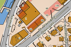
1108 Sandnes | 25eba64d-0187-4003-844a-5f62f056ea3b | 300614803 | 2017005061 | 181 | 2017-03-29 00:00:00 | FA | 2018-09-20 | N: 6526053.03, Ø: 313937.34 | ![Kartbilde fra WMS-tjeneste av avviket](https://wms.geonorge.no/skwms1/wms.topo?VERSION=1.1.1&SERVICE=WMS&REQUEST=GetMap&LAYERS=topo&STYLES=&FORMAT=image/png&SRS=EPSG:25832&BBOX=313862.0,6526003,314012.0,6526103&WIDTH=300&HEIGHT=200) |
1108 Sandnes | 283a772a-bae8-4ba4-84ff-0e27b99fe5b3 | 300639761 | 2017009299 | 181 | 2017-06-02 00:00:00 | FA | 2021-02-08 | N: 6531132.75, Ø: 312266.16 | ![Kartbilde fra WMS-tjeneste av avviket](https://wms.geonorge.no/skwms1/wms.topo?VERSION=1.1.1&SERVICE=WMS&REQUEST=GetMap&LAYERS=topo&STYLES=&FORMAT=image/png&SRS=EPSG:25832&BBOX=312191.0,6531082,312341.0,6531182&WIDTH=300&HEIGHT=200) |
1108 Sandnes | 2fdd7c14-a424-404f-91e8-214eb28a975b | 300639223 | 2017011843 | 181 | 2017-08-16 00:00:00 | FA | 2018-10-04 | N: 6526085.87, Ø: 313980.97 | ![Kartbilde fra WMS-tjeneste av avviket](https://wms.geonorge.no/skwms1/wms.topo?VERSION=1.1.1&SERVICE=WMS&REQUEST=GetMap&LAYERS=topo&STYLES=&FORMAT=image/png&SRS=EPSG:25832&BBOX=313905.0,6526035,314055.0,6526135&WIDTH=300&HEIGHT=200) |