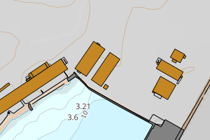
Avvikene skyldes oftest manglende eller unøyaktig registrering av bygningspunkt i matrikkelen. Rettes vanligvis i matrikkelen
Kommune | LokalId | Areal (m2) | Posisjon | WMS-bilde |
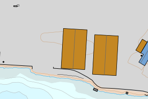
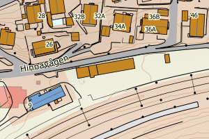
1103 Stavanger | 87623f4b-8955-45cd-8218-bc995dbe9c65 | 4584.33 | N: 6537754.54, Ø: 309708.56 | ![Kartbilde fra WMS-tjeneste av avviket](https://wms.geonorge.no/skwms1/wms.topo?VERSION=1.1.1&SERVICE=WMS&REQUEST=GetMap&LAYERS=topo&STYLES=&FORMAT=image/png&SRS=EPSG:25832&BBOX=309633.0,6537704,309783.0,6537804&WIDTH=300&HEIGHT=200) |
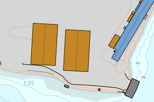
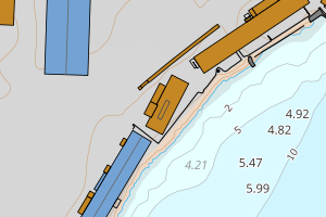
1103 Stavanger | 29716ac1-76e0-4c78-b947-9879f28c01ee | 2954.80 | N: 6556375.48, Ø: 318084.42 | ![Kartbilde fra WMS-tjeneste av avviket](https://wms.geonorge.no/skwms1/wms.topo?VERSION=1.1.1&SERVICE=WMS&REQUEST=GetMap&LAYERS=topo&STYLES=&FORMAT=image/png&SRS=EPSG:25832&BBOX=318009.0,6556325,318159.0,6556425&WIDTH=300&HEIGHT=200) |
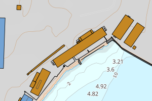
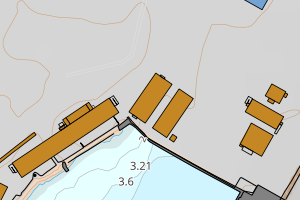
1103 Stavanger | a2265133-600a-4952-bfc8-8f497c5dd417 | 2098.81 | N: 6537188.04, Ø: 312912.69 | ![Kartbilde fra WMS-tjeneste av avviket](https://wms.geonorge.no/skwms1/wms.topo?VERSION=1.1.1&SERVICE=WMS&REQUEST=GetMap&LAYERS=topo&STYLES=&FORMAT=image/png&SRS=EPSG:25832&BBOX=312837.0,6537138,312987.0,6537238&WIDTH=300&HEIGHT=200) |
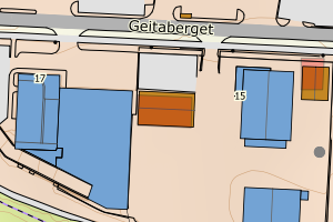
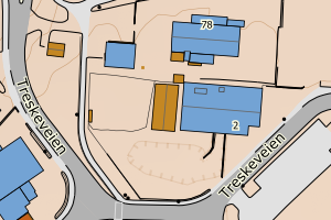
1103 Stavanger | e7c77045-fd54-4ffa-9be9-08101245c5f2 | 1821.21 | N: 6536923.58, Ø: 310461.83 | ![Kartbilde fra WMS-tjeneste av avviket](https://wms.geonorge.no/skwms1/wms.topo?VERSION=1.1.1&SERVICE=WMS&REQUEST=GetMap&LAYERS=topo&STYLES=&FORMAT=image/png&SRS=EPSG:25832&BBOX=310386.0,6536873,310536.0,6536973&WIDTH=300&HEIGHT=200) |
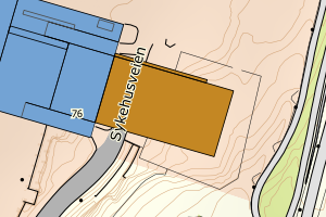
1103 Stavanger | 847822d7-af93-4f9f-b6e6-bc0196a96b12 | 1715.50 | N: 6533334.64, Ø: 309826.41 | ![Kartbilde fra WMS-tjeneste av avviket](https://wms.geonorge.no/skwms1/wms.topo?VERSION=1.1.1&SERVICE=WMS&REQUEST=GetMap&LAYERS=topo&STYLES=&FORMAT=image/png&SRS=EPSG:25832&BBOX=309751.0,6533284,309901.0,6533384&WIDTH=300&HEIGHT=200) |
1103 Stavanger | e5dc8728-8b21-43c9-ab23-d1043500da9a | 1699.14 | N: 6562368.29, Ø: 317638.06 | ![Kartbilde fra WMS-tjeneste av avviket](https://wms.geonorge.no/skwms1/wms.topo?VERSION=1.1.1&SERVICE=WMS&REQUEST=GetMap&LAYERS=topo&STYLES=&FORMAT=image/png&SRS=EPSG:25832&BBOX=317563.0,6562318,317713.0,6562418&WIDTH=300&HEIGHT=200) |
1103 Stavanger | 6124a9f7-6e4c-4da2-a95d-03e87aa609b6 | 1467.88 | N: 6574608.65, Ø: 321157.09 | ![Kartbilde fra WMS-tjeneste av avviket](https://wms.geonorge.no/skwms1/wms.topo?VERSION=1.1.1&SERVICE=WMS&REQUEST=GetMap&LAYERS=topo&STYLES=&FORMAT=image/png&SRS=EPSG:25832&BBOX=321082.0,6574558,321232.0,6574658&WIDTH=300&HEIGHT=200) |
1103 Stavanger | 8709ff70-8516-4c40-8b2a-f5fbb264e2f7 | 1181.14 | N: 6559800.65, Ø: 305202.76 | ![Kartbilde fra WMS-tjeneste av avviket](https://wms.geonorge.no/skwms1/wms.topo?VERSION=1.1.1&SERVICE=WMS&REQUEST=GetMap&LAYERS=topo&STYLES=&FORMAT=image/png&SRS=EPSG:25832&BBOX=305127.0,6559750,305277.0,6559850&WIDTH=300&HEIGHT=200) |
1103 Stavanger | 22c7c9c2-07f1-4e94-a764-f3b0dc5a6746 | 878.28 | N: 6535196.94, Ø: 311548.75 | ![Kartbilde fra WMS-tjeneste av avviket](https://wms.geonorge.no/skwms1/wms.topo?VERSION=1.1.1&SERVICE=WMS&REQUEST=GetMap&LAYERS=topo&STYLES=&FORMAT=image/png&SRS=EPSG:25832&BBOX=311473.0,6535146,311623.0,6535246&WIDTH=300&HEIGHT=200) |
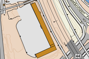
1103 Stavanger | 43af4ff0-40a0-4e3a-9e71-9febc837615d | 740.32 | N: 6572134.59, Ø: 320267.97 | ![Kartbilde fra WMS-tjeneste av avviket](https://wms.geonorge.no/skwms1/wms.topo?VERSION=1.1.1&SERVICE=WMS&REQUEST=GetMap&LAYERS=topo&STYLES=&FORMAT=image/png&SRS=EPSG:25832&BBOX=320192.0,6572084,320342.0,6572184&WIDTH=300&HEIGHT=200) |
1103 Stavanger | b42a5117-2111-4656-bddc-5c6f5e711afe | 719.89 | N: 6544353.13, Ø: 308485.93 | ![Kartbilde fra WMS-tjeneste av avviket](https://wms.geonorge.no/skwms1/wms.topo?VERSION=1.1.1&SERVICE=WMS&REQUEST=GetMap&LAYERS=topo&STYLES=&FORMAT=image/png&SRS=EPSG:25832&BBOX=308410.0,6544303,308560.0,6544403&WIDTH=300&HEIGHT=200) |
1103 Stavanger | bc1ff729-7bee-43fd-8149-a458491e35c1 | 676.17 | N: 6540929.35, Ø: 312201.59 | ![Kartbilde fra WMS-tjeneste av avviket](https://wms.geonorge.no/skwms1/wms.topo?VERSION=1.1.1&SERVICE=WMS&REQUEST=GetMap&LAYERS=topo&STYLES=&FORMAT=image/png&SRS=EPSG:25832&BBOX=312126.0,6540879,312276.0,6540979&WIDTH=300&HEIGHT=200) |
1103 Stavanger | d7c49e94-d3fb-4881-a53a-f28d91ab9a91 | 597.31 | N: 6543077.36, Ø: 311693.86 | ![Kartbilde fra WMS-tjeneste av avviket](https://wms.geonorge.no/skwms1/wms.topo?VERSION=1.1.1&SERVICE=WMS&REQUEST=GetMap&LAYERS=topo&STYLES=&FORMAT=image/png&SRS=EPSG:25832&BBOX=311618.0,6543027,311768.0,6543127&WIDTH=300&HEIGHT=200) |
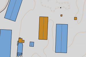
1103 Stavanger | 8bb38e3a-6a49-482b-abd0-92f10870ef08 | 580.74 | N: 6540886.22, Ø: 313871.28 | ![Kartbilde fra WMS-tjeneste av avviket](https://wms.geonorge.no/skwms1/wms.topo?VERSION=1.1.1&SERVICE=WMS&REQUEST=GetMap&LAYERS=topo&STYLES=&FORMAT=image/png&SRS=EPSG:25832&BBOX=313796.0,6540836,313946.0,6540936&WIDTH=300&HEIGHT=200) |
1103 Stavanger | b8289de5-0daa-474b-9dac-84baa3996442 | 570.11 | N: 6571235.86, Ø: 319285.05 | ![Kartbilde fra WMS-tjeneste av avviket](https://wms.geonorge.no/skwms1/wms.topo?VERSION=1.1.1&SERVICE=WMS&REQUEST=GetMap&LAYERS=topo&STYLES=&FORMAT=image/png&SRS=EPSG:25832&BBOX=319210.0,6571185,319360.0,6571285&WIDTH=300&HEIGHT=200) |
1103 Stavanger | 3bc28400-e429-4206-be72-626ec4bb0fc2 | 554.16 | N: 6544458.60, Ø: 308642.15 | ![Kartbilde fra WMS-tjeneste av avviket](https://wms.geonorge.no/skwms1/wms.topo?VERSION=1.1.1&SERVICE=WMS&REQUEST=GetMap&LAYERS=topo&STYLES=&FORMAT=image/png&SRS=EPSG:25832&BBOX=308567.0,6544408,308717.0,6544508&WIDTH=300&HEIGHT=200) |
1103 Stavanger | 61f72784-07e6-42a8-b2e5-bbedfc0b1114 | 507.34 | N: 6543054.87, Ø: 311810.02 | ![Kartbilde fra WMS-tjeneste av avviket](https://wms.geonorge.no/skwms1/wms.topo?VERSION=1.1.1&SERVICE=WMS&REQUEST=GetMap&LAYERS=topo&STYLES=&FORMAT=image/png&SRS=EPSG:25832&BBOX=311735.0,6543004,311885.0,6543104&WIDTH=300&HEIGHT=200) |
1103 Stavanger | e1436e67-1956-4470-aae8-52ac4e5165dd | 491.56 | N: 6536814.28, Ø: 310320.98 | ![Kartbilde fra WMS-tjeneste av avviket](https://wms.geonorge.no/skwms1/wms.topo?VERSION=1.1.1&SERVICE=WMS&REQUEST=GetMap&LAYERS=topo&STYLES=&FORMAT=image/png&SRS=EPSG:25832&BBOX=310245.0,6536764,310395.0,6536864&WIDTH=300&HEIGHT=200) |
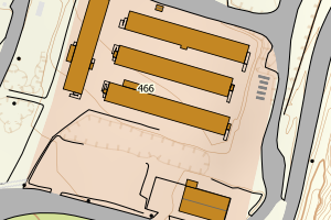
1103 Stavanger | a9acf92e-5593-4a9d-827d-bf61040a9b61 | 488.70 | N: 6536847.90, Ø: 310326.27 | ![Kartbilde fra WMS-tjeneste av avviket](https://wms.geonorge.no/skwms1/wms.topo?VERSION=1.1.1&SERVICE=WMS&REQUEST=GetMap&LAYERS=topo&STYLES=&FORMAT=image/png&SRS=EPSG:25832&BBOX=310251.0,6536797,310401.0,6536897&WIDTH=300&HEIGHT=200) |
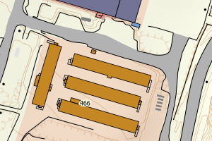
1103 Stavanger | 63884cb4-9280-403c-ab7c-a18c8a2121ca | 470.57 | N: 6536831.45, Ø: 310323.96 | ![Kartbilde fra WMS-tjeneste av avviket](https://wms.geonorge.no/skwms1/wms.topo?VERSION=1.1.1&SERVICE=WMS&REQUEST=GetMap&LAYERS=topo&STYLES=&FORMAT=image/png&SRS=EPSG:25832&BBOX=310248.0,6536781,310398.0,6536881&WIDTH=300&HEIGHT=200) |
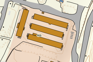
1103 Stavanger | 635bd13d-0cbe-4004-9b4d-c17a418a3f23 | 415.46 | N: 6544351.95, Ø: 308077.25 | ![Kartbilde fra WMS-tjeneste av avviket](https://wms.geonorge.no/skwms1/wms.topo?VERSION=1.1.1&SERVICE=WMS&REQUEST=GetMap&LAYERS=topo&STYLES=&FORMAT=image/png&SRS=EPSG:25832&BBOX=308002.0,6544301,308152.0,6544401&WIDTH=300&HEIGHT=200) |
1103 Stavanger | 95e254dc-000f-4f69-9e60-0fe1d30e4f19 | 389.51 | N: 6536843.51, Ø: 310284.39 | ![Kartbilde fra WMS-tjeneste av avviket](https://wms.geonorge.no/skwms1/wms.topo?VERSION=1.1.1&SERVICE=WMS&REQUEST=GetMap&LAYERS=topo&STYLES=&FORMAT=image/png&SRS=EPSG:25832&BBOX=310209.0,6536793,310359.0,6536893&WIDTH=300&HEIGHT=200) |
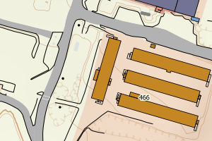
1103 Stavanger | 0c133809-a741-47db-a3b0-fc64357b12c9 | 379.75 | N: 6539613.39, Ø: 310191.82 | ![Kartbilde fra WMS-tjeneste av avviket](https://wms.geonorge.no/skwms1/wms.topo?VERSION=1.1.1&SERVICE=WMS&REQUEST=GetMap&LAYERS=topo&STYLES=&FORMAT=image/png&SRS=EPSG:25832&BBOX=310116.0,6539563,310266.0,6539663&WIDTH=300&HEIGHT=200) |
1103 Stavanger | db5ce886-cac2-479b-b00a-70339caa06b4 | 365.75 | N: 6572752.06, Ø: 318461.86 | ![Kartbilde fra WMS-tjeneste av avviket](https://wms.geonorge.no/skwms1/wms.topo?VERSION=1.1.1&SERVICE=WMS&REQUEST=GetMap&LAYERS=topo&STYLES=&FORMAT=image/png&SRS=EPSG:25832&BBOX=318386.0,6572702,318536.0,6572802&WIDTH=300&HEIGHT=200) |
1103 Stavanger | f39f550c-32d5-4f4f-8637-a13c0bdf2287 | 357.39 | N: 6540930.64, Ø: 304896.28 | ![Kartbilde fra WMS-tjeneste av avviket](https://wms.geonorge.no/skwms1/wms.topo?VERSION=1.1.1&SERVICE=WMS&REQUEST=GetMap&LAYERS=topo&STYLES=&FORMAT=image/png&SRS=EPSG:25832&BBOX=304821.0,6540880,304971.0,6540980&WIDTH=300&HEIGHT=200) |
1103 Stavanger | 4e76b6bb-b976-4627-ac24-de3b457f7158 | 352.17 | N: 6541155.21, Ø: 312904.34 | ![Kartbilde fra WMS-tjeneste av avviket](https://wms.geonorge.no/skwms1/wms.topo?VERSION=1.1.1&SERVICE=WMS&REQUEST=GetMap&LAYERS=topo&STYLES=&FORMAT=image/png&SRS=EPSG:25832&BBOX=312829.0,6541105,312979.0,6541205&WIDTH=300&HEIGHT=200) |
1103 Stavanger | 31755312-94bd-43ec-9c36-0e1947a341fc | 291.74 | N: 6573492.30, Ø: 330434.52 | ![Kartbilde fra WMS-tjeneste av avviket](https://wms.geonorge.no/skwms1/wms.topo?VERSION=1.1.1&SERVICE=WMS&REQUEST=GetMap&LAYERS=topo&STYLES=&FORMAT=image/png&SRS=EPSG:25832&BBOX=330359.0,6573442,330509.0,6573542&WIDTH=300&HEIGHT=200) |
1103 Stavanger | ee4d493b-40fe-4751-ad20-82d6c1fa95dc | 284.63 | N: 6540744.76, Ø: 313651.27 | ![Kartbilde fra WMS-tjeneste av avviket](https://wms.geonorge.no/skwms1/wms.topo?VERSION=1.1.1&SERVICE=WMS&REQUEST=GetMap&LAYERS=topo&STYLES=&FORMAT=image/png&SRS=EPSG:25832&BBOX=313576.0,6540694,313726.0,6540794&WIDTH=300&HEIGHT=200) |
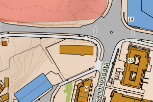
1103 Stavanger | d3e76aff-91dc-4409-8f91-298106299f58 | 274.96 | N: 6534038.60, Ø: 309892.41 | ![Kartbilde fra WMS-tjeneste av avviket](https://wms.geonorge.no/skwms1/wms.topo?VERSION=1.1.1&SERVICE=WMS&REQUEST=GetMap&LAYERS=topo&STYLES=&FORMAT=image/png&SRS=EPSG:25832&BBOX=309817.0,6533988,309967.0,6534088&WIDTH=300&HEIGHT=200) |
1103 Stavanger | 6f2b87a3-a3de-4690-ab05-d4d965dbb9fd | 233.64 | N: 6544604.30, Ø: 308287.64 | ![Kartbilde fra WMS-tjeneste av avviket](https://wms.geonorge.no/skwms1/wms.topo?VERSION=1.1.1&SERVICE=WMS&REQUEST=GetMap&LAYERS=topo&STYLES=&FORMAT=image/png&SRS=EPSG:25832&BBOX=308212.0,6544554,308362.0,6544654&WIDTH=300&HEIGHT=200) |
1103 Stavanger | b115beac-7be0-42d2-8a5e-5078fcd65665 | 227.58 | N: 6541311.11, Ø: 313335.74 | ![Kartbilde fra WMS-tjeneste av avviket](https://wms.geonorge.no/skwms1/wms.topo?VERSION=1.1.1&SERVICE=WMS&REQUEST=GetMap&LAYERS=topo&STYLES=&FORMAT=image/png&SRS=EPSG:25832&BBOX=313260.0,6541261,313410.0,6541361&WIDTH=300&HEIGHT=200) |
1103 Stavanger | 5a702821-9de7-4956-8a0c-65d60143f5e1 | 208.47 | N: 6537012.02, Ø: 310506.32 | ![Kartbilde fra WMS-tjeneste av avviket](https://wms.geonorge.no/skwms1/wms.topo?VERSION=1.1.1&SERVICE=WMS&REQUEST=GetMap&LAYERS=topo&STYLES=&FORMAT=image/png&SRS=EPSG:25832&BBOX=310431.0,6536962,310581.0,6537062&WIDTH=300&HEIGHT=200) |
1103 Stavanger | 1029e186-4a42-42d5-81de-5f4622323fa8 | 206.71 | N: 6536789.77, Ø: 310297.36 | ![Kartbilde fra WMS-tjeneste av avviket](https://wms.geonorge.no/skwms1/wms.topo?VERSION=1.1.1&SERVICE=WMS&REQUEST=GetMap&LAYERS=topo&STYLES=&FORMAT=image/png&SRS=EPSG:25832&BBOX=310222.0,6536739,310372.0,6536839&WIDTH=300&HEIGHT=200) |
1103 Stavanger | 4f0b5668-40cc-4b3e-a6ee-4a01d78c71a3 | 206.31 | N: 6543060.78, Ø: 312118.74 | ![Kartbilde fra WMS-tjeneste av avviket](https://wms.geonorge.no/skwms1/wms.topo?VERSION=1.1.1&SERVICE=WMS&REQUEST=GetMap&LAYERS=topo&STYLES=&FORMAT=image/png&SRS=EPSG:25832&BBOX=312043.0,6543010,312193.0,6543110&WIDTH=300&HEIGHT=200) |
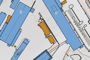
1103 Stavanger | 701125b1-a3bd-48ef-943c-438122706f2d | 203.29 | N: 6536033.83, Ø: 311823.60 | ![Kartbilde fra WMS-tjeneste av avviket](https://wms.geonorge.no/skwms1/wms.topo?VERSION=1.1.1&SERVICE=WMS&REQUEST=GetMap&LAYERS=topo&STYLES=&FORMAT=image/png&SRS=EPSG:25832&BBOX=311748.0,6535983,311898.0,6536083&WIDTH=300&HEIGHT=200) |